Next Issue
Volume 13, September-2
Previous Issue
Volume 13, August-2
 
 
remotesensing-logo

Journal Browser

Journal Browser

Remote Sens., Volume 13, Issue 17 (September-1 2021) – 208 articles

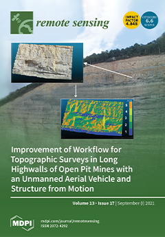
Cover Story (view full-size image): A highwall is the core of most mines as mineral feeding mining production originates there. Unexpected rock and earth falls can risk human lives and the economy activity; hence, continuous and detailed highwall monitoring is required. Topographic surveys of a highwall are very complex due a variety of challenging conditions: highwalls are vertical, long, and they often lack easy and safe access paths. We demonstrate based on SfM methodology that a facade drone flight mode combined with a nadir camera angle and automatically programmed with a computer-based mission planning software provides the most accurate and detailed topographies in the shortest time and with increased flight safety. View this paper.
  • Issues are regarded as officially published after their release is announced to the table of contents alert mailing list.
  • You may sign up for e-mail alerts to receive table of contents of newly released issues.
  • PDF is the official format for papers published in both, html and pdf forms. To view the papers in pdf format, click on the "PDF Full-text" link, and use the free Adobe Reader to open them.
Order results
Result details
Section
Select all
Export citation of selected articles as:
19 pages, 17200 KiB  
Article
Evaluation of a Statistical Approach for Extracting Shallow Water Bathymetry Signals from ICESat-2 ATL03 Photon Data
by Heidi Ranndal, Philip Sigaard Christiansen, Pernille Kliving, Ole Baltazar Andersen and Karina Nielsen
Remote Sens. 2021, 13(17), 3548; https://0-doi-org.brum.beds.ac.uk/10.3390/rs13173548 - 06 Sep 2021
Cited by 31 | Viewed by 3743
Abstract
In this study we present and validate a simple empirical method to obtain bathymetry profiles using the geolocated photon data from the Ice, Cloud, and Land Elevation Satellite-2 (ICESat-2) mission, which was launched by NASA in September 2018. The satellite carries the Advanced [...] Read more.
In this study we present and validate a simple empirical method to obtain bathymetry profiles using the geolocated photon data from the Ice, Cloud, and Land Elevation Satellite-2 (ICESat-2) mission, which was launched by NASA in September 2018. The satellite carries the Advanced Topographic Laser Altimeter System (ATLAS), which is a lidar that can detect single photons and calculate their bounce point positions. ATLAS uses a green laser, causing some of the photons to penetrate the air–water interface. Under the right conditions and in shallow waters (<40 m), these photons are reflected back to ATLAS after interaction with the ocean bottom. Using ICESat-2 data from four different overflights above the Heron Reef, Australia, a comparison with SDB data showed a median absolute deviation of approximately 18 cm and Root Mean Square Errors (RMSEs) down to 28 cm. Crossovers between two different overflights above the Heron Reef showed a median absolute difference of 13 cm. For an area north-west of Sisimiut, Greenland, the comparison was done with multibeam echo sounding data, with RMSEs down to between 35 cm, and correspondingly showed median absolute deviations between 33 and 49 cm. The proposed method works well under good conditions with clear waters such as in the Great Barrier Reef; however, for more difficult areas a more advanced machine learning technique should be investigated in order to find an automated method that can distinguish between bathymetry and other signals and noise. Full article
Show Figures

Graphical abstract

22 pages, 22566 KiB  
Article
Modifications of the Multi-Layer Perceptron for Hyperspectral Image Classification
by Xin He and Yushi Chen
Remote Sens. 2021, 13(17), 3547; https://0-doi-org.brum.beds.ac.uk/10.3390/rs13173547 - 06 Sep 2021
Cited by 18 | Viewed by 2872
Abstract
Recently, many convolutional neural network (CNN)-based methods have been proposed to tackle the classification task of hyperspectral images (HSI). In fact, CNN has become the de-facto standard for HSI classification. It seems that the traditional neural networks such as multi-layer perceptron (MLP) are [...] Read more.
Recently, many convolutional neural network (CNN)-based methods have been proposed to tackle the classification task of hyperspectral images (HSI). In fact, CNN has become the de-facto standard for HSI classification. It seems that the traditional neural networks such as multi-layer perceptron (MLP) are not competitive for HSI classification. However, in this study, we try to prove that the MLP can achieve good classification performance of HSI if it is properly designed and improved. The proposed Modified-MLP for HSI classification contains two special parts: spectral–spatial feature mapping and spectral–spatial information mixing. Specifically, for spectral–spatial feature mapping, each input sample of HSI is divided into a sequence of 3D patches with fixed length and then a linear layer is used to map the 3D patches to spectral–spatial features. For spectral–spatial information mixing, all the spectral–spatial features within a single sample are feed into the solely MLP architecture to model the spectral–spatial information across patches for following HSI classification. Furthermore, to obtain the abundant spectral–spatial information with different scales, Multiscale-MLP is proposed to aggregate neighboring patches with multiscale shapes for acquiring abundant spectral–spatial information. In addition, the Soft-MLP is proposed to further enhance the classification performance by applying soft split operation, which flexibly capture the global relations of patches at different positions in the input HSI sample. Finally, label smoothing is introduced to mitigate the overfitting problem in the Soft-MLP (Soft-MLP-L), which greatly improves the classification performance of MLP-based method. The proposed Modified-MLP, Multiscale-MLP, Soft-MLP, and Soft-MLP-L are tested on the three widely used hyperspectral datasets. The proposed Soft-MLP-L leads to the highest OA, which outperforms CNN by 5.76%, 2.55%, and 2.5% on the Salinas, Pavia, and Indian Pines datasets, respectively. The obtained results reveal that the proposed models provide competitive results compared to the state-of-the-art methods, which shows that the MLP-based methods are still competitive for HSI classification. Full article
Show Figures

Graphical abstract

18 pages, 6261 KiB  
Article
A New Approach for the Development of Grid Models Calculating Tropospheric Key Parameters over China
by Ge Zhu, Liangke Huang, Lilong Liu, Chen Li, Junyu Li, Ling Huang, Lv Zhou and Hongchang He
Remote Sens. 2021, 13(17), 3546; https://0-doi-org.brum.beds.ac.uk/10.3390/rs13173546 - 06 Sep 2021
Cited by 7 | Viewed by 2019
Abstract
Pressure, water vapor pressure, temperature, and weighted mean temperature (Tm) are tropospheric parameters that play an important role in high-precision global navigation satellite system navigation (GNSS). As accurate tropospheric parameters are obligatory in GNSS navigation and GNSS water vapor detection, high-precision [...] Read more.
Pressure, water vapor pressure, temperature, and weighted mean temperature (Tm) are tropospheric parameters that play an important role in high-precision global navigation satellite system navigation (GNSS). As accurate tropospheric parameters are obligatory in GNSS navigation and GNSS water vapor detection, high-precision modeling of tropospheric parameters has gained widespread attention in recent years. A new approach is introduced to develop an empirical tropospheric delay model named the China Tropospheric (CTrop) model, providing meteorological parameters based on the sliding window algorithm. The radiosonde data in 2017 are treated as reference values to validate the performance of the CTrop model, which is compared to the canonical Global Pressure and Temperature 3 (GPT3) model. The accuracy of the CTrop model in regards to pressure, water vapor pressure, temperature, and weighted mean temperature are 5.51 hPa, 2.60 hPa, 3.09 K, and 3.35 K, respectively, achieving an improvement of 6%, 9%, 10%, and 13%, respectively, when compared to the GPT3 model. Moreover, three different resolutions of the CTrop model based on the sliding window algorithm are also developed to reduce the amount of gridded data provided to the users, as well as to speed up the troposphere delay computation process, for which users can access model parameters of different resolutions for their requirements. With better accuracy of estimating the tropospheric parameters than that of the GPT3 model, the CTrop model is recommended to improve the performance of GNSS positioning and navigation. Full article
(This article belongs to the Special Issue BDS/GNSS for Earth Observation)
Show Figures

Figure 1

15 pages, 953 KiB  
Technical Note
Micro-Motion Parameter Extraction for Ballistic Missile with Wideband Radar Using Improved Ensemble EMD Method
by Nannan Zhu, Jun Hu, Shiyou Xu, Wenzhen Wu, Yunfan Zhang and Zengping Chen
Remote Sens. 2021, 13(17), 3545; https://0-doi-org.brum.beds.ac.uk/10.3390/rs13173545 - 06 Sep 2021
Cited by 10 | Viewed by 2340
Abstract
Micro-motion parameters extraction is crucial in recognizing ballistic missiles with a wideband radar. It is known that the phase-derived range (PDR) method can provide a sub-wavelength level accuracy. However, it is sensitive and unstable when the signal-to-noise ratio (SNR) is low. In this [...] Read more.
Micro-motion parameters extraction is crucial in recognizing ballistic missiles with a wideband radar. It is known that the phase-derived range (PDR) method can provide a sub-wavelength level accuracy. However, it is sensitive and unstable when the signal-to-noise ratio (SNR) is low. In this paper, an improved PDR method is proposed to reduce the impacts of low SNRs. First, the high range resolution profile (HRRP) is divided into a series of segments so that each segment contains a single scattering point. Then, the peak values of each segment are viewed as non-stationary signals, which are further decomposed into a series of intrinsic mode functions (IMFs) with different energy, using the ensemble empirical mode decomposition with the complementary adaptive noise (EEMDCAN) method. In the EEMDCAN decomposition, positive and negative adaptive noise pairs are added to each IMF layer to effectively eliminate the mode-mixing phenomenon that exists in the original empirical mode decomposition (EMD) method. An energy threshold is designed to select proper IMFs to reconstruct the envelop for high estimation accuracy and low noise effects. Finally, the least-square algorithm is used to do the ambiguous phases unwrapping to obtain the micro-curve, which can be further used to estimate the micro-motion parameters of the warhead. Simulation results show that the proposed method performs well with SNR at −5 dB with an accuracy level of sub-wavelength. Full article
Show Figures

Figure 1

22 pages, 1483 KiB  
Article
A Spatial Variant Motion Compensation Algorithm for High-Monofrequency Motion Error in Mini-UAV-Based BiSAR Systems
by Zhanze Wang, Feifeng Liu, Simin He and Zhixiang Xu
Remote Sens. 2021, 13(17), 3544; https://0-doi-org.brum.beds.ac.uk/10.3390/rs13173544 - 06 Sep 2021
Cited by 2 | Viewed by 1807
Abstract
High-frequency motion errors can drastically decrease the image quality in mini-unmanned-aerial-vehicle (UAV)-based bistatic synthetic aperture radar (BiSAR), where the spatial variance is much more complex than that in monoSAR. High-monofrequency motion error is a special BiSAR case in which the different motion errors [...] Read more.
High-frequency motion errors can drastically decrease the image quality in mini-unmanned-aerial-vehicle (UAV)-based bistatic synthetic aperture radar (BiSAR), where the spatial variance is much more complex than that in monoSAR. High-monofrequency motion error is a special BiSAR case in which the different motion errors from transmitters and receivers lead to the formation of monofrequency motion error. Furthermore, neither of the classic processors, BiSAR and monoSAR, can compensate for the coupled high-monofrequency motion errors. In this paper, a spatial variant motion compensation algorithm for high-monofrequency motion errors is proposed. First, the bistatic rotation error model that causes high-monofrequency motion error is re-established to account for the bistatic spatial variance of image formation. Second, the corresponding parameters of error model nonlinear gradient are obtained by the joint estimation of subimages. Third, the bistatic spatial variance can be adaptively compensated for based on the error of the nonlinear gradient through contour projection. It is suggested based on the simulation and experimental results that the proposed algorithm can effectively compensate for high-monofrequency motion error in mini-UAV-based BiSAR system conditions. Full article
Show Figures

Graphical abstract

11 pages, 3452 KiB  
Technical Note
Motion Phase Compensation Methods for Azimuth Ambiguity Suppression in HRWS SAR
by Junying Yang, Xiaolan Qiu, Mingyang Shang, Lihua Zhong and Chibiao Ding
Remote Sens. 2021, 13(17), 3543; https://0-doi-org.brum.beds.ac.uk/10.3390/rs13173543 - 06 Sep 2021
Cited by 1 | Viewed by 1543
Abstract
The azimuth multi-channel synthetic aperture radar (SAR) is widely used in marine observation, because of its excellent imaging ability of high-resolution and wide-swath (HRWS) signals. Different from the static targets, the azimuth ambiguity of the ships on the open sea resulting from the [...] Read more.
The azimuth multi-channel synthetic aperture radar (SAR) is widely used in marine observation, because of its excellent imaging ability of high-resolution and wide-swath (HRWS) signals. Different from the static targets, the azimuth ambiguity of the ships on the open sea resulting from the radial motion seriously affects the SAR image quality and ship detection probability. As a result, two methods of azimuth ambiguity suppression for moving ships based on motion phase compensation are proposed to apply to different practical application conditions. The simulation and real measured data experiments verify the ability of image quality improvement by proposed methods. Full article
(This article belongs to the Section Remote Sensing Communications)
Show Figures

Graphical abstract

27 pages, 5070 KiB  
Project Report
Air Quality over China
by Gerrit de Leeuw, Ronald van der A, Jianhui Bai, Yong Xue, Costas Varotsos, Zhengqiang Li, Cheng Fan, Xingfeng Chen, Ioannis Christodoulakis, Jieying Ding, Xuewei Hou, Georgios Kouremadas, Ding Li, Jing Wang, Marina Zara, Kainan Zhang and Ying Zhang
Remote Sens. 2021, 13(17), 3542; https://0-doi-org.brum.beds.ac.uk/10.3390/rs13173542 - 06 Sep 2021
Cited by 11 | Viewed by 3077
Abstract
The strong economic growth in China in recent decades, together with meteorological factors, has resulted in serious air pollution problems, in particular over large industrialized areas with high population density. To reduce the concentrations of pollutants, air pollution control policies have been successfully [...] Read more.
The strong economic growth in China in recent decades, together with meteorological factors, has resulted in serious air pollution problems, in particular over large industrialized areas with high population density. To reduce the concentrations of pollutants, air pollution control policies have been successfully implemented, resulting in the gradual decrease of air pollution in China during the last decade, as evidenced from both satellite and ground-based measurements. The aims of the Dragon 4 project “Air quality over China” were the determination of trends in the concentrations of aerosols and trace gases, quantification of emissions using a top-down approach and gain a better understanding of the sources, transport and underlying processes contributing to air pollution. This was achieved through (a) satellite observations of trace gases and aerosols to study the temporal and spatial variability of air pollutants; (b) derivation of trace gas emissions from satellite observations to study sources of air pollution and improve air quality modeling; and (c) study effects of haze on air quality. In these studies, the satellite observations are complemented with ground-based observations and modeling. Full article
(This article belongs to the Special Issue ESA - NRSCC Cooperation Dragon 4 Final Results)
Show Figures

Graphical abstract

18 pages, 45464 KiB  
Article
Efficient and Flexible Aggregation and Distribution of MODIS Atmospheric Products Based on Climate Analytics as a Service Framework
by Jianyu Zheng, Xin Huang, Supriya Sangondimath, Jianwu Wang and Zhibo Zhang
Remote Sens. 2021, 13(17), 3541; https://0-doi-org.brum.beds.ac.uk/10.3390/rs13173541 - 06 Sep 2021
Cited by 2 | Viewed by 2259
Abstract
MODIS (Moderate Resolution Imaging Spectroradiometer) is a key instrument onboard NASA’s Terra (launched in 1999) and Aqua (launched in 2002) satellite missions as part of the more extensive Earth Observation System (EOS). By measuring the reflection and emission by the Earth-Atmosphere system in [...] Read more.
MODIS (Moderate Resolution Imaging Spectroradiometer) is a key instrument onboard NASA’s Terra (launched in 1999) and Aqua (launched in 2002) satellite missions as part of the more extensive Earth Observation System (EOS). By measuring the reflection and emission by the Earth-Atmosphere system in 36 spectral bands from the visible to thermal infrared with near-daily global coverage and high-spatial-resolution (250 m ~ 1 km at nadir), MODIS is playing a vital role in developing validated, global, interactive Earth system models. MODIS products are processed into three levels, i.e., Level-1 (L1), Level-2 (L2) and Level-3 (L3). To shift the current static and “one-size-fits-all” data provision method of MODIS products, in this paper, we propose a service-oriented flexible and efficient MODIS aggregation framework. Using this framework, users only need to get aggregated MODIS L3 data based on their unique requirements and the aggregation can run in parallel to achieve a speedup. The experiments show that our aggregation results are almost identical to the current MODIS L3 products and our parallel execution with 8 computing nodes can work 88.63 times faster than a serial code execution on a single node. Full article
Show Figures

Figure 1

24 pages, 7153 KiB  
Article
Multidimensional Assessment of Lake Water Ecosystem Services Using Remote Sensing
by Donghui Shi, Yishao Shi and Qiusheng Wu
Remote Sens. 2021, 13(17), 3540; https://0-doi-org.brum.beds.ac.uk/10.3390/rs13173540 - 06 Sep 2021
Cited by 4 | Viewed by 4006
Abstract
Freshwater is becoming scarce worldwide with the rapidly growing population, developing industries, burgeoning agriculture, and increasing consumption. Assessment of ecosystem services has been regarded as a promising way to reconcile the increasing demand and depleting natural resources. In this paper, we proposed a [...] Read more.
Freshwater is becoming scarce worldwide with the rapidly growing population, developing industries, burgeoning agriculture, and increasing consumption. Assessment of ecosystem services has been regarded as a promising way to reconcile the increasing demand and depleting natural resources. In this paper, we proposed a multidimensional assessment framework for evaluating water provisioning ecosystem services by integrating multi-source remote sensing products. We applied the multidimensional framework to assess lake water ecosystem services in the state of Minnesota, US. We found that: (1) the water provisioning ecosystem services degraded during 1998–2018 from three assessment perspectives; (2) the output, efficiency, and trend indices have stable distribution and various spatial clustering patterns from 1998 to 2018; (3) high-level efficiency depends on high-level output, and low-level output relates to low-level efficiency; (4) Western Minnesota, including Northwest, West Central, and Southwest, degraded more severely than other zones in water provisioning services; (5) human activities impact water provisioning services in Minnesota more than climate changes. These findings can benefit policymakers by identifying the priorities for better protection, conservation, and restoration of lake ecosystems. Our multidimensional assessment framework can be adapted to evaluate ecosystem services in other regions. Full article
(This article belongs to the Special Issue Remote Sensing of Ecosystems)
Show Figures

Figure 1

30 pages, 96630 KiB  
Article
Boosting Few-Shot Hyperspectral Image Classification Using Pseudo-Label Learning
by Chen Ding, Yu Li, Yue Wen, Mengmeng Zheng, Lei Zhang, Wei Wei and Yanning Zhang
Remote Sens. 2021, 13(17), 3539; https://0-doi-org.brum.beds.ac.uk/10.3390/rs13173539 - 06 Sep 2021
Cited by 8 | Viewed by 2712
Abstract
Deep neural networks have underpinned much of the recent progress in the field of hyperspectral image (HSI) classification owing to their powerful ability to learn discriminative features. However, training a deep neural network often requires the availability of a large number of labeled [...] Read more.
Deep neural networks have underpinned much of the recent progress in the field of hyperspectral image (HSI) classification owing to their powerful ability to learn discriminative features. However, training a deep neural network often requires the availability of a large number of labeled samples to mitigate over-fitting, and these labeled samples are not always available in practical applications. To adapt the deep neural network-based HSI classification approach to cases in which only a very limited number of labeled samples (i.e., few or even only one labeled sample) are provided, we propose a novel few-shot deep learning framework for HSI classification. In order to mitigate over-fitting, the framework borrows supervision from an auxiliary set of unlabeled samples with soft pseudo-labels to assist the training of the feature extractor on few labeled samples. By considering each labeled sample as a reference agent, the soft pseudo-label is assigned by computing the distances between the unlabeled sample and all agents. To demonstrate the effectiveness of the proposed method, we evaluate it on three benchmark HSI classification datasets. The results indicate that our method achieves better performance relative to existing competitors in few-shot and one-shot settings. Full article
Show Figures

Figure 1

22 pages, 26327 KiB  
Article
Deriving Aerodynamic Roughness Length at Ultra-High Resolution in Agricultural Areas Using UAV-Borne LiDAR
by Katerina Trepekli and Thomas Friborg
Remote Sens. 2021, 13(17), 3538; https://0-doi-org.brum.beds.ac.uk/10.3390/rs13173538 - 06 Sep 2021
Cited by 5 | Viewed by 2523
Abstract
The aerodynamic roughness length (Z0) and surface geometry at ultra-high resolution in precision agriculture and agroforestry have substantial potential to improve aerodynamic process modeling for sustainable farming practices and recreational activities. We explored the potential of unmanned aerial vehicle (UAV)-borne LiDAR [...] Read more.
The aerodynamic roughness length (Z0) and surface geometry at ultra-high resolution in precision agriculture and agroforestry have substantial potential to improve aerodynamic process modeling for sustainable farming practices and recreational activities. We explored the potential of unmanned aerial vehicle (UAV)-borne LiDAR systems to provide Z0 maps with the level of spatiotemporal resolution demanded by precision agriculture by generating the 3D structure of vegetated surfaces and linking the derived geometry with morphometric roughness models. We evaluated the performance of three filtering algorithms to segment the LiDAR-derived point clouds into vegetation and ground points in order to obtain the vegetation height metrics and density at a 0.10 m resolution. The effectiveness of three morphometric models to determine the Z0 maps of Danish cropland and the surrounding evergreen trees was assessed by comparing the results with corresponding Z0 values from a nearby eddy covariance tower (Z0_EC). A morphological filter performed satisfactorily over a homogeneous surface, whereas the progressive triangulated irregular network densification algorithm produced fewer errors with a heterogeneous surface. Z0 from UAV-LiDAR-driven models converged with Z0_EC at the source area scale. The Raupach roughness model appropriately simulated temporal variations in Z0 conditioned by vertical and horizontal vegetation density. The Z0 calculated as a fraction of vegetation height or as a function of vegetation height variability resulted in greater differences with the Z0_EC. Deriving Z0 in this manner could be highly useful in the context of surface energy balance and wind profile estimations for micrometeorological, hydrologic, and ecologic applications in similar sites. Full article
(This article belongs to the Special Issue Remote Sensing for Agrometeorology)
Show Figures

Graphical abstract

16 pages, 1012 KiB  
Technical Note
Data-Driven Interpolation of Sea Surface Suspended Concentrations Derived from Ocean Colour Remote Sensing Data
by Jean-Marie Vient, Frederic Jourdin, Ronan Fablet, Baptiste Mengual, Ludivine Lafosse and Christophe Delacourt
Remote Sens. 2021, 13(17), 3537; https://0-doi-org.brum.beds.ac.uk/10.3390/rs13173537 - 06 Sep 2021
Cited by 4 | Viewed by 2672
Abstract
Due to complex natural and anthropogenic interconnected forcings, the dynamics of suspended sediments within the ocean water column remains difficult to understand and monitor. Numerical models still lack capabilities to account for the variabilities depicted by in situ and satellite-derived datasets. Besides, the [...] Read more.
Due to complex natural and anthropogenic interconnected forcings, the dynamics of suspended sediments within the ocean water column remains difficult to understand and monitor. Numerical models still lack capabilities to account for the variabilities depicted by in situ and satellite-derived datasets. Besides, the irregular space-time sampling associated with satellite sensors make crucial the development of efficient interpolation methods. Optimal Interpolation (OI) remains the state-of-the-art approach for most operational products. Due to the large increase of both in situ and satellite measurements more and more available information is coming from in situ and satellite measurements, as well as from simulation models. The emergence of data-driven schemes as possibly relevant alternatives with increased capabilities to recover finer-scale processes. In this study, we investigate and benchmark three state-of-the-art data-driven schemes, namely an EOF-based technique, an analog data assimilation scheme, and a neural network approach, with an OI scheme. We rely on an Observing System Simulation Experiment based on high-resolution numerical simulations and simulated satellite observations using real satellite sampling patterns. The neural network approach, which relies on variational data assimilation formulation for the interpolation problem, clearly outperforms both the OI and the other data-driven schemes, both in terms of reconstruction performance and of a greater ability to recover high-frequency events. We further discuss how these results could transfer to real data, as well as to other problems beyond interpolation issues, especially short-term forecasting problems from partial satellite observations. Full article
(This article belongs to the Section Ocean Remote Sensing)
Show Figures

Figure 1

21 pages, 2605 KiB  
Article
A Comparison of ALS and Dense Photogrammetric Point Clouds for Individual Tree Detection in Radiata Pine Plantations
by Irfan A. Iqbal, Jon Osborn, Christine Stone and Arko Lucieer
Remote Sens. 2021, 13(17), 3536; https://0-doi-org.brum.beds.ac.uk/10.3390/rs13173536 - 06 Sep 2021
Cited by 4 | Viewed by 3159
Abstract
Digital aerial photogrammetry (DAP) has emerged as a potentially cost-effective alternative to airborne laser scanning (ALS) for forest inventory methods that employ point cloud data. Forest inventory derived from DAP using area-based methods has been shown to achieve accuracy similar to that of [...] Read more.
Digital aerial photogrammetry (DAP) has emerged as a potentially cost-effective alternative to airborne laser scanning (ALS) for forest inventory methods that employ point cloud data. Forest inventory derived from DAP using area-based methods has been shown to achieve accuracy similar to that of ALS data. At the tree level, individual tree detection (ITD) algorithms have been developed to detect and/or delineate individual trees either from ALS point cloud data or from ALS- or DAP-based canopy height models. An examination of the application of ITDs to DAP-based point clouds has not yet been reported. In this research, we evaluate the suitability of DAP-based point clouds for individual tree detection in the Pinus radiata plantation. Two ITD algorithms designed to work with point cloud data are applied to dense point clouds generated from small- and medium-format photography and to an ALS point cloud. Performance of the two ITD algorithms, the influence of stand structure on tree detection rates, and the relationship between tree detection rates and canopy structural metrics are investigated. Overall, we show that there is a good agreement between ALS- and DAP-based ITD results (proportion of false negatives for ALS, SFP, and MFP was always lower than 29.6%, 25.3%, and 28.6%, respectively, whereas, the proportion of false positives for ALS, SFP, and MFP was always lower than 39.4%, 30.7%, and 33.7%, respectively). Differences between small- and medium-format DAP results were minor (for SFP and MFP, differences between recall, precision, and F-score were always less than 0.08, 0.03, and 0.05, respectively), suggesting that DAP point cloud data is robust for ITD. Our results show that among all the canopy structural metrics, the number of trees per hectare has the greatest influence on the tree detection rates. Full article
(This article belongs to the Special Issue Advances in LiDAR Remote Sensing for Forestry and Ecology)
Show Figures

Graphical abstract

30 pages, 16310 KiB  
Article
Exploiting High Geopositioning Accuracy of SAR Data to Obtain Accurate Geometric Orientation of Optical Satellite Images
by Zhongli Fan, Li Zhang, Yuxuan Liu, Qingdong Wang and Sisi Zlatanova
Remote Sens. 2021, 13(17), 3535; https://0-doi-org.brum.beds.ac.uk/10.3390/rs13173535 - 06 Sep 2021
Cited by 16 | Viewed by 3254
Abstract
Accurate geopositioning of optical satellite imagery is a fundamental step for many photogrammetric applications. Considering the imaging principle and data processing manner, SAR satellites can achieve high geopositioning accuracy. Therefore, SAR data can be a reliable source for providing control information in the [...] Read more.
Accurate geopositioning of optical satellite imagery is a fundamental step for many photogrammetric applications. Considering the imaging principle and data processing manner, SAR satellites can achieve high geopositioning accuracy. Therefore, SAR data can be a reliable source for providing control information in the orientation of optical satellite images. This paper proposes a practical solution for an accurate orientation of optical satellite images using SAR reference images to take advantage of the merits of SAR data. Firstly, we propose an accurate and robust multimodal image matching method to match the SAR and optical satellite images. This approach includes the development of a new structural-based multimodal applicable feature descriptor that employs angle-weighted oriented gradients (AWOGs) and the utilization of a three-dimensional phase correlation similarity measure. Secondly, we put forward a general optical satellite imagery orientation framework based on multiple SAR reference images, which uses the matches of the SAR and optical satellite images as virtual control points. A large number of experiments not only demonstrate the superiority of the proposed matching method compared to the state-of-the-art methods but also prove the effectiveness of the proposed orientation framework. In particular, the matching performance is improved by about 17% compared with the latest multimodal image matching method, namely, CFOG, and the geopositioning accuracy of optical satellite images is improved, from more than 200 to around 8 m. Full article
(This article belongs to the Section Earth Observation Data)
Show Figures

Figure 1

13 pages, 2050 KiB  
Communication
3D Point Cloud Reconstruction Using Inversely Mapping and Voting from Single Pass CSAR Images
by Shanshan Feng, Yun Lin, Yanping Wang, Fei Teng and Wen Hong
Remote Sens. 2021, 13(17), 3534; https://0-doi-org.brum.beds.ac.uk/10.3390/rs13173534 - 06 Sep 2021
Cited by 9 | Viewed by 2175
Abstract
3D reconstruction has raised much interest in the field of CSAR. However, three dimensional imaging results with single pass CSAR data reveals that the 3D resolution of the system is poor for anisotropic scatterers. According to the imaging mechanism of CSAR, different targets [...] Read more.
3D reconstruction has raised much interest in the field of CSAR. However, three dimensional imaging results with single pass CSAR data reveals that the 3D resolution of the system is poor for anisotropic scatterers. According to the imaging mechanism of CSAR, different targets located on the same iso-range line in the zero doppler plane fall into the same cell while for the same target point, imaging point will fall into the different positions at different aspect angles. In this paper, we proposed a method for 3D point cloud reconstruction using projections on 2D sub-aperture images. The target and background in the sub-aperture images are separated and binarized. For a projection point of target, given a series of offsets, the projection point will be mapped inversely to the 3D mesh along the iso-range line. We can obtain candidate points of the target. The intersection of iso-range lines can be regarded as voting process. For a candidate, the more times of intersection, the higher the number of votes, and the candidate point will be reserved. This fully excavates the information contained in the angle dimension of CSAR. The proposed approach is verified by the Gotcha Volumetric SAR Data Set. Full article
(This article belongs to the Special Issue Advances in Synthetic Aperture Radar Remote Sensing)
Show Figures

Graphical abstract

26 pages, 16067 KiB  
Article
Mapping Multi-Temporal Population Distribution in China from 1985 to 2010 Using Landsat Images via Deep Learning
by Haoming Zhuang, Xiaoping Liu, Yuchao Yan, Jinpei Ou, Jialyu He and Changjiang Wu
Remote Sens. 2021, 13(17), 3533; https://0-doi-org.brum.beds.ac.uk/10.3390/rs13173533 - 06 Sep 2021
Cited by 12 | Viewed by 2963
Abstract
Fine knowledge of the spatiotemporal distribution of the population is fundamental in a wide range of fields, including resource management, disaster response, public health, and urban planning. The United Nations’ Sustainable Development Goals also require the accurate and timely assessment of where people [...] Read more.
Fine knowledge of the spatiotemporal distribution of the population is fundamental in a wide range of fields, including resource management, disaster response, public health, and urban planning. The United Nations’ Sustainable Development Goals also require the accurate and timely assessment of where people live to formulate, implement, and monitor sustainable development policies. However, due to the lack of appropriate auxiliary datasets and effective methodological frameworks, there are rarely continuous multi-temporal gridded population data over a long historical period to aid in our understanding of the spatiotemporal evolution of the population. In this study, we developed a framework integrating a ResNet-N deep learning architecture, considering neighborhood effects with a vast number of Landsat-5 images from Google Earth Engine for population mapping, to overcome both the data and methodology obstacles associated with rapid multi-temporal population mapping over a long historical period at a large scale. Using this proposed framework in China, we mapped fine-scale multi-temporal gridded population data (1 km × 1 km) of China for the 1985–2010 period with a 5-year interval. The produced multi-temporal population data were validated with available census data and achieved comparable performance. By analyzing the multi-temporal population grids, we revealed the spatiotemporal evolution of population distribution from 1985 to 2010 in China with the characteristic of concentration of the population in big cities and the contraction of small- and medium-sized cities. The framework proposed in this study demonstrates the feasibility of mapping multi-temporal gridded population distribution at a large scale over a long period in a timely and low-cost manner, which is particularly useful in low-income and data-poor areas. Full article
Show Figures

Graphical abstract

16 pages, 3586 KiB  
Article
Detection of Microplastics in Water and Ice
by Seohyun Jang, Joo-Hyung Kim and Jihyun Kim
Remote Sens. 2021, 13(17), 3532; https://0-doi-org.brum.beds.ac.uk/10.3390/rs13173532 - 06 Sep 2021
Cited by 1 | Viewed by 3551
Abstract
It is possible to detect various microplastics (MPs) floating on water or contained in ice due to the unique optical characteristics of plastics of various chemical compositions and structures. When the MPs are measured in the spectral region between 800 and 1000 nm, [...] Read more.
It is possible to detect various microplastics (MPs) floating on water or contained in ice due to the unique optical characteristics of plastics of various chemical compositions and structures. When the MPs are measured in the spectral region between 800 and 1000 nm, which has relatively little influence on the temperature change in water, they are frequently perceived as noise or obscured by the surrounding reflection spectra because of the small number and low intensity of the representative peak wavelengths. In this study, we have applied several mathematical methods, including the convex hull, Gaussian deconvolution, and curve fitting to amplify and normalize the reflectance and thereby find the spectral properties of each polymer, namely polypropylene (PP), polyethylene terephthalate (PET), methyl methacrylate (PMMA), and polyethylene (PE). Blunt-shaped spectra with a relatively large maximum of normalized reflectance (NRmax) can be decomposed into several Gaussian peak wavelengths: 889, 910, and 932 nm for the PP and 898 and 931 nm for the PE. Moreover, unique peak wavelengths with the meaningful measure at 868 and 907 nm for the PET and 887 nm for the PMMA were also obtained. Based on the results of the study, one can say that each plastic can be identified with up to 81% precision by compensating based on the spectral properties even when they are hidden in water or ice. Full article
(This article belongs to the Section Environmental Remote Sensing)
Show Figures

Figure 1

19 pages, 5768 KiB  
Article
Projecting Future Vegetation Change for Northeast China Using CMIP6 Model
by Wei Yuan, Shuang-Ye Wu, Shugui Hou, Zhiwei Xu, Hongxi Pang and Huayu Lu
Remote Sens. 2021, 13(17), 3531; https://0-doi-org.brum.beds.ac.uk/10.3390/rs13173531 - 06 Sep 2021
Cited by 13 | Viewed by 3157
Abstract
Northeast China lies in the transition zone from the humid monsoonal to the arid continental climate, with diverse ecosystems and agricultural land highly susceptible to climate change. This region has experienced significant greening in the past three decades, but future trends remain uncertain. [...] Read more.
Northeast China lies in the transition zone from the humid monsoonal to the arid continental climate, with diverse ecosystems and agricultural land highly susceptible to climate change. This region has experienced significant greening in the past three decades, but future trends remain uncertain. In this study, we provide a quantitative assessment of how vegetation, indicated by the leaf area index (LAI), will change in this region in response to future climate change. Based on the output of eleven CMIP6 global climates, Northeast China is likely to get warmer and wetter in the future, corresponding to an increase in regional LAI. Under the medium emissions scenario (SSP245), the average LAI is expected to increase by 0.27 for the mid-century (2041–2070) and 0.39 for the late century (2071–2100). Under the high emissions scenario (SSP585), the increase is 0.40 for the mid-century and 0.70 for the late century, respectively. Despite the increase in the regional mean, the LAI trend shows significant spatial heterogeneity, with likely decreases for the arid northwest and some sandy fields in this region. Therefore, climate change could pose additional challenges for long-term ecological and economic sustainability. Our findings could provide useful information to local decision makers for developing effective sustainable land management strategies in Northeast China. Full article
Show Figures

Graphical abstract

27 pages, 5078 KiB  
Article
Fog Season Risk Assessment for Maritime Transportation Systems Exploiting Himawari-8 Data: A Case Study in Bohai Sea, China
by Pei Du, Zhe Zeng, Jingwei Zhang, Lu Liu, Jianchang Yang, Chuanping Qu, Li Jiang and Shanwei Liu
Remote Sens. 2021, 13(17), 3530; https://0-doi-org.brum.beds.ac.uk/10.3390/rs13173530 - 05 Sep 2021
Cited by 7 | Viewed by 3087
Abstract
Sea fog is a disastrous marine phenomenon for ship navigation. Sea fog reduces visibility at sea and has a great impact on the safety of ship navigation, which may lead to catastrophic accidents. Geostationary orbit satellites such as Himawari-8 make it possible to [...] Read more.
Sea fog is a disastrous marine phenomenon for ship navigation. Sea fog reduces visibility at sea and has a great impact on the safety of ship navigation, which may lead to catastrophic accidents. Geostationary orbit satellites such as Himawari-8 make it possible to monitor sea fog over large areas of the sea. In this paper, a framework for marine navigation risk evaluation in fog seasons is developed based on Himawari-8 satellite data, which includes: (1) a sea fog identification method for Himawari-8 satellite data based on multilayer perceptron; (2) a navigation risk evaluation model based on the CRITIC objective weighting method, which, along with the sea fog identification method, allows us to obtain historical sea fog data and marine environmental data, such as properties related to wind, waves, ocean currents, and water depth to evaluate navigation risks; and (3) a way to determine shipping routes based on the Delaunay triangulation method to carry out risk analyses of specific navigation areas. This paper uses global information system mapping technology to get navigation risk maps in different seasons in Bohai Sea and its surrounding waters. The proposed sea fog identification method is verified by CALIPSO vertical feature mask data, and the navigation risk evaluation model is verified by historical accident data. The probability of detection is 81.48% for sea fog identification, and the accident matching rate of the navigation risk evaluation model is 80% in fog seasons. Full article
(This article belongs to the Special Issue Remote Sensing for Marine Environmental Disaster Response)
Show Figures

Graphical abstract

16 pages, 3203 KiB  
Technical Note
Impact of Large-Scale Ocean–Atmosphere Interactions on Interannual Water Storage Changes in the Tropics and Subtropics
by Shengnan Ni, Zhicai Luo, Jianli Chen and Jin Li
Remote Sens. 2021, 13(17), 3529; https://0-doi-org.brum.beds.ac.uk/10.3390/rs13173529 - 05 Sep 2021
Viewed by 2095
Abstract
Satellite observations from the Gravity Recovery and Climate Experiment (GRACE) provide unique measurements of global terrestrial water storage (TWS) changes at different spatial and temporal scales. Large-scale ocean–atmosphere interactions might have significant impacts on the global hydrological cycle, resulting in considerable influences on [...] Read more.
Satellite observations from the Gravity Recovery and Climate Experiment (GRACE) provide unique measurements of global terrestrial water storage (TWS) changes at different spatial and temporal scales. Large-scale ocean–atmosphere interactions might have significant impacts on the global hydrological cycle, resulting in considerable influences on TWS changes. Quantifying the contributions of large-scale ocean–atmosphere interactions to TWS changes would be beneficial to improving our understanding of water storage responses to climate variability. In the study, we investigate the impact of three major global ocean–atmosphere interactions—El Niño and Southern Oscillation (ENSO), Indian Ocean Dipole (IOD), and Atlantic Meridional Mode (AMM) on interannual TWS changes in the tropics and subtropics, using GRACE measurements and climate indices. Based on the least square principle, these climate indices, and the corresponding Hilbert transformations along with a linear trend, annual and semi-annual terms are fitted to the TWS time series on global 1° × 1° grids. By the fitted results, we analyze the connections between interannual TWS changes and ENSO, IOD, and AMM indices, and estimate the quantitative contributions of these climate phenomena to TWS changes. The results indicate that interannual TWS changes in the tropics and subtropics are related to ENSO, IOD, and AMM climate phenomena. The contribution of each climate phenomenon to TWS changes might vary in different regions, but in most parts of the tropics and subtropics, the ENSO contribution to TWS changes is found to be more dominant than those from IOD and AMM. Full article
(This article belongs to the Special Issue Carbon, Water and Climate Monitoring Using Space Geodesy Observations)
Show Figures

Figure 1

16 pages, 8907 KiB  
Article
Analysis of Temporal and Spatial Variability of Fronts on the Amery Ice Shelf Automatically Detected Using Sentinel-1 SAR Data
by Tingting Zhu, Xiangbin Cui and Yu Zhang
Remote Sens. 2021, 13(17), 3528; https://0-doi-org.brum.beds.ac.uk/10.3390/rs13173528 - 05 Sep 2021
Viewed by 2227
Abstract
The Amery Ice Shelf (AIS) dynamics and mass balance caused by iceberg calving and basal melting are significant in the ocean climate system. Using satellite imagery from Sentinel-1 SAR, we monitored the temporal and spatial variability of the frontal positions on the Amery [...] Read more.
The Amery Ice Shelf (AIS) dynamics and mass balance caused by iceberg calving and basal melting are significant in the ocean climate system. Using satellite imagery from Sentinel-1 SAR, we monitored the temporal and spatial variability of the frontal positions on the Amery Ice Shelf, Antarctica, from 2015 to 2021. In this paper, we propose an automatic algorithm based on the SO-CFAR strategy and a profile cumulative method for frontal line extraction. To improve the accuracy of the extracted frontal lines, we developed a framework combining the Constant False Alarm Rate (CFAR) and morphological image-processing strategies. A visual comparison between the proposed algorithm and state-of-the-art algorithm shows that our algorithm is effective in these cases including rifts, icebergs, and crevasses as well as ice-shelf surface structures. We present a detailed analysis of the temporal and spatial variability of fronts on AIS that we find, an advance of the AIS frontal line before the D28 calving event, and a continuous advance after the event. The study reveals that the AIS extent has been advanced at the rate of 1015 m/year. Studies have shown that the frontal location of AIS has continuously expanded. From March 2015 to May 2021, the frontal location of AIS expanded by 6.5 km; while the length of the AIS frontal line is relatively different after the D28 event, the length of the frontal line increased by about 7.5% during 2015 and 2021 (255.03 km increased to 273.5 km). We found a substantial increase in summer advance rates and a decrease in winter advance rates with the seasonal characteristics. We found this variability of the AIS frontal line to be in good agreement with the ice flow velocity. Full article
(This article belongs to the Special Issue The Cryosphere Observations Based on Using Remote Sensing Techniques)
Show Figures

Figure 1

24 pages, 2399 KiB  
Article
Wildfire Segmentation Using Deep Vision Transformers
by Rafik Ghali, Moulay A. Akhloufi, Marwa Jmal, Wided Souidene Mseddi and Rabah Attia
Remote Sens. 2021, 13(17), 3527; https://0-doi-org.brum.beds.ac.uk/10.3390/rs13173527 - 05 Sep 2021
Cited by 48 | Viewed by 7861
Abstract
In this paper, we address the problem of forest fires’ early detection and segmentation in order to predict their spread and help with fire fighting. Techniques based on Convolutional Networks are the most used and have proven to be efficient at solving such [...] Read more.
In this paper, we address the problem of forest fires’ early detection and segmentation in order to predict their spread and help with fire fighting. Techniques based on Convolutional Networks are the most used and have proven to be efficient at solving such a problem. However, they remain limited in modeling the long-range relationship between objects in the image, due to the intrinsic locality of convolution operators. In order to overcome this drawback, Transformers, designed for sequence-to-sequence prediction, have emerged as alternative architectures. They have recently been used to determine the global dependencies between input and output sequences using the self-attention mechanism. In this context, we present in this work the very first study, which explores the potential of vision Transformers in the context of forest fire segmentation. Two vision-based Transformers are used, TransUNet and MedT. Thus, we design two frameworks based on the former image Transformers adapted to our complex, non-structured environment, which we evaluate using varying backbones and we optimize for forest fires’ segmentation. Extensive evaluations of both frameworks revealed a performance superior to current methods. The proposed approaches achieved a state-of-the-art performance with an F1-score of 97.7% for TransUNet architecture and 96.0% for MedT architecture. The analysis of the results showed that these models reduce fire pixels mis-classifications thanks to the extraction of both global and local features, which provide finer detection of the fire’s shape. Full article
(This article belongs to the Special Issue Data Mining in Multi-Platform Remote Sensing)
Show Figures

Graphical abstract

17 pages, 7592 KiB  
Article
A New Method for Crop Row Detection Using Unmanned Aerial Vehicle Images
by Pengfei Chen, Xiao Ma, Fangyong Wang and Jing Li
Remote Sens. 2021, 13(17), 3526; https://0-doi-org.brum.beds.ac.uk/10.3390/rs13173526 - 05 Sep 2021
Cited by 9 | Viewed by 3126
Abstract
Crop row detection using unmanned aerial vehicle (UAV) images is very helpful for precision agriculture, enabling one to delineate site-specific management zones and to perform precision weeding. For crop row detection in UAV images, the commonly used Hough transform-based method is not sufficiently [...] Read more.
Crop row detection using unmanned aerial vehicle (UAV) images is very helpful for precision agriculture, enabling one to delineate site-specific management zones and to perform precision weeding. For crop row detection in UAV images, the commonly used Hough transform-based method is not sufficiently accurate. Thus, the purpose of this study is to design a new method for crop row detection in orthomosaic UAV images. For this purpose, nitrogen field experiments involving cotton and nitrogen and water field experiments involving wheat were conducted to create different scenarios for crop rows. During the peak square growth stage of cotton and the jointing growth stage of wheat, multispectral UAV images were acquired. Based on these data, a new crop detection method based on least squares fitting was proposed and compared with a Hough transform-based method that uses the same strategy to preprocess images. The crop row detection accuracy (CRDA) was used to evaluate the performance of the different methods. The results showed that the newly proposed method had CRDA values between 0.99 and 1.00 for different nitrogen levels of cotton and CRDA values between 0.66 and 0.82 for different nitrogen and water levels of wheat. In contrast, the Hough transform method had CRDA values between 0.93 and 0.98 for different nitrogen levels of cotton and CRDA values between 0.31 and 0.53 for different nitrogen and water levels of wheat. Thus, the newly proposed method outperforms the Hough transform method. An effective tool for crop row detection using orthomosaic UAV images is proposed herein. Full article
Show Figures

Graphical abstract

28 pages, 14436 KiB  
Article
Continuous Monitoring of the Flooding Dynamics in the Albufera Wetland (Spain) by Landsat-8 and Sentinel-2 Datasets
by Carmela Cavallo, Maria Nicolina Papa, Massimiliano Gargiulo, Guillermo Palau-Salvador, Paolo Vezza and Giuseppe Ruello
Remote Sens. 2021, 13(17), 3525; https://0-doi-org.brum.beds.ac.uk/10.3390/rs13173525 - 05 Sep 2021
Cited by 26 | Viewed by 3347
Abstract
Satellite data are very useful for the continuous monitoring of ever-changing environments, such as wetlands. In this study, we investigated the use of multispectral imagery to monitor the winter evolution of land cover in the Albufera wetland (Spain), using Landsat-8 and Sentinel-2 datasets. [...] Read more.
Satellite data are very useful for the continuous monitoring of ever-changing environments, such as wetlands. In this study, we investigated the use of multispectral imagery to monitor the winter evolution of land cover in the Albufera wetland (Spain), using Landsat-8 and Sentinel-2 datasets. With multispectral data, the frequency of observation is limited by the possible presence of clouds. To overcome this problem, the data acquired by the two missions, Landsat-8 and Sentinel-2, were jointly used, thus roughly halving the revisit time. The varied types of land cover were grouped into four classes: (1) open water, (2) mosaic of water, mud and vegetation, (3) bare soil and (4) vegetated soil. The automatic classification of the four classes was obtained through a rule-based method that combined the NDWI, MNDWI and NDVI indices. Point information, provided by geo-located ground pictures, was spatially extended with the help of a very high-resolution image (GeoEye-1). In this way, surfaces with known land cover were obtained and used for the validation of the classification method. The overall accuracy was found to be 0.96 and 0.98 for Landsat-8 and Sentinel-2, respectively. The consistency evaluation between Landsat-8 and Sentinel-2 was performed in six days, in which acquisitions by both missions were available. The observed dynamics of the land cover were highly variable in space. For example, the presence of the open water condition lasted for around 60–80 days in the areas closest to the Albufera lake and progressively decreased towards the boundaries of the park. The study demonstrates the feasibility of using moderate-resolution multispectral images to monitor land cover changes in wetland environments. Full article
(This article belongs to the Special Issue Earth Observation Technologies for Monitoring of Water Environments)
Show Figures

Graphical abstract

22 pages, 7872 KiB  
Article
Detecting the Responses of CO2 Column Abundances to Anthropogenic Emissions from Satellite Observations of GOSAT and OCO-2
by Mengya Sheng, Liping Lei, Zhao-Cheng Zeng, Weiqiang Rao and Shaoqing Zhang
Remote Sens. 2021, 13(17), 3524; https://0-doi-org.brum.beds.ac.uk/10.3390/rs13173524 - 05 Sep 2021
Cited by 20 | Viewed by 3016
Abstract
The continuing increase in atmospheric CO2 concentration caused by anthropogenic CO2 emissions significantly contributes to climate change driven by global warming. Satellite measurements of long-term CO2 data with global coverage improve our understanding of global carbon cycles. However, the sensitivity [...] Read more.
The continuing increase in atmospheric CO2 concentration caused by anthropogenic CO2 emissions significantly contributes to climate change driven by global warming. Satellite measurements of long-term CO2 data with global coverage improve our understanding of global carbon cycles. However, the sensitivity of the space-borne measurements to anthropogenic emissions on a regional scale is less explored because of data sparsity in space and time caused by impacts from geophysical factors such as aerosols and clouds. Here, we used global land mapping column averaged dry-air mole fractions of CO2 (XCO2) data (Mapping-XCO2), generated from a spatio-temporal geostatistical method using GOSAT and OCO-2 observations from April 2009 to December 2020, to investigate the responses of XCO2 to anthropogenic emissions at both global and regional scales. Our results show that the long-term trend of global XCO2 growth rate from Mapping-XCO2, which is consistent with that from ground observations, shows interannual variations caused by the El Niño Southern Oscillation (ENSO). The spatial distributions of XCO2 anomalies, derived from removing background from the Mapping-XCO2 data, reveal XCO2 enhancements of about 1.5–3.5 ppm due to anthropogenic emissions and seasonal biomass burning in the wintertime. Furthermore, a clustering analysis applied to seasonal XCO2 clearly reveals the spatial patterns of atmospheric transport and terrestrial biosphere CO2 fluxes, which help better understand and analyze regional XCO2 changes that are associated with atmospheric transport. To quantify regional anomalies of CO2 emissions, we selected three representative urban agglomerations as our study areas, including the Beijing-Tian-Hebei region (BTH), the Yangtze River Delta urban agglomerations (YRD), and the high-density urban areas in the eastern USA (EUSA). The results show that the XCO2 anomalies in winter well capture the several-ppm enhancement due to anthropogenic CO2 emissions. For BTH, YRD, and EUSA, regional positive anomalies of 2.47 ± 0.37 ppm, 2.20 ± 0.36 ppm, and 1.38 ± 0.33 ppm, respectively, can be detected during winter months from 2009 to 2020. These anomalies are slightly higher than model simulations from CarbonTracker-CO2. In addition, we compared the variations in regional XCO2 anomalies and NO2 columns during the lockdown of the COVID-19 pandemic from January to March 2020. Interestingly, the results demonstrate that the variations of XCO2 anomalies have a positive correlation with the decline of NO2 columns during this period. These correlations, moreover, are associated with the features of emitting sources. These results suggest that we can use simultaneously observed NO2, because of its high detectivity and co-emission with CO2, to assist the analysis and verification of CO2 emissions in future studies. Full article
(This article belongs to the Section Urban Remote Sensing)
Show Figures

Graphical abstract

25 pages, 11179 KiB  
Article
Mapping Crop Types and Cropping Systems in Nigeria with Sentinel-2 Imagery
by Esther Shupel Ibrahim, Philippe Rufin, Leon Nill, Bahareh Kamali, Claas Nendel and Patrick Hostert
Remote Sens. 2021, 13(17), 3523; https://0-doi-org.brum.beds.ac.uk/10.3390/rs13173523 - 05 Sep 2021
Cited by 33 | Viewed by 6743
Abstract
Reliable crop type maps from satellite data are an essential prerequisite for quantifying crop growth, health, and yields. However, such maps do not exist for most parts of Africa, where smallholder farming is the dominant system. Prevalent cloud cover, small farm sizes, and [...] Read more.
Reliable crop type maps from satellite data are an essential prerequisite for quantifying crop growth, health, and yields. However, such maps do not exist for most parts of Africa, where smallholder farming is the dominant system. Prevalent cloud cover, small farm sizes, and mixed cropping systems pose substantial challenges when creating crop type maps for sub-Saharan Africa. In this study, we provide a mapping scheme based on freely available Sentinel-2A/B (S2) time series and very high-resolution SkySat data to map the main crops—maize and potato—and intercropping systems including these two crops on the Jos Plateau, Nigeria. We analyzed the spectral-temporal behavior of mixed crop classes to improve our understanding of inter-class spectral mixing. Building on the Framework for Operational Radiometric Correction for Environmental monitoring (FORCE), we preprocessed S2 time series and derived spectral-temporal metrics from S2 spectral bands for the main temporal cropping windows. These STMs were used as input features in a hierarchical random forest classification. Our results provide the first wall-to-wall crop type map for this key agricultural region of Nigeria. Our cropland identification had an overall accuracy of 84%, while the crop type map achieved an average accuracy of 72% for the five relevant crop classes. Our crop type map shows distinctive regional variations in the distribution of crop types. Maize is the dominant crop, followed by mixed cropping systems, including maize–cereals and potato–maize cropping; potato was found to be the least prevalent class. Plot analyses based on a sample of 1166 fields revealed largely homogeneous mapping patterns, demonstrating the effectiveness of our classification system also for intercropped classes, which are temporally and spatially highly heterogeneous. Moreover, we found that small field sizes were dominant in all crop types, regardless of whether or not intercropping was used. Maize–legume and maize exhibited the largest plots, with an area of up to 3 ha and slightly more than 10 ha, respectively; potato was mainly cultivated on fields smaller than 0.5 ha and only a few plots were larger than 1 ha. Besides providing the first spatially explicit map of cropping practices in the core production area of the Jos Plateau, Nigeria, the study also offers guidance for the creation of crop type maps for smallholder-dominated systems with intercropping. Critical temporal windows for crop type differentiation will enable the creation of mapping approaches in support of future smart agricultural practices for aspects such as food security, early warning systems, policies, and extension services. Full article
(This article belongs to the Collection Sentinel-2: Science and Applications)
Show Figures

Graphical abstract

27 pages, 8624 KiB  
Article
An Improved Cloud Gap-Filling Method for Longwave Infrared Land Surface Temperatures through Introducing Passive Microwave Techniques
by Thomas P. F. Dowling, Peilin Song, Mark C. De Jong, Lutz Merbold, Martin J. Wooster, Jingfeng Huang and Yongqiang Zhang
Remote Sens. 2021, 13(17), 3522; https://0-doi-org.brum.beds.ac.uk/10.3390/rs13173522 - 05 Sep 2021
Cited by 5 | Viewed by 3193
Abstract
Satellite-derived land surface temperature (LST) data are most commonly observed in the longwave infrared (LWIR) spectral region. However, such data suffer frequent gaps in coverage caused by cloud cover. Filling these ‘cloud gaps’ usually relies on statistical re-constructions using proximal clear sky LST [...] Read more.
Satellite-derived land surface temperature (LST) data are most commonly observed in the longwave infrared (LWIR) spectral region. However, such data suffer frequent gaps in coverage caused by cloud cover. Filling these ‘cloud gaps’ usually relies on statistical re-constructions using proximal clear sky LST pixels, whilst this is often a poor surrogate for shadowed LSTs insulated under cloud. Another solution is to rely on passive microwave (PM) LST data that are largely unimpeded by cloud cover impacts, the quality of which, however, is limited by the very coarse spatial resolution typical of PM signals. Here, we combine aspects of these two approaches to fill cloud gaps in the LWIR-derived LST record, using Kenya (East Africa) as our study area. The proposed “cloud gap-filling” approach increases the coverage of daily Aqua MODIS LST data over Kenya from <50% to >90%. Evaluations were made against the in situ and SEVIRI-derived LST data respectively, revealing root mean square errors (RMSEs) of 2.6 K and 3.6 K for the proposed method by mid-day, compared with RMSEs of 4.3 K and 6.7 K for the conventional proximal-pixel-based statistical re-construction method. We also find that such accuracy improvements become increasingly apparent when the total cloud cover residence time increases in the morning-to-noon time frame. At mid-night, cloud gap-filling performance is also better for the proposed method, though the RMSE improvement is far smaller (<0.3 K) than in the mid-day period. The results indicate that our proposed two-step cloud gap-filling method can improve upon performances achieved by conventional methods for cloud gap-filling and has the potential to be scaled up to provide data at continental or global scales as it does not rely on locality-specific knowledge or datasets. Full article
Show Figures

Graphical abstract

23 pages, 8342 KiB  
Article
CCT: Conditional Co-Training for Truly Unsupervised Remote Sensing Image Segmentation in Coastal Areas
by Bo Fang, Gang Chen, Jifa Chen, Guichong Ouyang, Rong Kou and Lizhe Wang
Remote Sens. 2021, 13(17), 3521; https://0-doi-org.brum.beds.ac.uk/10.3390/rs13173521 - 05 Sep 2021
Cited by 5 | Viewed by 2656
Abstract
As the fastest growing trend in big data analysis, deep learning technology has proven to be both an unprecedented breakthrough and a powerful tool in many fields, particularly for image segmentation tasks. Nevertheless, most achievements depend on high-quality pre-labeled training samples, which are [...] Read more.
As the fastest growing trend in big data analysis, deep learning technology has proven to be both an unprecedented breakthrough and a powerful tool in many fields, particularly for image segmentation tasks. Nevertheless, most achievements depend on high-quality pre-labeled training samples, which are labor-intensive and time-consuming. Furthermore, different from conventional natural images, coastal remote sensing ones generally carry far more complicated and considerable land cover information, making it difficult to produce pre-labeled references for supervised image segmentation. In our research, motivated by this observation, we take an in-depth investigation on the utilization of neural networks for unsupervised learning and propose a novel method, namely conditional co-training (CCT), specifically for truly unsupervised remote sensing image segmentation in coastal areas. In our idea, a multi-model framework consisting of two parallel data streams, which are superpixel-based over-segmentation and pixel-level semantic segmentation, is proposed to simultaneously perform the pixel-level classification. The former processes the input image into multiple over-segments, providing self-constrained guidance for model training. Meanwhile, with this guidance, the latter continuously processes the input image into multi-channel response maps until the model converges. Incentivized by multiple conditional constraints, our framework learns to extract high-level semantic knowledge and produce full-resolution segmentation maps without pre-labeled ground truths. Compared to the black-box solutions in conventional supervised learning manners, this method is of stronger explainability and transparency for its specific architecture and mechanism. The experimental results on two representative real-world coastal remote sensing datasets of image segmentation and the comparison with other state-of-the-art truly unsupervised methods validate the plausible performance and excellent efficiency of our proposed CCT. Full article
(This article belongs to the Special Issue Explainable Artificial Intelligence (XAI) in Remote Sensing Big Data)
Show Figures

Graphical abstract

25 pages, 8977 KiB  
Article
SVG-Loop: Semantic–Visual–Geometric Information-Based Loop Closure Detection
by Zhian Yuan, Ke Xu, Xiaoyu Zhou, Bin Deng and Yanxin Ma
Remote Sens. 2021, 13(17), 3520; https://0-doi-org.brum.beds.ac.uk/10.3390/rs13173520 - 05 Sep 2021
Cited by 14 | Viewed by 2962
Abstract
Loop closure detection is an important component of visual simultaneous localization and mapping (SLAM). However, most existing loop closure detection methods are vulnerable to complex environments and use limited information from images. As higher-level image information and multi-information fusion can improve the robustness [...] Read more.
Loop closure detection is an important component of visual simultaneous localization and mapping (SLAM). However, most existing loop closure detection methods are vulnerable to complex environments and use limited information from images. As higher-level image information and multi-information fusion can improve the robustness of place recognition, a semantic–visual–geometric information-based loop closure detection algorithm (SVG-Loop) is proposed in this paper. In detail, to reduce the interference of dynamic features, a semantic bag-of-words model was firstly constructed by connecting visual features with semantic labels. Secondly, in order to improve detection robustness in different scenes, a semantic landmark vector model was designed by encoding the geometric relationship of the semantic graph. Finally, semantic, visual, and geometric information was integrated by fuse calculation of the two modules. Compared with art-of-the-state methods, experiments on the TUM RBG-D dataset, KITTI odometry dataset, and practical environment show that SVG-Loop has advantages in complex environments with varying light, changeable weather, and dynamic interference. Full article
Show Figures

Graphical abstract

13 pages, 3375 KiB  
Case Report
Systematic Approach for Tunnel Deformation Monitoring with Terrestrial Laser Scanning
by Dongfeng Jia, Weiping Zhang and Yanping Liu
Remote Sens. 2021, 13(17), 3519; https://0-doi-org.brum.beds.ac.uk/10.3390/rs13173519 - 04 Sep 2021
Cited by 17 | Viewed by 3280
Abstract
The use of terrestrial laser scanning (TLS) point clouds for tunnel deformation measurement has elicited much interest. However, general methods of point-cloud processing in tunnels are still under investigation, given the high accuracy and efficiency requirements in this area. This study discusses a [...] Read more.
The use of terrestrial laser scanning (TLS) point clouds for tunnel deformation measurement has elicited much interest. However, general methods of point-cloud processing in tunnels are still under investigation, given the high accuracy and efficiency requirements in this area. This study discusses a systematic method of analyzing tunnel deformation. Point clouds from different stations need to be registered rapidly and with high accuracy before point-cloud processing. An orientation method of TLS in tunnels that uses a positioning base made in the laboratory is proposed for fast point-cloud registration. The calibration methods of the positioning base are demonstrated herein. In addition, an improved moving least-squares method is proposed as a way to reconstruct the centerline of a tunnel from unorganized point clouds. Then, the normal planes of the centerline are calculated and are used to serve as the reference plane for point-cloud projection. The convergence of the tunnel cross-section is analyzed, based on each point cloud slice, to determine the safety status of the tunnel. Furthermore, the results of the deformation analysis of a particular shield tunnel site are briefly discussed. Full article
Show Figures

Graphical abstract

Previous Issue
Back to TopTop