Next Issue
Volume 13, June
Previous Issue
Volume 13, April


Atmosphere, Volume 13, Issue 5 (May 2022) – 211 articles

Cover Story (view full-size image): 
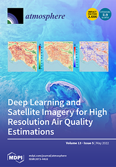
Some of the most populated (and polluted) cities in the world are not equipped with the infrastructure to monitor air quality (AQ) levels for actionable insights. Our research goal is to create daily AQ maps for developing cities that do not have historical sensor measurements by using a deep learning approach, and to help address a global challenge in earth science. This work examined the feasibility of an image-based object detection analysis approach using meter-scale commercial satellite imagery. The results demonstrate a low error with a total RMSE < 2 µg/m3, and highlight the contribution of specific urban features to continuous meter-scale AQ estimation. This approach offers promise for scaling to global applications in developed and developing urban environments. View this paper
  • Issues are regarded as officially published after their release is announced to the table of contents alert mailing list.
  • You may sign up for e-mail alerts to receive table of contents of newly released issues.
  • PDF is the official format for papers published in both, html and pdf forms. To view the papers in pdf format, click on the "PDF Full-text" link, and use the free Adobe Reader to open them.
Order results
Result details
Section
Select all
Export citation of selected articles as:
21 pages, 4915 KiB  
Article
Versatile Modelling of Extreme Surges in Connection with Large-Scale Circulation Drivers
by Lisa Baulon, Emma Imen Turki, Nicolas Massei, Gaël André, Yann Ferret and Nicolas Pouvreau
Atmosphere 2022, 13(5), 850; https://0-doi-org.brum.beds.ac.uk/10.3390/atmos13050850 - 23 May 2022
Cited by 2 | Viewed by 1551
Abstract
In this article, we investigate the dependence of extreme surges on the North Atlantic weather regime variability across different timescales using the North Atlantic Oscillation (NAO) and Scandinavian blocking (SCAND) indices. The analysis was done using time series of surges along the North [...] Read more.
In this article, we investigate the dependence of extreme surges on the North Atlantic weather regime variability across different timescales using the North Atlantic Oscillation (NAO) and Scandinavian blocking (SCAND) indices. The analysis was done using time series of surges along the North French Coast, covering long time periods (43 to 172 years of data). Time series that exhibited gaps were filled using linear interpolation to allow spectral analyses to be conducted. First, a continuous wavelet analysis on monthly maxima surges in the North French Coast was conducted to identify the multi-timescale variability. Second, a wavelet coherence analysis and maximum overlap discrete wavelet transform (MODWT) were used to study the timescale-dependent relationships between maxima surges and NAO or SCAND. Finally, NAO and SCAND were tested as physical covariates for a nonstationary generalized extreme value (GEV) distribution to fit monthly maxima surge series. Specific low-frequency variabilities characterizing these indices (extracted using MODWT) were also used as covariates to determine whether such specific variabilities would allow for even better GEV fitting. The results reveal common multi-annual timescales of variability between monthly maxima surge time series along the North French coasts: ~2–3 years, ~5–7 years, and ~12–17 years. These modes of variability were found to be mainly induced by the NAO and the SCAND. We identified a greater influence of the NAO on the monthly maxima surges of the westernmost stations (Brest, Cherbourg, Le Havre), while the SCAND showed a greater influence on the northernmost station (Dunkirk). This shows that the physical climate effects at multi-annual scales are manifested differently between the Atlantic/English Channel and the North Sea regions influenced by NAO and SCAND, respectively. Finally, the introduction of these two climate indices was found to clearly enhance GEV models as well as a few timescales of these indices. Full article
(This article belongs to the Special Issue Multi-Hazard Risk Assessment)
Show Figures

Figure 1

16 pages, 2004 KiB  
Article
Effect of Water Molecule on the Complete Series Reactions of Chlorothiobenzenes with H/·OH: A Theoretical Study
by Yanan Han, Siyuan Zheng, Zhuochao Teng, Mohammad Hassan Hadizadeh, Qi Zhang, Fei Xu and Yanhui Sun
Atmosphere 2022, 13(5), 849; https://0-doi-org.brum.beds.ac.uk/10.3390/atmos13050849 - 23 May 2022
Cited by 3 | Viewed by 1388
Abstract
The chlorothiobenzenes (CTBs) are the principal precursors for the formation of polychlorinated thianthrene/dibenzothiophenes (PCTA/DTs), which have high toxicity and wide distribution in the environment. Under the pyrolysis or combustion conditions, CTBs can react with H/·OH radicals to form the chlorothiobenzyl radicals (CTBRs) through [...] Read more.
The chlorothiobenzenes (CTBs) are the principal precursors for the formation of polychlorinated thianthrene/dibenzothiophenes (PCTA/DTs), which have high toxicity and wide distribution in the environment. Under the pyrolysis or combustion conditions, CTBs can react with H/·OH radicals to form the chlorothiobenzyl radicals (CTBRs) through abstraction of the chlorothiobenzyl-hydrogen. The water molecule can play an important role in this process. The coupling of CTBRs is the essential first step in forming PCTA/DTs. In this paper, quantum chemical calculations were carried out to investigate the formation of CTBRs from the complete series reactions of 19 chlorothiobenzene (CTB) congeners with H/·OH radicals in the presence of the water molecule. Using the MPWB1K/6-311 + G(3df,2p)//MPWB1K/6-31 + G(d,p) energy level, schematic energy profiles were constructed with the water molecule and then compared with the non-hydrated case. The present study shows that structural parameters and thermal data, as well as CTBRs formation potential from CTBs, are strongly dominated by the chlorine substitution at the ortho-position of CTBs. Meanwhile, the water molecule can promote the CTBR formation from CTBs abstracted by H/·OH, which has a stronger catalysis effect on the H abstraction from CTBs by OH than from CTBs by H. This study may provide reference parameters for future experimental research, which would enhance measures to reduce dioxin emission and establish dioxin control strategies. Full article
(This article belongs to the Special Issue New Insights into Secondary Organic Aerosol Formation)
Show Figures

Figure 1

10 pages, 3351 KiB  
Article
Monthly Precipitation Collected at Hirosaki, Japan: Its Tritium Concentration and Chemical and Stable Isotope Compositions
by Haruka Kuwata, Naofumi Akata, Kazusa Okada, Masahiro Tanaka, Hirofumi Tazoe, Naoyuki Kurita, Nao Otashiro, Ryoju Negami, Takahito Suzuki, Yuki Tamakuma, Yoshitaka Shiroma and Masahiro Hosoda
Atmosphere 2022, 13(5), 848; https://0-doi-org.brum.beds.ac.uk/10.3390/atmos13050848 - 23 May 2022
Cited by 2 | Viewed by 2483
Abstract
Monthly precipitation samples were collected at Hirosaki, Aomori Prefecture from January 2018 to December 2020 to measure the ion species and stable hydrogen and oxygen isotope ratios in order to understand the regional properties. The tritium concentration ranged from 0.28 to 1.20 Bq/L, [...] Read more.
Monthly precipitation samples were collected at Hirosaki, Aomori Prefecture from January 2018 to December 2020 to measure the ion species and stable hydrogen and oxygen isotope ratios in order to understand the regional properties. The tritium concentration ranged from 0.28 to 1.20 Bq/L, with mean values (±S.D.) of 0.52 ± 0.18, 0.67 ± 0.25 and 0.63 ± 0.21 Bq/L in 2018, 2019 and 2020, respectively. This concentration level was almost the same as for Rokkasho, Aomori Prefecture. The tritium concentration had clear seasonal variation: high in the spring and low in the summer. This trend was thought to arise from seasonal fluctuations in the atmospheric circulation. On the other hand, the pH tended to be low, and the electrical conductivity (EC) tended to be high from the winter to the spring. The ion components, which major ion species contained in sea salt, also tended to be high in the winter, and these components had a strong influence on EC. The d-excess values were high in the winter and low in the summer, and when this trend was considered from the viewpoint of the wind direction data in Hirosaki, these dust components were attributed to the northwest monsoon in the winter to the spring coming from the Asian continent. Full article
Show Figures

Figure 1

13 pages, 1443 KiB  
Article
Simulation of the Formation and Growth of Soot Aerosol Particles in a Premixed Combustion Process Using a Soot Aerosol Dynamics Model
by Sung Hoon Park
Atmosphere 2022, 13(5), 847; https://0-doi-org.brum.beds.ac.uk/10.3390/atmos13050847 - 23 May 2022
Viewed by 1678
Abstract
Recently, an aerosol dynamics model—the Soot Aggregate Moment Model (SAMM)—that can efficiently trace the size distribution and morphology of soot particles was developed. In order to examine the applicability of SAMM in association with open-source CFD and combustion chemistry solvers, the formation and [...] Read more.
Recently, an aerosol dynamics model—the Soot Aggregate Moment Model (SAMM)—that can efficiently trace the size distribution and morphology of soot particles was developed. In order to examine the applicability of SAMM in association with open-source CFD and combustion chemistry solvers, the formation and growth of soot particles in a premixed ethylene/air combustion were simulated by connecting SAMM with OpenSMOKE++ in this study. The simulation results were compared with available measurements and with the results of a previous study conducted using SAMM connected with an in-house CFD code and the CHEMKIN combustion chemistry package. Both CHEMKIN and OpenSMOKE++ underestimated C2H2 concentration compared to previous measurements, with deviation from the measured data being smaller for OpenSMOKE++. The chemical mechanism adopted in the CHEMKIN package was found to underestimate pyrene concentration by a factor of several tens. OpenSMOKE++ predicted much higher soot precursor concentrations than CHEMKIN, leading to a higher nucleation rate and a faster surface growth in the latter part of the reactor. This resulted in a reasonable soot production rate without introducing an artificial condensation enhancement factor. The overestimation of low-molecular-weight polycyclic aromatic hydrocarbons in the latter part of the reactor and the neglect of sintering led to an overprediction of soot production and primary particle number. This result indicates that accounting only for obliteration without sintering in SAMM could not simulate the merging of primary particles sufficiently. This indication merits further investigation. Full article
(This article belongs to the Special Issue Physical, Chemical and Optical Properties of Aerosols)
Show Figures

Figure 1

15 pages, 5597 KiB  
Article
Modified Inverse Distance Weighting Interpolation for Particulate Matter Estimation and Mapping
by Kanghyeok Choi and Kyusoo Chong
Atmosphere 2022, 13(5), 846; https://0-doi-org.brum.beds.ac.uk/10.3390/atmos13050846 - 22 May 2022
Cited by 20 | Viewed by 3212
Abstract
Various studies are currently underway on PM (Particulate Matter) monitoring in view of the importance of air quality in public health management. Spatial interpolation has been used to estimate PM concentrations due to that it can overcome the shortcomings of station-based PM monitoring [...] Read more.
Various studies are currently underway on PM (Particulate Matter) monitoring in view of the importance of air quality in public health management. Spatial interpolation has been used to estimate PM concentrations due to that it can overcome the shortcomings of station-based PM monitoring and provide spatially continuous information. However, PM is affected by a combination of several factors, and interpolation that only considers the spatial relationship between monitoring stations is limited in ensuring accuracy. Additionally, relatively accurate results may be obtained in the case of interpolation by using external drifts, but the methods have a disadvantage in that they require additional data and preprocessing. This study proposes a modified IDW (Inverse Distance Weighting) that allows more accurate estimations of PM based on the sole use of measurements. The proposed method improves the accuracy of the PM estimation based on weight correction according to the importance of each known point. Use of the proposed method on PM10 and PM2.5 in the Seoul-Gyeonggi region in South Korea led to an improved accuracy compared with IDW, kriging, and linear triangular interpolation. In particular, the proposed method showed relatively high accuracy compared to conventional methods in the case of a relatively large PM estimation error. Full article
(This article belongs to the Section Air Quality)
Show Figures

Figure 1

17 pages, 9931 KiB  
Article
Evaluation of the Planetary Boundary Layer Height in China Predicted by the CMA-GFS Global Model
by Haichuan Long, Qiying Chen, Xi Gong and Keyun Zhu
Atmosphere 2022, 13(5), 845; https://0-doi-org.brum.beds.ac.uk/10.3390/atmos13050845 - 21 May 2022
Cited by 1 | Viewed by 1823
Abstract
The key role of the planetary boundary layer height (PBLH) in pollution, climate, and model forecasting has long been recognized. However, the observed PBLH has rarely been used to evaluate numerical weather prediction models in China. We compared the temporal and spatial characteristics [...] Read more.
The key role of the planetary boundary layer height (PBLH) in pollution, climate, and model forecasting has long been recognized. However, the observed PBLH has rarely been used to evaluate numerical weather prediction models in China. We compared the temporal and spatial characteristics of the bias in the PBLH in China predicted by the CMA-GFS model with vertical high-resolution sounding data and Global Positioning System occultation data from 2019 to 2020. We found that: (1) The PBLH in East China is systematically underestimated by the CMA-GFS model. The bias mainly results from the underestimation of the wind shear in the boundary layer, a smaller sensible heat flux near the surface, and a lower surface temperature. The combined effects of these factors inhibit the boundary layer from developing to a higher height, although the most important contributor is the small sensible heat flux. (2) There is a systematic overestimation of the PBLH over the Tibetan Plateau throughout the year. The bias is mainly a result of the smaller buoyancy, higher wind shear, and larger sensible heat flux forecast by the CMA-GFS model, which drive the boundary layer to develop to a significantly deeper height than the observations. This bias in the CMA-GFS model is mainly caused by the bias in the sensible heat flux and wind shear forecasts. In contrast, the CMA-GFS model underestimates the PBLH in the Tarim Basin. Our preliminary analysis shows that the boundary layer forecasted is unable to develop because the buoyancy effect of the model is too strong. Therefore, the bias of the predicted PBLH by the CMA-GFS model in China is mainly caused by inaccuracies in the sensible heat flux and wind shear forecasts. Full article
(This article belongs to the Section Atmospheric Techniques, Instruments, and Modeling)
Show Figures

Figure 1

20 pages, 13360 KiB  
Article
Evaluation of Hydrological Simulation in a Karst Basin with Different Calibration Methods and Rainfall Inputs
by Chongxun Mo, Xinru Chen, Xingbi Lei, Yafang Wang, Yuli Ruan, Shufeng Lai and Zhenxiang Xing
Atmosphere 2022, 13(5), 844; https://0-doi-org.brum.beds.ac.uk/10.3390/atmos13050844 - 20 May 2022
Cited by 3 | Viewed by 1455
Abstract
Accurate hydrological simulation plays an important role in the research of hydrological problems; the accuracy of the watershed hydrological model is seriously affected by model-parameter uncertainty and model-input uncertainty. Thus, in this study, different calibration methods and rainfall inputs were introduced into the [...] Read more.
Accurate hydrological simulation plays an important role in the research of hydrological problems; the accuracy of the watershed hydrological model is seriously affected by model-parameter uncertainty and model-input uncertainty. Thus, in this study, different calibration methods and rainfall inputs were introduced into the SWAT (Soil and Water Assessment Tool) model for watershed hydrological simulation. The Chengbi River basin, a typical karst basin in Southwest China, was selected as the target basin. The indicators of the NSE (Nash efficiency coefficient), Re (relative error) and R2 (coefficient of determination) were adopted to evaluate the model performance. The results showed that: on the monthly and daily scales, the simulated runoff with the single-site method calibrated model had the lowest NSE value of 0.681 and highest NSE value of 0.900, the simulated runoff with the multi-site method calibrated model had the lowest NSE value of 0.743 and highest NSE value of 0.953, increased correspondingly, indicating that adopting the multi-site method could reduce the parameter uncertainty and improve the simulation accuracy. Moreover, the NSE values with IMERG (Integrated Multisatellite Retrievals for Global Rainfall Measurement) satellite rainfall data were the lowest, 0.660 on the monthly scale and 0.534 on the daily scale, whereas the NSE values with fusion rainfall data processed by the GWR (geographical weighted regression) method greatly increased to 0.854 and 0.717, respectively, and the NSE values with the measured rainfall data were the highest, 0.933 and 0.740, respectively, demonstrating that the latter two rainfall inputs were more suitable sources for hydrological simulation. Full article
(This article belongs to the Section Atmospheric Techniques, Instruments, and Modeling)
Show Figures

Figure 1

2 pages, 183 KiB  
Editorial
Extreme Hydro-Climate Events: Past, Present, and Future
by Haiyun Shi, Bellie Sivakumar, Suning Liu, Xuezhi Tan and Nasser Najibi
Atmosphere 2022, 13(5), 843; https://0-doi-org.brum.beds.ac.uk/10.3390/atmos13050843 - 20 May 2022
Viewed by 1518
Abstract
In recent years, extreme hydro-climate events (such as floods and droughts) have occurred more frequently, leading to significant threats to lives and damage of property [...] Full article
(This article belongs to the Special Issue Extreme Hydro-Climate Events: Past, Present, and Future)
22 pages, 11376 KiB  
Article
Effect of COVID-19 Response Policy on Air Quality: A Study in South China Context
by Xiaodan Jin, Hao Xu, Meixiu Guo, Jinmin Luo, Qiyin Deng, Yamei Yu, Jiemin Wu, Huarui Ren, Xue Hu, Linping Fan, Guimei Qin and Jinping Cheng
Atmosphere 2022, 13(5), 842; https://0-doi-org.brum.beds.ac.uk/10.3390/atmos13050842 - 20 May 2022
Cited by 1 | Viewed by 1667
Abstract
Mass suspension of anthropogenic activities is extremely rare, the quarantine due to the coronavirus disease 2019 (COVID-19) represents a natural experiment to investigate the impact of anthropogenic activities on air quality. The mitigation of air pollution during the COVID-19 lockdown has been reported [...] Read more.
Mass suspension of anthropogenic activities is extremely rare, the quarantine due to the coronavirus disease 2019 (COVID-19) represents a natural experiment to investigate the impact of anthropogenic activities on air quality. The mitigation of air pollution during the COVID-19 lockdown has been reported from a global perspective; however, the air pollution levels vary in different regions. This study initiated a novel synthesis of multiple-year satellite observations, national ground measurements towards SO2, NO2 and O3 and meteorological conditions to evaluate the impact of the COVID-19 lockdown in Beihai, a specific city in a less developed area in southwest China, to reveal the potential implications of control strategies for air pollution. The levels of the major air pollutants during the COVID-19 lockdown (LP) and during the same period of previous years (SP) were compared and a series of statistical tools were applied to analyze the sources of air pollution in Beihai. The results show that air pollutant levels decreased with substantial diversity during the LP. Satellite-retrieved NO2 and SO2 levels during the LP decreased by 5.26% and 22.06%, while NO2, SO2, PM2.5 and PM10 from ground measurements during the LP were 25.6%, 2.7%, 22.2% and 22.2% lower than during SP, respectively. Ground measured SO2 concentrations during the LP were only 2.7% lower than during the SP, which may be attributed to uninterrupted essential industrial activities, such as power plants. Polar plots analysis shows that NO2 concentrations were strongly associated with local emission sources, such as automobiles and local industry. Additionally, the much lower levels of NO2 concentrations during the LP and the absence of an evening peak may highlight the significant impact of the traffic sector on NO2. The decrease in daily mean O3 concentrations during the LP may be associated with the reduction in NO2 concentrations. Indications in this study could be beneficial for the formulation of atmospheric protection policies. Full article
(This article belongs to the Section Air Quality)
Show Figures

Figure 1

20 pages, 4330 KiB  
Article
Changes in Ambient Bacterial Community in Northern Taiwan during Long-Range Transport: Asian Dust Storm and Frontal Pollution
by Nai-Tzu Chen, Lai-Man Tam, Jer-Horng Wu, Ngok-Song Cheong, Chuan-Yao Lin, Chun-Chieh Tseng and Huey-Jen Su
Atmosphere 2022, 13(5), 841; https://0-doi-org.brum.beds.ac.uk/10.3390/atmos13050841 - 20 May 2022
Cited by 2 | Viewed by 1868
Abstract
Long-range transport (LRT) can carry air pollutants to downwind areas. However, studies about the impacts of LRT on bacterial communities are few. This study investigated the influence of Asian dust storms (ADS) and frontal pollution (FP) on bacterial communities in ambient air using [...] Read more.
Long-range transport (LRT) can carry air pollutants to downwind areas. However, studies about the impacts of LRT on bacterial communities are few. This study investigated the influence of Asian dust storms (ADS) and frontal pollution (FP) on bacterial communities in ambient air using next-generation sequencing (NGS) and Terminal Restriction Fragment Length Polymorphism (T-RFLP). Air samples were collected at Cape Fugui (CF) and National Taiwan University (NTU) in northern Taiwan before (or background days), during, and after LRTs from November 2013 to March 2015. The richness, H index, and evenness increased during FPs and then decreased after FPs. During and after ADS and FP, the prevalence of the phylum Proteobacteria decreased, but that of Firmicutes increased. The dominant class of Proteobacteria changed from Alphaproteobacteria on background days to Betaproteobacteria during LRTs. At the genus level, the high abundance of Ralstonia and Bacillus during FP and Clostridium during ADS were detected at both locations. Additionally, Ralstonia was dominant at CF during ADS. In conclusion, FP and ADS both changed the bacterial community. The indicator genus was Clostridium and Ralstonia for ADS as well as Bacillus and Ralstonia for FP. Given the potential health threats posed by the bioaerosols transported, people should avoid outdoor activities during LRTs. Full article
(This article belongs to the Topic Climate Change, Air Pollution, and Human Health)
Show Figures

Figure 1

22 pages, 9069 KiB  
Article
Air Quality in Two Northern Greek Cities Revealed by Their Tropospheric NO2 Levels
by Maria-Elissavet Koukouli, Andreas Pseftogkas, Dimitris Karagkiozidis, Ioanna Skoulidou, Theano Drosoglou, Dimitrios Balis, Alkiviadis Bais, Dimitrios Melas and Nikos Hatzianastassiou
Atmosphere 2022, 13(5), 840; https://0-doi-org.brum.beds.ac.uk/10.3390/atmos13050840 - 20 May 2022
Cited by 4 | Viewed by 2229
Abstract
In this article, we aim to show the capabilities, benefits, as well as restrictions, of three different air quality-related information sources, namely the Sentinel-5Precursor TROPOspheric Monitoring Instrument (TROPOMI) space-born observations, the Multi-Axis Differential Optical Absorption Spectroscopy (MAX-DOAS) ground-based measurements and the LOng Term [...] Read more.
In this article, we aim to show the capabilities, benefits, as well as restrictions, of three different air quality-related information sources, namely the Sentinel-5Precursor TROPOspheric Monitoring Instrument (TROPOMI) space-born observations, the Multi-Axis Differential Optical Absorption Spectroscopy (MAX-DOAS) ground-based measurements and the LOng Term Ozone Simulation-EURopean Operational Smog (LOTOS-EUROS) chemical transport modelling system simulations. The tropospheric NO2 concentrations between 2018 and 2021 are discussed as air quality indicators for the Greek cities of Thessaloniki and Ioannina. Each dataset was analysed in an autonomous manner and, without disregarding their differences, the common air quality picture that they provide is revealed. All three systems report a clear seasonal pattern, with high NO2 levels during wintertime and lower NO2 levels during summertime, reflecting the importance of photochemistry in the abatement of this air pollutant. The spatial patterns of the NO2 load, obtained by both space-born observations and model simulations, show the undeniable variability of the NO2 load within the urban agglomerations. Furthermore, a clear diurnal variability is clearly identified by the ground-based measurements, as well as a Sunday minimum NO2 load effect, alongside the rest of the sources of air quality information. Within their individual strengths and limitations, the space-borne observations, the ground-based measurements, and the chemical transport modelling simulations demonstrate unequivocally their ability to report on the air quality situation in urban locations. Full article
(This article belongs to the Special Issue Urban Climate and Air Quality in Mediterranean Cities)
Show Figures

Figure 1

19 pages, 5797 KiB  
Article
Wind Lidar and Radiosonde Measurements of Low-Level Jets in Coastal Areas of the German Bight
by Thomas Rausch, Beatriz Cañadillas, Oliver Hampel, Tayfun Simsek, Yilmaz Batuhan Tayfun, Thomas Neumann, Simon Siedersleben and Astrid Lampert
Atmosphere 2022, 13(5), 839; https://0-doi-org.brum.beds.ac.uk/10.3390/atmos13050839 - 20 May 2022
Cited by 3 | Viewed by 2421
Abstract
For wind energy, the knowledge of the available wind resource is essential. Therefore, specific wind phenomena at the altitude range of wind turbines are currently the focus of investigations. One such specific feature is the low-level jet (LLJ). The article analyses LLJ properties [...] Read more.
For wind energy, the knowledge of the available wind resource is essential. Therefore, specific wind phenomena at the altitude range of wind turbines are currently the focus of investigations. One such specific feature is the low-level jet (LLJ). The article analyses LLJ properties at two locations in the German Bight: A wind lidar system for measuring wind profiles at heights from 50 m to 500 m a.g.l. (above ground level) was first installed at the offshore island of Heligoland, Germany, and then at the coastal island of Norderney, Germany, for one year. The LLJ is defined here as a maximum horizontal wind speed in the vertical profile of horizontal wind speed followed by a minimum wind speed, independent of the mechanism or origin of the phenomenon. The two sites showed a similar annual and diurnal distribution of LLJ events with a maximum occurrence in spring and summer and during the night, and a most frequent jet core height of around 120 m a.g.l. Based on radiosondes launched from Norderney at midnight and noon, it is shown that LLJ events at noon are most frequent when atmospheric conditions are stable. A case study shows the horizontal extent of an LLJ event over at least 100 km by simultaneous wind lidar measurements at four sites in the German Bight and mesoscale simulations with the weather research and forecast (WRF) model. Full article
(This article belongs to the Special Issue Atmospheric Boundary Layer: Observation and Simulation)
Show Figures

Figure 1

28 pages, 19156 KiB  
Article
Uncertainty Quantification of WRF Model for Rainfall Prediction over the Sichuan Basin, China
by Yu Du, Ting Xu, Yuzhang Che, Bifeng Yang, Shaojie Chen, Zhikun Su, Lianxia Su, Yangruixue Chen and Jiafeng Zheng
Atmosphere 2022, 13(5), 838; https://0-doi-org.brum.beds.ac.uk/10.3390/atmos13050838 - 20 May 2022
Cited by 5 | Viewed by 2443
Abstract
The mesoscale Weather Research and Forecasting (WRF) model has been widely employed to forecast day-ahead rainfalls. However, the deterministic predictions from the WRF model incorporate relatively large errors due to numerical discretization, inaccuracies in initial/boundary conditions and parameterizations, etc. Among them, the uncertainties [...] Read more.
The mesoscale Weather Research and Forecasting (WRF) model has been widely employed to forecast day-ahead rainfalls. However, the deterministic predictions from the WRF model incorporate relatively large errors due to numerical discretization, inaccuracies in initial/boundary conditions and parameterizations, etc. Among them, the uncertainties in parameterization schemes have a huge impact on the forecasting skill of rainfalls, especially over the Sichuan Basin which is located east of the Tibetan Plateau in southwestern China. To figure out the impact of various parameterization schemes and their interactions on rainfall predictions over the Sichuan Basin, the Global Forecast System data are chosen as the initial/boundary conditions for the WRF model and 48 ensemble tests have been conducted based on different combinations of four microphysical (MP) schemes, four planetary boundary layer (PBL) schemes, and three cumulus (CU) schemes, for four rainfall cases in summer. Compared to the observations obtained from the Chinese ground-based and encrypted stations, it is found that the Goddard MP scheme together with the asymmetric convective model version 2 PBL scheme outperforms other combinations. Next, as the first step to explore further improvement of the WRF physical schemes, the polynomial chaos expansion (PCE) approach is then adopted to quantify the impacts of several empirical parameters with uncertainties in the WRF Single Moment 6-class (WSM6) MP scheme, the Yonsei University (YSU) PBL scheme and the Kain-Fritsch CU scheme on WRF rainfall predictions. The PCE statistics show that the uncertainty of the scaling factor applied to ice fall velocity in the WSM6 scheme and the profile shape exponent in the YSU scheme affects more dominantly the rainfall predictions in comparison with other parameters, which sheds a light on the importance of these schemes for the rainfall predictions over the Sichuan Basin and suggests the next step to further improve the physical schemes. Full article
(This article belongs to the Special Issue Identification and Optimization of Retrieval Model in Atmosphere)
Show Figures

Figure 1

35 pages, 1868 KiB  
Review
A Review on the Observed Climate Change in Europe and Its Impacts on Viticulture
by Fotoula Droulia and Ioannis Charalampopoulos
Atmosphere 2022, 13(5), 837; https://0-doi-org.brum.beds.ac.uk/10.3390/atmos13050837 - 20 May 2022
Cited by 27 | Viewed by 4906
Abstract
The European climate is changing displaying profound impacts on agriculture, thus strongly reaching the scientific community’s attention. In this review, the compilation of selected scientific research on the agroclimatic conditions’ changes and their impact on the productivity parameters (phenology timing, product quality and [...] Read more.
The European climate is changing displaying profound impacts on agriculture, thus strongly reaching the scientific community’s attention. In this review, the compilation of selected scientific research on the agroclimatic conditions’ changes and their impact on the productivity parameters (phenology timing, product quality and quantity) of grapevines and on the spatiotemporal characteristics of the viticultural areas are attempted for the first time. For this purpose, a thorough investigation through multiple search queries was conducted for the period (2005–2021). Overall, increasing (decreasing) trends in critical temperature (precipitation) parameters are the reality of the recent past with visible impacts on viticulture. The observed climate warming already enforces emerging phenomena related to the modification of the developmental rate (earlier phenological events, shortening of phenological intervals, lengthening of the growing season, earlier harvest), the alteration of product quality, the heterogeneous effects on grapevine yield and the emergence of new cool-climate viticulture areas highlighting the cultivation’s rebirth in the northern and central parts of the continent. The vulnerability of the wine-growing ecosystem urges the integration of innovative and sustainable solutions for confronting the impacts of climate change and safeguarding the production (quantity and quality) capacity of viticultural systems in Europe under a continuously changing environment. Full article
(This article belongs to the Special Issue Effects of Climate Change on Agriculture)
Show Figures

Figure 1

22 pages, 8634 KiB  
Article
Use of Toxic Substance Release Modelling as a Tool for Prevention Planning in Border Areas
by Jozef Kubas, Maria Polorecka, Katarina Holla, Viktor Soltes, Alexander Kelisek, Simeon Strachota and Stanislav Maly
Atmosphere 2022, 13(5), 836; https://0-doi-org.brum.beds.ac.uk/10.3390/atmos13050836 - 20 May 2022
Cited by 5 | Viewed by 1820
Abstract
The paper deals with the protection of the population and the environment in crisis management and emergency planning. It includes a proposal for an auxiliary tool for crisis managers and commanders to increase the safety of the population and the environment in the [...] Read more.
The paper deals with the protection of the population and the environment in crisis management and emergency planning. It includes a proposal for an auxiliary tool for crisis managers and commanders to increase the safety of the population and the environment in the evaluated area. The proposal was developed thanks to a detailed analysis of the border area in selected regions of Slovakia, where extraordinary events may occur during the cross-border transport of hazardous substances. The actual outputs are maps of area-border crossings, including the places of transport of hazardous substances specifying a range of possible adverse effects on the endangered area. The modelling process was based on real conditions in the given area. Various scenarios of the possible occurrence of the release of hazardous substances were developed. The scenarios were applied in the ALOHA CAMEO software. Using the software output, it was possible to draw the most probable emergency scenarios with a cross-border effect. Cross-border impacts are crucial challenges in dealing with an emergency, as there is a need to ensure cooperation and coordination of emergency services in two different countries. The outputs proposed by the authors are a tool suitable not only for taking preventive measures but also as an aid in repressive activities. It is, therefore, suitable both for reducing the probability of the occurrence of given emergencies and minimizing its consequences. Full article
Show Figures

Figure 1

16 pages, 1552 KiB  
Article
Oxidative Degradation of Pharmaceutical Waste, Theophylline, from Natural Environment
by Sunil Paul M. Menacherry, Usha K. Aravind and Charuvila T. Aravindakumar
Atmosphere 2022, 13(5), 835; https://0-doi-org.brum.beds.ac.uk/10.3390/atmos13050835 - 20 May 2022
Cited by 4 | Viewed by 2269
Abstract
The elimination of organic contaminants from natural resources is extremely important to ensure their (re-)usability. In this report, the degradation of a model pharmaceutical compound, theophylline, is compared between natural and laboratory-controlled environments. While the concentration of H2O2 variably affected [...] Read more.
The elimination of organic contaminants from natural resources is extremely important to ensure their (re-)usability. In this report, the degradation of a model pharmaceutical compound, theophylline, is compared between natural and laboratory-controlled environments. While the concentration of H2O2 variably affected the degradation efficiency (approximately from 8 to 20 min for complete degradation) in the photo-irradiation experiments, the inorganic compounds (NaNO3, KH2PO4 and ZnSO4) present in the medium seemed to affect the degradation by scavenging hydroxyl radicals (OH). The end-product studies using high-resolution mass spectrometry (HRMS) ruled out the involvement of secondary radicals in the degradation mechanism. The quantitative calculation with the help of authentic standards pointed out the predominant role of hydroxylation pathways, especially in the initial stages. Although a noticeable decline in the degradation efficiency was observed in river water samples (complete degradation after 25 min with an approximately 20% total organic carbon (TOC) removal), appreciable TOC removal (70%) was eventually achieved after prolonged irradiation (1 h) and in the presence of additional H2O2 (5 times), revealing the potential of our technique. The results furnished in this report could be considered as a preliminary step for the construction of OH-based wastewater treatment methodologies for the remediation of toxic pollutants from the real environment. Full article
(This article belongs to the Special Issue Air Pollution from Wastewater Management)
Show Figures

Figure 1

18 pages, 8007 KiB  
Article
Evaluation of the Wind Environment around Multiple Urban Canyons Using Numerical Modeling
by Minu Son, Jeong-In Lee, Jae-Jin Kim, Soo-Jin Park, Daegi Kim and Do-Yong Kim
Atmosphere 2022, 13(5), 834; https://0-doi-org.brum.beds.ac.uk/10.3390/atmos13050834 - 19 May 2022
Cited by 1 | Viewed by 1830
Abstract
This study aimed to evaluate the wind environment in step-up and step-down urban canyons through a computational numerical experiment using the computational fluid dynamics (CFD) model. Spatial structural conditions were considered according to the location of high-rise buildings, and the changing wind patterns [...] Read more.
This study aimed to evaluate the wind environment in step-up and step-down urban canyons through a computational numerical experiment using the computational fluid dynamics (CFD) model. Spatial structural conditions were considered according to the location of high-rise buildings, and the changing wind patterns inside canyons were compared and analyzed by varying the building heights. Under the step-up to step-down condition, wind velocity inside the canyon weakened, a vertical vortex formed, and vertical air flow separated; additionally, in shallow and deep canyons, wind velocity and detailed flow differed slightly according to each additional condition. For the step-down to step-up condition, the building located in the center appeared to be isolated, and a general wind environment phenomenon consistent with the step-up and step-down structures was observed. However, depending on the isolated area, an additional roof-top canyon was formed, and the wind field in the canyon was found to affect the wind velocity and detailed flow in other canyons. The wind velocity components of the inflow and outflow winds into the canyon differed based on the step-up to step-down or step-down to step-up conditions, and according to the conditions in the first and second canyons. Furthermore, the vertical wind velocity components were greatly affected by the step-up and step-down structures. Accordingly, the height and structural location of the building could affect various phenomena, such as the separation of vortices and air currents inside the canyon, and a variable wind environment was formed according to a series of conditions for the building. Full article
(This article belongs to the Special Issue Computational Fluid Dynamics Simulations of Urban Airflow)
Show Figures

Figure 1

14 pages, 1008 KiB  
Review
A Systematic Review of Drought Indices in Tropical Southeast Asia
by Muhamad Khoiru Zaki and Keigo Noda
Atmosphere 2022, 13(5), 833; https://0-doi-org.brum.beds.ac.uk/10.3390/atmos13050833 - 19 May 2022
Cited by 11 | Viewed by 2615
Abstract
This study systematically reviews the under-researched experience of performance indices to determine extreme hydroclimate in tropical Southeast Asia. The review was conducted by the Preferred Reporting Items for Systematic Review and Meta-Analysis methods with SCOPUS databases. The screening of the articles is based [...] Read more.
This study systematically reviews the under-researched experience of performance indices to determine extreme hydroclimate in tropical Southeast Asia. The review was conducted by the Preferred Reporting Items for Systematic Review and Meta-Analysis methods with SCOPUS databases. The screening of the articles is based on the inclusion and exclusion criteria encompassing articles published between 2000 and 2021 with solely focused on three extreme hydroclimate indices (standardized precipitation index or SPI, standardized precipitation evapotranspiration index or SPEI, and palmer drought severity index or PDSI) applied in tropical Southeast Asia, and articles form in English. This study found solely 14 of the 532 articles met the criteria and those articles were analyzed thematically and synthesized narratively. The results showed the strengths of indices with the simple data input (SPI and SPEI); those indices are commonly used at the government level in Southeast Asia due to their data availability, which has Viet Nam as the highest (5 articles) number of publications, followed by Malaysia (4 articles), Thailand (3 articles), and Indonesia (2 articles). On the other hand, the sensitivity of SPI and SPEI has the limitation for specific purposes such as in the agricultural sector when applied to Southeast Asia. In the end, we highlighted the potential of future research applying quasi-biennial oscillation and South Western Indian Ocean as well as El Niño Southern Oscillation climate indices. Full article
(This article belongs to the Special Issue Advances in Hydrometeorological Ensemble Prediction)
Show Figures

Figure 1

30 pages, 7133 KiB  
Article
Study on the Water and Heat Fluxes of a Very Humid Forest Ecosystem and Their Relationship with Environmental Factors in Jinyun Mountain, Chongqing
by Kai Wang, Yunqi Wang, Yujie Wang, Jieshuai Wang, Songnian Wang and Yincheng Feng
Atmosphere 2022, 13(5), 832; https://0-doi-org.brum.beds.ac.uk/10.3390/atmos13050832 - 19 May 2022
Cited by 3 | Viewed by 2407
Abstract
The high-humidity mountain forest ecosystem (HHMF) of Jinyun Mountain in Chongqing is a fragile ecosystem that is sensitive to climate change and human activities. Because it is shrouded in fog year-round, illumination in the area is seriously insufficient. However, the flux (energy, water) [...] Read more.
The high-humidity mountain forest ecosystem (HHMF) of Jinyun Mountain in Chongqing is a fragile ecosystem that is sensitive to climate change and human activities. Because it is shrouded in fog year-round, illumination in the area is seriously insufficient. However, the flux (energy, water) exchanges (FEs) in this ecosystem and their influencing factors are not clear. Using one-year data from flux towers with a double-layer (25 m and 35 m) eddy covariance (EC) observation system, we proved the applicability of the EC method on rough underlying surfaces, quantified the FEs of HHMFs, and found that part of the fog might also be observed by the EC method. The observation time was separated from day and night, and then the environmental control of the FEs was determined by stepwise regression analysis. Through the water balance, it was proven that the negative value of evapotranspiration (ETN), which represented the water vapor input from the atmosphere to the ecosystem, could not be ignored and provided a new idea for the possible causes of the evaporation paradox. The results showed that the annual average daily sensible heat flux (H) and latent heat flux (LE) ranged from −126.56 to 131.27 W m−2 and from −106.7 to 222.27 W m−2, respectively. The annual evapotranspiration (ET), positive evapotranspiration (ETP), and negative evapotranspiration (ETN) values were 389.31, 1387.76, and −998.45 mm, respectively. The energy closure rate of the EC method in the ecosystems was 84%. Fog was the ETN observed by the EC method and an important water source of the HHMF. Therefore, the study area was divided into subtropical mountain cloud forests (STMCFs). Stepwise regression analysis showed that the H and LE during the day were mainly determined by radiation (Rn) and temperature (Tair), indicating that the energy of the ecosystem was limited, and future climate warming may enhance the FEs of the ecosystem. Additionally, ETN was controlled by wind speed (WS) in the whole period, and WS was mainly affected by altitude and temperature differences within the city. Therefore, fog is more likely to occur in the mountains near heat island cities in tropical and subtropical regions. This study emphasizes that fog, as an important water source, is easily ignored in most EC methods and that there will be a large amount of fog in ecosystems affected by future climate warming, which can explain the evaporation paradox. Full article
(This article belongs to the Topic Climate Change and Environmental Sustainability)
Show Figures

Figure 1

20 pages, 6091 KiB  
Article
Intra-Seasonal Variations and Frequency of Major Sudden Stratospheric Warmings for Northern Winter in Multi-System Seasonal Hindcast Data
by Masakazu Taguchi
Atmosphere 2022, 13(5), 831; https://0-doi-org.brum.beds.ac.uk/10.3390/atmos13050831 - 19 May 2022
Cited by 1 | Viewed by 1223
Abstract
This study investigates intra-seasonal variations and frequency of major sudden stratospheric warmings (MSSWs) in Northern winter seasonal hindcasts of six systems from 1993/1994 to 2016/2017, in comparison to the Japanese 55-year Reanalysis data. Results show that, over all, all systems reproduce precursory signals [...] Read more.
This study investigates intra-seasonal variations and frequency of major sudden stratospheric warmings (MSSWs) in Northern winter seasonal hindcasts of six systems from 1993/1994 to 2016/2017, in comparison to the Japanese 55-year Reanalysis data. Results show that, over all, all systems reproduce precursory signals to the MSSWs well, such as the increase in the planetary wave heat flux in the extratropical lower stratosphere and the anomalous planetary wave patterns in the troposphere. Some systems are suggested to underestimate or overestimate the mean MSSW frequency. Such differences in the frequency of the MSSWs among the systems are related to those in the mean strength of the stratospheric polar vortex, and also may be partly contributed by those in the frequency of notable heat flux events. The hindcast data exhibit a weaker mean vortex and an increased MSSW frequency for a warm phase than for a cold phase of El Niño/Southern Oscillation, and for an easterly phase than for a westerly phase of the Quasi-Biennial Oscillation. These are qualitatively consistent with reanalysis results, except for a lower MSSW frequency for the warm phase in the reanalysis data. The reanalysis teleconnection results are larger in magnitude than the hindcast results for most ensemble members, although they are included near the edge of the distributions of the ensemble members. The changes in the MSSW frequency with the two external factors are correlated to those in the mean vortex strength among the ensemble members and also the ensemble means for some systems. Full article
(This article belongs to the Section Meteorology)
Show Figures

Figure 1

13 pages, 1505 KiB  
Article
Conifers May Ameliorate Urban Heat Waves Better Than Broadleaf Trees: Evidence from Vancouver, Canada
by Harold N. Eyster and Brian Beckage
Atmosphere 2022, 13(5), 830; https://0-doi-org.brum.beds.ac.uk/10.3390/atmos13050830 - 19 May 2022
Cited by 5 | Viewed by 3074
Abstract
Anthropogenic greenhouse gas emissions are increasing the frequency of deadly heat waves. Heat waves are particularly devastating in cities, where air pollution is high and air temperatures are already inflated by the heat island effect. Determining how cities can ameliorate extreme summer temperature [...] Read more.
Anthropogenic greenhouse gas emissions are increasing the frequency of deadly heat waves. Heat waves are particularly devastating in cities, where air pollution is high and air temperatures are already inflated by the heat island effect. Determining how cities can ameliorate extreme summer temperature is thus critical to climate adaptation. Tree planting has been proposed to ameliorate urban temperatures, but its effectiveness, particularly of coniferous trees in temperate climates, has not been established. Here, we use remote sensing data (Landsat 8), high-resolution land cover data, and Bayesian models to understand how different tree and land cover classes affect summer surface temperature in Metro Vancouver, Canada. Although areas dominated by coniferous trees exhibited the lowest albedo (95% CrI 0.08–0.08), they were significantly (12.2 °C) cooler than areas dominated by buildings. Indeed, we found that for conifers, lower albedo was associated with lower surface temperatures. Planting and maintaining coniferous trees in cities may not only sequester CO2 to mitigate global climate change, but may also ameliorate higher temperatures and deadly heat waves locally. Full article
(This article belongs to the Special Issue State-of-Art in Urban Climate Projections)
Show Figures

Figure 1

19 pages, 8706 KiB  
Article
Numerical Evaluation of a Novel Vertical Drop Airflow System to Mitigate Droplet Transmission in Trains
by Sungho Yun and Jae-Chul Kim
Atmosphere 2022, 13(5), 829; https://0-doi-org.brum.beds.ac.uk/10.3390/atmos13050829 - 18 May 2022
Cited by 3 | Viewed by 1582
Abstract
Owing to the outbreak of COVID-19, researchers are exploring methods to prevent contact and non-contact infections that occur via multiple transmission routes. However, studies on preventing infections caused by droplet transmission in public transportation are insufficient. To prevent the spread of infectious diseases, [...] Read more.
Owing to the outbreak of COVID-19, researchers are exploring methods to prevent contact and non-contact infections that occur via multiple transmission routes. However, studies on preventing infections caused by droplet transmission in public transportation are insufficient. To prevent the spread of infectious diseases, a new ventilation system in railway vehicles must be developed. In this study, a novel vertical drop airflow (VDA) system is proposed to mitigate the effect of droplet transmission in a high-speed train cabin. The droplet transmission route and droplet fate are investigated using three-dimensional fluid dynamics simulations, performed employing the Eulerian–Lagrangian model. Additionally, a porous model is adopted to simulate the effect of close-fitting masks. The results indicate that 120 s after coughing, the decrease in the droplet number in the VDA system is 72.1% of that observed in the conventional system. Moreover, the VDA system effectively suppresses droplet transmission because the maximum droplet travel distances of the VDA systems are 49.9% to 67.0% of those of the conventional systems. Furthermore, the effect of reducing droplet transmission by wearing a close-fitting mask is confirmed in all systems. Thus, the decrease in both droplet number and droplet transmission area in train cabins validate that the proposed VDA system has an effective airflow design to prevent droplet infection. Full article
(This article belongs to the Section Atmospheric Techniques, Instruments, and Modeling)
Show Figures

Figure 1

25 pages, 4108 KiB  
Article
Non-Stationary Hydrological Regimes Due to Climate Change: The Impact of Future Precipitation in the Spillway Design of a Reservoir, Case Study: Sube y Baja Dam, in Ecuador
by Jorge Enrique Herbozo, Luis Eduardo Muñoz, María José Guerra, Veronica Minaya, Patricia Haro, Veronica Carrillo, Carla Manciati and Lenin Campozano
Atmosphere 2022, 13(5), 828; https://doi.org/10.3390/atmos13050828 - 18 May 2022
Cited by 3 | Viewed by 2778
Abstract
Changes in flood loads and reservoir levels, produced by climate change (CC), represent an increasing concern for dam safety managers and downstream populations, highlighting the need to define adaptation strategies based on the dam failure risk management framework. Currently, thousands of dams worldwide, [...] Read more.
Changes in flood loads and reservoir levels, produced by climate change (CC), represent an increasing concern for dam safety managers and downstream populations, highlighting the need to define adaptation strategies based on the dam failure risk management framework. Currently, thousands of dams worldwide, varying in use, age, and maintenance, may represent a threat to downstream cities in the case of structural failure. Several studies relate the failure of dams to several issues in the spillway, which may be even more vulnerable in CC conditions. This study provides a review of dam safety threats due to CC and approaches for the design/redesign of the spillway to cope with CC. A general four-stage methodology is proposed: data gathering and hydro-climatic, hydrological, and hydraulic analyses. Afterward, this methodology is applied to the spillway design for the Sube y Baja dam in Ecuador. The Probable Maximum Precipitation (PMP) increases around 20% considering CC under the Representative Concentration Pathway 8.5. Such an increment derived a 25% increase in the spillway maximum flow. These results show that the non-stationary hydrological regimes related to CC require a revision of engineering design criteria for hydraulic structures in general, and call for a consensus on design variables under CC. Full article
(This article belongs to the Special Issue Hydrological Responses under Climate Changes)
Show Figures

Figure 1

15 pages, 1103 KiB  
Article
Analysis of Particulate Matter Concentration Changes before, during, and Post COVID-19 Lockdown: A Case Study from Victoria, Mexico
by Bárbara A. Macías-Hernández and Edgar Tello-Leal
Atmosphere 2022, 13(5), 827; https://0-doi-org.brum.beds.ac.uk/10.3390/atmos13050827 - 18 May 2022
Viewed by 1530
Abstract
The lockdown measures implemented due to the SARS-CoV-2 pandemic to reduce the epidemic curve, in most cases, have had a positive impact on air quality indices. Our study describes the changes in the concentration levels of PM2.5 and PM10 during the [...] Read more.
The lockdown measures implemented due to the SARS-CoV-2 pandemic to reduce the epidemic curve, in most cases, have had a positive impact on air quality indices. Our study describes the changes in the concentration levels of PM2.5 and PM10 during the lockdown and post-lockdown in Victoria, Mexico, considering the following periods: before the lockdown (BL) from 16 February to 14 March, during the lockdown (DL) from 15 March to 2 May, and in the partial lockdown (PL) from 3 May to 6 June. When comparing the DL period of 2019 and 2020, we document a reduction in the average concentration of PM2.5 and PM10 of −55.56% and −55.17%, respectively. Moreover, we note a decrease of −53.57% for PM2.5 and −51.61% for PM10 in the PL period. When contrasting the average concentration between the DL periods of 2020 and 2021, an increase of 91.67% for PM2.5 and 100.00% for PM10 was identified. Furthermore, in the PL periods of 2020 and 2021, an increase of 38.46% and 31.33% was observed for PM2.5 and PM10, respectively. On the other hand, when comparing the concentrations of PM2.5 in the three periods of 2020, we found a decrease between BL and DL of −50.00%, between BL and PL a decrease of −45.83%, and an increase of 8.33% between DL and PL. In the case of PM10, a decrease of −48.00% between BL and DL, −40.00% between BL and PL, and an increase of 15.38% between the DL and PL periods were observed. In addition, we performed a non-parametric statistical analysis, where a significant statistical difference was found between the DL-2020 and DL-2019 pairs (x2 = 1.204) and between the DL-2021 and DL-2019 pairs (x2 = 0.372), with a p<0.000 for PM2.5, and the contrast between pairs of PM10 (DL) showed a significant difference between all pairs with p<0.01. Full article
(This article belongs to the Section Air Quality)
Show Figures

Figure 1

24 pages, 11319 KiB  
Article
On the Detection of Snow Cover Changes over the Australian Snowy Mountains Using a Dynamic OBIA Approach
by Aliakbar A. Rasouli, Kevin K. W. Cheung, Keyvan Mohammadzadeh Alajujeh and Fei Ji
Atmosphere 2022, 13(5), 826; https://0-doi-org.brum.beds.ac.uk/10.3390/atmos13050826 - 18 May 2022
Cited by 2 | Viewed by 2631
Abstract
This study detected the spatial changes in Snow Cover Area (SCA) over the Snowy Mountains in New South Wales, Australia. We applied a combination of Object-Based Image Analysis (OBIA) algorithms by segmentation, classification, and thresholding rules to extract the snow, water, vegetation, and [...] Read more.
This study detected the spatial changes in Snow Cover Area (SCA) over the Snowy Mountains in New South Wales, Australia. We applied a combination of Object-Based Image Analysis (OBIA) algorithms by segmentation, classification, and thresholding rules to extract the snow, water, vegetation, and non-vegetation land covers. For validation, the Maximum Snow Depths (MSDs) were collected at three local snow observation sites (namely Three Mile Dam, Spencer Creek, and Deep Creek) from 1984 to 2020. Multiple Landsat 5, 7, and 8 imageries extracted daily MSDs. The process was followed by applying an Estimation Scale Parameter (ESP) tool to build the local variance (LV) of object heterogeneity for each satellite scene. By matching the required segmentation parameters, the optimal separation step of the image objects was weighted for each of the image bands and the Digital Elevation Model (DEM). In the classification stage, a few land cover classes were initially assigned, and three different indices—Normalized Differential Vegetation Index (NDVI), Surface Water Index (SWI), and a Normalized Differential Snow Index (NDSI)—were created. These indices were used to adjust a few classification thresholds and ruleset functions. The resulting MSDs in all snow observation sites proves noticeable reduction trends during the study period. The SCA classified maps, with an overall accuracy of nearly 0.96, reveal non-significant trends, although with considerable fluctuations over the past 37 years. The variations concentrate in the north and south-east directions, to some extent with a similar pattern each year. Although the long-term changes in SCA are not significant, since 2006, the pattern of maximum values has decreased, with fewer fluctuations in wet and dry episodes. A preliminary analysis of climate drivers’ influences on MSD and SCA variability has also been performed. A dynamic indexing OBIA indicated that continuous processing of satellite images is an effective method of obtaining accurate spatial–temporal SCA information, which is critical for managing water resources and other geo-environmental investigations. Full article
(This article belongs to the Section Climatology)
Show Figures

Figure 1

15 pages, 3464 KiB  
Article
Prediction of Fine Particulate Matter Concentration near the Ground in North China from Multivariable Remote Sensing Data Based on MIV-BP Neural Network
by Hailing Wu, Ying Zhang, Zhengqiang Li, Yuanyuan Wei, Zongren Peng, Jie Luo and Yang Ou
Atmosphere 2022, 13(5), 825; https://0-doi-org.brum.beds.ac.uk/10.3390/atmos13050825 - 18 May 2022
Cited by 1 | Viewed by 1621
Abstract
Rapid urbanization and industrialization lead to severe air pollution in China, threatening public health. However, it is challenging to understand the pollutants’ spatial distributions by relying on a network of ground-based monitoring instruments, considering the incomplete dataset. To predict the spatial distribution of [...] Read more.
Rapid urbanization and industrialization lead to severe air pollution in China, threatening public health. However, it is challenging to understand the pollutants’ spatial distributions by relying on a network of ground-based monitoring instruments, considering the incomplete dataset. To predict the spatial distribution of fine-mode particulate matter (PM2.5) pollution near the surface, we established models based on the back propagation (BP) neural network for PM2.5 mass concentration in North China using remote sensing products. According to our predictions, PM2.5 mass concentrations are affected by changes in surface reflectance and the dominant particle size for different seasons. The PM2.5 mass concentration predicted by the seasonal model shows a similar spatial pattern (high in the east but low in the west) influenced by the terrain, but shows high value in winter and low in summer. Compared to the ground-based data, our predictions agree with the spatial distribution of PM2.5 mass concentrations, with a mean bias of +17% in the North China Plain in 2017. Furthermore, the correlation coefficients (R) of the four seasons’ instantaneous measurements are always above 0.7, indicating that the seasonal models primarily improve the PM2.5 mass concentration prediction. Full article
(This article belongs to the Section Atmospheric Techniques, Instruments, and Modeling)
Show Figures

Figure 1

12 pages, 1970 KiB  
Article
The Light Absorption Heating Method for Measurement of Light Absorption by Particles Collected on Filters
by Carl G. Schmitt, Martin Schnaiter, Claudia Linke and W. Patrick Arnott
Atmosphere 2022, 13(5), 824; https://0-doi-org.brum.beds.ac.uk/10.3390/atmos13050824 - 18 May 2022
Cited by 1 | Viewed by 1920
Abstract
A new instrument for the quantification of light absorption by particles collected on filters has been developed to address long standing environmental questions about light-absorbing particles in air, water, and on snow and ice. The Light Absorption Heating Method (LAHM) uses temperature changes [...] Read more.
A new instrument for the quantification of light absorption by particles collected on filters has been developed to address long standing environmental questions about light-absorbing particles in air, water, and on snow and ice. The Light Absorption Heating Method (LAHM) uses temperature changes when filters are exposed to light to quantify absorption. Through the use of calibration standards, the observed temperature response of unknown materials can be related to the absorption cross section of the substance collected on the filter. Here, we present a detailed description of the instrument and calibration. The results of the calibration tests using a common surrogate for black carbon, Fullerene soot, show that the instrument provides stable results even when exposed to adverse laboratory conditions, and that there is little drift in the instrument over longer periods of time. Calibration studies using Fullerene soot suspended in water, airborne propane soot, as well as atmospheric particulates show consistent results for absorption cross section when using accepted values for the mass absorption cross section of the soot and when compared to results from a 3-wavelength photoacoustic instrument. While filter sampling cannot provide the time resolution of other instrumentation, the LAHM instrument fills a niche where time averaging is reasonable and high-cost instrumentation is not available. The optimal range of absorption cross sections for LAHM is from 0.1 to 5.0 cm2 (~1.0–50.0 µg soot) for 25 mm filters and 0.4 to 20 cm2 (4.0–200.0 µg soot) for 47 mm filters, with reduced sensitivity to higher values. Full article
(This article belongs to the Special Issue Light-Absorbing Particles in Snow and Ice)
Show Figures

Figure 1

12 pages, 2772 KiB  
Article
The Umbrella Type Canopy Increases Tolerance to Abiotic Stress-Leaf Microenvironment Temperature and Tropospheric Ozone in ‘Chambourcin’
by Xinfeng Li, Shangrui Li, Yifan Zhang, Wenwei Huang, Huaping Zhu, Heng Zhai, Zhen Gao and Yuanpeng Du
Atmosphere 2022, 13(5), 823; https://0-doi-org.brum.beds.ac.uk/10.3390/atmos13050823 - 18 May 2022
Viewed by 1475
Abstract
This study reports on the effect of the vertical shoot type canopy (VST) and umbrella type canopy (UT) on the fruit region microenvironment, light interception, tropospheric ozone, and berry quality of vertical trellis ‘Chambourcin’. The real-time temperature and humidity fluctuation and the daily [...] Read more.
This study reports on the effect of the vertical shoot type canopy (VST) and umbrella type canopy (UT) on the fruit region microenvironment, light interception, tropospheric ozone, and berry quality of vertical trellis ‘Chambourcin’. The real-time temperature and humidity fluctuation and the daily average temperature of the UT canopy were lower than that of the VST canopy. An extremely high temperature was recorded around the fruit region of the VST canopy. Notably, the UT canopy significantly increased light interception and leaf area index and reduced the damage of atmospheric ozone to the leaves. These phenomena increased the content of soluble solids, anthocyanins, total phenols, flavonoids, and flavanols in the mature fruits of the UT canopy more than in the VST canopy. In conclusion, the UT canopy saves shoot management labor and improves the fruit region’s microenvironment and the content of anthocyanins, total phenols, flavonoids, and flavanols. Full article
Show Figures

Figure 1

20 pages, 3061 KiB  
Article
PM2.5 Air Pollution Prediction through Deep Learning Using Multisource Meteorological, Wildfire, and Heat Data
by Pratyush Muthukumar, Kabir Nagrecha, Dawn Comer, Chisato Fukuda Calvert, Navid Amini, Jeanne Holm and Mohammad Pourhomayoun
Atmosphere 2022, 13(5), 822; https://0-doi-org.brum.beds.ac.uk/10.3390/atmos13050822 - 18 May 2022
Cited by 12 | Viewed by 3673
Abstract
Air pollution is a lethal global threat. To mitigate the effects of air pollution, we must first understand it, find its patterns and correlations, and predict it in advance. Air pollution is highly dependent on spatial and temporal correlations of prior meteorological, wildfire, [...] Read more.
Air pollution is a lethal global threat. To mitigate the effects of air pollution, we must first understand it, find its patterns and correlations, and predict it in advance. Air pollution is highly dependent on spatial and temporal correlations of prior meteorological, wildfire, and pollution structures. We use the advanced deep predictive Convolutional LSTM (ConvLSTM) model paired with the cutting-edge Graph Convolutional Network (GCN) architecture to predict spatiotemporal hourly PM2.5 across the Los Angeles area over time. Our deep-learning model does not use atmospheric physics or chemical mechanism data, but rather multisource imagery and sensor data. We use high-resolution remote-sensing satellite imagery from the Moderate Resolution Imaging Spectroradiometer (MODIS) instrument onboard the NASA Terra+Aqua satellites and remote-sensing data from the Tropospheric Monitoring Instrument (TROPOMI), a multispectral imaging spectrometer onboard the Sentinel-5P satellite. We use the highly correlated Fire Radiative Power data product from the MODIS instrument which provides valuable information about the radiant heat output and effects of wildfires on atmospheric air pollutants. The input data we use in our deep-learning model is representative of the major sources of ground-level PM2.5 and thus we can predict hourly PM2.5 at unparalleled accuracies. Our RMSE and NRMSE scores over various site locations and predictive time frames show significant improvement over existing research in predicting PM2.5 using spatiotemporal deep predictive algorithms. Full article
Show Figures

Figure 1

16 pages, 3785 KiB  
Article
Particulate Matter and Ammonia Pollution in the Animal Agricultural-Producing Regions of North Carolina: Integrated Ground-Based Measurements and Satellite Analysis
by Rebecca Wiegand, William H. Battye, Casey Bray Myers and Viney P. Aneja
Atmosphere 2022, 13(5), 821; https://0-doi-org.brum.beds.ac.uk/10.3390/atmos13050821 - 17 May 2022
Cited by 2 | Viewed by 2896
Abstract
Intensive animal agriculture is an important part of the US and North Carolina’s (NC’s) economy. Large emissions of ammonia (NH3) gas emanate from the handling of animal wastes at these operations contributing to the formation of fine particulate matter (PM2.5 [...] Read more.
Intensive animal agriculture is an important part of the US and North Carolina’s (NC’s) economy. Large emissions of ammonia (NH3) gas emanate from the handling of animal wastes at these operations contributing to the formation of fine particulate matter (PM2.5) around the state causing a variety of human health and environmental effects. The objective of this research is to provide the relationship between ammonia, aerosol optical depth and meteorology and its effect on PM2.5 concentrations using satellite observations (column ammonia and aerosol optical depth (AOD)) and ground-based meteorological observations. An observational-based multiple linear regression model was derived to predict ground-level PM2.5 during the summer months (JJA) from 2008–2017 in New Hanover County, Catawba County and Sampson County. A combination of the Cumberland and Johnston County models for the summer was chosen and validated for Duplin County, NC, then used to predict Sampson County, NC, PM2.5 concentrations. The model predicted a total of six 24 h exceedances over the nine-year period. This indicates that there are rural areas of the state that may have air quality issues that are not captured for a lack of measurements. Moreover, PM2.5 chemical composition analysis suggests that ammonium is a major component of the PM2.5 aerosol. Full article
(This article belongs to the Special Issue Improving Air Quality Predictions and Assessment across Scales)
Show Figures

Figure 1

Previous Issue
Next Issue
Back to TopTop