Next Issue
Volume 11, January
Previous Issue
Volume 10, November


Water, Volume 10, Issue 12 (December 2018) – 180 articles

Cover Story (view full-size image): 
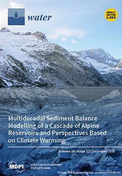
Reservoir sedimentation is a major concern in the operational management of dams and its appurtenant structures. This paper presents a methodology to characterize the annual sediment balance of reservoirs and to assess the effects of climate warming on the annual sediment yield. The methodology is tested on a case study, which consists of a cascade of hydropower reservoirs in the Swiss Alps. The results show that at present, the hydropower cascade formed by Oberaar, Grimsel and Räterichsboden retains about 92% of the annual sediment yield, of which only part of the finest suspended fraction reaches the river network downstream. Under a climate warming scenario with glacier retreat, both sediment yield and runoff will increase on annual average. Therefore, managing the likely greater annual inputs of sediments to the cascade is vital for the perennial use of the water storage facilities. View Paper here.
  • Issues are regarded as officially published after their release is announced to the table of contents alert mailing list.
  • You may sign up for e-mail alerts to receive table of contents of newly released issues.
  • PDF is the official format for papers published in both, html and pdf forms. To view the papers in pdf format, click on the "PDF Full-text" link, and use the free Adobe Reader to open them.
Order results
Result details
Section
Select all
Export citation of selected articles as:
26 pages, 10360 KiB  
Article
A Serious Game Designed to Explore and Understand the Complexities of Flood Mitigation Options in Urban–Rural Catchments
by Mehdi Khoury, Michael J. Gibson, Dragan Savic, Albert S. Chen, Lydia Vamvakeridou-Lyroudia, Harry Langford and Sarah Wigley
Water 2018, 10(12), 1885; https://0-doi-org.brum.beds.ac.uk/10.3390/w10121885 - 19 Dec 2018
Cited by 35 | Viewed by 9459
Abstract
Flood prevention in mixed urban–rural environments has become a greater concern due to climate change. It is a complex task requiring both efficient management of resources and the involvement of multiple stakeholders from diverse backgrounds. As Serious Games (games used for purposes other [...] Read more.
Flood prevention in mixed urban–rural environments has become a greater concern due to climate change. It is a complex task requiring both efficient management of resources and the involvement of multiple stakeholders from diverse backgrounds. As Serious Games (games used for purposes other than mere entertainment) have emerged as an effective means of engaging stakeholders, this work proposes a new Serious Game applied to flood mitigation in the village of Millbrook in the UK. Results show that the game has both an informative and a transformative effect (statistical significance levels from 0.01 to 0.05), improving participants’ understanding of the problem, and helping them to find a new and improved approach to flood risk management in Millbrook, with the potential to improve resilience significantly. Furthermore, the game successfully transformed participants into “citizen scientists” in the purest sense of the term—it led them to use inductive reasoning from data produced by the game to correctly confirm or reject hypotheses and resulted in more than 70% of the participants revising their initial assumptions. Interestingly, the game instigated the formation of new local partnerships and helped to prioritize the discussion of natural flood management measures in Millbrook Parish Council meetings. Full article
Show Figures

Figure 1

18 pages, 3936 KiB  
Article
Evaluation of Evapotranspiration Estimates in the Yellow River Basin against the Water Balance Method
by Guojie Wang, Jian Pan, Chengcheng Shen, Shijie Li, Jiao Lu, Dan Lou and Daniel F. T. Hagan
Water 2018, 10(12), 1884; https://0-doi-org.brum.beds.ac.uk/10.3390/w10121884 - 19 Dec 2018
Cited by 17 | Viewed by 3972
Abstract
Evapotranspiration (ET), a critical process in global climate change, is very difficult to estimate at regional and basin scales. In this study, we evaluated five ET products: the Global Land Surface Evaporation with the Amsterdam Methodology (GLEAM, the EartH2Observe ensemble (E2O)), the Global [...] Read more.
Evapotranspiration (ET), a critical process in global climate change, is very difficult to estimate at regional and basin scales. In this study, we evaluated five ET products: the Global Land Surface Evaporation with the Amsterdam Methodology (GLEAM, the EartH2Observe ensemble (E2O)), the Global Land Data Assimilation System with Noah Land Surface Model-2 (GLDAS), a global ET product at 8 km resolution from Zhang (ZHANG) and a supplemental land surface product of the Modern-ERA Retrospective analysis for Research and Applications (MERRA_land), using the water balance method in the Yellow River Basin, China, including twelve catchments, during the period of 1982–2000. The results showed that these ET products have obvious different performances, in terms of either their magnitude or temporal variations. From the viewpoint of multiple-year averages, the MERRA_land product shows a fairly similar magnitude to the ETw derived from the water balance method, while the E2O product shows significant underestimations. The GLEAM product shows the highest correlation coefficient. From the viewpoint of interannual variations, the ZHANG product performs best in terms of magnitude, while the E2O still shows significant underestimations. However, the E2O product best describes the interannual variations among the five ET products. Further study has indicated that the discrepancies between the ET products in the Yellow River Basin are mainly due to the quality of precipitation forcing data. In addition, most ET products seem to not be sensitive to the downward shortwave radiation. Full article
(This article belongs to the Special Issue Satellite Remote Sensing and Analyses of Climate Variability)
Show Figures

Figure 1

19 pages, 3031 KiB  
Article
Swimming Pool Evaporative Water Loss and Water Use in the Balearic Islands (Spain)
by Angela Hof, Enrique Morán-Tejeda, Jorge Lorenzo-Lacruz and Macià Blázquez-Salom
Water 2018, 10(12), 1883; https://0-doi-org.brum.beds.ac.uk/10.3390/w10121883 - 19 Dec 2018
Cited by 14 | Viewed by 7262
Abstract
The Balearic Islands are a major Mediterranean tourist destination that features one of the greatest swimming pool densities within Europe. In this paper, standard meteorological data were combined with a diachronic swimming pool inventory to estimate water evaporation from swimming pools over the [...] Read more.
The Balearic Islands are a major Mediterranean tourist destination that features one of the greatest swimming pool densities within Europe. In this paper, standard meteorological data were combined with a diachronic swimming pool inventory to estimate water evaporation from swimming pools over the Balearic archipelago. Evaporation was estimated using an empirical equation designed for open-water surfaces. Results revealed a 32% increase in swimming pools’ water use by 2015. Evaporation from swimming pools added 9.6 L of water to touristic consumption per guest night and person, and represented 4.9% of the total urban water consumption. In 2015, almost 5 hm3 (5 billion L) were lost from pools across the Balearic Islands. In several densely urbanized areas, evaporative water loss from pools exceeded four million litres per square kilometre and year. The water needed to refill the total of 62,599 swimming pools and to counteract evaporative water loss is equivalent to 1.2 pools per year. Swimming pools have rapidly proliferated across the islands. We have expounded on this development in view of much-needed responsible water management across the islands. Full article
(This article belongs to the Section Water Resources Management, Policy and Governance)
Show Figures

Graphical abstract

15 pages, 2657 KiB  
Article
Study on the Applicability of the Hargreaves Potential Evapotranspiration Estimation Method in CREST Distributed Hydrological Model (Version 3.0) Applications
by Zhansheng Li, Yuan Yang, Guangyuan Kan and Yang Hong
Water 2018, 10(12), 1882; https://0-doi-org.brum.beds.ac.uk/10.3390/w10121882 - 19 Dec 2018
Cited by 18 | Viewed by 4139 | Correction
Abstract
The potential evapotranspiration (PET) is an important input to the hydrological model and its compatibility has an important influence on the model applications. The applicability of the Hargreaves-Samani (HS) PET estimation method in Coupled Routing and Excess STorage distributed hydrological model version 3.0 [...] Read more.
The potential evapotranspiration (PET) is an important input to the hydrological model and its compatibility has an important influence on the model applications. The applicability of the Hargreaves-Samani (HS) PET estimation method in Coupled Routing and Excess STorage distributed hydrological model version 3.0 (CREST 3.0 model) was studied in a typical humid region, Ganjiang River Basin, in Southern China. The PET estimation methods were evaluated based on the streamflow simulation accuracies using the CREST 3.0 model driven by different PET products with various spatial resolutions. The Penman-Monteith (PM) equation-based PET estimation method was adopted as the reference PET estimation method in this study. The results demonstrated that PET obtained from the HS method was larger than that generated by the PM method, and the CREST 3.0 model driven by both HS and PM-based PET products can simulate the streamflow temporal variations equally well in annual time scale. Compared with the PM method, the HS method was more stable and robust in driving CREST 3.0 model under the scenarios of different spatial resolutions. In addition, during the validation period (2007–2009) with 2003–2006 as the calibration period, the HS outperformed PM considering the streamflow simulation accuracy. Therefore, the HS method was not only applicable to CREST 3.0 model with flexible spatial resolutions, but also can be an alternative method to PM method in CREST 3.0 model streamflow simulation applications in Ganjiang River Basin. The study results will not only increase the confidence on the applicability of the HS method in hydrological simulation in Ganjiang River Basin, but also prove the flexibility of CREST 3.0 model in terms of PET input, which will expand the application range of the CREST 3.0 model. Full article
(This article belongs to the Section Hydrology)
Show Figures

Figure 1

16 pages, 1827 KiB  
Review
Prospects for Improving Irrigated Agriculture in Southern Africa: Linking Water, Energy and Food
by Tafadzwanashe Mabhaudhi, Sylvester Mpandeli, Luxon Nhamo, Vimbayi G. P. Chimonyo, Charles Nhemachena, Aidan Senzanje, Dhesigen Naidoo and Albert T Modi
Water 2018, 10(12), 1881; https://0-doi-org.brum.beds.ac.uk/10.3390/w10121881 - 19 Dec 2018
Cited by 48 | Viewed by 9398
Abstract
Increasing agricultural productivity has always been a prominent feature on the regional agenda due to a high incidence of food and nutrition insecurity. This review assessed the current status of irrigated agriculture in southern Africa from a water–energy–food (WEF) nexus perspective. Gaps and [...] Read more.
Increasing agricultural productivity has always been a prominent feature on the regional agenda due to a high incidence of food and nutrition insecurity. This review assessed the current status of irrigated agriculture in southern Africa from a water–energy–food (WEF) nexus perspective. Gaps and opportunities for improving irrigated agriculture within the context of the WEF nexus were also assessed in terms of the feasible limits to which they can be exploited. Southern Africa faces water scarcity, and climate projections show that member states will face increased physical and/or economic water scarcity by as early as 2025, which will have negative impacts on water, energy and food production. Recurrent droughts experienced across the region reaffirm the sensitive issues of food and energy insecurity as well as water scarcity. Projections of an increasing population within the region indicate increased water, energy and food demand. With agriculture already accounting for about 70% of water withdrawals, increasing the area under irrigation will place additional demand on already strained energy grids and scarce water resources. This poses the question—is increasing irrigated agriculture a solution to improving water access, food security and energy supply? While there are prospects for increasing the area under irrigation and subsequent improvement in agricultural productivity, adopting a WEF nexus approach in doing so would mitigate trade-offs and unintended consequences. Consideration of the WEF nexus in integrated resources planning and management eliminates the possibilities of transferring problems from one sector to other, as it manages synergies and trade-offs. While it is acknowledged that improving water productivity in irrigated agriculture could reduce water and energy use while increasing yield output, there is a need to decide how such savings would then be reallocated. Any intervention to increase the irrigated area should be done in the context of a WEF nexus analytical framework to guide policy and decision-making. Technical planning should evolve around the WEF nexus approach in setting targets, as WEF nexus indicators would reveal the performance and impact of proposed interventions on any of the three WEF nexus components. Full article
(This article belongs to the Special Issue Management of Water-Energy-Food Security Nexus)
Show Figures

Figure 1

23 pages, 1277 KiB  
Article
Water Resources and Sustainability Assessment Based on Group AHP-PCA Method: A Case Study in the Jinsha River Basin
by Jian-Lan Zhou, Qin-Qin Xu and Xian-Yong Zhang
Water 2018, 10(12), 1880; https://0-doi-org.brum.beds.ac.uk/10.3390/w10121880 - 19 Dec 2018
Cited by 25 | Viewed by 3964
Abstract
There is a necessity to assess water resources sustainability for its development and management. However, achievements in water resources and sustainability assessment and specific assessment indicators are limited in current research. A comprehensive index system and the importance priorities of indicators are provided [...] Read more.
There is a necessity to assess water resources sustainability for its development and management. However, achievements in water resources and sustainability assessment and specific assessment indicators are limited in current research. A comprehensive index system and the importance priorities of indicators are provided in this study. The group AHP-PCA (group analytic hierarchy process and principal component analysis) method is proposed to calculate the importance priorities and reduce the dispersion existing in traditional group AHP. A case study is conducted to assess the water resource sustainability of four provinces where the Jinsha River flows and the results are consistent with the experience and knowledge of water resources management and actual situations of these provinces. Further work is still needed for more applications. Full article
(This article belongs to the Section Water Resources Management, Policy and Governance)
Show Figures

Figure 1

22 pages, 3503 KiB  
Article
Flood Inundation Assessment Considering Hydrologic Conditions and Functionalities of Hydraulic Facilities
by Yuan-Heng Wang, Yung-Chia Hsu, Gene Jiing-Yun You, Ching-Lien Yen and Chi-Ming Wang
Water 2018, 10(12), 1879; https://0-doi-org.brum.beds.ac.uk/10.3390/w10121879 - 19 Dec 2018
Cited by 2 | Viewed by 3657
Abstract
This study proposed a two-phase risk analysis scheme for flood management considering flood inundation losses, including: (1) simplified qualitative-based risk analysis incorporating the principles of failure mode and effect analysis (FMEA) to identify all potential failure modes associated with candidate flood control measures, [...] Read more.
This study proposed a two-phase risk analysis scheme for flood management considering flood inundation losses, including: (1) simplified qualitative-based risk analysis incorporating the principles of failure mode and effect analysis (FMEA) to identify all potential failure modes associated with candidate flood control measures, to formulate a remedial action plan aiming for mitigating the inundation risk within an engineering system; and (2) detailed quantitative-based risk analysis to employ numerical models to specify the consequences including flood extent and resulting losses. Conventional qualitative-based risk analysis methods have shown to be time-efficient but without quantitative information for decision making. However, quantitative-based risk analysis methods have shown to be time- and cost- consuming for a full spectrum investigation. The proposed scheme takes the advantages of both qualitative-based and quantitative-based approaches of time-efficient, cost-saving, objective and quantitative features for better flood management in term of expected loss. The proposed scheme was applied to evaluate the Chiang-Yuan Drainage system located on Lin-Bien River in southern Taiwan, as a case study. The remedial action plan given by the proposed scheme has shown to greatly reduce the inundation area in both highlands and lowlands. These measures was investigated to reduce the water volume in the inundation area by 0.2 million cubic meters, even in the scenario that the flood recurrence interval exceeded the normal (10-year) design standard. Our results showed that the high downstream water stage in the downstream boundary may increase the inundation area both in downstream and upstream and along the original drainage channel in the vicinity of the diversion. The selected measures given by the proposed scheme have shown to substantially reduce the flood risk and resulting loss, taking account of various scenarios: short duration precipitation, decreased channel conveyance, pump station failure and so forth. Full article
(This article belongs to the Special Issue The Application of Hydrologic Analysis in Disaster Prevention)
Show Figures

Figure 1

16 pages, 5476 KiB  
Article
Sensitivity Analyses for Modeling Evolving Reactivity of Granular Iron for the Treatment of Trichloroethylene
by Sung-Wook Jeen
Water 2018, 10(12), 1878; https://0-doi-org.brum.beds.ac.uk/10.3390/w10121878 - 19 Dec 2018
Cited by 1 | Viewed by 2563
Abstract
To better predict long-term performance of a remediation system, parameters of a numerical model should be constrained with care by calibrating with reliable experimental data. This study conducted sensitivity analyses for model parameters, which were shown to represent reasonably well the observed geochemical [...] Read more.
To better predict long-term performance of a remediation system, parameters of a numerical model should be constrained with care by calibrating with reliable experimental data. This study conducted sensitivity analyses for model parameters, which were shown to represent reasonably well the observed geochemical behaviors for the column experiments that evaluated evolving reactivity of granular iron for the treatment of trichloroethylene (TCE) resulting from precipitation of secondary minerals. The particular model parameters tested include iron corrosion rate, aragonite and Fe2(OH)2CO3 precipitation rates, and proportionality constants for each mineral. For sensitivity analyses, a specific parameter was systematically changed, while other parameters were fixed at the values for the base case. The ranges of parameters tested were determined based on the previous modeling study. The results showed that the most important and sensitive model parameters were secondary mineral precipitation rates. Also, not only absolute precipitation rate for each mineral but also relative precipitation rates among different minerals were important for system performance. With help of sensitivity analysis, the numerical model can be used as a predictive tool for designing an iron permeable reactive barrier (PRB) and can provide implications for the long-term changes in reactivity and permeability of the system. Full article
(This article belongs to the Section Wastewater Treatment and Reuse)
Show Figures

Figure 1

17 pages, 2986 KiB  
Article
Uncertainty Assessment of Climate Change Adaptation Options Using an Economic Pluvial Flood Risk Framework
by Qianqian Zhou and Karsten Arnbjerg-Nielsen
Water 2018, 10(12), 1877; https://0-doi-org.brum.beds.ac.uk/10.3390/w10121877 - 19 Dec 2018
Cited by 5 | Viewed by 3885
Abstract
Identifying what, when, and how much adaptation is needed to account for increased pluvial flood risk is inherently uncertain. This presents a challenge to decision makers when trying to identify robust measures. This paper presents an integrated uncertainty analysis to quantify not only [...] Read more.
Identifying what, when, and how much adaptation is needed to account for increased pluvial flood risk is inherently uncertain. This presents a challenge to decision makers when trying to identify robust measures. This paper presents an integrated uncertainty analysis to quantify not only the overall uncertainty of individual adaptation scenarios, but also the net uncertainty between adaptation alternatives for a direct comparison of their efficiency. Further, a sensitivity analysis is used to assess the relative contribution of inherent uncertainties in the assessment. A Danish case study shows that the uncertainties in relation to assessing the present hazards and vulnerabilities (e.g., input runoff volume, threshold for damage, and costing of floods) are important to the overall uncertainty, thus contributing substantially to the overall uncertainty in relation to decisions on action or in-action. Once a decision of action has been taken, the uncertainty of the hazards under the current climate, and also the magnitude of future climate change, are less important than other uncertainties such as discount rate and the cost of implementing the adaptation measures. The proposed methodology is an important tool for achieving an explicit uncertainty description of climate adaptation strategies and provides a guide for further efforts (e.g., field data collection) to improve decision-making in relation to climate change. Full article
(This article belongs to the Special Issue Recent Advances in the Assessment of Current and Future Flood Risk)
Show Figures

Figure 1

15 pages, 10097 KiB  
Article
Shock-Capturing Boussinesq Modelling of Broken Wave Characteristics Near a Vertical Seawall
by Weijie Liu, Yue Ning, Yao Zhang and Jiandong Zhang
Water 2018, 10(12), 1876; https://0-doi-org.brum.beds.ac.uk/10.3390/w10121876 - 19 Dec 2018
Cited by 8 | Viewed by 4268
Abstract
Broken wave characteristics in front of a vertical seawall were modeled and studied using a shock-capturing Boussinesq wave model FUNWAVE-TVD. Validation with the experimental data confirmed the capability of FUNWAVE-TVD in predicting the wave characteristics via the shock-capturing method. Compared to the results [...] Read more.
Broken wave characteristics in front of a vertical seawall were modeled and studied using a shock-capturing Boussinesq wave model FUNWAVE-TVD. Validation with the experimental data confirmed the capability of FUNWAVE-TVD in predicting the wave characteristics via the shock-capturing method. Compared to the results obtained from the Boussinesq model coupled with an empirical breaking model, the advantage of the present shock-capturing model for the broken waves near a vertical seawall was clearly revealed. A preliminary investigation of the effects of the key parameters, such as the incident wave height, water level at the seawall, and seabed slope, on the wave kinematics (i.e., the root mean square of the surface fluctuations and depth-averaged horizontal velocity) near the seawall was then conducted through a series of numerical experiments. The numerical results indicate the incident wave height and the water depth at the seawall are the important parameters in determining the magnitude of the wave kinematics, while the effect of the seabed slope seems to be insignificant. The role of the breaking point locations is also highlighted in this study, in which case further breaking can reduce the wave kinematics significantly for the coastal structures predominately subjected to broken waves. Full article
(This article belongs to the Section Hydraulics and Hydrodynamics)
Show Figures

Figure 1

21 pages, 3663 KiB  
Article
Enhancing the Adsorption of Lead (II) by Bentonite Enriched with pH-Adjusted Meranti Sawdust
by P. Mohajeri, C. Smith, M. R. Selamat and H. Abdul Aziz
Water 2018, 10(12), 1875; https://0-doi-org.brum.beds.ac.uk/10.3390/w10121875 - 18 Dec 2018
Cited by 22 | Viewed by 5181
Abstract
In recent years, the need for a safe and modern composite barrier for the prevention of groundwater contamination and the provision of geo-environmental protection has been studied together with the need of designing a low-cost and effective liner for isolating landfill contents from [...] Read more.
In recent years, the need for a safe and modern composite barrier for the prevention of groundwater contamination and the provision of geo-environmental protection has been studied together with the need of designing a low-cost and effective liner for isolating landfill contents from the environment. In this study, various mix designs involving two natural adsorbents, Na-bentonite the pH-adjusted sawdust, were prepared for a series of geo-environmental experiments to be carried out to determine the adsorption capacity, buffering capacity, pH changes, and Chemical Oxygen Demand (COD) changes among others, in the presence of Pb(NO3)2 contaminant concentrations. Generally, the results showed an increase in adsorption capacity in the acidic segment of the treatment. An increase of 58% of the adsorption efficiency of the Na-bentonite in adsorbing the contaminant at the highest concentration was the most important achievement of the system while in the acidic segment. Full article
(This article belongs to the Section Wastewater Treatment and Reuse)
Show Figures

Figure 1

9 pages, 1549 KiB  
Article
Pilot Performance of Chemical Demulsifier on the Demulsification of Produced Water from Polymer/Surfactant Flooding in the Xinjiang Oilfield
by Dong Chen, Feng Li, Yingxin Gao and Min Yang
Water 2018, 10(12), 1874; https://0-doi-org.brum.beds.ac.uk/10.3390/w10121874 - 18 Dec 2018
Cited by 14 | Viewed by 5650
Abstract
Purification of produced water (PW) from polymer/surfactant flooding is a challenge for the petroleum industry due to the high emulsion stability. Demulsification using chemical demulsifiers has been expected to be an effective way to treat PW. In this paper, five cationic (branched quaternary [...] Read more.
Purification of produced water (PW) from polymer/surfactant flooding is a challenge for the petroleum industry due to the high emulsion stability. Demulsification using chemical demulsifiers has been expected to be an effective way to treat PW. In this paper, five cationic (branched quaternary ammonium chloride) and four nonionic (copolymer of propylene oxide and ethylene oxide) demulsifiers with different molecular weights were employed to test their respective demulsification performance in the treatment of PW from polymer/surfactant flooding. The cationic demulsifiers, in general, exhibited better performance than the nonionic ones and one cationic demulsifier (CP-1) exhibiting the best demulsification efficiency was further employed for a pilot experiment in the Xinjiang Oilfield. The oil content of PW could be successfully reduced from 128~7364 to less than 10 mg/L with a dosage of CP-1 for 350 mg/L and polyaluminum chloride (PAC, 30% w/w Al2O3) for 500 mg/L under ambient temperature (14~22 °C). At the same time, partially hydrolyzed polyacrylamide (HPAM) was removed from 176.9~177.1 to 2.8~3.9 mg/L while petroleum sulfonate was not removed too much (from 35.5~43.8 to 25.5~26.5 mg/L). The interfacial rheology analysis on simulated PW from HPAM/petroleum sulfonate flooding revealed that the addition of CP-1 led to a significant increase of the oil-water interfacial tension (from 7 to 15~20 mN/m) and zeta potential (from −32.5 to −19.7 mV). It was, thus, assumed that the decreased net charge on the dispersed oil droplets surface and weakened oil/water film due to the formation of complex between the cationic demulsifier and HPAM may have facilitated the destabilization of the emulsion. The result of this study is useful in better understanding the demulsification processes as well as selecting suitable demulsifiers in the treatment of PW from polymer/surfactant flooding. Full article
(This article belongs to the Section Wastewater Treatment and Reuse)
Show Figures

Graphical abstract

20 pages, 1558 KiB  
Review
Rainfall Infiltration Modeling: A Review
by Renato Morbidelli, Corrado Corradini, Carla Saltalippi, Alessia Flammini, Jacopo Dari and Rao S. Govindaraju
Water 2018, 10(12), 1873; https://0-doi-org.brum.beds.ac.uk/10.3390/w10121873 - 18 Dec 2018
Cited by 45 | Viewed by 9702
Abstract
Infiltration of water into soil is a key process in various fields, including hydrology, hydraulic works, agriculture, and transport of pollutants. Depending upon rainfall and soil characteristics as well as from initial and very complex boundary conditions, an exhaustive understanding of infiltration and [...] Read more.
Infiltration of water into soil is a key process in various fields, including hydrology, hydraulic works, agriculture, and transport of pollutants. Depending upon rainfall and soil characteristics as well as from initial and very complex boundary conditions, an exhaustive understanding of infiltration and its mathematical representation can be challenging. During the last decades, significant research effort has been expended to enhance the seminal contributions of Green, Ampt, Horton, Philip, Brutsaert, Parlange and many other scientists. This review paper retraces some important milestones that led to the definition of basic mathematical models, both at the local and field scales. Some open problems, especially those involving the vertical and horizontal inhomogeneity of the soils, are explored. Finally, rainfall infiltration modeling over surfaces with significant slopes is also discussed. Full article
(This article belongs to the Special Issue Rainfall Infiltration Modeling)
Show Figures

Figure 1

23 pages, 4736 KiB  
Article
Uncertainty Analysis of Two Copula-Based Conditional Regional Design Flood Composition Methods: A Case Study of Huai River, China
by Shiyu Mou, Peng Shi, Simin Qu, Xiaomin Ji, Lanlan Zhao, Ying Feng, Chen Chen and Fengcheng Dong
Water 2018, 10(12), 1872; https://0-doi-org.brum.beds.ac.uk/10.3390/w10121872 - 17 Dec 2018
Cited by 3 | Viewed by 3615
Abstract
The issue of regional design flood composition should be considered when it comes to the analysis of multiple sections. However, the uncertainty accompanied in the process of regional design flood composition point identification is often overlooked in the literature. The purpose of this [...] Read more.
The issue of regional design flood composition should be considered when it comes to the analysis of multiple sections. However, the uncertainty accompanied in the process of regional design flood composition point identification is often overlooked in the literature. The purpose of this paper, therefore, is to uncover the sensibility of marginal distribution selection and the impact of sampling uncertainty caused by the limited records on two copula-based conditional regional design flood composition methods, i.e., the conditional expectation regional design flood composition (CEC) method and the conditional most likely regional design flood composition (CMLC) method, which are developed to derive the combinations of maximum 30-day flood volumes at the two sub-basins above Bengbu hydrological station for given univariate return periods. An experiment combing different marginal distributions was conducted to explore the former uncertainty source, while a conditional copula-based parametric bootstrapping (CC-PB) procedure together with five metrics (i.e., horizontal standard deviation, vertical standard deviation, area of 25%, 50%, 75% BCIs (bivariate confidence intervals)) were designed and employed subsequently to evaluate the latter uncertainty source. The results indicated that the CEC and CMLC point identification was closely bound up with the different combinations of univariate distributions in spite of the comparatively tiny difference of the fitting performances of seven candidate univariate distributions, and was greatly affected by the sampling uncertainty due to the limited observations, which should arouse critical attention. Both of the analyzed sources of uncertainty increased with the growing T (univariate return period). As for the comparison of the two proposed methods, it seemed that the uncertainty due to the marginal selection had a slight larger impact on the CEC scheme than the CMLC scheme; but in terms of sampling uncertainty, the CMLC method performed slightly stable for large floods, while when considering moderate and small floods, the CEC method performed better. Full article
(This article belongs to the Section Hydrology)
Show Figures

Figure 1

23 pages, 7603 KiB  
Article
Available Flood Evacuation Time for High-Risk Areas in the Middle Reach of Chao Phraya River Basin
by Sarawut Jamrussri and Yuji Toda
Water 2018, 10(12), 1871; https://0-doi-org.brum.beds.ac.uk/10.3390/w10121871 - 17 Dec 2018
Cited by 17 | Viewed by 5694
Abstract
Information about risk is essential to design flood risk management programs. To our knowledge, this is the first attempt to develop an emergency flood evacuation plan based on flood risk assessment. Flood risk assessment in the middle Chao Phraya River Basin (CPRB) was [...] Read more.
Information about risk is essential to design flood risk management programs. To our knowledge, this is the first attempt to develop an emergency flood evacuation plan based on flood risk assessment. Flood risk assessment in the middle Chao Phraya River Basin (CPRB) was simultaneously analyzed and mapped as the product of flood hazard, and social vulnerability maps generated by fuzzy Analytic Hierarchy Process (AHP) and fuzzy logic. One of the purposes of flood risk mapping is to promote proper and prompt evacuation actions for residents. The emergency flood evacuation model was tested to explore the available time of evacuation, to reduce the risk or even the loss of life. The simulation results showed that significant time was available for evacuation in the middle CPRB. This was calculated based on a physical status of evacuees, safe evacuation condition, shortest evacuation path, flood shelter, and road capacity. Full article
(This article belongs to the Section Water Resources Management, Policy and Governance)
Show Figures

Figure 1

25 pages, 7906 KiB  
Article
Coevolution of Hydrological Cycle Components under Climate Change: The Case of the Garonne River in France
by Youen Grusson, François Anctil, Sabine Sauvage and José Miguel Sánchez Pérez
Water 2018, 10(12), 1870; https://0-doi-org.brum.beds.ac.uk/10.3390/w10121870 - 17 Dec 2018
Cited by 14 | Viewed by 4168
Abstract
Climate change is suspected to impact water circulation within the hydrological cycle at catchment scale. A SWAT model approach to assess the evolution of the many hydrological components of the Garonne catchment (Southern France) is deployed in this study. Performance over the calibration [...] Read more.
Climate change is suspected to impact water circulation within the hydrological cycle at catchment scale. A SWAT model approach to assess the evolution of the many hydrological components of the Garonne catchment (Southern France) is deployed in this study. Performance over the calibration period (2000–2010) are satisfactory, with Nash–Sutcliffe ranging from 0.55 to 0.94 or R2 from 0.86 to 0.98. Similar performance values are obtained in validation (1962–2000). Water cycle is first analyzed based on past observed climatic data (1962–2010) to understand its variations and geographical spread. Comparison is then conducted against the different trends obtained from a climate ensemble over 2010–2050. Results show a strong impact on green water, such as a reduction of the soil water content (SWC) and a substantial increase in evapotranspiration (ET) in winter. In summer, however, some part of the watershed faces lower ET fluxes because of a lack of SWC to answer the evapotranspiratory demand, highlighting possible future deficits of green water stocks. Blue water fluxes are found significantly decreasing during summer, when in winter, discharge in the higher part of the watershed is found increasing because of a lower snow stock associated to an increase of liquid precipitation, benefiting surface runoff. Full article
(This article belongs to the Special Issue Effects of Climate Change on Water Resources)
Show Figures

Figure 1

15 pages, 3623 KiB  
Article
Locating Spatial Opportunities for Nature-Based Solutions: A River Landscape Application
by Paulina Guerrero, Dagmar Haase and Christian Albert
Water 2018, 10(12), 1869; https://0-doi-org.brum.beds.ac.uk/10.3390/w10121869 - 17 Dec 2018
Cited by 25 | Viewed by 6270
Abstract
Compared to technical infrastructure, nature-based solutions (NBS) strive to work with nature and to move beyond business-as-usual practices. Despite decades of research from various academia fields and a commencing mainstreaming of the term, a lack of cohesiveness and pertinent methods regarding the subject [...] Read more.
Compared to technical infrastructure, nature-based solutions (NBS) strive to work with nature and to move beyond business-as-usual practices. Despite decades of research from various academia fields and a commencing mainstreaming of the term, a lack of cohesiveness and pertinent methods regarding the subject matter hinders further implementation. Using a functional landscape approach, this paper aims to identify the spatial extent of existing and potential NBS locations and applies it across a case study in Germany. Inspired by hydrological models, which work with delineated hydrological response units, this research instead defines hydromorphological landscape units (HLU) based on biophysical spatial criteria to identify the potential areas that could function as NBS. This approach was tested for floodplain-based NBS. The identified HLU were then compared with historical floodplain and land-use data to differentiate between active or potential NBS. The spatial delineation identified 3.6 million hectares of already active floodplains areas, for which we recommend continued or modified protection measures, and 0.4 million ha where the hydromorphological conditions are apt to support floodplains, yet are cut-off from the flooding regime and require rehabilitation measures. The identification of NBS through explicitly defined HLU serves as a spatial approach to support NBS implementation. Taken together, our research can provide an essential contribution to systemize the emerging scholarship on NBS in river landscapes and to help in selecting and planning appropriate NBS in practice. Full article
(This article belongs to the Section Water Quality and Contamination)
Show Figures

Figure 1

22 pages, 5712 KiB  
Article
Ranking of CMIP5 GCM Skills in Simulating Observed Precipitation over the Lower Mekong Basin, Using an Improved Score-Based Method
by Yunfeng Ruan, Zhijun Yao, Rui Wang and Zhaofei Liu
Water 2018, 10(12), 1868; https://0-doi-org.brum.beds.ac.uk/10.3390/w10121868 - 17 Dec 2018
Cited by 21 | Viewed by 4348
Abstract
This study assessed the performances of 34 Coupled Model Intercomparison Project Phase 5 (CMIP5) general circulation models (GCMs) in reproducing observed precipitation over the Lower Mekong Basin (LMB). Observations from gauge-based data of the Asian Precipitation-Highly Resolved Observational Data Integration Towards Evaluation of [...] Read more.
This study assessed the performances of 34 Coupled Model Intercomparison Project Phase 5 (CMIP5) general circulation models (GCMs) in reproducing observed precipitation over the Lower Mekong Basin (LMB). Observations from gauge-based data of the Asian Precipitation-Highly Resolved Observational Data Integration Towards Evaluation of Water Resources (APHRODITE) precipitation data were obtained from 1975 to 2004. An improved score-based method was used to rank the performance of the GCMs in reproducing the observed precipitation over the LMB. The results revealed that most GCMs effectively reproduced precipitation patterns for the mean annual cycle, but they generally overestimated the observed precipitation. The GCMs showed good ability in reproducing the time series characteristics of precipitation for the annual period compared to those for the wet and dry seasons. Meanwhile, the GCMs obviously reproduced the spatial characteristics of precipitation for the dry season better than those for annual time and the wet season. More than 50% of the GCMs failed to reproduce the positive trend of the observed precipitation for the wet season and the dry season (approximately 52.9% and 64.7%, respectively), and approximately 44.1% of the GCMs failed to reproduce positive trend for annual time over the LMB. Furthermore, it was also revealed that there existed different robust criteria for assessing the GCMs’ performances at a seasonal scale, and using multiple criteria was superior to a single criterion in assessing the GCMs’ performances. Overall, the better-performed GCMs were obtained, which can provide useful information for future precipitation projection and policy-making over the LMB. Full article
(This article belongs to the Section Hydrology)
Show Figures

Figure 1

14 pages, 3600 KiB  
Article
Automated Laboratory Infiltrometer to Estimate Saturated Hydraulic Conductivity Using an Arduino Microcontroller Board
by Pedro Rodríguez-Juárez, Hugo E. Júnez-Ferreira, Julián González Trinidad, Manuel Zavala, Susana Burnes-Rudecino and Carlos Bautista-Capetillo
Water 2018, 10(12), 1867; https://0-doi-org.brum.beds.ac.uk/10.3390/w10121867 - 17 Dec 2018
Cited by 4 | Viewed by 5083
Abstract
This paper describes the design, calibration and testing processes of a new device named Automated Laboratory Infiltrometer (ALI). It allows to determinate in laboratory, under controlled conditions the saturated hydraulic conductivity (Ks) of altered or unaltered soil samples which is a key parameter [...] Read more.
This paper describes the design, calibration and testing processes of a new device named Automated Laboratory Infiltrometer (ALI). It allows to determinate in laboratory, under controlled conditions the saturated hydraulic conductivity (Ks) of altered or unaltered soil samples which is a key parameter to understand the movement of water through a porous medium. The ALI combines the advantages of three different approaches: measures vertical infiltration rates in a soil column, measures the actual volumes of vertically drained water through the soil column, and finally, uses heat as a natural tracer to determinate water flux rates through the porous medium; all those parameters are used to determinate Ks. The ALI was developed using the popular Arduino microcontroller board and commercially available sensors that give the whole system a low cost. Data from the ALI are recorded in a microSD memory so they can be easily read from any spreadsheet software helping to reduce time consuming and avoiding reading errors. The performance of this device was evaluated by comparing the water flow rates determined by the three approaches for which is designed; an excellent correlation among them was observed (worst correlation: R2 = 0.9826 and r-RSME = 0.94%). Full article
(This article belongs to the Special Issue Soil Hydrology for a Sustainable Land Management: Theory and Practice)
Show Figures

Figure 1

18 pages, 3900 KiB  
Article
Evaluating Future Flood Scenarios Using CMIP5 Climate Projections
by Narayan Nyaupane, Balbhadra Thakur, Ajay Kalra and Sajjad Ahmad
Water 2018, 10(12), 1866; https://0-doi-org.brum.beds.ac.uk/10.3390/w10121866 - 17 Dec 2018
Cited by 37 | Viewed by 5122
Abstract
Frequent flooding events in recent years have been linked with the changing climate. Comprehending flooding events and their risks is the first step in flood defense and can help to mitigate flood risk. Floodplain mapping is the first step towards flood risk analysis [...] Read more.
Frequent flooding events in recent years have been linked with the changing climate. Comprehending flooding events and their risks is the first step in flood defense and can help to mitigate flood risk. Floodplain mapping is the first step towards flood risk analysis and management. Additionally, understanding the changing pattern of flooding events would help us to develop flood mitigation strategies for the future. This study analyzes the change in streamflow under different future carbon emission scenarios and evaluates the spatial extent of floodplain for future streamflow. The study will help facility managers, design engineers, and stakeholders to mitigate future flood risks. Variable Infiltration Capacity (VIC) forcing-generated Coupled Model Intercomparison Project phase 5 (CMIP5) streamflow data were utilized for the future streamflow analysis. The study was done on the Carson River near Carson City, an agricultural area in the desert of Nevada. Kolmogorov–Smirnov and Pearson Chi-square tests were utilized to obtain the best statistical distribution that represents the routed streamflow of the Carson River near Carson City. Altogether, 97 projections from 31 models with four emission scenarios were used to predict the future flood flow over 100 years using a best fit distribution. A delta change factor was used to predict future flows, and the flow routing was done with the Hydrologic Engineering Center’s River Analysis System (HEC-RAS) model to obtain a flood inundation map. A majority of the climate projections indicated an increase in the flood level 100 years into the future. The developed floodplain map for the future streamflow indicated a larger inundation area compared with the current Federal Emergency Management Agency’s flood inundation map, highlighting the importance of climate data in floodplain management studies. Full article
Show Figures

Figure 1

11 pages, 944 KiB  
Article
Riverbank Filtration Impacts on Post Disinfection Water Quality in Small Systems—A Case Study from Auburn and Nebraska City, Nebraska
by Matteo D'Alessio, Bruce Dvorak and Chittaranjan Ray
Water 2018, 10(12), 1865; https://0-doi-org.brum.beds.ac.uk/10.3390/w10121865 - 15 Dec 2018
Cited by 4 | Viewed by 3654
Abstract
Small water systems can experience a fluctuating quality of water in the distribution system after disinfection. As chlorine is the most common disinfectant for small systems, the occurrence of disinfection byproducts (DBPs) represents a common problem for these systems. Riverbank filtration (RBF) can [...] Read more.
Small water systems can experience a fluctuating quality of water in the distribution system after disinfection. As chlorine is the most common disinfectant for small systems, the occurrence of disinfection byproducts (DBPs) represents a common problem for these systems. Riverbank filtration (RBF) can be a valuable solution for small communities located on riverbanks. The objectives of this study were to evaluate (i) the improvements in water quality at two selected RBF systems, and (ii) the potential lower concentrations of DBPs, in particular, trihalomethanes (THMs), in small systems that use RBF. Two small communities in Nebraska, Auburn and Nebraska City, using RBF were selected. Results from this study highlight the ability of RBF systems to consistently improve the quality of the source water and reduce the occurrence of THMs in the distribution water. However, the relative removal of THMs was directly impacted by the dissolved organic carbon (DOC) removal. Different THM concentrations and different DOC removals were observed at the two RBF sites due to the different travel distances between the river and the extractions wells. Full article
(This article belongs to the Special Issue Efficiency of Bank Filtration and Post-Treatment)
Show Figures

Figure 1

18 pages, 2723 KiB  
Article
Evapotranspiration of the Brazilian Pampa Biome: Seasonality and Influential Factors
by Gisele Cristina Rubert, Débora Regina Roberti, Luis Santos Pereira, Fernando L. F. Quadros, Haroldo Fraga de Campos Velho and Osvaldo Luiz Leal de Moraes
Water 2018, 10(12), 1864; https://0-doi-org.brum.beds.ac.uk/10.3390/w10121864 - 15 Dec 2018
Cited by 46 | Viewed by 4652 | Correction
Abstract
Experimentally characterizing evapotranspiration (ET) in different biomes around the world is an issue of interest for different areas of science. ET in natural areas of the Brazilian Pampa biome has still not been assessed. In this study, the actual ET (ETact) [...] Read more.
Experimentally characterizing evapotranspiration (ET) in different biomes around the world is an issue of interest for different areas of science. ET in natural areas of the Brazilian Pampa biome has still not been assessed. In this study, the actual ET (ETact) obtained from eddy covariance measurements over two sites of the Pampa biome was analyzed. The objective was to evaluate the energy partition and seasonal variability of the actual ET of the Pampa biome. Results showed that the latent heat flux was the dominant component in available energy in both the autumn–winter (AW) and spring–summer (SS) periods. Evapotranspiration of the Pampa biome showed strong seasonality, with highest ET rates in the SS period. During the study period, approximately 65% of the net radiation was used for the evapotranspiration process in the Pampa biome. The annual mean ET rate was 2.45 mm d−1. ET did not show to vary significantly between sites, with daily values very similar in both sites. The water availability in the Pampa biome was not a limiting factor for ET, which resulted in a small difference between the reference ET and the actual ET. These results are helpful in achieving a better understanding of the temporal pattern of ET in relation to the landscape of the Pampa biome and its meteorological, soil, and vegetation characteristics. Full article
(This article belongs to the Special Issue Innovation Issues in Water, Agriculture and Food)
Show Figures

Figure 1

17 pages, 6561 KiB  
Article
Assessment of Changes in Water Balance Components under 1.5 °C and 2.0 °C Global Warming in Transitional Climate Basin by Multi-RCPs and Multi-GCMs Approach
by Ying Hao, Jingjin Ma, Jing Chen, Dongyong Wang, Yuan Wang and Hongmei Xu
Water 2018, 10(12), 1863; https://0-doi-org.brum.beds.ac.uk/10.3390/w10121863 - 15 Dec 2018
Cited by 7 | Viewed by 3779
Abstract
The global warming of 1.5 °C and 2.0 °C proposed in the Paris Agreement has become the iconic threshold of climate change impact research. This study aims to assess the potential impact of 1.5 °C and 2.0 °C global warming on water balance [...] Read more.
The global warming of 1.5 °C and 2.0 °C proposed in the Paris Agreement has become the iconic threshold of climate change impact research. This study aims to assess the potential impact of 1.5 °C and 2.0 °C global warming on water balance components (WBC) in a transitional climate basin—Chaobai River Basin (CRB)—which is the main water supply source of Beijing. A semi-distributed hydrological model SWAT (Soil and Water Assessment Tool) was driven by climate projections from five General Circulation Models (GCMs) under three Representative Concentration Pathways (RCPs) to simulate the future WBC in CRB under the 1.5 °C and 2.0 °C global warming, respectively. The impacts on annual, monthly WBC were assessed and the uncertainty associated with GCMs and RCPs were analyzed quantitatively, based on the model results. Finally, spatial variation of WBC change trend and its possible cause were discussed. The analysis results indicate that all the annual WBC and water budget are projected to increase under both warming scenarios. Change trend of WBC shows significant seasonal and spatial inhomogeneity. The frequency of flood will increase in flood season, while the probability of drought in autumn and March is expected to rise. The uneven spatial distribution of change trend might be attributed to topography and land use. The comparison between two warming scenarios indicates that the increment of 0.5 °C could lead to the decrease in annual surface runoff, lateral flow, percolation, and the increase in annual precipitation and evapotranspiration (ET). Uncertainties of surface runoff, lateral flow, and percolation projections are greater than those of other components. The additional 0.5 °C global warming will lead to larger uncertainties of future temperature, precipitation, surface runoff, and ET assessment, but slightly smaller uncertainties of lateral flow and percolation assessment. GCMs are proved to be the main factors that are responsible for the impact uncertainty of the majority assessed components. Full article
(This article belongs to the Section Hydrology)
Show Figures

Figure 1

18 pages, 865 KiB  
Review
Why We Should Include Soil Structural Dynamics of Agricultural Soils in Hydrological Models
by Parvathy Chandrasekhar, Janis Kreiselmeier, Andreas Schwen, Thomas Weninger, Stefan Julich, Karl-Heinz Feger and Kai Schwärzel
Water 2018, 10(12), 1862; https://0-doi-org.brum.beds.ac.uk/10.3390/w10121862 - 15 Dec 2018
Cited by 31 | Viewed by 6526
Abstract
Surface soil structure is sensitive to natural and anthropogenic impacts that alter soil hydraulic properties (SHP). These alterations have distinct consequences on the water cycle. In this review, we summarized published findings on the quantitative effects of different agricultural management practices on SHP [...] Read more.
Surface soil structure is sensitive to natural and anthropogenic impacts that alter soil hydraulic properties (SHP). These alterations have distinct consequences on the water cycle. In this review, we summarized published findings on the quantitative effects of different agricultural management practices on SHP and the subsequent response of the water balance components. Generally, immediately after tillage, soils show a high abundance of large pores, which are temporally unstable and collapse due to environmental factors like rainfall. Nevertheless, most hydrological modeling studies consider SHP as temporally constant when predicting the flow of water and solutes in the atmosphere-plant-soil system. There have been some developments in mathematical approaches to capture the temporal dynamics of soil pore space. We applied one such pore evolution model to two datasets to evaluate its suitability to predict soil pore space dynamics after disturbance. Lack of knowledge on how dispersion of pore size distribution behaves after tillage may have led to over-estimation of some values predicted by the model. Nevertheless, we found that the model predicted the evolution of soil pore space reasonably well (r2 > 0.80 in most cases). The limiting factor to efficiently calibrate and apply such modeling tools is not in the theoretical part but rather the lack of adequate soil structural and hydrologic data. Full article
(This article belongs to the Special Issue Soil Hydrology in Agriculture)
Show Figures

Figure 1

13 pages, 2098 KiB  
Article
Behavior of Organic Micropollutants During River Bank Filtration in Budapest, Hungary
by Zsuzsanna Nagy-Kovács, Balázs László, Ernő Fleit, Katalin Czichat-Mártonné, Gábor Till, Hilmar Börnick, Yasmin Adomat and Thomas Grischek
Water 2018, 10(12), 1861; https://0-doi-org.brum.beds.ac.uk/10.3390/w10121861 - 14 Dec 2018
Cited by 26 | Viewed by 4807
Abstract
This paper summarizes results from a half-year sampling campaign in Budapest, when Danube River water and bank filtrate were analyzed for 36 emerging micropollutants. Twelve micropollutants were detected regularly in both river water and bank filtrate. Bisphenol A, carbamazepine, and sulfamethoxazole showed low [...] Read more.
This paper summarizes results from a half-year sampling campaign in Budapest, when Danube River water and bank filtrate were analyzed for 36 emerging micropollutants. Twelve micropollutants were detected regularly in both river water and bank filtrate. Bisphenol A, carbamazepine, and sulfamethoxazole showed low removal (<20%) during bank filtration on Szentendre Island and Csepel island, whereas 1H-benzotriazole, tolyltriazole, diclofenac, cefepime, iomeprol, metazachlor, and acesulfame showed medium to high removal rates of up to 78%. The concentration range in bank filtrate was much lower compared to river water, proving the equilibration effect of bank filtration for water quality. Full article
(This article belongs to the Special Issue Efficiency of Bank Filtration and Post-Treatment)
Show Figures

Figure 1

16 pages, 2241 KiB  
Article
Water Demand Framework and Water Development: The Case of China
by Yahua Wang, Tingting Wan and Cecilia Tortajada
Water 2018, 10(12), 1860; https://0-doi-org.brum.beds.ac.uk/10.3390/w10121860 - 14 Dec 2018
Cited by 8 | Viewed by 4480
Abstract
Water resources management is increasingly important for sustainable economic and social development. A coherent division of the development stages is of primary importance for selecting and implementing related water resource management strategies. Using evolving supply–demand relationships, this paper proposes a framework that considers [...] Read more.
Water resources management is increasingly important for sustainable economic and social development. A coherent division of the development stages is of primary importance for selecting and implementing related water resource management strategies. Using evolving supply–demand relationships, this paper proposes a framework that considers water development stages to present a series of dynamic relationships between water demand changes and overall economic development. The framework is applied to China to advance the understanding of how demand evolves at different stages of water resources development under specific socioeconomic circumstances, and of strategic choices in general. The case of China explains how water resources management has gradually improved during distinct socioeconomic development stages. It illustrates the varieties and effectiveness of water policies made to adapt to changing demand over the course of socioeconomic development. The framework can be potentially applied to other countries or regions to identify the development stage in order to select proper water management strategies. Full article
Show Figures

Figure 1

18 pages, 11652 KiB  
Article
Vortex Cascade Features of Turbulent Flow in Hydro-Turbine Blade Passage with Complex Geometry
by Xiucheng Hu and Lixiang Zhang
Water 2018, 10(12), 1859; https://0-doi-org.brum.beds.ac.uk/10.3390/w10121859 - 14 Dec 2018
Cited by 3 | Viewed by 6371
Abstract
A large-eddy simulation of three-dimensional turbulent flow for a hydro-turbine in the transitional process of decreasing load from rated power to no-load has been implemented by using ANSYS-Fluent in this paper. The survival space occupied by different scale flow structures for the different [...] Read more.
A large-eddy simulation of three-dimensional turbulent flow for a hydro-turbine in the transitional process of decreasing load from rated power to no-load has been implemented by using ANSYS-Fluent in this paper. The survival space occupied by different scale flow structures for the different guide vane opening degrees was well captured. The flow characteristics in the transitional process were obtained. Different forms of the channel vortex were studied. The features of the vortex cascade and dissipation of the turbulent energy in blade passage were analyzed. The results show that the scales of the vortex structures have a large change in the transitional process of rejecting load, and the vortex distributions in the blade passage are significantly distinguished. The survival space of the different scale eddies in the blade passage is closely related to the scales of the vortex. The survival volume ratio of the adjacent scale vortex in the runner is about 1.2–1.6. The turbulent kinetic energy and eddy viscosity increase rapidly along the blade passage with the small-scale eddies going up, which implies that a dissipating path for the energy in the blade passage is formed. Full article
Show Figures

Figure 1

21 pages, 7259 KiB  
Article
Spatial and Seasonal Distribution and Transportation of Different Forms of Phosphorus in the Middle Reaches of the Yarlung Zangbo River
by Xiaolong Cheng, Yanan Huang, Xunchi Pu, Ruidong An, Wendian Huang, Jia Li, Wei Wang and Ran Li
Water 2018, 10(12), 1858; https://0-doi-org.brum.beds.ac.uk/10.3390/w10121858 - 14 Dec 2018
Cited by 12 | Viewed by 3570
Abstract
The Yarlung Zangbo River basin ecosystem is fragile. The distribution and transportation of phosphorus is of great significance for aquatic environmental protection and ecological security. The sequential extraction method and molybdenum antimony anti-spectrophotometry were used to measure the concentrations of different forms of [...] Read more.
The Yarlung Zangbo River basin ecosystem is fragile. The distribution and transportation of phosphorus is of great significance for aquatic environmental protection and ecological security. The sequential extraction method and molybdenum antimony anti-spectrophotometry were used to measure the concentrations of different forms of phosphorus in the surface sediments from 15 sampling sites along the middle reaches of the Yarlung Zangbo River and its tributaries. The results show that the total phosphorus concentration in the surface sediments is 194.0~540.7 mg/kg, which is mainly composed of inorganic phosphorus. The concentrations of various phosphorus forms ranked as calcium-bound phosphorus (355.6 ± 86.0 mg/kg) > soluble phosphorus (15.9 ± 10.0 mg/kg) > iron-bound phosphorus (12.4 ± 12.3 mg/kg) > organic phosphorus (9.6 ± 6.1 mg/kg) > occluded phosphorus (9.2 ± 3.8 mg/kg) > aluminum-bound phosphorus (5.4 ± 2.3 mg/kg). On the whole, phosphorus concentration is greater in wet season than dry season. Regarding the spatial distribution characteristics, there are great disparities in the different forms of phosphorus in the middle reaches of the Yarlung Zangbo River. Comprehensive analysis shows that phosphorus of this area is mainly self-generated, and concentration of bioavailable phosphorus is small, demonstrating there will not be a large release. We also drew a “specific triangle” of the different forms of phosphorus concentrations in the research area and defined the “α” angle to determine the nutrient status of the overlying water quickly and effectively. Finally, phosphorus flux of the mainstream was estimated. This research may provide information on the phosphorus of Plateau Rivers. Full article
(This article belongs to the Special Issue Environmental Chemistry of Water Quality Monitoring)
Show Figures

Figure 1

19 pages, 4365 KiB  
Article
Qualifying Coordination Mechanism for Cascade-Reservoir Operation with a New Game-Theoretical Methodology
by Yuni Xu, Xiang Fu and Jianan Qin
Water 2018, 10(12), 1857; https://0-doi-org.brum.beds.ac.uk/10.3390/w10121857 - 14 Dec 2018
Cited by 8 | Viewed by 3056
Abstract
The coordinated operation for hydropower generation in cascade reservoirs is critical to resolve the conflicts in hydropower needs between upstream and downstream reservoirs. Due to the individual rationality and collective rationality highlighted by game theory, we propose an integrated game-theoretical model to simulate [...] Read more.
The coordinated operation for hydropower generation in cascade reservoirs is critical to resolve the conflicts in hydropower needs between upstream and downstream reservoirs. Due to the individual rationality and collective rationality highlighted by game theory, we propose an integrated game-theoretical model to simulate the coordination behaviors among cascade reservoirs for hydropower generation. In the case study of a cascade-reservoir system in the Yangtze River of China, three operation models are compared and analyzed: the non-cooperative model, centralized model, and integrated game-theoretical model. The factors influencing the coordination efficiency of the integrated game-theoretical model are also explored in this study. The results indicate that the system’s hydropower generation obtained by the integrated game-theoretical model is closer to the ideal solution obtained by the centralized model compared to that obtained by the non-cooperative model. Moreover, individual hydropower generation in non-cooperation (rational individual gains) is guaranteed by the integrated game-theoretical model, which is neglected by the centralized model. Furthermore, the coordination efficiency of the integrated game-theoretical model is influenced by the water availability variation and regulation capacities of cascade reservoirs. Full article
(This article belongs to the Special Issue Economics of Water Resources Management)
Show Figures

Figure 1

15 pages, 2835 KiB  
Article
Hydrochemical Changes and Influencing Factors in the Dongkemadi Region, Tanggula Range, China
by Tianding Han, Yuping Li, Jia Qin, Xiangying Li, Qin Yang and Xiaobo He
Water 2018, 10(12), 1856; https://0-doi-org.brum.beds.ac.uk/10.3390/w10121856 - 14 Dec 2018
Cited by 4 | Viewed by 2968
Abstract
In order to detect the source and controlling factors of hydrochemical ions in glacier meltwater-recharged rivers, the chemical characteristics of the river water, precipitation, and meltwater of the Dongkemadi River Basin, China, in 2014 (from May to October) were systematically analyzed, and combined [...] Read more.
In order to detect the source and controlling factors of hydrochemical ions in glacier meltwater-recharged rivers, the chemical characteristics of the river water, precipitation, and meltwater of the Dongkemadi River Basin, China, in 2014 (from May to October) were systematically analyzed, and combined with the hydrological and meteorological data. The results show that the hydrochemical pattern of the typical river was HCO3-Ca2+. The most cations were Ca2+ and Mg2+, and the predominant anions were HCO3 and SO42−, in the river. The concentration of major ions and total dissolved solids (TDS) in the river water were much larger than that in the precipitation and meltwater. The TDS concentration was ordered: River water > precipitation > meltwater. The water-rock interaction and the dilution effect of the precipitation and meltwater on the runoff ions resulted in a negative correlation between the ion concentration of the river water and the river flow. The chemical ions of the river runoff mainly originated from rock weathering and the erosion (abrasion) caused by glacier movement. In addition, the contributions of different sources to the dissolved components of the Dongkemadi River were ordered: Carbonate (75.8%) > silicate (15.5%) > hydatogenic rock (5.7%) > atmospheric precipitation (3%), calculated by a forward geochemical model. And the hydrochemical weathering rates of carbonate and silicate minerals were 12.30 t·km−2·a−1 and 1.98 t·km−2·a−1, respectively. The CO2 fluxes, consumed by the chemical weathering of carbonate and silicate, were 3.28 × 10⁵ mol·km−2·a−1 and 0.91 × 10⁵ mol·km−2·a−1, respectively. Full article
(This article belongs to the Special Issue Impacts of Climate Change on Water Resources in Glacierized Regions)
Show Figures

Figure 1

Previous Issue
Next Issue
Back to TopTop