Next Issue
Volume 12, December
Previous Issue
Volume 12, October


Water, Volume 12, Issue 11 (November 2020) – 343 articles

Cover Story (view full-size image): 
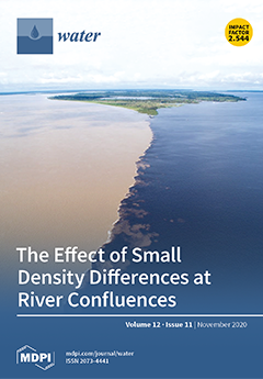
Remarkable 3D flow structures occur at river confluences with small density differences due to differences in sediment concentration or temperature. We explain these by comparing numerical simulations for an idealized confluence with aerial photographs of several river confluences where color differences express the pattern of density differences at the surface. We analyzed numerical simulations of the Rio Negro–Solimões confluence near Manaus, Brazil, in more detail. View this paper
  • Issues are regarded as officially published after their release is announced to the table of contents alert mailing list.
  • You may sign up for e-mail alerts to receive table of contents of newly released issues.
  • PDF is the official format for papers published in both, html and pdf forms. To view the papers in pdf format, click on the "PDF Full-text" link, and use the free Adobe Reader to open them.
Order results
Result details
Section
Select all
Export citation of selected articles as:
12 pages, 2049 KiB  
Technical Note
Calibrations of Suspended Sediment Concentrations in High-Turbidity Waters Using Different In Situ Optical Instruments
by Yunwei Wang, Yun Peng, Zhiyun Du, Hangjie Lin and Qian Yu
Water 2020, 12(11), 3296; https://0-doi-org.brum.beds.ac.uk/10.3390/w12113296 - 23 Nov 2020
Cited by 11 | Viewed by 2556
Abstract
In environments of high suspended sediment concentration (SSC > 1 kg/m3), efficient measurements of SSC through accurate calibration relationships between turbidity and SSC are necessary for studies on marine sediment dynamics. Here, we investigated the performance of three types of optical [...] Read more.
In environments of high suspended sediment concentration (SSC > 1 kg/m3), efficient measurements of SSC through accurate calibration relationships between turbidity and SSC are necessary for studies on marine sediment dynamics. Here, we investigated the performance of three types of optical instrument (OBS-3A, AQUAlogger 310TY, and RBRsolo3Tu with Seapoint sensor) in observations carried out at the middle of the Jiangsu coast, China. These instruments were calibrated in the lab using the water and suspended sediment samples collected from the observation site. It was found that both the calibration curves of OBS-3A and RBRsolo3Tu have an inflection point (at SSC of ca. 15 kg/m3 for OBS-3A and ca. 2 kg/m3 for RBRsolo3Tu), on either side of which turbidity increases (the left side) or decreases (the right side) with the increasing SSC. Only under SSCs smaller than the inflection point can OBS-3A and RBRsolo3Tu be applied to continuous SSC measurements at a fixed point. However, the turbidity output of AQUAlogger 310TY has always a positive correlation with SSC, which applies for SSC up to 40 kg/m3; thus, three fluid-mud events are quantified during this observation. AQUAlogger 310TY has important prospects for field applications in high-SSC environments. Full article
Show Figures

Figure 1

16 pages, 3950 KiB  
Article
Short-Term Impact of Tillage on Soil and the Hydrological Response within a Fig (Ficus Carica) Orchard in Croatia
by Leon Josip Telak, Paulo Pereira, Carla S. S. Ferreira, Vilim Filipovic, Lana Filipovic and Igor Bogunovic
Water 2020, 12(11), 3295; https://0-doi-org.brum.beds.ac.uk/10.3390/w12113295 - 23 Nov 2020
Cited by 14 | Viewed by 3215
Abstract
Tillage is well known to have impacts on soil properties and hydrological responses. This work aims to study the short-term impacts of tillage (0–3 months) on soil and hydrological responses in fig orchards located in Croatia. Understanding the soil hydrological response in the [...] Read more.
Tillage is well known to have impacts on soil properties and hydrological responses. This work aims to study the short-term impacts of tillage (0–3 months) on soil and hydrological responses in fig orchards located in Croatia. Understanding the soil hydrological response in the study area is crucial for soil management due to frequent autumn floods. The hydrological response was investigated using rainfall simulation experiments (58 mm h−1, for 30 min, over 0.785 m2 plots). The results show that the bulk density was significantly higher 3 months after tillage than at 0 and 1 months. The water holding capacity and amount of soil organic matter decreased with time. The water runoff and phosphorous loss (P loss) increased over time. The sediment concentration (SC) was significantly higher 3 months after tillage than in the previous monitoring periods, while sediment loss (SL) and carbon loss (C loss) were significantly lower 0 months after tillage than 3 months after tillage. Overall, there was an increase in soil erodibility with time (high SC, SL, C loss, and P loss), attributed to the precipitation patterns that increase the soil water content and therefore the hydrological response. Therefore, sustainable agricultural practices are needed to avoid sediment translocation and to mitigate floods and land degradation. Full article
(This article belongs to the Special Issue Impact of Land-Use Changes on Surface Hydrology and Water Quality)
Show Figures

Figure 1

19 pages, 4588 KiB  
Article
Assessing Land-Cover Effects on Stream Water Quality in Metropolitan Areas Using the Water Quality Index
by TaeHo Kim, YoungWoo Kim, Jihoon Shin, ByeongGeon Go and YoonKyung Cha
Water 2020, 12(11), 3294; https://0-doi-org.brum.beds.ac.uk/10.3390/w12113294 - 23 Nov 2020
Cited by 8 | Viewed by 6348
Abstract
This study evaluated the influence of different land-cover types on the overall water quality of streams in urban areas. To ensure national applicability of the results, this study encompassed ten major metropolitan areas in South Korea. Using cluster analysis, watersheds were classified into [...] Read more.
This study evaluated the influence of different land-cover types on the overall water quality of streams in urban areas. To ensure national applicability of the results, this study encompassed ten major metropolitan areas in South Korea. Using cluster analysis, watersheds were classified into three land-cover types: Urban-dominated (URB), agriculture-dominated (AGR), and forest-dominated (FOR). For each land-cover type, factor analysis (FA) was used to ensure simple and feasible parameter selection for developing the minimum water quality index (WQImin). The chemical oxygen demand, fecal coliform (total coliform for FOR), and total nitrogen (nitrate-nitrogen for URB) were selected as key parameters for all land-cover types. Our results suggest that WQImin can minimize bias in water quality assessment by reducing redundancy among correlated parameters, resulting in better differentiation of pollution levels. Furthermore, the dominant land-cover type of watersheds, not only affects the level and causes of pollution, but also influences temporal patterns, including the long-term trends and seasonality, of stream water quality in urban areas in South Korea. Full article
(This article belongs to the Special Issue Assessing Water Quality by Statistical Methods)
Show Figures

Figure 1

25 pages, 6077 KiB  
Article
Innovative Trend Analysis of Air Temperature and Precipitation in the Jinsha River Basin, China
by Zengchuan Dong, Wenhao Jia, Ranjan Sarukkalige, Guobin Fu, Qing Meng and Qin Wang
Water 2020, 12(11), 3293; https://0-doi-org.brum.beds.ac.uk/10.3390/w12113293 - 23 Nov 2020
Cited by 17 | Viewed by 3623
Abstract
Trend detection based on hydroclimatological time series is crucial for understanding climate change. In this study, the innovative trend analysis (ITA) method was applied to investigate trends in air temperature and precipitation over the Jinsha River Basin (JRB), China, from 1961 to 2016 [...] Read more.
Trend detection based on hydroclimatological time series is crucial for understanding climate change. In this study, the innovative trend analysis (ITA) method was applied to investigate trends in air temperature and precipitation over the Jinsha River Basin (JRB), China, from 1961 to 2016 based on 40 meteorological stations. Climatic factors series were divided into three categories according to percentile, and the hidden trends were evaluated separately. The ITA results show that annual and seasonal temperatures have significantly increased whereas the variation range of annual temperature tended to narrow. Spatial pattern analysis of the temperature indicates that high elevation areas show more increasing trends than flat areas. Furthermore, according to ITA, significant increase trends are observed in annual precipitation and “high” category of spring precipitation. The sub-basins results show a significant decreasing trend in elevation zones of ≤2000 m and an increasing trend where elevation is >2000 m. Moreover, linkage between temperature and precipitation was analyzed and the potential impact of the combined changes was demonstrated. The results of this study provide a reference for future water resources planning in the JRB and will help advance the understanding of climate change in similar areas. Full article
(This article belongs to the Section Hydrology)
Show Figures

Figure 1

21 pages, 5100 KiB  
Article
Sources, Influencing Factors, and Pollution Process of Inorganic Nitrogen in Shallow Groundwater of a Typical Agricultural Area in Northeast China
by Xinqiang Du, Jing Feng, Min Fang and Xueyan Ye
Water 2020, 12(11), 3292; https://0-doi-org.brum.beds.ac.uk/10.3390/w12113292 - 23 Nov 2020
Cited by 9 | Viewed by 2447
Abstract
As one of the largest agricultural areas, the Sanjiang Plain of Northeast China has faced serious inorganic nitrogen pollution of groundwater, but the sources and the formation mechanism of pollution in the regional shallow groundwater remain unclear, which constrains the progress of pollution [...] Read more.
As one of the largest agricultural areas, the Sanjiang Plain of Northeast China has faced serious inorganic nitrogen pollution of groundwater, but the sources and the formation mechanism of pollution in the regional shallow groundwater remain unclear, which constrains the progress of pollution control and agricultural development planning. An investigation on potential nitrogen sources, groundwater inorganic nitrogen compounds (NH4+, NO3, NO2), and topsoil total nitrogen concentration (TN) was conducted in a typical paddy irrigation area of Sanjiang Plain. Multivariate statistical analysis combined with geospatial-based assessment was applied to identify the sources, determine the governing influencing factors, and analyze the formation process of inorganic nitrogen compounds in shallow groundwater. The results show that the land use type, oxidation-reduction potential (Eh), groundwater depth, NO2 concentration, and electrical conductivity (EC) are highly correlated with the NO3 pollution in groundwater, while DO and Eh affected the distribution of NH4+ most; the high concentrations of NO3 in sampling wells are most likely to be found in the residential land and are distributed mainly in densely populated areas, whereas the NH4+ compounds are most likely to accumulate in the paddy field or the lands surrounded by paddy field and reach the highest level in the northwest of the area, where the fields were cultivated intensively with higher fertilization rates and highest values of topsoil TN. From the results, it can be concluded that that the NO3 compounds in groundwater originated from manure and domestic waste and accumulated in the oxidizing environment, while the NH4+ compounds were derived from N fertilization and remained steady in the reducing environment. NO2 compounds in groundwater were the immediate products of nitrification as a result of microorganism activities. Full article
(This article belongs to the Special Issue Assessing Water Quality by Statistical Methods)
Show Figures

Figure 1

13 pages, 3949 KiB  
Article
Analysis of the Flow Performance of the Complex Cross-Section Module to Reduce the Sedimentation in a Combined Sewer Pipe
by Hyon Wook Ji, Sung Soo Yoo, Dan Daehyun Koo and Jeong-Hee Kang
Water 2020, 12(11), 3291; https://0-doi-org.brum.beds.ac.uk/10.3390/w12113291 - 23 Nov 2020
Cited by 4 | Viewed by 2304
Abstract
The difference in the amount of stormwater and sewage in a combined sewer system is significantly large in areas where heavy rainfall is concentrated. This leads to a low water level and slow flow velocity inside the pipes, which causes sedimentation and odor [...] Read more.
The difference in the amount of stormwater and sewage in a combined sewer system is significantly large in areas where heavy rainfall is concentrated. This leads to a low water level and slow flow velocity inside the pipes, which causes sedimentation and odor on non-rainy days. A complex cross-section module increases the flow velocity by creating a small waterway inside the pipe for sewage to flow on non-rainy days. While considering Manning’s equation, we applied the principle where the flow velocity is proportional to two-thirds of the power of the hydraulic radius. The flow velocity of a circular pipe with a diameter of 450 mm and the corresponding complex cross-section module was analyzed by applying Manning’s equation and numerical modeling to show the effects of the complex cross-section module. The tractive force was compared based on a lab-scale experiment. When all conditions were identical except for the cross-sectional shape, the average flow velocity of the complex cross-section module was 14% higher while the size of the transported sand grains was up to 0.5 mm larger. This increase in flow velocity can be even higher if the roughness coefficient of aging pipes can be decreased. Full article
(This article belongs to the Section Urban Water Management)
Show Figures

Figure 1

13 pages, 4581 KiB  
Article
An Augmented Reality Facility to Run Hybrid Physical-Numerical Flood Models
by Jerónimo Puertas, Luis Hernández-Ibáñez, Luis Cea, Manuel Regueiro-Picallo, Viviana Barneche-Naya and Francisco-Alberto Varela-García
Water 2020, 12(11), 3290; https://0-doi-org.brum.beds.ac.uk/10.3390/w12113290 - 23 Nov 2020
Cited by 6 | Viewed by 3429
Abstract
This article presents a novel installation for the development of hybrid physical-numerical flood models in an augmented reality environment. This installation extends the concept introduced by the well-known Augmented Reality-SandBox (AR-Sandbox) module, which presents a more educational, and less research-based and professional application. [...] Read more.
This article presents a novel installation for the development of hybrid physical-numerical flood models in an augmented reality environment. This installation extends the concept introduced by the well-known Augmented Reality-SandBox (AR-Sandbox) module, which presents a more educational, and less research-based and professional application. It consists of a physical scale topography built in a sandbox into which other elements (such as buildings, roads or dikes) can be incorporated. A scanner generates, in real time, a Digital Terrain Model (DTM) from the sandbox topography, which serves as a basis for the simulation of overland flow using professional hydraulic software (Iber+). The hydraulic and hydrological parameters (surface roughness, inlet discharges, boundary conditions) are entered with a simple Graphical User Interface (GUI) developed specifically for this project, as indeed was the entire system that allows the visualization of the simulation results. This allows us to obtain quantitative results of flood extension and magnitude, which are represented directly over the physical topography, yielding a realistic visual effect. This installation is conceived for both educational and professional uses. An example of its use is presented, through which its accuracy can be appreciated, and which also illustrates its potential. Full article
(This article belongs to the Special Issue Physical Modelling in Hydraulics Engineering)
Show Figures

Figure 1

20 pages, 3578 KiB  
Article
Response and Modeling of Hybrid Maize Seed Vigor to Water Deficit at Different Growth Stages
by Rongchao Shi, Ling Tong, Taisheng Du and Manoj K. Shukla
Water 2020, 12(11), 3289; https://0-doi-org.brum.beds.ac.uk/10.3390/w12113289 - 23 Nov 2020
Cited by 13 | Viewed by 2500
Abstract
Research is imperative to predict seed vigor of hybrid maize production under water deficit in arid areas. Field experiments were conducted in 2018 and 2019 in arid areas of northwestern China to investigate the effects of different irrigation strategies at various growth stages [...] Read more.
Research is imperative to predict seed vigor of hybrid maize production under water deficit in arid areas. Field experiments were conducted in 2018 and 2019 in arid areas of northwestern China to investigate the effects of different irrigation strategies at various growth stages with drip irrigation under film mulching on grain yield, kernel weight, seed protein content, and seed vigor of hybrid maize (Zea mays L.). Water deficit at vegetative, flowering, and grain-filling stages was considered and a total of 16 irrigation treatments was applied. A total of 12 indices of germination percentage, germination index (GI), shoot length (SL), and root length (RL) under different germination conditions (standard germination and accelerated aging); electrical conductivity (EC) of the leachate; and activities of peroxidase, catalase, and superoxide dismutase in seeds were measured and analyzed using the combinational evaluation method (CEM). Furthermore, five water production functions (Blank, Stewart, Rao, Jensen, and Minhas) were used to predict seed vigor evaluated by CEM under water deficit. The results showed that leachate EC was higher under water deficit than that under sufficient irrigation. The SL, RL, and GI of different germination conditions increased under water deficit at the flowering stage. The Rao model was considered the best fitted model to predict the vigor of hybrid maize seeds under water deficit, and an appropriate water deficit at the flowering stage is recommended to ensure high seed vigor of hybrid maize production with drip irrigation under film mulching. Our findings would be useful for reducing crop water use while ensuring seed vigor for hybrid maize production in arid areas. Full article
(This article belongs to the Special Issue Evapotranspiration and Plant Irrigation Strategies)
Show Figures

Figure 1

16 pages, 2741 KiB  
Article
Comparison of NCEP-CFSR and CMADS for Hydrological Modelling Using SWAT in the Muda River Basin, Malaysia
by Dandan Zhang, Mou Leong Tan, Sharifah Rohayah Sheikh Dawood, Narimah Samat, Chun Kiat Chang, Ranjan Roy, Yi Lin Tew and Mohd Amirul Mahamud
Water 2020, 12(11), 3288; https://0-doi-org.brum.beds.ac.uk/10.3390/w12113288 - 23 Nov 2020
Cited by 13 | Viewed by 3290
Abstract
Identification of reliable alternative climate input data for hydrological modelling is important to manage water resources and reduce water-related hazards in ungauged or poorly gauged basins. This study aims to evaluate the capability of the National Centers for Environmental Prediction Climate Forecast System [...] Read more.
Identification of reliable alternative climate input data for hydrological modelling is important to manage water resources and reduce water-related hazards in ungauged or poorly gauged basins. This study aims to evaluate the capability of the National Centers for Environmental Prediction Climate Forecast System Reanalysis (NCEP-CFSR) and China Meteorological Assimilation Driving Dataset for the Soil and Water Assessment Tool (SWAT) model (CMADS) for simulating streamflow in the Muda River Basin (MRB), Malaysia. The capability was evaluated in two perspectives: (1) the climate aspect—validation of precipitation, maximum and minimum temperatures from 2008 to 2014; and (2) the hydrology aspect—comparison of the accuracy of SWAT modelling by the gauge station, NCEP-CFSR and CMADS products. The results show that CMADS had a better performance than NCEP-CFSR in the climate aspect, especially for the temperature data and daily precipitation detection capability. For the hydrological aspect, the gauge station had a “very good” performance in a monthly streamflow simulation, followed by CMADS and NCEP-CFSR. In detail, CMADS showed an acceptable performance in SWAT modelling, but some improvements such as bias correction and further SWAT calibration are needed. In contrast, NCEP-CFRS had an unacceptable performance in validation as it dramatically overestimated the low flows of MRB and contains time lag in peak flows estimation. Full article
(This article belongs to the Section Hydrology)
Show Figures

Figure 1

15 pages, 1518 KiB  
Article
The Adsorption Selectivity of Short and Long Per- and Polyfluoroalkyl Substances (PFASs) from Surface Water Using Powder-Activated Carbon
by Heejong Son, Taehoon Kim, Hoon-Sik Yoom, Dongye Zhao and Byungryul An
Water 2020, 12(11), 3287; https://0-doi-org.brum.beds.ac.uk/10.3390/w12113287 - 23 Nov 2020
Cited by 44 | Viewed by 4764
Abstract
Nine per- and polyfluoroalkyl substances (PFASs), including six perfluoroalkyl carboxylic acids (PFCAs) and three perfluoroalkyl sulfonic acids (PFSAs), were tested to find their adsorption selectivity from surface water and the feasibility of the powder activated carbon (PAC) process between the perchlorination and coagulation [...] Read more.
Nine per- and polyfluoroalkyl substances (PFASs), including six perfluoroalkyl carboxylic acids (PFCAs) and three perfluoroalkyl sulfonic acids (PFSAs), were tested to find their adsorption selectivity from surface water and the feasibility of the powder activated carbon (PAC) process between the perchlorination and coagulation processes by operating parameters such as mixing intensity, dosage, contact time, initial pH, and concentration of perchlorination. The removal efficiency of four types of PAC revealed that the coal-based activated carbon was clearly advanced for all of the PFASs, and the thermal regenerated PAC did not exhibit a significant reduction in adsorption capacity. The longer carbon chain or the higher molecular weight (MW) obtained a higher adsorption capacity and the MW exhibited a more proportional relationship with the removal efficiency than the carbon chain number, regardless of the PFCA and PFSA species. Approximately 80% and 90% equilibria were accomplished within 60 and 120 min for the long chain carbon PFAS, respectively, while for the short chain PFAS, 240 min was required to reach 85% equilibrium. The effect of mixing intensity (rpm) was not considered for the removal of the PFAS, although it was relatively influenced in the short PFAS species. Due to the surface charge of the PAC and the properties of protonation of the PFASs, the acid condition increased the PFASs’ adsorption capacity. The prechlorination decreased the removal efficiency, and the reduction rate was more significantly influenced for the short chain PFAS than for the long chain PFAS. Full article
(This article belongs to the Section Wastewater Treatment and Reuse)
Show Figures

Figure 1

21 pages, 6397 KiB  
Review
The Water Footprint of the United States
by Megan Konar and Landon Marston
Water 2020, 12(11), 3286; https://0-doi-org.brum.beds.ac.uk/10.3390/w12113286 - 23 Nov 2020
Cited by 21 | Viewed by 6364
Abstract
This paper commemorates the influence of Arjen Y. Hoekstra on water footprint research of the United States. It is part of the Special Issue “In Memory of Prof. Arjen Y. Hoekstra”. Arjen Y. Hoekstra both inspired and enabled a community of scholars to [...] Read more.
This paper commemorates the influence of Arjen Y. Hoekstra on water footprint research of the United States. It is part of the Special Issue “In Memory of Prof. Arjen Y. Hoekstra”. Arjen Y. Hoekstra both inspired and enabled a community of scholars to work on understanding the water footprint of the United States. He did this by comprehensively establishing the terminology and methodology that serves as the foundation for water footprint research. His work on the water footprint of humanity at the global scale highlighted the key role of a few nations in the global water footprint of production, consumption, and virtual water trade. This research inspired water scholars to focus on the United States by highlighting its key role amongst world nations. Importantly, he enabled the research of many others by making water footprint estimates freely available. We review the state of the literature on water footprints of the United States, including its water footprint of production, consumption, and virtual water flows. Additionally, we highlight metrics that have been developed to assess the vulnerability, resiliency, sustainability, and equity of sub-national water footprints and domestic virtual water flows. We highlight opportunities for future research. Full article
(This article belongs to the Special Issue In Memory of Prof. Arjen Y. Hoekstra)
Show Figures

Figure 1

18 pages, 4819 KiB  
Article
Distribution of Carbon and Nitrogen as Indictors of Environmental Significance in Coastal Sediments of Weizhou Island, Beibu Gulf
by Zhiyi Tang, Chao Cao, Kunxian Tang, Hongshuai Qi, Yuanmin Sun and Jiangbo Yang
Water 2020, 12(11), 3285; https://0-doi-org.brum.beds.ac.uk/10.3390/w12113285 - 23 Nov 2020
Cited by 3 | Viewed by 2447
Abstract
Carbon and nitrogen contents and their isotopic components, and AMS (Accelerator Mass Spectrometry) radiocarbon dating ages, were measured for 57 coastal sediments from Weizhou Island to analyze the distribution of total inorganic carbon (TIC) and its carbon and oxygen isotopic components (δ [...] Read more.
Carbon and nitrogen contents and their isotopic components, and AMS (Accelerator Mass Spectrometry) radiocarbon dating ages, were measured for 57 coastal sediments from Weizhou Island to analyze the distribution of total inorganic carbon (TIC) and its carbon and oxygen isotopic components (δ13Ccarb and δ18Ocarb), total organic carbon (TOC) and total nitrogen (TN) contents and their stable isotopic components (δ13CTOC and δ15NTN), and their environmental significance. The results showed that the oldest age of coastal sediments on Weizhou Island was 2750 cal. a BP (before present), and the average TIC contents of cores A1, A2, B1, C1, and D1 in the intertidal zone were all greater than 5%, where δ13Ccarb and δ18Ocarb were enriched, whereas the TIC contents in cores A3, C2, and D2 of the supra-tidal zone were low, where δ13Ccarb and δ18Ocarb were depleted. Moreover, TIC decreased sharply, 4.95% on average, to close to zero from the estuary to the upstream region in the C1-C2 section. The average C/N ratio was 7.02, and δ13CTOC and δ15NTN were between −14.96‰ and −27.26‰ and −14.38‰ and 4.12‰, respectively. These measurements indicate that the TIC in coastal sediments mainly came from seawater. Cores A1, A2, and B1 in the northern intertidal zone exhibited organic terrestrial signals because of C3 and C4 plant inputs, which indicates that the important source on the northern coast of Weizhou Island came from island land but followed the decrease in C3 plants. The lacustrine facies deposits were mainly distributed in the upper reaches of the river, the northern coastline was advancing toward the sea, and part of the southwestern coastal sediments rapidly accumulated on the shore under the influence of a storm surge. The relative sea level of the Weizhou Island area has continuously declined at a rate of approximately 2.07 mm/a, using beach rock as a marker, since the Holocene. Full article
Show Figures

Figure 1

16 pages, 3896 KiB  
Article
Carabus Population Response to Drought in Lowland Oak Hornbeam Forest
by Bernard Šiška, Mariana Eliašová and Ján Kollár
Water 2020, 12(11), 3284; https://0-doi-org.brum.beds.ac.uk/10.3390/w12113284 - 23 Nov 2020
Cited by 6 | Viewed by 2241
Abstract
Forest management practices and droughts affect the assemblages of carabid species, and these are the most important factors in terms of influencing short- and long-term population changes. During 2017 and 2018, the occurrences and seasonal dynamics of five carabid species (Carabus coriaceus, [...] Read more.
Forest management practices and droughts affect the assemblages of carabid species, and these are the most important factors in terms of influencing short- and long-term population changes. During 2017 and 2018, the occurrences and seasonal dynamics of five carabid species (Carabus coriaceus, C. ulrichii, C. violaceus, C. nemoralis and C. scheidleri) in four oak hornbeam forest stands were evaluated using the method of pitfall trapping. The climate water balance values were cumulatively calculated here as cumulative water balance in monthly steps. The cumulative water balance was used to identify the onset and duration of drought. The number of Carabus species individuals was more than three times higher in 2018 than in 2017. Spring activity was influenced by temperature. The extremely warm April in 2018 accelerated spring population dynamics; however, low night temperatures in April in 2017 slowed the spring activity of nocturnal species. Drought negatively influenced population abundance, and the effect of a drought is likely to be expressed with a two-year delay. In our investigation, a drought in 2015 started in May and lasted eight months; however, the drought was not recorded in 2016, and 2016 was evaluated as a humid year. The meteorological conditions in the year influenced seasonal activity patterns and the timings of peaks of abundance for both spring breeding and autumn breeding Carabus species. Full article
Show Figures

Figure 1

18 pages, 6356 KiB  
Article
Integrated Taxonomy for Halistemma Species from the Northwest Pacific Ocean
by Nayeon Park, Andrey A. Prudkovsky and Wonchoel Lee
Water 2020, 12(11), 3283; https://0-doi-org.brum.beds.ac.uk/10.3390/w12113283 - 22 Nov 2020
Cited by 2 | Viewed by 2765
Abstract
During a survey of the siphonophore community in the Kuroshio Extension, Northwest Pacific Ocean, a new Halistemma Huxley, 1859 was described using integrated molecular and morphological approaches. The Halistemma isabu sp. nov. nectophore is most closely related morphologically to H. striata Totton, [...] Read more.
During a survey of the siphonophore community in the Kuroshio Extension, Northwest Pacific Ocean, a new Halistemma Huxley, 1859 was described using integrated molecular and morphological approaches. The Halistemma isabu sp. nov. nectophore is most closely related morphologically to H. striata Totton, 1965 and H. maculatum Pugh and Baxter, 2014. These species can be differentiated by their nectosac shape, thrust block size, ectodermal cell patches and ridge patterns. The new species’ bracts are divided into two distinct types according to the number of teeth. Type A bracts are more closely related to ventral bracts in H. foliacea (Quoy and Gaimard, 1833) while Type B bracts are more similar to H. rubrum (Vogt, 1852). Each type differs, however, from the proximal end shape, distal process and bracteal canal. Both of the new species’ morphological type and phylogenetic position within the genus Halistemma are supported by phylogenetic analysis of concatenated DNA dataset (mtCOI, 16S rRNA and 18S rRNA). Integrated morphological and molecular approaches to the taxonomy of siphonophores showed a clear delimitation of the new species from the congeners. Halistemma isabu sp. nov. is distributed with the congeners H. rubrum, H. cupulifera, H. foliacea and H. striata in the northwestern Pacific Ocean. Full article
(This article belongs to the Special Issue Species Richness and Diversity of Aquatic Ecosystems)
Show Figures

Figure 1

18 pages, 1838 KiB  
Article
Livelihood Vulnerability and Adaptation Capacity of Rice Farmers under Climate Change and Environmental Pressure on the Vietnam Mekong Delta Floodplains
by Dung Duc Tran, Chau Nguyen Xuan Quang, Pham Duy Tien, Pham Gia Tran, Pham Kim Long, Ho Van Hoa, Ngo Ngoc Hoang Giang and Le Thi Thu Ha
Water 2020, 12(11), 3282; https://0-doi-org.brum.beds.ac.uk/10.3390/w12113282 - 22 Nov 2020
Cited by 21 | Viewed by 5475
Abstract
Agricultural production is the primary source of income and food security for rural households in many deltas of the world. However, the sustainability of farm livelihoods is under threat, due to the impacts of climate change and environmental pressure, including shifting hydrological regimes, [...] Read more.
Agricultural production is the primary source of income and food security for rural households in many deltas of the world. However, the sustainability of farm livelihoods is under threat, due to the impacts of climate change and environmental pressure, including shifting hydrological regimes, droughts, water pollution, land subsidence and riverbank erosion. This study evaluated the livelihood sustainability and vulnerability of triple rice farmers on the floodplains of the Vietnam Mekong Delta (VMD). We focused on the perceptions of rice farmers, based on a survey of 300 farmers. Increasing temperatures, drought, water pollution and sediment shortages were the four factors considered by farmers to have the most impact on their agricultural livelihoods. We analyzed farmers’ capacity to sustain their livelihoods and adapt to the changing environment. Results show relatively low vulnerability of rice farmers overall, though many of those surveyed reported very low incomes from rice production. Factors of most concern to farmers were rising temperatures and more frequent droughts. Farmers were already taking steps to adapt, for example, increasing production inputs and investing more labor time, as well as switching production methods. Yet, our findings suggest that policymakers and scientists have a role to play in developing more sustainable adaptation paths. The research clarifies the livelihood vulnerability of triple rice farmers on the VMD floodplains, while more generally contributing to the body of literature on farming and climate change and environmental pressure. Full article
(This article belongs to the Special Issue Water Resources Vulnerability and Resilience in a Changing Climate)
Show Figures

Figure 1

19 pages, 5574 KiB  
Article
Using the Turnover Time Index to Identify Potential Strategic Groundwater Resources to Manage Droughts within Continental Spain
by David Pulido-Velazquez, Javier Romero, Antonio-Juan Collados-Lara, Francisco J. Alcalá, Francisca Fernández-Chacón and Leticia Baena-Ruiz
Water 2020, 12(11), 3281; https://0-doi-org.brum.beds.ac.uk/10.3390/w12113281 - 22 Nov 2020
Cited by 11 | Viewed by 2709
Abstract
The management of droughts is a challenging issue, especially in water scarcity areas, where this problem will be exacerbated in the future. The aim of this paper is to identify potential groundwater (GW) bodies with reduced vulnerability to pumping, which can be used [...] Read more.
The management of droughts is a challenging issue, especially in water scarcity areas, where this problem will be exacerbated in the future. The aim of this paper is to identify potential groundwater (GW) bodies with reduced vulnerability to pumping, which can be used as buffer values to define sustainable conjunctive use management during droughts. Assuming that the long term natural mean reserves are maintained, a preliminary assessment of GW vulnerability can be obtained by using the natural turnover time (T) index, defined in each GW body as the storage capacity (S) divided by the recharge (R). Aquifers where R is close to S are extremely vulnerable to exploitation. This approach will be applied in the 146 Spanish GW bodies at risk of not achieving the Water Framework Directive (WFD objectives, to maintain a good quantitative status. The analyses will be focused on the impacts of the climate drivers on the mean T value for Historical and potential future scenarios, assuming that the Land Use and Land Cover (LULC) changes and the management strategies will allow maintenance of the long term mean natural GW body reserves. Around 26.9% of these GW bodies show low vulnerability to pumping, when viewing historical T values over 100 years, this percentage growing to 33.1% in near future horizon values (until 2045). The results show a significant heterogeneity. The range of variability for the historical T values is around 3700 years, which also increases in the near future to 4200 years. These T indices will change in future horizons, and, therefore, the potential of GW resources to undergo sustainable strategies to adapt to climate change will also change accordingly, making it necessary to apply adaptive management strategies. Full article
Show Figures

Figure 1

26 pages, 6328 KiB  
Article
Is It Optimal to Use the Entirety of the Available Flow Records in the Range of Variability Approach?
by Yuanyuan Sun, Cailing Liu, Yanwei Zhao, Xianqiang Mao, Jun Zhang and Hongrui Liu
Water 2020, 12(11), 3280; https://0-doi-org.brum.beds.ac.uk/10.3390/w12113280 - 22 Nov 2020
Cited by 1 | Viewed by 1709
Abstract
Reducing the degree of flow regime alteration is a basic principle for biodiversity conservation in rivers. The range of variability approach (RVA) is the most widely used method to assess flow regime alteration. Generally, researchers tend to put all of the available pre-impact [...] Read more.
Reducing the degree of flow regime alteration is a basic principle for biodiversity conservation in rivers. The range of variability approach (RVA) is the most widely used method to assess flow regime alteration. Generally, researchers tend to put all of the available pre-impact and post-impact flow records into the RVA. However, no research has tested whether it is optimal to use the entirety of the available flow records from the perspective of calculation accuracy for the degree of flow regime alteration. In this research, a series of numerical simulations is conducted, demonstrating that the greatest accuracy for flow regime alteration degree assessed by the RVA is achieved when the length of both the pre- and post-impact flow time series is set equal to multiples of periodicity length, and that, when attempting to put the whole available flow record into the RVA, calculation accuracy may be reduced. On the basis of these findings, we further propose revising the traditional RVA procedure by assessing the periodicity of the pre- and post-impact flow time series in advance. If the periodicity of the pre- or post-impact flows is detected, the length of the time series should be set equal to its periodicity. Full article
(This article belongs to the Section Hydrology)
Show Figures

Figure 1

10 pages, 1698 KiB  
Article
Net Primary Production Predicted by the Proportion of C:N:P Stoichiometric Ratio in the Leaf-Stem and Root of Cynodon Dactylon (Linn.) in the Riparian Zone of the Three Gorges Reservoir
by Dan Liu, Liping He, Zhiguo Yu, Zhengxue Liu and Junjie Lin
Water 2020, 12(11), 3279; https://0-doi-org.brum.beds.ac.uk/10.3390/w12113279 - 22 Nov 2020
Cited by 4 | Viewed by 2214
Abstract
Net primary production (NPP) is closely related to the proportion of carbon (C), nitrogen (N) and phosphorus (P) in the leaf-stem and root of perennial herbs. However, the relationship of NPP with the C:N:P stoichiometric ratio in above- and below-ground plant tissues remains [...] Read more.
Net primary production (NPP) is closely related to the proportion of carbon (C), nitrogen (N) and phosphorus (P) in the leaf-stem and root of perennial herbs. However, the relationship of NPP with the C:N:P stoichiometric ratio in above- and below-ground plant tissues remains unknown under the periodic flooding stresses in the riparian zone ecosystem. In this study, the leaf-stem and root C, N, P content and biomass of Cynodon dactylon (Linn.) Pers. (C. dactylon) were investigated at the riparian zone altitudes of 145–155, 155–165, and 165–175 m above sea level (masl) of in a Three Gorges Reservoir (TGR) tributary–Pengxi River. The results showed that the NPP and biomass of C. dactylon had a similar decreasing trend with a riparian zone altitudes decrease. The root of C. dactylon showed relatively lower N and P content, but much higher N and P use efficiency with higher C:N and C:P ratio than that of a leaf-stem under N limitation conditions. NPP was positively correlated to C:N in the stem-leaf to root ratio (C:Nstem-leaf/root) and C:P ratio in the root (C:Proot ratio). Hydrological and C:N:P stoichiometric variables could predict 68% of the NPP variance, and thus could be regarded as the main predictor of NPP in the riparian zone of the TGR. Full article
Show Figures

Figure 1

15 pages, 7459 KiB  
Editorial
Application of Innovative Technologies for Active Control and Energy Efficiency in Water Supply Systems
by Armando Carravetta, Maurizio Giugni and Stefano Malavasi
Water 2020, 12(11), 3278; https://0-doi-org.brum.beds.ac.uk/10.3390/w12113278 - 22 Nov 2020
Cited by 2 | Viewed by 2945
Abstract
The larger anthropic pressure on the Water Supply Systems (WSS) and the increasing concern for the sustainability of the large energy use for water supply, transportation, distribution, drainage and treatment are determining a new perspective in the management of water systems [...] Full article
Show Figures

Figure 1

17 pages, 2815 KiB  
Article
A Study on Heavy Metals in the Surface Soil of the Region around the Qinghai Lake in Tibet Plateau: Pollution Risk Evaluation and Pollution Source Analysis
by Peiru Wei, Tianjie Shao, Ruojin Wang, Zongyan Chen, Zhongdi Zhang, Zhiping Xu, Yadi Zhu, Dongze Li, Lijuan Fu and Feier Wang
Water 2020, 12(11), 3277; https://0-doi-org.brum.beds.ac.uk/10.3390/w12113277 - 22 Nov 2020
Cited by 18 | Viewed by 3230
Abstract
In order to reveal the pollution characteristics and sources of heavy metals in surface soil of the region around the Qinghai Lake in Tibet Plateau, improve the prevention awareness and measures of local residents and urge the local government to implement necessary prevention [...] Read more.
In order to reveal the pollution characteristics and sources of heavy metals in surface soil of the region around the Qinghai Lake in Tibet Plateau, improve the prevention awareness and measures of local residents and urge the local government to implement necessary prevention and control measures, nine heavy metals (As, Cd, Co, Cr, Cu, Mn, Ni, Pb and Zn) in the surface soil samples of the region around the Qinghai Lake have been collected and analyzed. The methods such as statistic method, geo-accumulation index method, Nemerow index method, potential ecological risk index method, human health risk evaluation method and positive matrix factor analysis model (PMF) have been used to evaluate pollution characteristics and potential risks and analyze the sources of heavy metals. The results are shown below. First, the average contents of heavy metals (As, Cd, Co, Cr, Cu, Mn, Ni, Pb and Zn) in soil are 11.73 ± 3.78, 0.62 ± 1.40, 12.38 ± 3.68, 41.35 ± 13.01, 19.33 ± 8.92, 546.96 ± 159.28, 21.18 ± 7.04, 21.86 ± 6.61 and 63.51 ± 19.71 mg·kg−1, respectively. Compared with the background values of the soil environment in Qinghai Province, it can be seen that there is an accumulation of these heavy metals to varying degrees, which is the most serious in Cd, Co and Pb. Second, the analysis of the geo-accumulation index and Nemerow index indicates that the heavy metals in the surface soil of the region around the Qinghai Lake have reached the level of heavy pollution, mainly polluted by Cd, and the accumulation of heavy metal pollution in the north, south, southwest and southeast of the study area is more serious. Third, the results of potential ecological risk evaluation show that the study area as a whole is classified as an area with high ecological risk, and Cd contributes the most to the overall risk. In fact, the heavy metals in the soil of the study area produce no noncarcinogenic and carcinogenic health risks to human health, and children and adults may be exposed to these risks by the mouth. Finally, the PMF results reveal that the sources of heavy metals in the study area include the sources of agricultural production, the nature, coal burning and transportation, with a contribution rate of 43.10%, 25.34%, 19.67% and 11.89%, respectively. Full article
Show Figures

Figure 1

20 pages, 3649 KiB  
Article
Variability in Environmental Conditions Strongly Impacts Ostracod Assemblages of Lowland Springs in a Heavily Anthropized Area
by Giampaolo Rossetti, Valentina Pieri, Rossano Bolpagni, Daniele Nizzoli and Pierluigi Viaroli
Water 2020, 12(11), 3276; https://0-doi-org.brum.beds.ac.uk/10.3390/w12113276 - 21 Nov 2020
Cited by 5 | Viewed by 2925
Abstract
The Po river plain (Northern Italy) hosts artificial, lowland springs locally known as fontanili, which provide important ecosystem services in an area dominated by intensive agricultural activities. Here we present a study carried out in 50 springs. Each spring was visited once from [...] Read more.
The Po river plain (Northern Italy) hosts artificial, lowland springs locally known as fontanili, which provide important ecosystem services in an area dominated by intensive agricultural activities. Here we present a study carried out in 50 springs. Each spring was visited once from October 2015 to January 2016. The sampled sites were selected to include springs studied in 2001 and 2004, to evaluate changes in water quality and ostracod assemblages that possibly occurred over a period of 10–15 years, and explore the relationships between ostracod community composition and water physical and chemical variables. Our results showed a decrease in the chemical water quality especially, in springs south of the Po river, evidenced by high nitrate levels. Most of the studied springs showed a relevant decrease in dissolved reactive silica, probably related to recent transformations of either agricultural practices or crop typology. Ostracods were mostly represented by common and tolerant species, and communities were characterized by low alpha diversity and high species turnover. Water temperature and mineralization level were the most influential variables in structuring the ostracod communities. We stress the need to implement conservation and restoration measures for these threatened ecosystems, to regain their role as ecosystem services providers. Full article
Show Figures

Figure 1

19 pages, 4687 KiB  
Article
Oxidation of Selected Trace Organic Compounds through the Combination of Inline Electro-Chlorination with UV Radiation (UV/ECl2) as Alternative AOP for Decentralized Drinking Water Treatment
by Philipp Otter, Katharina Mette, Robert Wesch, Tobias Gerhardt, Frank-Marc Krüger, Alexander Goldmaier, Florian Benz, Pradyut Malakar and Thomas Grischek
Water 2020, 12(11), 3275; https://0-doi-org.brum.beds.ac.uk/10.3390/w12113275 - 21 Nov 2020
Cited by 9 | Viewed by 3281
Abstract
A large variety of Advanced Oxidation Processes (AOPs) to degrade trace organic compounds during water treatment have been studied on a lab scale in the past. This paper presents the combination of inline electrolytic chlorine generation (ECl2) with low pressure UV [...] Read more.
A large variety of Advanced Oxidation Processes (AOPs) to degrade trace organic compounds during water treatment have been studied on a lab scale in the past. This paper presents the combination of inline electrolytic chlorine generation (ECl2) with low pressure UV reactors (UV/ECl2) in order to allow the operation of a chlorine-based AOP without the need for any chlorine dosing. Lab studies showed that from a Free Available Chlorine (FAC) concentration range between 1 and 18 mg/L produced by ECl2 up to 84% can be photolyzed to form, among others, hydroxyl radicals (OH) with an UV energy input of 0.48 kWh/m3. This ratio could be increased to 97% by doubling the UV energy input to 0.96 kWh/m3 and was constant throughout the tested FAC range. Also the achieved radical yield of 64% did not change along the given FAC concentration range and no dependence between pH 6 and pH 8 could be found, largely simplifying the operation of a pilot scale system in drinking water treatment. Whereas with ECl2 alone only 5% of benzotriazoles could be degraded, the combination with UV improved the degradation to 89%. Similar results were achieved for 4-methylbenzotriazole, 5-methylbenzotriazole and iomeprol. Oxipurinol and gabapentin were readily degraded by ECl2 alone. The trihalomethanes values were maintained below the Germany drinking water standard of 50 µg/L, provided residual chlorine concentrations are kept within the permissible limits. The here presented treatment approach is promising for decentralized treatment application but requires further optimization in order to reduce its energy requirements. Full article
(This article belongs to the Special Issue Advanced Oxidation Processes for Water and Wastewater Treatment)
Show Figures

Figure 1

39 pages, 30926 KiB  
Article
The Characteristics of Coastal Highway Wave Attack and Nearshore Morphology: Provincial Highway No. 9, Taiwan
by Wei-Shiun Lu, Han-Lun Wu, Kai-Cheng Hu, Yen-Lung Chen, Wei-Bo Chen, Shih-Chun Hsiao, Yu Hsiao, Chun-Yen Chen and Li-Hung Tsai
Water 2020, 12(11), 3274; https://0-doi-org.brum.beds.ac.uk/10.3390/w12113274 - 21 Nov 2020
Viewed by 2388
Abstract
This study explores coastal hazard characteristics along Provincial Highway No. 9 (hereafter the Provincial Highway) in Taiwan. Numerical simulation was conducted to analyze wave attacks and medium-to-long-term coastal morphological change along the Provincial Highway and identify areas of high hazard potential. Hydrodynamic and [...] Read more.
This study explores coastal hazard characteristics along Provincial Highway No. 9 (hereafter the Provincial Highway) in Taiwan. Numerical simulation was conducted to analyze wave attacks and medium-to-long-term coastal morphological change along the Provincial Highway and identify areas of high hazard potential. Hydrodynamic and morphological change numerical models were used to simulate various meteorological scenarios in the research site; specifically, far-field, medium-field, and near-field simulations were performed. Subsequently, the simulated results were employed to analyze hazard characteristics and determine the potential for hazard along the Provincial Highway. According to the analysis of hazard characteristics, the high potential of wave attacks was revealed in the following sections of the highway: 440K+000-441K+000, areas near 424K+500, and 396K+000-396K+500, and the highest potential for erosion was shown in the areas near 418K+000 and 397K+500. Finally, these areas with a high potential for wave attacks and erosion were marked to create a map of hazard potential for the provincial highway, and thus provide insights into future construction works or hazard-prevention operations. Full article
(This article belongs to the Special Issue Wave and Tide Modelling in Coastal and Ocean Hydrodynamics)
Show Figures

Figure 1

20 pages, 5385 KiB  
Article
Floating Wetland Islands Implementation and Biodiversity Assessment in a Port Marina
by Cristina S. C. Calheiros, João Carecho, Maria P. Tomasino, C. Marisa R. Almeida and Ana P. Mucha
Water 2020, 12(11), 3273; https://0-doi-org.brum.beds.ac.uk/10.3390/w12113273 - 21 Nov 2020
Cited by 10 | Viewed by 6124
Abstract
Floating wetland islands (FWI) are considered nature-based solutions with great potential to promote several ecosystem services, such as biodiversity and water quality enhancement through phytoremediation processes. To our knowledge, the present work is the first to scientifically document the in-situ establishment of an [...] Read more.
Floating wetland islands (FWI) are considered nature-based solutions with great potential to promote several ecosystem services, such as biodiversity and water quality enhancement through phytoremediation processes. To our knowledge, the present work is the first to scientifically document the in-situ establishment of an FWI in a seawater port marina. The establishment and performance of a cork floating platform with a polyculture (Sarcocornia perennis, Juncus maritimus, Phragmites australis, Halimione portulacoides, Spartina maritima, Limonium vulgare) was evaluated. The diversity of organisms present in the FWI was undertaken based on the macrofauna assessment, taking into consideration marine water characterization, with a focus on hydrocarbons. Microbial communities were assessed based on metabarcoding approach to study 16S rRNA gene from environmental DNA retrieved from biofilm (from the planting media), marine biofouling (from the submerged platform) and surface marina water. S. perennis was the species with the highest survival rate and growth. The structure of the microbial community showed clear differences between those established in the FWI and those in the surrounding water, showing the presence of some bacterial groups that can be relevant for bioremediation processes (e.g., Saprospiraceae family). Concerning the macrofauna analysis, Mytilus sp. was the predominant taxa. To be of relevance, total petroleum hydrocarbons were detected at the marina up to ca. 6 mg/L. This study gives new insights into broadening FWI application to the saline environments of port marinas and to supporting a management strategy to promote several ecosystem services such biodiversity, species habitat, water quality enhancement and added aesthetic value to the marina landscape. Full article
(This article belongs to the Special Issue Water Management: New Paradigms for Water Treatment and Reuse)
Show Figures

Graphical abstract

31 pages, 5407 KiB  
Article
The Impacts of Climate Change on Wastewater Treatment Costs: Evidence from the Wastewater Sector in China
by Ami Reznik, Yu Jiang and Ariel Dinar
Water 2020, 12(11), 3272; https://0-doi-org.brum.beds.ac.uk/10.3390/w12113272 - 21 Nov 2020
Cited by 7 | Viewed by 3552
Abstract
Treatment of wastewater is expected to become a major development issue in the years to come. We investigate the relationship between climate and costs of wastewater treatment with the objective of examining if changes in climate might have an impact on the costs [...] Read more.
Treatment of wastewater is expected to become a major development issue in the years to come. We investigate the relationship between climate and costs of wastewater treatment with the objective of examining if changes in climate might have an impact on the costs of wastewater treatment. For that purpose, we use a cross-section sample of 163 treatment plants from China to estimate the industry’s cost function. The methodology used comprises an econometric estimation procedure of treatment costs of the wastewater sector, and a simulation of changes in these costs predicted with future climate conditions, policy implementation scenarios, population growth and development trends. Our results find evidence of climate change impact on treatment costs. We also simulate potential impact of future policy and climate scenarios on costs of treatment, and we measure the cost impact of all other cost determinants but climate—as these are indirectly affected by accounting for climate in the estimation procedure. This indirect impact predicts total cost changes of different magnitudes across the range of future scenarios investigated. Full article
(This article belongs to the Special Issue Water Management: New Paradigms for Water Treatment and Reuse)
Show Figures

Figure 1

23 pages, 8143 KiB  
Article
Intercomparison of Gridded Precipitation Datasets over a Sub-Region of the Central Himalaya and the Southwestern Tibetan Plateau
by Alexandra Hamm, Anselm Arndt, Christine Kolbe, Xun Wang, Boris Thies, Oleksiy Boyko, Paolo Reggiani, Dieter Scherer, Jörg Bendix and Christoph Schneider
Water 2020, 12(11), 3271; https://0-doi-org.brum.beds.ac.uk/10.3390/w12113271 - 21 Nov 2020
Cited by 20 | Viewed by 4076
Abstract
Precipitation is a central quantity of hydrometeorological research and applications. Especially in complex terrain, such as in High Mountain Asia (HMA), surface precipitation observations are scarce. Gridded precipitation products are one way to overcome the limitations of ground truth observations. They can provide [...] Read more.
Precipitation is a central quantity of hydrometeorological research and applications. Especially in complex terrain, such as in High Mountain Asia (HMA), surface precipitation observations are scarce. Gridded precipitation products are one way to overcome the limitations of ground truth observations. They can provide datasets continuous in both space and time. However, there are many products available, which use various methods for data generation and lead to different precipitation values. In our study we compare nine different gridded precipitation products from different origins (ERA5, ERA5-Land, ERA-interim, HAR v2 10 km, HAR v2 2 km, JRA-55, MERRA-2, GPCC and PRETIP) over a subregion of the Central Himalaya and the Southwest Tibetan Plateau, from May to September 2017. Total spatially averaged precipitation over the study period ranged from 411 mm (GPCC) to 781 mm (ERA-Interim) with a mean value of 623 mm and a standard deviation of 132 mm. We found that the gridded products and the few observations, with few exceptions, are consistent among each other regarding precipitation variability and rough amount within the study area. It became obvious that higher grid resolution can resolve extreme precipitation much better, leading to overall lower mean precipitation spatially, but higher extreme precipitation events. We also found that generally high terrain complexity leads to larger differences in the amount of precipitation between products. Due to the considerable differences between products in space and time, we suggest carefully selecting the product used as input for any research application based on the type of application and specific research question. While coarse products such as ERA-Interim or ERA5 that cover long periods but have coarse grid resolution have previously shown to be able to capture long-term trends and help with identifying climate change features, this study suggests that more regional applications, such as glacier mass-balance modeling, require higher spatial resolution, as is reproduced, for example, in HAR v2 10 km. Full article
Show Figures

Figure 1

15 pages, 3983 KiB  
Article
Analysis of the Uncertainty in Estimates of Manning’s Roughness Coefficient and Bed Slope Using GLUE and DREAM
by Guilherme da Cruz dos Reis, Tatiane Souza Rodrigues Pereira, Geovanne Silva Faria and Klebber Teodomiro Martins Formiga
Water 2020, 12(11), 3270; https://0-doi-org.brum.beds.ac.uk/10.3390/w12113270 - 21 Nov 2020
Cited by 1 | Viewed by 2120
Abstract
River discharge data are critical to elaborating on engineering projects and water resources management. Discharge data must be precise and collected with good temporal resolution. To elaborate on a more accurate database, this paper aims to quantify the uncertainty generated while applying Bayesian [...] Read more.
River discharge data are critical to elaborating on engineering projects and water resources management. Discharge data must be precise and collected with good temporal resolution. To elaborate on a more accurate database, this paper aims to quantify the uncertainty generated while applying Bayesian inference through the GLUE and DREAM methods. Both methods were used to estimate hydraulic parameters and compare between them with Manning’s equation. Throughout the statistical analysis, the uncertainties in the application of the models are used to determine the parameters of Manning’s roughness coefficient and bed slope. The validation was made via a comparison of the calculated maximum and minimum discharges, and the observed flow available at HidroWeb. In conclusion, both methods estimated the hydraulic parameters well, but a higher relative deviation was seen in the intervals with smaller calculated discharges; DREAM appears to be more accurate than GLUE, once the relative deviation in GLUE became greater. Full article
(This article belongs to the Section Hydraulics and Hydrodynamics)
Show Figures

Figure 1

23 pages, 2726 KiB  
Article
Conflict Resilience of Water and Energy Supply Infrastructure: Insights from Yemen
by Mohammad Al-Saidi, Emma Lauren Roach and Bilal Ahmed Hassen Al-Saeedi
Water 2020, 12(11), 3269; https://0-doi-org.brum.beds.ac.uk/10.3390/w12113269 - 21 Nov 2020
Cited by 11 | Viewed by 6440
Abstract
Political instability and conflicts are contemporary problems across the Middle East. They threaten not only basic security, but also infrastructure performance. Supply infrastructure, providing basic services such as water and electricity, has been subjected to damage, capacity deterioration, and the bankruptcy of public [...] Read more.
Political instability and conflicts are contemporary problems across the Middle East. They threaten not only basic security, but also infrastructure performance. Supply infrastructure, providing basic services such as water and electricity, has been subjected to damage, capacity deterioration, and the bankruptcy of public providers. Often, in conflict countries such as Yemen, the continuity of basic supply is only possible thanks to adaptation efforts on the community and household levels. This paper examines the conflict resilience of water and energy supply infrastructure in Yemen during the armed conflict 2015–today. It contributes to resilience studies by linking knowledge on state fragility and conflicts, humanitarian aid, and infrastructure resilience. The paper presents adaptation responses of communities and public entities in the water and energy sectors in Yemen and critically evaluates these responses from the perspective of conflict resilience of infrastructure. The gained insights reaffirm the notion about the remarkable adaptive capacities of communities during conflicts and the importance of incorporating community-level adaptation responses into larger efforts to enhance the conflict resilience of infrastructure systems. Full article
Show Figures

Figure 1

23 pages, 4004 KiB  
Article
Identifying Optimal Security Management Policy for Water–Energy–Food Nexus System under Stochastic and Fuzzy Conditions
by Jing Liu, Yongping Li and Xiao Li
Water 2020, 12(11), 3268; https://0-doi-org.brum.beds.ac.uk/10.3390/w12113268 - 21 Nov 2020
Cited by 7 | Viewed by 2142
Abstract
An interval-stochastic-fuzzy policy analysis model is proposed to generate optimal security management policy for a water–energy–food nexus system of the urban agglomeration under multiple uncertainties. A number of planning policies under interval-stochastic surface water and groundwater conditions are obtained. Ranking scores of all [...] Read more.
An interval-stochastic-fuzzy policy analysis model is proposed to generate optimal security management policy for a water–energy–food nexus system of the urban agglomeration under multiple uncertainties. A number of planning policies under interval-stochastic surface water and groundwater conditions are obtained. Ranking scores of all policies in descending order, policy with the highest score is the best choice. Results disclose that (a) interval-stochastic available water resources lead to changing system benefits. (b) The shares of cropland area targets are 2.7% (Xiamen), 42.6% (Zhangzhou), and 54.7% (Quanzhou). (c) Different available water scenarios result in varied irrigation patterns. (d) Surface water takes a high fraction of the total water supply (about [71.34, 73.68]%), diesel agricultural machinery service more than 60% of the total cropland. (e) Zhangzhou contributes about 50.01% of total TN and TP emissions, while Quanzhou contributes about 50.61% of total carbon emission. (f) Security level of policies would change with the varied σ and α values, due to the risk attitudes of policy makers. (h) Sweet potato and others are the crops with the highest safety performance; (i) Zhangzhou is the city with highest comprehensive safety performance. Full article
(This article belongs to the Special Issue Management of Water-Energy-Food Security Nexus)
Show Figures

Figure 1

22 pages, 3081 KiB  
Article
Variable Seepage Meter Efficiency in High-Permeability Settings
by Donald O. Rosenberry, José Manuel Nieto López, Richard M. T. Webb and Sascha Müller
Water 2020, 12(11), 3267; https://0-doi-org.brum.beds.ac.uk/10.3390/w12113267 - 21 Nov 2020
Cited by 5 | Viewed by 2708
Abstract
The efficiency of seepage meters, long considered a fixed property associated with the meter design, is not constant in highly permeable sediments. Instead, efficiency varies substantially with seepage bag fullness, duration of bag attachment, depth of meter insertion into the sediments, and seepage [...] Read more.
The efficiency of seepage meters, long considered a fixed property associated with the meter design, is not constant in highly permeable sediments. Instead, efficiency varies substantially with seepage bag fullness, duration of bag attachment, depth of meter insertion into the sediments, and seepage velocity. Tests conducted in a seepage test tank filled with isotropic sand with a hydraulic conductivity of about 60 m/d indicate that seepage meter efficiency varies widely and decreases unpredictably when the volume of the seepage bag is greater than about 65 to 70 percent full or less than about 15 to 20 percent full. Seepage generally decreases with duration of bag attachment even when operated in the mid-range of bag fullness. Stopping flow through the seepage meter during bag attachment or removal also results in a decrease in meter efficiency. Numerical modeling indicates efficiency is inversely related to hydraulic conductivity in highly permeable sediments. An efficiency close to 1 for a meter installed in sediment with a hydraulic conductivity of 1 m/d decreases to about 60 and then 10 percent when hydraulic conductivity is increased to 10 and 100 m/d, respectively. These large efficiency reductions apply only to high-permeability settings, such as wave- or tidally washed coarse sand or gravel, or fluvial settings with an actively mobile sand or gravel bed, where low resistance to flow through the porous media allows bypass flow around the seepage cylinder to readily occur. In more typical settings, much greater resistance to bypass flow suppresses small changes in meter resistance during inflation or deflation of seepage bags. Full article
Show Figures

Figure 1

Previous Issue
Next Issue
Back to TopTop