Next Issue
Volume 13, October-1
Previous Issue
Volume 13, September-1


Water, Volume 13, Issue 18 (September-2 2021) – 152 articles

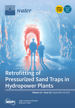
Cover Story (view full-size image): For hydraulic scale model testing of sediment transport in pressurized flow in a hydropower sand trap, Richter et al. (2021) applied a novel scaling method. A 1:1 scaling of the water velocity and 1:1 scaling of the sediment sizes from the prototype result in Euler and Shield similitude. The results were remarkably similar to observations from the prototype. The hydraulic scale model was used to test novel retrofitting solutions for improving existing sand traps, where one solution showed a significant improvement and is now scheduled for full-scale implementation. View this paper.
  • Issues are regarded as officially published after their release is announced to the table of contents alert mailing list.
  • You may sign up for e-mail alerts to receive table of contents of newly released issues.
  • PDF is the official format for papers published in both, html and pdf forms. To view the papers in pdf format, click on the "PDF Full-text" link, and use the free Adobe Reader to open them.
Order results
Result details
Section
Select all
Export citation of selected articles as:
18 pages, 318 KiB  
Article
Designing a Flood Storage Option on Agricultural Land: What Can Flood Risk Managers Learn from Drought Management?
by Rosalind H. Bark
Water 2021, 13(18), 2604; https://0-doi-org.brum.beds.ac.uk/10.3390/w13182604 - 21 Sep 2021
Cited by 2 | Viewed by 2901
Abstract
The increasing probability of loss and damage to floods is a global concern. Countries are united by an urgent need to reduce flood risk to households, businesses, agricultural land, and infrastructure. As natural and engineered protection erodes with climate change and development pressures, [...] Read more.
The increasing probability of loss and damage to floods is a global concern. Countries are united by an urgent need to reduce flood risk to households, businesses, agricultural land, and infrastructure. As natural and engineered protection erodes with climate change and development pressures, new approaches to flood risk management delivered at the catchment scale that work with nature hold promise. One nature-based solution that aligns with this Special Issue on river flooding is the temporary storage of floodwaters on the floodplain. In many countries, this would involve controlled flooding inland low-lying agricultural land. Designing schemes that farmers and irrigation districts will adopt is essential. To inform future floodplain storage options, we review farm-centred drought management, specifically, agreements that transfer agricultural water to municipalities through fallowing in California, USA and an Australian farm exit scheme. These initiatives reveal underpinning principles around the need to: balance the multiple objectives of the parties, share the benefits and responsibilities, address local impacts and practical guidance on incentive design including the consideration of conditional participation requirements and responding to farmer and public preferences. In terms of funding there is opportunity for blended financing with flood-prone communities, insurers, and conservation charities. Full article
(This article belongs to the Special Issue Research of River Flooding)
15 pages, 6242 KiB  
Article
Understanding the Role of Complexation of Fluoroquinolone and β-Lactam Antibiotics with Iron (III) on the Photodegradation under Solar Light and UVC Light
by Efraím A. Serna-Galvis, Yudy L. Martínez-Mena, Jazmín Porras, Yenny Ávila-Torres, Javier Silva-Agredo and Ricardo A. Torres-Palma
Water 2021, 13(18), 2603; https://0-doi-org.brum.beds.ac.uk/10.3390/w13182603 - 21 Sep 2021
Cited by 7 | Viewed by 2249
Abstract
Antibiotics elimination by some photochemical processes involves ferric ions, but little is discussed about the fundamental aspects of complexation effects on their degradation. This study compares the photodegradation of two fluoroquinolones, three β-lactams, and their ferric complexes in deionized water. The complexed antibiotics [...] Read more.
Antibiotics elimination by some photochemical processes involves ferric ions, but little is discussed about the fundamental aspects of complexation effects on their degradation. This study compares the photodegradation of two fluoroquinolones, three β-lactams, and their ferric complexes in deionized water. The complexed antibiotics were more recalcitrant than the free antibiotics to the solar light action (the photodegradation rate constants diminished by more than 50%). To better study the photodegradation, other experiments considering two representative cases (ciprofloxacin and dicloxacillin) were performed. For ciprofloxacin, as the iron amount was increased from 0 to 7.5 µmol L−1, its photodegradation rate constant decreased from 0.017 to 0.004 min−1. In contrast, for dicloxacillin, the increase in iron concentration (from 0 to 7.5 µmol L−1) accelerated its photodegradation (the rate constant augmented from 0 to 0.0026 min−1). When UVC light was used, the degradations of free and complexed antibiotics were very close, exhibiting values of degradation rate constants between 0.030 and 0.085 min−1. The antimicrobial activity (AA) was eliminated when 90% of ciprofloxacin and 90–95% of dicloxacillin were degraded. The AA removal was associated with structural changes in relevant moieties of antibiotics, such as fluorine and piperazyl ring for ciprofloxacin, or β-lactam ring for dicloxacillin. Full article
(This article belongs to the Section Wastewater Treatment and Reuse)
Show Figures

Figure 1

17 pages, 5724 KiB  
Article
Salt Leaching with Brackish Water during Growing Season Improves Cotton Growth and Productivity, Water Use Efficiency and Soil Sustainability in Southern Xinjiang
by Chao Xiao, Meng Li, Junliang Fan, Fucang Zhang, Yi Li, Houliang Cheng, Yuepeng Li, Xianghao Hou and Junqing Chen
Water 2021, 13(18), 2602; https://0-doi-org.brum.beds.ac.uk/10.3390/w13182602 - 21 Sep 2021
Cited by 11 | Viewed by 2740
Abstract
Low water use efficiency and soil salinization are two main factors limiting cotton production in southern Xinjiang. A field experiment was conducted to investigate the effects of brackish water irrigation levels on cotton growth, yield and soil water–salt dynamics in southern Xinjiang, so [...] Read more.
Low water use efficiency and soil salinization are two main factors limiting cotton production in southern Xinjiang. A field experiment was conducted to investigate the effects of brackish water irrigation levels on cotton growth, yield and soil water–salt dynamics in southern Xinjiang, so as to provide a theoretical and experimental basis for the development and utilization of brackish water. There were three irrigation levels: W1 (75 mm + 80%ETc), W2 (150 mm + 80%ETc) and W3 (240 mm + 80%ETc) at the seeding stage (S1), seeding stage + budding stage (S2) and seeding stage + budding stage + flowering stage (S3), with an irrigation amount of 450 mm during spring as the CK (the local reference level) (10 treatments in total). The salt of the local brackish water used was 3 g·L−1. Film-mulched drip irrigation experiments were conducted to observe cotton growth, aboveground dry matter, cotton yield, soil water and salt distribution, as well as other indicators. The results showed that the irrigation applications of S3 can improve the soil moisture and salt distribution of the root zone. The salt accumulation at the harvest stage of W3S3 was reduced by 39.5% and 2.8% compared with W3S1 and W3S2, respectively. More frequent irrigation applications can reduce a soil’s total dissolved solids (TDS), avoid exceeding the salt tolerance threshold of 4.8 g kg−1 and lead to higher aboveground dry matter and cotton yields. W3S3 obtained the highest yield of 5685 kg ha−1, which was increased by 39.59%, 7.85% and 11.25% compared with W3S1, W3S2 and CK, respectively. The higher the irrigation amount, the less water use efficiency (WUE), following the order of S3 > S2 > S1 > CK at various growth stages. W3S1 obtained the lowest WUE of 0.64 kg·m−3. Comprehensively considering the effects of soil moisture retention and salt suppression, cotton growth, yield and water use efficiency, an irrigation amount of 240 mm brackish water at three growth stages, with 80%ETc for irrigation, is recommended for the sustainable production of cotton in southern Xinjiang. Full article
(This article belongs to the Special Issue Green and Efficient Utilization of Agricultural Water)
Show Figures

Figure 1

17 pages, 4128 KiB  
Article
The Effects of Soil Drying Out and Rewetting on Nitrogen and Carbon Leaching—Results of a Long-Term Lysimeter Experiment
by Holger Rupp, Nadine Tauchnitz and Ralph Meissner
Water 2021, 13(18), 2601; https://0-doi-org.brum.beds.ac.uk/10.3390/w13182601 - 21 Sep 2021
Cited by 6 | Viewed by 3281
Abstract
As a result of global climate change, heavy rainfall events and dry periods are increasingly occurring in Germany, with consequences for the water and solute balance of soils to be expected. The effects of climate change on nitrogen and carbon leaching were investigated [...] Read more.
As a result of global climate change, heavy rainfall events and dry periods are increasingly occurring in Germany, with consequences for the water and solute balance of soils to be expected. The effects of climate change on nitrogen and carbon leaching were investigated using 21 non-weighable manually filled lysimeters of the UFZ lysimeter facility Falkenberg, which have been managed since 1991 according to the principles of the best management practices and organic farming. Based on a 29-year dataset (precipitation, evaporation, leachate, nitrate and dissolved organic carbon concentrations), the lysimeter years 1995/96, 2018/19, and 2003/04 were identified as extremely dry years. Under the climatic conditions in northeastern Germany, seepage fluxes were disrupted in these dry years. The reoccurrence of seepage was associated with exceptionally high nitrogen concentrations and leaching losses, which exceeded the current drinking water limits by many times and may result in a significant risk to water quality. In contrast, increased DOC leaching losses occurred primarily as a result of increased seepage fluxes. Full article
(This article belongs to the Special Issue Research on Soil Water Balance)
Show Figures

Figure 1

24 pages, 1586 KiB  
Review
Hydrological Performance of Green Roofs in Mediterranean Climates: A Review and Evaluation of Patterns
by Joana Silva, Teresa A. Paço, Vítor Sousa and Cristina M. Silva
Water 2021, 13(18), 2600; https://0-doi-org.brum.beds.ac.uk/10.3390/w13182600 - 21 Sep 2021
Cited by 10 | Viewed by 2868
Abstract
The capacity of green roofs to intercept rainfall, and consequently store and slow runoff resulting in a reduction in flood risk, is one of their main advantages. In this review, previous research related to the influence of green roofs on the hydrological cycle [...] Read more.
The capacity of green roofs to intercept rainfall, and consequently store and slow runoff resulting in a reduction in flood risk, is one of their main advantages. In this review, previous research related to the influence of green roofs on the hydrological cycle is examined with a special focus on studies for Mediterranean climate conditions (Csa and Csb according to the Köppen–Geiger climate classification). This climate is characterized by short and intense rainfall occurrences which, along with the increased area of impervious surface on Mediterranean regions, intensify the risk of flooding, particularly in the cities. The analysis covers the variables rainfall retention (R, %), runoff delay (RD, min or h), peak delay (PD, min or h), peak attenuation (PA, %), and runoff coefficient (RC, −), in relation to physical features of the green roof such as layers, substrate depth, slope, and vegetation, as well as, weather conditions, such as monthly temperature and monthly precipitation. Following a statistical analysis, some patterns for the average rainfall retention (%) were found in the published literature for green roofs under Mediterranean climate conditions—namely, that the most significant variables are related to the substrate depth, the existence of certain layers (root barrier, drainage layer), the origin of the vegetation, the types of green roofs (extensive, semi-intensive, intensive), and the precipitation and temperature of the location. Moreover, a multivariate analysis was conducted using multiple linear regression to identify the set of green roof features and weather conditions that best explain the rainfall retention (%), taking into consideration not only the studies under Mediterranean conditions but all climates, and a similar pattern emerged. Recommendations for future research include addressing the effect of physical features and weather conditions on the other variables (RD, PD, PA, RC) since, although present in some studies, they still do not provide enough information to reach clear conclusions. Full article
(This article belongs to the Special Issue Green Infrastructure as a Technology for Rainwater Retention)
Show Figures

Figure 1

21 pages, 2634 KiB  
Article
Promoting Water Efficiency and Hydrocitizenship in Young People’s Learning about Drought Risk in a Temperate Maritime Country
by Verity Jones, Sarah Whitehouse, Lindsey McEwen, Sara Williams and Luci Gorell Barnes
Water 2021, 13(18), 2599; https://0-doi-org.brum.beds.ac.uk/10.3390/w13182599 - 21 Sep 2021
Cited by 2 | Viewed by 3518
Abstract
Engaging young citizens with drought risk and positive water behaviours is essential in domestic water demand management within the wider climate crisis. This paper evaluates a new research-informed, picture book—‘DRY: The Diary of a Water Superhero’—that explores UK drought. The book’s development was [...] Read more.
Engaging young citizens with drought risk and positive water behaviours is essential in domestic water demand management within the wider climate crisis. This paper evaluates a new research-informed, picture book—‘DRY: The Diary of a Water Superhero’—that explores UK drought. The book’s development was underpinned by research within the Drought Risk and You (DRY) project. The book’s concept and storyline were co-produced by an interdisciplinary team, including a creative practitioner. This focused on key themes: drought definitions and types; drought myths; adaptation and young people’s (YP) agency. Characters and storyline were co-created to promote YP’s autonomy as change agents, and to encourage intergenerational and community learning. This paper evaluates the book from three perspectives: of YP, trainee teachers (TT) and teachers. Emergent themes are triangulated: drought as a sensitive issue, subject knowledge and changes in behaviour, and YP’s misconceptions about drought and place. TT also contemplated their improved subject knowledge and barriers to engaging with positive water behaviours. Teachers reflected on classroom use of the book, prior experiences about teaching drought, curriculum context and st/age of YP engaged. This paper reflects on how these insights feed into school practice and water industry outreach, in developing effective learning resources that promote a valuing of water, behaviour change and wider hydrocitizenship among YP and their communities. Full article
(This article belongs to the Special Issue Water Demand Management)
Show Figures

Graphical abstract

20 pages, 2761 KiB  
Article
Recovery of Cr(III) from Tannery Effluents by Diafiltration Using Chitosan Modified Membranes
by Asmaa Zakmout, Fatma Sadi, Svetlozar Velizarov, João G. Crespo and Carla A. M. Portugal
Water 2021, 13(18), 2598; https://0-doi-org.brum.beds.ac.uk/10.3390/w13182598 - 21 Sep 2021
Cited by 9 | Viewed by 2252
Abstract
The selective recovery of chromium remaining in tannery effluents after the leather tanning process is highly desirable to potentiate its reuse, simultaneously minimizing the ecotoxicity of these effluents. To the best of our knowledge, this work evaluates for the first time the ability [...] Read more.
The selective recovery of chromium remaining in tannery effluents after the leather tanning process is highly desirable to potentiate its reuse, simultaneously minimizing the ecotoxicity of these effluents. To the best of our knowledge, this work evaluates for the first time the ability of a chitosan-based membrane for selective recovery of chromium from a tannery wastewater by subsequent diafiltration and selective chromium desorption, envisaging their integration after tannery wastewater treatment by reverse osmosis (RO). A polyethersulfone (PES) microfiltration membrane top-coated with a chitosan layer (cs-PES MF022) was used for selective recovery of Cr(III), from concentrate streams obtained by treatment of synthetic and real tannery effluents through reverse osmosis (RO), through a diafiltration process. The diafiltration of the RO concentrates was conducted by an intermittent addition of water acidified to pH 3.6. The prepared cs-PES MF022 membranes were able to retain 97% of the total mass of Cr(III) present in the RO concentrates, from a real tannery effluent, with a selectivity of 4.2 and 5 in reference to NH4+ and Cl, respectively, 12.9 and 14.6 in reference to K and Na, and >45 in reference to Mg, Ca, and S. Such a high selectivity is explained by the preferential adsorption of Cr(III) onto chitosan, and by the relatively high permeability of cs-PES MF022 membranes to the other ionic species. Proof of concept studies were performed to investigate the desorption of Cr(III) at pH 2 and 5.8. A higher Cr(III) desorption degree was obtained at pH 2, leading to a final solution enriched in Cr(III), which may be re-used in tannery operations, thus improving the process economy and reducing the hazardous impact of the effluents discharged by this industry. Full article
Show Figures

Figure 1

28 pages, 13431 KiB  
Article
MIS 5.5 Highstand and Future Sea Level Flooding at 2100 and 2300 in Tectonically Stable Areas of Central Mediterranean Sea: Sardinia and the Pontina Plain (Southern Latium), Italy
by Giacomo Deiana, Fabrizio Antonioli, Lorenzo Moretti, Paolo Emanuele Orrù, Giovanni Randazzo and Valeria Lo Presti
Water 2021, 13(18), 2597; https://0-doi-org.brum.beds.ac.uk/10.3390/w13182597 - 21 Sep 2021
Cited by 4 | Viewed by 3905
Abstract
Areas of the Mediterranean Sea are dynamic habitats in which human activities have been conducted for centuries and which feature micro-tidal environments with about 0.40 m of range. For this reason, human settlements are still concentrated along a narrow coastline strip, where any [...] Read more.
Areas of the Mediterranean Sea are dynamic habitats in which human activities have been conducted for centuries and which feature micro-tidal environments with about 0.40 m of range. For this reason, human settlements are still concentrated along a narrow coastline strip, where any change in the sea level and coastal dynamics may impact anthropic activities. We analyzed light detection and ranging (LiDAR) and Copernicus Earth observation data. The aim of this research is to provide estimates and detailed maps (in three coastal plain of Sardinia (Italy) and in the Pontina Plain (southern Latium, Italy) of: (i) the past marine transgression occurred during MIS 5.5 highstand 119 kyrss BP; (ii) the coastline regression occurred during the last glacial maximum MIS 2 (21.5 krs cal BP); and (iii) the potential marine submersion for 2100 and 2300. The objective of this multidisciplinary study is to provide maps of sea level rise future scenarios using the IPCC RCP 8.5 2019 projections and glacio-hydro-isostatic movements for the above selected coastal zones (considered tectonically stable), which are the locations of touristic resorts, railways and heritage sites. We estimated a potential loss of land for the above areas of between about 146 km2 (IPCC 2019-RCP8.5 scenario) and 637 km2 along a coastline length of about 268 km. Full article
(This article belongs to the Special Issue Relative Sea Level Change and Coastal Vulnerability)
Show Figures

Figure 1

19 pages, 1337 KiB  
Article
Back to Ecology: Reference Conditions as a Basis for Assessment, Restoration and Sustainable Management of Large Rivers
by Gorazd Urbanič, Zlatko Mihaljević, Vesna Petkovska and Maja Pavlin Urbanič
Water 2021, 13(18), 2596; https://0-doi-org.brum.beds.ac.uk/10.3390/w13182596 - 20 Sep 2021
Cited by 2 | Viewed by 2095
Abstract
Under the EU Water Framework Directive, ecological assessment and management are based on type-specific reference conditions. In the EU it may be difficult to find sites in large rivers with at least near-natural conditions, though this is not the case in southeast Europe, [...] Read more.
Under the EU Water Framework Directive, ecological assessment and management are based on type-specific reference conditions. In the EU it may be difficult to find sites in large rivers with at least near-natural conditions, though this is not the case in southeast Europe, where stretches of large rivers still exist with at least near-natural conditions, meaning that there is little or no disturbance from hydromorphological alteration, water quality, land use in the catchment and alien species. We examined benthic invertebrate assemblages in 45 samples collected from near-natural sites of several large rivers: Sava, Drava, Mura, Kupa and Una. The near-natural benthic invertebrate assemblages of large rivers contained several rare or remarkable species, especially among stoneflies, e.g., Marthamea vitripennis, Xanthoperla apicalis. We compared benthic invertebrate communities in river sections with fine and coarse substrates and in three eco-hydromorphological (ECO-HM) types of large rivers, reflecting habitat heterogeneity: lowland-deep, lowland-braided and intermountain. Multivariate analysis of variance (PERMANOVA) was used to statistically evaluate similarities among assemblages. It was found that the composition of benthic invertebrate assemblages varied by both ECO-HM types and substrate category. Similarity percentage (SIMPER) analysis showed that the average dissimilarity of benthic invertebrate assemblages was high between all ECO-HM type pairs and between fine and coarse substrate. We found that habitat heterogeneity and substrate independently influenced benthic invertebrate assemblages. To achieve ecological goals in the management of large rivers, in addition to functionality, a holistic view with at least near-natural assemblages, including the names of the taxa present, should also be considered. Full article
(This article belongs to the Special Issue Large Rivers: Ecology and Management in a Changing World)
Show Figures

Figure 1

15 pages, 28836 KiB  
Article
Aquifer Storage and Recovery in Layered Saline Aquifers: Importance of Layer-Arrangements
by Hongkai Li, Yu Ye and Chunhui Lu
Water 2021, 13(18), 2595; https://0-doi-org.brum.beds.ac.uk/10.3390/w13182595 - 20 Sep 2021
Cited by 2 | Viewed by 2183
Abstract
Aquifer storage and recovery (ASR) refers to injecting freshwater into an aquifer and later withdrawing it. In brackish-to-saline aquifers, density-driven convection and fresh-saline water mixing lead to a reduced recovery efficiency (RE, i.e., the volumetric ratio between recovered potable water and injected freshwater) [...] Read more.
Aquifer storage and recovery (ASR) refers to injecting freshwater into an aquifer and later withdrawing it. In brackish-to-saline aquifers, density-driven convection and fresh-saline water mixing lead to a reduced recovery efficiency (RE, i.e., the volumetric ratio between recovered potable water and injected freshwater) of ASR. For a layered aquifer, previous studies assume a constant hydraulic conductivity ratio between neighboring layers. In order to reflect the realistic formation of layered aquifers, we systematically investigate 120 layered heterogeneous scenarios with different layer arrangements on multiple-cycle ASR using numerical simulations. Results show that the convection (as is reflected by the tilt of the fresh-saline interface) and mixing phenomena of the ASR system vary significantly among scenarios with different layer arrangements. In particular, the lower permeable layer underlying the higher permeable layer restricts the free convection and leads to the spreading of salinity at the bottom of the higher permeable layer and early salt breakthrough to the well. Correspondingly, the RE values are different among the heterogeneous scenarios, with a maximum absolute RE difference of 22% for the first cycle and 9% for the tenth cycle. Even though the difference in RE decreases with more ASR cycles, it is still non-negligible and needs to be considered after ten ASR cycles. The method to homogenize the layered heterogeneity by simply taking the arithmetic and geometric means of the hydraulic conductivities among different layers as the horizontal and vertical hydraulic conductivities is shown to overestimate the RE for multiple-cycle ASR. The outcomes of this research illustrate the importance of considering the geometric arrangement of layers in assessing the feasibility of multiple-cycle ASR operations in brackish-to-saline layered aquifers. Full article
(This article belongs to the Section Hydrogeology)
Show Figures

Figure 1

15 pages, 19662 KiB  
Article
Ecosystem Services of Large Wood: Mapping the Research Gap
by Zuzana Poledniková and Tomáš Galia
Water 2021, 13(18), 2594; https://0-doi-org.brum.beds.ac.uk/10.3390/w13182594 - 20 Sep 2021
Cited by 7 | Viewed by 2557
Abstract
It is well known that large wood affects geomorphic processes and functions in rivers. It enhances the quality of the habitat but it can also cause a threat to the population. These processes and functions of the environment can be transformed into ecosystem [...] Read more.
It is well known that large wood affects geomorphic processes and functions in rivers. It enhances the quality of the habitat but it can also cause a threat to the population. These processes and functions of the environment can be transformed into ecosystem (dis)services, which represent direct or indirect (dis)benefits that the society obtains from nature. The goal of this paper was to describe the current relations between large wood and ecosystem services and map the related knowledge gaps. Firstly, we conducted a systematic literature review that was elaborated according to the six-stage and PRISMA protocols and workflow diagram. We found 499 papers; however, only 137 were eligible for the following analyses. Secondly, we made a transformation of research information from the articles (n = 135) into ecosystem services. The highest number of ecosystem services detected in the articles belonged to the regulation and maintenance section (n = 126), followed by the provisioning (n = 15) and cultural (n = 11) sections. The detected classes with the highest frequency of studies were specific habitat creation and increased channel heterogeneity. The findings show that the number of research papers on this topic is still insufficient; however, anaylzing ecosystem services could be useful to advocate the presence of large wood in the rivers. Full article
(This article belongs to the Special Issue Impact of Large Wood on River Ecosystems)
Show Figures

Graphical abstract

22 pages, 6820 KiB  
Review
Scientometric Analysis-Based Review for Drought Modelling, Indices, Types, and Forecasting Especially in Asia
by Dan Wu, Yanan Li, Hui Kong, Tingting Meng, Zenghui Sun and Han Gao
Water 2021, 13(18), 2593; https://0-doi-org.brum.beds.ac.uk/10.3390/w13182593 - 20 Sep 2021
Cited by 7 | Viewed by 3080
Abstract
An extended drought period with low precipitation can result in low water availability and issues for humans, animals, and plants. Drought forecasting is critical for water resource development and management as it helps to reduce negative consequences. In this study, scientometric analysis and [...] Read more.
An extended drought period with low precipitation can result in low water availability and issues for humans, animals, and plants. Drought forecasting is critical for water resource development and management as it helps to reduce negative consequences. In this study, scientometric analysis and manual comprehensive analysis on drought modelling and forecasting are used. A scientometric analysis is used to determine the current research trend using bibliometric data and to identify relevant publication field sources with the most publications, the most frequently used keywords, the most cited articles and authors, and the countries that have made the greatest contributions to the field of water resources. This paper also tries to provide an overview of water issues, such as drought classification, drought indices, historical droughts, and their impact on Asian countries such as China, Pakistan, India, and Iran. There have been many models established for this purpose and choosing the appropriate model for study is a long procedure for researchers. An appropriate, comprehensive, pedagogical study of model ideas and historical implementations would benefit researchers by helping them to avoid overlooking viable model options, thus reducing their time spent on the topic. As a result, the goal of this paper is to review drought-forecasting approaches and recommend the best models for the Asian region. The models are divided into four categories based on their mechanisms: Regression analysis, stochastic modelling, machine learning, and dynamic modelling. The basic concepts of each approach in terms of the model’s historical use, benefits, and limitations are explained. Finally, prospects for future drought research in Asia are discussed as well as potential modelling techniques. Full article
(This article belongs to the Special Issue Advances in Flood Forecasting and Hydrological Modeling)
Show Figures

Figure 1

14 pages, 2079 KiB  
Article
Copper and Zinc Removal Efficiency of Two Reactive Filter Media Treating Motorway Runoff—Model for Service Life Estimation
by Raúl Rodríguez-Gómez, Agnieszka Renman, Batoul Mahmoudzadeh and Gunno Renman
Water 2021, 13(18), 2592; https://0-doi-org.brum.beds.ac.uk/10.3390/w13182592 - 20 Sep 2021
Cited by 4 | Viewed by 3413
Abstract
The predominant techniques used for road runoff treatment are sedimentation and filtration. In filtration systems, the ability of the media to adsorb the contaminants is a finite process. Consequently, construction, operation and maintenance managers of such systems should know in advance the service [...] Read more.
The predominant techniques used for road runoff treatment are sedimentation and filtration. In filtration systems, the ability of the media to adsorb the contaminants is a finite process. Consequently, construction, operation and maintenance managers of such systems should know in advance the service life, i.e., when the used medium should be replaced, and associated costs of operation and maintenance. A batch experiment followed by a packed bed reactor (PBR) experiment addressed the kinetics of the studied media argon oxygen decarburization slag (AOD) and Polonite, followed by the development of a 1D-model to describe the change of concentration of Cu and Zn within time. The batch test results showed that Cu and Zn adsorption followed the Freundlich isotherms for AOD and Polonite. Those results coupled with the linear driving force model and the developed model resulted in good agreement between the PBR results and the simulation. The model was capable to predict (i), the service life at the hydraulic load of 0.18 m/h for AOD (Cu: 395 d; Zn: 479 d) and Polonite (Cu: 445 d; Zn: 910 d), to show (ii) the profile concentration in the PBR within time and the gradient of the concentration along the height of the reactor. Full article
Show Figures

Figure 1

17 pages, 2546 KiB  
Article
Theoretical Investigation of the Adsorption of Cadmium Iodide from Water Using Polyaniline Polymer Filled with TiO2 and ZnO Nanoparticles
by Noureddine Mahdhi, Norah Salem Alsaiari, Fatimah Mohammed Alzahrani, Khadijah Mohammedsaleh Katubi, Abdelfattah Amari and Saber Hammami
Water 2021, 13(18), 2591; https://0-doi-org.brum.beds.ac.uk/10.3390/w13182591 - 19 Sep 2021
Cited by 2 | Viewed by 2463
Abstract
The removal of heavy metals from drinking water has attracted great interest in water purification technology. In this study, a biocompatible Polyaniline (PANI) polymer filled with TiO2 and ZnO nanoparticles (NPs) is considered as an adsorbent of cadmium iodide from water. Theoretical [...] Read more.
The removal of heavy metals from drinking water has attracted great interest in water purification technology. In this study, a biocompatible Polyaniline (PANI) polymer filled with TiO2 and ZnO nanoparticles (NPs) is considered as an adsorbent of cadmium iodide from water. Theoretical investigation of the van der Waals (vdW) interactions deduced from the Hamaker constant calculated on the basis of Lifshitz theory was presented. It was found that the surface energy as well as the work of adhesion between water and PANI/NPs across air increases with an increasing volume fraction of the TiO2 and ZnO nanoparticles. Consequently, an increase in the Laplace pressure around the cavities/porosities was found, which leads to the enhancement of the specific contact surface between water and PANI/NPs. On the other hand, for the interactions between CdI2 particles and PANI/NPs surface across water, we show that the interactions are governed principally by the attractive London dispersion forces. The vdW energy and force increase proportionally with the augmentation of the volume fraction of nanoparticles and of the radius of the CdI2 particle. Particularly, the PANI/TiO2 has been proved to be a better candidate for adsorption of cadmium iodide from water than PANI/ZnO. Full article
(This article belongs to the Special Issue Water Treatment by Adsorption and Catalytic Methods)
Show Figures

Figure 1

9 pages, 988 KiB  
Article
Effects of Water Depth on the Growth of the Submerged Macrophytes Vallisneria natans and Hydrilla verticillata: Implications for Water Level Management
by Qisheng Li, Yanqing Han, Kunquan Chen, Xiaolong Huang, Kuanyi Li and Hu He
Water 2021, 13(18), 2590; https://0-doi-org.brum.beds.ac.uk/10.3390/w13182590 - 19 Sep 2021
Cited by 10 | Viewed by 3002
Abstract
Water level is one of the most important factors affecting the growth of submerged macrophytes in aquatic ecosystems. The rosette plant Vallisneria natans and the erect plant Hydrilla verticillata are two common submerged macrophytes in lakes of the middle and lower reaches of [...] Read more.
Water level is one of the most important factors affecting the growth of submerged macrophytes in aquatic ecosystems. The rosette plant Vallisneria natans and the erect plant Hydrilla verticillata are two common submerged macrophytes in lakes of the middle and lower reaches of the Yangtze River, China. How water level fluctuations affect their growth and competition is still unknown. In this study, three water depths (50 cm, 150 cm, and 250 cm) were established to explore the responses in growth and competitive patterns of the two plant species to water depth under mixed planting conditions. The results show that, compared with shallow water conditions (50 cm), the growth of both submerged macrophytes was severely suppressed in deep water depth (250 cm), while only V. natans was inhibited under intermediate water depth (150 cm). Moreover, the ratio of biomass of V. natans to H. verticillata gradually increased with increasing water depth, indicating that deep water enhanced the competitive advantage of V. natans over H.verticillata. Morphological adaptation of the two submerged macrophytes to water depth was different. With increasing water depth, H. verticillata increased its height, at the cost of reduced plant numbers to adapt to poor light conditions. A similar strategy was also observed in V. natans, when water depth increased from 50 cm to 150 cm. However, both the plant height and number were reduced at deep water depth (250 cm). Our study suggests that water level reduction in lake restoration efforts could increase the total biomass of submerged macrophytes, but the domination of key plants, such as V. natans, may decrease. Full article
(This article belongs to the Special Issue Ecosystem-Based Understanding and Management of Eutrophication)
Show Figures

Figure 1

15 pages, 3632 KiB  
Article
Genetic Signature of a Past Anthropogenic Transportation of a Far-Eastern Endemic Cladoceran (Crustacea: Daphniidae) to the Volga Basin
by Dmitry P. Karabanov, Petr G. Garibian, Eugeniya I. Bekker, Rimma Z. Sabitova and Alexey A. Kotov
Water 2021, 13(18), 2589; https://0-doi-org.brum.beds.ac.uk/10.3390/w13182589 - 19 Sep 2021
Cited by 5 | Viewed by 2927
Abstract
Most studies of water flea (Crustacea: Cladocera) invasions are concentrated on a few taxa with an obvious harmful influence on native ecosystems, while our knowledge of cases of anthropogenic introduction with not-so-obvious consequences, in most other taxa, is poor. We found in the [...] Read more.
Most studies of water flea (Crustacea: Cladocera) invasions are concentrated on a few taxa with an obvious harmful influence on native ecosystems, while our knowledge of cases of anthropogenic introduction with not-so-obvious consequences, in most other taxa, is poor. We found in the Volga basin (European Russia) a population that contained D. curvirostris Eylmann, 1887 and its hybrids with D. korovchinskyi Kotov et al. 2021. The latter taxon is endemic to the Far East and it has appeared in the Volga basin as a result of past human-mediated transportation. The population from Bakhilovo is represented by two strongly different groups of the COI haplotypes belonging, respectively, to (1) D. curvirostris and (2) D. korovchinskyi. We detected SNPs in the position 60 of the HSP-90ex3 locus and in the 195 positions of 28S rRNA locus, which differentiate two species. Part of the specimens from Bakhilovo belonged to D. curvirostris s.str., demonstrating homozygote SNP sites in two loci, but two specimens had heterozygote SNP sites in both nuclear loci. They belong to D. curvirostris x korovchinskyi hybrids. Most morphological traits of the females were characteristic of D. curvirostris. We found in some specimens some characters which could suggest their hybrid status, but this opinion is a hypothesis only, which needs to be checked on more ample material. The exact hybrid system in this pond is not known. Moreover, we have no evidences of sexual reproduction of the hybrids; they could reproduce by parthenogenesis only as is known for hybrids of the D. pulex group, or continuously crossing with parents like some members of D. longispina group. However, poor parental D. korovchinskyi was not detected in the pond either morphologically or genetically. The exact vector of its past anthropogenic transportation to the Volga is unknown. Most probably, just ephippia of D. korovchinskyi were translocated replaced from the Khabarovsk Territory to the Samara Area somehow. This is the first report on hybrids within the D. curvirostris species complex. Here, we demonstrated that accurate studies with deep resolution increase the number of revealed cryptic invasions. We expect that the number of revealed cases of cryptic interspecific invasions will grow rapidly. Full article
(This article belongs to the Special Issue Species Richness and Diversity of Aquatic Ecosystems)
Show Figures

Figure 1

17 pages, 4152 KiB  
Article
Development of an Interdisciplinary Prediction System Combining Sediment Transport Simulation and Ensemble Method
by Hao-Che Ho, Yen-Ming Chiang, Che-Chi Lin, Hong-Yuan Lee and Cheng-Chia Huang
Water 2021, 13(18), 2588; https://0-doi-org.brum.beds.ac.uk/10.3390/w13182588 - 19 Sep 2021
Cited by 2 | Viewed by 1738
Abstract
The change in movable beds is related to the mechanisms of sediment transport and hydrodynamics. Numerical modelling with empirical equations and the simplified momentum equation is the common means to analyze the complicated sediment transport processing in river channels. The optimization of parameters [...] Read more.
The change in movable beds is related to the mechanisms of sediment transport and hydrodynamics. Numerical modelling with empirical equations and the simplified momentum equation is the common means to analyze the complicated sediment transport processing in river channels. The optimization of parameters is essential to obtain the proper results. Inadequate parameters would cause errors during the simulation process and accumulate the errors with long-time simulation. The optimized parameter combination for numerical modelling, however, is rarely discussed. This study adopted the ensemble method to simulate the change in the river channel, with a single model combined with multiple parameters. The optimized parameter combinations for a given river reach are investigated. Two river basins, located in Taiwan, were used as study cases, to simulate river morphology through the SRH-2D, which was developed by the U.S. Bureau of Reclamation. The input parameters related to the sediment transport module were randomly selected within a reasonable range. The parameter sets with proper results were selected as ensemble members. The concentration of sedimentation and bathymetry elevation was used to conduct the calibration. Both study cases show that 20 ensemble members were good enough to capture the results and save simulation time. However, when the ensemble members increased to 100, there was no significant improvement, but a longer simulation time. The result showed that the peak concentration and the occurrence of time could be predicted by the ensemble size of 20. Moreover, with consideration of the bed elevation as the target, the result showed that this method could quantitatively simulate the change in bed elevation. With both cases, this study showed that the ensemble method is a suitable approach for river morphology numerical modelling. The ensemble size of 20 can effectively obtain the result and reduce the uncertainty for sediment transport simulation. Full article
(This article belongs to the Section Hydraulics and Hydrodynamics)
Show Figures

Figure 1

13 pages, 862 KiB  
Article
Evaluation of Water Resources Carrying Capacity Using Principal Component Analysis: An Empirical Study in Huai’an, Jiangsu, China
by Fan Wu, Zhicheng Zhuang, Hsin-Lung Liu and Yan-Chyuan Shiau
Water 2021, 13(18), 2587; https://0-doi-org.brum.beds.ac.uk/10.3390/w13182587 - 19 Sep 2021
Cited by 13 | Viewed by 3088
Abstract
With the rapid development of urbanization, problems such as the tight supply and demand of water resources and the pollution of the water environment have become increasingly prominent, and the pressure on the carrying capacity of water resources has gradually increased. In order [...] Read more.
With the rapid development of urbanization, problems such as the tight supply and demand of water resources and the pollution of the water environment have become increasingly prominent, and the pressure on the carrying capacity of water resources has gradually increased. In order to better promote the sustainable development of cities, it is extremely important to coordinate the relationship between water resources and economic society. This study analyzed the current research status of water resources carrying capacity from two aspects, i.e., research perspective and research methodology, established an innovative evaluation system, and used the principal component analysis to analyze the water resources carrying capacity in Huai’an City, an important city in China’s Huaihe River Ecological Economic Zone. Based on the results, it is found that the water resources carrying capacity of Huai’an City has been declining year by year from 2013 to 2019. Based on the evaluation results, suggestions and measures to improve the water resources carrying capacity of the empirical city are proposed to provide an important decision basis for the coordinated development of urban economy, society, and water resources. Full article
Show Figures

Figure 1

15 pages, 14847 KiB  
Article
Environmental Flows as a Proactive Tool to Mitigate the Impacts of Climate Warming on Freshwater Macroinvertebrates
by Christos Theodoropoulos, Ioannis Karaouzas and Anastasios Stamou
Water 2021, 13(18), 2586; https://0-doi-org.brum.beds.ac.uk/10.3390/w13182586 - 18 Sep 2021
Cited by 2 | Viewed by 2066
Abstract
What would happen in Mediterranean rivers and streams if warming but not drying occurred? We examined whether the delivery of environmental flows within a warming climate can maintain suitable macroinvertebrate habitats despite warming. A two-dimensional ecohydraulic model was used to (1) simulate the [...] Read more.
What would happen in Mediterranean rivers and streams if warming but not drying occurred? We examined whether the delivery of environmental flows within a warming climate can maintain suitable macroinvertebrate habitats despite warming. A two-dimensional ecohydraulic model was used to (1) simulate the influence of water temperature and flow on macroinvertebrates by calculating habitat suitability for 12 climate change scenarios and (2) identify the mechanism by which macroinvertebrate assemblages respond to warming. The results suggest that not all watersheds will be equally influenced by warming. The impact of warming depends on the habitat conditions before warming occurs. Watersheds can, thus, be categorized as losing (those in which warming will degrade current optimal thermal habitat conditions) and winning ones (those in which warming will optimize current sub-optimal thermal habitat conditions, until a given thermal limit). Our models indicate that in losing watersheds, the delivery of environmental flows can maintain suitable habitats (and, thus, healthy macroinvertebrate assemblages) for up to 1.8–2.5 °C of warming. In winning watersheds, environmental flows can maintain suitable habitats when thermal conditions are optimal. Environmental flows could, thus, be used as a proactive strategy/tool to mitigate the ecological impacts of warming before more expensive reactive measures within a changing climate become necessary. Full article
(This article belongs to the Special Issue Emerging Trends in Freshwater Ecology and Ecosystem Management)
Show Figures

Figure 1

10 pages, 506 KiB  
Review
Self-Flocculation as an Efficient Method to Harvest Microalgae: A Mini-Review
by Tianrui Li, Jiangjun Hu and Liandong Zhu
Water 2021, 13(18), 2585; https://0-doi-org.brum.beds.ac.uk/10.3390/w13182585 - 18 Sep 2021
Cited by 15 | Viewed by 4523
Abstract
The development of clean and renewable biofuels has been of wide concern on the topic of energy and environmental issues. As a kind of biomass energy with great application prospects, microalgae have many advantages and are used in the fields of environmental protection [...] Read more.
The development of clean and renewable biofuels has been of wide concern on the topic of energy and environmental issues. As a kind of biomass energy with great application prospects, microalgae have many advantages and are used in the fields of environmental protection and biofuels as well as food or feed production for humans and animals. However, the high cost of microalgae harvesting is the main bottleneck of industrial production on a large scale. Self-flocculation is a cost-efficient and promising method for harvesting microalgal biomass. This article briefly describes the current commonly used technology for microalgae harvesting, focusing on the research progress of self-flocculation. This article explores the relative mechanisms and influencing factors of self-flocculation and discusses a proposal for the integration of algae cultivation and harvesting as well as the co-cultivation of algae and bacteria in an effort to provide a reference for microalgae harvesting with high efficiency and low cost. Full article
(This article belongs to the Special Issue Advances in Microalgal Harvesting)
Show Figures

Figure 1

14 pages, 3225 KiB  
Article
Multiple-Depth Soil Moisture Estimates Using Artificial Neural Network and Long Short-Term Memory Models
by Heechan Han, Changhyun Choi, Jongsung Kim, Ryan R. Morrison, Jaewon Jung and Hung Soo Kim
Water 2021, 13(18), 2584; https://0-doi-org.brum.beds.ac.uk/10.3390/w13182584 - 18 Sep 2021
Cited by 10 | Viewed by 2985
Abstract
Accurate prediction of soil moisture is important yet challenging in various disciplines, such as agricultural systems, hydrology studies, and ecosystems studies. However, many data-driven models are being used to simulate and predict soil moisture at only a single depth. To predict soil moisture [...] Read more.
Accurate prediction of soil moisture is important yet challenging in various disciplines, such as agricultural systems, hydrology studies, and ecosystems studies. However, many data-driven models are being used to simulate and predict soil moisture at only a single depth. To predict soil moisture at various soil depths with depths of 100, 200, 500, and 1000 mm from the surface, based on the weather and soil characteristic data, this study designed two data-driven models: artificial neural networks and long short-term memory models. The developed models are applied to predict daily soil moisture up to 6 days ahead at four depths in the Eagle Lake Observatory in California, USA. The overall results showed that the long short-term memory model provides better predictive performance than the artificial neural network model for all depths. The root mean square error of the predicted soil moisture from both models is lower than 2.0, and the correlation coefficient is 0.80–0.97 for the artificial neural network model and 0.90–0.98 for the long short-term memory model. In addition, monthly based evaluation results showed that soil moisture predicted from the data-driven models is highly useful for analyzing the effects on the water cycle during the wet season as well as dry seasons. The prediction results can be used as basic data for numerous fields such as hydrological study, agricultural study, and environment, respectively. Full article
(This article belongs to the Special Issue The Application of Artificial Intelligence in Hydrology)
Show Figures

Figure 1

28 pages, 11120 KiB  
Article
Development of a Numerical Multi-Layered Groundwater Model to Simulate Inter-Aquifer Water Exchange in Shelby County, Tennessee
by Rodrigo Villalpando-Vizcaino, Brian Waldron, Daniel Larsen and Scott Schoefernacker
Water 2021, 13(18), 2583; https://0-doi-org.brum.beds.ac.uk/10.3390/w13182583 - 18 Sep 2021
Cited by 4 | Viewed by 4786
Abstract
Inter-aquifer water exchange between the shallow and Memphis aquifers in Shelby County, Tennessee may pose a contamination threat due to the downward migration of younger, poor quality groundwater into deeper, more pristine aquifer. Discontinuities (breaches) in the upper Claiborne confining unit (UCCU) allow [...] Read more.
Inter-aquifer water exchange between the shallow and Memphis aquifers in Shelby County, Tennessee may pose a contamination threat due to the downward migration of younger, poor quality groundwater into deeper, more pristine aquifer. Discontinuities (breaches) in the upper Claiborne confining unit (UCCU) allow for leakage into the Memphis aquifer, a sand-dominated aquifer that provides about 95% of the groundwater used in the Memphis area. This study created a multi-layered 3D groundwater model for Shelby County using the United States Geological Survey’s MODFLOW-NWT program to evaluate water exchange for a simulation period from January 2005 to December 2016. Results indicate an overall leakage through the UCCU of 61 m3/min into the Memphis aquifer in Shelby County, accounting for 10% of its water budget inflow, with localized areas experiencing as much as 20% water exchange. As young water tends to stay in the upper part of the Memphis aquifer, water budget assessment for the upper 60 m of the Memphis aquifer revealed leakage representing 29% of the zone inflow, and as much as 53% in certain areas. More localized studies must be conducted to understand the location, characteristics, and orientation of the confining unit breaches, as well as the inter-aquifer water exchange. Full article
(This article belongs to the Section Hydrogeology)
Show Figures

Figure 1

11 pages, 1015 KiB  
Article
Shift towards Opportunistic Life-History of Sleeper in Response to Multi-Decadal Overfishing
by Miao Xiang, Andrew L. Rypel, Fei Cheng, Jiao Qin, Lei Zhang, Yushun Chen and Songguang Xie
Water 2021, 13(18), 2582; https://0-doi-org.brum.beds.ac.uk/10.3390/w13182582 - 18 Sep 2021
Cited by 2 | Viewed by 3162
Abstract
Understanding long-term changes in life-history traits is central to assessing and managing freshwater fisheries. In this study, we explored how life-history traits have shifted in association with long-term change in population status for a native fish species (freshwater sleeper, Odontobutis sinensis, a [...] Read more.
Understanding long-term changes in life-history traits is central to assessing and managing freshwater fisheries. In this study, we explored how life-history traits have shifted in association with long-term change in population status for a native fish species (freshwater sleeper, Odontobutis sinensis, a by-catch species of shrimp traps) in the middle Yangtze lakes, China. We assessed the life-history traits of the species from Honghu Lake in 2016, where abundance had been dramatically lower following about 60 years of high fishing pressure, and made comparisons to similar data from Liangzi Lake (1957), when fishing intensity was low and abundance was high, and Bao’an Lake (1993–1994), when about 10 years of intense exploitation had occurred and abundance had greatly declined. Modern Honghu Lake sleeper exhibit life-history traits that are substantially more opportunistic compared to both of the historical populations. Modern fish were larger at age-1 and had significantly faster growth rates, a higher prevalence of sexually mature individuals and increased fecundities. Fish from the historical samples were larger and had higher age class diversity and delayed sexual maturation. Combined, the data suggest that faster growth towards early sexual maturation and reduced body sizes are associated with destabilized populations and ecosystems. Similar life-history patterns are common in other declined fish populations under exploitation. Recovering historic fish life-history dynamics requires conservation management policies aimed at reducing harvest and improving floodplain habitats. Full article
(This article belongs to the Special Issue Biology and Ecology of Threatened Freshwater Fish)
Show Figures

Figure 1

17 pages, 818 KiB  
Article
Predicting Intent to Conserve Freshwater Resources Using the Theory of Planned Behavior (TPB)
by Kristin E. Gibson, Alexa J. Lamm, Kyle Maurice Woosnam and D. B. Croom
Water 2021, 13(18), 2581; https://0-doi-org.brum.beds.ac.uk/10.3390/w13182581 - 18 Sep 2021
Cited by 12 | Viewed by 3837
Abstract
Freshwater resources are being rapidly depleted by unsustainable human activities in the United States (U.S.), causing concern for water security. If individuals were targeted with appropriate information, public engagement in water conservation may increase. Political affiliation and ideology may play a role in [...] Read more.
Freshwater resources are being rapidly depleted by unsustainable human activities in the United States (U.S.), causing concern for water security. If individuals were targeted with appropriate information, public engagement in water conservation may increase. Political affiliation and ideology may play a role in grouping individuals based on their engagement in water conservation, as environmental issues are politically contentious in the U.S. The purpose of the study was to determine if political affiliation, political ideology, and theory of planned behavior variables related to water conservation predicted intent to engage in water conservation. Data were collected from 1049 U.S. residents using non-probability opt-in sampling methods. Descriptive statistics and multiple linear regression models were used to analyze the data via the Statistical Package for the Social Sciences (SPSS) 26. The results from a multiple linear regression model revealed that political affiliation, political ideology, attitude, subjective norms, and perceived behavioral control predicted 27.5% of variance in respondents’ intent to engage in water conservation; however, the variance accounted for was mostly attributed to theory of planned behavior variables. The findings have implications for environmental communication, namely focusing on increasing subjective norms towards water conservation. Full article
(This article belongs to the Section Water Resources Management, Policy and Governance)
Show Figures

Figure 1

17 pages, 2194 KiB  
Article
Forecasting Summer Rainfall and Streamflow over the Yangtze River Valley Using Western Pacific Subtropical High Feature
by Ranran He, Yuanfang Chen, Qin Huang, Wenpeng Wang and Guofang Li
Water 2021, 13(18), 2580; https://0-doi-org.brum.beds.ac.uk/10.3390/w13182580 - 18 Sep 2021
Cited by 4 | Viewed by 2252
Abstract
The western Pacific subtropical high (WPSH) is one of the key systems affecting the summer rainfall over the Yangtze River Valley in China. In this study, the forecasting capacity of the WPSH for summer rainfall and streamflow is evaluated based on the WPSH [...] Read more.
The western Pacific subtropical high (WPSH) is one of the key systems affecting the summer rainfall over the Yangtze River Valley in China. In this study, the forecasting capacity of the WPSH for summer rainfall and streamflow is evaluated based on the WPSH index (WPSHI) derived from the NCEP/NCAR reanalysis dataset. It has been found that WPSHI can identify extreme flood years with a higher skill than normal wet years. Specifically, exceedance probability forecasting based on WPSHI has higher skills for higher thresholds of rainfall. For streamflow, adding WPSHI as a predictor only enhances the skill for higher thresholds of streamflow relative to models based on antecedent streamflow. Under the same framework, performances of two postprocessing approaches for dynamical forecasts, i.e., the model output statistics (MOS) approach and the reanalysis-based (RAN) approach are compared. Hindcasts from Climate Forecast System version 2 from the National Center for Environmental Prediction (CFSv2) are used to calculate WPSHI, which is used as the predictor for rainfall and streamflow. The result shows that the RAN approach performs better than the MOS approach. This study emphasizes the fact that the forecasting skill of exceedance probability would largely depend on the selected threshold of the predictand, and this fact should be noticed in future studies in the long-term forecasting field. Full article
(This article belongs to the Special Issue Statistics in Hydrology)
Show Figures

Figure 1

18 pages, 3077 KiB  
Article
Stringency of Water Conservation Determines Drinking Water Quality Trade-Offs: Lessons Learned from a Full-Scale Water Distribution System
by Fatemeh Hatam, Gabrielle Ebacher and Michèle Prévost
Water 2021, 13(18), 2579; https://0-doi-org.brum.beds.ac.uk/10.3390/w13182579 - 18 Sep 2021
Cited by 2 | Viewed by 2262
Abstract
Demand variations over time affect the hydraulic and water quality behavior of water distribution systems. Therefore, it is important to assess the network performance under various future water demand scenarios to plan effectively for demand management strategies, considering the network’s topology, volume, and [...] Read more.
Demand variations over time affect the hydraulic and water quality behavior of water distribution systems. Therefore, it is important to assess the network performance under various future water demand scenarios to plan effectively for demand management strategies, considering the network’s topology, volume, and operational conditions. The performance of a full-scale water distribution system is evaluated by means of hydraulic and water quality simulations under different hypothetical demand management strategies. Residential and nonresidential consumptions are varied, resulting in different global multiplicative factors (from 0.53 to 1.18). Criteria including water loss, velocity, water age, free chlorine, and THMs are selected to compare the performance of the network between the current scenario and eight demand scenarios. Water conservation generally increases nodal water age values more in smaller diameter pipes. A nodal chlorine residual reliability index is proposed to account for the duration of low chlorine residuals. With a goal of maintaining a reference free chlorine concentration of ≥0.2 mg/L, the reliability index is less than 0.9 for about 14% of nodes under the reference scenario and this proportion increases to 34% of nodes under the most extreme future water conservation scenario. The robustness of the studied network under different water conservation scenarios is tested by increasing the chlorine residual at the outlet of the WTPs from 1 to 2 mg/L. This is an easily implemented adjustment and dramatically improves the chlorine reliability (<0.9 at only 15% of the nodes), even for the most extreme future water conservation scenario. However, this reliability comes at the cost of higher yet compliant THM concentrations for the low demand scenarios, revealing the challenges of balancing competing water quality goals. With a goal of maintaining a reference level of THMs at ≤80 ug/L, the THM reliability index is ≥0.9 at almost all nodes even under the most extreme conservation scenario. The evaluation of self-cleaning potential velocities shows that sufficient velocities can only be reached at daily maximum flow in 5% of smaller diameter piping even in the reference scenario. Full article
(This article belongs to the Section Urban Water Management)
Show Figures

Figure 1

16 pages, 1831 KiB  
Article
TIEOF: Algorithm for Recovery of Missing Multidimensional Satellite Data on Water Bodies Based on Higher-Order Tensor Decompositions
by Leonid Kulikov, Natalia Inkova, Daria Cherniuk, Anton Teslyuk and Zorigto Namsaraev
Water 2021, 13(18), 2578; https://0-doi-org.brum.beds.ac.uk/10.3390/w13182578 - 18 Sep 2021
Cited by 1 | Viewed by 2302
Abstract
Satellite research methods are frequently used in observations of water bodies. One of the most important problems in satellite observations is the presence of missing data due to internal malfunction of satellite sensors and poor atmospheric conditions. We proceeded on the assumption that [...] Read more.
Satellite research methods are frequently used in observations of water bodies. One of the most important problems in satellite observations is the presence of missing data due to internal malfunction of satellite sensors and poor atmospheric conditions. We proceeded on the assumption that the use of data recovery methods based on spatial relationships in data can increase the recovery accuracy. In this paper, we present a method for missing data reconstruction from remote sensors. We refer our method to as Tensor Interpolating Empirical Orthogonal Functions (TIEOF). The method relies on the two-dimensional nature of sensor images and organizes the data into three-dimensional tensors. We use high-order tensor decomposition to interpolate missing data on chlorophyll a concentration in lake Baikal (Russia, Siberia). Using MODIS and SeaWiFS satellite data of lake Baikal we show that the observed improvement of TIEOF was 69% on average compared to the current state-of-the-art DINEOF algorithm measured in various preprocessing data scenarios including thresholding and different interpolating schemes. Full article
Show Figures

Graphical abstract

21 pages, 4770 KiB  
Article
Threats to Cultural Heritage Caused by the Global Sea Level Rise as a Result of the Global Warming
by Mateusz Ciski and Krzysztof Rząsa
Water 2021, 13(18), 2577; https://0-doi-org.brum.beds.ac.uk/10.3390/w13182577 - 18 Sep 2021
Cited by 8 | Viewed by 3976
Abstract
Climate change resulting from global warming has an increasing impact on Earth. The resulting sea level rise is starting to be noticed in some regions today, and based on projections, could have severe consequences in the future. These consequences would primarily be felt [...] Read more.
Climate change resulting from global warming has an increasing impact on Earth. The resulting sea level rise is starting to be noticed in some regions today, and based on projections, could have severe consequences in the future. These consequences would primarily be felt by residents of coastal areas, but through the potential for irreparable damage to cultural heritage sites, could be significant for the general public. The primary aim of the research undertaken in this article was to assess the threat to cultural heritage objects on the case study area of Tri-City, Poland. A review of available elevation data sources for their potential use in analyses of sea level changes was required. The selection of the optimal data source for the cultural heritage threat analysis of historic sites was carried out. The analyses were conducted for three scenarios, using ArcGIS Pro 2.7 software. A series of maps were thus prepared to show the threats to specific historic sites for various global sea level rise scenarios. Even with the slightest rise in sea level, monuments could be permanently lost. The authors point out that a lack of action to stop climate change could result not only in economic but also cultural losses. Full article
(This article belongs to the Special Issue GIS Application: Flood Risk Management)
Show Figures

Figure 1

29 pages, 6506 KiB  
Article
Corrections of Precipitation Particle Size Distribution Measured by a Parsivel OTT2 Disdrometer under Windy Conditions in the Antisana Massif, Ecuador
by Luis Felipe Gualco, Lenin Campozano, Luis Maisincho, Leandro Robaina, Luis Muñoz, Jean Carlos Ruiz-Hernández, Marcos Villacís and Thomas Condom
Water 2021, 13(18), 2576; https://0-doi-org.brum.beds.ac.uk/10.3390/w13182576 - 18 Sep 2021
Cited by 3 | Viewed by 3299
Abstract
Monitoring precipitation in mountainous areas using traditional tipping-bucket rain gauges (TPB) has become challenging in sites with strong variations of air temperature and wind speed (Ws). The drop size distributions (DSD), amount, and precipitation-type of a Parsivel OTT2 [...] Read more.
Monitoring precipitation in mountainous areas using traditional tipping-bucket rain gauges (TPB) has become challenging in sites with strong variations of air temperature and wind speed (Ws). The drop size distributions (DSD), amount, and precipitation-type of a Parsivel OTT2 disdrometer installed at 4730 m above sea level (close to the 0 °C isotherm) in the glacier foreland of the Antisana volcano in Ecuador are used to analyze the precipitation type. To correct the DSDs, we removed spurious particles and shifted fall velocities such that the mean value matches with the fall velocity–diameter relationship of rain, snow, graupel, and hail. Solid (SP) and liquid precipitation (LP) were identified through −1 and 3 °C thresholds and then grouped into low, medium, and high Ws categories by k-means approach. Changes in DSDs were tracked using concentration spectra and particle’s contribution by diameter and fall velocity. Thus, variations of concentration/dispersion and removed hydrometeors were linked with Ws changes. Corrected precipitation, assuming constant density (1 g cm−3), gives reliable results for LP with respect to measurements at TPB and overestimates SP measured in disdrometer. Therefore, corrected precipitation varying density models achieved fewer differences. These results are the first insight toward the understating of precipitation microphysics in a high-altitude site of the tropical Andes. Full article
(This article belongs to the Section Hydrology)
Show Figures

Figure 1

23 pages, 6593 KiB  
Article
Analysis of the Influencing Factors of Drought Events Based on GRACE Data under Different Climatic Conditions: A Case Study in Mainland China
by Lilu Cui, Cheng Zhang, Chaolong Yao, Zhicai Luo, Xiaolong Wang and Qiong Li
Water 2021, 13(18), 2575; https://0-doi-org.brum.beds.ac.uk/10.3390/w13182575 - 18 Sep 2021
Cited by 14 | Viewed by 3118
Abstract
The occurrence of droughts has become more frequent, and their intensity has increased in mainland China. With the aim of better understanding the influence of climate background on drought events in this region, we analyzed the role of the drought-related factors and extreme [...] Read more.
The occurrence of droughts has become more frequent, and their intensity has increased in mainland China. With the aim of better understanding the influence of climate background on drought events in this region, we analyzed the role of the drought-related factors and extreme climate in the formation of droughts by investigating the relationship between the drought severity index (denoted as GRACE-DSI) based on the terrestrial water storage changes (TWSCs) derived from Gravity Recovery and Climate Experiment (GRACE) time-variable gravity fields and drought-related factors/extreme climate. The results show that GRACE-DSI was consistent with the self-calibrating Palmer Drought Severity Index in mainland China, especially for the subtropical monsoon climate, with a correlation of 0.72. Precipitation (PPT) and evapotranspiration (ET) are the main factors causing drought events. However, they play different roles under different climate settings. The regions under temperate monsoon climate and subtropical monsoon climate were more impacted by PPT, while ET played a leading role in the regions under temperate continental climate and plateau mountain climate. Moreover, El Niño–Southern Oscillation (ENSO) and North Atlantic Oscillation (NAO) events mainly caused abnormalities in PPT and ET by affecting the strength of monsoons (East Asian and Indian monsoon) and regional highs (Subtropical High, Siberian High, Central Asian High, etc.). As a result, the various affected regions were prone to droughts during ENSO or NAO events, which disturbed the normal operation of atmospheric circulation in different ways. The results of this study are valuable in the efforts to understand the formation mechanism of drought events in mainland China. Full article
Show Figures

Figure 1

Previous Issue
Back to TopTop