Next Issue
Volume 13, March-2
Previous Issue
Volume 13, February-2


Water, Volume 13, Issue 5 (March-1 2021) – 166 articles

Cover Story (view full-size image): 
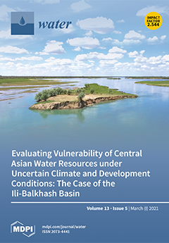
Exemplary for Central Asian water management challenges, the data-scarce Ili-Balkhash basin shared between China and Kazakhstan is confronted with climate change and shifts in water demand as a result of land use changes under the Belt and Road Initiative. This study assesses reliability of environmental flows of the Ili river to Lake Balkhash using a scenario-based modeling approach. The results suggest that the basin is historically vulnerable to environmental shortages, and potentially growing competition for water resources between domestic and up- and downstream users may be exacerbated by climatic conditions. The modeling tool and outcomes support transboundary management and local decision making. View this paper
  • Issues are regarded as officially published after their release is announced to the table of contents alert mailing list.
  • You may sign up for e-mail alerts to receive table of contents of newly released issues.
  • PDF is the official format for papers published in both, html and pdf forms. To view the papers in pdf format, click on the "PDF Full-text" link, and use the free Adobe Reader to open them.
Order results
Result details
Section
Select all
Export citation of selected articles as:
26 pages, 4813 KiB  
Article
Distributed-Framework Basin Modeling System: II. Hydrologic Modeling System
by Gang Chen, Wenjuan Hua, Xing Fang, Chuanhai Wang and Xiaoning Li
Water 2021, 13(5), 744; https://0-doi-org.brum.beds.ac.uk/10.3390/w13050744 - 09 Mar 2021
Cited by 7 | Viewed by 3021
Abstract
A distributed-framework hydrologic modeling system (DF-HMS) is a primary and significant component of a distributed-framework basin modeling system (DFBMS), which simulates the hydrological processes and responses after rainfall at the basin scale, especially for non-homogenous basins. The DFBMS consists of 11 hydrological feature [...] Read more.
A distributed-framework hydrologic modeling system (DF-HMS) is a primary and significant component of a distributed-framework basin modeling system (DFBMS), which simulates the hydrological processes and responses after rainfall at the basin scale, especially for non-homogenous basins. The DFBMS consists of 11 hydrological feature units (HFUs) involving vertical and horizontal geographic areas in a basin. Appropriate hydrologic or hydraulic methods are adopted for different HFUs to simulate corresponding hydrological processes. The digital basin generation model is first developed to determine the essential information for hydrologic and hydraulic simulation. This paper mainly describes two significant HFUs contained in the DF-HMS for hydrologic modeling: Hilly sub-watershed and plain overland flow HFUs. A typical hilly area application case study in the Three Gorges area is introduced, which demonstrates DF-HMS’s good performance in comparison with the observed streamflow at catchment outlets. Full article
(This article belongs to the Special Issue Modelling Hydrologic Response of Non­-homogeneous Catchments)
Show Figures

Figure 1

21 pages, 4534 KiB  
Article
A Parametric Approach for Determining Fishway Attraction Flow at Hydropower Dams
by Patrick Heneka, Markus Zinkhahn, Cornelia Schütz and Roman B. Weichert
Water 2021, 13(5), 743; https://0-doi-org.brum.beds.ac.uk/10.3390/w13050743 - 09 Mar 2021
Cited by 5 | Viewed by 3292
Abstract
High discharges at hydropower plants (HPP) may mask fishway attraction flows and, thereby, prevent fishes from locating and using fishways critical for their access to upstream spawning and rearing habitats. Existing methods for determining attraction flows are either based on simple guidelines (e.g., [...] Read more.
High discharges at hydropower plants (HPP) may mask fishway attraction flows and, thereby, prevent fishes from locating and using fishways critical for their access to upstream spawning and rearing habitats. Existing methods for determining attraction flows are either based on simple guidelines (e.g., a proportion of HPP discharge) that cannot address the spatial and temporal complexity of tailrace flow patterns or complicated studies (e.g., combinations of detailed hydraulic and biological investigations) that are expensive and time-consuming. To bridge this gap, we present a new, intermediate approach to reliably determine attraction flows for technical fishways at small to medium-sized waterways (mean annual flow up to 400 m3/s). Fundamental to our approach is a design criterion that the attraction flow should maintain its integrity as it propagates downstream from the fishway entrance to beyond the highly turbulent zone characteristic of HPP tailraces to create a discernable migration corridor connecting the fishway entrance to the downstream river. To implement this criterion, we describe a set of equations to calculate the width of the entrance and the corresponding attraction discharge. Input data are usually easy to obtain and include geometrical and hydraulic parameters describing the target HPP and its tailrace. To confirm our approach, we compare model results to four sites at German waterways where the design of attraction flow was obtained by detailed experimental and numerical methods. The comparison shows good agreement supporting our approach as a useful, intermediate alternative for determining attraction flows that bridges the gap between simple guidelines and detailed hydraulic and biological investigations. Full article
(This article belongs to the Special Issue Fish Passage at Hydropower Dams)
Show Figures

Figure 1

4 pages, 4213 KiB  
Editorial
Natural Radionuclides as Aquatic Tracers in the Terrestrial and the Coastal/Marine Environment
by Michael Schubert and Jan Scholten
Water 2021, 13(5), 742; https://0-doi-org.brum.beds.ac.uk/10.3390/w13050742 - 09 Mar 2021
Cited by 1 | Viewed by 1790
Abstract
Investigations in hydrology and hydrogeology are often hampered by a lack of parameters that permit direct observation or monitoring of the processes of interest [...] Full article
Show Figures

Figure 1

32 pages, 30439 KiB  
Article
Quaternary Evolution of the Lower Calore and Middle Volturno Valleys (Southern Italy)
by Francesca Filocamo, Natalia Leone, Carmen Maria Rosskopf, Vittoria Scorpio, Santiago Giralt and Pietro Patrizio Ciro Aucelli
Water 2021, 13(5), 741; https://0-doi-org.brum.beds.ac.uk/10.3390/w13050741 - 09 Mar 2021
Cited by 2 | Viewed by 2775
Abstract
The lower Calore and middle Volturno valleys preserve stratigraphical and morphological evidence and tephrostratigraphic markers particularly suitable for reconstructing the long-term geomorphological evolution of the central-southern Apennines. Aim of our study is to identify the main steps of the Quaternary landscape evolution of [...] Read more.
The lower Calore and middle Volturno valleys preserve stratigraphical and morphological evidence and tephrostratigraphic markers particularly suitable for reconstructing the long-term geomorphological evolution of the central-southern Apennines. Aim of our study is to identify the main steps of the Quaternary landscape evolution of these valley systems and to improve knowledge about the relationships between fluvial processes and tectonics, volcanic activity, climatic and human influences. To this purpose, we carried out an integrated geomorphological and chrono-stratigraphical analysis of identified fluvial landforms and related deposits, integrated by 230Th/234U datings on travertines from the Telese Plain area. The study highlighted in particular: (1) fluvial sedimentation started in the Middle Pleistocene (~650 ka) within valleys that originated in the lower Pleistocene under the control of high-angle faults; (2) extensional tectonics acted during the Middle and Upper Pleistocene, driving the formation of the oldest fluvial terraces and alluvial fans, and persisted beyond the emplacement of the Campanian Ignimbrite pyroclastic deposits (~39 ka); and (3) from the late Upper Pleistocene onwards (<15 ka), the role of tectonics appears negligible, while climatic changes played a key role in the formation of three orders of valley floor terraces and the youngest alluvial fans. Full article
(This article belongs to the Special Issue Fluvial Geomorphology and River Management)
Show Figures

Figure 1

13 pages, 1697 KiB  
Article
Nitrogen Leaching and Nitrogen Balance under Differing Nitrogen Fertilization for Sugarcane Cultivation on a Subtropical Island
by Ken Okamoto, Shinkichi Goto, Toshihiko Anzai and Shotaro Ando
Water 2021, 13(5), 740; https://0-doi-org.brum.beds.ac.uk/10.3390/w13050740 - 09 Mar 2021
Cited by 6 | Viewed by 2415
Abstract
Fertilizer application during sugarcane cultivation is a main source of nitrogen (N) loads to groundwater on small islands in southwestern Japan. The aim of this study was to quantify the effect of reducing the N fertilizer application rate on sugarcane yield, N leaching, [...] Read more.
Fertilizer application during sugarcane cultivation is a main source of nitrogen (N) loads to groundwater on small islands in southwestern Japan. The aim of this study was to quantify the effect of reducing the N fertilizer application rate on sugarcane yield, N leaching, and N balance. We conducted a sugarcane cultivation experiment with drainage lysimeters and different N application rates in three cropping seasons (three years). N loads were reduced by reducing the first N application rate in all cropping seasons. The sugarcane yields of the treatment to which the first N application was halved (T2 = 195 kg ha−1 N) were slightly lower than those of the conventional application (T1 = 230 kg ha−1 N) in the first and third seasons (T1 = 91 or 93 tons ha−1, T2 = 89 or 87 tons ha−1). N uptake in T1 and T2 was almost the same in seasons 1 (186–188 kg ha−1) and 3 (147–151 kg ha−1). Based on the responses of sugarcane yield and N uptake to fertilizer reduction in two of the three years, T2 is considered to represent a feasible fertilization practice for farmers. The reduction of the first N fertilizer application reduced the underground amounts of N loads (0–19 kg ha−1). However, application of 0 N in the first fertilization would lead to a substantial reduction in yield in all seasons. Reducing the amount of N in the first application (i.e., replacing T1 with T2) improved N recovery by 9.7–11.9% and reduced N leaching by 13 kg ha−1. These results suggest that halving the amount of N used in the first application can improve N fertilizer use efficiency and reduce N loss to groundwater. Full article
(This article belongs to the Section Water Quality and Contamination)
Show Figures

Figure 1

16 pages, 3136 KiB  
Article
Setting the Phosphorus Boundaries for Greek Natural Shallow and Deep Lakes for Water Framework Directive Compliance
by Ifigenia Kagalou, Chrysoula Ntislidou, Dionissis Latinopoulos, Dimitra Kemitzoglou, Vasiliki Tsiaoussi and Dimitra C. Bobori
Water 2021, 13(5), 739; https://0-doi-org.brum.beds.ac.uk/10.3390/w13050739 - 09 Mar 2021
Cited by 7 | Viewed by 2196
Abstract
Eutrophication caused by nutrient enrichment is a predominant stressor leading to lake degradation and, thus, the set-up of boundaries that support good ecological status, the Water Framework Directive’s main target, is a necessity. Greece is one of the Member States that have recorded [...] Read more.
Eutrophication caused by nutrient enrichment is a predominant stressor leading to lake degradation and, thus, the set-up of boundaries that support good ecological status, the Water Framework Directive’s main target, is a necessity. Greece is one of the Member States that have recorded delays in complying with the coherent management goals of European legislation. A wide range of different statistical approaches has been proposed in the Best Practice Guide for determining appropriate nutrient thresholds. To determine the nutrient thresholds supporting the good status of natural Greek lakes, the phytoplankton dataset gathered from the national monitoring programme (2015–2020) was used for shallow and deep natural lakes. The regression analyses were sufficient and robust in order to derive total phosphorus thresholds that ranged from 20 to 41 μg/L in shallow and 15–32 μg/L in deep natural lake types. Nutrient boundaries that encompass the stressors these lakes are subject to, are essential in proper lake management design. Full article
Show Figures

Graphical abstract

19 pages, 6860 KiB  
Article
Development of Fragility Curves for Piping and Slope Stability of River Levees
by Nicola Rossi, Mario Bačić, Meho Saša Kovačević and Lovorka Librić
Water 2021, 13(5), 738; https://0-doi-org.brum.beds.ac.uk/10.3390/w13050738 - 09 Mar 2021
Cited by 8 | Viewed by 3471
Abstract
The design code Eurocode 7 relies on semi-probabilistic calculation procedures, through utilization of the soil parameters obtained by in situ and laboratory tests, or by the means of transformation models. To reach a prescribed safety margin, the inherent soil parameter variability is accounted [...] Read more.
The design code Eurocode 7 relies on semi-probabilistic calculation procedures, through utilization of the soil parameters obtained by in situ and laboratory tests, or by the means of transformation models. To reach a prescribed safety margin, the inherent soil parameter variability is accounted for through the application of partial factors to either soil parameters directly or to the resistance. However, considering several sources of geotechnical uncertainty, including the inherent soil variability, measurement error and transformation uncertainty, full probabilistic analyses should be implemented to directly consider the site-specific variability. This paper presents the procedure of developing fragility curves for levee slope stability and piping as failure mechanisms that lead to larger breaches, where a direct influence of the flood event intensity on the probability of failure is calculated. A range of fragility curve sets is presented, considering the variability of levee material properties and varying durations of the flood event, thus providing crucial insight into the vulnerability of the levee exposed to rising water levels. The procedure is applied to the River Drava levee, a site which has shown a continuous trend of increased water levels in recent years. Full article
(This article belongs to the Special Issue Dam Safety. Overtopping and Geostructural Risks)
Show Figures

Figure 1

25 pages, 10113 KiB  
Article
Means and Extremes: Evaluation of a CMIP6 Multi-Model Ensemble in Reproducing Historical Climate Characteristics across Alberta, Canada
by Badrul Masud, Quan Cui, Mohamed E. Ammar, Barrie R. Bonsal, Zahidul Islam and Monireh Faramarzi
Water 2021, 13(5), 737; https://0-doi-org.brum.beds.ac.uk/10.3390/w13050737 - 09 Mar 2021
Cited by 17 | Viewed by 4765
Abstract
This study evaluates General Circulation Models (GCMs) participating in the Coupled Model Intercomparison Project Phase 6 (CMIP6) for their ability in simulating historical means and extremes of daily precipitation (P), and daily maximum (Tmax), and minimum temperature (Tmin). Models are evaluated against hybrid [...] Read more.
This study evaluates General Circulation Models (GCMs) participating in the Coupled Model Intercomparison Project Phase 6 (CMIP6) for their ability in simulating historical means and extremes of daily precipitation (P), and daily maximum (Tmax), and minimum temperature (Tmin). Models are evaluated against hybrid observations at 2255 sub-basins across Alberta, Canada using established statistical metrics for the 1983–2014 period. Three extreme indices including consecutive wet days (CWD), summer days (SD), and warm nights (WN) are defined based on the peak over the threshold approach and characterized by duration and frequency. The tail behaviour of extremes is evaluated using the Generalized Pareto Distribution. Regional evaluations are also conducted for four climate sub-regions across the study area. For both mean annual precipitation and mean annual daily temperature, most GCMs more accurately reproduce the observations in northern Alberta and follow a gradient toward the south having the poorest representation in the western mountainous area. Model simulations show statistically better performance in reproducing mean annual daily Tmax than Tmin, and in reproducing annual mean duration compared to the frequency of extreme indices across the province. The Kernel density curves of duration and frequency as simulated by GCMs show closer agreement to that of observations in the case of CWD. However, it is slightly (completely) overestimated (underestimated) by GCMs for warm nights (summer days). The tail behaviour of extremes indicates that GCMs may not incorporate some local processes such as the convective parameterization scheme in the simulation of daily precipitation. Model performances in each of the four sub-regions are quite similar to their performances at the provincial scale. Bias-corrected and downscaled GCM simulations using a hybrid approach show that the downscaled GCM simulations better represent the means and extremes of P characteristics compared to Tmax and Tmin. There is no clear indication of an improved tail behaviour of GPD based on downscaled simulations. Full article
(This article belongs to the Special Issue Past and Future Trends and Variability in Hydro-Climatic Processes)
Show Figures

Figure 1

11 pages, 1971 KiB  
Review
The Problem of Removing Seaweed from the Beaches: Review of Methods and Machines
by Łukasz Warguła, Bartosz Wieczorek, Mateusz Kukla, Piotr Krawiec and Jakub Wojciech Szewczyk
Water 2021, 13(5), 736; https://0-doi-org.brum.beds.ac.uk/10.3390/w13050736 - 08 Mar 2021
Cited by 9 | Viewed by 4950
Abstract
Beach cleaning and algae collection in the shoreline area are important for the tourism industry, mainly for aesthetic reasons, but also to protect human health. In addition, the collected material can be used in many industries such as energy, medicine, cosmetics or catering. [...] Read more.
Beach cleaning and algae collection in the shoreline area are important for the tourism industry, mainly for aesthetic reasons, but also to protect human health. In addition, the collected material can be used in many industries such as energy, medicine, cosmetics or catering. The problem of cleaning the shoreline area concerns the need to clear land, water and the strip of shore and land onto which water is thrown from falling waves. The vast majority of available cleaning methods are adapted to cleaning beaches or waters. There is a lack of solutions and machine designs suitable for cleaning the coastal strip, which includes: land, the area of land on which the wave is thrown, shoal and deep water. This area is particularly important for tourism as it is mainly used for water bathing. Pictures from tourist areas that are exposed to intensive water contamination show that measures taken to clear the shoreline area are not very effective, as seaweed in shallow water is thrown ashore with the waves. The paper presents a review of methods for cleaning coastal waters and beaches from contamination. It also shows the author’s conceptual design adapted to clear the shoreline area and sandy beaches. Full article
(This article belongs to the Section Water Resources Management, Policy and Governance)
Show Figures

Figure 1

23 pages, 2282 KiB  
Article
Natural Background Levels of Potentially Toxic Elements in Groundwater from a Former Asbestos Mine in Serpentinite (Balangero, North Italy)
by Elisa Sacchi, Massimo Bergamini, Elisa Lazzari, Arianna Musacchio, Jordi-René Mor and Elisa Pugliaro
Water 2021, 13(5), 735; https://0-doi-org.brum.beds.ac.uk/10.3390/w13050735 - 08 Mar 2021
Cited by 12 | Viewed by 2251
Abstract
The definition of natural background levels (NBLs) for potentially toxic elements (PTEs) in groundwater from mining environments is a real challenge, as anthropogenic activities boost water–rock interactions, further increasing the naturally high concentrations. This study illustrates the procedure followed to derive PTE concentration [...] Read more.
The definition of natural background levels (NBLs) for potentially toxic elements (PTEs) in groundwater from mining environments is a real challenge, as anthropogenic activities boost water–rock interactions, further increasing the naturally high concentrations. This study illustrates the procedure followed to derive PTE concentration values that can be adopted as NBLs for the former Balangero asbestos mine, a “Contaminated Site of National Interest”. A full hydrogeochemical characterisation allowed for defining the dominant Mg-HCO3 facies, tending towards the Mg-SO4 facies with increasing mineralisation. PTE concentrations are high, and often exceed the groundwater quality thresholds for Cr VI, Ni, Mn and Fe (5, 20, 50 and 200 µg/L, respectively). The Italian guidelines for NBL assessment recommend using the median as a representative concentration for each monitoring station. However, this involves discarding half of the measurements and in particular the higher concentrations, thus resulting in too conservative estimates. Using instead all the available measurements and the recommended statistical evaluation, the derived NBLs were: Cr = 39.3, Cr VI = 38.1, Ni = 84, Mn = 71.36, Fe = 58.4, Zn = 232.2 µg/L. These values are compared to literature data from similar hydrogeochemical settings, to support the conclusion on their natural origin. Results highlight the need for a partial rethink of the guidelines for the assessment of NBLs in naturally enriched environmental settings. Full article
(This article belongs to the Special Issue Natural Background Levels in Groundwater)
Show Figures

Figure 1

27 pages, 2423 KiB  
Review
Finding Nano: Challenges Involved in Monitoring the Presence and Fate of Engineered Titanium Dioxide Nanoparticles in Aquatic Environments
by Simone Heilgeist, Ryo Sekine, Oz Sahin and Rodney A. Stewart
Water 2021, 13(5), 734; https://0-doi-org.brum.beds.ac.uk/10.3390/w13050734 - 08 Mar 2021
Cited by 20 | Viewed by 5213
Abstract
In recent years, titanium dioxide (TiO2) has increasingly been used as an inorganic ultraviolet (UV) filter for sun protection. However, nano-TiO2 may also pose risks to the health of humans and the environment. Thus, to adequately assess its potential adverse [...] Read more.
In recent years, titanium dioxide (TiO2) has increasingly been used as an inorganic ultraviolet (UV) filter for sun protection. However, nano-TiO2 may also pose risks to the health of humans and the environment. Thus, to adequately assess its potential adverse effects, a comprehensive understanding of the behaviour and fate of TiO2 in different environments is crucial. Advances in analytical and modelling methods continue to improve researchers’ ability to quantify and determine the state of nano-TiO2 in various environments. However, due to the complexity of environmental and nanoparticle factors and their interplay, this remains a challenging and poorly resolved feat. This paper aims to provide a focused summary of key particle and environmental characteristics that influence the behaviour and fate of sunscreen-derived TiO2 in swimming pool water and natural aquatic environments and to review the current state-of-the-art of single particle inductively coupled plasma mass spectrometry (SP-ICP-MS) approaches to detect and characterise TiO2 nanoparticles in aqueous media. Furthermore, it critically analyses the capability of existing fate and transport models to predict environmental TiO2 levels. Four particle and environmental key factors that govern the fate and behaviour of TiO2 in aqueous environments are identified. A comparison of SP-ICP-MS studies reveals that it remains challenging to detect and characterise engineered TiO2 nanoparticles in various matrices and highlights the need for the development of new SP-ICP-MS pre-treatment and analysis approaches. This review shows that modelling studies are an essential addition to experimental studies, but they still lack in spatial and temporal resolution and mostly exclude surface transformation processes. Finally, this study identifies the use of Bayesian Network-based models as an underexplored but promising modelling tool to overcome data uncertainties and incorporates interconnected variables. Full article
(This article belongs to the Special Issue Emerging Contaminants (ECs) in Water)
Show Figures

Figure 1

12 pages, 31035 KiB  
Article
An Assessment of Dam Operation Considering Flood and Low-Flow Control in the Han River Basin
by Jaewon Kwak
Water 2021, 13(5), 733; https://0-doi-org.brum.beds.ac.uk/10.3390/w13050733 - 08 Mar 2021
Cited by 2 | Viewed by 2208
Abstract
An assessment of dam operation is essential in dam management; however, there is a lack of a simple method that could be used in actual practice. This study aims for an actual dam operation evaluation method for flood and low-flow control of the [...] Read more.
An assessment of dam operation is essential in dam management; however, there is a lack of a simple method that could be used in actual practice. This study aims for an actual dam operation evaluation method for flood and low-flow control of the three multi-purpose dams of Soyanggang, Chungju, and Hoengseong in the Han River basin, South Korea. Frequency matching method was applied to make a pair of cumulative distribution function (CDF) using daily dam inflow and outflow records. Runoff increasing and flood reduction rates are derived using CDFs of total and annual records. As a result, the average flood mitigation rates of the Chungju dam is approximately 35% annually and is relatively disadvantaged than the Soyanggang dam, which is 67.7% annually, due to small flood control capacity. The Hoengseong dam appeared to have a small flood reduction rate, but its runoff increasing rate is 94.7% annually because of the 209 km2 upper basin area. The suggested method in this study could be used as a simple and intuitive field method to evaluate dam operations. Also, according to the annual evaluation, the Soyanggang and Chunju dam need more aggressive and anticipative operations for flood control such as pre-discharge before flooding or modify the Restricted Water Level (RWL) for flood seasons. On the other hand, Hoengseong dam need further data and studies. Full article
(This article belongs to the Section Hydrology)
Show Figures

Figure 1

17 pages, 6002 KiB  
Article
Developing Real-Time Nowcasting System for Regional Landslide Hazard Assessment under Extreme Rainfall Events
by Yuan-Chang Deng, Jin-Hung Hwang and Yu-Da Lyu
Water 2021, 13(5), 732; https://0-doi-org.brum.beds.ac.uk/10.3390/w13050732 - 08 Mar 2021
Cited by 7 | Viewed by 2301
Abstract
In this research, a real-time nowcasting system for regional landslide-hazard assessment under extreme-rainfall conditions was established by integrating a real-time rainfall data retrieving system, a landslide-susceptibility analysis program (TRISHAL), and a real-time display system to show the stability of regional slopes in real [...] Read more.
In this research, a real-time nowcasting system for regional landslide-hazard assessment under extreme-rainfall conditions was established by integrating a real-time rainfall data retrieving system, a landslide-susceptibility analysis program (TRISHAL), and a real-time display system to show the stability of regional slopes in real time and provide an alert index under rainstorm conditions for disaster prevention and mitigation. The regional hydrogeological parameters were calibrated using a reverse-optimization analysis based on an RGA (Real-coded Genetic Algorithm) of the optimization techniques and an improved version of the TRIGRS (Transient Rainfall Infiltration and Grid-based Regional Slope-Stability) model. The 2009 landslide event in the Xiaolin area of Taiwan, associated with Typhoon Morakot, was used to test the real-time regional landslide-susceptibility system. The system-testing results showed that the system configuration was feasible for practical applications concerning disaster prevention and mitigation. Full article
(This article belongs to the Special Issue Rainfall-Induced Shallow Landslides Modeling and Warning)
Show Figures

Figure 1

17 pages, 9236 KiB  
Article
Stratigraphic Analysis of Firn Cores from an Antarctic Ice Shelf Firn Aquifer
by Shelley MacDonell, Francisco Fernandoy, Paula Villar and Arno Hammann
Water 2021, 13(5), 731; https://0-doi-org.brum.beds.ac.uk/10.3390/w13050731 - 08 Mar 2021
Cited by 5 | Viewed by 3356
Abstract
In recent decades, several large ice shelves in the Antarctic Peninsula region have experienced significant ice loss, likely driven by a combination of oceanic, atmospheric and hydrological processes. All three areas need further research, however, in the case of the role of liquid [...] Read more.
In recent decades, several large ice shelves in the Antarctic Peninsula region have experienced significant ice loss, likely driven by a combination of oceanic, atmospheric and hydrological processes. All three areas need further research, however, in the case of the role of liquid water the first concern is to address the paucity of field measurements. Despite this shortage of field observations, several authors have proposed the existence of firn aquifers on Antarctic ice shelves, however little is known about their distribution, formation, extension and role in ice shelf mechanics. In this study we present the discovery of saturated firn at three drill sites on the Müller Ice Shelf (67°14′ S; 66°52′ W), which leads us to conclude that either a large contiguous or several disconnected smaller firn aquifers exist on this ice shelf. From the stratigraphic analysis of three short firn cores extracted during February 2019 we describe a new classification system to identify the structures and morphological signatures of refrozen meltwater, identify evidence of superficial meltwater percolation, and use this information to propose a conceptual model of firn aquifer development on the Müller Ice Shelf. The detailed stratigraphic analysis of the sampled cores will provide an invaluable baseline for modelling studies. Full article
Show Figures

Figure 1

10 pages, 20397 KiB  
Communication
On the Power of Microwave Communication Data to Monitor Rain for Agricultural Needs in Africa
by Noam David, Yanyan Liu, Kingsley K. Kumah, Joost C. B. Hoedjes, Bob Z. Su and H. Oliver Gao
Water 2021, 13(5), 730; https://0-doi-org.brum.beds.ac.uk/10.3390/w13050730 - 08 Mar 2021
Cited by 10 | Viewed by 4816
Abstract
Over the last two decades, prevalent technologies and Internet of Things (IoT) systems have been found to have potential for carrying out environmental monitoring. The data generated from these infrastructures are readily available and have the potential to provide massive spatial coverage. The [...] Read more.
Over the last two decades, prevalent technologies and Internet of Things (IoT) systems have been found to have potential for carrying out environmental monitoring. The data generated from these infrastructures are readily available and have the potential to provide massive spatial coverage. The costs involved in using these data are minimal since the records are already generated for the original uses of these systems. Commercial microwave links, which provide the underlying framework for data transfer between cellular network base stations, are one example of such a system and have been found useful for monitoring rainfall. Wireless infrastructure of this kind is deployed widely by communication providers across Africa and can thus be used as a rainfall monitoring device to complement the sparse proprietary resources that currently exist or to substitute for them where alternatives do not exist. Here we focus this approach’s potential to acquire valuable information required for agricultural needs across Africa using Kenya as an example. Full article
Show Figures

Figure 1

27 pages, 7155 KiB  
Article
Interdecadal Variability in Myanmar Rainfall in the Monsoon Season (May–October) Using Eigen Methods
by Zin Mie Mie Sein, Irfan Ullah, Farhan Saleem, Xiefei Zhi, Sidra Syed and Kamran Azam
Water 2021, 13(5), 729; https://0-doi-org.brum.beds.ac.uk/10.3390/w13050729 - 07 Mar 2021
Cited by 29 | Viewed by 5037
Abstract
In this study, we investigated the interdecadal variability in monsoon rainfall in the Myanmar region. The gauge-based gridded rainfall dataset of the Global Precipitation Climatology Centre (GPCC) and Climatic Research Unit version TS4.0 (CRU TS4.0) were used (1950–2019) to investigate the interdecadal variability [...] Read more.
In this study, we investigated the interdecadal variability in monsoon rainfall in the Myanmar region. The gauge-based gridded rainfall dataset of the Global Precipitation Climatology Centre (GPCC) and Climatic Research Unit version TS4.0 (CRU TS4.0) were used (1950–2019) to investigate the interdecadal variability in summer monsoon rainfall using empirical orthogonal function (EOF), singular value decomposition (SVD), and correlation approaches. The results reveal relatively negative rainfall anomalies during the 1980s, 1990s, and 2000s, whereas strong positive rainfall anomalies were identified for the 1970s and 2010s. The dominant spatial variability mode showed a dipole pattern with a total variance of 47%. The power spectra of the principal component (PC) from EOF revealed a significant peak during decadal timescales (20–30 years). The Myanmar summer monsoon rainfall positively correlated with Atlantic multidecadal oscillation (AMO) and negatively correlated with Pacific decadal oscillation (PDO). The results reveal that extreme monsoon rainfall (flood) events occurred during the negative phase of the PDO and below-average rainfall (drought) occurred during the positive phase of the PDO. The cold phase (warm phase) of AMO was generally associated with negative (positive) decadal monsoon rainfall. The first SVD mode indicated the Myanmar rainfall pattern associated with the cold and warm phase of the PDO and AMO, suggesting that enhanced rainfall for about 53% of the square covariance fraction was related to heavy rain over the study region except for the central and eastern parts. The second SVD mode demonstrated warm sea surface temperature (SST) in the eastern equatorial Pacific (El Niño pattern) and cold SST in the North Atlantic Ocean, implying a rainfall deficit of about 33% of the square covariance fraction, which could be associated with dry El Niño conditions (drought). The third SVD revealed that cold SSTs in the central and eastern equatorial Pacific (La Niña pattern) caused enhance rainfall with a 6.7% square covariance fraction related to flood conditions. Thus, the extra-subtropical phenomena may affect the average summer monsoon trends over Myanmar by enhancing the cross-equatorial moisture trajectories into the North Atlantic Ocean. Full article
(This article belongs to the Section Water Use and Scarcity)
Show Figures

Figure 1

16 pages, 3438 KiB  
Article
1,2-DCA Natural Attenuation Evaluation in Groundwater: Insight by Dual Isotope 13C/37Cl and Molecular Analysis Approach
by Giovanna Carpani, Massimo Marchesi, Ilaria Pietrini, Luca Alberti, Luciano Massimo Zaninetta, Orfan Shouakar-Stash and Francesca de Ferra
Water 2021, 13(5), 728; https://0-doi-org.brum.beds.ac.uk/10.3390/w13050728 - 07 Mar 2021
Cited by 3 | Viewed by 2943
Abstract
Natural attenuation (NA) processes represent a valuable option in groundwater remediation. At a heavily 1,2-dichloroethane (1,2-DCA) contaminated site, Compound-Specific Isotope Analysis (CSIA) in combination with Biological Molecular Tools (BMTs) were implemented as a rigorous characterization approach to evaluate the occurrence of Natural Attenuation [...] Read more.
Natural attenuation (NA) processes represent a valuable option in groundwater remediation. At a heavily 1,2-dichloroethane (1,2-DCA) contaminated site, Compound-Specific Isotope Analysis (CSIA) in combination with Biological Molecular Tools (BMTs) were implemented as a rigorous characterization approach to evaluate the occurrence of Natural Attenuation in the proximity of the source area. By the use of microcosm experiments, the potential for natural and enhanced biodegradation under anaerobic conditions was documented, following the dichloroelimination pathway. Enrichment factors of −9.1‰ and −11.3‰ were obtained for 13C while Geobacter spp. and reductive dehalogenase genes (rdhs) were identified as main site-specific biomarkers. At pilot scale, enrichments of 13.5‰ and 6.3‰ for δ13C and δ37Cl, respectively, high levels of reductive dehalogenase (rdh group VI) along with the dominance of Geobacter spp. indicated the occurrence of significant dichloroelimination processes in groundwater under anaerobic conditions. By using the site-specific enrichment factors, degradation extents over approximately 70–80% were estimated, highlighting the relevant potential of NA in 1,2-DCA degradation in the vicinity of the source area at the site. The proposed fine-tuned protocol, including CSIA and BMTs, is proven to be effective as a groundwater remediation strategy, properly assessing and monitoring NA at site scale. Full article
(This article belongs to the Special Issue Groundwater and Soil Remediation)
Show Figures

Figure 1

22 pages, 3363 KiB  
Article
An Enhanced Innovative Triangular Trend Analysis of Rainfall Based on a Spectral Approach
by Bilel Zerouali, Nadhir Al-Ansari, Mohamed Chettih, Mesbah Mohamed, Zaki Abda, Celso Augusto Guimarães Santos, Bilal Zerouali and Ahmed Elbeltagi
Water 2021, 13(5), 727; https://0-doi-org.brum.beds.ac.uk/10.3390/w13050727 - 07 Mar 2021
Cited by 15 | Viewed by 3352
Abstract
The world is currently witnessing high rainfall variability at the spatiotemporal level. In this paper, data from three representative rain gauges in northern Algeria, from 1920 to 2011, at an annual scale, were used to assess a relatively new hybrid method, which combines [...] Read more.
The world is currently witnessing high rainfall variability at the spatiotemporal level. In this paper, data from three representative rain gauges in northern Algeria, from 1920 to 2011, at an annual scale, were used to assess a relatively new hybrid method, which combines the innovative triangular trend analysis (ITTA) with the orthogonal discrete wavelet transform (DWT) for partial trend identification. The analysis revealed that the period from 1950 to 1975 transported the wettest periods, followed by a long-term dry period beginning in 1973. The analysis also revealed a rainfall increase during the latter decade. The combined method (ITTA–DWT) showed a good efficiency for extreme rainfall event detection. In addition, the analysis indicated the inter- to multiannual phenomena that explained the short to medium processes that dominated the high rainfall variability, masking the partial trend components existing in the rainfall time series and making the identification of such trends a challenging task. The results indicate that the approaches—combining ITTA and selected input combination models resulting from the DWT—are auspicious compared to those found using the original rainfall observations. This analysis revealed that the ITTA–DWT method outperformed the ITTA method for partial trend identification, which proved DWT’s efficiency as a coupling method. Full article
Show Figures

Figure 1

13 pages, 2054 KiB  
Article
Comparison between the Lagrangian and Eulerian Approach in Simulation of Free Surface Air-Core Vortices
by Maryam Azarpira, Amir Reza Zarrati and Pouya Farrokhzad
Water 2021, 13(5), 726; https://0-doi-org.brum.beds.ac.uk/10.3390/w13050726 - 07 Mar 2021
Cited by 5 | Viewed by 6990
Abstract
The problematic consequences regarding formation of air-core vortices at the intakes and the drastic necessity of a thorough investigation into the phenomenon has resulted in particular attention being placed on Computational Fluid Dynamics (CFD) as an economically viable method. Two main approaches could [...] Read more.
The problematic consequences regarding formation of air-core vortices at the intakes and the drastic necessity of a thorough investigation into the phenomenon has resulted in particular attention being placed on Computational Fluid Dynamics (CFD) as an economically viable method. Two main approaches could be taken using CFD, namely the Eulerian and Lagrangian methods each of which is characterized by specific advantages and disadvantages. Whereas many researchers have used the Eulerian approach for vortex simulation, the Lagrangian approach has not been found in the literature. The present study dealt with the comparison of the Lagrangian and Eulerian approaches in the simulation of vortex flow. Simulations based on both approaches were carried out by solving the Navier–Stokes equations accompanied by the LES turbulence model. The results of the numerical model were evaluated in accordance with a physical model for steady vortex flow using particle image velocimetry (PIV), revealing that both approaches are sufficiently capable of simulating the vortex flow but with the difference that the Lagrangian method has greater computational cost with less accuracy. Full article
(This article belongs to the Special Issue Computational Fluid Mechanics and Hydraulics)
Show Figures

Figure 1

22 pages, 4553 KiB  
Article
Nonlinear Water Quality Response to Numerical Simulation of In Situ Phosphorus Control Approaches
by Baichuan Zhang, Ningya Lin, Xi Chen, Qiaoming Fan, Xing Chen, Tingyu Ren, Rui Zou and Huaicheng Guo
Water 2021, 13(5), 725; https://0-doi-org.brum.beds.ac.uk/10.3390/w13050725 - 07 Mar 2021
Cited by 1 | Viewed by 2176
Abstract
The nonlinear and heterogeneous responses of nutrients to eutrophication control measures are a major challenge for in situ treatment engineering design, especially for large water bodies. Tackling the problem calls for a full understanding of potential water quality responses to various treatment schemes, [...] Read more.
The nonlinear and heterogeneous responses of nutrients to eutrophication control measures are a major challenge for in situ treatment engineering design, especially for large water bodies. Tackling the problem calls for a full understanding of potential water quality responses to various treatment schemes, which cannot be fulfilled by empirical-based methods or small-scale tests. This paper presents a methodology for Phoslock application based on the idea of object-oriented intelligent engineering design (OOID), which includes numerical simulation to explore the features of responses to numerous assumed schemes. A large plateau lake in Southwestern China was employed as a case study to illustrate the characteristics of the water quality response and demonstrate the applicability of this new approach. It was shown by the simulation and scenario analysis that the water quality response to Phoslock application always reflected nonlinearity and spatiotemporal heterogeneity, and always varied with objects, boundary conditions, and engineering design parameters. It was also found that some design parameters, like release position, had a significant impact on efficiency. Thus, a remarkable improvement could be obtained by cost-effective analysis based on scenarios using combinations of design parameters. Full article
Show Figures

Figure 1

17 pages, 6352 KiB  
Article
Performance Assessment of Posidonia oceanica (L.) Delile Restoration Experiment on Dead matte Twelve Years after Planting—Structural and Functional Meadow Features
by Sebastiano Calvo, Roberta Calvo, Filippo Luzzu, Vincenzo Raimondi, Mauro Assenzo, Federica Paola Cassetti and Agostino Tomasello
Water 2021, 13(5), 724; https://0-doi-org.brum.beds.ac.uk/10.3390/w13050724 - 07 Mar 2021
Cited by 15 | Viewed by 3771
Abstract
Following the restoration of natural conditions by reducing human pressures, reforestation is currently considered a possible option to accelerate the recovery of seagrass habitats. Long-term monitoring programs theoretically represent an ideal solution to assess whether a reforestation plan has produced the desired results. [...] Read more.
Following the restoration of natural conditions by reducing human pressures, reforestation is currently considered a possible option to accelerate the recovery of seagrass habitats. Long-term monitoring programs theoretically represent an ideal solution to assess whether a reforestation plan has produced the desired results. Here, we report on the performance of a 20 m2 patch of Posidonia oceanica transplanted on dead matte twelve years after transplantation in the Gulf of Palermo, northwestern Sicily. Photo mosaic performed in the area allowed us to detect 23 transplanted patches of both regular and irregular shape, ranging from 0.1 to 2.7 m2 and an overall surface close to 19 m2. Meadow density was 331.6 ± 17.7 shoot m−2 (currently five times higher than the initial value of 66 shoots m−2), and it did not show statistical differences from a close by natural meadow (331.2 ± 14.9). Total primary production, estimated by lepidochronology, varied from 333.0 to 332.7 g dw m2/year, at the transplanted and natural stand, respectively. These results suggest that complete restoration of P. oceanica on dead matte is possible in a relatively short time (a decade), thus representing a good starting point for upscaling the recovery of the degraded meadows in the area. Full article
(This article belongs to the Special Issue Restore Degraded Marine Coastal Areas in the Mediterranean Sea)
Show Figures

Figure 1

19 pages, 1915 KiB  
Article
A New, Catchment-Scale Integrated Water Quality Model of Phosphorus, Dissolved Oxygen, Biochemical Oxygen Demand and Phytoplankton: INCA-Phosphorus Ecology (PEco)
by Jill Crossman, Gianbattista Bussi, Paul G. Whitehead, Daniel Butterfield, Emma Lannergård and Martyn N. Futter
Water 2021, 13(5), 723; https://0-doi-org.brum.beds.ac.uk/10.3390/w13050723 - 07 Mar 2021
Cited by 13 | Viewed by 4202
Abstract
Process-based models are commonly used to design management strategies to reduce excessive algal growth and subsequent hypoxia. However, management targets typically focus on phosphorus control, under the assumption that successful nutrient reduction will solve hypoxia issues. Algal responses to nutrient drivers are not [...] Read more.
Process-based models are commonly used to design management strategies to reduce excessive algal growth and subsequent hypoxia. However, management targets typically focus on phosphorus control, under the assumption that successful nutrient reduction will solve hypoxia issues. Algal responses to nutrient drivers are not linear and depend on additional biotic and abiotic controls. In order to generate a comprehensive assessment of the effectiveness of nutrient control strategies, independent nutrient, dissolved oxygen (DO), temperature and algal models must be coupled, which can increase overall uncertainty. Here, we extend an existing process-based phosphorus model (INtegrated CAtchment model of Phosphorus dynamics) to include biological oxygen demand (BOD), dissolved oxygen (DO) and algal growth and decay (INCA-PEco). We applied the resultant model in two eutrophied mesoscale catchments with continental and maritime climates. We assessed effects of regional differences in climate and land use on parameter importance during calibration using a generalised sensitivity analysis. We successfully reproduced in-stream total phosphorus (TP), suspended sediment, DO, BOD and chlorophyll-a (chl-a) concentrations across a range of temporal scales, land uses and climate regimes. While INCA-PEco is highly parameterized, model uncertainty can be significantly reduced by focusing calibration and monitoring efforts on just 18 of those parameters. Specifically, calibration time could be optimized by focusing on hydrological parameters (base flow, Manning’s n and river depth). In locations with significant inputs of diffuse nutrients, e.g., in agricultural catchments, detailed data on crop growth and nutrient uptake rates are also important. The remaining parameters provide flexibility to the user, broaden model applicability, and maximize its functionality under a changing climate. Full article
(This article belongs to the Special Issue Current Trends in Catchment Biogeochemical and Hydrological Modelling)
Show Figures

Figure 1

15 pages, 2846 KiB  
Article
Development of a New Testing Approach for Decentralised Technical Sustainable Drainage Systems
by Johannes Wolfgang Neupert, Philipp Lau, Daniel Venghaus and Matthias Barjenbruch
Water 2021, 13(5), 722; https://0-doi-org.brum.beds.ac.uk/10.3390/w13050722 - 06 Mar 2021
Cited by 6 | Viewed by 3142
Abstract
A part of the sustainable drainage systems (SuDS) are used to treat stormwater and must be tested for their hydraulic performance and the removal efficiency to assess serviceability and retention of the pollutants efficacy for in situ use. Current test procedures provide a [...] Read more.
A part of the sustainable drainage systems (SuDS) are used to treat stormwater and must be tested for their hydraulic performance and the removal efficiency to assess serviceability and retention of the pollutants efficacy for in situ use. Current test procedures provide a good basis for laboratory testing SuDS on the test stand. However, the evaluation is not sufficiently representative to compare different SuDS with each other or for in situ use. The individual steps and specifications of an applied test procedure in Germany were considered and evaluation and optimizations for the test substance and sampling methodology of SuDS on the test stand were proposed. A comparison of the particle size distribution of the test substance Millisil W4 currently in use and total suspended solids of real road runoff was made, which showed that the presented test substance of real road-deposited sediments (RDS) provides a better reference for the test conditions and they could be the basis for more representative test methods. A particle size distribution was proposed for this new test substance. Furthermore, two methods of sampling were compared, which showed that a full flow sampling is preferable to a discrete sample. At the same time, it was shown that a separation limit of 20 µm is sufficient for the determination of TSS63. Full article
(This article belongs to the Special Issue Rainwater Management in Urban Areas)
Show Figures

Figure 1

12 pages, 5074 KiB  
Article
How Can Be Lotic Ecosystem Size More Precisely Estimated? Comparing Different Approximations in Pre-Pyrenean and Pyrenean Mountains
by Fernando Coello Sanz, Frederic Casals and Jorge Rubén Sánchez-González
Water 2021, 13(5), 721; https://0-doi-org.brum.beds.ac.uk/10.3390/w13050721 - 06 Mar 2021
Viewed by 2653
Abstract
Rivers are among the most biodiverse and endangered ecosystems on earth. In Europe, concern over their conservation promoted the development of legal instruments for habitat and species conservation, the Habitats Directive, and water resource management, the Water Framework Directive. This legal protection demanded [...] Read more.
Rivers are among the most biodiverse and endangered ecosystems on earth. In Europe, concern over their conservation promoted the development of legal instruments for habitat and species conservation, the Habitats Directive, and water resource management, the Water Framework Directive. This legal protection demanded the estimate of river ecosystem surface for different purposes. Different approaches allow river surface to be measured at a low cost. Some accurate techniques like satellite images or LiDAR (Light Detection and Ranging) do not always work at a large scale or for streams and small rivers. We discuss here the use of the traditional hydraulics relationship between drainage area and bankfull width as a good approach to river surface estimation. We confirm that the use of this cheap and simple method could be a good approach to estimate river surface. However, we also proved that the development of regional curves, i.e., to establish the empirical relationship based on study area data, constitutes an essential improvement to estimation. Full article
(This article belongs to the Section Water Quality and Contamination)
Show Figures

Figure 1

18 pages, 4720 KiB  
Article
Urban Groundwater Contamination by Non-Steroidal Anti-Inflammatory Drugs
by Anna Jurado, Enric Vázquez-Suñé and Estanislao Pujades
Water 2021, 13(5), 720; https://0-doi-org.brum.beds.ac.uk/10.3390/w13050720 - 06 Mar 2021
Cited by 24 | Viewed by 3277
Abstract
Pharmaceuticals, such as non-steroidal anti-inflammatory drugs (NSAIDs) and their metabolites, have become a major concern due to their increasing consumption and their widespread occurrence in the environment. In this paper, we investigate the occurrence of NSAIDs and their metabolites in an urban aquifer, [...] Read more.
Pharmaceuticals, such as non-steroidal anti-inflammatory drugs (NSAIDs) and their metabolites, have become a major concern due to their increasing consumption and their widespread occurrence in the environment. In this paper, we investigate the occurrence of NSAIDs and their metabolites in an urban aquifer, which may serve as a potential resource for drinking water, and propose a methodology to assess the removal of these substances in the river–groundwater interface. Then, risk quotients (RQs) are computed, in order to determine the risk posed by the single NSAIDs and their mixture to human health. To this end, six NSAIDs and two metabolites were collected from an urban aquifer located in the metropolitan area of Barcelona (NE, Spain), in which the major pollution source is a contaminated river. All of the target NSAIDs were detected in groundwater samples, where the concentrations in the aquifer were higher than those found in the river water (except for ibuprofen). Diclofenac, ketoprofen, propyphenazone and salicylic acid were detected at high mean concentrations (ranging from 91.8 ng/L to 225.2 ng/L) in the aquifer. In contrast, phenazone and mefenamic acid were found at low mean concentrations (i.e., lower than 25 ng/L) in the aquifer. According to the proposed approach, the mixing of river water recharge into the aquifer seemed to some extent to promote the removal of the NSAIDs under the sub-oxic to denitrifying conditions found in the groundwater. The NSAIDs that presented higher mean removal values were 4OH diclofenac (0.8), ibuprofen (0.78), salicylic acid (0.35) and diclofenac (0.28), which are likely to be naturally attenuated under the aforementioned redox conditions. Concerning human health risk assessment, the NSAIDs detected in groundwater and their mixture do not pose any risk for all age intervals considered, as the associated RQs were all less than 0.05. Nevertheless, this value must be taken with caution, as many pharmaceuticals might occur simultaneously in the groundwater. Full article
(This article belongs to the Special Issue Urban Groundwater)
Show Figures

Figure 1

18 pages, 5425 KiB  
Article
Towards a Correlation between Long-Term Seawater Intrusion Response and Water Level Fluctuations
by Antoifi Abdoulhalik, Ashraf A. Ahmed, Abdelrahman M. Abdelgawad and G. A. Hamill
Water 2021, 13(5), 719; https://0-doi-org.brum.beds.ac.uk/10.3390/w13050719 - 06 Mar 2021
Cited by 4 | Viewed by 2829
Abstract
Laboratory and numerical experiments were conducted to provide a quantitative steady-state analysis of the effect of incremental variations of water level on saltwater intrusion. The purpose was to seek mathematical correlations relating both the wedge toe length and the height along the coastline [...] Read more.
Laboratory and numerical experiments were conducted to provide a quantitative steady-state analysis of the effect of incremental variations of water level on saltwater intrusion. The purpose was to seek mathematical correlations relating both the wedge toe length and the height along the coastline to the boundary head difference. The laboratory experiments were completed in a 2D sand tank where both freshwater and seawater levels were varied. The experiments were conducted for two bead sizes having different hydraulic conductivities. The numerical model SEAWAT was used to validate the results and then to perform sensitivity analysis. The experimental results show that at steady-state conditions, the logarithmic toe length could be expressed as a linear function of the boundary head difference. The linear relationship was recorded in both advancing and receding wedge phases. The linearity of the correlation was also well demonstrated with analytical solutions. Similar relationships were also derived in the scenarios where the sea level fluctuated while the freshwater boundary head was constant. The height of the saltwater wedge along the coastline was also found to be a linear function of the boundary head difference. The sensitivity analysis shows that the regression coefficients were sensitive to the hydraulic conductivity, the dispersivity, and the saltwater density, while the porosity and the rate of boundary head change induced negligible effects. The existence of a linear relationship between the logarithmic toe length and the boundary head difference was also well evidenced in a field-scale aquifer model for all the different hydrogeological aquifer conditions tested. This study is the first attempt in identifying the underlying correlation between the boundary water level variations and the main seawater intrusion (SWI) external metrics under controlled laboratory conditions, which is of great relevance from a water resources management perspective. Full article
(This article belongs to the Special Issue Seawater Intrusion into Coastal Aquifers)
Show Figures

Figure 1

22 pages, 3422 KiB  
Article
Construction of Critical Periods for Water Resources Management and Their Application in the FEW Nexus
by Val Z. Schull, Sushant Mehan, Margaret W. Gitau, David R. Johnson, Shweta Singh, Juan P. Sesmero and Dennis C. Flanagan
Water 2021, 13(5), 718; https://0-doi-org.brum.beds.ac.uk/10.3390/w13050718 - 06 Mar 2021
Cited by 3 | Viewed by 3233
Abstract
Amidst the growing population, urbanization, globalization, and economic growth, along with the impacts of climate change, decision-makers, stakeholders, and researchers need tools for better assessment and communication of the highly interconnected food–energy–water (FEW) nexus. This study aimed to identify critical periods for water [...] Read more.
Amidst the growing population, urbanization, globalization, and economic growth, along with the impacts of climate change, decision-makers, stakeholders, and researchers need tools for better assessment and communication of the highly interconnected food–energy–water (FEW) nexus. This study aimed to identify critical periods for water resources management for robust decision-making for water resources management at the nexus. Using a 4610 ha agricultural watershed as a pilot site, historical data (2006–2012), scientific literature values, and SWAT model simulations were utilized to map out critical periods throughout the growing season of corn and soybeans. The results indicate that soil water deficits are primarily seen in June and July, with average deficits and surpluses ranging from −134.7 to +145.3 mm during the study period. Corresponding water quality impacts include average monthly surface nitrate-N, subsurface nitrate-N, and soluble phosphorus losses of up to 0.026, 0.26, and 0.0013 kg/ha, respectively, over the growing season. Estimated fuel requirements for the agricultural practices ranged from 24.7 to 170.3 L/ha, while estimated carbon emissions ranged from 0.3 to 2.7 kg CO2/L. A composite look at all the FEW nexus elements showed that critical periods for water management in the study watershed occurred in the early and late season—primarily related to water quality—and mid-season, related to water quantity. This suggests the need to adapt agricultural and other management practices across the growing season in line with the respective water management needs. The FEW nexus assessment methodologies developed in this study provide a framework in which spatial, temporal, and literature data can be implemented for improved water resources management in other areas. Full article
(This article belongs to the Special Issue The Water-Energy-Food Nexus: Sustainable Development)
Show Figures

Figure 1

15 pages, 661 KiB  
Article
Water Insecurity in Ontario First Nations: An Exploratory Study on Past Interventions and the Need for Indigenous Water Governance
by Rachel Arsenault
Water 2021, 13(5), 717; https://0-doi-org.brum.beds.ac.uk/10.3390/w13050717 - 06 Mar 2021
Cited by 15 | Viewed by 13781
Abstract
In 2018, I began an exploratory study involving fourteen Ontario First Nation participants that examined some First Nation water security challenges and opportunities. In acknowledgment that many of the government assessments, reports, and investments to date have failed, this study aims to determine [...] Read more.
In 2018, I began an exploratory study involving fourteen Ontario First Nation participants that examined some First Nation water security challenges and opportunities. In acknowledgment that many of the government assessments, reports, and investments to date have failed, this study aims to determine the causes of the water crisis as well as potential solutions by sharing Indigenous perspectives and recommendations on water governance and security. During the study, Indigenous participants were asked interview questions regarding their water and wastewater systems, their historical and current water security conditions, and if they had recommendations for achieving water security in First Nations. The analysis from these interviews demonstrated that there were ten different themes for water security and insecurity in First Nation communities as well as a set of four recommendations shared by the fourteen participants. The participant recommendations are: (1) that Traditional Knowledge (TK) and Indigenous laws be included in water security initiatives and water governance; (2) that provincial and federal governments work with Indigenous communities on their water security challenges and opportunities; (3) that First Nation leadership develops and implements community water protection plans; (4) that Indigenous communities establish an oversight committee or body for monitoring tourist ventures and extractive development projects such as mining on their territories. This paper will also discuss how an Indigenous research paradigm can be applied during the research process to ensure that the information is captured from the Indigenous perspectives of the participants. Full article
(This article belongs to the Special Issue Sustainable Water Governance through Indigenous Research Approaches)
Show Figures

Figure 1

32 pages, 15381 KiB  
Article
Impact of Prospective Climate Change Scenarios upon Hydropower Potential of Ethiopia in GERD and GIBE Dams
by Giovanni Martino Bombelli, Stefano Tomiet, Alberto Bianchi and Daniele Bocchiola
Water 2021, 13(5), 716; https://0-doi-org.brum.beds.ac.uk/10.3390/w13050716 - 06 Mar 2021
Cited by 17 | Viewed by 4267
Abstract
Ethiopia is growing fast, and the country has a dire need of energy. To avoid environmental damages, however, Ethiopia is looking for green energy polices, including hydropower exploitation, with large water availability (i.e., the Blue Nile, the greatest tributary of Nile river). Besides [...] Read more.
Ethiopia is growing fast, and the country has a dire need of energy. To avoid environmental damages, however, Ethiopia is looking for green energy polices, including hydropower exploitation, with large water availability (i.e., the Blue Nile, the greatest tributary of Nile river). Besides other dams on the Omo river, the GIBE family, Ethiopia is now building the largest hydropower plant of Africa, the GERD (Grand Ethiopian Renaissance Dam), on the Blue Nile river, leading to tensions between Ethiopia, and Egypt, due to potentially conflictive water management. In addition, present and prospective climate change may affect reservoirs’ operation, and this thereby is relevant for downstream water users, population, and environment. Here, we evaluated water management for the GERD, and GIBE III dams, under present, and future hydrological conditions until 2100. We used two models, namely, Poli-Hydro and Poli-Power, to describe (i) hydrological budget, and flow routing and (ii) optimal/maximum hydropower production from the two dams, under unconstrained (i.e., no release downstream besides MIF) and constrained (i.e., with fair release downstream) simulation. We then used climate change scenarios from the reports CMIP5/6 of the Intergovernmental Panel on Climate Change (IPCC) until 2100, to assess future hydropower production. Our results demonstrate that the filling phase of the GERD, particularly critical, have optimal filling time of 5 years or so. Stream flows at GERD could be greater than the present ones (control run CR) at half century (2050–2059), but there could be large decrease at the end of century (2090–2099). Energy production at half century may increase, and then decrease until the end of century. In GIBE III discharges would increase both at half century, and at the end of century, and so would energy production. Constrained, and unconstrained simulation provide in practice similar results, suggesting potential for shared water management in both plants. Full article
(This article belongs to the Special Issue Impact of River Hydrology on Hydraulic Engineering and Hydropower)
Show Figures

Figure 1

28 pages, 47792 KiB  
Article
Alkylphenols and Chlorophenols Remediation in Vertical Flow Constructed Wetlands: Removal Efficiency and Microbial Community Response
by Inês P. F. M. Montenegro, Ana P. Mucha, Maria Paola Tomasino, Carlos Rocha Gomes and Cristina Marisa R. Almeida
Water 2021, 13(5), 715; https://0-doi-org.brum.beds.ac.uk/10.3390/w13050715 - 06 Mar 2021
Cited by 6 | Viewed by 2745
Abstract
This study aims to investigate the effect of two different groups of phenolic compounds (the alkylphenols nonylphenol (NP) and octylphenol (OP), and the chlorophenol pentachlorophenol (PCP)) on constructed wetlands (CWs) performance, including on organic matter, nutrients and contaminants removal efficiency, and on microbial [...] Read more.
This study aims to investigate the effect of two different groups of phenolic compounds (the alkylphenols nonylphenol (NP) and octylphenol (OP), and the chlorophenol pentachlorophenol (PCP)) on constructed wetlands (CWs) performance, including on organic matter, nutrients and contaminants removal efficiency, and on microbial community structure in the plant bed substrate. CWs were assembled at lab scale simulating a vertical flow configuration and irrigated along eight weeks with Ribeira de Joane (an urban stream) water not doped (control) or doped with a mixture of NP and OP or with PCP (at a 100 μg·L−1 concentration each). The presence of the phenolic contaminants did not interfere in the removal of organic matter or nutrients in CWs in the long term. Removals of NP and OP were >99%, whereas PCP removals varied between 87% and 98%, mainly due to biodegradation. Microbial richness, diversity and dominance in CWs substrate were generally not affected by phenolic compounds, with only PCP decreasing diversity. Microbial community structure, however, showed that there was an adaptation of the microbial community to the presence of each contaminant, with several specialist genera being enriched following exposure. The three more abundant specialist genera were Methylotenera and Methylophilus (methylophilaceae family) and Hyphomicrobium (hyphomicrobiaceae family) when the systems were exposed to a mixture of NP and OP. When exposed to PCP, the three more abundant genera were Denitromonas (Rhodocyclaceae family), Xenococcus_PCC_7305 (Xenococcaceae family) and Rhodocyclaceae_uncultured (Rhodocyclaceae family). To increase CWs efficiency in the elimination of phenolic compounds, namely PCP which was not totally removed, strategies to stimulate (namely biostimulation) or increase (namely bioaugmentation) the presence of these bacteria should be explore. This study clearly shows the potential of vertical flow CWs for the removal of phenolic compounds, a still little explored subject, contributing to promote the use of CWs as nature-based solutions to remediate water contaminated with different families of persistent and/or emergent contaminants. Full article
Show Figures

Figure 1

Previous Issue
Next Issue
Back to TopTop