Next Issue
Volume 14, July-1
Previous Issue
Volume 14, June-1


Water, Volume 14, Issue 12 (June-2 2022) – 150 articles

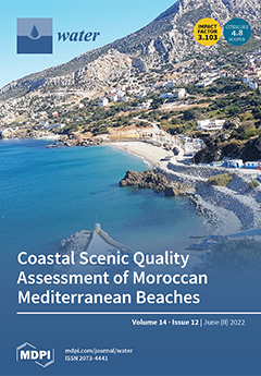
Cover Story (view full-size image): Landscape is a fundamental element of coastal tourism and a multifunctional system of high environmental and economic value. The scenic appeal is one of the most important factors tourists take into consideration when choosing a coastal destination. This research evaluates the coastal scenes of 50 sites along the Morocco Mediterranean coast, analyzing the different sources of impacts and providing complementary information to aid future management plans. View this paper
  • Issues are regarded as officially published after their release is announced to the table of contents alert mailing list.
  • You may sign up for e-mail alerts to receive table of contents of newly released issues.
  • PDF is the official format for papers published in both, html and pdf forms. To view the papers in pdf format, click on the "PDF Full-text" link, and use the free Adobe Reader to open them.
Order results
Result details
Section
Select all
Export citation of selected articles as:
21 pages, 700 KiB  
Article
Travelling Plastics: Exploring River Cruise Companies’ Practices and Policies for the Environmental Protection of the Rhine
by Demi van Klink, Mark Wiering, Marjolein van Eerd and Margriet Schoor
Water 2022, 14(12), 1978; https://0-doi-org.brum.beds.ac.uk/10.3390/w14121978 - 20 Jun 2022
Cited by 1 | Viewed by 2722
Abstract
Since 2013, romantic Rhine cruises gained immense popularity in Europe. However, these tourism activities also involve the generation of large amounts of waste. As rivers contribute significantly to the plastic waste influx in the marine environment, it is essential that river cruise companies [...] Read more.
Since 2013, romantic Rhine cruises gained immense popularity in Europe. However, these tourism activities also involve the generation of large amounts of waste. As rivers contribute significantly to the plastic waste influx in the marine environment, it is essential that river cruise companies cope with plastics in an environmentally-safe way. In this contribution, we try to overcome knowledge gaps regarding both the plastic practices of river cruise companies and the policies on cruise tourism and environmental pollution. We adopt a multiple-case study approach and use the Social Practice Theory to analyse the companies’ practices and challenges. Furthermore, we combine this with the analytical approaches of the Policy Arrangements and Synoptic Governance to explore the policies for environmental protection and tourism. The results show that, overall, river cruise companies have an eco-friendly approach to plastic waste management. However, dealing with plastics in the freshwater environment is not sufficiently rooted in the above policies: river cruise companies face important omissions in policies and facilities, resulting in plastic emissions in the river. Following the results, we formulate recommendations to support sustainable waste management routines onboard and to improve waste reception facilities onshore to protect the aquatic environment. Full article
(This article belongs to the Special Issue Advances in Aquatic Plastics)
Show Figures

Figure 1

19 pages, 2575 KiB  
Article
Combining Fish Passage and Sediment Bypassing: A Conceptual Solution for Increased Sustainability of Dams and Reservoirs
by Anders Foldvik, Ana T. Silva, Ismail Albayrak, Kordula Schwarzwälder, Robert M. Boes and Nils Ruther
Water 2022, 14(12), 1977; https://0-doi-org.brum.beds.ac.uk/10.3390/w14121977 - 20 Jun 2022
Cited by 6 | Viewed by 3743
Abstract
Sedimentation is one of the main eco-morphological and technological challenges associated with reservoirs. Sedimentation not only reduces the functional capacity of a reservoir by filling it, but also changes downstream sediment dynamics and habitat availability for the aquatic biota. Additionally, dams hinder free [...] Read more.
Sedimentation is one of the main eco-morphological and technological challenges associated with reservoirs. Sedimentation not only reduces the functional capacity of a reservoir by filling it, but also changes downstream sediment dynamics and habitat availability for the aquatic biota. Additionally, dams hinder free bi-directional fish passage, emerging as a major threat to species of migratory fish. In the past decades, mitigation measures aimed at reducing such environmental and technological impacts have been developed. Sediment bypass tunnels (SBTs) have been shown to successfully help prevent reservoir sedimentation, whereas fish passages have been found to be potential solutions to facilitate bi-directional passage of fish. However, the construction of such structures, in particular of SBT, can be extremely costly. The development of design solutions that can function both for downstream sediment transport and up- and downstream fish passage should be considered as they can mitigate ecological deficiencies of reservoir operations while accounting for economic feasibility. Possibilities and challenges of combining SBT and fish passage were explored by bringing together a team of interdisciplinary specialists on hydraulics, sediment transport and continuity, bypassing, hydraulic structures, hydropower engineering, aquatic biology, and fish passage in a two-day workshop. Here, we present potential solutions identified during the workshop for integrating SBT and fish passage. Full article
(This article belongs to the Special Issue Fish Passage at Hydropower Dams 2.0)
Show Figures

Figure 1

22 pages, 7199 KiB  
Article
Long-Term Evolution of Rainfall and Its Consequences on Water Resources: Application to the Watershed of the Kara River (Northern Togo)
by Mozimwè Ani, Jessy Jaunat, Béatrice Marin, Marie Barel and Kissao Gnandi
Water 2022, 14(12), 1976; https://0-doi-org.brum.beds.ac.uk/10.3390/w14121976 - 20 Jun 2022
Cited by 1 | Viewed by 2059
Abstract
The Kara River watershed (KRW), northern Togo, is facing climate-change impacts that have never been clearly characterized. Six decades of rainfall data (1961–2020) from six measuring stations ideally distributed across the watershed were used in this study. The flow records from two stations [...] Read more.
The Kara River watershed (KRW), northern Togo, is facing climate-change impacts that have never been clearly characterized. Six decades of rainfall data (1961–2020) from six measuring stations ideally distributed across the watershed were used in this study. The flow records from two stations situated in contrasting locations on the KRW were also used. Statistical tests were conducted to assess the spatial and temporal variability of the rainfall and to detect tendencies within these meteorological series. The water balance method and calculation of the dry-off coefficient and of the groundwater volume drained by rivers allowed evaluating the impact of climatic evolution on surface flow and on groundwater volumes during the six decades studied. The results showed contrasting spatiotemporal variability of rainfall (and of aquifer recharge) over the watershed with a decreasing tendency upstream and an increasing one downstream. At the same time, the water volume drained by the aquifer to sustain the river’s base flow decreased from −22% to −36% depending on the measuring station. These results constitute a decision-making tool for Togolese water resource managers and are of primary importance for characterizing the fate of water resources worldwide in regions subject to severe droughts. Full article
(This article belongs to the Special Issue Drought and Groundwater Development)
Show Figures

Figure 1

13 pages, 6686 KiB  
Article
Analysis of Surface Water Quality in Upstream Province of Vietnamese Mekong Delta Using Multivariate Statistics
by Tran Thi Kim Hong and Nguyen Thanh Giao
Water 2022, 14(12), 1975; https://0-doi-org.brum.beds.ac.uk/10.3390/w14121975 - 20 Jun 2022
Cited by 13 | Viewed by 2481
Abstract
The study employed different statistical approaches to assess surface water quality in the upstream region of the Vietnamese Mekong Delta. The dataset included seven parameters (i.e., temperature, pH, total suspended solids (TSS), five-day biological oxygen demand (BOD5), chemical oxygen demand (COD), [...] Read more.
The study employed different statistical approaches to assess surface water quality in the upstream region of the Vietnamese Mekong Delta. The dataset included seven parameters (i.e., temperature, pH, total suspended solids (TSS), five-day biological oxygen demand (BOD5), chemical oxygen demand (COD), ammonium nitrogen (NH4+-N) and coliform) at seventy-three locations. Cluster analysis (CA) and principal component analysis (PCA) were applied to analyze spatial variations in surface water quality and recognize the important parameters. The findings revealed that surface water quality was deteriorated by organic matters (high BOD5 and COD), nutrients and microorganisms. Particularly, urban areas were found to be more polluted than the other areas. The PCA results indicated that three potential water pollution sources, including industry, urban and tourism, could explain 87.03% of the total variance. Coliform was identified as the leading latent factor that controls surface water quality in the study area. CA grouped the sampling locations into 11 groups, in which the groups of the baseline monitoring sites and large rivers had better water quality. The results indicated a significant impact of anthropogenic activities (especially, urban and tourism practices) in surface water quality degradation. Moreover, CA suggested that the numbers of the sampling sites could be reduced from 73 to 58 locations, lowering 20.54% of the monitoring cost. Thus, the study recommends scrutinizing the current surface water quality monitoring system to be more economic and urgently implementing appropriate solutions to mitigate coliform pollution in the smaller water bodies. Full article
Show Figures

Figure 1

14 pages, 3042 KiB  
Article
Performance Evaluation of Artificial Recharge–Water Intake System Using 3D Numerical Modeling
by Jae-Young Lee and Tae-Young Woo
Water 2022, 14(12), 1974; https://0-doi-org.brum.beds.ac.uk/10.3390/w14121974 - 20 Jun 2022
Cited by 1 | Viewed by 1540
Abstract
In this study, 3D detailed numerical modeling was performed to evaluate the performance of an artificial recharge–water intake system installed to secure agricultural water in drought areas. Using a 3D irregular finite element grid, a conceptual model was constructed that reflected the actual [...] Read more.
In this study, 3D detailed numerical modeling was performed to evaluate the performance of an artificial recharge–water intake system installed to secure agricultural water in drought areas. Using a 3D irregular finite element grid, a conceptual model was constructed that reflected the actual scale of the study area and artificial recharge–water intake system and considered the characteristics of saturated–unsaturated aquifers. The optimal design factors for the artificial recharge system were derived through the constructed conceptual model, and were reflected to evaluate the individual performance of the artificial recharge and water intake system in the study area. Finally, an optimal operating scenario for the artificial recharge and water intake system was developed. The operation scenarios were composed of an appropriate injection rate and water withdrawal for each period from March, when the demand for agricultural water was low, to June, when the dry season and farming season overlapped, considering the target water withdrawal amount (30,000 tons) of the region, derived from water budget analysis. The proposed results are expected to be very useful in the future for the efficient operation and management of artificial recharge–water intake systems installed in drought areas. Full article
(This article belongs to the Special Issue Drought and Groundwater Development)
Show Figures

Figure 1

25 pages, 9935 KiB  
Article
Identification of High-Impact Uncertainty Sources for Urban Flood Models in Hillside Peri-Urban Catchments
by Stefan Reinstaller, Gerald Krebs, Markus Pichler and Dirk Muschalla
Water 2022, 14(12), 1973; https://0-doi-org.brum.beds.ac.uk/10.3390/w14121973 - 20 Jun 2022
Cited by 4 | Viewed by 2426
Abstract
Climate change, as well as increasing urbanization, lead to an increase in urban flooding events around the world. Accurate urban flood models are an established tool to predict flooding areas in urban as well as peri-urban catchments, to derive suitable measures to increase [...] Read more.
Climate change, as well as increasing urbanization, lead to an increase in urban flooding events around the world. Accurate urban flood models are an established tool to predict flooding areas in urban as well as peri-urban catchments, to derive suitable measures to increase resilience against urban flooding. The high computational cost and complex processes of urban flooding with numerous subprocesses are the reason why many studies ignore the discussion of model uncertainties as well as model calibration and validation. In addition, the influence of steep surface (hillside) conditions on calibration parameters such as surface roughness are frequently left out of consideration. This study applies a variance-based approach to analyze the impact of three uncertainty sources on the two variables—flow and water depth—in a steep peri-urban catchment: (i) impact of DEM validation; (ii) calibration of the model parameter; (iii) differences between 1D/2D and 2D models. The results demonstrate the importance of optimizing sensitive model parameters, especially surface roughness, in steep catchments. Additional findings of this work indicate that the sewer system cannot be disregarded in the context of urban flood modeling. Further research with real heavy storm events is to be pursued to confirm the main results of this study. Full article
(This article belongs to the Section Urban Water Management)
Show Figures

Figure 1

17 pages, 2508 KiB  
Article
Characterisation of Hydro-Geochemical Processes Influencing Groundwater Quality in Rural Areas: A Case Study of Soutpansberg Region, Limpopo Province, South Africa
by Lindelani Lalumbe and Thokozani Kanyerere
Water 2022, 14(12), 1972; https://doi.org/10.3390/w14121972 - 20 Jun 2022
Cited by 6 | Viewed by 2516
Abstract
Groundwater is often the main or only source of fresh water supply in arid to semi-arid rural areas owing to decreasing rainfall patterns, reduced availability of surface water and socioeconomic activities. It is important to understand the hydro-geochemical processes influencing groundwater quality for [...] Read more.
Groundwater is often the main or only source of fresh water supply in arid to semi-arid rural areas owing to decreasing rainfall patterns, reduced availability of surface water and socioeconomic activities. It is important to understand the hydro-geochemical processes influencing groundwater quality for improved management and sustainability of resources and to improve rural livelihoods. To understand the hydro-geochemical process influencing the hydro-geochemistry of the Soutpansberg region, this study assessed groundwater quality data from 12 boreholes and 2 geothermal springs collected between 1995 and 2017. This study indicated that the majority of the samples were classified as fresh groundwater dominated by Ca-HCO3 and mixed Ca-Mg-Cl types. Gibbs diagrams, Pearson correlations, bivariate plots and saturation indexes suggested that rock dominance processes, such as weathering of silicates, dissolution of carbonates and halite minerals and ion exchange processes, were the main hydro-geochemical processes influencing the groundwater quality in the Soutpansberg region. The high concentration of F in the geothermal spring was attributed to the dissolution of fluorite mineral. Point source anthropogenic inputs from fertilisers were attributed to the high concentration of NO3 in the groundwater. This study recommends that research outputs should be used to influence and support policy change and groundwater allocation in arid to semi-arid rural environments for improved management of resources and livelihoods. This study further recommends that suitable deflouridation and denitrification techniques be applied to improve the quality of groundwater for drinking purposes. Full article
(This article belongs to the Special Issue Groundwater Quality and Human Health Risk)
Show Figures

Figure 1

18 pages, 3739 KiB  
Article
Water Level Forecasting Using Deep Learning Time-Series Analysis: A Case Study of Red River of the North
by Vida Atashi, Hamed Taheri Gorji, Seyed Mojtaba Shahabi, Ramtin Kardan and Yeo Howe Lim
Water 2022, 14(12), 1971; https://0-doi-org.brum.beds.ac.uk/10.3390/w14121971 - 20 Jun 2022
Cited by 24 | Viewed by 5659
Abstract
The Red River of the North is vulnerable to floods, which have caused significant damage and economic loss to inhabitants. A better capability in flood-event prediction is essential to decision-makers for planning flood-loss-reduction strategies. Over the last decades, classical statistical methods and Machine [...] Read more.
The Red River of the North is vulnerable to floods, which have caused significant damage and economic loss to inhabitants. A better capability in flood-event prediction is essential to decision-makers for planning flood-loss-reduction strategies. Over the last decades, classical statistical methods and Machine Learning (ML) algorithms have greatly contributed to the growth of data-driven forecasting systems that provide cost-effective solutions and improved performance in simulating the complex physical processes of floods using mathematical expressions. To make improvements to flood prediction for the Red River of the North, this paper presents effective approaches that make use of a classical statistical method, a classical ML algorithm, and a state-of-the-art Deep Learning method. Respectively, the methods are seasonal autoregressive integrated moving average (SARIMA), Random Forest (RF), and Long Short-Term Memory (LSTM). We used hourly level records from three U.S. Geological Survey (USGS), at Pembina, Drayton, and Grand Forks stations with twelve years of data (2007–2019), to evaluate the water level at six hours, twelve hours, one day, three days, and one week in advance. Pembina, at the downstream location, has a water level gauge but not a flow-gauging station, unlike the others. The floodwater-level-prediction results show that the LSTM method outperforms the SARIMA and RF methods. For the one-week-ahead prediction, the RMSE values for Pembina, Drayton, and Grand Forks are 0.190, 0.151, and 0.107, respectively. These results demonstrate the high precision of the Deep Learning algorithm as a reliable choice for flood-water-level prediction. Full article
(This article belongs to the Special Issue Advances in Flood Forecasting and Hydrological Modeling)
Show Figures

Figure 1

20 pages, 3188 KiB  
Article
Multi-Stakeholder Coordinated Operation of Reservoir Considering Irrigation and Ecology
by Na Wei, Shuni He, Kunming Lu, Jiancang Xie and Yuxin Peng
Water 2022, 14(12), 1970; https://0-doi-org.brum.beds.ac.uk/10.3390/w14121970 - 20 Jun 2022
Cited by 5 | Viewed by 1379
Abstract
In traditional ecological operation, it is difficult to coordinate the balance among the interests of stakeholders, and stakeholders find it difficult to accept the operation scheme. To address these problems, this study proposed a method of multi-stakeholder coordinated operation of reservoir (MSCOR). By [...] Read more.
In traditional ecological operation, it is difficult to coordinate the balance among the interests of stakeholders, and stakeholders find it difficult to accept the operation scheme. To address these problems, this study proposed a method of multi-stakeholder coordinated operation of reservoir (MSCOR). By comprehensively considering the interest demands of stakeholders, the multi-stakeholder interval coordination mechanism (MSICM) for reservoir operation was established. The multi-stakeholder coordinated operation model (MSCOM) was constructed. The multi-stakeholder solution algorithm based on the MSICM, the non-dominated sorting genetic algorithm II, and the approach of successive elimination of alternative schemes based on the k-order and p-degree of efficiency (MSIC-NSGA-II-SEABODE) were applied to solve the MSCOR problem. The coordination mechanism, model construction, multi-stakeholder optimization, and multi-attribute decision making were coupled to establish a multi-stakeholder coordinated operation method, comprising the whole process of mechanism–modeling–optimization–decision making. Taking Baojixia Reservoir as an example, the performance of the coordinated operation method was compared with that of the traditional optimal operation method, and the relationship between the irrigation benefits and ecological benefits of the reservoir was explored. The results show that: (1) On the premise of the same satisfaction degree of basic irrigation interests, the ecological AAPFD value of coordinated operation decreased by 0.184, 0.469, and 0.886 in a normal year, dry year, and extraordinary dry year, respectively. The effect of coordinated operation on balancing various stakeholders was more obvious with the decrease in water inflow. (2) The MSICM ensures that the multi-stakeholder operation of the reservoir conforms to the principles of comprehensiveness, balance, and sustainability. (3) The coordination scheme obtained by the MSIC-NSGA-II-SEABODE algorithm is more reasonable and feasible. The research results provide a new idea and method to address the MSCOR problem. Full article
(This article belongs to the Section Water Resources Management, Policy and Governance)
Show Figures

Figure 1

19 pages, 6116 KiB  
Article
Inverse Trend in Runoff in the Source Regions of the Yangtze and Yellow Rivers under Changing Environments
by Houfa Wu, Zhenxin Bao, Jie Wang, Guoqing Wang, Cuishan Liu, Yanqing Yang, Dan Zhang, Shuqi Liang and Chengfeng Zhang
Water 2022, 14(12), 1969; https://0-doi-org.brum.beds.ac.uk/10.3390/w14121969 - 20 Jun 2022
Cited by 2 | Viewed by 1512
Abstract
The source regions of the Yangtze River (SRYZ) and the Yellow River (SRYR) are sensitive areas of global climate change. Hence, determining the variation characteristics of the runoff and the main influencing factors in this region would be of great significance. In this [...] Read more.
The source regions of the Yangtze River (SRYZ) and the Yellow River (SRYR) are sensitive areas of global climate change. Hence, determining the variation characteristics of the runoff and the main influencing factors in this region would be of great significance. In this study, different methods were used to quantify the contributions of climate change and other environmental factors to the runoff variation in the two regions, and the similarities and differences in the driving mechanisms of runoff change in the two regions were explored further. First, the change characteristics of precipitation, potential evapotranspiration, and runoff were analyzed through the observational data of the basin. Then, considering the non-linearity and non-stationarity of the runoff series, a heuristic segmentation algorithm method was used to divide the entire study period into natural and impacted periods. Finally, the effects of climate change and other environmental factors on runoff variation in two regions were evaluated comprehensively using three methods, including the improved double mass curve (IDMC), the slope change ratio of cumulative quantity (SCRCQ), and the Budyko-based elasticity (BBE). Results indicated that the annual precipitation and potential evapotranspiration increased during the study period in the two regions. However, the runoff increased in the SRYZ and decreased in the SRYR. The intra-annual distribution of the runoff in the SRYZ was unimodal during the natural period and bimodal in the SRYR. The mutation test indicated that the change points of annual runoff series in the SRYZ and SRYR occurred in 2004 and 1989, respectively. The attribution analysis methods yielded similar results that climate change had the greatest effect on the runoff variation in the SRYZ, with a contribution of 59.6%~104.6%, and precipitation contributed 65.3%~109.6% of the increase in runoff. In contrast, the runoff variation in the SRYR was mainly controlled by other environmental factors such as permafrost degradation, land desertification, and human water consumption, which contributed 83.7%~96.5% of the decrease in the runoff. The results are meaningful for improving the efficiency of water resources utilization in the SRYZ and SRYR. Full article
Show Figures

Figure 1

20 pages, 6284 KiB  
Article
Metropolis-Hastings Markov Chain Monte Carlo Approach to Simulate van Genuchten Model Parameters for Soil Water Retention Curve
by Xuan Du, Can Du, Jesse Radolinski, Qianfeng Wang and Jinshi Jian
Water 2022, 14(12), 1968; https://0-doi-org.brum.beds.ac.uk/10.3390/w14121968 - 20 Jun 2022
Cited by 4 | Viewed by 2244
Abstract
The soil water retention curve (SWRC) is essential for assessing water flow and solute transport in unsaturated media. The van Genuchten (VG) model is widely used to describe the SWRC; however, estimation of its effective hydraulic parameters is often prone to error, especially [...] Read more.
The soil water retention curve (SWRC) is essential for assessing water flow and solute transport in unsaturated media. The van Genuchten (VG) model is widely used to describe the SWRC; however, estimation of its effective hydraulic parameters is often prone to error, especially when data exist for only a limited range of matric potential. We developed a Metropolis-Hastings algorithm of the Markov chain Monte Carlo (MH-MCMC) approach using R to estimate VG parameters, which produces a numerical estimate of the joint posterior distribution of model parameters, including fully-quantified uncertainties. When VG model parameters were obtained using complete range of soil water content (SWC) data (i.e., from saturation to oven dryness), the MH-MCMC approach returned similar accuracy as the widely used non-linear curve-fitting program RETC (RETention Curve), but avoiding non-convergence issues. When VG model parameters were obtained using 5 SWC data measured at matric potential of around −60, −100, −200, −500, and −15,000 cm, the MH-MCMC approach was more robust than the RETC program. The performance of MH-MCMC are generally good (R2 > 0.95) for all 8 soils, whereas the RETC underperformed for coarse-textured soils. The MH-MCMC approach was used to obtain VG model parameters for all 1871 soils in the National Cooperative Soil Characterization dataset with SWC measured at matric potentials of −60 cm, −100 cm, −330 cm, and −15,000 cm; the results showed that the simulated SWC by MH-MCMC model were highly consistent with the measured SWC at corresponding matric potential. Altogether, our new MH-MCMC approach to solving the VG model is more robust to limited coverage of soil matric potential when compared to the RETC procedures, making it an effective alternative to traditional water retention solvers. We developed an MH-MCMC code in R for solving VG model parameters, which can be found at the GitHub repository. Full article
Show Figures

Figure 1

9 pages, 2020 KiB  
Article
Consolidation Properties of Soil/Modified Bentonite Backfill in Salt Solution
by Aiguo Fang, Yuling Yang, Zhongjun Yang, Sudong Hua, Jinchao Wang and Feng Zhou
Water 2022, 14(12), 1967; https://0-doi-org.brum.beds.ac.uk/10.3390/w14121967 - 20 Jun 2022
Cited by 2 | Viewed by 1743
Abstract
The consolidation properties of soil-bentonite (SB) backfills containing 20% of the weight of sodium-hexametaphosphate-modified calcium bentonite (SHMP-20CaB) and prepared with 0 mM to 1000 mM calcium chloride (CaCl2) solution were evaluated. The results indicated that both consolidation stress and CaCl2 [...] Read more.
The consolidation properties of soil-bentonite (SB) backfills containing 20% of the weight of sodium-hexametaphosphate-modified calcium bentonite (SHMP-20CaB) and prepared with 0 mM to 1000 mM calcium chloride (CaCl2) solution were evaluated. The results indicated that both consolidation stress and CaCl2 concentration had significant effects on the consolidation behaviors of the SHMP-20CaB backfill. In general, an increase in consolidation stress resulted in a decrease in the void ratio (e) and in the coefficient of volume change (mv), alongside an increase in the coefficient of consolidation (cv). The increased CaCl2 concentration yielded a dropped void ratio, and a nonlinear decreased compression index (Cc) and rebound index (Cs), respectively, from 0.18 to 0.13 and from 0.022 to 0.010, and a nonlinear increase cv. A threshold CaCl2 concentration of 100 mM was observed at the inflection points of the Cc, Cs, and cv. In contrast, the mv was insensitive to the CaCl2 solutions. The deterioration in e, Cc, and Cs and the increase in cv were the result of a compressed diffuse double layer of the bentonite by the CaCl2 solution, which thus exerted certain negative effects on the consolidation behaviors of the SHMP-20CaB backfill. Full article
(This article belongs to the Section Soil and Water)
Show Figures

Figure 1

18 pages, 1637 KiB  
Article
Hydrodynamic Model Ensembles for Climate Change Projections in Estuarine Regions
by Isabel Iglesias, Ana Bio, Willian Melo, Paulo Avilez-Valente, José Pinho, Mariana Cruz, Ana Gomes, José Vieira, Luísa Bastos and Fernando Veloso-Gomes
Water 2022, 14(12), 1966; https://0-doi-org.brum.beds.ac.uk/10.3390/w14121966 - 20 Jun 2022
Cited by 9 | Viewed by 2123
Abstract
In the current context of climate change, understanding the effects of the changing conditions on estuaries is of utmost importance to protect populations and ecosystems. Given the diversity of impacts depending on the region, there is a need for local and dedicated studies [...] Read more.
In the current context of climate change, understanding the effects of the changing conditions on estuaries is of utmost importance to protect populations and ecosystems. Given the diversity of impacts depending on the region, there is a need for local and dedicated studies to understand and mitigate the risks. Numerical models can provide forecasts of extreme floods and sea-level rise (SLR). However, they can present inaccuracies. In this work, the ensemble technique was applied to improve the numerical modeling forecasting for estuaries by considering scenarios of extreme river flow discharges (EFDs) and SLR scenarios for 2050 and 2100. The simulations were performed for two different estuarine regions in northern Portugal, and the superensemble was constructed with the results of two different numerical models. The results differed per estuary, highlighting the importance of a local approach. For the Douro estuary dynamics, the results showed that for the EFD, the effects of the SLR were not noticeable, indicating that, in this estuary, the river component was more important than the maritime component. In contrast, the Minho estuary dynamics were found to be affected by the SLR along the whole estuarine region, indicating a maritime influence and a worsening of the flood conditions for future scenarios. Full article
(This article belongs to the Special Issue Modelling of Floods and Droughts under a Changing Climate)
Show Figures

Figure 1

16 pages, 3987 KiB  
Article
A Comprehensive Model for Hydraulic Analysis and Wetting Patterns Simulation under Subsurface Drip Laterals
by Saeid Zamani, Rouhollah Fatahi and Giuseppe Provenzano
Water 2022, 14(12), 1965; https://0-doi-org.brum.beds.ac.uk/10.3390/w14121965 - 19 Jun 2022
Cited by 2 | Viewed by 2151
Abstract
In the absence of suitable specialized models to simulate the soil wetting patterns in subsurface drip irrigation systems considering the hydraulic conditions along the laterals, a new model was developed and named a “comprehensive model” in this study. This model couples the subsurface [...] Read more.
In the absence of suitable specialized models to simulate the soil wetting patterns in subsurface drip irrigation systems considering the hydraulic conditions along the laterals, a new model was developed and named a “comprehensive model” in this study. This model couples the subsurface drip irrigation lateral characteristics with the soil hydraulic properties and utilizes the Hydrus-3D software as a complementary section of the model to simulate the wetting front beneath the lateral. To evaluate the model, three 16 mm drip-line pipes of 62 m length with 20, 40, and 50 cm spacing emitters and 2 to 5 L/h discharge were buried at 0.2 m depth in a soil box containing clay loamy soil. Then, the experiments were conducted at 50, 100, and 150 kPa pressures, and the wetting pattern geometry associated with each lateral was measured at 1, 2, 3, and 24 h and compared with the model simulations. Moreover, the values of the root mean square error (RMSE), mean absolute error (MAE), and the refined index of agreement of the wetting depth beneath the lateral ranged from 0.013 to 0.03 m, 0.002 to 0.004 m, and 0.886 to 0.927 m, respectively. In addition, the mentioned indexes values at the first and the last cross-sections of the laterals varied between 0.001 and 0.004 m, 0.011 and 0.035 m, 0.814 and 0.942 m, respectively. These results proved that the differences between measured and predicted dimensions of the wetting pattern are not significant and comprehensive model provides good estimations of the emitter flow rates, as well as realistic wetting patterns. Full article
(This article belongs to the Special Issue Study of the Soil Water Movement in Irrigated Agriculture Ⅱ)
Show Figures

Figure 1

21 pages, 4079 KiB  
Article
Oxygen Transfer of Fine-Bubble Aeration in Activated Sludge Treating Saline Industrial Wastewater
by Justus Behnisch, Maximilian Schwarz, Jana Trippel, Markus Engelhart and Martin Wagner
Water 2022, 14(12), 1964; https://0-doi-org.brum.beds.ac.uk/10.3390/w14121964 - 19 Jun 2022
Cited by 2 | Viewed by 2282
Abstract
Aeration is usually the most energy-intensive part of the activated sludge process, accounting for 50% to 80% of the total requirement. To achieve high efficiency, designers and operators of WWTPs must, therefore, consider all influencing factors, including salinity. With increasing salinity, oxygen transfer [...] Read more.
Aeration is usually the most energy-intensive part of the activated sludge process, accounting for 50% to 80% of the total requirement. To achieve high efficiency, designers and operators of WWTPs must, therefore, consider all influencing factors, including salinity. With increasing salinity, oxygen transfer increases compared to tap water (TW), due to the inhibition of bubble coalescence. Previous saline water (SW) experiments showed that by using small slits in the diffuser membrane design, oxygen transfer and aeration efficiency increase further. In this study, we present a modified approach for considering the salt effect on oxygen transfer and assess the transferability of SW results to saline-activated sludge (sAS) conditions. Therefore, we operated a pilot-activated sludge plant over 269 days with a saline industrial wastewater influent. The oxygen transfer of disc-diffusers with two different membrane designs was measured continuously via the off-gas method. The salt concentration (cSalt) measured via ion analysis ranged between 4.9 and 11 g/L. Despite a high cSalt fluctuation, COD elimination was >90% all the time. Our results confirm previous SW results. Oxygen transfer in sAS is up to three times higher compared to non-saline conditions. Aeration efficiency shows that despite a higher pressure drop, diffusers with smaller slits are to be recommended in order to improve aeration in sAS. Full article
(This article belongs to the Special Issue Biological Wastewater Treatment: Current Advances and Challenges)
Show Figures

Figure 1

16 pages, 3128 KiB  
Article
Start-Up and Performance of a Full Scale Passive System In-Cluding Biofilters for the Treatment of Fe, as and Mn in a Neutral Mine Drainage
by Jérôme Jacob, Catherine Joulian and Fabienne Battaglia-Brunet
Water 2022, 14(12), 1963; https://0-doi-org.brum.beds.ac.uk/10.3390/w14121963 - 19 Jun 2022
Cited by 2 | Viewed by 2175
Abstract
Passive mine drainage treatment plants are the scene of many chemical and biological reactions. Here, the establishment of iron (Fe), arsenic (As), and manganese (Mn) removal was monitored immediately after the commissioning of the Lopérec (Brittany, France) passive water treatment plant, composed of [...] Read more.
Passive mine drainage treatment plants are the scene of many chemical and biological reactions. Here, the establishment of iron (Fe), arsenic (As), and manganese (Mn) removal was monitored immediately after the commissioning of the Lopérec (Brittany, France) passive water treatment plant, composed of aeration cascades and settling ponds followed by pozzolana biofilters. Iron and As were almost completely removed immediately after commissioning, while Mn removal took more than 28 days to reach its maximum performance. Investigations were performed during two periods presenting strong variations in feeding flow-rates: from 2.8 m3.h−1 to 8.6 m3.h−1 and from 13.2 m3.h−1 to 31.3 m3.h−1. Design flow rate was reached during the first week of the second period. Dissolved Fe and As were not affected by the decrease in residence time while Mn was only slightly affected. Microbial communities in biofilter presented similarities with those of the pond sludge, and genera including Mn-oxidizing species were detected. Proportion of bacteria carrying the aioA gene encoding for As(III)-oxidase enzyme increased in communities during the second period. Results suggest Mn removal is mainly associated with bio-oxidation whereas removal of Fe and As could be mainly attributed to chemical oxidation and precipitation of Fe, possibly helped by As(III) bio-oxidation. Full article
Show Figures

Figure 1

14 pages, 643 KiB  
Article
Effects of Spring Warming and Drought Events on the Autumn Growth of Larix kaempferi Seedlings
by Hyeonji Kim, Heejae Jo, Gwang-Jung Kim, Hyung-Sub Kim and Yowhan Son
Water 2022, 14(12), 1962; https://0-doi-org.brum.beds.ac.uk/10.3390/w14121962 - 19 Jun 2022
Viewed by 1668
Abstract
High temperatures and droughts following winter dormancy can negatively affect seedling growth and mortality. An open-field experiment was conducted to study the growth and mortality of Larix kaempferi seedlings in response to spring warming and drought treatments and to determine whether seedlings could [...] Read more.
High temperatures and droughts following winter dormancy can negatively affect seedling growth and mortality. An open-field experiment was conducted to study the growth and mortality of Larix kaempferi seedlings in response to spring warming and drought treatments and to determine whether seedlings could regain their growth capability once the treatments were discontinued. In May 2020, 1-year-old seedlings were exposed to four treatments: control, warming-only, drought-only, and the combined warming and drought. Drought treatment reduced the seedling height and root collar diameter and increased the mortality rate. The combined warming and drought treatments had the highest mortality rates, followed by the drought, control, and warming treatments. However, after the cessation of the treatments, the combined warming and drought treatments increased seedling height, root collar diameter, and individual seedling biomass because the high mortality rate relaxed competition among seedlings. This suggests that the effects of low competition on the surviving seedlings may mitigate the negative effects of warming and drought on seedling growth. Our study demonstrates that despite the high mortality and decreased growth during the treatment period, seedlings subjected to combined high temperature and drought stress showed short-term high levels of growth compared to seedlings subjected to a single stress. Full article
Show Figures

Figure 1

23 pages, 9082 KiB  
Article
A Simplified Method for Leakage Estimation of Clay Core Dams with Different Groundwater Levels
by Chao Yang, Zhenzhong Shen, Liqun Xu and Hongjie Shen
Water 2022, 14(12), 1961; https://0-doi-org.brum.beds.ac.uk/10.3390/w14121961 - 19 Jun 2022
Cited by 3 | Viewed by 4612
Abstract
Clay core dams are widely applied in reservoir construction, regulating water resource and provide electric power. Leakage is a common problem in reservoir construction, and the leakage amount, which not only affects the economic benefits of the project, but also relates to the [...] Read more.
Clay core dams are widely applied in reservoir construction, regulating water resource and provide electric power. Leakage is a common problem in reservoir construction, and the leakage amount, which not only affects the economic benefits of the project, but also relates to the safety of the dam body, is difficult to estimate. According to Darcy’s law and stable seepage theory, an analytical method can be proposed to calculate the leakage of the clay core dam to gain the seepage flux in a short time. By making some reasonable assumptions, we propose formulae for seepage calculation in different conditions of the position of the groundwater levels, below or above the reservoir bottom. Both sets of formulae contain two parts of leakage calculation, i.e., leakage from the reservoir bottom and leakage from the dam body. By using the proposed analytical method, the leakage of clay core dams can be estimated considering the influence of the groundwater level. To prove the rationality of the analytical method, a simple numerical model can be established using Geo-studio 2020 to calculate the seepage flux of the clay core dam, where relative errors between numerical solutions and analytical solutions are less than 10%. To verify the feasibility in engineering applications, the proposed method was applied to calculate the seepage of a clay core dam in Sichuan, China, which was also calculated using numerical methods by establishing a three-dimensional model. The results show the rationality of the analytical method, which can strike a balance between precision and efficiency. Full article
(This article belongs to the Special Issue Safety Monitoring and Management of Reservoir and Dams)
Show Figures

Figure 1

20 pages, 565 KiB  
Article
Comparison of the Transition to More Sustainable Stormwater Management in China and the USA
by Yitong Zhao, Mackay Price and Sam Trowsdale
Water 2022, 14(12), 1960; https://0-doi-org.brum.beds.ac.uk/10.3390/w14121960 - 19 Jun 2022
Viewed by 1937
Abstract
This paper presents a comparative cross-nation study of the transition to more sustainable stormwater management (SSWM) in the United States and China. Multi-level perspective and multiphase models are used to examine the transition dynamics and reflect on how transition theory explains the change [...] Read more.
This paper presents a comparative cross-nation study of the transition to more sustainable stormwater management (SSWM) in the United States and China. Multi-level perspective and multiphase models are used to examine the transition dynamics and reflect on how transition theory explains the change within federal and socialist context. Instead of simply differentiating the two countries’ transition patterns by using terms such as bottom-up or top-down, we consider the importance of changes at all three levels of the system. The main difference between the transition process in the United States and China is the extent to which niche level innovations are developed, especially in the type of actors and activities investigated. The analysis suggests that the Chinese transition is less radical, while the U.S. pathway exhibits signs of reconfiguration, dealignment and realignment. Developing learning networks across sectors and actors to spread knowledge and experience appears to be the next major challenge for the Chinese Sponge City initiative. Despite the feasibility of transition theory for transition comparison, the author suggests its usage with caution and critical reflection to avoid the risk of embedding the mindset of ‘catch-up’ and convergence. Full article
(This article belongs to the Special Issue Urban Runoff Control and Sponge City Construction II)
Show Figures

Figure 1

15 pages, 6925 KiB  
Article
Effect of Consistency Limit on the Strength of Cement-Solidified Dredged Sludge: Modelling and Micro-Mechanism
by Shiquan Wang, Xingxing He, Jiangshan Li, Shenzhen Li, Huajin Qin, Yuanyuan Ma, Hongrui Ma, Shunmei Gong and Zhiyong Niu
Water 2022, 14(12), 1959; https://0-doi-org.brum.beds.ac.uk/10.3390/w14121959 - 18 Jun 2022
Cited by 2 | Viewed by 1720
Abstract
The unconfined compressive strength (UCS) of sludge with different consistency limits solidified by cement was investigated. The results showed that under the condition of constant initial water content, a higher liquid index of soil resulted in higher UCS. A novel strength-evaluation model based [...] Read more.
The unconfined compressive strength (UCS) of sludge with different consistency limits solidified by cement was investigated. The results showed that under the condition of constant initial water content, a higher liquid index of soil resulted in higher UCS. A novel strength-evaluation model based on the ratio of the liquid index to the cement content was developed, and the prediction deviation of the model was within 30%. The influence mechanism of the consistency limit of sludge on the cement solidification was revealed by scanning electron microscopy, mercury intrusion porosimetry, X-ray diffractometer and thermogravimetric analysis. For the cement-solidified dredged sludge (CDS) with a lower liquid index, a large amount of hydrate was interlaced with each other and wrapped soil particles, promoting the formation of a dense structure. For the CDS with a higher liquid index, hydrates such as C-S-H and ettringite challenged each other to play the role of “cementing particles” and “filling pores”, resulting in the formation of the porous structure. The mineralogical analyses confirmed that more C-S-H gels and ettringites were generated in the CDS with a lower liquid index, but less calcite was formed due to its denser structure. In engineering applications, reducing the liquid index by adjusting the consistency limit can improve the strength performance of CDS. Full article
(This article belongs to the Special Issue Innovative Technologies for Soil and Water Remediation)
Show Figures

Figure 1

25 pages, 4174 KiB  
Article
Rainfall Runoff Balance Enhanced Model Applied to Tropical Hydrology
by Arisvaldo Vieira Méllo Júnior, Lina Maria Osorio Olivos, Camila Billerbeck, Silvana Susko Marcellini, William Dantas Vichete, Daniel Manabe Pasetti, Ligia Monteiro da Silva, Gabriel Anísio dos Santos Soares and João Rafael Bergamaschi Tercini
Water 2022, 14(12), 1958; https://0-doi-org.brum.beds.ac.uk/10.3390/w14121958 - 18 Jun 2022
Cited by 4 | Viewed by 2617
Abstract
The integrative and comprehensive analysis considering the spatial and temporal representation of the hydrological process, such as the distribution of rainfall, land cover and land use, is a challenge for the water resources management. In tropical areas, energy availability throughout the year defines [...] Read more.
The integrative and comprehensive analysis considering the spatial and temporal representation of the hydrological process, such as the distribution of rainfall, land cover and land use, is a challenge for the water resources management. In tropical areas, energy availability throughout the year defines the rainfall distribution and evapotranspiration rate according to vegetation heterogeneity. To quantify water balance in tropical areas including these heterogeneities in the soil-vegetation-atmosphere relationship, we developed a fully distributed hydrological model called the Rainfall Runoff Balance Enhanced Model (RUBEM). The model was developed under a physics-based process structure, using remote sensing data to represent soil-water balance patterns, such as evapotranspiration, interception, baseflow, lateral flow, recharge, and runoff. The calibration procedure was based on nine global parameters. RUBEM could represent the spatio-temporal heterogeneities (soil, land use and land cover (LULC), topography, vegetation, and climate) in three basins in a tropical area. The results showed good adherence between the processes governing the soil-vegetation-atmosphere relationship according to the humidity indicator and the runoff coefficient. Overall, RUBEM can be used to help improve the management and planning of integrated water resources under climate, land use, and land cover changes in tropical regions. Full article
(This article belongs to the Special Issue Advances in Hydroinformatics for Water Data Management and Analysis)
Show Figures

Figure 1

14 pages, 35213 KiB  
Article
Ice Velocity in Upstream of Heilongjiang Based on UAV Low-Altitude Remote Sensing and the SIFT Algorithm
by Enliang Wang, Shengbo Hu, Hongwei Han, Yuang Li, Zhifeng Ren and Shilin Du
Water 2022, 14(12), 1957; https://0-doi-org.brum.beds.ac.uk/10.3390/w14121957 - 18 Jun 2022
Cited by 4 | Viewed by 1832
Abstract
In river management, it is important to obtain ice velocity quickly and accurately during ice flood periods. However, traditional ice velocity monitoring methods require buoys, which are costly and inefficient to distribute. It was found that UAV remote sensing images combined with machine [...] Read more.
In river management, it is important to obtain ice velocity quickly and accurately during ice flood periods. However, traditional ice velocity monitoring methods require buoys, which are costly and inefficient to distribute. It was found that UAV remote sensing images combined with machine vision technology yielded obvious practical advantages in ice velocity monitoring. Current research has mainly monitored sea ice velocity through GPS or satellite remote sensing technology, with few reports available on river ice velocity monitoring. Moreover, traditional river ice velocity monitoring methods are subjective. To solve the problems of existing time-consuming and inaccurate ice velocity monitoring methods, a new ice velocity extraction method based on UAV remote sensing technology is proposed in this article. In this study, the Mohe River section in Heilongjiang Province was chosen as the research area. High-resolution orthoimages were obtained with a UAV during the ice flood period, and feature points in drift ice images were then extracted with the scale-invariant feature transform (SIFT) algorithm. Moreover, the extracted feature points were matched with the brute force (BF) algorithm. According to optimization results obtained with the random sample consensus (RANSAC) algorithm, the motion trajectories of these feature points were tracked, and an ice displacement rate field was finally established. The results indicated that the average ice velocities in the research area reached 2.00 and 0.74 m/s, and the maximum ice velocities on the right side of the river center were 2.65 and 1.04 m/s at 16:00 on 25 April 2021 and 8:00 on 26 April 2021, respectively. The ice velocity decreased from the river center toward the river banks. The proposed ice velocity monitoring technique and reported data in this study could provide an effective reference for the prediction of ice flood disasters. Full article
(This article belongs to the Special Issue Sea, River, Lake Ice Properties and Their Applications in Practices)
Show Figures

Figure 1

21 pages, 10772 KiB  
Article
Identification and Prediction of Crop Waterlogging Risk Areas under the Impact of Climate Change
by Xin Jin, Yanxiang Jin, Jingya Zhai, Di Fu and Xufeng Mao
Water 2022, 14(12), 1956; https://0-doi-org.brum.beds.ac.uk/10.3390/w14121956 - 18 Jun 2022
Cited by 5 | Viewed by 2036
Abstract
Waterlogging refers to the damage to plants by water stress due to excess soil water in the crop’s root zone that exceeds the maximum water holding capacity of the field. It is one of the major disasters affecting agricultural production. This study aims [...] Read more.
Waterlogging refers to the damage to plants by water stress due to excess soil water in the crop’s root zone that exceeds the maximum water holding capacity of the field. It is one of the major disasters affecting agricultural production. This study aims to add a crop waterlogging identification module to the coupled SWAT (Soil and Water Assessment Tools)-MODFLOW (Modular Finite Difference Groundwater Flow Model) model and to accurately identify and predict crop waterlogging risk areas under the CMIP6 (Coupled Model Intercomparison Project 6) climate scenarios. The result showed that: (1) The SWAT-MODFLOW model, which coupled with a crop waterlogging identification module, had good simulation results for LAI (Leaf Area Index), ET (Evapotranspiration), spring wheat yield, and groundwater level in the middle and lower reaches of the Bayin River; (2) The precipitation showed an overall increasing trend in the Bayin River watersheds over the next 80 years under the SSP1-2.6, SSP2-4.5 and SSP5-8.5 scenarios. The temperature showed a clear increasing trend over the next 80 years under the SSP2-4.5 and SSP5-8.5 scenarios; (3) Under the SSP1-2.6 scenario, the mountain runoff from the upper reaches of the Bayin River was substantially higher than in other scenarios after 2041. The mountain runoff in the next 80 years will decrease substantially under the SSP2-4.5 scenario. The mountain runoff over the next 80 years showed an initial decrease and then an increasing trend under the SSP5-8.5 scenario; (4) During the historical period, the crop waterlogging risk area was 10.9 km2. In the next 80 years, the maximum crop waterlogging area will occur in 2055 under the SSP1-2.6 scenario. The minimum crop waterlogging area, 9.49 km2, occurred in 2042 under the SSP2-4.5 scenario. The changes in the area at risk of crop waterlogging under each scenario are mainly influenced by the mountain runoff from the upper reaches of the Bayin River. Full article
Show Figures

Figure 1

19 pages, 4278 KiB  
Article
Ozone β-Cyclodextrin Inclusion Complex Characterization and Application in the Remediation of Total Petroleum Hydrocarbons
by Menghau Sung and Kuan-Yi Kuo
Water 2022, 14(12), 1955; https://0-doi-org.brum.beds.ac.uk/10.3390/w14121955 - 18 Jun 2022
Viewed by 1690
Abstract
Green remediation is essential in the current practice of water resources management. In this study, a series of ozone β-cyclodextrin (O3-βCD) inclusion complexes were prepared under a selected range of different ozone concentrations, β-CD concentrations, and solution pHs to test their [...] Read more.
Green remediation is essential in the current practice of water resources management. In this study, a series of ozone β-cyclodextrin (O3-βCD) inclusion complexes were prepared under a selected range of different ozone concentrations, β-CD concentrations, and solution pHs to test their ozone release rates and efficiencies in the treatment of total petroleum hydrocarbons (TPH) in water. The main objectives of this study are to characterize the O3-βCD system, mathematically model its ozone release rate, and test its capability in the degradation of pollutants. From the results, it was found that by defining a set of dimensionless parameters, including β-CD to ozone molar ratio and various degrees of ozone saturation, the steady-state conditions in the O3-βCD system can be represented by a newly developed dimensionless plot. In an optimal condition, the dissolved ozone release rate of 6.8 × 10⁻⁵ mM/min can be achieved in the O3-βCD system. A mathematical model was successfully developed to estimate the ozone release rate. In the TPH removal experiments, the effects of β-CD to ozone molar ratio and ozone dosage on the removal efficiency were rigorously examined. Overall, an optimal TPH removal of nearly 90% can be achieved in the treatment of 50 mg/L of TPH in water using this inclusion complex reagent. Full article
(This article belongs to the Topic Organic Pollution in Soil and Groundwater)
Show Figures

Graphical abstract

35 pages, 13059 KiB  
Article
Water Consumption Pattern Analysis Using Biclustering: When, Why and How
by Miguel G. Silva, Sara C. Madeira and Rui Henriques
Water 2022, 14(12), 1954; https://0-doi-org.brum.beds.ac.uk/10.3390/w14121954 - 18 Jun 2022
Cited by 3 | Viewed by 2371
Abstract
Sensors deployed within water distribution systems collect consumption data that enable the application of data analysis techniques to extract essential information. Time series clustering has been traditionally applied for modeling end-user water consumption profiles to aid water management. However, its effectiveness is limited [...] Read more.
Sensors deployed within water distribution systems collect consumption data that enable the application of data analysis techniques to extract essential information. Time series clustering has been traditionally applied for modeling end-user water consumption profiles to aid water management. However, its effectiveness is limited by the diversity and local nature of consumption patterns. In addition, existing techniques cannot adequately handle changes in household composition, disruptive events (e.g., vacations), and consumption dynamics at different time scales. In this context, biclustering approaches provide a natural alternative to detect groups of end-users with coherent consumption profiles during local time periods while addressing the aforementioned limitations. This work discusses when, why and how to apply biclustering techniques for water consumption data analysis, and further proposes a methodology to this end. To the best of our knowledge, this is the first work introducing biclustering to water consumption data analysis. Results on data from a real-world water distribution system—Quinta do Lago, Portugal—confirm the potentialities of the proposed approach for pattern discovery with guarantees of statistical significance and robustness that entities can rely on for strategic planning. Full article
Show Figures

Figure 1

17 pages, 7292 KiB  
Article
Experimental Study on Surface Erosion of Grade A Marine Steel by Ultrahigh-Pressure Water Jet
by Yu-Peng Cao, Shu-Ming Cheng, Wei-Dong Shi, Yong-Fei Yang and Gao-Wei Wang
Water 2022, 14(12), 1953; https://0-doi-org.brum.beds.ac.uk/10.3390/w14121953 - 18 Jun 2022
Cited by 4 | Viewed by 1741
Abstract
To investigate the interaction and erosion mechanisms between an ultrahigh-pressure water jet and the surface of Grade A marine steel, this study used the ANSYS FLUENT software to simulate the hydrodynamic characteristics of an ultrahigh-pressure water jet. To erode the Grade A marine [...] Read more.
To investigate the interaction and erosion mechanisms between an ultrahigh-pressure water jet and the surface of Grade A marine steel, this study used the ANSYS FLUENT software to simulate the hydrodynamic characteristics of an ultrahigh-pressure water jet. To erode the Grade A marine steel, a water jet with ultrahigh-pressure (200 MPa, 40 L/min) was used. An ASMC2-4 resistance strain gauge collected the dynamic strain signal at the back of the sample during jet impingement, and the simulation results were compared to experimental results. A scanning electron microscope (SEM), X-ray diffractometer (XRD), energy dispersive spectrometer (EDS), and other equipment were used to observe and analyze the phase before impact and the material surface morphology and element distribution after impact. The results reveal that as the wall shear stress increased with the target distance, the energy loss of the jet could be reduced by changing the jet incidence angle, and the peak value of the wall shear stress increased. Under the pressure of 200 MPa, the average microstrain at the back side of the impact center area of the Grade A marine steel was 180 × 10−6, and the microstrain amplitude was 35 × 10−6–50 × 10−6. The impact force of the water jet on the Grade A marine steel produced alternating stress with cyclic fluctuation. The experimental results are consistent with the simulation results. Under the alternating jet stress action, fatigue failure and cavitation failure occurred on the sample surface, which was characterized by a spalling pit, layer erosion, and cavitation hole morphology. The surface stripping model of the Grade A marine steel under an ultrahigh-pressure water jet was established, and the interaction mechanism and erosion mechanism between the ultrahigh-pressure water jet and the surface of the Grade A marine steel were elucidated. Full article
(This article belongs to the Topic Advances in Well and Borehole Hydraulics and Hydrogeology)
Show Figures

Figure 1

21 pages, 4997 KiB  
Article
ERA5 and ERA-Interim Data Processing for the GlobWat Global Hydrological Model
by Banafsheh Abdollahi, Fakhereh Alidoost, Davood Moshir Panahi, Rolf Hut and Nick van de Giesen
Water 2022, 14(12), 1950; https://0-doi-org.brum.beds.ac.uk/10.3390/w14121950 - 18 Jun 2022
Cited by 1 | Viewed by 2424
Abstract
The reproducibility of computational hydrology is gaining attention among hydrologists. Reproducibility requires open and reusable code and data, allowing users to verify results and process new datasets. The creation of input files for global hydrological models (GHMs) requires complex high-resolution gridded dataset processing, [...] Read more.
The reproducibility of computational hydrology is gaining attention among hydrologists. Reproducibility requires open and reusable code and data, allowing users to verify results and process new datasets. The creation of input files for global hydrological models (GHMs) requires complex high-resolution gridded dataset processing, limiting the model’s reproducibility to groups with advanced programming skills. GlobWat is one of these GHMs, which was developed by the Food and Agriculture Organization (FAO) to assess irrigation water use. Although the GlobWat code and sample input data are available, the methods for pre-processing model inputs are not available. Here, we present a set of open-source Python and YAML scripts within the Earth System Model Evaluation Tool (ESMValTool) that provide a formalized technique for developing and processing GlobWat model weather inputs. We demonstrate the use of these scripts with the ERA5 and ERA-Interim datasets from the European Centre for Medium-Range Weather Forecasts (ECMWF). To demonstrate the advantage of using these scripts, we ran the GlobWat model for 30 years for the entire world. The focus of the evaluation was on the Urmia Lake Basin in Iran. The validation of the model against the observed discharge in this basin showed that the combination of ERA5 and the De Bruin reference evaporation method yields the best GlobWat performance. Moreover, the scripts allowed us to examine the causes behind the differences in model outcomes. Full article
(This article belongs to the Section Hydrology)
Show Figures

Figure 1

15 pages, 4890 KiB  
Article
Effects of Water and Fertilizer Flow Rates on the Mixing Process and Fertilization Uniformity of Cotton under Mulch Drip Irrigation
by Xiao Ma, Lixin Zhang, Changxin Fu, Wendong Wang and Yongchun Yan
Water 2022, 14(12), 1952; https://0-doi-org.brum.beds.ac.uk/10.3390/w14121952 - 17 Jun 2022
Viewed by 1779
Abstract
Water and fertilizer flow rates are the most convenient variable to control in the process of drip irrigation under mulch. Suitable water and fertilizer flow rates are beneficial to improve water and fertilizer uniformity. Nine groups of water and fertilizer rate combinations were [...] Read more.
Water and fertilizer flow rates are the most convenient variable to control in the process of drip irrigation under mulch. Suitable water and fertilizer flow rates are beneficial to improve water and fertilizer uniformity. Nine groups of water and fertilizer rate combinations were set in the common water and fertilizer rate range to study the influence of the water and fertilizer rate on fertilization uniformity. The numerical simulation of the mixing process in the main pipe was first carried out based on the multiphase flow theory, and then the field experiment for the different water and fertilizer rate combinations in the machine-picked cotton-planting pattern (one film, three tubes and six rows) was conducted. Through the numerical simulation of the mixing process in the pipeline and the analysis of water and fertilizer uniformity field experiment results, it was found that the uniform mixing length is related to the water and fertilizer flow rate, and the water and fertilizer flow rate had some effect on fertilizer uniformity. In the irrigation system with a main pipe diameter of 100 mm and a fertilizer injection pipe diameter of 20 mm, the water fertilizer flow rate ratio should be between 3–8 to ensure the effect of the mixing process and fertilization uniformity. A water flow rate of 2 m s−1 and fertilizer flow rate of 0.35 m s−1 is recommended during the fertilizer process in northern Xinjiang. This paper shows the feasibility of numerical simulation in the study of cotton water and fertilizer mixing processes, and the results can provide some reference for cotton planting. Full article
(This article belongs to the Section Water, Agriculture and Aquaculture)
Show Figures

Figure 1

12 pages, 1373 KiB  
Article
Sorption of Perfluorinated and Pharmaceutical Compounds in Plastics: A Molecular Simulation Study
by Siphesihle Mangena Khumalo, Matthew Lasich, Babatunde Femi Bakare and Sudesh Rathilal
Water 2022, 14(12), 1951; https://0-doi-org.brum.beds.ac.uk/10.3390/w14121951 - 17 Jun 2022
Cited by 5 | Viewed by 2067
Abstract
The aim of the current study is to investigate the effect of temperature and degree of polymerisation on the thermodynamic interaction of perfluorinated compounds (PFCs) into plastics. The occurrence of contaminants of emerging concern such as pharmaceutical drugs, PFCs, microplastics (MPs), etc., in [...] Read more.
The aim of the current study is to investigate the effect of temperature and degree of polymerisation on the thermodynamic interaction of perfluorinated compounds (PFCs) into plastics. The occurrence of contaminants of emerging concern such as pharmaceutical drugs, PFCs, microplastics (MPs), etc., in sources of drinking water have posed significant health risks to aquatic life and humans in recent years. These organic pollutants can interact with MPs and pose much higher health risks; consequently, MPs become a transport vector and thus alter their migration as well as occurrence in the environment. The purpose of this paper is to examine the adsorption mechanism of perfluorooctanoic acid (PFOA), perfluorooctane sulfonic acid (PFOS), and sulfamethazine (SMT)—relative to water—on polyethylene (PE) and polypropylene (PP) using an extended Flory–Huggins approach. The results suggest that in an aqueous environment, both PFOA and PFOS may be taken up preferentially by PP and PE, although less strongly by PE. The degree of polymerisation of PE and PP did not significantly influence the observed behaviour. In terms of sorption affinity, the observed affinity was PFOA>PFOS>SMT which was consistence for both PE and PP. Full article
Show Figures

Graphical abstract

13 pages, 2068 KiB  
Article
Comparison of Critical Shear Stress of Rill Erosion Estimated from Two Methods
by Ren Geng, Qiu Jin, Shaohua Lei, Hongyuan Liu, Bin Lu and Meixiang Xie
Water 2022, 14(12), 1949; https://0-doi-org.brum.beds.ac.uk/10.3390/w14121949 - 17 Jun 2022
Cited by 3 | Viewed by 1870
Abstract
Various disputes exist regarding the critical shear stress (τc) of rill erosion determined by linear regression. Alternatively, some researchers have attempted to measure critical shear stress (τo) of rill erosion by observing the start of soil particle detachment and [...] Read more.
Various disputes exist regarding the critical shear stress (τc) of rill erosion determined by linear regression. Alternatively, some researchers have attempted to measure critical shear stress (τo) of rill erosion by observing the start of soil particle detachment and showed promising results. However, few studies have been conducted to evaluate the reliability of the method determining τo. Thus, this study was conducted to identify the reliability of the method determining τo by comparing the values of τc and τo and their relationships with rill erodibility (Kr) and influencing factors, using 360 disturbed soil samples (standing for the freshly tilled condition) from six sampling sites along a 330 km transect in the Loess Plateau. Results indicated that the mean τc was 1.90 times greater than that of τo. No significant relationship was found between τc and Kr. An inverse changing trend between Kr and τo was observed from Yijun to Zizhou, while both Kr and τo exhibited increasing trends from Zizhou to Yulin. The τo of six sampling sites all demonstrated increasing trends with slope gradient (S), which contradicted the statement of the WEPP model that τc was independent of S. The relationships between τc and the measured soil properties were poor, whereas the τo increased exponentially with soil organic matter. Generally, τo did not present significantly better results than τc; the reliability of τo also showed some uncertainties, such as the subjective judgment of the beginning detachment of soil particles. This result has great importance for deepening our understanding of the rill erosion mechanism. Full article
Show Figures

Figure 1

Previous Issue
Next Issue
Back to TopTop