Next Issue
Volume 11, March
Previous Issue
Volume 11, January


Land, Volume 11, Issue 2 (February 2022) – 172 articles

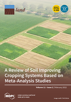
Cover Story (view full-size image): Improved crop husbandry and soil management practices or soil-improving cropping systems are required to maintain or improve crop yield and to prevent water pollution and emission of greenhouse gasses and ammonia into the atmosphere. A review of 154 meta-analyses shows that reported effects of alternative practices, relative to conventional practice, were positive in general. Effect sizes were relatively large for nutrient leaching and greenhouse gas emissions and small for soil quality except for soil life and crop yield. The meta-analysis studies indicate that there is large scope for increasing cropland productivity and minimizing environmental impacts. It is recommended to formulate goals for each farmer and to integrate and optimize farming practices. View this paper
  • Issues are regarded as officially published after their release is announced to the table of contents alert mailing list.
  • You may sign up for e-mail alerts to receive table of contents of newly released issues.
  • PDF is the official format for papers published in both, html and pdf forms. To view the papers in pdf format, click on the "PDF Full-text" link, and use the free Adobe Reader to open them.
Order results
Result details
Section
Select all
Export citation of selected articles as:
43 pages, 11040 KiB  
Article
Analyzing the Effects of Land Cover Change on the Water Balance for Case Study Watersheds in Different Forested Ecosystems in the USA
by Nathan C. Healey and Jennifer A. Rover
Land 2022, 11(2), 316; https://0-doi-org.brum.beds.ac.uk/10.3390/land11020316 - 21 Feb 2022
Cited by 7 | Viewed by 2774
Abstract
We analyzed impacts of interannual disturbance on the water balance of watersheds in different forested ecosystem case studies across the United States from 1985 to 2016 using a remotely sensed long-term land cover monitoring record (U.S. Geological Survey Land Change Monitoring, Assessment, and [...] Read more.
We analyzed impacts of interannual disturbance on the water balance of watersheds in different forested ecosystem case studies across the United States from 1985 to 2016 using a remotely sensed long-term land cover monitoring record (U.S. Geological Survey Land Change Monitoring, Assessment, and Projection (LCMAP) Collection 1.0 Science products), gridded precipitation and evaporation data, and streamgaging data using paired watersheds (high and low disturbance). LCMAP products were used to quantify the timing and degree of interannual disturbance and to gain a better understanding of how land cover change affects the water balance of disturbed watersheds. In this paper, we present how LCMAP science products can be used to improve knowledge for hydrologic modeling, climate research, and forest management. Anthropogenic influences (e.g., dams and irrigation diversions) often minimize the impacts of land cover change on water balance dynamics when compared to interannual fluctuations of hydroclimatic events (e.g., drought and flooding). Our findings show that each watershed exhibits a complex suite of influences involving climate variables and other factors that affect each of their water balances differently when land cover change occurs. In this study, forests within arid to semi-arid climates experience greater water balance effects from land cover change than watersheds where water is less limited. Full article
(This article belongs to the Special Issue Impacts of Land Use and Land Cover Change on Hydrological Systems)
Show Figures

Figure 1

22 pages, 1732 KiB  
Article
Diversity in Protected Area Governance and Its Implications for Management: An Institutional Analysis of Selected Parks in Iceland
by Jukka Siltanen, Jon Geir Petursson, David Cook and Brynhildur Davidsdottir
Land 2022, 11(2), 315; https://0-doi-org.brum.beds.ac.uk/10.3390/land11020315 - 21 Feb 2022
Cited by 4 | Viewed by 3124
Abstract
A protected area (PA) is essentially a governance system, a spatially defined area encompassing natural and/or cultural attributes, governed by a set of actors with different roles and institutional frameworks. There are many types of PA governance systems, guided by historical-, site-specific- and [...] Read more.
A protected area (PA) is essentially a governance system, a spatially defined area encompassing natural and/or cultural attributes, governed by a set of actors with different roles and institutional frameworks. There are many types of PA governance systems, guided by historical-, site-specific- and context-dependent factors. This study has the objective to advance understanding of PA governance systems, their diversity and the implications for management. We take the case of Iceland and five of its major PAs. We develop an analytical framework for the study of PA governance systems, investigating their evolutionary trajectories, conducting a comparative institutional analysis of their environmental governance systems (EGS), and assessing their management implications using nature-based tourism as a key variable. We find this framework effective and applicable beyond this study. We find great diversity in the five PA governance systems that has not come by chance but deliberately negotiated in their protracted establishment trajectories. At the individual park level, such PA diversity can be embraced as a sign of an adaptive approach to governance instead of a one-size-fits-all solution while at the national level, however, such fragmentation constitutes coordination challenges. Our analysis of the current portfolio of PA governance systems reveals they accommodate most of the needed management measures, but a problem remains concerning scattered and locked-in individual governance systems that do not support coordinated action and sharing of expertise and resources. This calls upon policy guidance with more formal coordination, such as a legal and national policy framework embracing PA governance diversity, but also securing more coordinated measures for day-to-day management. Full article
Show Figures

Figure 1

18 pages, 5623 KiB  
Article
Land Use Change and Its Driving Factors in the Rural–Urban Fringe of Beijing: A Production–Living–Ecological Perspective
by Changchun Feng, Hao Zhang, Liang Xiao and Yongpei Guo
Land 2022, 11(2), 314; https://0-doi-org.brum.beds.ac.uk/10.3390/land11020314 - 21 Feb 2022
Cited by 23 | Viewed by 4032
Abstract
Production–Living–Ecological Space (PLES) is a useful tool to identify land use status patterns and optimize land resource allocation. In this study, the spatial econometric model was chosen to analyze the driving factors of land use change in Chaoyang District, part of the rural–urban [...] Read more.
Production–Living–Ecological Space (PLES) is a useful tool to identify land use status patterns and optimize land resource allocation. In this study, the spatial econometric model was chosen to analyze the driving factors of land use change in Chaoyang District, part of the rural–urban fringe in Beijing, from the perspective of PLES evolution, from 2005 to 2020. The results showed the following: (1) Production Space (PS) to Living-Non-Farm Production Space (LNPS) has been the most significant conversion process of PLES since 2005, making LNPS the PLES type with the highest proportion in the study area. (2) With the spatial order from near-to-far from the city center, the scale of PS was reduced and concentrated, Ecological Space (ES) was formed in a green belt at the periphery of Beijing, Eco-Agricultural Production Space (EAPS) and Living-Agricultural Production Space were rapidly reduced, and LNPS was rapidly expanded in the point-line-plane order. (3) The PS to LNPS conversion was mainly driven by economic development and industrial structure upgrades, while the PS to ES conversion was mainly due to the distribution of population density and also industrial structures. The conversion of EAPS to LNPS was driven by the increase of the urbanization rate and economic growth. This study confirmed the policy-driven effect of the conversion from PS to ES. Due to the “Concentric Circle” spatial structure of Beijing, the conversion of PLES is generally related to the distance from the city center. Full article
(This article belongs to the Special Issue Sustainable Rural Transformation under Rapid Urbanization)
Show Figures

Figure 1

17 pages, 3617 KiB  
Article
Extracting Land Use Change Patterns of Rural Town Settlements with Sequence Alignment Method
by Senkai Xie, Wenjia Zhang, Yi Zhao and De Tong
Land 2022, 11(2), 313; https://0-doi-org.brum.beds.ac.uk/10.3390/land11020313 - 20 Feb 2022
Cited by 7 | Viewed by 2112
Abstract
Understanding land use change patterns of rural town settlements (RTSs) is crucial for rural and small-town planning; however, few studies have explored pattern mining approaches to RTS trajectory analysis. In this study, we adopted a novel method by building sequence alignment method (SAM) [...] Read more.
Understanding land use change patterns of rural town settlements (RTSs) is crucial for rural and small-town planning; however, few studies have explored pattern mining approaches to RTS trajectory analysis. In this study, we adopted a novel method by building sequence alignment method (SAM) to detect representative trajectory clusters of land use change of 1158 RTSs in seven waves from 1980 to 2015 in Guangdong, China. The results suggest that there are 10 clusters of RTSs with varying trajectories of land use change, implying their differences in the development processes and underlying socioeconomic, demographical, and institutional factors. A spatial distribution map of RTSs shows that stable cultivated ecological and stable ecologically dominant RTSs are distributed in the northern, eastern, and western parts of Guangdong, whereas stable rural construction and stable mixed construction RTSs are mostly located around the provincial boundary. Notably, 73% of the RTSs that have undergone changes in land use types are located in the Pearl River Delta (PRD), including urbanized and agricultural upgraded RTSs. The analysis presented here summarizes the driving forces of the spatial evolution of RTSs, including the location, landforms, industries, and policy factors. This study provides dynamic policy implications to understand longitudinal and sequential spatial restructuring and regional coordinated development in the fast-growing PRD area. Full article
(This article belongs to the Special Issue Sustainable Rural Transformation under Rapid Urbanization)
Show Figures

Figure 1

29 pages, 38756 KiB  
Article
The Perception of the Vertical Dimension (3D) through the Lens of Different Stakeholders in the Property Market of China
by Yue Ying, Mila Koeva, Monika Kuffer, Kwabena Obeng Asiama, Xia Li and Jaap Zevenbergen
Land 2022, 11(2), 312; https://0-doi-org.brum.beds.ac.uk/10.3390/land11020312 - 19 Feb 2022
Cited by 2 | Viewed by 2770
Abstract
China has experienced fast urbanization with a growing urban population, which has inevitably led to the adoption of a vertical housing style with high-rise buildings. However, how people subjectively perceive the vertical dimension (3D) in the property market is neither adequately documented nor [...] Read more.
China has experienced fast urbanization with a growing urban population, which has inevitably led to the adoption of a vertical housing style with high-rise buildings. However, how people subjectively perceive the vertical dimension (3D) in the property market is neither adequately documented nor well understood. The 3D perception helps us to understand a myriad of social and psychological effects of living in high-rise buildings. We organized and conducted semi-structured expert interviews, focus groups, and the circulation and compilation of questionnaires in Xi’an, China, to investigate how different stakeholders in the property market perceive 3D. The results show that: (1) real estate developers do not adjust property prices for specific 3D factors, and the local government does not consider 3D in housing policies; (2) the current status of 3D modeling in Xi’an is still in the embryonic state; (3) 3D factors are highly valued by buyers but not well-understood by real estate developers and local government. In addition, 3D factors score higher than horizontal (2D) factors (1.12 to 0.88). Gender and age groups do not influence housing preferences concerning 2D and 3D factors. These findings provide valuable insights for real estate developers concerning pricing policies and the local government concerning housing policies. In the future, 3D perceptions and factors should be prioritized in order to improve urban infrastructure and ensure the increased availability of, and fair public access to welfare related to 3D in urban areas. Full article
Show Figures

Figure 1

20 pages, 3512 KiB  
Article
Typing Colonial Perceptions of Carrum Carrum Swamp: The Expected and the Surprising
by Meredith Frances Dobbie
Land 2022, 11(2), 311; https://0-doi-org.brum.beds.ac.uk/10.3390/land11020311 - 18 Feb 2022
Viewed by 2845
Abstract
Carrum Carrum Swamp was a vast wetland to the south-east of Melbourne, Victoria, Australia, at the time that it was first sighted by white colonists in 1803. By 1878, the colonists had commenced converting the swamp to dry land for agricultural and horticultural [...] Read more.
Carrum Carrum Swamp was a vast wetland to the south-east of Melbourne, Victoria, Australia, at the time that it was first sighted by white colonists in 1803. By 1878, the colonists had commenced converting the swamp to dry land for agricultural and horticultural pursuits, and 100 years later it was predominantly residential land. Shifting values in the 1970s led to environmental concerns about water quality in local creeks and Port Phillip Bay and subsequent residential development on the former swamp included the construction of stormwater treatment wetlands. Perceptions of wetlands are now diverse, including positive perceptions that support their presence in urban settings. In contrast, traditionally, wetlands have been perceived negatively, as waste lands, leading to their drainage. Nevertheless, alternative, perhaps positive, perceptions could have existed, only to be overwhelmed by the negative perceptions driving drainage. Understanding the full range of past perceptions is important to ensure that the historical record is correct and to provide historical context to contemporary perceptions of wetlands. It will better equip natural resource managers and designers and managers of constructed wetlands in urban locations to ensure that wetlands are healthy, functioning and appreciated by their local and wider communities. Thus, the perceptions of Carrum Carrum Swamp by colonists from 1803 to 1878 were examined through qualitative content analysis of historical documents, and a typology was developed. Seven different perceptions were identified: scientific, premodern, exploitative, romantic, aesthetic, medico-mythic and ecological. Most could be traced to the colonists’ predominantly British heritage, but one perception arose in the colony in response to the specific environmental conditions that the colonists encountered. This ecological perception valued wetlands as places of predictable water supply in a land of unpredictable rainfall. It recognised wetlands as part of a broader hydrological system, with influences on the local climate. Its proponents promoted the need for a different approach to the management of wetlands than in Britain and Europe. Nevertheless, a dominant exploitative perception prevailed, leading to the drainage of Carrum Carrum Swamp. The typology developed in this study will be useful for exploring perceptions of other wetlands, both colonial and contemporary. Full article
(This article belongs to the Special Issue Celebrating 25 Years of World Wetlands Day)
Show Figures

Figure 1

21 pages, 6388 KiB  
Article
GIAHS as an Instrument to Articulate the Landscape and Territorialized Agrifood Systems—The Example of La Axarquía (Malaga Province, Spain)
by Rocío Silva-Pérez and Gema González-Romero
Land 2022, 11(2), 310; https://0-doi-org.brum.beds.ac.uk/10.3390/land11020310 - 18 Feb 2022
Cited by 5 | Viewed by 2389
Abstract
The theoretical literature makes a connection between the notions of landscape and territorialised agrifood systems, but these connections are rarely specified or explained. Their consideration in development proposals requires the relationship between the two and their magnitude to be made explicit. This article [...] Read more.
The theoretical literature makes a connection between the notions of landscape and territorialised agrifood systems, but these connections are rarely specified or explained. Their consideration in development proposals requires the relationship between the two and their magnitude to be made explicit. This article enquires into this and explores its programmatic forecasts from both the theoretical and empirical perspectives. An epistemological and regulatory review points to the FAO Globally Important Agriculture Heritage System (GIAHS) programme as the instrument that articulates the logic of landscape and territorialised agrifood in marginal rural areas. The empirical part of the study focuses on the dried grape (raisin) agrifood system in Axarquía (Malaga province, Spain) GIAHS since 2018. Territorial recognition and semi-structured interviews have enabled a deep study of the praxis of these connections. Axarquía is seen to be an excellent laboratory of the synergies between territorialised agrifood system synergies and landscapes. GIAHS is substantiated as a virtual instrument that can contribute to agriculture-based territorial development. It acts as a stimulus to development and combines forces through territorial governance processes. It highlights the value of agriculture as a cornerstone of development, examines agricultural functionalities in detail, and gives meaning to agricultural landscapes. Full article
Show Figures

Figure 1

15 pages, 6781 KiB  
Article
Soil Organic Carbon Isotope Tracing in Sorghum under Ambient CO2 and Free-Air CO2 Enrichment (FACE)
by Steven W. Leavitt, Li Cheng, David G. Williams, Talbot Brooks, Bruce A. Kimball, Paul J. Pinter, Gerard W. Wall, Michael J. Ottman, Allan D. Matthias, Eldor A. Paul, Thomas L. Thompson and Neal R. Adam
Land 2022, 11(2), 309; https://0-doi-org.brum.beds.ac.uk/10.3390/land11020309 - 18 Feb 2022
Cited by 1 | Viewed by 1553
Abstract
As atmospheric carbon dioxide concentrations, [CO2Air], continue their uncontrolled rise, the capacity of soils to accumulate or retain carbon is uncertain. Free-air CO2 enrichment (FACE) experiments have been conducted to better understand the plant, soil and ecosystem response to elevated [...] Read more.
As atmospheric carbon dioxide concentrations, [CO2Air], continue their uncontrolled rise, the capacity of soils to accumulate or retain carbon is uncertain. Free-air CO2 enrichment (FACE) experiments have been conducted to better understand the plant, soil and ecosystem response to elevated [CO2], frequently employing commercial CO2 that imparts a distinct isotopic signal to the system for tracing carbon. We conducted a FACE experiment in 1998 and 1999, whereby sorghum (C4 photosynthetic pathway) was grown in four replicates of four treatments using a split-strip plot design: (i) ambient CO2/ample water (365 μmol mol−1, “Control–Wet”), (ii) ambient CO2/water stress (“Control–Dry”), (iii) CO2-enriched (560 μmol mol−1, “FACE–Wet”), and (iv) CO2-enriched/water stressed (“FACE–Dry”). The stable-carbon isotope composition of the added CO2 (in FACE treatments) was close to that of free atmosphere background values, so the subsequent similar 13C-enriched carbon signal photosynthetically fixed by C4 sorghum plants could be used to trace the fate of carbon in both FACE and control treatments. Measurement of soil organic carbon content (SOC (%) = gC/gdry soil × 100%) and δ13C at three depths (0–15, 15–30, and 30–60 cm) were made on soils from the beginning and end of the two experimental growing seasons. A progressive ca. 0.5‰–1.0‰ δ13C increase in the upper soil SOC in all treatments over the course of the experiment indicated common entry of new sorghum carbon into the SOC pools. The 0–15 cm SOC in FACE treatments was 13C-enriched relative to the Control by ca. 1‰, and according to isotopic mass balance, the fraction of the new sorghum-derived SOC in the Control–Wet treatment at the end of the second season was 8.4%, 14.2% in FACE–Wet, 6.5% in Control–Dry, and 14.2% in FACE–Dry. The net SOC enhancement resulting from CO2 enrichment was therefore 5.8% (or 2.9% y−1 of experiment) under ample water and 7.7% (3.8% y−1 of experiment) under limited water, which matches the pattern of greater aboveground biomass increase with elevated [CO2Air] under the Dry treatment, but no parallel isotopic shifts were found in deeper soils. However, these increased fractions of new carbon in SOC at the end of the experiment do not necessarily mean an increase in total SOC content, because gravimetric measurements of SOC did not reveal a significant increase under elevated [CO2Air], at least within the limits of SOC-content error bars. Thus, new carbon gains might be offset by pre-experiment carbon losses. The results demonstrate successful isotopic tracing of carbon from plants to soils in this sorghum FACE experiment showing differences between FACE and Control treatments, which suggest more dynamic cycling of SOC under elevated [CO2Air] than in the Control treatment. Full article
Show Figures

Figure 1

14 pages, 4071 KiB  
Article
Cultural Tourism Weakens Seasonality: Empirical Analysis of Chinese Tourism Cities
by Jing Zhang, Zhonglei Yu, Changhong Miao, Yuting Li and Shuai Qiao
Land 2022, 11(2), 308; https://0-doi-org.brum.beds.ac.uk/10.3390/land11020308 - 18 Feb 2022
Cited by 7 | Viewed by 2858
Abstract
Cultural tourism is less seasonal than nature tourism. However, previous studies have mainly compared the tourist flow of scenic spots, and it is still unclear how cultural tourism affects regional tourism seasonality. This study investigated the seasonal patterns by analyzing the monthly inbound [...] Read more.
Cultural tourism is less seasonal than nature tourism. However, previous studies have mainly compared the tourist flow of scenic spots, and it is still unclear how cultural tourism affects regional tourism seasonality. This study investigated the seasonal patterns by analyzing the monthly inbound tourist flow of the 28 typical Chinese tourist cities from 2001 to 2012, and examined the effect of cultural tourism on weakening seasonality by using the random-response panel Tobit model. It was found that the seasonal patterns of inbound tourists present non-peak, one-peak, two-double, and three-peak regular fluctuations, and also have irregular fluctuations affected by emergencies and festivals. Cultural tourism can weaken the seasonality of regional tourism, while nature tourism products enhance tourism seasonality. Suitable travel times throughout the year and destination reception industry levels, locations, and external connections have a significant impact on the regional tourism seasonality, but climate comfort, foreign direct investment, and simply the number of hotels and international travel agencies are not significant for tourism seasonality. Full article
Show Figures

Figure 1

20 pages, 2285 KiB  
Article
Land Use/Cover Change Reduces Elephant Habitat Suitability in the Wami Mbiki–Saadani Wildlife Corridor, Tanzania
by Lucas Theodori Ntukey, Linus Kasian Munishi, Edward Kohi and Anna Christina Treydte
Land 2022, 11(2), 307; https://0-doi-org.brum.beds.ac.uk/10.3390/land11020307 - 17 Feb 2022
Cited by 11 | Viewed by 3596
Abstract
Wildlife corridors are critical for maintaining the viability of isolated wildlife populations and conserving ecosystem functionality. Anthropogenic pressure has negatively impacted wildlife habitats, particularly in corridors between protected areas, but few studies have yet quantitatively assessed habitat changes and corresponding wildlife presence. We [...] Read more.
Wildlife corridors are critical for maintaining the viability of isolated wildlife populations and conserving ecosystem functionality. Anthropogenic pressure has negatively impacted wildlife habitats, particularly in corridors between protected areas, but few studies have yet quantitatively assessed habitat changes and corresponding wildlife presence. We quantified land use/land cover and human–elephant conflict trends over the past two decades in the Wami Mbiki–Saadani (WMS) wildlife corridor, Tanzania, using RS and GIS combined with human–wildlife conflict reports. We designed landscape metrics and habitat suitability models for the African savanna elephant (Loxodonta africana) as a large mammal key species in the WMS ecosystem. Our results showed that forest cover, a highly suitable habitat for elephants, decreased by 3.0% between 1998 and 2008 and 20.3% between 2008 and 2018. Overall, the highly suitable habitat for elephants decreased by 22.4% from 1998 to 2018, when it was scarcely available and when small fragmented patches dominated the unprotected parts of the corridor. Our findings revealed that large mammalian habitat conservation requires approaches beyond habitat-loss detection and must consider other facets of landscape patterns. We suggest strengthening elephant habitat conservation through community conservation awareness, wildlife corridor mapping, and restoration practices to ensure a sustainable pathway to human–wildlife coexistence. Full article
Show Figures

Figure 1

18 pages, 3656 KiB  
Article
Impact of Local Grasslands on Wild Grass Pollen Emission in Bavaria, Germany
by Stephan Jung, Ye Yuan, Maria Stange Del Carpio, Thomas Pawlik, Stephan Hartmann, Nicole Estrella, Jose Oteros, Claudia Traidl-Hoffmann, Athanasios Damialis, Jeroen Buters and Annette Menzel
Land 2022, 11(2), 306; https://0-doi-org.brum.beds.ac.uk/10.3390/land11020306 - 17 Feb 2022
Cited by 5 | Viewed by 2775
Abstract
Meteorological conditions and the distribution of pollen sources are the two most decisive factors influencing the concentration of airborne grass pollen. However, knowledge about land-use types, their potential pollen emission, and the importance of local sources remains limited. In this study, wild grass [...] Read more.
Meteorological conditions and the distribution of pollen sources are the two most decisive factors influencing the concentration of airborne grass pollen. However, knowledge about land-use types, their potential pollen emission, and the importance of local sources remains limited. In this study, wild grass pollen concentrations from 27 stations in Bavaria, Germany, were linked to potential pollen within a 30 km radius. Agricultural grass pollen sources were derived from the InVeKos database, which contains detailed information on agricultural land-use types and their spatial distribution. Non-agricultural grassland was identified by OpenStreetMap. Further source classification was conducted using a cultivation intensity indicator and wind direction. We show that the grassland percentage and pollen concentrations, specified as annual pollen integral and pollen peak vary strongly between pollen stations. Correlation analyses indicated that the impact of the grassland on pollen concentration was greater within 10 km of the pollen traps. At greater distances, the correlation coefficient between the grassland percentage and pollen indicators steadily declined. Full article
(This article belongs to the Topic Climate Change and Environmental Sustainability)
Show Figures

Figure 1

17 pages, 2410 KiB  
Article
Strategies to Mitigate the Deteriorating Habitat Quality in Dong Trieu District, Vietnam
by Thi Thu Vu, Yuan Shen and Hung-Yu Lai
Land 2022, 11(2), 305; https://0-doi-org.brum.beds.ac.uk/10.3390/land11020305 - 17 Feb 2022
Cited by 1 | Viewed by 1415
Abstract
Dong Trieu district is a vital connection for territorial ecological security and human welfare between Hanoi (the capital of Vietnam) and Quang Ninh province. Therefore, habitat quality (HQ) is of extraordinary importance to the area’s sustainable development. The ArcGIS platform, Dyna-CLUE, and InVEST [...] Read more.
Dong Trieu district is a vital connection for territorial ecological security and human welfare between Hanoi (the capital of Vietnam) and Quang Ninh province. Therefore, habitat quality (HQ) is of extraordinary importance to the area’s sustainable development. The ArcGIS platform, Dyna-CLUE, and InVEST models were utilized in this study to assess the spatial and temporal transformations of land use and the changes of HQ in 2030 under various scenarios, with intentions to find strategies that may mitigate the HQ’s deteriorating trend in the district. Simulated results indicated that, assuming the development is maintained as usual, the average HQ of the District at 2030 could diminish by 0.044 from that of 2019 (a four-times decrease compared to the previous decade). Cases comprised of four basic scenarios, including development as usual, built-up expansion slowdown, forest protection emphasized, and agricultural land conversion, were used to identify potential strategies to mitigate the deteriorating trend. Simulated results revealed that keeping the built-up expansion rate lower than 100 ha y−1, the deforestation rate lower than 20 ha y−1, and preferring orchards over agricultural land conversion is required to limit the drop in HQ to within 0.01 in the next decade. Other than the existing population growth control policy, new guidelines such as (1) changing urban expansion type from outward to upward to control the built-up expansion rate, (2) substituting forest-harming industries to forest-preservation industries to reduce deforestation rate, (3) encouraging orchards preferred over agricultural land conversion to increase incomes while maintaining higher habitat quality, (4) practicing better farming technologies to improve crop production and to alleviate potential food security issues due to considerable reduction in cropland, and (5) promoting Green Infrastructure and the Belt and Road Initiative to increase urban green cover and raise residents’ income should be considered in designing the new mitigation strategies. Full article
(This article belongs to the Section Land Socio-Economic and Political Issues)
Show Figures

Figure 1

10 pages, 268 KiB  
Communication
The Nexus between Cultural Heritage Management and the Mental Health of Urban Communities
by Dirk H. R. Spennemann
Land 2022, 11(2), 304; https://0-doi-org.brum.beds.ac.uk/10.3390/land11020304 - 16 Feb 2022
Cited by 16 | Viewed by 2413
Abstract
In authorized cultural heritage management discourse, heritage sites can be included in local government heritage registers if their aesthetic, scientific, historic or social values are deemed significant. While notionally providing protection from major alterations and destruction for the benefit of future generations, such [...] Read more.
In authorized cultural heritage management discourse, heritage sites can be included in local government heritage registers if their aesthetic, scientific, historic or social values are deemed significant. While notionally providing protection from major alterations and destruction for the benefit of future generations, such listings primarily serve the present generation whose values they reflect. This paper considers the role that cultural heritage places play in terms of community identity and their contribution to a sense of place, to place attachment and, by implication, to personal and community mental health. Full article
(This article belongs to the Special Issue Quality of Urban Space versus Quality of Urban Life)
17 pages, 10894 KiB  
Article
Evaluation and Improvement of Cultivated Land Leisure Service Function Based on Multisource Spatial Data
by Yiming Yang, Xiuli Wang, Jian Wang, Yiwei Geng, Weiqiang Chen, Qun Wu and Xiaoke Guan
Land 2022, 11(2), 303; https://0-doi-org.brum.beds.ac.uk/10.3390/land11020303 - 16 Feb 2022
Cited by 3 | Viewed by 1802
Abstract
The leisure service function is an important component of the derivative function and non-market function of cultivated land. Therefore, exploring the strength of the cultivated land leisure service function with the help of spatial information technology is significant in guiding the proper utilization [...] Read more.
The leisure service function is an important component of the derivative function and non-market function of cultivated land. Therefore, exploring the strength of the cultivated land leisure service function with the help of spatial information technology is significant in guiding the proper utilization and protection of cultivated land resources. This paper constructed an evaluation system based on the three dimensions of ecological landscape, social activities, and economic performance, explored the spatial difference of the cultivated land leisure service function in Yuanyang County, the major grain-producing area along the Yellow River through spatial weighted overlay, classified the hot spots of leisure services and presented suggestions for improvement. Results show the following: (1) the landscape resources in the northern part are relatively monotonous, while those in the southern part are rich and evenly distributed. Spatial accessibility presents a distribution of “one core with multiple subcores”. The distribution of leisure service supply capacity is characterized by “multiple cores and multiple circles.” (2) The hot spots of the cultivated land leisure service function are the Urban Agricultural Central Area and the Ecological Agriculture Core Area in the middle of the county, and the Suburban Agritourism Development Area, the Yellow River Agritourism Transitional Area, and the Leisure Agriculture Connection Area on the periphery of the county. (3) The agricultural landscape should be fully protected and utilized in the Urban Agricultural Central Area. The spatial accessibility and regional reputation of the Ecological Agriculture Core Area need to be improved. The landscape diversity and landscape quality should be improved in the Suburban Agritourism Development Area. The Yellow River Agritourism Transitional Area needs to overcome the loss of tourists. The Leisure Agriculture Connection Area should increase the number of leisure and tourism facilities. Full article
(This article belongs to the Special Issue The Impact of Land Use on Atmospheric Environment)
Show Figures

Figure 1

16 pages, 5660 KiB  
Article
Addressing Climate Change Vulnerability in the IUCN Red List of Ecosystems—Results Demonstrated for a Cross-Section of Major Vegetation-Based Ecosystem Types in the United States
by Patrick J. Comer, Jon C. Hak and Patrick McIntyre
Land 2022, 11(2), 302; https://0-doi-org.brum.beds.ac.uk/10.3390/land11020302 - 16 Feb 2022
Viewed by 3881
Abstract
The IUCN Red List of Ecosystems (RLE) is a global standard for ecosystem risk assessment that integrates data and knowledge to document the relative risk status of ecosystem types as critically endangered (CR), endangered (EN), and vulnerable (VU). A series of indicators for [...] Read more.
The IUCN Red List of Ecosystems (RLE) is a global standard for ecosystem risk assessment that integrates data and knowledge to document the relative risk status of ecosystem types as critically endangered (CR), endangered (EN), and vulnerable (VU). A series of indicators for each type gauge the probability of range wide “collapse”. Climate change vulnerability can factor into RLE assessments, especially as indicators of climate change severity under the criteria for environmental degradation over the recent and upcoming 50 years. We applied a new framework to assess climate change vulnerability—and thus, severity of climate change degradation—to a cross-section of 33 upland ecosystem types in the United States to demonstrate this input to the RLE. The framework addressed climate exposure and ecosystem resilience. Measures of climate change exposure used climate projections for the mid-21st century compared against a 20th century baseline. Augmenting measures in use for RLE assessment, measures of resilience included several for adaptive capacity, including topoclimate variability, diversity with functional species groups, and vulnerability of any keystone species. All 33 types were listed as VU (n = 22), EN (n = 9), or CR (n = 2) and 51% scored at least one step higher (e.g., LC up to VU) from climate change severity. Full article
(This article belongs to the Special Issue Identifying Endangered Terrestrial Ecosystems)
Show Figures

Figure 1

18 pages, 2575 KiB  
Article
European Ground Squirrels at the Edge: Current Distribution Status and Anticipated Impact of Climate on Europe’s Southernmost Population
by Dimitra-Lida Rammou, Christos Astaras, Despina Migli, George Boutsis, Antonia Galanaki, Theodoros Kominos and Dionisios Youlatos
Land 2022, 11(2), 301; https://0-doi-org.brum.beds.ac.uk/10.3390/land11020301 - 16 Feb 2022
Cited by 9 | Viewed by 3747
Abstract
The European ground squirrel (Spermophilus citellus) is an endangered semifossorial small mammal of grassland/agricultural ecosystems. In the last few decades, the species’ population has declined throughout its range in Europe. The Greek populations represent the southernmost limit of the species’ range [...] Read more.
The European ground squirrel (Spermophilus citellus) is an endangered semifossorial small mammal of grassland/agricultural ecosystems. In the last few decades, the species’ population has declined throughout its range in Europe. The Greek populations represent the southernmost limit of the species’ range and are notably small, scattered, and located mainly in human-modified areas. The goal of the present research is to understand the environmental and anthropogenic variables associated with its distribution in the Mediterranean habitats, assess possible drivers of observed local extinctions, and propose conservation and land-use management actions in light of near-future climate change scenarios. We used presence records since 2000 across all known populations (107 colonies) and maximum entropy conditional probability models (MaxEnt) to calculate both the habitat suitability (bioclimatic variables) and habitat availability (anthropogenic/land-use variables) within the European ground squirrel’s historical range in northern Greece. We report a projected 39% to 94.3% decrease in habitat suitability by 2040–2060 due to climate change. Based on our findings, we provide guidance by proposing nascent conservation actions to protect the few existing colonies in Greece via improved land management practices and identify in situ climate refugia that could be prioritized as sites for future reintroductions. Full article
(This article belongs to the Special Issue Wildlife Protection and Habitat Management: Practice and Perspectives)
Show Figures

Figure 1

20 pages, 37818 KiB  
Article
Catchment-Scale Participatory Mapping Identifies Stakeholder Perceptions of Land and Water Management Conflicts
by Kathleen C. Stosch, Richard S. Quilliam, Nils Bunnefeld and David M. Oliver
Land 2022, 11(2), 300; https://0-doi-org.brum.beds.ac.uk/10.3390/land11020300 - 16 Feb 2022
Cited by 4 | Viewed by 2487
Abstract
Competing socioecological demands and pressures on land and water resources have the potential to increase land use conflict. Understanding ecosystem service provisioning and trade-offs, competing land uses, and conflict between stakeholder groups in catchments is therefore critical to inform catchment management and the [...] Read more.
Competing socioecological demands and pressures on land and water resources have the potential to increase land use conflict. Understanding ecosystem service provisioning and trade-offs, competing land uses, and conflict between stakeholder groups in catchments is therefore critical to inform catchment management and the sustainable use of natural resources. We developed a novel stakeholder engagement methodology that incorporates participatory conflict mapping in three catchments with a short questionnaire to identify the perceptions of 43 participants from four key land and water management stakeholder groups: environmental regulators, water industry practitioners, the farm advisor community, and academics. The participatory mapping exercise produced heat maps of perceived conflict and land use competition, providing spatial detail of the complex combination of land use issues faced by catchment managers. Distinct, localised hotspots were identified in areas under pressure from flooding, abstraction, and urbanisation; as well as more dispersed issues of relevance at the landscape scale, such as from farming, forestry, energy production, and tourism. Subsequent regression modelling linked perceived conflict to land cover maps and identified coastal, urban, and grassland areas as the most likely land cover types associated with conflict in the study catchments. Our approach to participatory conflict mapping provides a novel platform for catchment management and can facilitate increased cooperation among different catchment stakeholders. In turn, land and water management conflicts can be recognised and their underlying drivers and likely solutions identified in an effort to better manage competing demands on catchment resources. Full article
(This article belongs to the Special Issue Land Use Optimisation)
Show Figures

Figure 1

14 pages, 3395 KiB  
Article
Stakeholders’ Perceptions on the Role of Urban Green Infrastructure in Providing Ecosystem Services for Human Well-Being
by Mojca Nastran, Marina Pintar, Špela Železnikar and Rozalija Cvejić
Land 2022, 11(2), 299; https://0-doi-org.brum.beds.ac.uk/10.3390/land11020299 - 16 Feb 2022
Cited by 21 | Viewed by 3378
Abstract
The perception of linkages between ecosystem services (ES) and the urban green infrastructure (UGI) is evaluated, and their impact on human well-being (WB) is defined. Using a theoretical approach, the UGI’s specific contribution to WB is calculated as the sum of the products [...] Read more.
The perception of linkages between ecosystem services (ES) and the urban green infrastructure (UGI) is evaluated, and their impact on human well-being (WB) is defined. Using a theoretical approach, the UGI’s specific contribution to WB is calculated as the sum of the products of (a) the number of perceived ES per ES group and the WB weight factor divided by the product of (b) the number of respondents and (c) the sum of the products of ES and the WB weight factor. Stakeholders demand more ES than the perceived ES supply from all types of UGI, especially for the social relations component of WB. The highest number of perceived ES and greatest impact on all WB components is provided by urban forests. This method could be helpful in acknowledging ES and involving stakeholders not previously familiar with the ES concept with the aim of introducing ES into UGI governance. Full article
Show Figures

Figure 1

20 pages, 4111 KiB  
Article
Conterminous United States Land-Cover Change (1985–2016): New Insights from Annual Time Series
by Roger F. Auch, Danika F. Wellington, Janis L. Taylor, Stephen V. Stehman, Heather J. Tollerud, Jesslyn F. Brown, Thomas R. Loveland, Bruce W. Pengra, Josephine A. Horton, Zhe Zhu, Alemayehu A. Midekisa, Kristi L. Sayler, George Xian, Christopher P. Barber and Ryan R. Reker
Land 2022, 11(2), 298; https://0-doi-org.brum.beds.ac.uk/10.3390/land11020298 - 16 Feb 2022
Cited by 18 | Viewed by 5363
Abstract
Sample-based estimates augmented by complete coverage land-cover maps were used to estimate area and describe patterns of annual land-cover change across the conterminous United States (CONUS) between 1985 and 2016. Most of the CONUS land cover remained stable in terms of net class [...] Read more.
Sample-based estimates augmented by complete coverage land-cover maps were used to estimate area and describe patterns of annual land-cover change across the conterminous United States (CONUS) between 1985 and 2016. Most of the CONUS land cover remained stable in terms of net class change over this time, but a substantial gross change dynamic was captured by the annual and cumulative time intervals. The dominant types of changes can be grouped into natural resource cycles, increases in urbanization, and surface-water dynamics. The annual estimates over the 30-year time series showed a reduction in the rate of urban expansion after 2006, new growth in cropland after 2007, but a net overall decline in cropland since 1985, and two eras of net tree cover loss, the first one early in the time series and the second starting in 2012. Our study provides a holistic assessment of the CONUS land-cover conversion (class) change and can serve as a new benchmark for future research. Full article
(This article belongs to the Section Land – Observation and Monitoring)
Show Figures

Figure 1

16 pages, 6963 KiB  
Article
A Land-Use Change Model to Support Land-Use Planning in the Mekong Delta (MEKOLUC)
by Quang Chi Truong, Thao Hong Nguyen, Kenichi Tatsumi, Vu Thanh Pham and Van Pham Dang Tri
Land 2022, 11(2), 297; https://0-doi-org.brum.beds.ac.uk/10.3390/land11020297 - 15 Feb 2022
Cited by 11 | Viewed by 3337
Abstract
Agricultural land-use changes pose challenges for land managers in terms of ensuring the implementation of local land-use plans. This paper aims to build a land-use change model named MEKOLUC (Mekong Delta land-use change) for simulating land-use changes under the impacts of socioeconomic factors [...] Read more.
Agricultural land-use changes pose challenges for land managers in terms of ensuring the implementation of local land-use plans. This paper aims to build a land-use change model named MEKOLUC (Mekong Delta land-use change) for simulating land-use changes under the impacts of socioeconomic factors (profitability of land-use types, societal impacts on neighborhoods) and environmental factors (soil, salinity, persistence of salinity). The salinity diffusion map was generated using GAMA software and employed Markov cellular automata to depict the spread of salinity under the influence of dike and sluice gate system operations. The land-use decision-making process was based on multi-criteria selection of the main factors, which were land suitability, land convertibility, density of land use in the neighborhood and profitability of land-use patterns. The input data for the case study were historical land-use maps from 2005, 2010 and 2015 of Soc Trang, a coastal province in the Mekong Delta. The model was calibrated using a land-use map from 2010 (with kappa = 0.86) and was verified with land-use maps from 2015 and 2020 with deviations from 0 to 19%. The simulated results showed that shrimp–rice farming areas have been shrinking, even though these are recommended as sustainable farming systems. Inversely, intensive rice crops tended to change to rice–vegetable crops, vegetable crops or perennial fruit trees, which are projected to be well adapted to climate and salinity intrusion by 2030. This case study shows that the developed model is an essential tool for helping land managers and farmers build land-use plans. Full article
Show Figures

Figure 1

5 pages, 460 KiB  
Editorial
Land Perspectives: People, Tenure, Planning, Tools, Space, and Health
by Uchendu Eugene Chigbu, Ruishan Chen and Chao Ye
Land 2022, 11(2), 296; https://0-doi-org.brum.beds.ac.uk/10.3390/land11020296 - 15 Feb 2022
Cited by 1 | Viewed by 1414
Abstract
The global agendas on land and related issues (including agendas on land degradation neutrality, New Urban Agenda, climate change, United Nations’ decades on ecosystem restoration, and Sustainable Development Goals) are vulnerable to being neglected due to the current global focus on eradicating the [...] Read more.
The global agendas on land and related issues (including agendas on land degradation neutrality, New Urban Agenda, climate change, United Nations’ decades on ecosystem restoration, and Sustainable Development Goals) are vulnerable to being neglected due to the current global focus on eradicating the COVID-19 or coronavirus pandemic [...] Full article
(This article belongs to the Special Issue Land Perspectives: People, Tenure, Planning, Tools, Space, and Health)
Show Figures

Figure 1

15 pages, 2496 KiB  
Article
Microbial Biomass Is More Important than Runoff Export in Predicting Soil Inorganic Nitrogen Concentrations Following Forest Conversion in Subtropical China
by Chao Xu, Teng-Chiu Lin, Jr-Chuan Huang, Zhijie Yang, Xiaofei Liu, Decheng Xiong, Shidong Chen, Minhuang Wang, Liuming Yang and Yusheng Yang
Land 2022, 11(2), 295; https://0-doi-org.brum.beds.ac.uk/10.3390/land11020295 - 15 Feb 2022
Viewed by 1348
Abstract
Elevated runoff export and declines in soil microbial biomass and enzyme activity following forest conversion are known to reduce soil inorganic nitrogen (N) but their relative importance remains poorly understood. To explore their relative importance, we examined soil inorganic N (NH4+ [...] Read more.
Elevated runoff export and declines in soil microbial biomass and enzyme activity following forest conversion are known to reduce soil inorganic nitrogen (N) but their relative importance remains poorly understood. To explore their relative importance, we examined soil inorganic N (NH4+ and NO3) concentrations in relation to microbial biomass, enzyme activity, and runoff export of inorganic N in a mature secondary forest, young (five years old) Castanopsis carlessi and Cunninghamia lanceolate (Chinese fir) plantations, and forests developing through assisted natural regeneration (ANR). The surface runoff export of inorganic N was greater, but fine root biomass, soil microbial biomass, enzyme activity, and inorganic N concentrations were smaller in the young plantations than the secondary forest and the young ANR forests. Microbial biomass, enzyme activity, and runoff inorganic N export explained 84% and 82% of the variation of soil NH4+ and NO3 concentrations, respectively. Soil microbial biomass contributed 61% and 94% of the explaining power for the variation of soil NH4+ and NO3 concentrations, respectively, among the forests. Positive relationships between microbial enzyme activity and soil inorganic N concentrations were likely mediated via microbial biomass as it was highly correlated with microbial enzyme activity. Although surface runoff export can reduce soil inorganic N, the effect attenuated a few years after forest conversion. By contrast, the differences in microbial biomass persisted for a long time, leading to its dominance in regulating soil inorganic N concentrations. Our results highlight that most of the variation in soil inorganic N concentration following forest conversion was related to soil microbial biomass and that assisted natural regeneration can effectively conserve soil N. Full article
Show Figures

Figure 1

18 pages, 1078 KiB  
Article
Performance Analysis of Dairy Farms Transitioning to Environmentally Friendly Grazing Practices: The Case Study of Santa Catarina, Brazil
by Andréa Castelo Branco Brasileiro-Assing, Jini Kades, Paulo Antônio de Almeida Sinisgalli, Joshua Farley and Abdon Schmitt-Filho
Land 2022, 11(2), 294; https://0-doi-org.brum.beds.ac.uk/10.3390/land11020294 - 15 Feb 2022
Cited by 1 | Viewed by 2334
Abstract
The conflict between food production and environmental conservation demands alternative agriculture practices to maintain or increase food production, protect and restore critical ecosystem processes, and reduce dependence on non-renewable agricultural inputs. Deforestation in Brazil’s Atlantic Forest, for which agriculture has been a primary [...] Read more.
The conflict between food production and environmental conservation demands alternative agriculture practices to maintain or increase food production, protect and restore critical ecosystem processes, and reduce dependence on non-renewable agricultural inputs. Deforestation in Brazil’s Atlantic Forest, for which agriculture has been a primary driver, already threatens the biome’s impressive biodiversity and the ecosystem services it helps sustain. Many small family farmers in Santa Catarina—located in the South of Brazil—have adopted the Voisin Rational Grazing System (VRG) as an alternative to conventional and environmentally detrimental dairy activities. This article presents the results of a research project designed to analyze the economic, social, and ecological VRG impacts based on farmers’ perceptions and economic accounts. We compare farmer profitability and critical social and environmental aspects of both systems using detailed interviews and monthly accounting of revenues and expenditures on VRG and conventional farms. We found that VRG is more profitable than the conventional dairy system in Santa Rosa de Lima. However, most farmers combine VRG with some conventional practices, affecting profitability and potential ecological benefits. The adoption of VRG in Santa Rosa de Lima nonetheless correlates with reduced use of environmentally harmful inputs, compatible with a gradual transition to a more ecologically-friendly and sustainable system. Full article
(This article belongs to the Special Issue Sustainable Management of Natural Resources in Livestock System)
Show Figures

Figure 1

26 pages, 6909 KiB  
Article
Evictions, Foreclosures, and Global Housing Speculation in Palma, Spain
by Jesús M. González-Pérez
Land 2022, 11(2), 293; https://0-doi-org.brum.beds.ac.uk/10.3390/land11020293 - 15 Feb 2022
Cited by 3 | Viewed by 1661
Abstract
Over the last two decades, the property bubble and the subsequent economic crisis and post-crisis policies have heightened urban inequalities, mainly in cities in southern Europe. The gaps between social classes have widened with the configuration of new urban spaces characterized by segregation [...] Read more.
Over the last two decades, the property bubble and the subsequent economic crisis and post-crisis policies have heightened urban inequalities, mainly in cities in southern Europe. The gaps between social classes have widened with the configuration of new urban spaces characterized by segregation and exclusion. Palma is the capital of one of the top tourist destinations in the Mediterranean (the Balearic Islands) and it is usually regarded as a successful tourism model and a land of opportunity for property investors. Nevertheless, serious problems of inequality exist in the city. The centre of this dual city is split between a process of spreading gentrification and the urban blight of its poor neighbourhoods. Son Gotleu is a particular case in point. The neighbourhood is home to a large number of social housing blocks (1960s) with residents from mostly migrant backgrounds. Within a global context of new redefined rent-seeking mechanisms, this article analysed impoverishment in Son Gotleu, based on three variables associated with housing: evictions, foreclosures and the property market. Our study shows that evictions were a determining feature of impoverishment, linked to the emergence of new speculative investment interests. Indeed, investment funds are very probably the most influential urban agents today. Full article
Show Figures

Figure 1

23 pages, 1465 KiB  
Article
The Compossessorates in the Olt Land (Romania) as Sustainable Commons
by Daniela Sorea, Gheorghe Roșculeț and Gabriela Georgeta Rățulea
Land 2022, 11(2), 292; https://0-doi-org.brum.beds.ac.uk/10.3390/land11020292 - 15 Feb 2022
Cited by 5 | Viewed by 1641
Abstract
The compossessorates are traditional Transylvanian commons. They were disbanded during the Communist regime and re-established after 1989 according to the successive laws concerning land restitution. The current article highlights the importance of compossessorates in the Olt Land (in the south of Transylvania, Romania) [...] Read more.
The compossessorates are traditional Transylvanian commons. They were disbanded during the Communist regime and re-established after 1989 according to the successive laws concerning land restitution. The current article highlights the importance of compossessorates in the Olt Land (in the south of Transylvania, Romania) as partners involved in projects focused on the sustainable development of the area. To this end, the paper presents the main features of contemporary Romanian commons, underlines the sustainable traditional orientation of compossessorates, and signals the latter’s difficulty in establishing relations with environmental protection-oriented NGOs, in this case Foundation Conservation Carpathia which focuses on establishing a national park in the area. Consequently, the methods employed to achieve all of the above was the thematic analysis of publications found in the Anelis+ databases which were considered relevant for the theme of Romanian commons, and the content analysis of some normative acts and compossessorates’ by-laws dating back to the first half of the 20th century. The information on the relations between the commons and NGOs were retrieved from the official websites of the organizations, and from the media. The article shows that current compossessorates have social potential and economic efficiency. Their existence in the Olt Land is significant from an identity-based perspective. The latter is built upon the common interest of law makers and locals to constructively manage the forestry fund and respect property rights. Their functioning can be made more efficient. Both these and the NGOs openly state their sustainable orientation and that could contribute to reducing the tensions between them through correct communication. Ignoring the compossessorates’ sustainable orientation and their community prestige could sabotage any sustainable local development project if they are not consulted and invited as partners. Full article
Show Figures

Figure 1

18 pages, 2073 KiB  
Article
The Different Impacts of Airports on the Ecological Environment under Distinct Institutional Contexts
by Changsheng Xiong, Yu Tian, Xue Liu, Rong Tan and Qiaolin Luan
Land 2022, 11(2), 291; https://0-doi-org.brum.beds.ac.uk/10.3390/land11020291 - 15 Feb 2022
Cited by 2 | Viewed by 3568
Abstract
Few studies have attempted to investigate the impact of airports on the ecological environment. This paper compares the effects of airports in China and Germany on the surrounding ecological environment and discusses the underlying institutional mechanisms that lead to these impacts. We used [...] Read more.
Few studies have attempted to investigate the impact of airports on the ecological environment. This paper compares the effects of airports in China and Germany on the surrounding ecological environment and discusses the underlying institutional mechanisms that lead to these impacts. We used remote-sensing ecological indicators to assess ecological environment quality. A buffer analysis was used to determine the influence scopes of airports on the ecological environment. The institutional analysis development framework was adopted to investigate the functions of different institutions on the influence scopes and intensities. The results showed that the Chinese airport had obvious negative effects and that its impact scope was wide, while the impact intensity of the German airport was weaker. These significant differences stem from the distinct institutional systems that structure the two airports. Our findings ultimately provide insight into how to improve the relationship between infrastructure construction and environmental protection in China. Full article
(This article belongs to the Special Issue Territory Spatial Planning toward High-Quality Development in China)
Show Figures

Figure 1

19 pages, 3420 KiB  
Article
Assessment of Contamination Management Caused by Copper and Zinc Cations Leaching and Their Impact on the Hydraulic Properties of a Sandy and a Loamy Clay Soil
by Anastasia Angelaki, Alkiviadis Dionysidis, Parveen Sihag and Evangelia E. Golia
Land 2022, 11(2), 290; https://0-doi-org.brum.beds.ac.uk/10.3390/land11020290 - 14 Feb 2022
Cited by 16 | Viewed by 1846
Abstract
Soil hydraulic properties are crucial to agriculture and water management and depend on soil structure. The impact of Cu and Zn cations on the hydraulic properties of sandy and loamy clay soil samples of Central Greece, was investigated in the present study. Metal [...] Read more.
Soil hydraulic properties are crucial to agriculture and water management and depend on soil structure. The impact of Cu and Zn cations on the hydraulic properties of sandy and loamy clay soil samples of Central Greece, was investigated in the present study. Metal solutions with increased concentrations were used to contaminate the soil samples and the effect on hydraulic properties was evaluated, demonstrating the innovation of the current study. The soil samples were packed separately into transparent columns and the initial values of hydraulic conductivity, cumulative infiltration, infiltration rate and sorptivity were estimated. In order to evaluate soil adsorption, metal concentrations were measured at the water leachate. After the contamination of the soil samples, the hydraulic properties under investigation were determined again, using distilled water as the incoming fluid; the differences at the hydraulic parameters were observed. After doubling metal concentrations into the incoming solution of loamy clay soil, metal adsorption and the values of the hydraulic parameters increased significantly. Loamy clay soil showed interaction between the clay particles and the positive charge in the incoming fluid, which led to a possible increase in aggregation. Furthermore, aggregation may led to pore generation. Contamination of sandy soil exhibited no impact on aggregation and soil structure. In order to evaluate the differences on the hydraulic properties and soil structure, the experimental points were approximated with two infiltration models. Full article
Show Figures

Figure 1

15 pages, 2409 KiB  
Article
Effect of Short-Term Zero Tillage and Legume Intercrops on Soil Quality, Agronomic and Physiological Aspects of Cotton under Arid Climate
by Muhammad Faisal Saleem, Abdul Ghaffar, Muhammad Habib ur Rahman, Muhammad Imran, Rashid Iqbal, Walid Soufan, Subhan Danish, Rahul Datta, Karthika Rajendran and Ayman EL Sabagh
Land 2022, 11(2), 289; https://0-doi-org.brum.beds.ac.uk/10.3390/land11020289 - 14 Feb 2022
Cited by 6 | Viewed by 2561
Abstract
A detailed field experiment was carried out to study the effect of conventional and zero tillage and legume intercrops on soil health indicators and cotton productivity and also yield components of leguminous crops at the Research Farm, MNS-University of Agriculture, Multan, Pakistan. The [...] Read more.
A detailed field experiment was carried out to study the effect of conventional and zero tillage and legume intercrops on soil health indicators and cotton productivity and also yield components of leguminous crops at the Research Farm, MNS-University of Agriculture, Multan, Pakistan. The field experiment was comprised of four legume intercrops (no intercrops (sole cotton), mung bean, mash bean, and soybean) and two tillage systems (three years zero tillage (ZT) and long-term conventional tillage (CT)). The CT showed the highest plant height (121 cm), total bolls per plant (22.9 bolls), boll weight (2.74 g) and seed yield (2031 kg ha−1) of the cotton crop, as compared to ZT. The highest leaf transpiration rate (9.28 mmol H2O m−2 s−1), net leaf photosynthetic rate (27.17 µmol m−2 s−1), stomatal conductance (0.493 mmol m−2 s−1), chlorophyll content (62.3 SPAD value), plant height (123 cm), total bolls per plant (24.4), boll weight (2.83 g), and seed yield (2090 kg ha−1) of cotton crop were recorded when it was grown as a sole crop, as compared to legume intercrops. However, soil organic matter (0.77%), phosphorus (8.08 mg kg−1), potassium (253 mg kg−1), and microbial population (7.26 × 10⁶ Cfu) were higher in ZT than in CT. Mung bean showed a maximum number of pods (32), seed yield (173 kg ha−1), biomass (950 kg ha−1), and harvest index (19.0%), when intercropped with cotton. The highest land equivalent ratio and area time equivalent ratio were recorded in mung bean and cotton intercropping, grown under a CT system. Furthermore, the maximum benefit-cost ratio was recorded in mung bean and cotton intercropping, over sole cotton cropping under CT (1.75) and ZT (1.67) systems. The ZT and intercropping of leguminous crops with cotton might be a promising option for increasing the seed cotton yield, seed yield of leguminous crops, system profitability, and sustainability of soil health. Full article
Show Figures

Figure 1

5 pages, 187 KiB  
Editorial
Multiple Roles for Landscape Ecology in Future Farming Systems: An Editorial Overview
by Diane Pearson, Julian Gorman and Richard Aspinall
Land 2022, 11(2), 288; https://0-doi-org.brum.beds.ac.uk/10.3390/land11020288 - 14 Feb 2022
Cited by 4 | Viewed by 1689
Abstract
Farming faces new and urgent pressures, with an array of mounting social, environmental and economic challenges, and growing public and political expectations for improved stewardship of natural resources [...] Full article
(This article belongs to the Special Issue Multiple Roles for Landscape Ecology in Future Farming Systems)
16 pages, 3470 KiB  
Article
Forest Ecosystem Fragmentation in Ecuador: Challenges for Sustainable Land Use in the Tropical Andean
by Jin Kyoung Noh, Cristian Echeverria, Gabriel Gaona, Janina Kleemann, Hongmi Koo, Christine Fürst and Pablo Cuenca
Land 2022, 11(2), 287; https://0-doi-org.brum.beds.ac.uk/10.3390/land11020287 - 13 Feb 2022
Cited by 6 | Viewed by 3177
Abstract
Natural ecosystems are declining and fragmenting globally at unprecedented rates. Fragmentation of natural ecosystems leads to decline in functions and services with severe impact on people. In Ecuador, despite establishment of the nationwide ecosystem classification, this baseline information has not been fully exploited [...] Read more.
Natural ecosystems are declining and fragmenting globally at unprecedented rates. Fragmentation of natural ecosystems leads to decline in functions and services with severe impact on people. In Ecuador, despite establishment of the nationwide ecosystem classification, this baseline information has not been fully exploited to generate a monitoring system for ecosystem changes. Forest ecosystems are altered daily in Ecuador by human impact, but the relationship between forest fragmentation and human land use has not been adequately explored. To provide an overview of how recent forest fragmentation at the national and ecosystem level was affected by practices in human land use, we quantified the degree of forest fragmentation using the forest fragmentation index (FFI). The relationship between the degree of forest ecosystem fragmentation and human land use of 64 natural forest ecosystems was analyzed during the time period 1990 to 2014. At the national level, the expansion of pasture and inhabited area significantly increased forest fragmentation. The regression models based on the FFI value indicated that the forest fragmentation was highly correlated to pastures in forest ecosystems with low, moderate, and high fragmentation in 2014 due to a progressive increase in pastures. This study showed the critical gaps between forest conservation strategies and actual practices in human land use. Full article
(This article belongs to the Special Issue Identifying Endangered Terrestrial Ecosystems)
Show Figures

Figure 1

Previous Issue
Next Issue
Back to TopTop