Communication

Patterns of Tree Distribution within Small Communities of the Sudanian Savanna-Sahel

School of Forest Resources and Environmental Science, Michigan Technological University, Houghton, MI 49931, USA
*
Author to whom correspondence should be addressed.
Submission received: 18 September 2014 / Revised: 3 November 2014 / Accepted: 24 November 2014 / Published: 4 December 2014

Abstract

:
Crown diameter and tree density were measured in 52 communities in the Sudan-Sahel using satellite imagery to determine the relationships between rainfall and distance from community center to crown size diameter and tree density. As distance from the community center increased, tree density and crown diameter decreased. As rainfall increased, tree density decreased while crown diameter increased. Distance from the community center is a proxy for age since urbanization and our results indicate that older parts of communities show longer and more consistent tree management. The trends in patterns of tree distribution and size in communities are different from those in natural woodlands.

Graphical Abstract

1. Introduction

Our objective was to determine the tree distribution patterns in village, town and small-city environments in the Sudan-Sahel of Africa and to determine if these patterns are consistent with intentional management of trees by local residents. For brevity in the remainder of the paper we use the term “Sahel” to include the Sahel, Sudanian Savanna, and northern part of the Guinean Savanna ecological zones, roughly 400 mm to 1300 mm annual rainfall [1] and the word “community” to describe the densely populated “urban” settlements in the study. Within communities trees may be used for shade, as meeting places, for the production of food or medicine within home gardens, and for many broader environmental services [2,3]. While our study could not determine specific uses of individual trees, we hypothesized that the combination of these uses would lead to patterns within communities that are consistent with human care and management of trees, whether these trees are originally present, naturally regenerated or planted. These patterns can be rapidly assessed using satellite imagery.
The Sahel has been undergoing demographic and land-use change which has led to the expansion villages, towns, and cities [4,5,6,7]. We hypothesize that trees will be larger and found in greater numbers in older parts of the communities. This would be consistent with value and care of trees in an area where population and community size are expanding. Our hypotheses follow from von Thunen’s model of concentric patterns of land use with decreasing value for each land use as one moves away from the city center. The urban center will be the most valuable land use, followed by residential use, and then agricultural use. As the total population of a community increases each circle expands outwards so that distance from the city center is a proxy for age; more distant points have been in the current land use for a shorter time period [8,9].
Local use of trees has been widely investigated throughout our study region. Most of these studies have focused on much smaller regions, frequently several adjacent communities (e.g., [10,11]) or on individual species and their uses (e.g., [12,13]). Studies of changes in land use often focus on change in the context of expanding agricultural use (e.g., [14,15]) or the implications of climate change on land use (e.g., [16,17]). The limited number of studies on urban forestry in sub-Saharan Africa, less than 2% of all urban forestry research—with most studies in South Africa [18], view urban forestry as planned government or development agency undertaking (e.g., [2,19]). Our study encompasses a much broader geographic range than most studies, examining general patterns within the “urban” environments of the communities that often have been generated by local residents without apparent outside intervention. Unlike a meta-analysis our methodology is consistent for all communities across the wide geographic range of our study. The results cover a much broader geographic range than most urban African studies and are derived from a large primary data set.

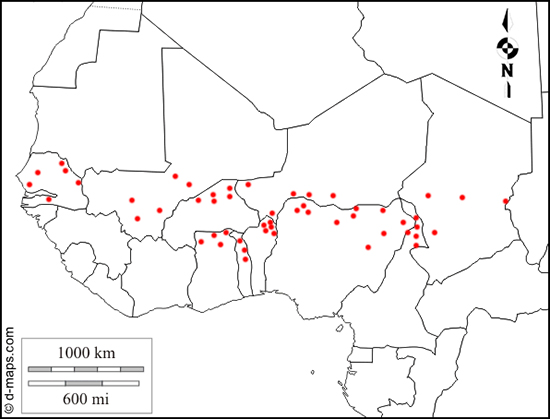
2. Materials and Methods

The study area was bounded by longitudes from 16°24′W to 22°11′E, and latitudes from 8°57′N to 15°31′N. A random sample of 52 communities with initial estimated population less than 100,000 and with adequate satellite imagery in ten countries was selected (Figure 1). For each community we recorded community population and area, mean annual rainfall, latitude and longitude (Table 1). Population data sources varied and for some communities several sources with different population estimates were available. In those cases we averaged the available values. Annual rainfall for each community was based on data in Ogigirigi [20]. As we could not measure number of stems, trees may include large shrubs, multi-stemmed trees, or trees in very close proximity.
Tree species could not be identified from this data set. Common native trees in our study include species in the Acacia, Combretum, and Isoberlinia genera; Commiphora africana is also common [21,22]. Exotic species are also widely planted in the study area [23]. Azadirachta indica is a common urban species and non-native woodlot trees including species within the Eucalyptus and Acacia genera can be found planted in communities [22,23]. Fruit trees such as mango (Mangifera indica) and papaya (Carica papaya) are tended in home compounds and many native species with important food and medicinal uses such as Adansonia digitata, Parkia biglobosa, Vitellaria paradoxa, and Zizyphus mauritania are valued in communities [22].
Figure 1. Location of 52 communities sampled. (Base map used with permission from [24]).
Land 03 01284 g001
Table 1. Variables used in determining tree patterns in 52 urban areas in the Sahel.
VariablenMinMaxMeanStandard Deviation
Crown Diameter (m)60561.032.36.63.1
No. of trees per plot 121811182.522.47
Distance from Center (m)6056503600466396
Population5273998,00016,74018,234
Annual Rainfall (mm)524001240749251
Area (km2)520.1115.132.672.89
Latitude528°57′N15°31′N----
Longitude5216°24′W22°11′E----
1 For plots with trees.
Tree data along transects were collected from satellite imagery. In each community transects were laid due north, south, east and west of the community center unless a transect would be biased by following a primary route or grid pattern in the community. If necessary, transects were offset 30 degrees to avoid systematic bias from a transportation route or a grid pattern. Twenty-five meter radius plots were laid every 50 m for small communities (populations up to 9999), every 100 m for medium communities (populations between 10,000 and 39,999), and every 150 m for large communities (populations of 40,000 or greater). Tree and plot data and location were collected using satellite imagery and Google Earth technology [25]. Crown diameters (meters) were measured for all trees falling, even partially, within each plot. Crown diameters could be measured using the Google Earth ruler function to 0.5 m but were recorded to the nearest meter. Each plot was assigned one of three land use zones: an urban center, a surrounding residential zone, and the outlying agricultural zone. The urban center included larger commercial buildings and shops. The residential zone included houses or housing compounds. The outlying agricultural zone began where farm fields became the dominant land use. Some smaller communities did not have a visible urban center. Plot measurements were halted after three successive agricultural plots fell beyond the community boundaries. This method generated 2181 plots with 6056 individual trees. The complete data set is available online as supplementary material associated with this paper.
Tests for correlation were used to identify relationships between variables [26]. We primarily investigated relationships between the pairs of variables that tested our primary hypotheses about crown diameter and trees per plot, but we also tested for collinear relationships between all pairs of cardinal variables. An ANOVA test was used to examine the relationship between land use zone and number of trees and crown size. SAS Proc CORR and Proc GLM, SAS version 9.2 (SAS Institute Inc., Cary, NC, USA), was used for the statistical analysis. These methods do not allow inference of cause and effect, only consistency between data and hypotheses.

3. Results

We broadly hypothesized that people would prefer trees around their property, and that trees were less preferred where they conflicted with agricultural use of the land. This implies that as communities expand in size, the older portions of a community would have older and larger trees. Also, as people had longer time periods to develop their property, they should have more opportunities to plant and maintain trees. Therefore, property closer to the center of a community would have more and larger trees. Community centers might be more densely built and have more commercial property and less residential property. While each landowner’s (e.g., household’s, tenant’s, shopkeeper’s, public agency’s) plot could have more and larger trees, there might be fewer landowners, especially residential households, per hectare in the community center as residential use is replaced by commercial land use; thus, as a whole, the community center might have fewer trees.
Our model assumes that communities are expanding. We examined the 42 communities (of our total sample of 52 communities) that had two satellite images taken at least 5 years apart. The average annual increase in community perimeter was 1.95%. Larger communities expanded more rapidly than smaller communities, using either perimeter (r2 = 0.12, p = 0.02) or area (r2 = 0.11, p = 0.03) as the independent variable with rate of increase as the dependent variable.
Correlations among the variables indicate that the data set is robust and reasonably accurate given the large geographic scope of the study. Annual rainfall is strongly and negatively correlated with latitude (r = −0.709, p < 0.001) as would be expected. Population is also correlated with area (km2) for the communities (r = 0.700, p < 0.001). Both of these correlations are highly significant and what one would expect, indicating that measurements obtained were consistent with each other and with generally agreed upon ecological and geographic relationships.
The average crown diameter in a plot and distance from the center of the community were weakly and negatively correlated (r = −0.199, p < 0.001), suggesting that larger, presumably older, trees are typically found closer to the center of the community. Likewise, the number of trees in a sample plot decreased as one moved away from the community center (r = −0.225, p < 0.001). We also examined this relationship for each of the three zones, eliminating community size as a confounding element. Tree density was highest in the center of a community, decreased somewhat in the surrounding residential zone, and was lowest in the agricultural fields surrounding the communities (Table 2). All differences were statistically significant (F = 4.11, p < 0.001). Crown diameter was also decreasing and significantly different between the urban community center, the residential housing zone, and the agricultural zone (F = 7.76, p < 0.001) (Table 2).
Table 2. Mean and standard deviation of number of trees per plot and crown diameter (m) by land use zone. Standard deviations in parentheses. All zones are significantly different from each other (0.05 confidence) for both number of trees per plot and crown diameter. For number of trees per plot n = 2181, for crown diameter n = 6056.
Land Use Zone
CenterResidential HousingAgriculture
Number of Trees per Plot3.16 (2.49)2.61 (2.49)1.52 (2.09)
Crown Diameter (m)6.75 (3.24)5.87 (3.49)4.46 (3.79)
Since our data were collected in areas which ranged from 400 to 1240 mm average annual rainfall, we also examined the relationship between average annual rainfall on crown size and density to determine if this might influence our results. The number of trees per plot showed no significant correlation (r = 0.017, p = 0.172), however, the mean crown size increased as rainfall decreased (r = −0.088, p < 0.001). The correlation between crown size and rainfall is extremely weak, but is statistically significant. Rainfall seemed to have no apparent impact on tree density within communities while in savannas and dispersed woodlands of the undisturbed environment, within our study area, tree density and size decrease with decreasing rainfall and as one moves north [1]. Decreasing tree density and decreasing tree size, the pattern found in rural and forested areas, does not hold in the modified urban environment of smaller communities in the Sahel.

4. Discussion

In general, most our hypotheses were consistent with our statistical results, either through tests for correlation or ANOVA tests, with high levels of confidence. The relationships, however, tended to be weak. This is understandable given the wide geographic area, from Chad to the Atlantic Ocean, and the several vegetation zones sampled. Other variables, from government policy regarding natural resource ownership and management, to species characteristics, to technical support for tree planting, or cultural preferences, may also play a substantial role in a landowner’s decision to plant or care for trees, whether planted or originating from natural regeneration. Species also vary over the region. Our methods and results do not indicate causality, only that a statistical relationship exists between variables. Yet, over a broad geographical area in semi-arid West Africa we found that our results were consistent with three key ideas:
(1)
Tree planting and management are actively pursued in communities. As one moves from older to younger parts of a community the trees are smaller and tree density declines. Beyond the perimeter of the community one finds only agricultural land with few or no trees. Only in Ati, Chad did we find a substantial forested area on the northwestern edge of the urban area. Ati did expand into this area.
(2)
Crown diameter increases with decreasing rainfall. This correlation is the reverse of crown diameter-rainfall relationship in forests of the region [1]. We believe considerable attention must be paid to the planting or care of trees within communities for the patterns of crown size and tree density relative to rainfall patterns to exist as they do in our study area.
(3)
Older, more centrally located areas in the community have more trees per unit area, and those trees have larger crown diameters (density and crown diameters decrease with increased distance from the center of the community). This pattern would be consistent with the long-term historical management of trees. Older parts of a community have been established for longer periods of time and those near the edge have recently been converted from nearly treeless farm fields. The older parts of a community would have more and larger trees. Similar patterns of tree characteristics are true for urban areas in the United States [27,28,29].
This study shows only that there exists some consistent relationship between humans and the presence of non-agricultural vegetation in communities of the Sahel. These results warrant continued exploration into this relationship. With a clearer understanding of the relationship and the motivations one could target efforts within these communities in order to expand the many benefits provided by trees within communities of the Sahel. Our data set does not allow us to explain personal motivations for the planting or care of trees. Patterns may vary with climatic zone, cultural values [30], and personal landowner characteristics. Wealth may be an especially important characteristic for households [30].
Urban trees provide a wide range of environmental services and can play a substantial role in motivating landowners to plant or maintain trees [30,31]. Both fruit and shade are common reasons to plant trees [31], but the general amenity value [32], soil conservation [2], carbon management [3], biodiversity [32] and medicinal uses [2,33] also are benefits derived from urban tree planting [2]. Community residents in our study area apparently see these benefits and a combination of these benefits results in the planting and care of trees in their communities [2,33].

5. Conclusions

Using satellite imagery it is possible to use a consistent sampling method over a wide area to discern tree pattern in small urban communities. The patterns observed are consistent with care and management of trees in small urban communities in the Sahel. For example, crown diameter in the communities increases as one moves north and rainfall decreases, the reverse of patterns in natural forests. The study does not allow one to infer the specific benefits that motivate individuals to manage and protect trees. Such an understanding would allow targeted urban forestry efforts in the region.

Acknowledgments

We would like to thank Tom Brandeis, James B. Pickens, and Christopher R. Webster for their useful contributions to the discussion on the appropriate statistical methods to use with this data set. We thank two anonymous reviewers and the editors for their many useful suggestions. All errors and omissions are the responsibility of the authors.

Author Contributions

Sarah J. Sterling was responsible for data collection. In all other segments of the project the authors worked collaboratively and share in the contributions.

Conflicts of Interest

The authors declare no conflict of interest.

References

  1. White, F. Vegetation of Africa: A Descriptive Memoir to Accompany the UNESCO/AETFAT/UNSO Vegetation Map of Africa; The United Nations Educational, Scientific and Cultural Organization (UNESCO): Paris, France, 1983. [Google Scholar]
  2. Fuwape, J.A.; Onyekwelu, J.C. Urban forest development in West Africa: Benefits and challenges. J. Biodivers. Ecol. Sci. 2011, 1, 77–94. [Google Scholar]
  3. McPherson, E.G.; Simpson, J.R. Carbon Dioxide Reductions through Urban Forestry: Guidelines for Professional and Volunteer Tree Planters; General Technical Report PSW171; USDA Forest Service, Pacific Southwest Research Station: Albany, CA, USA, 1999.
  4. Bilsborrow, R.E.; Okoth Ogendo, H.W.O. Population-driven changes in land use in developing countries. Ambio 1992, 21, 37–45. [Google Scholar]
  5. Cour, J.M. The Sahel in West Africa: Countries in transition to a full market economy. Glob. Environ. Chang. 2001, 11, 31–47. [Google Scholar] [CrossRef]
  6. Girault, F. Contemporary dynamics of small towns in West Africa. In Rural-Urban Dynamics in Francophone Africa; Baker, J., Ed.; Nordiska Afikainstitutet: Uppsala, Sweden, 1997; pp. 26–50. [Google Scholar]
  7. Tettey, C. Urbanization in Africa in Relation to Socio-Economic Development: A Multi-Faceted Quantitative Analysis. Ph.D. Thesis, University of Akron, Akron, OH, USA, 2005. [Google Scholar]
  8. Briggs, J. The peri-urban zone of Dar es Salaam, Tanzania: Recent trends and changes in agricultural land use. Trans. Instit. Br. Geogr. New Ser. 1991, 16, 319–331. [Google Scholar] [CrossRef]
  9. Sinclair, R. Von Thunen and urban sprawl. Ann. Assoc. Am. Geogr. 1967, 57, 72–87. [Google Scholar] [CrossRef]
  10. Kristensen, M.; Balslev, H. Perceptions, use and availability of woody plants among the Gourounsi in Burkina Faso. Biodivers. Conserv. 2003, 12, 1715–1739. [Google Scholar] [CrossRef]
  11. Sop, T.K.; Oldeland, J.; Bognounou, F.; Schmiedel, U.; Thiombiono, A. Ethnobotanical knowledge and valuation of woody plants species: A comparative analysis of three ethnic groups from the sub-Sahel of Burkina Faso. Environ. Dev. Sustain. 2012, 14, 627–649. [Google Scholar] [CrossRef]
  12. Gaou, O.G.; Ticktin, T. Patterns of harvesting foliage and bark from the multipurpose tree Khaya senegalensis in Benin: Variation across ecological regions and its impacts on population structure. Biol. Conserv. 2007, 137, 424–436. [Google Scholar] [CrossRef]
  13. Shao, M. Parkia biglobosa: Changes in Resource Allocation in Kandinga, Ghana. Master’s Thesis, Michigan Technological University, Houghton, MI, USA, 2002. [Google Scholar]
  14. Oudrago, I. Land Use Dynamics and Demographic Change in Southern Burkina Faso. Ph.D. Thesis, Swedish University of Agricultural Sciences, Alnarp, Sweden, 2010. [Google Scholar]
  15. Reenberg, A. Agricultural land use pattern dynamics in the Sudan-Sahel—Towards an event-driven framework. Land Use Policy 2001, 18, 309–319. [Google Scholar] [CrossRef]
  16. Kurukulasuriya, P.; Mendelsohn, R. Crop switching as a strategy for adapting to climate change. Afr. J. Agric. Res. 2008, 2, 105–125. [Google Scholar]
  17. Schlenker, W.; Lobell, D.B. Robust negative impacts of climate change on African agriculture. Environ. Res. Lett. 2010, 5, 1–8. [Google Scholar] [CrossRef]
  18. Shackleton, C.M. Is there no urban forestry in sub-Saharan Africa? Sci. Res. Essays 2012, 7, 3329–3335. [Google Scholar]
  19. De Zeeuw, H.; van Veenhuizen, R.; Dubbeling, M. The role of urban agriculture in building resilient cities in developing countries. J. Agric. Sci. 2011, 149, 153–163. [Google Scholar] [CrossRef]
  20. Ogigirigi, M.A. Climate of the Guinea and Sudan savannas of West Africa. In Savanna Afforestation in Africa; Food and Agriculture Organization of the United Nations: Rome, Italy, 1997; pp. 9–19. [Google Scholar]
  21. Millington, A.C.; Critchley, R.W.; Douglas, T.D.; Ryan, P. Estimating Woody Biomass in Sub-Saharan Africa; The International Bank for Reconstruction and Development/The World Bank: Washington, DC, USA, 1994. [Google Scholar]
  22. von Maydell, H.-J. Arbres et arbustes du Sahel: Leurs Caractéristiqes et Leurs Utilsations; Duetsche Gesellschaft fur Technische Zusammenarbeit GmbH: Eschborn, Germany, 1983. [Google Scholar]
  23. Weber, F.R. Reforestation in Arid Lands, 1st ed.; Peace Corps/VITA: Washington, DC, USA, 1977. [Google Scholar]
  24. D-Maps.com, Free Maps. Available online: http://d-maps.com/carte.php?num_car=737&lang=en (accessed on 11 November 2014).
  25. Google Earth Version 5.0. Available online: http://earth.google.com/intl/en/ (accessed on 12 May 2009).
  26. Steel, R.G.D.; Torrie, J.H. Principles and Procedures of Statistics; McGraw-Hill: New York, NY, USA, 1960. [Google Scholar]
  27. Boone, C.G.; Cadenasso, M.L.; Grove, J.M.; Schwarz, K.; Buckley, G.L. Landscape, vegetation characteristics, and group identity in an urban and suburban watershed: Why the 60s matter. Urban Ecosyst. 2009. [Google Scholar] [CrossRef]
  28. Dow, K. Social dimensions of gradients in urban ecosystems. Urban Ecosyst. 2000, 4, 255–275. [Google Scholar] [CrossRef]
  29. Hope, D.; Gries, C.; Zhu, W.; Fagan, W.F.; Redman, C.L.; Grimm, N.B.; Nelson, A.L.; Martin, C.; Kinzig, A. Socioeconomics drive urban plant diversity. Proc. Natl. Acad. Sci. USA 2003, 100, 8788–8792. [Google Scholar] [CrossRef] [PubMed]
  30. Gustad, G.; Dhillion, S.S.; Sidebé, D. Local use and cultural and economic value of products from trees in the parklands of the municipality of Cinzana, Mali. Econ. Bot. 2004, 58, 578–587. [Google Scholar] [CrossRef]
  31. Kaoma, H.; Shackleton, C.M. Homestead greening is widespread amongst the urban poor in three medium-sized South African towns. Urban Ecosyst. 2014, 17, 1191–1207. [Google Scholar] [CrossRef]
  32. Jim, C.Y.; Chen, W.Y. Diversity and distribution of landscape trees in the compact Asian city of Taipei. Appl. Geogr. 2009, 29, 577–587. [Google Scholar] [CrossRef]
  33. Babalolo, F.D.; Borokini, T.I.; Onefeli, A.O.; Muchi, M. Socio-economic contributions of an indigenous tree in urban areas of Southwest Nigeria. Afr. J. Sci. Technol. Innov. Dev. 2013, 6, 479–489. [Google Scholar] [CrossRef]

