Geotourism—Examining Tools for Sustainable Development

Welterbe Grube Messel gGmbH, Rossdörferstrasse 108, 64409 Messel, Germany
Geosciences 2021, 11(1), 30; https://0-doi-org.brum.beds.ac.uk/10.3390/geosciences11010030
Submission received: 1 July 2020
/
Revised: 17 August 2020
/
Accepted: 26 August 2020
/
Published: 7 January 2021
Abstract
:From the middle of the 1990s, geotourism was introduced through the first geotrails, their evolution, and the first geopark worldwide in Gerolstein/Vulkaneifel, Germany. The latter is one of the founding members of the European Geoparks Network, which was established in 2000 at the International Tourism Bourse (ITB) in Berlin. The main goal of the first geopark was to link geological heritage with tourism in a rural area that was trying to create new perspectives to inspire young people to stay in their home territory. Geotourism was initiated as part of sustainable tourist development and for future sustainable development at that time in the Gerolstein region. The first steps to implement the Gerolstein/Vulkaneifel Geopark, Germany, were taken in 1992. The core aspects included geological heritage, science transfer, and education as tools for developing geotourism in the broad sense and integrating local people and municipalities in the geopark activities of the rural region. Close collaboration with the local and regional tourism organizations highlighted the need to both define tools and demonstrate their success. Up to now, practice has shown that such success can be demonstrated by the infrastructure created, as well as adjacent measures and activities. A network of factors was determined to play a significant role in ensuring the successful sustainable development in a geopark across the field of geotourism. There are many activities and publications on geological heritage, geosite assessment, significance, and use, but there are fewer which reflect on the network of factors highlighted in this contribution which were first presented in 2002. In many publications and investigations, one factor in particular is emphasized, e.g., infrastructure development, such as panels or other items. Not all of the mentioned factors, however, are being addressed. As a result, a selection of good practice examples of UNESCO Global Geoparks (UGGP) working on the network-oriented conceptual basis has been studied here, in line with the conceptual principle set forth about 25 years ago. The geopark examples in this study include Lesvos Island UGGp (Greece), Naturtejo UGGP (Portugal), Vulkaneifel UGGp (Germany), and Hong Kong UGGP (China), as well as the example of the Messel Pit World Heritage Site (WHS) (Germany). The latter was integrated to present an example which is not a geopark, showing that this concept can also be transferred to a WHS as a tool for sustainable development according the UN 2030 Agenda. The information on the development of the selected examples was obtained by visiting the geopark territory and from the geopark’s websites and published material as a combined methodology.
1. Introduction
The geotourism conceptual basis used here was first announced in 1993 [1,2,3]. It was presented in 1998 at a poster session at a scientific conference and subsequently published by Frey [4,5] and Frey, Schäfer, Büchel & Patzak [6]. Only two years earlier, four geopark partners created the “European Geoparks Network” (EGN). Members followed the underlying concepts for the sustainable development of the geoparks and surrounding areas [6,7,8,9,10,11,12,13,14,15,16]. No one expected the idea to gather and maintain much momentum at that time.
Geotourism as a concept for ensuring the sustainable development of an area attracted considerable interest in the scientific community and was proposed as a discipline within the geosciences [5,17,18,19,20]. Others [21,22,23] started to work in this direction, but there was limited scientific research devoted to the core aspects of the geotourism conceptual basis used here in comparison with the vast number of publications concerning geological heritage sites; geotrails, e.g., in Germany [24,25,26,27]; geosites; and geotopes [28,29,30,31,32] and their geological significance, the selection and evaluation of geosites, protection measures, and long-term geosite management strategies and assessment [33,34,35]. The definition of geotourism, taking into account the aforementioned areas, was developed by [1,2,3,5,34,36,37,38,39,40,41] and others in combination with geoheritage themes.
This study presents an overview of the general characteristics, tools, and effects of the above elements and how they have contributed to the successful implementation of the geotourism concept as defined by [2,6,11,17,36] initial framework, including examples of successful results. The basic disciplines associated with geotourism include science, economics, social science, education, and media [42,43]. Approximately 25 years ago, the first geotourism activities were launched in the Gerolstein/Vulkaneifel Geopark (Figure 1a–c).
Seventeen years ago, back in 2002, geotourism was proposed as a discipline within the applied geosciences in German language publications. It is now time to present the effects of this type of geotourism for sustainable development on
- the general understanding of geoscientific topics;
- the creation of a sustainable, forward-looking geo-image;
- geoscience popularization and education;
- communication tools and media for a communication network, including a functioning distribution structure for generations to come; and
- the process of safeguarding areas of international geological significance through collaboration and exchange.
On 17 November 2015, UNESCO created the UNESCO Global Geoparks (UGGp) label and certified the first UGGp. These geoparks were all members of the Global Geoparks Network (GGN) at that time. This step was seen as confirmation of the successful implementation of the geotourism concept, as it is fundamental to the philosophy of all global geoparks. As of the end of April 2019, 147 regions in 41 countries were certified as UGGp. The GGN has worked with its members to develop activities specifically designed to promote sustainable development. However, successful implementation must be based on revived specific geoheritage identification within the population of the region. This identification represents the core of all activities. This study introduces four global geoparks and one world heritage site as examples of regions where sustainable development and the geotourism conceptual basis are particularly evident through the combination of the aforementioned elements:
Lesvos Island Geopark (Greece Figure 2a) [36], Vulkaneifel Global Geopark [44,45,46] (Germany, Figure 2b), Naturtejo Global Geopark (Portugal, Figure 3) [47], Hong Kong Global Geopark (China, Figure 4) [48], and Messel Pit World Heritage Site (Germany, Figure 5) [49].
The author provides relevant information for each of these examples, in addition to their acceptance in the GGN or within a regional network, with regard to the type of visitors, the marketing tools they use, and region-related activities. This study also provides details of the educational and tourism tools developed and used in each area as well as the available product range, activities devised to exchange information between scientists and lay people, tourist destinations, activities offered by guides, activities for exchanging information with scientists, and any additional measures. These are important measures for reviving the geo-identity of an area, convincing political stakeholders, and establishing a new awareness and pride in the local population to ensure sustainable future development through geotourism.
In the context of this long-term development, it is also important to examine issues that have proven difficult [14,39,40], seek ways to develop and cope with them and identify options for enhancing them to ensure sustainable development. The options may include general and intensive courses focusing on the diversity and common characteristics of global geoparks and world heritage sites. The role of the GGN will also be explained with respect to the UNESCO regional networks listed in the guidelines: the European Geoparks Network (EGN), the Asia Pacific Geoparks Network (APGN), the Latin America and Caribbean Geoparks Network (LACGN), and recently the African Global Geoparks Network (AGGN). They represent the GGN networks that are currently active.
2. Conceptual Basis
From the outset, the activities in the world’s first geopark in Gerolstein/Vulkaneifel, (Germany), focused on regional needs for forward-looking sustainable development [1,2,3,4,15,16,40,44]. This was an important basis for implementing the Gerolstein/Vulkaneifel Geopark (Figure 6a–c). The geopark joined the collaboration project to develop the EGN in 1998. This was initiated by Réserve Geologique de Haute Provence (France, Figure 6a) [34,50].
The Petrified Forest in Lesvos UNESCO Global Geopark (UGGp) in Greece and Maestrazgo Terruel Cultural Park in Spain were the core partners in this project [34]. Lesvos UGGp is still the basis for the GGN operations. This cooperation revealed that, despite the differences between the geoparks, they all share fundamental qualities for the sustainable development of their respective areas [10,11]. The first collaboration project from 1998–2000 focused on developing geotourism. Indicators for the positive development of the respective regions were identified. The mere existence of these indicators is not enough; however, they must be interconnected to achieve sustainable development. This study illustrates how their interactions were brought together to form a mosaic. The data has been collected from various websites of the global geoparks highlighted here, studying the published material of the geoparks as well as personal visits and observations made. The assessment covers the arrangement of the various existing elements described above. It then addresses their availability to and acceptance by visitors and local population relating to the developed activities. The latter are presented here by photos of and in existing publications and explanations in the subsequent chapters.
Its international geological significance alone will therefore not contribute to the sustainable development of the area in the medium to long-term. It needs to be interconnected with the other heritage areas of the territory, including intangible heritage. The following indicators form the initial basis for defining geotourism as a field within applied geosciences,
- a general concept for reviving the geological heritage and creating a corporate identity (CI) as well as an annual budget for overall task management;
- staff in the management organization responsible for core issues;
- infrastructure for science popularization, e.g., visitor center or museum and accessible information [6];
- geotourism products and services (e.g., guided tours in combination with add-ons, such as coffee and cake or souvenirs, etc.);
- trained guides with a wide scientific and/or academic background for tourist and educational activities;
- regular guided tours during the main season (e.g., April to October in Europe);
- visitors of all ages and educational backgrounds, e.g., need to be attracted;
- geo-education tools for programs (e.g., worksheets and information sheets, coloring books for children, games, and easy-to-understand publications);
- guide training and additional qualification opportunities, e.g., with partners;
- marketing tools (e.g., flyers, magazines, newsletters, giveaways, and online tools);
- collaboration with the tourist destinations and stakeholders (e.g., hotels and restaurants);
- participation in tourism marketing activities (e.g., tourism fairs and promotion activities);
- active collaboration projects and exchange of information with municipalities and companies in the region;
- scientific partners (e.g., universities) on geological heritage, culture, construction and intangible heritage;
- active joint projects and/or information exchange with partners from the GGN and World Heritage, Man & Biosphere partners, etc.;
- events to promote local interest in geoheritage and gain media interest;
- indicators of statistics and evaluation of the completed work of the territory.
To evaluate the results of the development of the four chosen UNESCO Global Geoparks and the Messel Pit World Heritage Site (WHS), the author examined the websites and materials from the four selected geoparks and the Messel Pit WHS.
The listed indicators have been listed and checked for all the examples that have been chosen for this investigation. The results of this are given in Section 4. The results are described as case examples as follows.
3. Case Examples
The experience gained over the past years has shown that it takes some time for aspiring geoparks and scientists to understand the Global Geoparks philosophy and its Past–Present–Future Concept [7,11,13,14,15,33,35,51,52].
This section introduces four global geoparks and the Messel Pit WHS in order to illustrate how the geotourism concept has proven useful in encouraging sustainable development. This concept has been implemented since 1993 and sees tourism as the first step toward smoothly operating a geopark. In each case, the first section includes information about size, area, population as well as the Geo-Nature-Culture-Heritage constellation for each area and site. This is followed by an examination of the activities performed by the selected UGGps and the Messel Pit WHS. The aim is to illustrate how the different spheres of activities and scientific fields have been implemented and incorporated based on information retrieved from the relevant websites. The study also considers individual aspects of the geoparks.
3.1. Lesvos UNESCO Global Geopark (Member of the EGN Since 2000)
The island of Lesvos as a whole forms the Lesvos UNESCO Global Geopark (UGGp). It is located in the northeastern Aegean Sea. It covers an area of 1632 km2 and is the third largest Greek island. The coast of Turkey is within viewing distance across the Mytilene Strait. In the late Paleolithic, the island was joined to the Anatolian mainland. Separation occurred at the end of the last glacial period. Today, the population of Lesvos Island is ~90,000, a large proportion of whom live in Mytilene, the capital city in the southeast part of the island. The remaining population lives in small towns and villages. The seven largest villages are Kalloni, Plomari, Agiassos, Polichnitos, Eresos, Petra, and Molyvos (ancient Mythimna). Lesvos UGGp represents an area of special geological importance comprising 300 million years of the Earth’s history, indicating the evolution of the Aegean basin and the closing of the Tethys Ocean. One visible testimony of the highly complex geological development of the area is the famous Petrified Forest of Lesvos. It was pronounced a National Protected Natural Monument in 1985. The Petrified Forest was formed by active volcanism 21.5 to 16.5 million years ago in a tropical climate. These geological processes affected large areas of the island. The islanders regard the fossilized trees and the Petrified Forest with all accompanying geological phenomena as their geo-identity and high quality geoheritage sites [36,52].
Lesvos UGGp also encompasses numerous areas of outstanding natural beauty, a large diversity of ecosystems, and a wide variety of cultural and archaeological monuments. Some of these are directly related to the historical activities of famous poets and philosophers, such as Sappho and Theophrastus. This rich and diverse mosaic of natural, cultural, and archaeological elements formed the basis for Lesvos Geopark to become one of the founding members of the EGN in March 2000. The entire island was designated a UNESCO Global Geopark in 2012. The geopark invites visitors to explore the area through a number of geotrails and museums (Figure 7).
They can participate in a wide variety of eco-tourism activities, including educational and cultural programs. Lesvos UGGp and its partners also offer tourist activities in collaboration with local hotels and restaurants. The geopark provides the infrastructure for a wide variety of activities, such as hiking, cycling, and sailing.
Educational activities are available for teachers and students of all ages. In this context, the geopark has introduced a special program called “I am a Geoparker” to increase the geo-identity of local residents. The Geoparkers of Lesvos UGGp comprise six schools and kindergartens, each dealing with a special topic:
- Kindergarten in Taxiarches “Travelling in my place”
- Kindergarten in Chidira “Tree, our best friend”
- Second Elementary School in Mytilene: “Sappho and the Deinothere”—A fairytale written and illustrated by pupils in the 4th grade
- Ninth Elementary School in Mytilene: “I learn about climate change through Lesvos Geopark” by pupils in the 4th grade
- Fourth High School in Mytilene: “Lesvos Petrified Forest”
- Experimental Lyceum in Mytilene of the University of the Aegean: “The Refugee Island”
The geopark has collaborated with the Lesvos Petrified Museum (Sigri) to develop educational programs for primary and secondary schools.
Since 2007, The University of the Aegean has offered an annual study module, called “International Intensive Course on Global Geoparks Management” (Figure 8).
According to its website, Lesvos UGGp currently collaborates with seven universities in five countries: United Kingdom (London, Sheffield), Germany (Kiel), the United States of America (New York), China (Geological School of the University of Earth Sciences in Beijing), and Greece (Thessaloniki and Athens). This collaboration has resulted in a large number of publications. Since the early 1990s, Lesvos Petrified Forest Museum has produced its own magazine. In addition to this, The University of the Aegean publishes the extensive International Conference Proceedings on European Geoparks Conferences.
In addition to the International Intensive Course on Global Geoparks, Lesvos UGGp has signed twinning agreements with nine UNESCO Global Geoparks in China and one in Japan to promote capacity-building activities. There is an active exchange with its twinned partners through school collaborations and other projects (Lesvos UGGp website information). It also provides operational support for the functioning of the EGN and the GGN, in addition to the Beijing office of the GGN.
3.2. Vulkaneifel UNESCO Global Geopark, Germany (Member of the EGN Since 2000)
In Gerolstein/Vulkaneifel, Germany, the work on establishing the geopark began in 1992 when the municipality initiated the Gerolstein Geopark project [1,2,3,4,5,6,7,8,44]. A two-year collaboration with the Reserve Geologique de Haute Provence, in France; Lesvos Petrified Forest/Lesvos Island, in Greece; and Cultural Park Maestrazgo Terruel, in Spain, designed to implement the EU-funded LEADER IIC project to “develop geotourism across Europe” ultimately culminated in the founding of the EGN in March 2000 at the International Tourism Bourse (ITB) in Berlin, Germany.
The Vulkaneifel UNESCO Global Geopark (UGGp) covers an area of ~1800 square kilometers, stretching northwest to southeast from Ormont close to the Belgian border to Bad Bertrich, in the southeast. It crosses the “Eifel North–South Zone” a worldwide unique depression area comprising tectonic structures of Devonian limestone synclines [25,26,27,28,53]. It encloses the quaternary Westeifel volcanic field, an extensive group of mainly basaltic volcanoes. This activity produced a wide range of volcanic structures [54,55,56,57,58,59]. This landscape, with more than 250 volcanoes, has been the focus of geological research for a long time, as many volcanoes were effectively sliced open when they were used as quarries. As a result, the area presents an open-air display of cut-open extinct volcanoes. The most recent volcanic activity dates back to ~9500 years ago, when the Ulmen Maar in the east part of the Westeifel Volcanic Field erupted. New research investigations [60,61] offer proof of a buoyant mantle plume beneath the Eifel volcanic area of Germany.
Approximately 120,000 people live in the geopark area. Daun and Gerolstein are the main economic centers. The volcanoes, together with the fossil-rich Devonian reef limestone formations and the red Bunter sandstone, have been the basis for tourism marketing strategies from the beginning. Nevertheless, the decision to change the name of the district “Daun” to “Vulkaneifel” by the District Parliament in Daun in 2006 was quite a remarkable step and an impressive result of many years of geopark activities. This also underlines the fact that the local population has revived its regional geoheritage awareness and has accepted that it will be the basis for future development, an essential objective of the GGN.
Since 1986 [25,26,27,28], ~250 interpretation panels have been installed along more than 10 geotrails in the different municipalities of the Vulkaneifel district. The underlying concept couples information transfer and science popularization, tourism, and education to encourage sustainable development. This also involves training local people to become tour guides offering activities in the tourist sector. At that time, it was a new approach of “education through geotourism” [1,2,3,22]. Between seven and ten persons have been trained at the Vulkaneifel UGGp and a team of specially trained freelancer guides now provides a wide range of geological, historical, cultural, and biological tours in the geopark as tourism service companies (see also Figure 10). These activities highlight the geological significance of the region and interconnect this with other fields of human life and existence supporting a sustainable development.
In this context, it is not surprising that the first geo-character for children in a geopark was born in Vulkaneifel Global Geopark in 1996. The figure is called “Willi Basalt”, constituting part of the large “Vulkaneifel Family” [62]. (Frey 1996) (Figure 9a–c).
The idea behind the “Vulkaneifel Family” is to encourage children to discover the Earth in an interesting and playful way. The figures are designed to stimulate curiosity in young people and those who want to discover the Earth in a different way. Their function goes beyond just being a mascot loved by people of all ages. This family and the “Willi Basalt” character are designed to show the different rocks and processes in a volcanic landscape and provide information on topics that are usually expounded by scientists in a very complex manner. Willi Basalt and the “Vulkaneifel Family” also create positive links between the Earth and human beings, as many people think rocks are “dirty, ugly, and dead”, according to an observation made by a tourism board staff member in Vulkaneifel in 1996. However, nobody views volcanoes in this way. This led to the idea of presenting the topics in a funny and interesting way to connect people to their planet. A teddy bear designer was commissioned to develop a suitable mascot and educational tools were created, such as a coloring book, breakfast sets for children with the different Vulkaneifel family members and a story book of the first activity of Willi Basalt. A small Willi Basalt doll is still available. These ideas were used as the basis for developing a whole new range of geo-souvenir articles.
The special concept behind this character is that it can be applied all over the world in other geoparks. For example, in Lesvos UGGp, a character called “Lauri Andesite” could represent the typical rock type in the Petrified Forest on Lesvos Island. A story was developed which combines him and a traditional myth. Willi Basalt has become a global icon for geological processes related to volcanism and supported similar ideas in other geoparks, e.g., in Hong Kong Folks can be looked upon as an example. While many geoparks have developed “mascots” based on their unique geological heritage, there may be something lacking within the didactic concept, as some may not be effectively linked to local Earth sciences or the geo-identity of the UGGp.
Much has improved in this geopark since certification. The geopark management was transferred to a limited company, which is also responsible for developing new projects. For example, the organization develops projects with nurseries, the so-called “Geopark Kindergärten”, which enables children to learn at an early age about the origins of their landscapes in terms of fire, rocks, soil, water and vegetation. The “Geopark Academy” is another project, whose aim is to foster interest in science by presenting new research results and other geopark topics on a regular basis for guides as well as interested residents and visitors. Lecturers are invited from different universities in Germany, such as Jena, Mainz, Trier, and Aachen, which also ratcheted up the exchange of information with scientists. New projects have been developed to provide information and education for all on sustainability topics, such as climate change and on other topics related to the UNESCO 2030 Agenda. All guides are in regular contact with the management body. This ensures that the standards for all freelancers are maintained at a high level. This is reflected in high-quality tourism products which are not only marketed by the geopark organization (Figure 10) but also promoted by the tourism destination “EIFEL” in a special tour program brochure. They are also available in local tourist offices and hotels.
In line with GGN membership tasks, Vulkaneifel UGGp maintains an active collaboration with geoparks in China, Belgium, and Luxembourg and supports other parts of the world, e.g., Africa. Groups of visitors come regularly to observe new projects, deliberate on creating and implementing geoparks, discuss geopark management and development, and exchange ideas with representatives of other geoparks.
3.3. Naturtejo UNESCO Global Geopark, Portugal (Member of the EGN Since 2006
Naturtejo UNESCO Global Geopark (UGGp) covers an area of over 4600 square kilometers and has a population of ~100,000. Naturtejo promotes the “Geopark Naturtejo da Meseta Meridional (of southern upland)”. The municipalities of Castelo Branco, Idanha-a-Nova, Nisa, Oleiros, Penamacor, Proença-a-Nova, and Vila Velha de Ródão lie within the geopark boundaries. Naturtejo Global Geopark is a Classified Area, according to national law 142/2008. It was accepted as member of EGN and GGN in 2003.
The Naturtejo Geopark landscape tells the story of the last 600 million years of the Earth’s history. The main elements of the landscape comprise vast flat areas, in which a residual granite relief (Monsanto) forms the geomorphology (Figure 11a,b).
Other areas were formed by sedimentary rocks (Murracha, Murrachinha, and Pedras Ninhas) which were created during tectonic alignments (fault scarp of the Ponsul and Sobreira Formosa) and quartzite ridges (Penha Garcia, Ródão, Moradal, and Monforte da Beira). Today, these highlands are greatly influenced by the hydrographic network of the Lower Tejo River.
The considerable geodiversity of Naturtejo Geopark is apparent from the large number of geological outcrops and 16 geo-monuments. These are key sites for interpreting the geological history of the area. These geosites form the basis for four hiking trails which have been developed to highlight different geological and paleontological features [63]. The Ordovician trilobite, the park’s paleontological highlight, is located on one of the geosites and serves as the icon to promote the geopark. It is used to highlight activities visitors can experience and features they can discover. For example, a trilobite mascot with a book promotes education and a trilobite mascot with a pack promotes walking (Figure 12).
The logo of Naturtejo UGGP comprises an abstract rendering of typical geological and natural features of the geopark.
The wide and homogeneous landscape of the Naturtejo UGGp offers a wide range of tourist activities, all utilizing nature and the excellent infrastructure as added value [6,14,16]. They are visitor-oriented and strive to satisfy the needs and demands of visitors by providing a wide range of offers through collaborations with small hotels and restaurants. New companies have been created in cooperation with the Geopark. It officially collaborates with the Portugal’s Tourism Department and has accepted its guidelines. It also participates in 10 national and international tourism fairs [61].
The stories told by the people of the region play an important role in promoting the geopark, as they impart the sense of passing time. They also convey the idea that time is required to enjoy the food, scents, crafts, music, etc. that originate in the landscape and that visitors should be offered an experience during each and every moment of their stay as if they have all the time of the world.
In addition to educational programs for schools and universities, Naturtejo UGGp promotes training opportunities for students in a professional context, with regular annual curricular, professional, and academic internship opportunities which allow students to develop skills in the field. The main topics include environmental management, tourism, geology, health tourism (thermal springs), event management, ecotourism, management, communication, environmental and rural tourism, and more [16]. Naturtejo UGGp participates in “GEOschools”, a European Union project and a Lifelong Learning Program, that brings together geoscientists from universities, museums, geoparks, teaching training institutions, and other educators. The aim of the project is to translate difficult geoscientific subjects into understandable language and provide learning opportunities for students.
The collaboration between Naturtejo UGGp and academic institutions [61] supports daily work, encompassing monographs, end-of-course projects, and theses produced and carried out in various educational institutions. The geopark prints its own magazine called “Cruziana” which provides a monthly report on all activities. The first magazine was published in August/September 2006. The geopark has developed training courses, including theoretical and practical training to support guides in the area who offer guided tours for visitors and other activities.
The geopark also collaborates with partners in the GGN, such as Bergstrasse-Odenwald in Germany (Peony Festival, Figure 13) and geoparks in China.
In its endeavors to carry out GGN capacity-building activities, the geopark supports other aspiring geoparks in South America and Asia.
3.4. Hong Kong UNESCO Global Geopark, China (CGN Member Since 2009, GGN Member Since 2011)
Hong Kong UNESCO Global Geopark (UGGp) covers an area of 1104 square kilometers. Millions of people live and work in the urban area of Hong Kong, but many are unaware of this historical and natural part of Hong Kong that is certified as a UNESCO Global Geopark. The area, which is primarily composed of volcanic rocks, boasts high natural diversity and 360–400 million years of geological development has left much more behind, such as 360 million years old Devonian rocks with occasional fossils [64].
The geopark is located in the southernmost corner of China and is a Special Administrative Region (SAR). The Hong Kong SAR comprises Hong Kong Island, Kowloon Peninsula, the New Territories, which are adjacent to Mainland China, Lantau Island, and more than 200 outlying islands (Figure 14).
Hong Kong is part of the southeastern Pearl River Estuary, neighboring Mount Nanling in the north and offers an open view of the South China Sea in the south. The local topography is hilly with scattered coastal plains. It was accepted as a member of the Global Geoparks Network in 2011 [48,64].
The Hong Kong UGGp landscape tells the story of the last 360–400 million years of the Earth’s history [48]. This includes extraordinary volcanic activity during the Mesozoic, which produced acidic intrusions and eruptions. These volcanic and plutonic rocks are the dominant rock types in Hong Kong. They comprise granite plutons, rhyolitic dykes, tuffs, and lavas. Pyroclastic flows were deposited on an extensive scale. When cooling they produced a typical columnar structure, widespread in the Sai Kung Volcanic Rock Region of the geopark.
The geological evolution of Hong Kong resulted in a wide variety of landforms created by different formation processes. The long, sinuous coastline is a natural geological gallery, featuring spectacular landforms. The land and rocks were shaped by waves and the elements. These processes have led to a wide diversity of geomorphological landforms.
The geopark has transmitted this geodiversity to the general public by selecting topics relevant to the geological history of the area, including many islands. Several walking trails have been developed on different islands. These are conserved and managed by a professional team [64]. The objective of the trails is to highlight the important geological, natural, and cultural heritage of the geopark area. The geopark has developed eight “characters” [65], called the “Hong Kong Geofolks” (Figure 15) as a “Rock Family” and others as educational tools based on the topics and geological phenomena that can be seen in the geopark.
The Geofolks represent the following geological topics and are designed to cater to the needs of children. Each of the cartoon characters represents a key geological topic in the formation history of the geopark area:
- G for Geologic (absolute age)
- E for Expose (weathering)
- for Older (relative age)
- F for Fault (faults)
- for uncOnformity (unconformity)
- L for crystaL (igneous rock)
- K for dyKe (dyke)
- S for Sediment (sedimentary rock)
Each character is available as a doll and is on sale in bookstores. These characters are also used in children’s educational materials in “kid’s corners”, on information boards and on display panels in visitor centers. The characters are an integral part of a learning kit created for the “Rock Academy”, which is also available in bookstores. The Geofolks also appear in tourist brochures supporting the promotion of the hiking trails for adults, families and school classes.
The Hong Kong Global Geopark team includes well-educated and well-trained guides. Their certificates have to be renewed at regular intervals to ensure quality. The guides offer professional guided tours on geopark trails as well as boat tours, for groups with different educational backgrounds and tourists, starting from a new visitor center (Figure 16a–c). The tour guides are highly professional and are widely accepted by the visitors. This is indicated by increasing visitor numbers. The geopark cooperates with local restaurants and hotels to develop “geofood”, using a competition and special combined offers with geopark-associated hotels, for example. Modern technology is used for educational programs. The geopark’s e-classroom has been transmitted in Mainland China and at the Messel Pit UNESCO World Heritage Site in Germany. The geopark has also organized direct student exchange programs from schools in Hong Kong with those from sister geoparks. The geopark is involved in partner activities with more than six regular partners in the GGN and is highly active in collaboration projects and school exchange programs.
The geopark participates in capacity-building activities for aspiring geoparks. Furthermore, Hong Kong Geopark collaborates with various scientific institutions, such as The University of Hong Kong, to expand the geological and cultural understanding of the geopark area. This wide range of activities shows that the future of the geopark will be based on a solid foundation.
3.5. The Messel Pit Fossil Site World Heritage Site, Germany (WHS Since 1995, EGN/GGN Partner Since 2004)
The Messel Pit World Heritage Site (WHS) covers an area of 42,000 square meters (42 ha) and is located ~56 km south of Frankfurt/Main, Germany and 10 km east of Darmstadt, in the middle of the Messel Forest. The site was discovered during exploration of the area between 1850 and 1870. The first crocodile fossils were unearthed in 1871. The Messel Pit WHS lies in the northern part of the Bergstrasse-Odenwald UGGp and functions as the north entrance gate of the geopark. More than 500 million years of the Earth’s history [66,67] can be traced in the area immediately surrounding the Messel Pit WHS. During the Paleozoic, the area was an ocean, which was then integrated into the Variscan mountain-building process. Today, the deep parts of the former mountain belt, composed of granitic and amphibolitic rocks, are exposed on the Earth’s surface. The Messel Pit WHS with its extremely rare and uniquely preserved fossils lies within the so-called crystalline Odenwald. Their existence is closely related to the surrounding crystalline rocks that helped protect the deposits in a maar volcano crater, which erupted ~48 million years ago (Figure 17).
From a geological point of view, the outstanding, universal value of the Messel Pit WHS is related to deposits of fossil algae in a former maar crater lake during the Eocene [68,69,70]. During deposition, the fine algae mud covered a vast number of animal remains. In addition to the sheer quantity of fossils, the diversity of animal species is extremely high. Both phenomena provide a fossil record of an ecosystem around a crater lake in a paratropical climate zone. The uniqueness of the fossil deposit is constituted by a combination of the complex formation process in the Variscan crystalline basement area and the occurrence of complete skeletons, especially of mammals. The latter indicate a rainforest ecosystem ~48 million years ago. The “outstanding universal value” (OUV) of this location, however, is not only fossils. It also includes the entirety of the geological and anthropogenic processes leading up to its current state as a former open-cast mine. All these themes have been integrated into the development of the new visitor center located south of the World Heritage Site which was opened in 2010. As the fossils are displayed mainly in the Senckenberg Museum in Frankfurt/Main and the Hesse State Museum in Darmstadt, a new tourism marketing approach was developed to attract visitors.
The Messel Pit WHS lies in the tourist destination of Odenwald, which was newly defined in 2018. The site is managed by the Senckenberg Society for Nature Research regarding scientific activities and research. A non-profit limited company Welterbe Grube Messel gGmbH (Messel Pit Non for profit company) is responsible for ensuring public access, world heritage education, etc. for the Messel Pit WHS, as well as developing and managing the new visitor center [71] (Figure 18). All these tasks are undertaken in line with UNESCO aims for the WHS.
All activities follow the so called “5 Cs” of the UNESCO Convention [69,70] and focus on the “outstanding universal value” (OUV) of the location as defined in the UNESCO application. This describes the unique geological situation of the location: its formation as a volcanic maar eruption during the Eocene, 48 million years ago, and the development of a crater lake, which functioned as a fossil trap. Within a period of ~1 million years [69,70] this produced an enormous fossil deposit not only in sheer numbers but also in species diversity. This applies particularly to fossil mammals. Using the OUV as the central marketing base [71,72,73], the different geo-scientific disciplines are integrated into the guided tours available for visitors and children of all ages. This approach is also utilized in the overall conception of the new visitor center. When the center was opened in August 2010, many visitors were surprised not to find a museum. Instead, all the partners involved in the development of the visitor center decided to create a communication platform for people from all over the world using the Messel Pit topics and historical dates to link them together in this special location.
This is a sound concept, as new exhibits are presented on a regular basis and visitors have the opportunity to observe ongoing paleontological work inside the Messel Pit. This is possible because right from the beginning, the area was also marketed as a scientific research mine.
Even today, it is surprising that despite the fact that the fossils are concealed in the algae mud deposit of a maar volcano crater lake, many visitors still want to see this “locus spiritus”. Luckily, the historical open-cast mining activities have reconstructed the former crater area since industrial exploitation started in about 1871.
With such a diversity of topics, it is not easy to find a key marketing focus. During the discussions concerning the architecture and thematic rooms at the new visitor center, it became apparent that the location could be marketed under the heading “Celebration of Times” [74,75]. Accordingly, all guided tours and programs for visitors were brought in line with this central theme. The guiding line behind all offers is “Dive into time, come here, take a deep breath and relax in time as you touch eternity”. However, it must not be forgotten that visitors are fascinated by fossils and like to examine them, touch them, and observe the true colors of 48 million-year-old beetles or walk into the depths of an ancient lake without the need for oxygen. The interpretation and knowledge transfer are an integral part of the educational activities for tourists and have been continually developed for more than 15 years at the Messel Pit WHS.
In a novel step, the development of these activities has always been centered around geo-heritage on the basis of its OUV. One idea was to create a character to transmit the Messel Pit message to children and to develop people’s curiosity. A new character and didactic concept were developed for geo-educational purposes: “Fiora Eocene-Queen of Time” is the lead character, who is accompanied by her time travel crew (Figure 19a,b). Immediately after their “birth”, they were used on popular souvenir articles in the shop, on caps and T-shirts, in books, as pins, stickers and sweets, etc. [76,77,78,79,80].
Well-trained guides take adults, visitor groups, school children, and young children into the Messel Pit. They explain the site and reveal the story of how it was formed and all the struggles the local people endured and the efforts they put into stopping the waste disposal site that was once planned for the abandoned pit. The guided tours and other activities as well as the new visitor center attract ~40,000 visitors per year (average of the last nine years). This is handled by a team of 9–10 employees and 6–10 freelancers working on a regular basis during the main season from April to October. To maintain this outstanding geoheritage, it is very important to have well-trained staff and freelancers. Lectures on new research results as well as on other UNESCO topics are organized on a regular basis. Quality management has been a focus for several years, indicating that the idea of delivering “a good service” is an important part of the daily work at the Messel Pit WHS. The German tourist organization runs a longstanding initiative called “Service Qualität Deutschland”—“Service Quality Germany”. The Messel Pit WHS complies with the criteria set for service level I.
It has taken some time to combine all these features to better market this outstanding treasure. Initially, the front page of the leaflet for visitors showed a fossil. However, this was quickly changed to depict a colorful photo of people admiring or looking curiously at something with the Messel Pit in the background (Figure 20).
The results were striking. When people were shown on the front page, visitors to trade fairs and shows were much more interested in finding out more about this outdoor locality. These days, people like to be independent, so one of the main tasks was to develop and plan guided tour offers in accordance with visitors’ time schedules, educational background, and interest in Earth sciences. The combination of guided tours and the new visitor center enables the WHS to provide more services and thus develop and create new innovative geotourism products. In this context, a new task for the company was to ensure the adequate distribution of promotional material to potential visitors.
An easy and cost-effective method of achieving this was to distribute promotional materials, such as magazines via partners, e.g., the tourism organization of Odenwald Tourism GmbH, with which there has been collaboration since 2004 [66,67,68]. This makes it necessary to select core partners for strategic marketing [67,74,75,82]. However, a good relationship between partners must be built step-by-step and requires trust and successful collaboration projects. The optimum result is for a tourist destination to choose a location like the Messel Pit to be a “lighthouse” or gateway for the tourist destination.
As the Messel Pit WHS has a limited area, it is important to consider how to guide and organize the stream of visitors at the location. With this in mind, an information, interpretation, educational and communication concept was developed in 2008 [77], encompassing knowledge transfer concepts for individuals and groups, from children to seniors and for people of all educational backgrounds. This concept starts as soon as the visitors leave their cars. Free access areas around the new visitor center invite visitors to read interpretation panels and explore and enjoy the location. Visitors can then select guided tours of different durations (1 h, 2 h, 2.5 h). Since the summer of 2018, a new e-mobile bus has been available for up to seven people, which enables handicapped people to visit the Messel Pit WHS. Many visitors appreciate the opportunity to enjoy the Messel Pit in the comfort of this e-mobile bus [83]. This service is also attractive for visitors from different cultural backgrounds, such as Asian visitors. This is a new perspective and a chance to market the Messel Pit as “the place to be” for all.
4. Discussion of the Findings Presented in the Case Studies
The points listed in Section 2 have been developed and implemented in all selected geoparks as the portraits demonstrate. In the Lesvos Island and Vulkaneifel geoparks, they were already initiated before the EGN was founded in 2000. The original aim of the EGN was to develop geotourism [8,9,10,11,84,85]. Just as the EGN member Naturtejo Geopark started in 2000 and the Hong Kong Geopark started in 2011 after its acceptance into the GGN. The Messel Pit WHS has followed this concept of sustainable development through geotourism since 2004.
Geoparks may prioritize specific points differently, because of the different political, administrative, cultural, and geological situations.
The examples presented here indicate that existing organizational structures, infrastructures, educational, geotourism opportunities [86] and scientific activities act as the driving force for sustainable development. The four geoparks examined here have all designed and produced products and services since 2000: Lesvos and Vulkaneifel since 2006, and Naturtejo and Hong Kong since 2009, including educational programs to promote geo-identity, science popularization, tourist guide training, and tourist marketing initiatives. Various related scientific disciplines have been incorporated into the work of the UGGps and the WHS [68,72,73,81,82]. They have attracted the attention of tourism professionals and destination companies, thus successfully reaching the first service level. This has opened a new perspective on the work of the geoparks. They have enjoyed success by offering innovative products and services, supported by highly qualified employees and freelancers, thus successfully achieved a higher level. These successful activities have increasingly convinced local politician. They have seen that geotourism supports the sustainable development of their communities. Today, they are not only well informed about the geoparks, but also involved in presentations and activities, indicating strong acceptance by society for the sustainable geopark concept.
In some countries, universities have developed courses that integrate some of the aforementioned topics into their Bachelor and Master degree programs. This is the result of cooperation projects with European, Asian-Pacific, and Global Geoparks. Examples can be found in the UK (e.g., Manchester and London), the USA, and especially in Portuguese- and Spanish-speaking countries (Portugal, Spain, and Brazil). The focus of these courses is the conservation and management of geological and nature heritage. Geography departments in universities, such as the University of Manchester in the UK and Giessen University in Germany, now offer geotourism as a discipline in geography. It is still not offered in applied geosciences, where many people thought it would be more appropriately utilized about 25 years ago. Collaboration between geoparks from regional networks of the GGN has enabled people living in rural communities to get to know each other better. Project meetings have proved to be an excellent platform for exchanging experiences, providing participants with an opportunity to learn about other cultural and geo-scientific aspects of geoparks.
When accepted as a discipline, geotourism integrates the knowledge gathered from the connected sciences to create new competencies. Herein lies the root of its success. The following defined objectives have been achieved in the sphere of activities, fields of competence, and range of measures described in the portraits above,
- increased knowledge of the Earth, global geoparks, and the significance of geological and natural heritage;
- communication of scientific knowledge from different discipline to the general public (e.g., in leaflets, brochure etc.);
- collaboration with local companies, institutions, and disciplines, including tangible heritage topics in the broadest sense;
- consideration of the needs and interests of people of all ages and communication with them (e.g., Messel Pit and geopark–ranger collaboration); and
It has become obvious during the existence and life of the geoparks that it is very important to continue to develop and interconnect global geoparks and world heritage sites, and to develop new projects to promote exchanges of experiences.
These objectives have been assembled from the descriptions of activities undertaken as shown in the portraits above. The compilation has been provided in the attached Table 1.
The activities also included newly created characters for children as well as didactic concepts and media. Examples of this include Willi Basalt [62] and Fiora Eocene and her Time Travel Crew [49,78,79,80]. These characters appear in coloring books and jigsaw puzzles, for example in the Messel Pit WHS. They take on a physical form as geo-souvenir puppets, such as the Geofolks [65] in Hong Kong or as icons on caps [48]. In the Lesvos Island and Naturtejo global geoparks, scientifically significant topics, such as the Petrified Forest and the trilobites, are used in the logo for marketing products, such as hiking tours, educational programs, and festival events, such as the Peony Festival [47]. Educating and training tourist guides and providing courses on capacity development undoubtedly have a life-long learning effect, assisted by textbooks in Lesvos, Hong Kong, Naturtejo, Vulkaneifel [28] and the Messel Pit. In the broadest sense, games and coloring books for children, produced by the Messel Pit WHS, for example, have achieved acceptance among people of all age groups and educational backgrounds [78,79,80]. They have been very helpful, especially when presented on the web, during the COVID-19 times when families have worked from home [83]. All the different tools help to improve and benefit all activities.
In conclusion, the immense success of the guided tours in all geographical regions presented here is indicative of the new perspective and opportunities provided by geotourism for the overall tourism sector, as shown by the increasing numbers of visitors to these regions. The social sciences are involved to provide expertise in new topics, such as conflict management, visitor services, and other areas necessary for these activities. This complements the abilities of the tourist guides in the regions presented here, which is reflected in quantifiable positive responses to satisfaction surveys concerning tour quality.
The UGGps presented and the Messel Pit WHS follow similar strategies in their activities and measures taken as listed following,
- professional internal and external marketing tools, such as flyers, brochures, magazines, newsletters, websites, social media platforms, advertisements, participation in trade shows, and advertising campaigns;
- following a marketing strategy, at a local level, 50–150 km around the site and nationally;
- collaborating with local and regional tourist organizations at the geopark destination;
- complying with service quality criteria for guided tour offers, professionally trained tourist guides, and freelancers;
- gathering data on the catchment area of guests and visitors;
- identifying guest profiles;
- developing didactic educational materials that are fun, including lifelong learning activities;
- working together with the media to promote geotourism;
- promoting activities, such as hiking with radio presenters; and
- producing videos and films.
All of the above strategies contribute to the development and strengthening of sustainable development in their UGGp territories. The following activities support sustainable development in particular,
- teaching tourist guides, as they function as multipliers;
- promoting regional development concepts with companies and the farming community to cultivate opinions and perspectives;
- promoting natural and geological heritage conservation [87], combining Geo+Bio+Culture, and intangible heritage;
- networking with global geoparks, world heritage sites, local companies, and other partners to create a new sense of pride in the region and prevent people from leaving these areas;
- conducting joint marketing through networking—on a regional, national, and international level-creates understanding;
- arranging collaboration between geoparks and world heritage sites in scientific projects leads to new perspectives;
- initiating geopark ranger programs to generate new creative energy and perspectives within and for rural areas;
- publishing junior “World Heritage Guides”, e.g., at UNESCO world heritage sites in Germany, with information about scientific responsibility and decisions;
- providing lectures in courses at universities leading to a Bachelor of Science in Geoheritage (e.g., universities in Portugal cooperate with Arouca Global Geopark and Naturtejo Global Geopark); and
- providing a Master of Science in Geoheritage Management, (e.g., at The University of the Aegean in Lesvos UGGp and the University of Peking, China). They support conservation, protection, sustainable maintenance, and use.
The described measures, activities, tourist products, and services show in Table 1 that a lot has been implemented and developed, including those created for educational purposes to popularize scientific topics. Table 1 presents an initial qualitative compilation based on the investigations presented in this paper.
These specified competence fields can be examined, analyzed, and evaluated in further investigations. The fields specified in this study should receive more attention from the different scientific disciplines, evaluators and geoparks to enhance the future development of geoparks. It would be highly desirable to receive professional support in this endeavor from scientific institutions, in addition to the research fields already existing.
The global geoparks are working to capacity and fulfilling their everyday tasks more than 100%. Regular professional input from the outside would be very helpful for the daily local work as well as for political decision-makers, as far as future financial development of the geoparks is concerned. From the author’s point of view, cooperative project work in this field would be an asset for all involved and would ensure ongoing and sustainable development of geoparks and WHS.
5. Conclusions—Across-the-Board Collaboration and the Way Forward
The examples described in Section 3 show that there is a common pattern in the four global geoparks and the Messel Pit WHS. This may constitute infrastructure, such as geotrails, interpretation panels, and visitor centers. These are linked to guided tours, which are promoted in flyers or annual programs promoted at tourism destinations. The partners and institutions that provide these services profit financially from these activities, as do their employees, as their positions are secured by the increased demand for their services and products.
As the description of the different geopark areas and activities in Section 3 shows, there has been clear development in the geoparks, with their cooperation partners, associated institutions and companies. This development will remain sustainable if it can continue in the medium to long term, as shown in the five areas studied here. The qualitative results are intended to initiate further investigations from professional disciplines connected to the indicators in order to bring them together and integrate scientists in providing more scientific support for developing geoparks.
With regards to the objectives Geosciences, Education, and Tourism defined by [1,2] and extended by [5,6] for “geotourism as a discipline within the applied geosciences” (definition from 2002), it is evident that the objectives described at the beginning of this study can be achieved. In this context, the discernible results are as follows,
- developing, creating, and utilizing media and communication forms appropriate to the current needs, from, e.g., flyers and leaflets to websites, press, TV, radio, CDs, Facebook, and Instagram,
- developing a communication network with a functioning distribution and marketing structure with existing tourism organizations at destinations [84],
- safeguarding the geo-scientifically significant geological heritage in the broadest sense for the following generations, for example, by establishing a geotope registry [29,31] and geological heritage management [35] and connecting this with history, culture, and conservation as well with social aspects of the former life in the geopark territories, e.g., Hong Kong UGGp project with villagers; and
This study clearly shows that many different scientific disciplines are fundamentally important for this type of “applied geotourism as a discipline within the applied geosciences”:
- geo-science, natural sciences, history, and cultural studies;
- communication science;
- media science;
- economics and business studies (logistics and marketing) and management;
- didactics and pedagogy; and
- social sciences and language sciences, etc.
These disciplines are already an integral part of important areas of responsibilities in the daily work of the global geoparks and world heritage sites. Successful activities over the years have shown that it is not sufficient to impart information about these disciplines to geopark staff and freelancers as they carry out their daily work. They need more than just to have heard about the science that underlies their daily work. It is not possible to obtain scientific competency in one-off courses or workshops to be able to use this in their work.
Studying all of these sciences in separate courses is not effective. However, it is important to obtain the knowledge required to carry out the daily task of implementing the complex interplay of disciplines that is part of the work involved in operating global geoparks and world heritage sites. It should go without saying that there must be collaboration on equal terms between geotourism researchers and UNESCO Global Geoparks and World Heritage Sites. Implementation of the described interaction of disciplines at universities is vitally important for future development and awareness of geotourism [35,41,82,86,90]. To date, primarily geography and tourism management as disciplines seem to have picked up this.
The objective should be to introduce this range of disciplines in a course to enable students to more easily obtain the necessary competencies, especially technical methodology appropriate for the wide range of tasks in these fields as well as quantitative data on how geotourism functions. Only then can it be applied in practice and therefore be more attractive to young people. Attracting them is a crucial task for global geoparks and world heritage sites, as they are our guarantee that this work will continue in the future. Due to global demographic changes, also in the context of societal changes and during times of diseases with people working from home, the newly cross-linked science disciplines will contribute towards a common, peaceful future for mankind.
Funding
The research received no external funding. The authors thanks the Welterbe Grube Messel gGmbH for the permission to use the data of this company.
Data Availability Statement
The data presented in this study are available on request from the corresponding author. The data are not publicly available due to privacy restrictions.
Acknowledgments
The Global Geoparks Network and UNESCO Global Geoparks have been created by courageous politicians from all over the world, committed and enthusiastic geoscientists, and active young geoscientists in 2000, 2004, 2015, and up to the present day-GGN members sharing a passion for geosciences and heritage, including human beings in the broad sense in connection with a future development for people and regions. I am very grateful to Guy Martini, Nikolas Zouros, and Mateo Andres who have made it possible to start and also all members of GGN who supported us to go ahead with an adventure, in spite of many discussions and difficulties. I am grateful to my passionate colleagues in Lesvos, Portugal, Hong Kong, Vulkaneifel, and Bergstrasse-Odenwald and many more from the UGGps in Europe, Asia-Pacific, as well as in Latin America and the Caribbean, North America, and Africa. Thank you to all of you for the new perspective, the chance to realize the dream and to work in a global network to build a perspective for the future generations. I am very happy to be part of this family that collaborates and shares experiences for a peaceful future, to serve the needs of future generations. Thank you for all your work, creativity, and energy to move towards a peaceful future. Thank you to Geosciences (e.g., Polly Chen and Gladys Di) for their highly dedicated support and the constructive comments of the anonymous reviewers that have been helpful and supported the improvement of the manuscript. Thanks to M. Walker, P. Gause, and especially E. Leismer to translate the manuscript into English language. Additional thanks to X. Jin (University of Geosciences Beijing) and K.M. Yeung, UGGP Hong Kong who have proofread the manuscript.
Conflicts of Interest
The author declares no conflict of interest.
References
- Frey, M.L. Der Geo-Park in der Verbandsgemeinde Gerolstein: Planung und Realisierung; Eifelverein Düren (Hrsg.): Düren, Germany, 1993; pp. 106–113. [Google Scholar]
- Frey, M.L. Geo-Park Gerolstein—1st Flyer Geopark Gerolstein/Vulkaneifel; Gerolstein: Eifel, Germany, 1994. [Google Scholar]
- Frey, M.L.; Schneider, J. Munterley Plateau von Gerolstein und Seine Umgebung; GEO-Reportage 1—Route 1: Verbandsgemeinde Gerolstein; Gerolstein: Eifel, Germany, 1995; p. 90. ISBN 3931844005. [Google Scholar]
- Frey, M.L. Erfahrungen beim Aufbau eines Geo-Park—2. Jahrestagung Arbeitsgemeinschaft Geotopschutz in den deutschsprachigen Ländern, 16—19. März 1994 in Gerolstein/Vulkaneifel, Gerolstein. In Aachener Geowissen-Schaftliche Beiträge; Verlag der Augustinus Buchhandlung: Aachen, Germany, 1997; Volume 21, pp. 52–66. [Google Scholar]
- Frey, M.L. Geologie—Geo-Tourismus—Umweltbildung; Themen und Tätigkeitsbereiche im Spannungs-feld Ökonomie und Nachhaltige Entwicklung—Terra Nostra, Schriften der Alfred-Wegener Stiftung, 98/3, 150 Jahre Dt. Geol. Ges, Technical University Berlin. In Proceedings of the Programs and Summary of the Meeting Contributions, Berlin, Germany, 6–9 October 1998. [Google Scholar]
- Frey, M.L. Geopark Vulkaneifel—Geo-potential, touristic valorization and sustainable development—2nd International European Geoparks Conference. In Proceedings of the International Symp. Geol. Heritage Protection and Local Development, Lesvos Island, Greece, 3–7 October 2001; pp. 29–44. [Google Scholar]
- Frey, M.L.; Schäfer, K.; Büchel, G. Geowissenschaftliche Öffentlichkeitsarbeit—Eine Option für die Zukunft; Scriptum: Krefeld, Germany, 2002; Volume 9, pp. 17–37. [Google Scholar]
- Frey, M.L.; Schäfer, K.; Büchel, G.; Patzak, M. Geoparks—A regional, European and global policy. In Geotourism; Dowling, R.K., Newsome, D., Eds.; Elsevier: Amsterdam, The Netherlands; London, UK; New York, NY, USA, 2006; p. 260. [Google Scholar]
- Martini, G. Declaration of the Rights of the Earth; Digne les Bains, France, 1993. [Google Scholar]
- Martini, G. The Geological Reserve of Haute Provence, France. In Aachener Geowiss. Beiträge, Verbandsgemeinde Gerolstein: Geologische Öffentlichkeitsarbeit im Geotopschutz), Bd. 21; Kasig, W., Frey, M.L., Eds.; Augustinus Verlag: Aachen, Germany, 1997; Volume 21, pp. 142–146. [Google Scholar]
- Martini, G.; Zouros, N. European Geoparks: Geological heritage and European identity—Co-operation for a common future. In European Geoparks Magazine; Frey, M.L., Ed.; Prüm: Eifel, Germany, 2001; p. 4. [Google Scholar]
- Röhling, H.-G.; Schmidt-Thomé, W. Geoscience for the public: Geotopes and National GeoParks in Germany. Episodes 2004, 27, 279–283. [Google Scholar] [CrossRef] [Green Version]
- Martini, G.; Frey, M.L. Geo-Geopark-Geotourism: Basic concept. In Proceedings of the 9th European Geoparks Conference, Lesvos Island, Greece, 1–5 October 2010; p. 7. [Google Scholar]
- Zouros, N.; Martini, G.; Frey, M.-L. The European Geoparks Network. In Proceedings of the 2nd European Geoparks Network Meeting, Lesvos, Greece, 3–7 October 2001; p. 184. [Google Scholar]
- Frey, M.L. Vulkaneifel, a role model for the European and Global Geoparks Network. In Proceedings of the Contact Forum “Geoheritage, Geoconservation & Geotourism” on 15 November 2012, Royal Flemish Academy of Belgium for Science and the Arts, Bruxelles, Museum; Geological Survey of Belgium: Brussels, Belgium, 2012; pp. 31–44. [Google Scholar]
- Farsani, N.T.; Coelho, C.; Costa, C. Geotourism and Geoparks as novel strategies for socio-economic development in rural areas. Int. J. Tourism Res. 2011, 1, 68–81. [Google Scholar] [CrossRef]
- Martini, G.; Zhang, Z.; Gu, Y.; Li, W. Creating a New Strong Geopark Identity in front of other. In World UNESCO Territories: The PPF Concept; Acta Geoscientica Sinica: Beijing, China, 2013; Volume 34, pp. 1–4. [Google Scholar]
- Escher, H.; Frey, M.L.; Kupetz, M. Fortentwicklung des Global Geopark Netzwerks (GGN) unter der Schirmherrschaft der UNESCO hin zu einer Kategorie UNESCO Global Geopark. Schriftenreihe Dt. Ges. Geowiss. 2016, 86, 16–25. [Google Scholar] [CrossRef]
- Reh, W.; Frey, M.-L.; Schäfer, K.; Büchel, G. Geotourismus—Bedeutung, Besonderheiten—Chancen. Geogr. Sch. 2006, 28, 4–8. [Google Scholar]
- Chen, X. Chinese Geoparks: Establishment and development. In Proceedings of the Keynote Presentation, Intern. Seminar on Hong Kong Geopark Inauguration; Association for Conservation: Hong Kong, China, 2009. [Google Scholar]
- Chen, A.; Lu, Y.; Ng, Y.C.Y. The Principles of Geotourism; Springer Geography, Science Press: Beijing, China, 2015; p. 264. [Google Scholar]
- 22. Clement. Geotourismus und Nachhaltige Entwicklung. Bachelor Thesis, Universität Hannover, Hannover, Germany, 2002.
- Slomka, T.; Kicinska-Swiderska, A. Geotourism—The basic concepts. Geotourystyka 2004, 1, 2–5. [Google Scholar]
- Megerle, H. Geoparke und Geotourismus—Chancen und Risiken; Nationalpark: Tübingen, Germany, 2006; pp. 35–39. [Google Scholar]
- Kasig, W. Geologische Öffentlichkeitsarbeit—Dargestellt an Projekten im Aachener Gebiet und in der Eifel (Linksrheinisches Schiefergebirge, Deutschland). Bull. Soc. Belg. Geol. 1989, 98, 275–283. [Google Scholar]
- Kasig, W. Der Eifel-Geopfad zwischen Aachen und Daun als Beispiel geologischer Öffentlichkeitsarbeit. In Eifeljahrbuch; Eifelverein: Düren, Germany, 1993; pp. 57–69. [Google Scholar]
- Kasig, W.; Meyer, D.E. Grundlagen, Aufgaben und Ziele der Umweltgeologie. Z. Dt. Geol. Ges. 1989, 135, 383–402. [Google Scholar]
- Eschghi, I.; Kasig, W.; Laschet, C. Der GEO-Pfad—Der geologische Lehr- und Wanderpfad der Verbandsgemeinde Hillesheim; Begleitbuch, M., Ed.; Verbandsgemeinde Hillesheim: Vulkaneifel, Germany, 1989; p. 126. [Google Scholar]
- Lagally, U. Geowissenschaftlich schutzwürdige Objekte in Bayern–Erfassung–Bewertung. In Materialien Naturschutzzentrum Wasserschloss Mitwitz; Springer: Heidelberg, Germany, 2020; p. 155. [Google Scholar]
- Lagally, U. Geotopschutz—Eine Neue Aufgabe der Erdwissenschaften; Mattschullat, J., Müller, G., Eds.; Springer: Berlin/Heidelberg, Germany; New York, NY, USA, 1994; pp. 245–252. [Google Scholar]
- Lagally, U. Earth sciences for everybody as promotion of geotourism: The Day of Geosites. In Handbook of Geotourism Edward; Dowling, R.K., Newsome, D., Eds.; Elgar Publishing: Cheltenham, Germany, 2018; pp. 254–264. [Google Scholar]
- Mattig, U. Geologische Öffentlichkeitsarbeit im Freilichtmuseum Hessenpark. In Aachener Geowiss. Beiträge, Verbandsgemeinde Gerolstein: Geologische Öffentlichkeitsarbeit im Geotopschutz), Bd. 21; Kasig, W., Frey, M.L., Eds.; Augustinus Verlag: Aachen, Germany, 1997; pp. 87–98. [Google Scholar]
- Wiedenbein, F.W. Gründung einer deutschsprachigen Arbeitsgemeinschaft Geotopschutz in Mittwitz/Oberfranken. Geol. Bl. No-Bayern 1992, 42, 147–152. [Google Scholar]
- Zouros, N. The European Geoparks Network. Episodes 2004, 27, 165–171. [Google Scholar] [CrossRef] [Green Version]
- Reynard, E.; Brilha, J. (Eds.) Geoheritage—Assessment, Protection and Management; Elsevier Inc.: Amsterdam, The Netherlands, 2018; 450p. [Google Scholar]
- Zouros, N.; Valiakos, I. Geoparks Management and Assessment. Bull. Geol. Soc. Greece 2010, 43, 965–977. [Google Scholar] [CrossRef] [Green Version]
- Hose, T.M. Telling the story of stone—Assessing the client base. In Geological and Landscape Conservation; O’Halloran, D., Green, C., Harley, M., Stanley, M., Knill, J., Eds.; Geological Society: London, UK, 1994; pp. 451–457. [Google Scholar]
- Hose, T.M. Selling the story of Britain’s stone. Environ. Interpret. 1995, 10, 16–17. [Google Scholar]
- Tourtellot, J. Geotourism; National Geographic: Washington, DC, USA, 2003. [Google Scholar]
- Dowling, R.K.; Newsone, D. Geotourism; Elsevier: Amsterdam, The Netherlands, 2006. [Google Scholar]
- Dowling, R.K.; Newsome, D. Handbook of Geotourism; Edward Elgar Publishing: Cheltenham, Germany, 2018; p. 499. [Google Scholar]
- Olafsdóttir, R.; Tverijonaite, E. Geotourism a Systematic Literature Review. Geosciences 2018, 8, 234. [Google Scholar] [CrossRef] [Green Version]
- Newsome, D.; Dowling, R. Geoheritage and Geotourism. In Geoheritage—Assessment, Protection and Management; Reynard, E., Brilha, J., Eds.; Elsevier Inc.: Amsterdam, The Netherlands, 2018; pp. 305–321. [Google Scholar]
- Rutt, P. Panel beating in Gerolstein. Environ. Interpret. 1995, 10, 12–14. [Google Scholar]
- Digital Course on UNESCO Global Geoparks. Available online: http://petrifiedforest.gr/geoparks2020/ (accessed on 1 July 2020).
- Volcanic Eifel Nature Park. Available online: http://www.geopark-vulkaneifel.de (accessed on 1 July 2020).
- Naturtejo Geopark. Available online: http://www.naturtejo.com (accessed on 1 July 2020).
- Hong Kong UNESCO Global Geopark. Available online: http://geopark.gov.hk.com/en_index.htm (accessed on 1 July 2020).
- Welterbe Grube Messel. Available online: http://www.grube-messel.de (accessed on 1 July 2020).
- Geopark Haute-Provence. Available online: http://wwwgeoparchauteprovence.com (accessed on 1 July 2020).
- Martini, G.; Zouros, N. Geoparks—A Vision for the Future; Geosciences, BRGM: Paris, France, 2008; pp. 182–189. [Google Scholar]
- Zouros, N. Geomorphosite assessment and management in protected areas of Greece. The case of the Lesvos Island—Coastal geomorphosites. Geogr. Helv. 2007, 62, 169–180. [Google Scholar] [CrossRef]
- Cloos. Hebung, Spaltung, Vulkanismus. Geol. Rdsch. 1939, 30, 405–527.
- Schmidt, W. Neue Ergebnisse der Revisionskartierung des hohen Venns. Beih. Geol. J. 1956, 21, 146. [Google Scholar]
- Mitscherlich, E.; Roth, E. Über die vulkanischen Erscheinungen in der Eifel und über die Metamorphie der Gesteine durch erhöhte Temperatur. In Abh. Kgl. Akad.; Phys. Kl; Wiss: Berlin, Germany, 1865; pp. 1–77. [Google Scholar]
- Rahm, G. Der quartäre Vulkanismus im zentralen Feil der Westeifel ein Beitrag zum Eruptionsmechanis-mus der Eifelvulkane. Dechaniana 1956, 109, 11–51. [Google Scholar]
- Steininger, J. Die Erloschenen Vulkane in der Eifel und am Niederrheine; Ein Bericht für die Gesellschaft Nützlicher Forschungen zu Trier; Kupferberg: Mainz, Germany, 1820; 180p. [Google Scholar]
- Büchel, G. Die Maare im Vulkanfeld der Westeifel, ihr Geophysikalischer Nachweis, ihr Alter und ihre Beziehung zur Tektonik der Erdkruste; Dissertation Universität Mainz: Mainz, Germany, 1984; p. 385. [Google Scholar]
- Büchel, G. Maars of the Westeifel, Germany. In Paleolimnology of European Maar Lakes—Lect. Notes Earth Sci.; Negendank, J.F.W., Zolitschka, B., Eds.; Springer: Berlin/Heidelberg, Germany; New York, NY, USA, 1993; Volume 49, pp. 1–13. [Google Scholar]
- Reischmann, T. Tertiärer Vulkanismus. In Schriftenreihe der Dt. Ges. f. Geowissenschaften, Grimm, K.I. et al. Stratigraphie in Deutschland IX; Tertiär, Teil 1: Oberrheingraben und Benachbarte Gebiete; Schweizerbart Science Publishers: Stuttgart, Germany, 2011; 461p. [Google Scholar]
- Kremer, C.; Blewitt, E.; Davis, P.M. Geodetic evidence for a buoyant mantle plume beneath the Eifel Volcanic Area, NW Europe. Geophys. J. Int. 2020, 222, 1316–1332. [Google Scholar] [CrossRef]
- Frey, M.L. Willi Basalt in der Welt des Sprudelwasser; Ed. Verbandsgemeinde Gerolstein: Gerolstein, Germany, 1996. [Google Scholar]
- Farsani, N.T.; Neto de Carvalho, C.; Xu, K. Education as a key tenet of geotourism. In Handbook of Geotourism; Dowling, R.K., Newsome, D., Eds.; Edward Elgar Publishing: Cheltenham, UK, 2018; pp. 234–243. [Google Scholar]
- Young, C.Y.N. Geoparks and Geotourism: A Management Approach to Conserve Valuable Geological Heritage in China and the Hong Kong Special Administrative Region. Ph.D. Thesis, University of Sydney, Sydney, Australia, 2011; 385p. [Google Scholar]
- Aiba, S.A. Geopark in close proximity. In Geo Folk’s Paper Craft—Lions Nature Education Foundation; Agriculture, Fisheries and Conservation Department, Cosmos Books Ltd.: Hong Kong, China, 2011; p. 44. [Google Scholar]
- Weber, J. Erdgeschichte und viel mehr—Die Geotope des Jahres im Geo-Naturpark-Bergstraße Odenwald—“Geotop 2012—Landschaften und ihr Geotoppotential”. Intern. Jahrestag. Fachsekt. Geotop Dt. Ges. Geow. 2012, 79, 42–44. [Google Scholar]
- Weber, J. Geotourism in Bergstraße-Odenwald UNESCO Global Geopark, Germany. In Handbook of Geotourism; Dowling, R.K., Newsome, D., Eds.; Edward Elgar Publishing: Cheltenham, UK, 2018; pp. 292–305. [Google Scholar]
- McKeever, P.J.; Frey, M.L.; Weber, J. Global Geoparks and Geological World Heritage—A Case Study from Germany; World Heritage: Paris, France, 2012; Volume 70, pp. 36–42. [Google Scholar]
- Schaal, S.; Ziegler, W. Messel—An Insight into the History of Life and of the Earth; Clarendon Press: Oxford, UK, 1992; p. 322. [Google Scholar]
- Schaal, S.F.K.; Smith, K.T.; Habersetzer, J. (Eds.) Messel, a fossil Tropical Ecosystem. In Schweizerbart’sche Verlagsbuchhandlung (Nägele u. Obermiller) and Senckenberg Society for Nature Research; Senckenberg-Buch: Stuttgart, Germany, 2018; Volume 79, p. 355. [Google Scholar]
- Frey, M.L. Visitor Centre at the Messel Pit World Heritage Site—Platform for the greater public, science and World Heritage. In Welterbe Vermitteln—Ein UNESCO Auftrag; Dornbusch, R., Hansell, F., Manz, K., Eds.; Industrie-Archäologie, 19, Sächsisches Industriemuseum; IWTG/TU Bergakademie Freiberg, UNESCO Commission: Bonn, Germany, 2018; pp. 98–107. [Google Scholar]
- Albert, M.T. (Ed.) 40 Jahre Welterbekonvention—Zur Popularisierung eines Schutzkonzeptes für Kultur- und Naturgüter—Heritage Studies; De Gruyter: Berlin, Germany; Boston, MA, USA, 2015; Volume 2, p. 326. [Google Scholar]
- Albert, M.T. (Ed.) Perceptions of Sustainability in Heritage Studies; Heritage Studies; De Gruyter: Berlin, Germany; Boston, MA, USA, 2015; Volume 4, p. 239. [Google Scholar]
- Freyer, W. Tourismus—Einführung in Die Fremdenverkehrsökonomie; De Gruyter Oldenbourg: Berlin/München, Germany; Boston, MA, USA, 2015; p. 707. [Google Scholar]
- Engl, C. Destination Branding—Von der Geografie zur Bedeutung; UVK Verlagsgesellschaft Konstanz: München, Germany, 2017; p. 312. [Google Scholar]
- Frey, M.L. The World Heritage Site Messel Pit—Connecting Geotourism and Education for the General Public. In Proceedings of the 3rd International Symposium on Development within Geoparks, Beijing, China, 22–25 August 2009; Geological Publishing House: Beijing, China, 2009; p. 92. [Google Scholar]
- Frey, M.L.; Wurche, B. Wissenschaftliche Themenvielfalt und Erfahrungen in der Besucher orientierten Kommunikation der UNESCO-Grube Messel. In Vielperspektivität und Teilnehmerzentrierung—Richtungs-Weiser der Exkursionsdidaktik—Praxis Neue Kulturgeographie, Bd. 6; Dickel, M., Glasze, G., Eds.; LIT-Verlag: Berlin, Germany, 2008. [Google Scholar]
- Frey, M.L. Uli Urfperd in Not.!—Mein + Dein Lese- und Mitmachbuch mit Mitmach- und Suchspielen; Welterbe Grube Messel gGmbH: Messel, Germany, 2013; p. 16. [Google Scholar]
- Frey, M.L. Die Zeitreisen-Crew Grube Messel—Mein & Dein Lese- und Malbuch; Welterbe Grube Messel gGmbH: Messel, Germany, 2016; p. 16. [Google Scholar]
- Frey, M.L. Fiora Eozän und die Zeitreisen-Crew—Zehn Jahre UNESCO-Weltnaturerbe Grube Messel im Netzwerk ihrer Partner. In Zeit und Messel Welten Magazin; GmbH: Mainz-Kastel, Germany, 2006; p. 31. [Google Scholar]
- Frey, M.L. Geoscience Public Outreach at Messel Pit World Heritage (WHS, Germany)—Hand in Hand of World Heritage and Global Geoparks. In Kultur.Wert.Stein. Verantwortung und Chancen für Geoparks; Heß, V., Rascher, J., Zellmer, H., Eds.; SDGG: Hannover, Germany, 2016; Volume 88, pp. 37–44. [Google Scholar]
- Rein, H.; Schuler, A. Naturtourismus; UTB GmbH: München, Germany, 2019; p. 300. [Google Scholar]
- Frey, M.L.; Schmitz, P.; Weber, J. Messel Pit Fossil Site UNESCO World Heritage in the UNESCO Global Geopark Bergstraße-Odenwald, Germany—Challenges of Geoscience Popularisation in a complex geoheritage context. Geoconserv. Res. 2021, in press. [Google Scholar]
- Ramsay, T. European Geoparks Magazines; Natural History Museum of the Lesvos Petrified Forest on Behalf of the European Geoparks Network: Lesvos, Greece, 2002–2018; Volume 3–16, pp. 30–60. [Google Scholar]
- European Geoparks Network. Available online: http://www.europeangeoparks.org (accessed on 1 July 2020).
- Schumacher, K. Wandern als Erlebnis—Merkmale, Wahrnehmung, Analyse; Erich Schmidt Verlag: Berlin, Germany, 2016; p. 136. [Google Scholar]
- Strba, L.; Krsák, B.; Sidor, C. Some comments on Geosite Assessment, Visitors, and Geotourism Sustainability. Sustainability 2018, 10, 2589. [Google Scholar] [CrossRef] [Green Version]
- Visit Hong Kong. Available online: http://www.visithongkong.com (accessed on 1 July 2020).
- Widawski, K.; Rozenkiewicz, A.; Łach, J.; Krzemińska, A.; Oleśniewicz, P. Geotourism starts with accessible information: The Internet as a promotional tool for the georesources of Lower Silesia. Open Geosci. 2018, 10, 275–288. [Google Scholar] [CrossRef]
- Wiesner, K.A. Strategisches Tourismusmarketing—2. Aufl.; Erich Schmidt Verlag: Berlin, Germany, 2016; p. 239. [Google Scholar]
Figure 1.
(a) Geopark Gerolstein/Vulkaneifel, Germany—Papenkaule view east to Rockeskyll Volcano head. (b) View of Weinfelder Maar close to Daun, Germany. (c) Geopark Gerolstein/Vulkan-eifel Germany [43].
Figure 1.
(a) Geopark Gerolstein/Vulkaneifel, Germany—Papenkaule view east to Rockeskyll Volcano head. (b) View of Weinfelder Maar close to Daun, Germany. (c) Geopark Gerolstein/Vulkan-eifel Germany [43].

Figure 2.
(a) Lesvos UGGp, Greece—Giant tree in the Petrified Forest in Sigri, Lesvos. (b) Vulkaneifel UGGp, Germany—Ulmen Maar Crater Lake.
Figure 2.
(a) Lesvos UGGp, Greece—Giant tree in the Petrified Forest in Sigri, Lesvos. (b) Vulkaneifel UGGp, Germany—Ulmen Maar Crater Lake.

Figure 3.
Naturtejo UGGp, Portugal—Landscape view at the Peony Festival.

Figure 4.
Hong Kong UGGp, China—View of the island landscape.

Figure 5.
Messel Pit World Heritage Site (WHS), Hesse, Germany—View into fossil site.

Figure 6.
Haute Provence UGGp, France, (a) ammonite slab with giant ammonites from the Jurassic period from two vantage points. (b) Lesvos UGGp, Sigri, Greece. (c) Giant tree—7 m high in the Petrified Forest, Sigri, Greece. (d) Maestrazgo Terruel Landscape, Spain.
Figure 6.
Haute Provence UGGp, France, (a) ammonite slab with giant ammonites from the Jurassic period from two vantage points. (b) Lesvos UGGp, Sigri, Greece. (c) Giant tree—7 m high in the Petrified Forest, Sigri, Greece. (d) Maestrazgo Terruel Landscape, Spain.

Figure 7.
Lesvos Museum entrance in Sigri, close to the Petrified Forest, Greece.

Figure 8.
Lesvos International Intensive Course on Global Geoparks with participants from all over the world.
Figure 8.
Lesvos International Intensive Course on Global Geoparks with participants from all over the world.

Figure 9.
(a) Willi Basalt and (b) Lisa Maar are members of the Vulkaneifel family, created in 1996 [62]. (c) Coloring booklet with Vulkaneifel Family.
Figure 9.
(a) Willi Basalt and (b) Lisa Maar are members of the Vulkaneifel family, created in 1996 [62]. (c) Coloring booklet with Vulkaneifel Family.

Figure 10.
Vulkaneifel UGGP Program Autumn/Winter 2018/2019.

Figure 11.
(a) The new Naturtejo UGGp information center. (b) Naturtejo landscape.

Figure 12.
Naturtejo UGGp: (a) The mascot and promotion ambassador for the (b) Peony Festival.

Figure 13.
(a) Promotion board for the Peony Festival in Naturtejo UGGp in 2018. (b) A rocky field forms a peony habitat.
Figure 13.
(a) Promotion board for the Peony Festival in Naturtejo UGGp in 2018. (b) A rocky field forms a peony habitat.

Figure 14.
Hong Kong UGGp—View of the island landscape in Hong Kong (China).

Figure 15.
Geofolks on a Hong Kong UGGp panel in Lai Chi Wo.

Figure 16.
(a) Visitor center close to a boat pier in Hong Kong UGGp. (b) Geopark boat trip from a pier, including a visit to Lai Chi Wo. (c) Geopark visitor center.
Figure 16.
(a) Visitor center close to a boat pier in Hong Kong UGGp. (b) Geopark boat trip from a pier, including a visit to Lai Chi Wo. (c) Geopark visitor center.

Figure 17.
Messel Pit WHS open-cast mine—mining has exposed the form of the ancient maar volcano crater.
Figure 17.
Messel Pit WHS open-cast mine—mining has exposed the form of the ancient maar volcano crater.

Figure 18.
Visitor Center entrance at Messel Pit WHS.

Figure 19.
(a) Fiora Eocene—Queen of Time of the Time Travel Crew Messel Pit WHS. (b) Jigsaw puzzle of the time travel crew.
Figure 19.
(a) Fiora Eocene—Queen of Time of the Time Travel Crew Messel Pit WHS. (b) Jigsaw puzzle of the time travel crew.


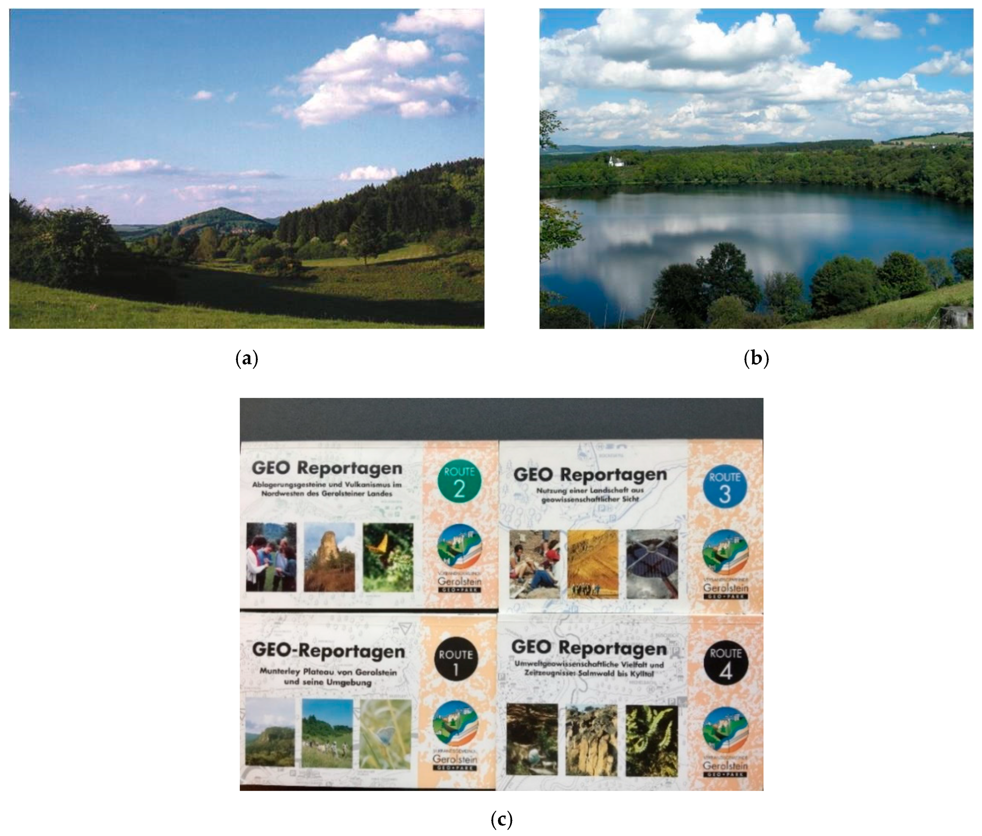
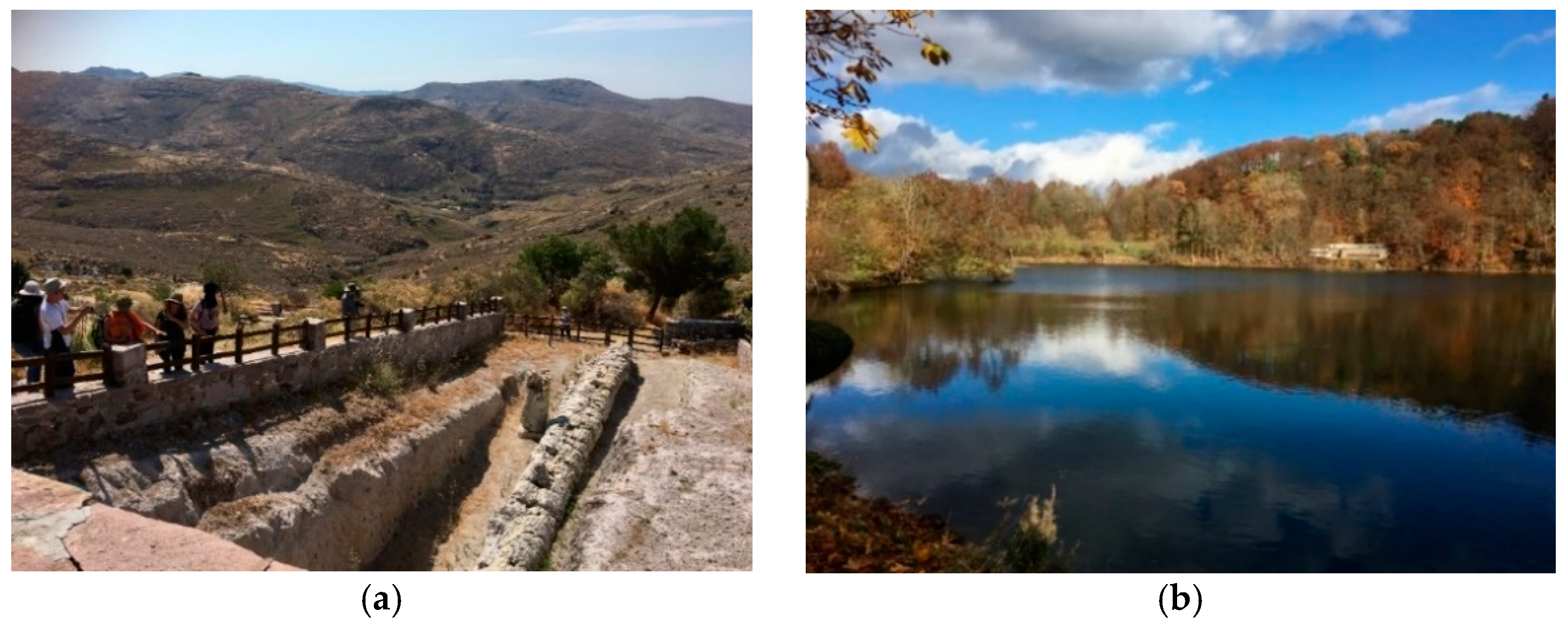
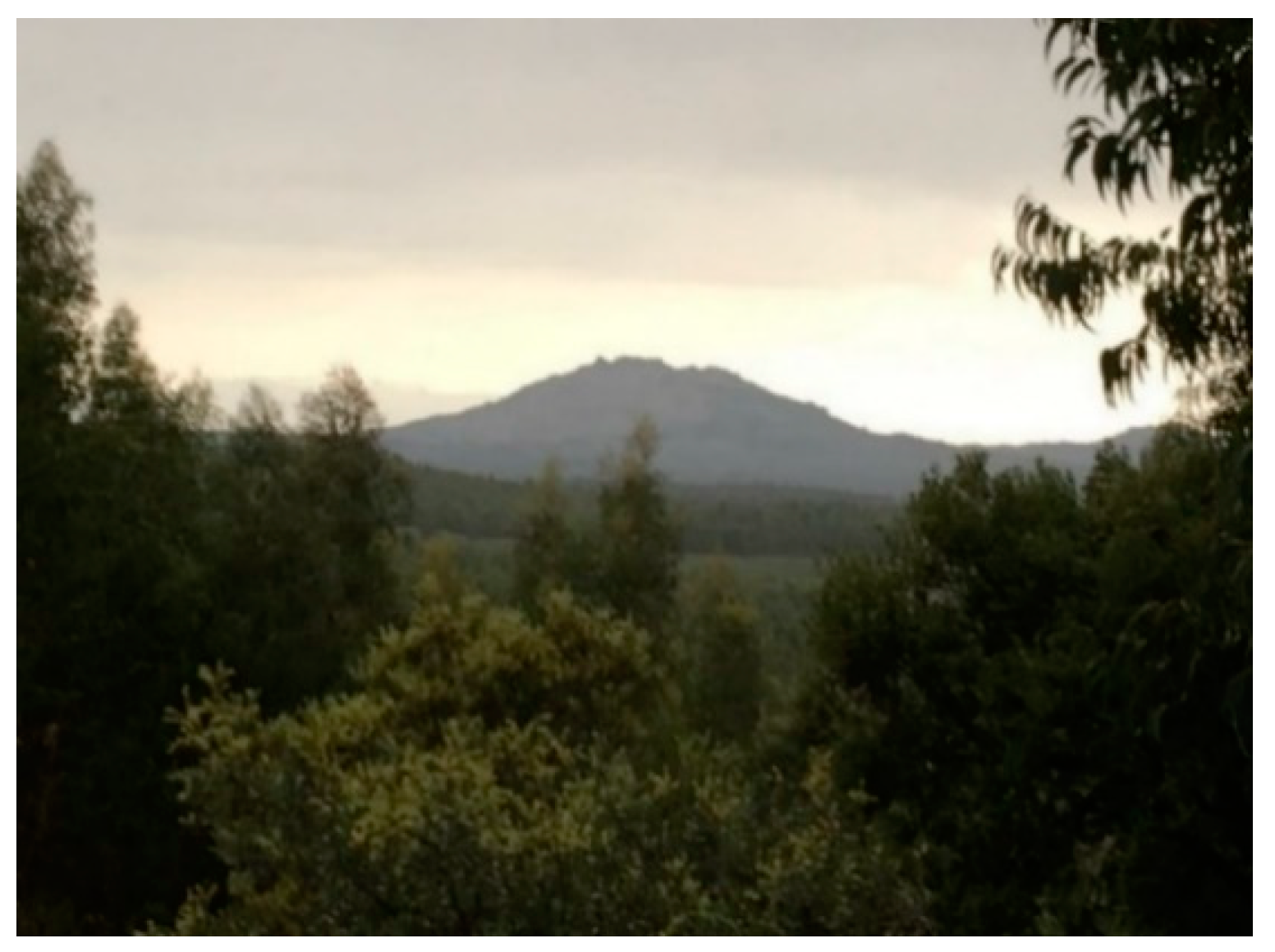
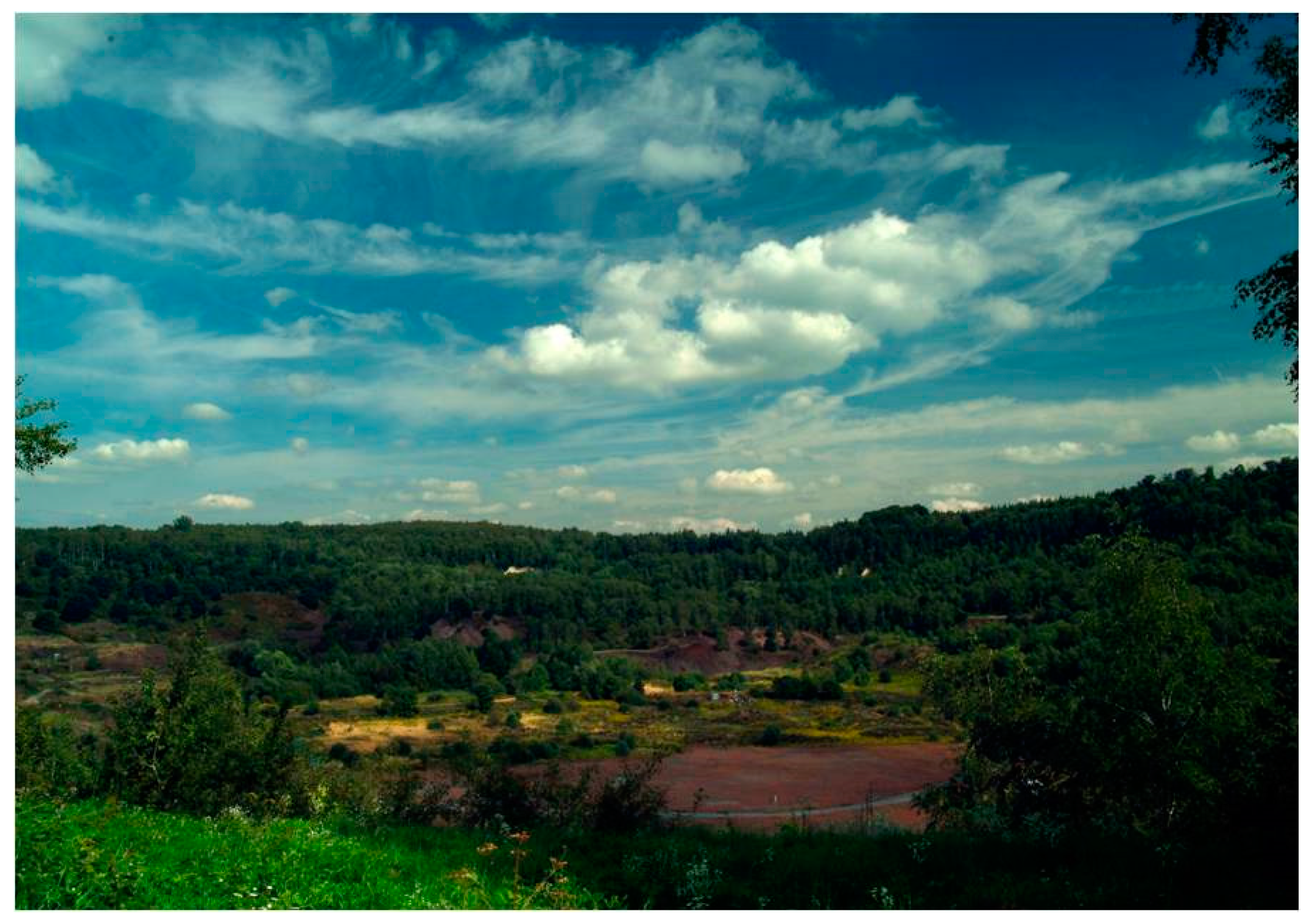
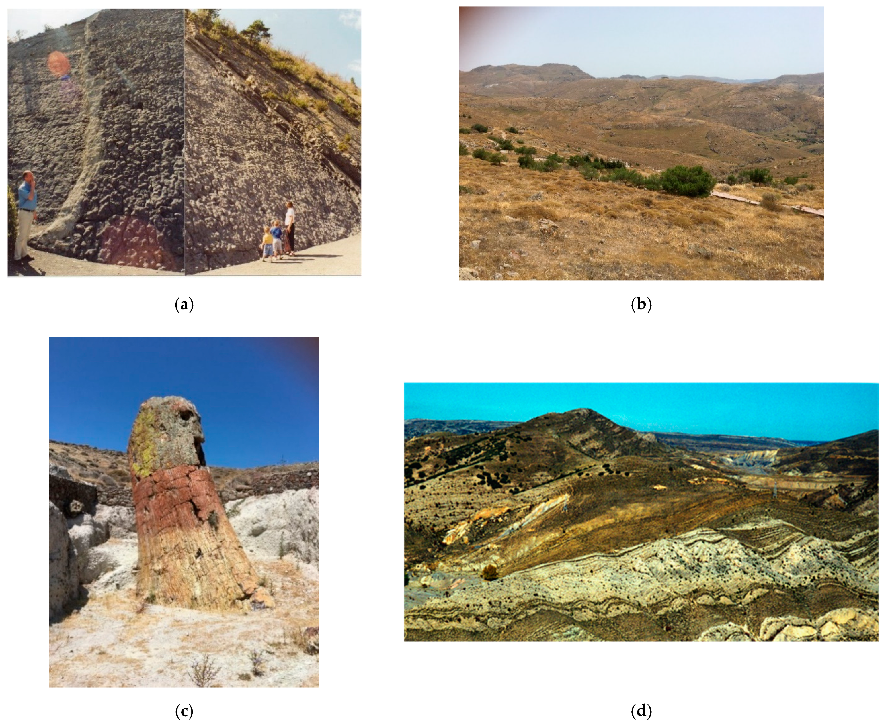
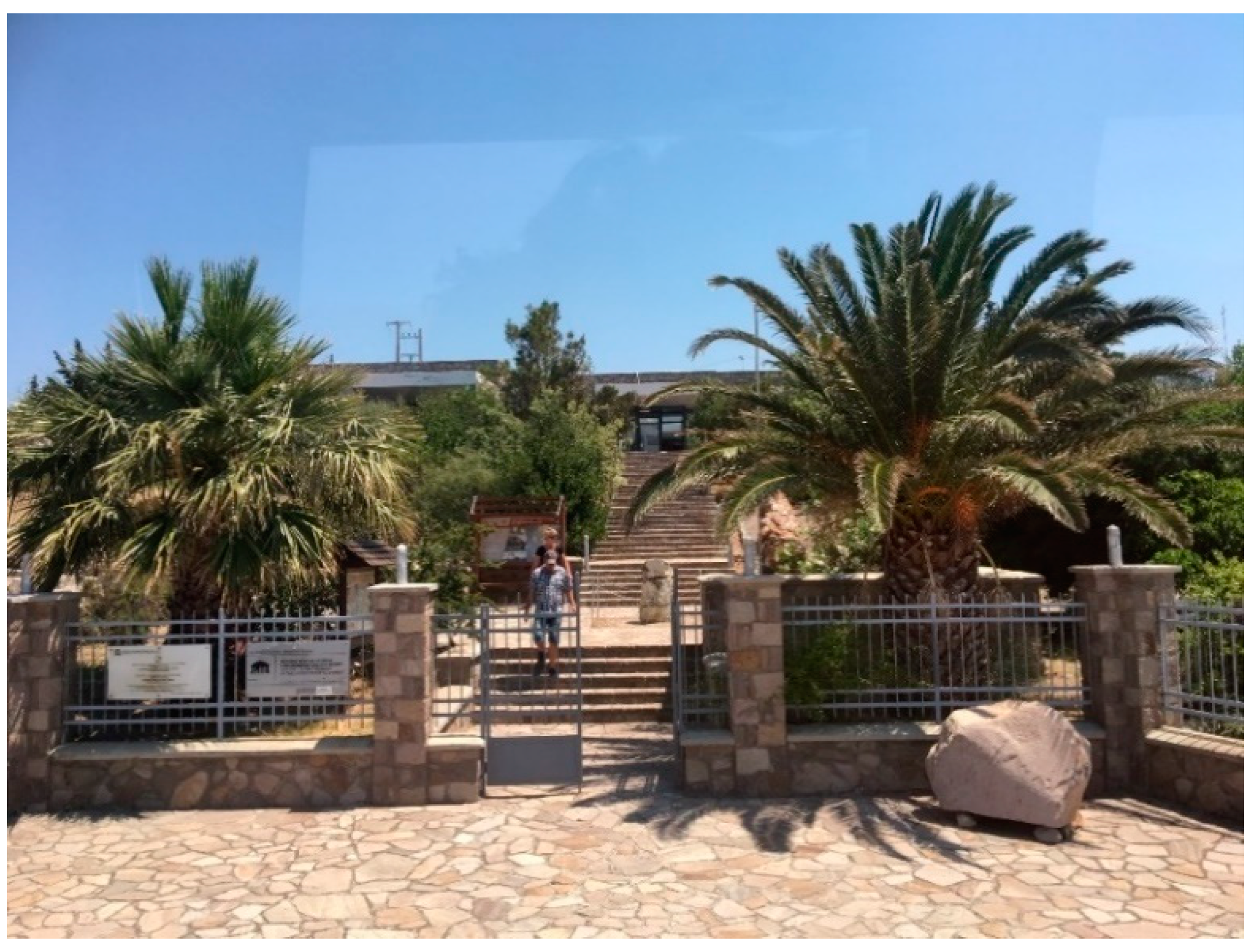
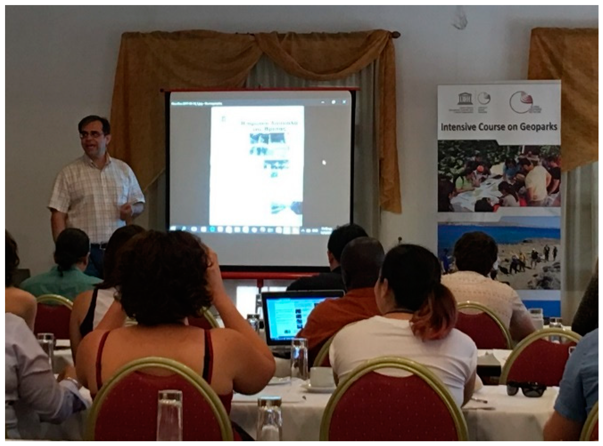
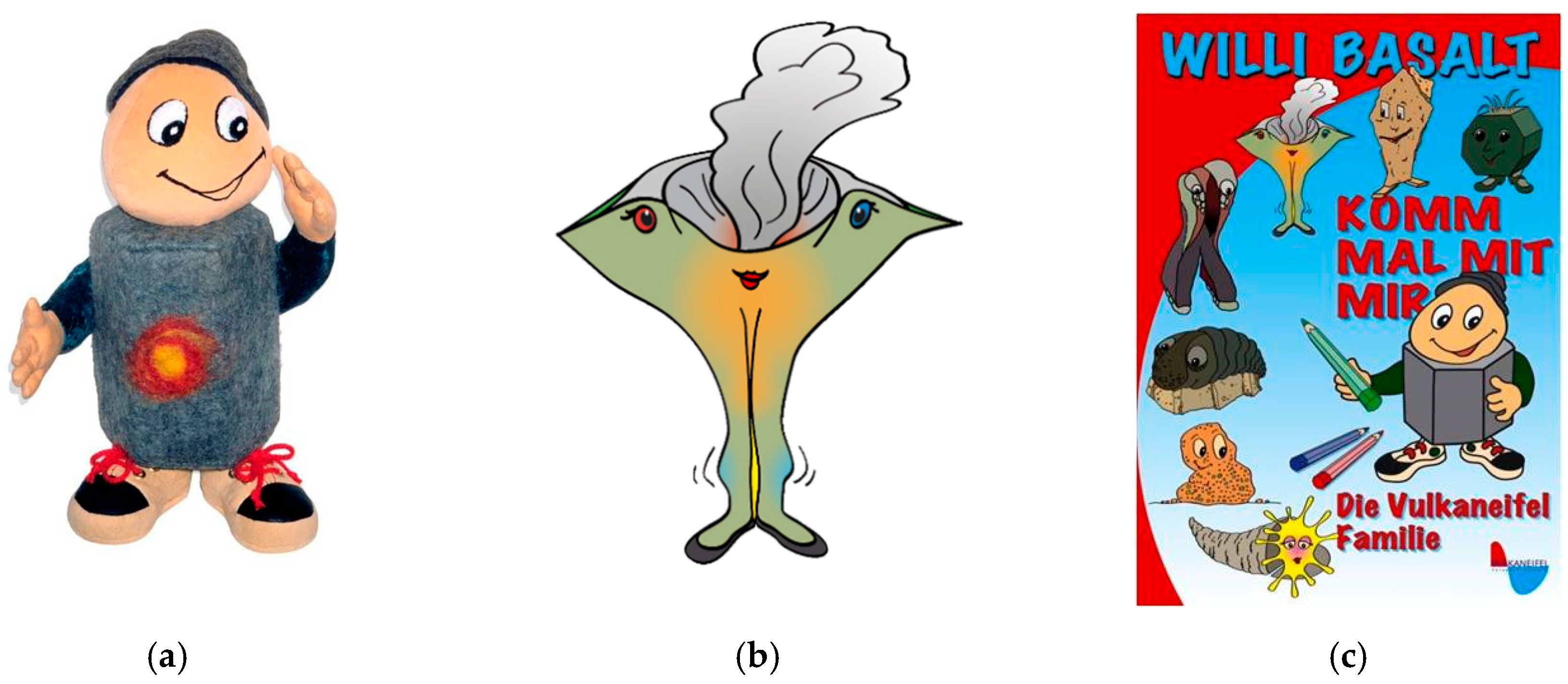
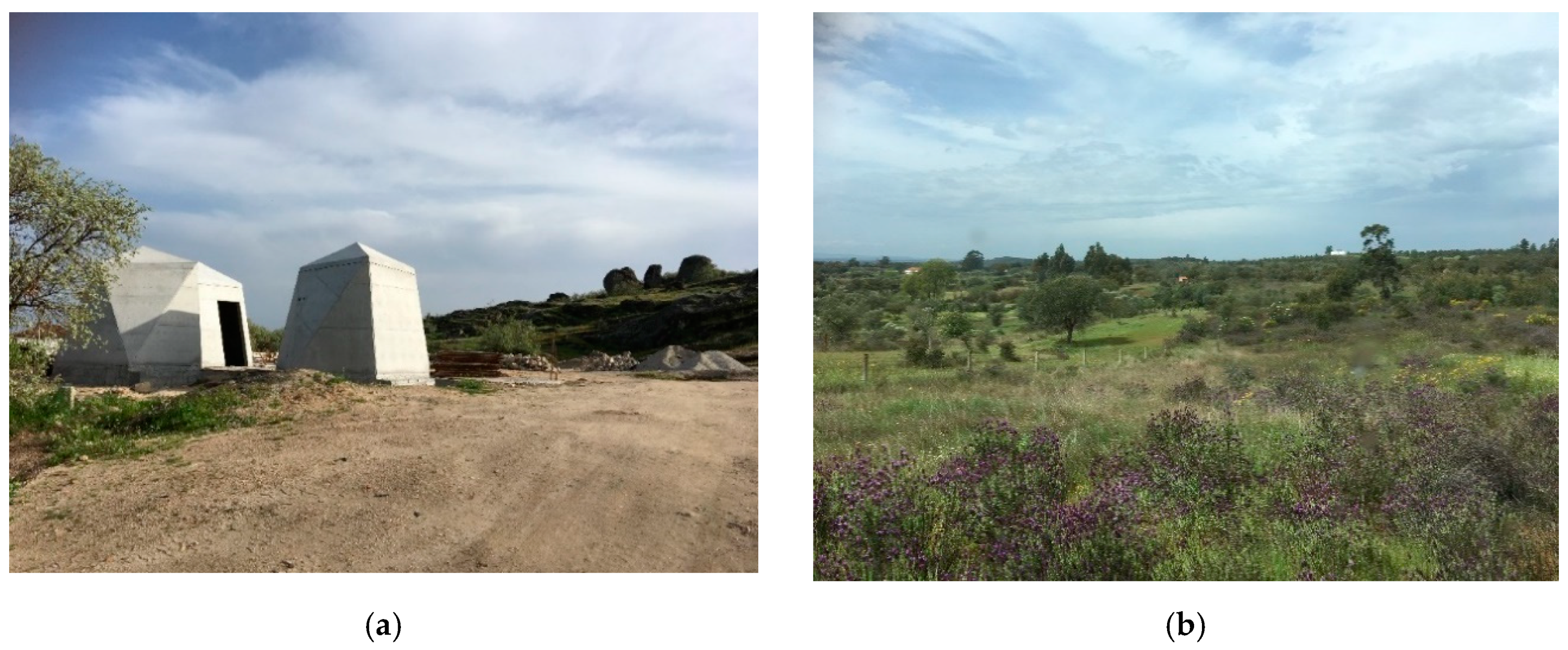
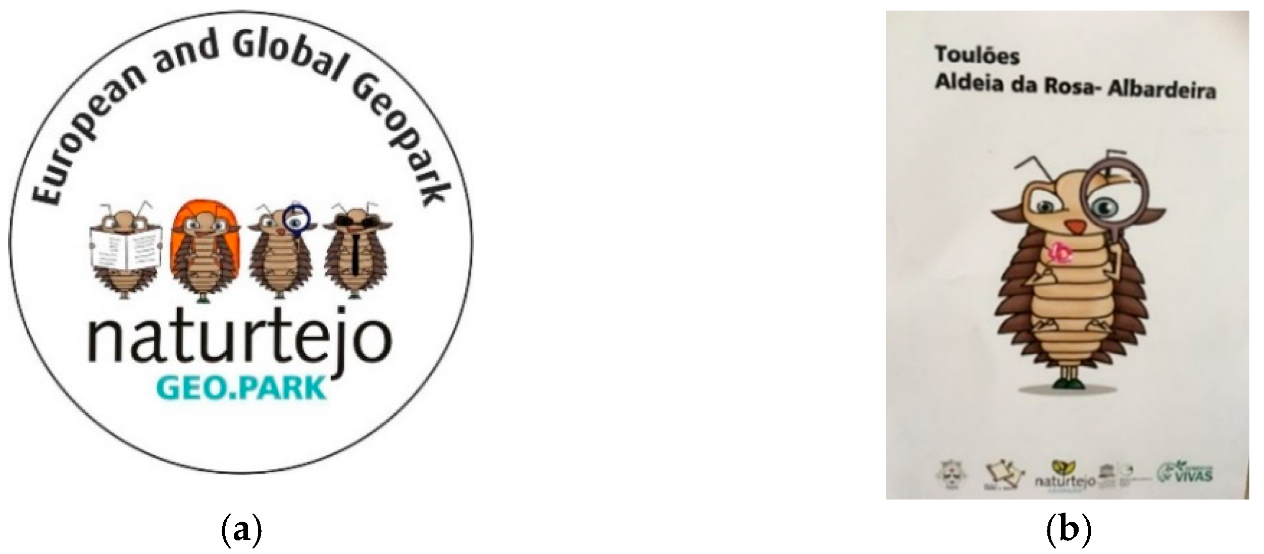
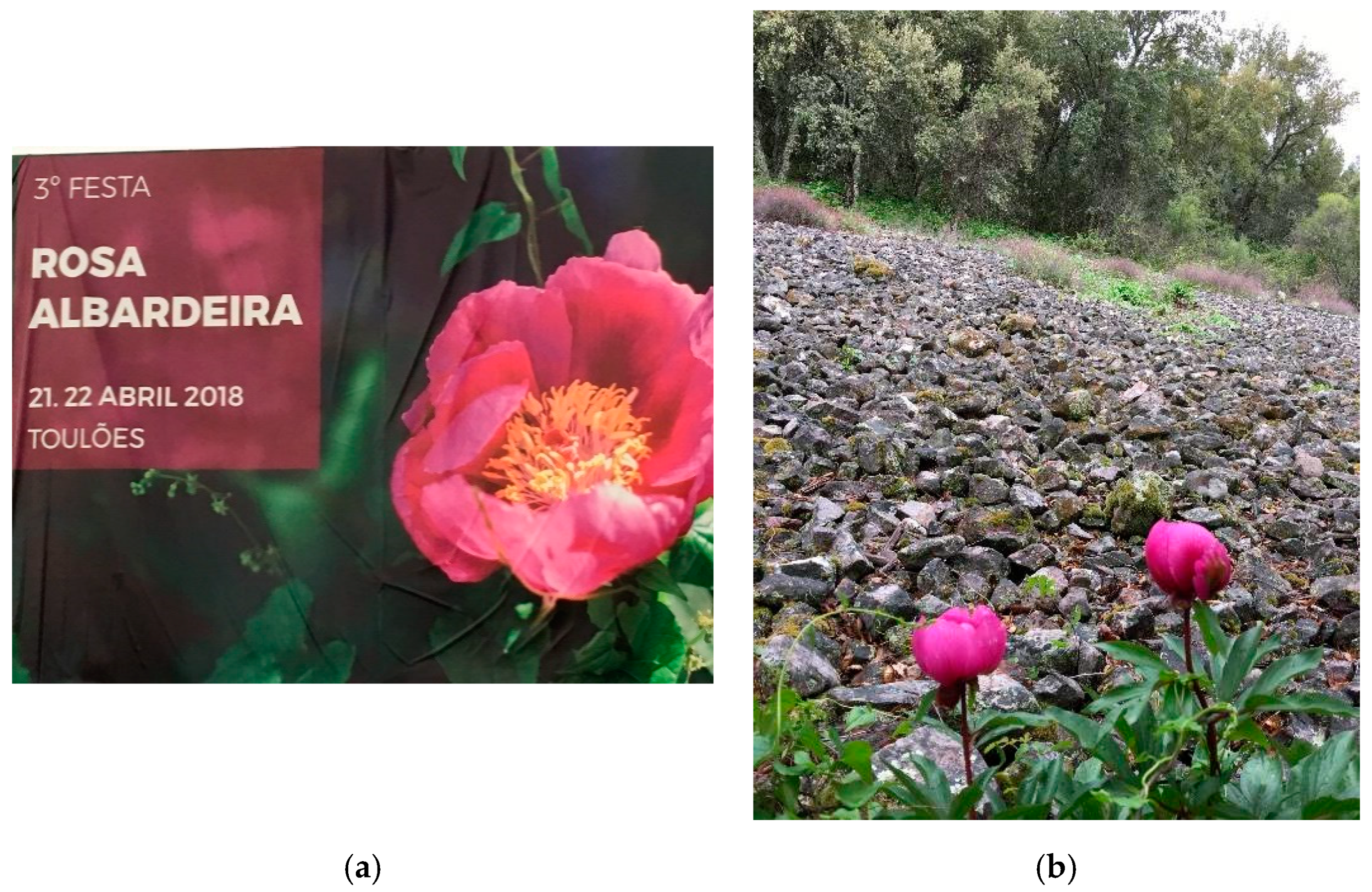
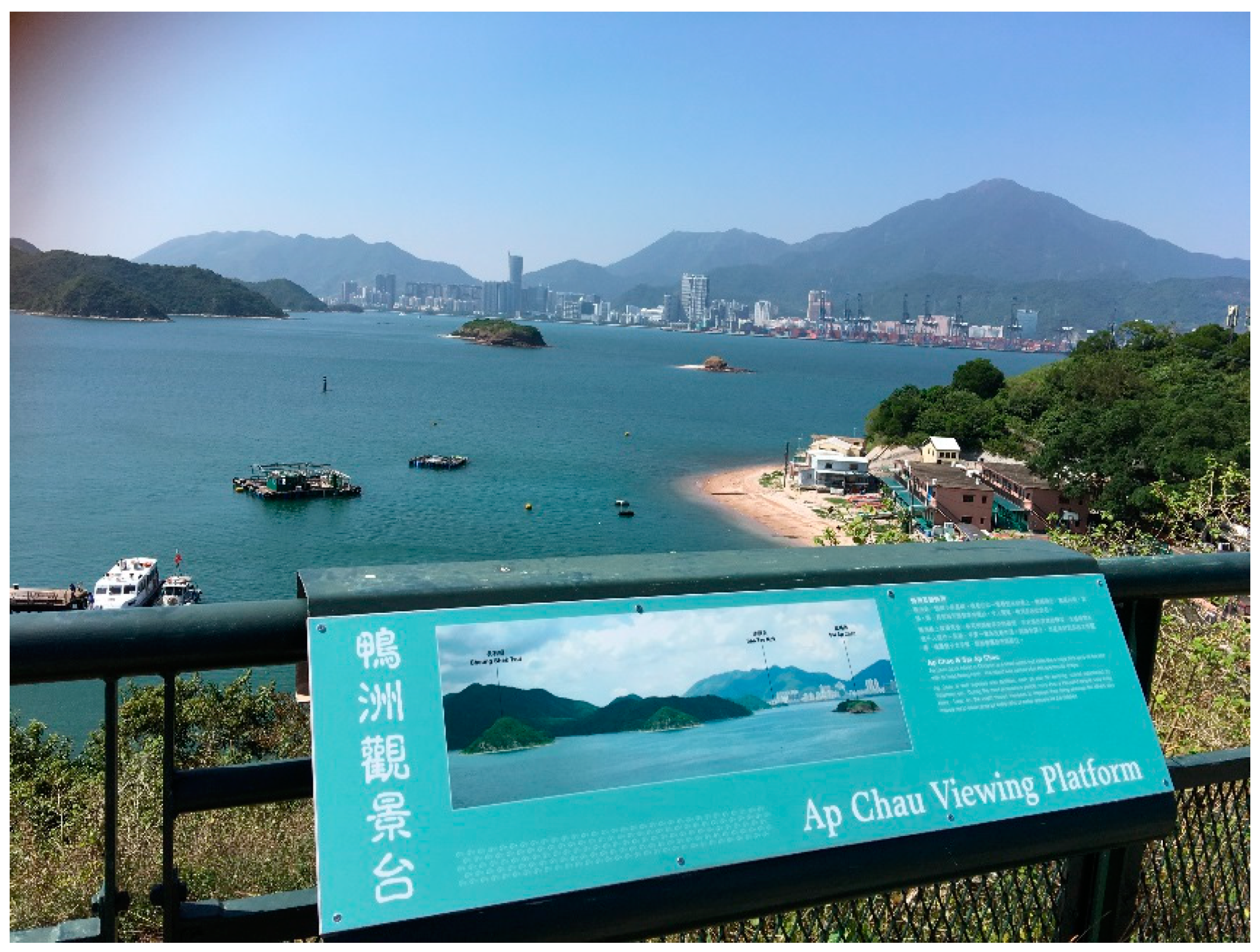
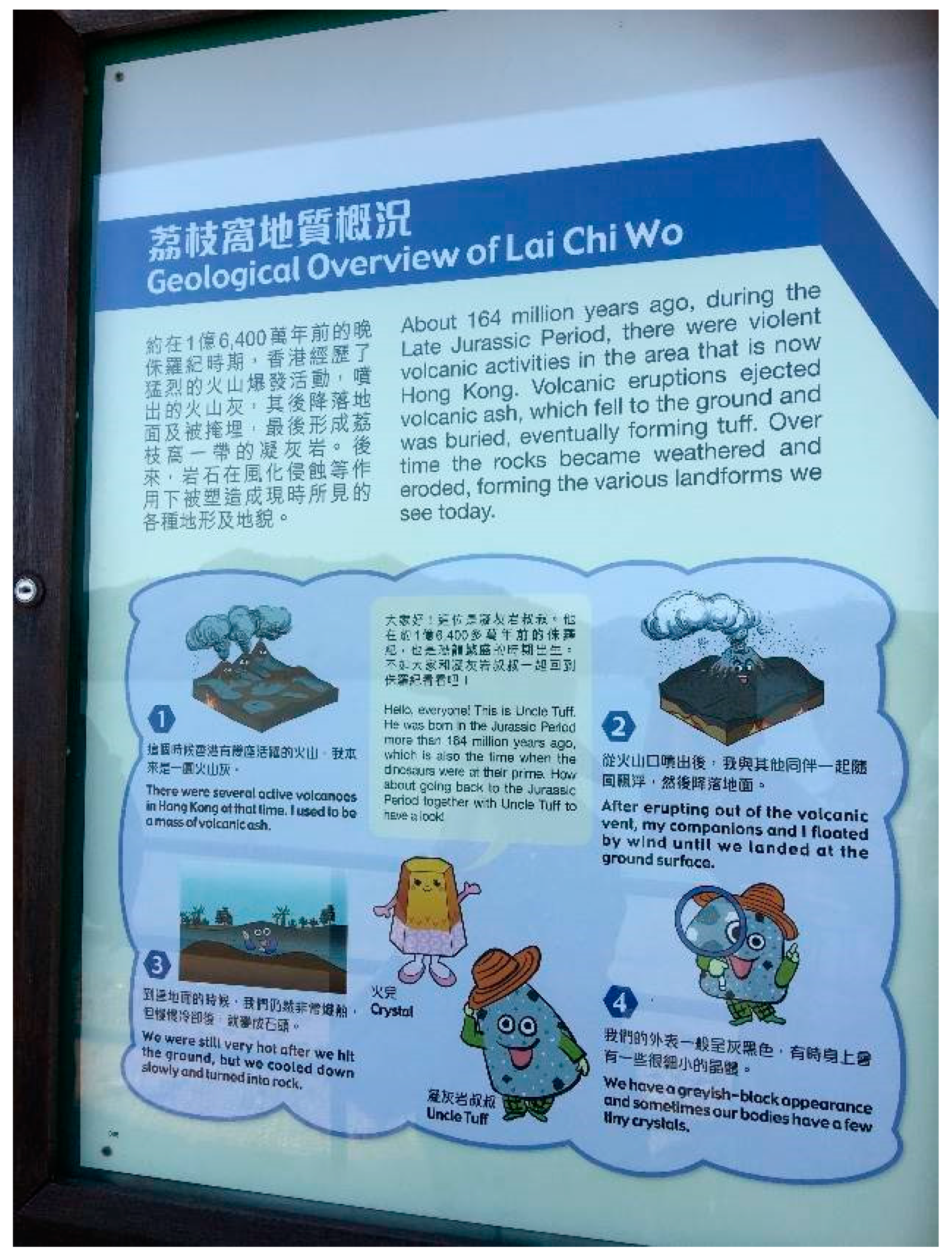
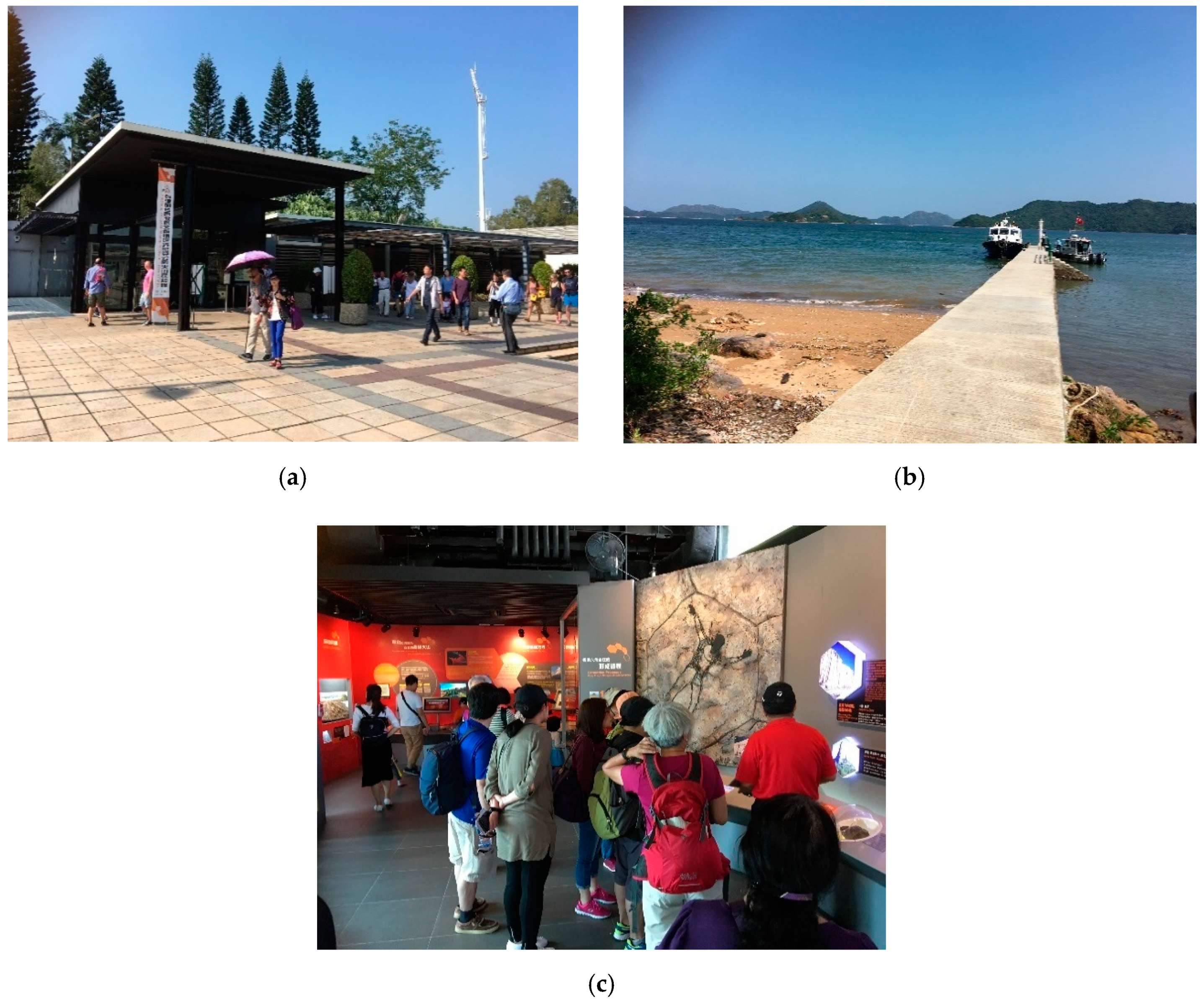
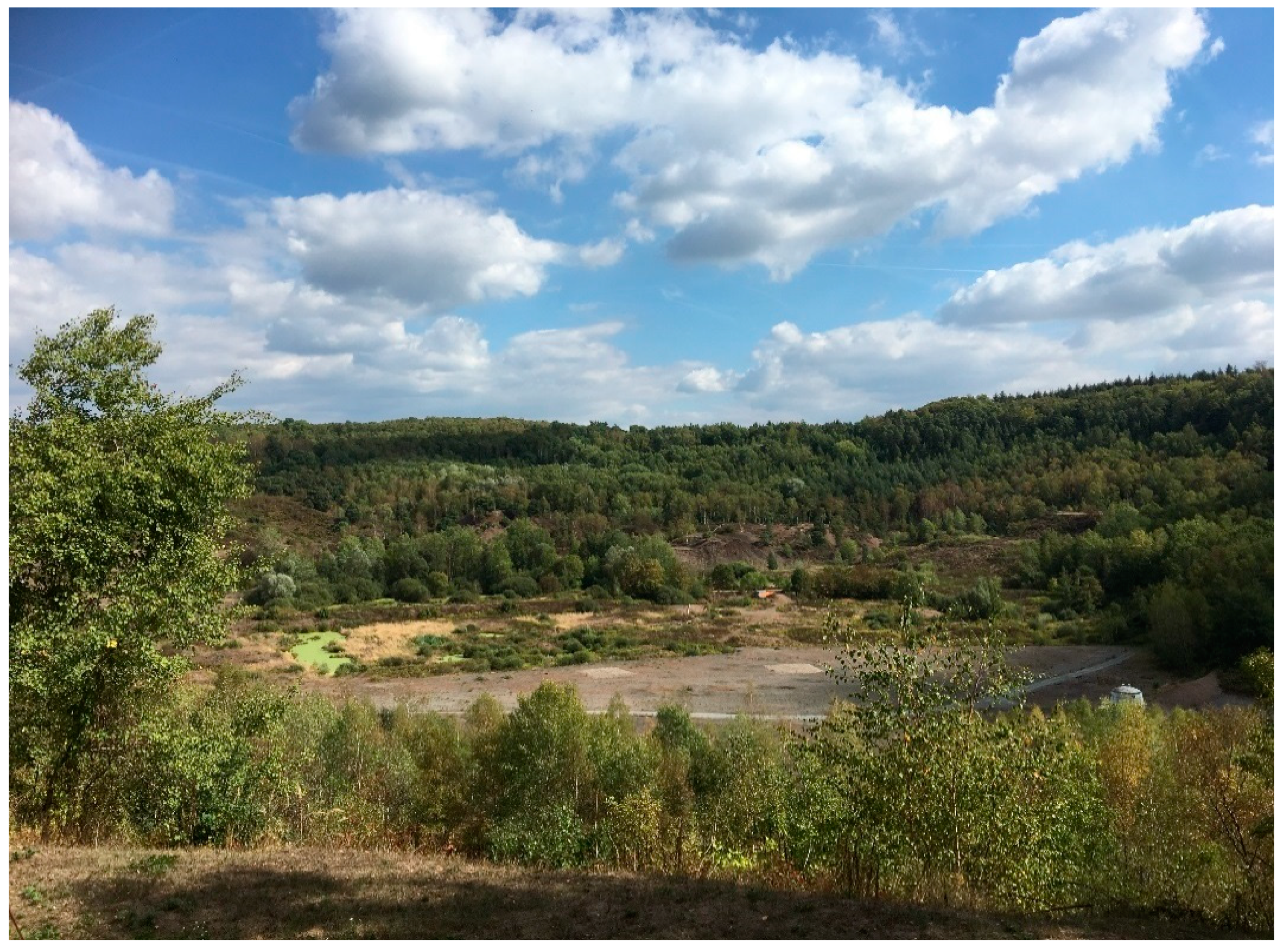
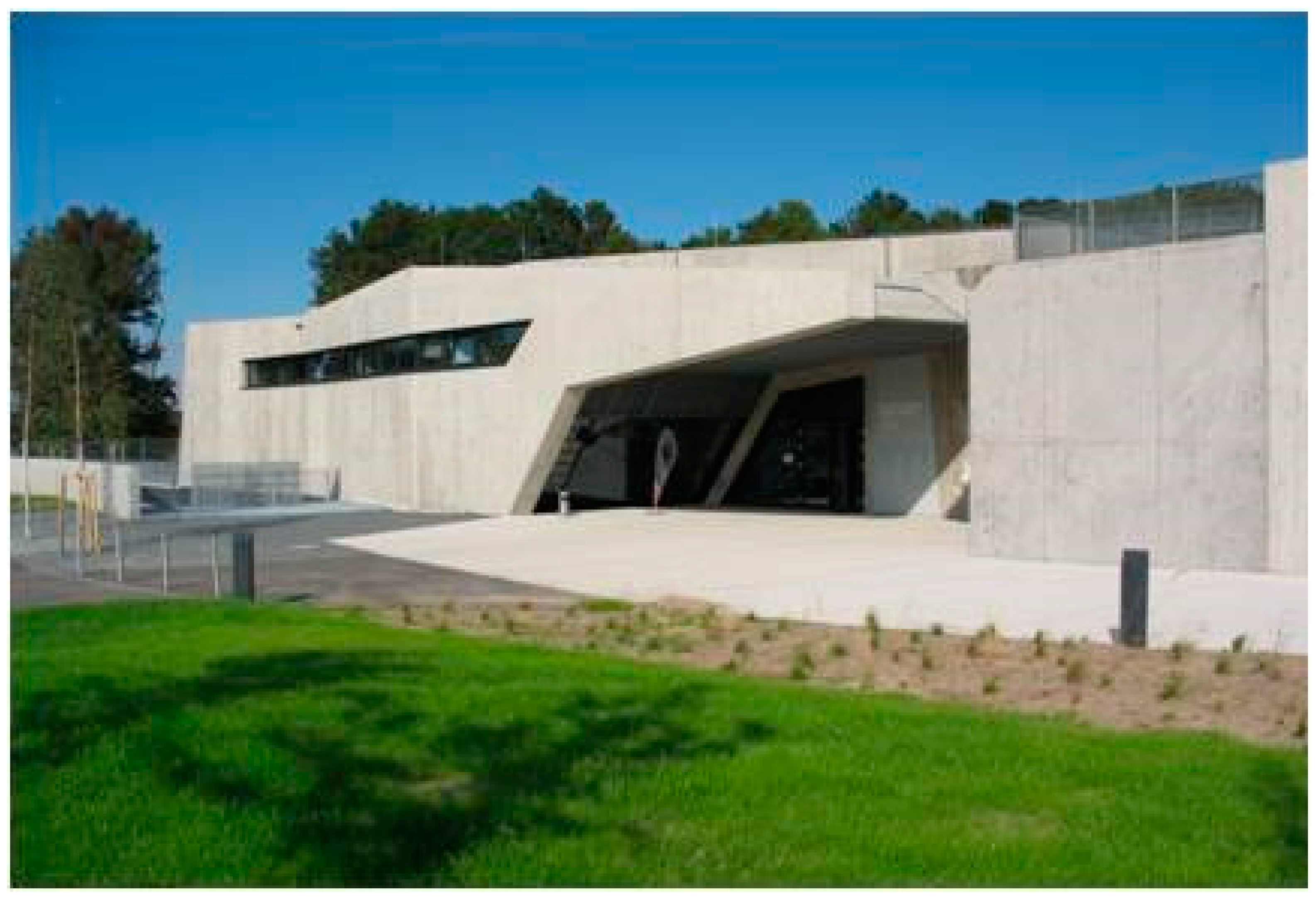
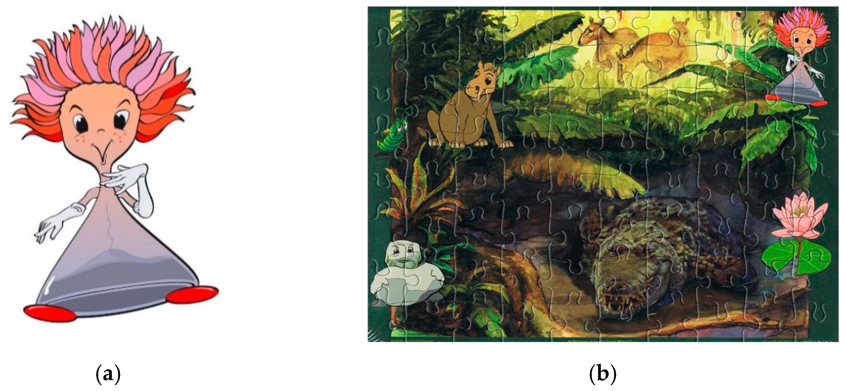
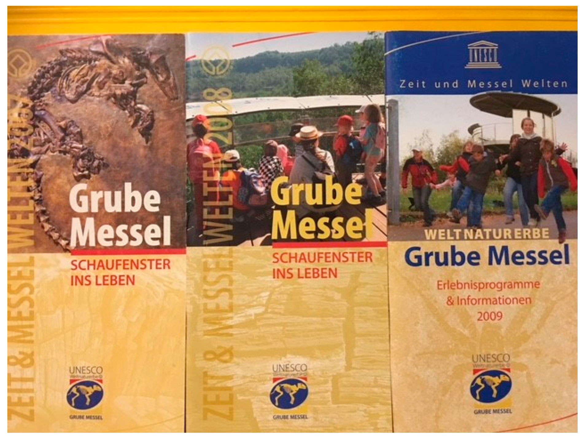
Table 1.
Indicators on “Geotourism Mosaic Model by Frey [59]”. Examples from four UGGps and one WHS.
Table 1.
Indicators on “Geotourism Mosaic Model by Frey [59]”. Examples from four UGGps and one WHS.
| Existence of Indicators Fitting to the Author’s Model | Lesvos | Naturtejo | Vulkaneifel | Hong Kong | Messel Pit | ||||||
|---|---|---|---|---|---|---|---|---|---|---|---|
| (web-site, printed material and by personal interview information) | Yes | No | Yes | No | Yes | No | Yes | No | Yes | No | |
| 1 | General concept on geological heritage, corporate identity (CI), yearly budget & management | x | x | x | x | x | |||||
| 2 | Staff in the management organization responsible for core issues | x | x | x | x | x | |||||
| 3 | Infrastructure for science popularization, e.g., museum or visitor centre | x | x | x | x | x | |||||
| 4 | Geotourism products and services (e.g., guided tours, souvenirs etc.) | x | x | x | x | x | |||||
| 5 | Existence of trained guides for tourist and educational activities | x | x | x | x | x | |||||
| 6 | Regular guided tours during the main season (e.g., April to October in Europe) | x | x | x | x | x | |||||
| 7 | Visitors of all ages and educational backgrounds | x | x | x | x | x | |||||
| 8 | Existence of geo-education tools, easy-to-understand publications | x | x | x | x | x | |||||
| 9 | Existence of guide training, qualification opportunities, e.g., with partners | x | ni | x | x | min | |||||
| 10 | Marketing tools (e.g., flyers, magazines, newsletters, giveaways, online tools) | x | X | x | x | x | |||||
| 11 | Collaboration with the tourist destinations and stakeholders (e.g., hotels, restaurants) | x | X | x | x | Min | |||||
| 12 | Participation in tourism marketing activities (e.g., tourism fairs, promotion activities) | x | X | x | x | X | |||||
| 13 | Active collaboration projects & exchange with municipalities and companies in the region | x | X | x | x | min | |||||
| 14 | Scientific partners (e.g., universities) on geological heritage, culture etc.) | x | X | x | x | min | |||||
| 15 | Active joint projects and or exchange with partners from the GGN etc. | x | x | x | x | x | |||||
| 16 | Events to promote local interest in geoheritage and gain media interest | x | x | x | Min | min | |||||
| 17 | Information on statistics and evaluation of the realized work of the territory | instat | instat | instat | instat | instat | |||||
Abbreviations—Table 1: ni—no information identifiable; min—minimum activities exist; instat—internal statistics exist, some in integrated in scientific publications or given by personal information.
Publisher’s Note: MDPI stays neutral with regard to jurisdictional claims in published maps and institutional affiliations. |
© 2021 by the author. Licensee MDPI, Basel, Switzerland. This article is an open access article distributed under the terms and conditions of the Creative Commons Attribution (CC BY) license (http://creativecommons.org/licenses/by/4.0/).
Share and Cite
MDPI and ACS Style
Frey, M.-L. Geotourism—Examining Tools for Sustainable Development. Geosciences 2021, 11, 30. https://0-doi-org.brum.beds.ac.uk/10.3390/geosciences11010030
AMA Style
Frey M-L. Geotourism—Examining Tools for Sustainable Development. Geosciences. 2021; 11(1):30. https://0-doi-org.brum.beds.ac.uk/10.3390/geosciences11010030
Chicago/Turabian StyleFrey, Marie-Luise. 2021. "Geotourism—Examining Tools for Sustainable Development" Geosciences 11, no. 1: 30. https://0-doi-org.brum.beds.ac.uk/10.3390/geosciences11010030
Note that from the first issue of 2016, this journal uses article numbers instead of page numbers. See further details here.