Next Issue
Volume 12, June
Previous Issue
Volume 12, April


Geosciences, Volume 12, Issue 5 (May 2022) – 39 articles

Cover Story (view full-size image): 
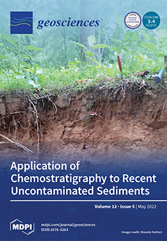
Floodplain deposits record a history of a river’s responses to natural and anthropogenic disturbances, and numerous types of stratigraphic markers have been used to interpret temporal and spatial changes in riverine ecosystems. A significant, recent approach to the analysis of floodplain deposits is chemostratigraphy in which chemically defined units of a given age (chemical isochrones) are used to assess the dispersal and three-dimensional depositional pattern of contaminated sediment with recent alluvial deposits. This paper explores the use of chemostratigraphy to interpret the deposition of recent uncontaminated legacy sediments representative of those found throughout the eastern and southeastern US, as well as many other parts of the world. View this paper
  • Issues are regarded as officially published after their release is announced to the table of contents alert mailing list.
  • You may sign up for e-mail alerts to receive table of contents of newly released issues.
  • PDF is the official format for papers published in both, html and pdf forms. To view the papers in pdf format, click on the "PDF Full-text" link, and use the free Adobe Reader to open them.
Order results
Result details
Section
Select all
Export citation of selected articles as:
18 pages, 2349 KiB  
Article
Garnet Geochemistry and Lu-Hf Geochronology of a Gold-Bearing Sillimanite-Garnet-Biotite Gneiss at the Borden Lake Belt
by Daniel LaFontaine, Audrey Bouvier and Mary Louise Hill
Geosciences 2022, 12(5), 218; https://0-doi-org.brum.beds.ac.uk/10.3390/geosciences12050218 - 23 May 2022
Viewed by 2328
Abstract
The Kapuskasing Structural Zone transects the Wawa and Abitibi greenstone belts in the Superior province of the Canadian Shield. At the southern margin of the Kapuskasing Structural Zone (KSZ), the Borden Gold deposit hosts low-grade-gold mineralization within upper amphibolite- to granulite-facies sillimanite-garnet-biotite gneisses. [...] Read more.
The Kapuskasing Structural Zone transects the Wawa and Abitibi greenstone belts in the Superior province of the Canadian Shield. At the southern margin of the Kapuskasing Structural Zone (KSZ), the Borden Gold deposit hosts low-grade-gold mineralization within upper amphibolite- to granulite-facies sillimanite-garnet-biotite gneisses. Here, we present the geochemistry and Lu-Hf geochronological studies of a gold-hosting garnet-bearing gneiss to constrain the formation history of the deposit and regional geological history. The garnet is almandine-rich, and contains inclusions of quartz, biotite, pyrite, and zircon. The absence of chemical zoning in garnet is likely due to intracrystalline diffusion at peak metamorphic temperatures. The 176Lu-176Hf internal isochron of two garnet fractions and three corresponding whole-rock splits from a gneissic unit yield a precise internal isochron age at 2629.0 ± 4.3 Ma (MSWD = 0.66), with an initial 176Hf/177Hf = 0.281210 ± 0.000010 corresponding to an εHfi = +4.1. This signature suggests a mafic source, which was derived from a long-term depleted reservoir, for this metasediment. The Lu-Hf age is consistent with the youngest age population of zircons from the paragneisses, which were previously dated in the area. Our results thus provide upper constraints on the timing of retrograde upper-amphibolite metamorphism and gold mineralization at Borden. Full article
(This article belongs to the Section Geochemistry)
Show Figures

Figure 1

14 pages, 1071 KiB  
Article
Soil Characteristics in Private Gardens of Different City Neighborhoods: A Case Study of Taibe, Israel
by Pariente Sarah, Helena Zhevelev, Shatha Haj-Yehia, Eyal Sachs and Anatoly G. Fragin
Geosciences 2022, 12(5), 217; https://0-doi-org.brum.beds.ac.uk/10.3390/geosciences12050217 - 23 May 2022
Viewed by 1515
Abstract
City green areas including private gardens, provide ecological, sociological, cultural, health, and engineering advantages that motivate the urban system. Manmade impacts on the development of urban soils are of greater importance than natural ones. Soil properties were studied in an Arab city—Taibe—in Israel. [...] Read more.
City green areas including private gardens, provide ecological, sociological, cultural, health, and engineering advantages that motivate the urban system. Manmade impacts on the development of urban soils are of greater importance than natural ones. Soil properties were studied in an Arab city—Taibe—in Israel. Two neighborhoods in the city, which differed in time of establishment, were selected: An older residential neighborhood constructed more than 70 years ago, and a newer one built 10 years ago. In each neighborhood, 15 private gardens were randomly chosen. In total, the study was conducted in 30 gardens. In each garden, soil samples were collected from three depths: 0–2, 2–10, and 10–30 cm, respectively. In each sample, organic matter, hygroscopic moisture, calcium carbonate, bulk density, field water content, lead, copper and zinc contents, and texture were determined. The soil of the older neighborhood expressed greater values of soil properties and higher profile differentiation than the newer one. The heavy metals in the soil of the private gardens of both neighborhoods are not present in excess nor are they toxic. Under the prevailing environmental conditions, the soil of the newer neighborhood will become like that of the older one in the future unless a new soil interruption occurs. The calcium carbonate and heavy metals contents in the soil can be used as indicators of soil maturity in different areas of the city having similar environmental conditions. In addition, the gradients of these properties along profiles can be helpful in restoring the history of human activity, which prevailed in the area. Full article
(This article belongs to the Special Issue Medical Geology in the Urban Environment)
Show Figures

Figure 1

18 pages, 36100 KiB  
Article
Evaluation of the Installation Effect on the Performance of a Granular Column
by Firas Ghrairi, Arash Alimardani Lavasan and Torsten Wichtmann
Geosciences 2022, 12(5), 216; https://0-doi-org.brum.beds.ac.uk/10.3390/geosciences12050216 - 18 May 2022
Cited by 1 | Viewed by 1522
Abstract
The procedure of granular column installation impacts soil properties such as stress state, stiffness, and permeability in the near-field of the column. For an accurate and efficient design of relatively costly geostructures on improved subsoil with granular columns, a reliable estimation of the [...] Read more.
The procedure of granular column installation impacts soil properties such as stress state, stiffness, and permeability in the near-field of the column. For an accurate and efficient design of relatively costly geostructures on improved subsoil with granular columns, a reliable estimation of the column installation effects on the properties of natural subsoil deposits is necessary. To achieve this goal, two phases are adopted in numerical simulations: (1) the installation phase based on the cavity expansion method using a 2D model, and (2) the construction phase in conjunction with the improved soil properties after column installation using a 3D model. The latter phase includes the construction of an embankment and the column is considered as an independent unit. The soil profile, i.e., stress and stiffness, is spatially updated from the first simulation (i.e., installation phase). In this frame, the stiffness was calculated according to a procedure suggested by the authors to determine the final stiffness based on the formulation of the Hardening Soil constitutive model. The numerical models were validated through a comparison with the recorded data of a field test obtained from the Klagenfurt site. Results of numerical analyses for the case study indicated that application of proposed methodology led to a more accurate estimate of the settlement, demonstrating that the installation effects have be taken into consideration to assure reliable evaluation of granular-column performance. Full article
(This article belongs to the Collection New Advances in Geotechnical Engineering)
Show Figures

Figure 1

18 pages, 4672 KiB  
Article
Regional-Scale Seismic Liquefaction Susceptibility Mapping via an Empirical Approach Validated by Site-Specific Analyses
by Veronica Zumpano, Luca Pisano, Francesco Filice, Angelo Ugenti, Daniela de Lucia, Janusz Wasowski, Francesca Santaloia and Piernicola Lollino
Geosciences 2022, 12(5), 215; https://0-doi-org.brum.beds.ac.uk/10.3390/geosciences12050215 - 17 May 2022
Cited by 3 | Viewed by 2306
Abstract
Regional-scale analyses of susceptibility to liquefaction are seldom performed in data-scarce areas. However, in spite of data limitations, such efforts can still provide useful information in case of populated, seismically active regions. The present work focuses on susceptibility zonation for soil liquefaction that [...] Read more.
Regional-scale analyses of susceptibility to liquefaction are seldom performed in data-scarce areas. However, in spite of data limitations, such efforts can still provide useful information in case of populated, seismically active regions. The present work focuses on susceptibility zonation for soil liquefaction that might occur due to ground shaking in the Foggia Province, a data-scarce, seismically active area of about 7000 km2 located in southern Italy. The Analytical Hierarchy Process (AHP) approach is used to obtain the susceptibility to liquefaction map of the whole area, while a geological and geotechnical database including 531 boreholes from 84 localities is used for cross-validation. The data are processed by means of a simplified quantitative method to determine liquefaction potential and assess whether a specific area is prone to liquefaction or not. Our results, along with an AUC − ROC = 0.89 test value, indicate that there are widespread areas of medium to high and very high susceptibility, and that the most susceptible zones are localized along the Adriatic Sea coastline and watercourses. The final susceptibility to liquefaction map represents a step forward towards the assessment of secondary seismic hazard in the study area, thus supporting the regional and local administrations responsible for land-use planning and risk mitigation. Full article
Show Figures

Figure 1

15 pages, 3533 KiB  
Article
The Energy Cost of Extracting Critical Raw Materials from Tailings: The Case of Coltan
by Ricardo Magdalena, Guiomar Calvo and Alicia Valero
Geosciences 2022, 12(5), 214; https://0-doi-org.brum.beds.ac.uk/10.3390/geosciences12050214 - 17 May 2022
Cited by 3 | Viewed by 2464
Abstract
Niobium and tantalum are mainly produced from columbite–tantalite ores, and 60% of their production is nowadays located in the Democratic Republic of Congo and Rwanda. The concentration of supply, the scarcity, the wide range of use in all electronic devices, and the expected [...] Read more.
Niobium and tantalum are mainly produced from columbite–tantalite ores, and 60% of their production is nowadays located in the Democratic Republic of Congo and Rwanda. The concentration of supply, the scarcity, the wide range of use in all electronic devices, and the expected future demand boosted by the clean and digital transition means that Nb and Ta have high supply risks. In this context, extraction from rich Ta and Nb tailings from abandoned mines could partly offset such risks. This study analyzes the energy cost that the reprocessing of both elements from tailings would have. To that end, we simulate with HSC Chemistry software the different processes needed to beneficiate and refine both metals from zinc tailings as a function of Nb and Ta concentration. At current energy and metal prices, tantalum recovery from rich Ta-Nb tailings would be cost-effective if ore-handling costs were allocated to a paying metal. By way of contrast, niobium recovery would not be favored unless market prices increase. Full article
Show Figures

Figure 1

18 pages, 3386 KiB  
Article
First Speleological and Biological Characterization of a Submerged Cave of the Tremiti Archipelago Geomorphosite (Adriatic Sea)
by Frine Cardone, Martina Mazzetti, Adelmo Sorci, Andrea Cesaretti, Roberta Cimmaruta and Maria Flavia Gravina
Geosciences 2022, 12(5), 213; https://0-doi-org.brum.beds.ac.uk/10.3390/geosciences12050213 - 17 May 2022
Cited by 2 | Viewed by 2457
Abstract
The Tremiti Islands Archipelago is located in the Central-Southern Adriatic Sea and is characterized by a strong karst activity. Due to their landscape, geological, hydrological, archaeological, and historical value, Tremiti Islands are considered a geomorphosite. We carried out a preliminary, non-destructive survey by [...] Read more.
The Tremiti Islands Archipelago is located in the Central-Southern Adriatic Sea and is characterized by a strong karst activity. Due to their landscape, geological, hydrological, archaeological, and historical value, Tremiti Islands are considered a geomorphosite. We carried out a preliminary, non-destructive survey by studying the speleological and biological features of the submerged sea cave Elle, located at Cala Sorrentino (Capraia Island), representing an EU Natura 2000 Priority Habitat. Topographic (perimeter length, width, height, GPS location, depth) and hydrological parameters (temperature, dissolved oxygen, pH, irradiance, water movement) were measured and its map was produced, based on morphological measurements and biological evidence. Species composition and biotic cover were investigated by image analysis. The benthic community was dominated by poriferans, together with remarkable assemblages of scleractinians and polychaete serpulids and clearly reflected the sharp light and hydrological gradients from the entrance to the cave bottom. Furthermore, different phases were hypothesized for the genesis of the cave during sea regression and flooding periods. To be signaled is the record of Petrobiona massiliana, a sponge was protected under both Barcelona and Bern Convention and of some individuals of polychaete Serpulinae, which are still under description. Full article
(This article belongs to the Special Issue Recent and Fossil Submarine Caves)
Show Figures

Figure 1

18 pages, 5651 KiB  
Article
Ductile Shearing and Focussed Rejuvenation: Records of High-P (eo-)Alpine Metamorphism in the Variscan Lower Crust (Serre Massif, Calabria—Southern Italy)
by Vincenzo Festa, Annamaria Fornelli, Francesca Micheletti, Richard Spiess and Fabrizio Tursi
Geosciences 2022, 12(5), 212; https://0-doi-org.brum.beds.ac.uk/10.3390/geosciences12050212 - 17 May 2022
Cited by 1 | Viewed by 1688
Abstract
In the present study, we unveil the real significance of mylonitic reworking of the polymetamorphic crystalline basement in the Serre Massif of Calabria (Southern Italy). We use a multidisciplinary approach to comprehend the structural, microstructural and petrologic changes that occurred along a, so [...] Read more.
In the present study, we unveil the real significance of mylonitic reworking of the polymetamorphic crystalline basement in the Serre Massif of Calabria (Southern Italy). We use a multidisciplinary approach to comprehend the structural, microstructural and petrologic changes that occurred along a, so far, not much considered shear zone affecting the Variscan lower crustal rocks. It was never before studied in detail, although some late Cretaceous ages were reported for these mylonites, suggesting that this shear zone is of prime importance. Our observations reveal now that the formation of the new structural fabric within the shear zone was accompanied by changes in mineral assemblages, in a dominant compressive tectonic regime. During this tectono-metamorphic event, high-P mylonitic mineral assemblages were stabilized, consisting of chloritoid, kyanite, staurolite, garnet and paragonite, whereas plagioclase became unstable. Average peak PT conditions of 1.26–1.1 GPa and 572–626 °C were obtained using THERMOCALC software. These data question (i) that the Serre Massif represents an undisturbed continuous section of the Variscan crust, as generally suggested in the literature, and (ii) highlight the role of (eo-)Alpine high-P tectonics in the Serre Massif, recorded within mylonite zones, where the Variscan basement was completely rejuvenated. Full article
(This article belongs to the Special Issue Microstructural Analyses of Fault Rocks)
Show Figures

Figure 1

24 pages, 10104 KiB  
Article
Terrace Morpho-Sedimentary Sequences on the Sibari Plain (Calabria, Southern Italy): Implication for Sea Level and Tectonic Controls
by Federica Lucà, Andrea Brogno, Vincenzo Tripodi and Gaetano Robustelli
Geosciences 2022, 12(5), 211; https://0-doi-org.brum.beds.ac.uk/10.3390/geosciences12050211 - 16 May 2022
Cited by 3 | Viewed by 1796
Abstract
The Sibari Plain (northeastern Calabria) shows a well-developed stair of late Quaternary marine/coastal terraces resulting from the interaction between sea level fluctuations and tectonic uplift. This paper (i) provides a stratigraphic description of terraced deposits between the Raganello and Coscile rivers, (ii) assesses [...] Read more.
The Sibari Plain (northeastern Calabria) shows a well-developed stair of late Quaternary marine/coastal terraces resulting from the interaction between sea level fluctuations and tectonic uplift. This paper (i) provides a stratigraphic description of terraced deposits between the Raganello and Coscile rivers, (ii) assesses the relative controls of eustacy and uplift on the staircase formation, and (iii) unravels the Quaternary morphosedimentary evolution of the study area. A geomorphological approach was coupled with stratigraphic field surveys. Photo interpretation, topographic map analyses, and field surveys allowed us to map ten orders of terraces forming telescopically incised valley-fills. Based on the uppermost position of foreshore deposits on inner margins and an average uplift rate of ~1 mm/y, inferred from the Marine Isotope Stage (MIS) 5.5, terraces were correlated with highstands. Sedimentological and stratigraphic analyses allowed us to recognize four assemblages of genetically associated sedimentary facies related to superimposed and juxtaposed coastal and alluvial systems, showing a seaward-stepping architecture. Based on stratal geometry and facies association, we argue that alluvial/fluvial sediments and coastal depositional systems formed contemporaneously along the same terrace. Terrace arrangement resulted from repeated cycles of valley incision (sea level fall) and aggradational to progradational stacking pattern (sea level rise and highstands) in a framework of sustained uplift. Full article
(This article belongs to the Section Sedimentology, Stratigraphy and Palaeontology)
Show Figures

Figure 1

24 pages, 6505 KiB  
Article
Effect of Culture pH on Properties of Exopolymeric Substances from Synechococcus PCC7942: Implications for Carbonate Precipitation
by Marlisa Martinho de Brito, Irina Bundeleva, Frédéric Marin, Emmanuelle Vennin, Annick Wilmotte, Laurent Plasseraud and Pieter T. Visscher
Geosciences 2022, 12(5), 210; https://0-doi-org.brum.beds.ac.uk/10.3390/geosciences12050210 - 16 May 2022
Cited by 4 | Viewed by 2633
Abstract
The role of culture conditions on the production of exopolymeric substances (EPS) by Synechococcus strain PCC7942 was investigated. Carbonate mineral precipitation in these EPS was assessed in forced precipitation experiments. Cultures were grown in HEPES-buffered medium and non-buffered medium. The pH of buffered [...] Read more.
The role of culture conditions on the production of exopolymeric substances (EPS) by Synechococcus strain PCC7942 was investigated. Carbonate mineral precipitation in these EPS was assessed in forced precipitation experiments. Cultures were grown in HEPES-buffered medium and non-buffered medium. The pH of buffered medium remained constant at 7.5, but in non-buffered medium it increased to 9.5 within a day and leveled off at 10.5. The cell yield at harvest was twice as high in non-buffered medium than in buffered medium. High molecular weight (>10 kDa) and low molecular weight (3–10 kDa) fractions of EPS were obtained from both cultures. The cell-specific EPS production in buffered medium was twice as high as in non-buffered medium. EPS from non-buffered cultures contained more negatively charged macromolecules and more proteins than EPS from buffered cultures. The higher protein content at elevated pH may be due to the induction of carbon-concentrating mechanisms, necessary to perform photosynthetic carbon fixation in these conditions. Forced precipitation showed smaller calcite carbonate crystals in EPS from non-buffered medium and larger minerals in polymers from buffered medium. Vaterite formed only at low EPS concentrations. Experimental results are used to conceptually model the impact of pH on the potential of cyanobacterial blooms to produce minerals. We hypothesize that in freshwater systems, small crystal production may benefit the picoplankton by minimizing the mineral ballast, and thus prolonging the residence time in the photic zone, which might result in slow sinking rates. Full article
(This article belongs to the Special Issue Current and Future Perspectives in Microbial Carbonate Precipitation)
Show Figures

Figure 1

21 pages, 7748 KiB  
Article
Progress in Tsunami Science: Toward an Improved Integration of Hydrodynamical Modeling and Geomorphic Field Evidence
by Anja Scheffers and Wibke Erdmann
Geosciences 2022, 12(5), 209; https://0-doi-org.brum.beds.ac.uk/10.3390/geosciences12050209 - 13 May 2022
Viewed by 2526
Abstract
Risks posed by sea-level rise and cyclones are becoming more prevalent along the world’s coastlines. In recent years, tsunamis have had devastating impacts on communities in different ocean basins. Although storms and tsunamis can be clearly distinguished when they occur in the present, [...] Read more.
Risks posed by sea-level rise and cyclones are becoming more prevalent along the world’s coastlines. In recent years, tsunamis have had devastating impacts on communities in different ocean basins. Although storms and tsunamis can be clearly distinguished when they occur in the present, this does not apply to the past, from which only their traces in the form of sedimentary or geomorphologic features provide clues about their occurrence. Following a short review of research on tsunamis from the last decades, this study uses the example of coastal boulder deposits to highlight where knowledge gaps exist. This report focuses on the spatial distribution of sediment patterns and how these may provide clues to the transport processes. However, the history of these deposits and related sea-level records during the same time span must also be recorded and contextualized. Theoretical modeling results without including these parameters will remain fuzzy, if not inaccurate. This contribution points to the need for consideration of both data and nature’s reality (which are complementary and interdependent) in this field. Full article
(This article belongs to the Collection Tsunamis: From the Scientific Challenges to the Social Impact)
Show Figures

Figure 1

19 pages, 26241 KiB  
Article
Assessment of Badlands Erosion Dynamics in the Adriatic Side of Central Italy
by Margherita Bufalini, Adel Omran and Alberto Bosino
Geosciences 2022, 12(5), 208; https://0-doi-org.brum.beds.ac.uk/10.3390/geosciences12050208 - 13 May 2022
Cited by 3 | Viewed by 2150
Abstract
Badlands are unique soil erosion landforms distributed in numerous geological, geomorphological, and climate contexts in several Mediterranean countries. The aim of this study was to map, classify, and analyze the temporal evolution of the badlands that crop out between the Tesino and Tronto [...] Read more.
Badlands are unique soil erosion landforms distributed in numerous geological, geomorphological, and climate contexts in several Mediterranean countries. The aim of this study was to map, classify, and analyze the temporal evolution of the badlands that crop out between the Tesino and Tronto Rivers in the Marche region, Central Apennines (Italy). In this study, 328 badlands landforms were mapped through Google Earth, orthophoto analysis (year 2016), and field surveys. Moreover, badlands were classified from a morphological point of view based on the active processes detected in the field. Additionally, badlands were studied from a lithological point of view, meaning they were strictly related to the soft sedimentary formations of the study area. Subsequently, through the analysis of a 10 × 10 m DEM, the most significant morphometric indices were extrapolated and badlands were classified. Finally, through the orthophotos from 1988, another badlands dataset was created and the area of each landform was compared with respect to the orthophotos from 2016. The multi-temporal air photo analysis, combined with the NDVI results, identified a general reduction trend in badlands areas, with increases in green cover and dense vegetation and changes in badlands morphotypes. Full article
Show Figures

Figure 1

15 pages, 4392 KiB  
Article
Geomechanical Behaviour of Clay Stabilised with Fly-Ash-Based Geopolymer for Deep Mixing
by Hayder H. Abdullah and Mohamed A. Shahin
Geosciences 2022, 12(5), 207; https://0-doi-org.brum.beds.ac.uk/10.3390/geosciences12050207 - 12 May 2022
Cited by 3 | Viewed by 2620
Abstract
Geopolymer has recently become an attractive alternative to traditional binders (e.g., cement and lime) used for chemical soil improvement, with several environmental benefits including lower toxic emissions and energy consumption. This paper presents an evaluation of the geomechanical behaviour of soft clay treated [...] Read more.
Geopolymer has recently become an attractive alternative to traditional binders (e.g., cement and lime) used for chemical soil improvement, with several environmental benefits including lower toxic emissions and energy consumption. This paper presents an evaluation of the geomechanical behaviour of soft clay treated with fly-ash-based geopolymer incorporating slag for deep soil mixing (DSM) applications. The geomechanical properties of stabilised clay were evaluated using unconfined compressive strength (UCS) tests and durability against wetting–drying. Thermal conductivity and pH tests along with microstructural analysis using scanning electron microscopy (SEM) were also performed to provide insights into the effect of geopolymer on treated clay. The results indicate that the inclusion of geopolymer with the increase in curing time and activator content considerably improves the geomechanical performance of geopolymer-treated soft clay in terms of stress–strain response and attainable peak compressive strength. Although it was found that a small percentage of geopolymer can enhance the initial compressive response, a larger dosage of geopolymer up to 30% was necessary to maintain stable durability performance over successive wetting–drying cycles. Such improved durability performance is related to the enhanced soil structure due to the cementation development and overall reduction in thermal conductivity. The reduction in thermal conductivity of treated clay was found to be activator-dependent and was suppressed steadily with the increase in activator concentration. Overall, geopolymer-treated clay showed promising potential for DSM applications due to its enhanced strength and durability responses. Full article
(This article belongs to the Collection New Advances in Geotechnical Engineering)
Show Figures

Figure 1

20 pages, 8695 KiB  
Article
GEOENT: A Toolbox for Calculating Directional Geological Entropy
by Daniele Pedretti and Marco Bianchi
Geosciences 2022, 12(5), 206; https://0-doi-org.brum.beds.ac.uk/10.3390/geosciences12050206 - 12 May 2022
Cited by 2 | Viewed by 1860
Abstract
Geological entropy is based on Shannon information entropy and measures order in the structure of a spatial random variable. Metrics have been defined to quantify geological entropy in multidimensional (2D and 3D) heterogeneous systems, for instance, porous and fractured geological media. This study [...] Read more.
Geological entropy is based on Shannon information entropy and measures order in the structure of a spatial random variable. Metrics have been defined to quantify geological entropy in multidimensional (2D and 3D) heterogeneous systems, for instance, porous and fractured geological media. This study introduces GEOENT, a toolbox that can efficiently be used to calculate geological entropy metrics for any kind of input-gridded field. Additionally, the definition of geological entropy metrics is updated to consider anisotropy in the structure of the heterogeneous system. Directional entrograms provide more accurate descriptions of spatial order over different Cartesian directions. This study presents the development of the geological entropy metrics, a description of the toolbox, and examples of its applications in different datasets, including 2D and 3D gridded fields, representing a variety of heterogeneous environments at different scales, from pore-scale microtomography (μCT) images to aquifer analogues. Full article
(This article belongs to the Section Hydrogeology)
Show Figures

Figure 1

16 pages, 5827 KiB  
Article
Wadenow: A Matlab Toolbox for Early Forecasting of the Velocity Trend of a Rainfall-Triggered Landslide by Means of Continuous Wavelet Transform and Deep Learning
by Giordano Teza, Simonetta Cola, Lorenzo Brezzi and Antonio Galgaro
Geosciences 2022, 12(5), 205; https://0-doi-org.brum.beds.ac.uk/10.3390/geosciences12050205 - 12 May 2022
Cited by 5 | Viewed by 3575
Abstract
A procedure aimed at forecasting the velocity trend of a landslide for a period of some hours to one or two days is proposed here together with its MATLAB implementation. The method is based on continuous wavelet transform (CWT) and convolutional neural network [...] Read more.
A procedure aimed at forecasting the velocity trend of a landslide for a period of some hours to one or two days is proposed here together with its MATLAB implementation. The method is based on continuous wavelet transform (CWT) and convolutional neural network (CNN) applied to rainfall and velocity time series provided by a real-time monitoring system. It is aimed at recognizing the conditions that induce a strong increase, or even a significant decrease, in the average velocity of the unstable slope. For each evaluation time, the rainfall and velocity scalograms related to the previous days (e.g., two weeks) are computed by means of CWT. A CNN recognizes the velocity trend defined in the training stage corresponds to these scalograms. In this way, forecasts about the start, persistence, and end of a critical event can be provided to the decision makers. An application of the toolbox to a landslide (Perarolo di Cadore landslide, Eastern Alps, Italy) is also briefly described to show how the parameters can be chosen in a real case and the corresponding performance. Full article
(This article belongs to the Special Issue Local and Territorial Landslide Early Warning Systems)
Show Figures

Figure 1

28 pages, 12085 KiB  
Article
Reconstructing the Fluvial History of the Lilas River (Euboea Island, Central West Aegean Sea) from the Mycenaean Times to the Ottoman Period
by Matthieu Ghilardi, Tim Kinnaird, Katerina Kouli, Andrew Bicket, Yannick Crest, François Demory, Doriane Delanghe, Sylvian Fachard and David Sanderson
Geosciences 2022, 12(5), 204; https://0-doi-org.brum.beds.ac.uk/10.3390/geosciences12050204 - 11 May 2022
Viewed by 2924
Abstract
This paper aims to reconstruct the alluvial activity for the Lilas river, the second-largest catchment of Euboea Island (Central Western Aegean Sea), for approximately the last three and a half millennia. The middle reaches (Gides basin) exhibit several historical alluvial terraces that were [...] Read more.
This paper aims to reconstruct the alluvial activity for the Lilas river, the second-largest catchment of Euboea Island (Central Western Aegean Sea), for approximately the last three and a half millennia. The middle reaches (Gides basin) exhibit several historical alluvial terraces that were first recognised in the 1980s but have remained poorly studied, resulting in uncertain chronological control of palaeofluvial activity. In order to reconstruct the past fluvial dynamics of the Lilas river, a ca. 2.5 m thick stratigraphic profile has been investigated for granulometry and magnetic parameters. Absolute dating of the sediments was possible by applying Optically Stimulated Luminescence (OSL). The results reveal: (i) two coarse-grained aggradational episodes dated from the Mycenaean/Early Iron Age and the Roman periods, respectively, (ii) a phase of rapid fine-grained vertical accretion corresponding to the Late Byzantine to early Venetian periods, (iii) potential evidence for final alluvial deposition from the Little Ice Age/Ottoman period, and (iv) two major incision episodes inferred from Ancient Greek times and most of the Byzantine period. Based on the published core material, the paper also evaluates the direct impacts of the Late Holocene alluviation recorded mid-stream on the fluvial system situated downstream in the deltaic area. Sediment sourcing is attempted based on the magnetic properties of the catchment lithology and of alluvium collected upstream along the main stream bed. Finally, the present paper discusses the possible links between Late Holocene hydroclimatic oscillations and the aggradational/incision phases revealed in the Gides basin. Correlations are attempted with regional palaeoclimate records obtained for the Aegean. In addition to climatic variability, anthropogenic factors are considered: specific land use for agricultural purposes, in particular during the Mycenaean period, the Roman and the Late Byzantine/Early Venetian periods, might have enhanced sediment deposition. Archaeological information and pollen records were also evaluated to reconstruct regional land-use patterns and possible impacts on soil accumulation over the last 3.5 millennia. Full article
Show Figures

Figure 1

19 pages, 6637 KiB  
Article
Paleogene Lithostratigraphy and Recognition of the Marine Incursion of the Proto-Paratethys Sea in the Fergana Basin, Uzbekistan
by Otabek Ulugbek Ogli Anvarov, Yoshihito Kamata, Teruyuki Maruoka, Junichiro Kuroda, Shigeyuki Wakaki and Ken-ichiro Hisada
Geosciences 2022, 12(5), 203; https://0-doi-org.brum.beds.ac.uk/10.3390/geosciences12050203 - 10 May 2022
Viewed by 1974
Abstract
Lithostratigraphy and isotopes of Paleogene sequences consisting mainly of terrestrial clastics and limestone were examined in the northern Fergana Basin of Uzbekistan. The studied sections consisted of two facies: the lower sequence coarse-grained terrestrial clastics and the upper sequence limestone clastics characterized by [...] Read more.
Lithostratigraphy and isotopes of Paleogene sequences consisting mainly of terrestrial clastics and limestone were examined in the northern Fergana Basin of Uzbekistan. The studied sections consisted of two facies: the lower sequence coarse-grained terrestrial clastics and the upper sequence limestone clastics characterized by limestone beds. The sulfur isotopic composition of the bivalve obtained from the lower sequence was relatively low, namely, 14.94–16.82‰, which is equivalent to the Early Cretaceous; however, it is possible that the isotopic composition differed from that obtained in open seawater due to the presence of terrestrial clastics and the freshwater effect. In contrast, the sulfur isotopic composition of limestone from the upper sequence was relatively high, namely, 19.37–21.19‰, thereby indicating that they were likely to originate from the Early to Middle Eocene. Furthermore, the strontium isotopic compositions of the lower and upper sequences were 0.707772–0.707875‰ and 0.707812–0.708063‰, respectively. These values are more similar to those of the Paleogene than the Cretaceous. Finally, lithostratigraphy and age determination allowed us to correlate the upper sequence with representative limestone from the fourth transgression of the proto-Paratethys Sea, whilst the limestone beds were deduced to be remnants of the Eocene marine incursion of the proto-Paratethys Sea. Full article
Show Figures

Figure 1

18 pages, 7633 KiB  
Article
Carbon in Mineralised Plutons
by Joseph G. T. Armstrong, John Parnell and Adrian J. Boyce
Geosciences 2022, 12(5), 202; https://0-doi-org.brum.beds.ac.uk/10.3390/geosciences12050202 - 10 May 2022
Cited by 1 | Viewed by 1869
Abstract
The Paleoproterozoic schists of the Leverburgh Belt, South Harris and the Neoproterozoic carbonaceous metasediments of the Dalradian Supergroup were deposited during the two most significant periods of black shale deposition globally. Hosted within these metasedimentary rocks are graphite-bearing mineralised plutons, formed during orogenic [...] Read more.
The Paleoproterozoic schists of the Leverburgh Belt, South Harris and the Neoproterozoic carbonaceous metasediments of the Dalradian Supergroup were deposited during the two most significant periods of black shale deposition globally. Hosted within these metasedimentary rocks are graphite-bearing mineralised plutons, formed during orogenic events. The assimilation of carbonaceous lithologies during magmatic pluton emplacement is a commonly recognised mechanism in the formation of many metal and semi-metal-enriched deposits. Graphite mineralisation as a result of carbon assimilation is a feature often associated with these mineral deposits, though the source of the carbon and any associated metal deposits is not always understood. In this study, carbon and sulphur isotope analyses demonstrate that the crustal assimilation of the Paleoproterozoic host rocks took place during magmatic emplacement and provided the source of carbon and sulphur during mineralisation of the plutons. Minor enrichments of trace elements are present in the South Harris plutonic lithologies, indicating that mobilisation and enrichment occurred during assimilation of the schists. Petrographic and elemental analysis of a Dalradian-hosted Ordovician pluton indicates a similar but more substantial enrichment of these trace elements during crustal assimilation. The timing and depth of assimilation appear to play key roles in the extent of graphite and associated trace element enrichments. Full article
(This article belongs to the Collection Geological Features on Magmatic–Hydrothermal Mineralization)
Show Figures

Figure 1

20 pages, 2945 KiB  
Review
Review of Petroleum and Hydrogeology Equations for Characterizing the Pressure Front Diffusion during Pumping Tests
by Daouda Méité, Silvain Rafini, Romain Chesnaux and Anouck Ferroud
Geosciences 2022, 12(5), 201; https://0-doi-org.brum.beds.ac.uk/10.3390/geosciences12050201 - 08 May 2022
Cited by 4 | Viewed by 2191
Abstract
In hydrogeology, the pressure front diffusion equation is crucial for the interpretation of pumping tests. It describes the displacement around the pumping well of the pressure front generated by a hydraulic disturbance, such as pumping or injection. This equation serves to physically locate [...] Read more.
In hydrogeology, the pressure front diffusion equation is crucial for the interpretation of pumping tests. It describes the displacement around the pumping well of the pressure front generated by a hydraulic disturbance, such as pumping or injection. This equation serves to physically locate the hydraulic objects (the recharge boundary, impermeable boundary, fault and hydraulic connection) that are able to influence the hydrodynamic behaviour of aquifers during a transient hydraulic test. However, several authors who have attempted to characterize this equation have come up with different expressions because the pressure front has been defined according to different approaches. This paper first clarifies the origin of the divergence between authors before reviewing seven approaches used to characterize the diffusion equation. In addition, a new approach is proposed, which is more practical and which defines the pressure front using the logarithmic derivative of the drawdown. Finally, all these reviewed approaches, plus the new one, are unified into a single general approach that defines the pressure front according to a general criterion, which is the critical drawdown, noted as sc. To do this, the pressure front criteria of each existing approach, including the new one, were converted into equivalent critical drawdowns. The ultimate goal of this study is to enable hydrogeologists to use all these approaches correctly in order to improve the accuracy of the interpretation of pumping test data for the better characterization of the geometry of aquifers. Full article
Show Figures

Figure 1

24 pages, 6566 KiB  
Article
A Chronological Database about Natural and Anthropogenic Sinkholes in Italy
by Carmela Vennari and Mario Parise
Geosciences 2022, 12(5), 200; https://0-doi-org.brum.beds.ac.uk/10.3390/geosciences12050200 - 06 May 2022
Cited by 9 | Viewed by 2456
Abstract
Sinkholes are a widespread geological hazard, typical of karst lands, where they generally originate as collapse features related to presence of underground voids. Nevertheless, other types of sinkholes can be formed through solution, suffusion and sagging processes. Sinkholes can also be originated in [...] Read more.
Sinkholes are a widespread geological hazard, typical of karst lands, where they generally originate as collapse features related to presence of underground voids. Nevertheless, other types of sinkholes can be formed through solution, suffusion and sagging processes. Sinkholes can also be originated in relation to artificial cavities, excavated by man in past times. In Italy, sinkholes interest large sectors of the country, given the very long history of Italy with an intense utilization of the underground. They cause serious damage to infrastructures, economic activities, and human health every year. We present a catalogue on natural and anthropogenic sinkholes in Italy, as the first step toward evaluation of the sinkhole hazard. After introducing sinkholes, which is definitely a highly underrated type of disaster in Italy, we point out their occurrence in the country. We illustrate the methodology used to build the database, with particular focus on accuracy and reliability of the data. Collecting information from different types of sources, a catalogue of some 1190 sinkhole events is built. Database structure and data analysis are then illustrated. Eventually, we draw some conclusions on the likely uses of our work by providing recommendations for environmental management on this very delicate issue. Full article
(This article belongs to the Special Issue Development and Use of Databases to Analyze Geo-Hydrological Hazards)
Show Figures

Figure 1

23 pages, 11379 KiB  
Review
Numerical Modelling Challenges in Rock Engineering with Special Consideration of Open Pit to Underground Mine Interaction
by Tia Shapka-Fels and Davide Elmo
Geosciences 2022, 12(5), 199; https://0-doi-org.brum.beds.ac.uk/10.3390/geosciences12050199 - 06 May 2022
Cited by 6 | Viewed by 3041
Abstract
This paper raises important questions about the way we approach numerical analysis in rock engineering design. The application of advanced numerical models is essential to adequately analyze and design different geotechnical aspects of pit-to-cave transitions. We present a critical review of numerical methods [...] Read more.
This paper raises important questions about the way we approach numerical analysis in rock engineering design. The application of advanced numerical models is essential to adequately analyze and design different geotechnical aspects of pit-to-cave transitions. We present a critical review of numerical methods centered around the hypothesis that a model is not, and cannot be, a perfect imitation of reality; therefore, numerical modelling of large-scale mining projects requires the real problem to be idealized and simplified. The discussion highlights the dichotomy of continuum vs. discontinuum modelling and the important question of whether continuum models can effectively capture dynamic continuum-to-discontinuum processes typical of cave mining. The discussion is complemented by examples of hybrid continuum-discontinuum models to analyze the important problem of transitioning from surface (open pit) mining to underground mass mining (caving). The results demonstrate the hypothesis that forward modelling should be performed in the context of a risk-based approach, with numerical models becoming investigative tools to assess risk and evaluate the impact of different unknowns, thus classifying modelling outputs in terms of expected consequences. Full article
(This article belongs to the Collection New Advances in Geotechnical Engineering)
Show Figures

Figure 1

22 pages, 4243 KiB  
Article
Experimental Analysis of the Fire-Induced Effects on the Physical, Mechanical, and Hydraulic Properties of Sloping Pyroclastic Soils
by Dario Peduto, Luca Iervolino and Vito Foresta
Geosciences 2022, 12(5), 198; https://0-doi-org.brum.beds.ac.uk/10.3390/geosciences12050198 - 06 May 2022
Cited by 6 | Viewed by 2199
Abstract
The paper investigates the changes in the physical, mechanical, and hydraulic properties of coarse-grained pyroclastic soils, considered under both wildfire-burned and laboratory heating conditions. The soil samples were collected on Mount “Le Porche” in the municipality of Siano (Campania Region, Southern Italy), hit [...] Read more.
The paper investigates the changes in the physical, mechanical, and hydraulic properties of coarse-grained pyroclastic soils, considered under both wildfire-burned and laboratory heating conditions. The soil samples were collected on Mount “Le Porche” in the municipality of Siano (Campania Region, Southern Italy), hit by wildfires on 20 September 2019. The area is prone to fast-moving landslides, as testified by the disastrous events of 5–6 May 1998. The experimental results show that the analyzed surficial samples exhibited (i) grain size distribution variations due to the disaggregation of gravelly and sandy particles (mostly of pumice nature), (ii) chromatic changes ranging from black to reddish, (iii) changes in specific gravity in low-severity fire-burned soil samples different from those exposed to laboratory heating treatments; (iv) progressive reductions of shear strength, associated with a decrease in the cohesive contribution offered by the soil-root systems and, for more severe burns, even in the soil friction angle, and (v) changes in soil-water retention capacity. Although the analyses deserve further deepening, the appropriate knowledge on these issues could provide key inputs for geotechnical analyses dealing with landslide susceptibility on fire-affected slopes in unsaturated conditions. Full article
(This article belongs to the Special Issue Climate Change and Geotechnical Engineering)
Show Figures

Figure 1

18 pages, 3639 KiB  
Article
Intercomparison Experiment of Water-Insoluble Carbonaceous Particles in Snow in a High-Mountain Environment (1598 m a.s.l.)
by Outi Meinander, Anne Kasper-Giebl, Silvia Becagli, Minna Aurela, Daniela Kau, Giulia Calzolai and Wolfgang Schöner
Geosciences 2022, 12(5), 197; https://0-doi-org.brum.beds.ac.uk/10.3390/geosciences12050197 - 04 May 2022
Cited by 1 | Viewed by 1824
Abstract
The harmonization of sampling, sample preparation and laboratory analysis methods to detect carbon compounds in snow requires detailed documentation of those methods and their uncertainties. Moreover, intercomparison experiments are needed to reveal differences and quantify the uncertainties further. Here, we document our sampling, [...] Read more.
The harmonization of sampling, sample preparation and laboratory analysis methods to detect carbon compounds in snow requires detailed documentation of those methods and their uncertainties. Moreover, intercomparison experiments are needed to reveal differences and quantify the uncertainties further. Here, we document our sampling, filtering, and analysis protocols used in the intercomparison experiment from three laboratories to detect water-insoluble carbon in seasonal surface snow in the high-mountain environment at Kolm Saigurn (47.067842° N, 12.98394° E, alt 1598 m a.s.l.), Austria. The participating laboratories were TU Wien (Austria), the University of Florence (Italy), and the Finnish Meteorological Institute (Finland). For the carbon analysis, the NIOSH5040 and EUSAAR2 protocols of the OCEC thermal-optical method were used. The median of the measured concentrations of total carbon (TC) was 323 ppb, organic carbon (OC) 308 ppb, and elemental carbon (EC) 16 ppb. The methods and protocols used in this experiment did not reveal large differences between the laboratories, and the TC, OC, and EC values of four inter-comparison locations, five meters apart, did not show meter-scale horizontal variability in surface snow. The results suggest that the presented methods are applicable for future research and monitoring of carbonaceous particles in snow. Moreover, a recommendation on the key parameters that an intercomparison experiment participant should be asked for is presented to help future investigations on carbonaceous particles in snow. The work contributes to the harmonization of the methods for measuring the snow chemistry of seasonal snow deposited on the ground. Full article
Show Figures

Figure 1

13 pages, 16783 KiB  
Article
Discovery of Stishovite in the Prismatine-Bearing Granulite from Waldheim, Germany: A Possible Role of Supercritical Fluids of Ultrahigh-Pressure Origin
by Rainer Thomas, Paul Davidson, Adolf Rericha and Ulrich Recknagel
Geosciences 2022, 12(5), 196; https://0-doi-org.brum.beds.ac.uk/10.3390/geosciences12050196 - 04 May 2022
Cited by 4 | Viewed by 2284
Abstract
For the first time in the sixty years since the synthesis of stishovite, we report unambiguous evidence of stishovite formed in the deep Earth. A minimum pressure of about 7.5 GPa at 1000 °C is necessary for the formation of stishovite, corresponding to [...] Read more.
For the first time in the sixty years since the synthesis of stishovite, we report unambiguous evidence of stishovite formed in the deep Earth. A minimum pressure of about 7.5 GPa at 1000 °C is necessary for the formation of stishovite, corresponding to a depth of about 230 km. In this manuscript we report the identification of stishovite along with coesite as inclusions in mineral grains from the Waldheim granulite. This implies that the stishovite was transported upwards, probably very rapidly to a depth of about 130 km, corresponding to the highest pressure indicated by newly identified coesite in the prismatine of the Waldheim granulite, and continuing up to the depth of emplacement of the Waldheim prismatine granulite. The analysis of the Raman spectra obtained from a metastable trapped stishovite micro-crystal show that all the diagnostic Raman bands are present. However, given the metastability of the stishovite at room temperatures and pressures, this mineral breaks down step-by-step into stable polymorphs, first coesite and then quartz and cristobalite, during the Raman stimulation. The rare coesite crystals in prismatine have also resulted from the irreversible transformation from stishovite. Although the Waldheim occurrence may be unique, we suggest that Raman analysis of co-trapped crystals in similar deep-seated rocks, an area of limited previous research, may prove an important innovation in the study of mantle processes. Full article
Show Figures

Figure 1

33 pages, 7332 KiB  
Article
Fracture Transmissivity in Prospective Host Rocks for Enhanced Geothermal Systems (EGS)
by Johannes Herrmann, Valerian Schuster, Chaojie Cheng, Harald Milsch and Erik Rybacki
Geosciences 2022, 12(5), 195; https://0-doi-org.brum.beds.ac.uk/10.3390/geosciences12050195 - 03 May 2022
Cited by 3 | Viewed by 2091
Abstract
We experimentally determined the hydraulic properties of fractures within various rock types, focusing on a variety of Variscan rocks. Flow-through experiments were performed on slate, graywacke, quartzite, granite, natural fault gouge, and claystone samples containing an artificial fracture with a given roughness. For [...] Read more.
We experimentally determined the hydraulic properties of fractures within various rock types, focusing on a variety of Variscan rocks. Flow-through experiments were performed on slate, graywacke, quartzite, granite, natural fault gouge, and claystone samples containing an artificial fracture with a given roughness. For slate samples, the hydraulic transmissivity of the fractures was measured at confining pressures, pc, at up to 50 MPa, temperatures, T, between 25 and 100 °C, and differential stress, σ, acting perpendicular to the fracture surface of up to 45 MPa. Fracture transmissivity decreases non-linearly and irreversibly by about an order of magnitude with increasing confining pressure and differential stress, with a slightly stronger influence of pc than of σ. Increasing temperature reduces fracture transmissivity only at high confining pressures when the fracture aperture is already low. An increase in the fracture surface roughness by about three times yields an initial fracture transmissivity of almost one order of magnitude higher. Fractures with similar surface roughness display the highest initial transmissivity within slate, graywacke, quartzite and granite samples, whereas the transmissivity in claystone and granitic gouge material is up to several orders of magnitude lower. The reduction in transmissivity with increasing stress at room temperature varies with composition and uniaxial strength, where the deduction is lowest for rocks with a high fraction of strong minerals and associated high brittleness and strength. Microstructural investigations suggest that the reduction is induced by the compaction of the matrix and crushing of strong asperities. Our results suggest that for a given surface roughness, the fracture transmissivity of slate as an example of a target reservoir for unconventional EGS, is comparable to that of other hard rocks, e.g., granite, whereas highly altered and/or clay-bearing rocks display poor potential for extracting geothermal energy from discrete fractures. Full article
Show Figures

Figure 1

17 pages, 26225 KiB  
Article
Characterizing a Wedged Chalk Prospect in the Danish Central Graben Using Direct Probabilistic Inversion
by Kenneth Bredesen, Ian Herbert, Florian Smit, Ask Frode Jakobsen, Peter Frykman and Anders Bruun
Geosciences 2022, 12(5), 194; https://0-doi-org.brum.beds.ac.uk/10.3390/geosciences12050194 - 29 Apr 2022
Viewed by 2305
Abstract
A novel direct probabilistic inversion using seismic pre-stack data as input to characterize a wedged chalk reservoir prospect was demonstrated from the Upper Cretaceous unit, Danish North Sea. The objective was to better resolve the lateral extent and pinch-out of the chalk prospect [...] Read more.
A novel direct probabilistic inversion using seismic pre-stack data as input to characterize a wedged chalk reservoir prospect was demonstrated from the Upper Cretaceous unit, Danish North Sea. The objective was to better resolve the lateral extent and pinch-out of the chalk prospect in a frontier exploration setting and compare the results with a more traditional deterministic inversion and geostatistical reservoir modeling. The direct probabilistic inversion results provided additional reservoir insights that were challenging to obtain from the more traditional workflows and are also more flexible for associated uncertainty assessments. Hence, this study demonstrates the usefulness of such direct probabilistic inversions even with suboptimal data availability. Full article
(This article belongs to the Special Issue Bayesian Inference and Its Application to Geophysical Inversion)
Show Figures

Figure 1

23 pages, 16866 KiB  
Article
Methodological Approach for the Study of Historical Centres of High Architectural Value Affected by Geo-Hydrological Hazards: The Case of Lanciano (Abruzzo Region—Central Italy)
by Nicola Sciarra, Massimo Mangifesta, Luigi Carabba and Luigina Mischiatti
Geosciences 2022, 12(5), 193; https://0-doi-org.brum.beds.ac.uk/10.3390/geosciences12050193 - 28 Apr 2022
Viewed by 1929
Abstract
The study of geo-hydrological problems in urban contexts of considerable historical importance plays an extremely interesting role in the safeguarding of architectural and artistic assets of great value. The need to guarantee the conservation of monumental heritage is an ethical and moral requirement [...] Read more.
The study of geo-hydrological problems in urban contexts of considerable historical importance plays an extremely interesting role in the safeguarding of architectural and artistic assets of great value. The need to guarantee the conservation of monumental heritage is an ethical and moral requirement that new generations have a duty to support. Operating in urbanised contexts is extremely difficult, due to the presence of infrastructures and underground services that prevent the execution of classical surveys and prospecting. The technologies currently available, however, allow us to also investigate the subsoil in a non-destructive way and to control the evolution of active natural phenomena in a continuous and automated way with remote-sensing techniques. The methodological approach consists of the development of a series of cognitive investigations, aimed at identifying the elements of weakness of the soil system, so as to be able to subsequently undertake the most appropriate decisions for the reduction of geo-hydrological risks. The case here analysed concerns Lanciano city (Central Italy), famous for its pre-Roman origins, that was affected by a violent storm in the summer of 2018. This event devastated the inhabited Centre with flooding of all the neighbourhoods and the collapse of parts of buildings. For this reason, direct and indirect geognostic investigations were carried out within the Historical Centre, which is of considerable architectural value, and an important monitoring system was installed. The actual geo-hydrological hazard was planned using 3D numerical modelling to define the hydraulic and deformational behaviour of the subsoil. Comparison between the modelling performed and the monitoring data acquired has allowed us to understand the complex behaviour of the subsoil and the subsidence mechanisms of the Historic Centre. Full article
(This article belongs to the Special Issue Scientific Assessment of Recent Natural Hazard Events)
Show Figures

Figure 1

15 pages, 4886 KiB  
Article
Probabilistic Safety Analysis of the Liquefaction Hazard for a Nuclear Power Plant
by Tamás János Katona and Zoltán Karsa
Geosciences 2022, 12(5), 192; https://0-doi-org.brum.beds.ac.uk/10.3390/geosciences12050192 - 28 Apr 2022
Cited by 1 | Viewed by 1814
Abstract
Liquefaction hazard safety is essential for operating nuclear power plants where the elimination of hazards via engineering measures is not practicable. For this, the core damage frequency should be evaluated via integration of the liquefaction hazard into the seismic probabilistic safety analysis. In [...] Read more.
Liquefaction hazard safety is essential for operating nuclear power plants where the elimination of hazards via engineering measures is not practicable. For this, the core damage frequency should be evaluated via integration of the liquefaction hazard into the seismic probabilistic safety analysis. In the seismic probabilistic safety analysis, the maximum horizontal acceleration is used as the intensity measure and as the engineering demand parameter for a simple calculation of failure rates. According to the studies performed for the Paks Nuclear Power Plant, loss of emergency service water supply due to relative settlement of adjacent structures and structural and functional failures due to tilting are the dominating failure modes. To integrate these failure modes into a seismic probabilistic safety analysis, hazard and fragility should be evaluated as functions of properly identified intensity measures and engineering demand parameters, preferable the maximum horizontal acceleration. Since a generic procedure does not exist in nuclear practice, based on the analyses for the Paks Nuclear Power Plant, two practical options are proposed for integration of the liquefaction hazard into a seismic probabilistic safety analysis, and for the calculation of annual probability of failure of critical structures. Full article
(This article belongs to the Special Issue Assessment of Earthquake-Induced Soil Liquefaction Hazard)
Show Figures

Figure 1

10 pages, 4764 KiB  
Article
A More Comprehensive Way to Analyze Foam Stability for EPB Tunnelling—Introduction of a Mathematical Characterization
by Andrea Carigi, Carmine Todaro, Daniele Martinelli and Daniele Peila
Geosciences 2022, 12(5), 191; https://0-doi-org.brum.beds.ac.uk/10.3390/geosciences12050191 - 28 Apr 2022
Cited by 2 | Viewed by 1878
Abstract
In the tunnelling industry, a large share of the market is occupied by EPB (Earth Pressure Balance) machines. To operate this kind of machine, a radical change in the rheological behaviour of the excavated soil must be performed, and this is achieved by [...] Read more.
In the tunnelling industry, a large share of the market is occupied by EPB (Earth Pressure Balance) machines. To operate this kind of machine, a radical change in the rheological behaviour of the excavated soil must be performed, and this is achieved by adding water, foam, and, eventually, polymers. The stability of the foam is assessed through a half-life test. The main limitation of this test is that only one value is used in the characterization of the foam degradation process, which is insufficient to describe the whole evolution of the phenomenon. The results of more than 270 tests were modelled through a five-parameter mathematical formulation that suited the experimental data. The results show that the influence of concentration on the stability of the foam is not always present and that the flow rate used during production bears an influence on the characteristics of the foam. Full article
Show Figures

Figure 1

43 pages, 7103 KiB  
Article
Diachroneity Rules the Mid-Latitudes: A Test Case Using Late Neogene Planktic Foraminifera across the Western Pacific
by Adriane R. Lam, Martin P. Crundwell, R. Mark Leckie, James Albanese and Jacob P. Uzel
Geosciences 2022, 12(5), 190; https://0-doi-org.brum.beds.ac.uk/10.3390/geosciences12050190 - 26 Apr 2022
Cited by 12 | Viewed by 2692
Abstract
Planktic foraminifera are commonly used for first-order age control in deep-sea sediments from low-latitude regions based on a robust tropical–subtropical zonation scheme. Although multiple Neogene planktic foraminiferal biostratigraphic zonations for mid-latitude regions exist, quantification of diachroneity for the species used as datums to [...] Read more.
Planktic foraminifera are commonly used for first-order age control in deep-sea sediments from low-latitude regions based on a robust tropical–subtropical zonation scheme. Although multiple Neogene planktic foraminiferal biostratigraphic zonations for mid-latitude regions exist, quantification of diachroneity for the species used as datums to test paleobiogeographic patterns of origination and dispersal is lacking. Here, we update the age models for seven southwest-Pacific deep-sea sites using calcareous nannofossil and bolboform biostratigraphy and magnetostratigraphy, and use 11 sites between 37.9° N and 40.6° S in the western Pacific to correlate existing planktic foraminiferal biozonations and quantify the diachroneity of species used as datums. For the first time, northwest and southwest Pacific biozones are correlated and compared to the global tropical planktic foraminiferal biozonation. We find a high degree of diachroneity in the western Pacific, within and between the northwest and southwest regions, and between the western Pacific and the tropical zonation. Importantly, some datums that are found to be diachronous between regions have reduced diachroneity within regions. Much work remains to refine regional planktic foraminiferal biozonations and more fully understand diachroneity between the tropics and mid-latitudes. This study indicates that diachroneity is the rule for Late Neogene planktic foraminifera, rather than the exception, in mid-latitude regions. Full article
(This article belongs to the Special Issue Application of Foraminifera in Biochronology)
Show Figures

Figure 1

17 pages, 315 KiB  
Article
Cascadia Subduction Zone Residents’ Tsunami Evacuation Expectations
by Michael K. Lindell, Carla S. Prater and Donald H. House
Geosciences 2022, 12(5), 189; https://0-doi-org.brum.beds.ac.uk/10.3390/geosciences12050189 - 26 Apr 2022
Cited by 10 | Viewed by 2645
Abstract
The U.S. Pacific Northwest coast must be prepared to evacuate immediately after a Cascadia Subduction Zone earthquake. This requires coastal residents to understand the tsunami threat, have accurate expectations about warning sources, engage in preimpact evacuation preparedness actions, and plan (and practice) their [...] Read more.
The U.S. Pacific Northwest coast must be prepared to evacuate immediately after a Cascadia Subduction Zone earthquake. This requires coastal residents to understand the tsunami threat, have accurate expectations about warning sources, engage in preimpact evacuation preparedness actions, and plan (and practice) their evacuation logistics, including an appropriate transportation mode, evacuation route, and destination. A survey of 221 residents in three communities identified areas in which many coastal residents have reached adequate levels of preparedness. Moreover, residents who are not adequately prepared are willing to improve their performance in most of the areas in which they fall short. However, many respondents expect to engage in time-consuming evacuation preparations before evacuating. Additionally, their estimates of evacuation travel time might be inaccurate because only 28–52% had practiced their evacuation routes. These results indicate that more coastal residents should prepare grab-and-go kits to speed their departure, as well as practice evacuation preparation and evacuation travel to test the accuracy of these evacuation time estimates. Overall, these results, together with recommendations for overcoming them, can guide CSZ emergency managers in methods of improving hazard awareness and education programs. In addition, these data can guide transportation engineers’ evacuation analyses and evacuation plans. Full article
(This article belongs to the Special Issue Interdisciplinary Geosciences Perspectives of Tsunami Volume 4)
Previous Issue
Next Issue
Back to TopTop