Next Issue
Volume 10, January
Previous Issue
Volume 9, November


Geosciences, Volume 9, Issue 12 (December 2019) – 36 articles

Cover Story (view full-size image): 
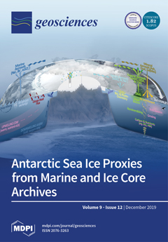
Sea ice has undergone dramatic change in recent decades. However, our understanding of sea ice variability is limited to the satellite era (post-1970), making it hard to place recent trends in context or benchmark future changes. Paleoclimate archives, from marine sediments and ice cores, provide a means of reconstructing sea ice conditions over a range of timescales. Here, we review the marine and atmospheric sea ice proxies used to reconstruct Antarctic sea ice over the past 2000 years and explore how the marine and ice core records could be combined to increase our spatial and temporal coverage. View this paper.
  • Issues are regarded as officially published after their release is announced to the table of contents alert mailing list.
  • You may sign up for e-mail alerts to receive table of contents of newly released issues.
  • PDF is the official format for papers published in both, html and pdf forms. To view the papers in pdf format, click on the "PDF Full-text" link, and use the free Adobe Reader to open them.
Order results
Result details
Section
Select all
Export citation of selected articles as:
9 pages, 3353 KiB  
Article
Cretaciella sorianoae gen. et sp. nov. (Coleoptera, Leiodidae, Cholevinae, Oritocatopini), Anophthalmic Species from Albian Amber of the Escucha Formation (Alava, Spain)
by Michel Perreau
Geosciences 2019, 9(12), 521; https://0-doi-org.brum.beds.ac.uk/10.3390/geosciences9120521 - 17 Dec 2019
Cited by 2 | Viewed by 2235
Abstract
Cretaciella sorianoae gen. et sp. nov. (Coleoptera, Leiodidae, Cholevinae, Oritocatopini) from Albian amber of the Escucha Formation (Alava, Spain) is described and illustrated. This is the first species of Leiodidae from Alava amber and the first Cholevinae from Cretaceous amber. External and internal [...] Read more.
Cretaciella sorianoae gen. et sp. nov. (Coleoptera, Leiodidae, Cholevinae, Oritocatopini) from Albian amber of the Escucha Formation (Alava, Spain) is described and illustrated. This is the first species of Leiodidae from Alava amber and the first Cholevinae from Cretaceous amber. External and internal structures are investigated by propagation phase contrast X-ray microtomography. Based on both external and genital structures, Cretaciella is tentatively placed in the tribe Oritocatopini, the extant species of which occur in Sub-Saharan Africa. This specimen has no visible eyes or hind wings, which suggests an adaptation to subterranean or at least to soil litter environments. The biogeography of the tribe is succinctly discussed. Full article
(This article belongs to the Special Issue The Evolutionary History of the Coleoptera)
Show Figures

Figure 1

25 pages, 5031 KiB  
Article
On the Processes that Produce Hydrocarbon and Mineral Resources in Sedimentary Basins
by Lawrence Cathles
Geosciences 2019, 9(12), 520; https://doi.org/10.3390/geosciences9120520 - 17 Dec 2019
Cited by 7 | Viewed by 2990
Abstract
Sedimentary basins are near-planetary scale stratigraphic-structural-thermochemical reactors that produce a cornucopia of organic and inorganic resources. The scale over which fluid movements coordinate in basins and the broad mix of processes involved is remarkable. Easily observed characteristics indicate the style of flow that [...] Read more.
Sedimentary basins are near-planetary scale stratigraphic-structural-thermochemical reactors that produce a cornucopia of organic and inorganic resources. The scale over which fluid movements coordinate in basins and the broad mix of processes involved is remarkable. Easily observed characteristics indicate the style of flow that has operated and suggest what kind of resources the basin has likely produced. The case for this proposition is built by reviewing and interpreting observations. Features that future basin models might include to become more effective exploration and development tools are suggested. Full article
Show Figures

Figure 1

5 pages, 1790 KiB  
Article
Early Observations of the Interstellar Comet 2I/Borisov
by Chien-Hsiu Lee
Geosciences 2019, 9(12), 519; https://0-doi-org.brum.beds.ac.uk/10.3390/geosciences9120519 - 17 Dec 2019
Cited by 1 | Viewed by 2593
Abstract
2I/Borisov is the second ever interstellar object (ISO). It is very different from the first ISO ’Oumuamua by showing cometary activities, and hence provides a unique opportunity to study comets that are formed around other stars. Here we present early imaging and spectroscopic [...] Read more.
2I/Borisov is the second ever interstellar object (ISO). It is very different from the first ISO ’Oumuamua by showing cometary activities, and hence provides a unique opportunity to study comets that are formed around other stars. Here we present early imaging and spectroscopic follow-ups to study its properties, which reveal an (up to) 5.9 km comet with an extended coma and a short tail. Our spectroscopic data do not reveal any emission lines between 4000–9000 Angstrom; nevertheless, we are able to put an upper limit on the flux of the C2 emission line, suggesting modest cometary activities at early epochs. These properties are similar to comets in the solar system, and suggest that 2I/Borisov—while from another star—is not too different from its solar siblings. Full article
Show Figures

Figure 1

30 pages, 16237 KiB  
Article
Rock Mass Behavior under Tunnel Widening in Asymmetric and Symmetric Modes Considering Different Shapes and Parametric Conditions
by Babar Khan, Syed Muhammad Jamil, Jung Joo Kim, Turab H. Jafri and Jonguk Kim
Geosciences 2019, 9(12), 518; https://0-doi-org.brum.beds.ac.uk/10.3390/geosciences9120518 - 16 Dec 2019
Viewed by 5179
Abstract
To accommodate traffic volume on roads due to ever-increasing population growth, the widening of highways and motorways is in high demand. Nevertheless, the widening of tunnels on these road networks is quite complex due to the presence of numerous rock types, in situ [...] Read more.
To accommodate traffic volume on roads due to ever-increasing population growth, the widening of highways and motorways is in high demand. Nevertheless, the widening of tunnels on these road networks is quite complex due to the presence of numerous rock types, in situ stress, and different widening modes. To overcome these complexities, eight different tunnel shapes were simulated under varying support conditions for asymmetric and symmetric widening. It was found that the tunnels with a round shape, such as horseshoe and semicircular with flatbed, are more effective for asymmetric widening, whereas the provision of a rounded invert in these shapes can reverse the widening option to symmetric. Furthermore, an insignificant effect of the difference in asymmetric and symmetric widening of regular tunnel shapes, such as box, rectangular, and semi-elliptical, was found. A full factorial design statistical analysis confirmed the decrease in tunnel deformation by using various tunnel support systems and showed a significant deformation difference according to monitoring locations at the tunnel periphery. The deformation difference in the case of both tunnel widening modes was also analyzed according to different design parameters. This study provides a comprehensive understanding of rock mass behavior when the widening of any underground opening is carried out. Full article
Show Figures

Figure 1

4 pages, 737 KiB  
Communication
Should Glaciers Be Considered Permafrost?
by Maciej Dąbski
Geosciences 2019, 9(12), 517; https://0-doi-org.brum.beds.ac.uk/10.3390/geosciences9120517 - 16 Dec 2019
Cited by 6 | Viewed by 4864
Abstract
This commentary critically evaluates concepts of extending the term permafrost to any parts of an active glacier. The whole mass of any glacier is at zero centigrade or below (cryotic), except for non-ice inclusions at the glacier surface. Therefore, if glacial ice is [...] Read more.
This commentary critically evaluates concepts of extending the term permafrost to any parts of an active glacier. The whole mass of any glacier is at zero centigrade or below (cryotic), except for non-ice inclusions at the glacier surface. Therefore, if glacial ice is considered a monomineral rock, then any glacier constitutes a perennially cryotic ground (i.e., permafrost), according to the purely thermal definition. However, extending the term permafrost to active glaciers introduces misconceptions, rather than a clarification of important geological terms. Full article
Show Figures

Figure 1

23 pages, 12019 KiB  
Article
Results from the First Phase of the Seafloor Backscatter Processing Software Inter-Comparison Project
by Mashkoor Malik, Alexandre C. G. Schimel, Giuseppe Masetti, Marc Roche, Julian Le Deunf, Margaret F.J. Dolan, Jonathan Beaudoin, Jean-Marie Augustin, Travis Hamilton and Iain Parnum
Geosciences 2019, 9(12), 516; https://0-doi-org.brum.beds.ac.uk/10.3390/geosciences9120516 - 16 Dec 2019
Cited by 5 | Viewed by 4480
Abstract
Seafloor backscatter mosaics are now routinely produced from multibeam echosounder data and used in a wide range of marine applications. However, large differences (>5 dB) can often be observed between the mosaics produced by different software packages processing the same dataset. Without transparency [...] Read more.
Seafloor backscatter mosaics are now routinely produced from multibeam echosounder data and used in a wide range of marine applications. However, large differences (>5 dB) can often be observed between the mosaics produced by different software packages processing the same dataset. Without transparency of the processing pipeline and the lack of consistency between software packages raises concerns about the validity of the final results. To recognize the source(s) of inconsistency between software, it is necessary to understand at which stage(s) of the data processing chain the differences become substantial. To this end, willing commercial and academic software developers were invited to generate intermediate processed backscatter results from a common dataset, for cross-comparison. The first phase of the study requested intermediate processed results consisting of two stages of the processing sequence: the one-value-per-beam level obtained after reading the raw data and the level obtained after radiometric corrections but before compensation of the angular dependence. Both of these intermediate results showed large differences between software solutions. This study explores the possible reasons for these differences and highlights the need for collaborative efforts between software developers and their users to improve the consistency and transparency of the backscatter data processing sequence. Full article
(This article belongs to the Section Geophysics)
Show Figures

Figure 1

10 pages, 6726 KiB  
Article
Formation of the Yamal Crater in Northern West Siberia: Evidence from Geochemistry
by Sergey Vorobyev, Andrey Bychkov, Vanda Khilimonyuk, Sergey Buldovicz, Evgeny Ospennikov and Evgeny Chuvilin
Geosciences 2019, 9(12), 515; https://0-doi-org.brum.beds.ac.uk/10.3390/geosciences9120515 - 14 Dec 2019
Cited by 9 | Viewed by 4716
Abstract
In the framework of this work, studies on the Yamal crater formed as a result of a cryogenic eruption of a water-gas fluid were carried out. The structure and variations of the composition of the geochemical field along the section of the upper [...] Read more.
In the framework of this work, studies on the Yamal crater formed as a result of a cryogenic eruption of a water-gas fluid were carried out. The structure and variations of the composition of the geochemical field along the section of the upper horizons of permafrost are considered on the basis of field work, including the drilling of boreholes near the crater. The obtained regularities of the distribution of chemical elements, and gases between the mineral component of the soil and meltwater, suggest that permafrost at the site of the funnel are the remains of a sub-lake paleo-talik, from which mineralized water and gases were expulsed into the yet unfrozen reservoir that previously existed at this place. The component composition of gases suggests that they are products of biochemical processes similar to those that occur in modern peatlands. The δ13C value for methane extracted from the sediments of the near-contact zone of the Yamal crater was found to be −76‰. The predominance of high molecular weight normal alkanes in frozen bitumen indicates that the original organic substrate which was buried contained remains of higher vegetation. The Yamal funnel was formed by the sediment’s “explosion” while the water-gas fluid was released. The volume of the ejected sediment amounted to about 220 thousand m3. Full article
(This article belongs to the Special Issue Gas and Gas Hydrate in Permafrost)
Show Figures

Figure 1

20 pages, 714 KiB  
Review
The Fossil Record of Darkling Beetles (Insecta: Coleoptera: Tenebrionidae)
by Maxim V. Nabozhenko
Geosciences 2019, 9(12), 514; https://0-doi-org.brum.beds.ac.uk/10.3390/geosciences9120514 - 13 Dec 2019
Cited by 21 | Viewed by 4750
Abstract
The fossil record of Tenebrionidae (excluding the Quartenary) is presented. In total, 122 fossil species, clearly belonging to the family, are known; some beetles were determined only to genus; 78 genera are listed in the fossil record, including 29 extinct genera. The great [...] Read more.
The fossil record of Tenebrionidae (excluding the Quartenary) is presented. In total, 122 fossil species, clearly belonging to the family, are known; some beetles were determined only to genus; 78 genera are listed in the fossil record, including 29 extinct genera. The great diversity of tenebrionids occurs in the Lower Cretaceous Lagerstätte of China (Yixian Formation), Middle Paleocene of France (Menat), Lower Eocene deposits of Germany (Geiseltal), Upper Eocene Baltic amber (Eastern Europe), Upper Eocene deposits of Florissant Formation (USA) and Miocene (Dominican amber). Tenebrionids of the following major lineages, including seven subfamilies, are currently known in the fossil record. These include the lagrioid branch (Lagriinae, Nilioninae), pimelioid branch (Pimeliinae), and tenebrioid branch (Alleculinae, Tenebrioninae, Diaperinae, Stenochiinae). The importance of the fossil record for evolutionary reconstructions and phylogenetic patterns is discussed. The oldest Jurassic and Early Cretaceous darkling beetles of the tenebrionoid branch consist of humid-adapted groups from the extant tribes Alleculini, Ctenopodiini (Alleculinae), and Alphitobiini (Tenebrioninae). Thus, paleontological evidence suggests that differentiation of the family started at least by the Middle Jurassic but does not indicate that xerophilic darkling beetles differentiated much earlier than mesophilic groups. Full article
(This article belongs to the Special Issue The Evolutionary History of the Coleoptera)
Show Figures

Figure 1

19 pages, 8848 KiB  
Article
Experimental and Modelled Reactions of CO2 and SO2 with Core from a Low Salinity Aquifer Overlying a Target CO2 Storage Complex
by Julie K. Pearce, Grant K.W. Dawson, Silvano Sommacal and Suzanne D. Golding
Geosciences 2019, 9(12), 513; https://0-doi-org.brum.beds.ac.uk/10.3390/geosciences9120513 - 12 Dec 2019
Cited by 9 | Viewed by 2753
Abstract
CO2-induced reactions in low salinity aquifers overlying CO2 storage sites are of interest to understand potential reactions or impacts in the possible case of a leak. Previous investigations of overlying aquifers in the context of CO2 storage have focused [...] Read more.
CO2-induced reactions in low salinity aquifers overlying CO2 storage sites are of interest to understand potential reactions or impacts in the possible case of a leak. Previous investigations of overlying aquifers in the context of CO2 storage have focused on pure CO2 streams, however captured industrial CO2 streams may contain ancillary gases, including SO2, O2, NOx, H2S, N2, etc., some of which may be more reactive than CO2 when dissolved in formation water. Eight drill cores from two wells in a low salinity sandstone aquifer that overlies a target CO2 storage complex are characterised for porosity (helium, mercury injection, or micro CT), permeability, and mineral content. The eight Hutton Sandstone cores are variable with porosities of 5.2–19.6%, including carbonaceous mudstones, calcite cemented sandstones, and quartz rich sandstones, common lithologies that may be found generally in overlying aquifers of CO2 storage sites. A chlorite rich sandstone was experimentally reacted with CO2 and low concentrations of SO2 to investigate the potential reactions and possible mineral trapping in the unlikely event of a leak. Micro CT characterisation before and after the reaction indicated no significant change in porosity, although some fines movement was observed that could affect permeability. Dissolved concentrations of Fe, Ca, Mn, Cr, Mg, Rb, Li, Zn, etc., increased during the reaction, including from dissolution of chlorite and trace amounts of ankerite. After ~40 days dissolved concentrations including Fe, Zn, Al, Ba, As and Cr decreased. Chlorite was corroded, and Fe-rich precipitates mainly Fe-Cr oxides were observed to be precipitated on rock surfaces after experimental reaction. Concentrations of Rb and Li increased steadily and deserve further investigation as potential monitoring indicators for a leak. The reaction of chlorite rich sandstone with CO2 and SO2 was geochemically modelled over 10 years, with mainly chlorite alteration to siderite mineral trapping 1.55 kg/m3 of CO2 and removing dissolved Fe from solution. Kaolinite and chalcedony precipitation was also predicted, with minor pyrite precipitation trapping SO2, however no changes to porosity were predicted. Full article
(This article belongs to the Special Issue Geochemical and associated Changes with Gas-Water-Rock Reactions)
Show Figures

Graphical abstract

27 pages, 10968 KiB  
Article
Undrained Cyclic Laboratory Behavior of Sandy Soils
by Francesco Castelli, Antonio Cavallaro, Salvatore Grasso and Valentina Lentini
Geosciences 2019, 9(12), 512; https://0-doi-org.brum.beds.ac.uk/10.3390/geosciences9120512 - 11 Dec 2019
Cited by 13 | Viewed by 3133
Abstract
The complex cyclic shear stress path experienced by the soil during an earthquake, which could also induce liquefaction phenomena, can be approximated in the laboratory only by using sophisticated testing apparatuses. Cyclic triaxial tests have been widely used, especially for coarse grained soils, [...] Read more.
The complex cyclic shear stress path experienced by the soil during an earthquake, which could also induce liquefaction phenomena, can be approximated in the laboratory only by using sophisticated testing apparatuses. Cyclic triaxial tests have been widely used, especially for coarse grained soils, as in this study. In the framework of the design for the seismic retrofitting of the ‘‘Ritiro viaduct’’ foundations along the A20 motorway connecting Messina with Palermo (Italy), a soil liquefaction study was also carried out. With this aim, a detailed geological and geotechnical characterization of the area was performed by in situ and laboratory tests, including seismic dilatometer Marchetti tests (SDMTs), the combined resonant column (RCT) and cyclic loading torsional shear tests (CLTSTs), and undrained cyclic loading triaxial tests (CLTxTs). In particular, the paper presents the results of cyclic triaxial tests carried out on isotropically consolidated specimens of a sandy soil. The seismic retrofitting works include the reinforcement of the foundation and replacement of the decks with newly designed type and structural schemes, mixed steel, and concrete with continuous girder. During the investigation, data were acquired for the characterization of materials, for the definition of degradation phenomena with the relative identification of possible causes, and for the estimation of the residual performance characteristics of the building. The structural campaign of investigations necessary to determine all of the key parameters useful for a correct definition of the residual performance capabilities of the work was divided into two phases: One in situ and one in the laboratory. Full article
Show Figures

Figure 1

23 pages, 6422 KiB  
Article
Improvement of an Operational Forecasting System for Extreme Tidal Events in Santos Estuary (Brazil)
by Joana Mendes, Paulo Leitão, José Chambel Leitão, Sofia Bartolomeu, João Rodrigues and João Miguel Dias
Geosciences 2019, 9(12), 511; https://0-doi-org.brum.beds.ac.uk/10.3390/geosciences9120511 - 10 Dec 2019
Cited by 4 | Viewed by 3283
Abstract
Forecasting estuarine circulation is a hot topic, especially in densely populated regions, like Santos (Brazil). This paper aims to improve a water-level forecasting system for the Santos estuary, particularly the physical forcing determining the residual tide, which in extreme cases increase the predicting [...] Read more.
Forecasting estuarine circulation is a hot topic, especially in densely populated regions, like Santos (Brazil). This paper aims to improve a water-level forecasting system for the Santos estuary, particularly the physical forcing determining the residual tide, which in extreme cases increase the predicting errors. The MOHID hydrodynamic model was implemented with a nested downscaling approach. All automatic procedures to provide a high-resolution real-time forecast system are managed by the AQUASAFE software. Water-level observation and prediction datasets (2016–2017) of five tide gauges in the Santos channel were analyzed, resulting in distinct model configurations, aiming to minimize forecasting inaccuracies. Current MOHID open boundary reference solutions were modified: the astronomical solution was updated from FES2012 to FES2014 whereas the meteorological component (Copernicus Marine Environment Monitoring Service (CMEMS) global solution) time resolution was altered from daily to hourly data. Furthermore, the correlation between significant wave height with positive residual tide events was identified. The model validation presented a minimum Root Mean Square Error (RMSE) of 12.5 cm. Despite FES2014 solution improvements at the bay entrance, errors increase in inner stations were maintained, portraying the need for better bathymetric data. The use of a CMEMS hourly resolution decreased the meteorological tide errors. A linear regression method was developed to correct the residual tide through post-processing, under specific wave height conditions. Overall, the newest implementation increased the water-level forecast accuracy, particularly under extreme events. Full article
Show Figures

Figure 1

18 pages, 11192 KiB  
Article
A Silicified Carboniferous Lycopsid Forest in the Colorado Rocky Mountains, USA
by Mike Viney, Robert D. Hickey and George E. Mustoe
Geosciences 2019, 9(12), 510; https://0-doi-org.brum.beds.ac.uk/10.3390/geosciences9120510 - 07 Dec 2019
Cited by 4 | Viewed by 6494
Abstract
The 1930 discovery of Carboniferous lycopsid fossils in south central Colorado resulted in the naming of a new species of scale tree, Lepidodendron johnsonii (=Lepidophloios johnsonii (Arnold) DiMichele). Cellular structures of L. johnsonii axes and periderm are preserved in silica—an unusual mode of [...] Read more.
The 1930 discovery of Carboniferous lycopsid fossils in south central Colorado resulted in the naming of a new species of scale tree, Lepidodendron johnsonii (=Lepidophloios johnsonii (Arnold) DiMichele). Cellular structures of L. johnsonii axes and periderm are preserved in silica—an unusual mode of fossil preservation for Pennsylvanian lycopsid plant remains. The early reports on the Trout Creek lycopsid fossils focused on taxonomic and paleobotanical aspects. Our 2019 reinvestigation of the locality produced many new specimens and a wealth of new data from a variety of analytical methods. Optical microscopy, X-ray diffraction, scanning electron microscopy, energy dispersive electron spectroscopy, determination of specific gravity, and Loss on Ignition provide details of mineralization. Cell walls are preserved with very small fine quartz particles, and cell lumina are filled with microcrystalline quartz. Some cell exteriors are encrusted with euhedral quartz crystals. These multiple forms of quartz are evidence that petrifaction involved several episodes of silicification. The dark color of the fossil wood and siliceous matrix appears to be caused by traces of dispersed carbon, but 500 °C Loss on Ignition reveals that the fossil wood preserves only very small amounts of the original organic matter. Full article
Show Figures

Figure 1

21 pages, 13527 KiB  
Article
Analysis of Flood Storage Area Operations in Huai River Using 1D and 2D River Simulation Models Coupled with Global Optimization Algorithms
by Andreja Jonoski, Ioana Popescu, Sun Zhe, Yuhan Mu and Yiqing He
Geosciences 2019, 9(12), 509; https://0-doi-org.brum.beds.ac.uk/10.3390/geosciences9120509 - 06 Dec 2019
Cited by 11 | Viewed by 2938
Abstract
This article addresses the issue of flood management using four flood storage areas in the middle section of Huai River in China which protect the important downstream city of Bengbu. The same areas are also used by the local population as residential and [...] Read more.
This article addresses the issue of flood management using four flood storage areas in the middle section of Huai River in China which protect the important downstream city of Bengbu. The same areas are also used by the local population as residential and agricultural zones. An optimization problem is therefore posed, with two objectives of simultaneously minimizing the downstream flood risk in Bengbu city and the storage areas’ economic damages. The methodology involved development of river flood models using HEC-RAS, with varying complexity, such as 1-dimensional (1D) model with storage areas represented as lumped conceptual reservoirs, and 2-dimensional (2D) models with detailed representation of the terrain, land-use and hydrodynamics in the storage areas. Experiments of coupling these models with global optimization algorithms (NSGA-II, PESA-II and SPEA-II) were performed (using the HEC-RAS Controller), in which the two objective functions were minimized, while using stage differences between the river and the storage areas as decision variables for controlling the opening/closing of the gates at the lateral structures that link the river with the storage areas. The comparative analysis of the results indicate that more refined optimal operational strategies that spread the damages across all storage areas can be obtained only with the detailed flood simulation models, regardless of the optimization algorithm used. Full article
(This article belongs to the Special Issue Impacts of Compound Hydrological Hazards or Extremes)
Show Figures

Figure 1

34 pages, 19785 KiB  
Article
Fracture Seismic: Mapping Subsurface Connectivity
by Charles Sicking and Peter Malin
Geosciences 2019, 9(12), 508; https://0-doi-org.brum.beds.ac.uk/10.3390/geosciences9120508 - 06 Dec 2019
Cited by 13 | Viewed by 4888
Abstract
Fracture seismic is the method for recording and analyzing passive seismic data for mapping the fractures in the subsurface. Fracture seismic is able to map the fractures because of two types of mechanical actions in the fractures. First, in cohesive rock, fractures can [...] Read more.
Fracture seismic is the method for recording and analyzing passive seismic data for mapping the fractures in the subsurface. Fracture seismic is able to map the fractures because of two types of mechanical actions in the fractures. First, in cohesive rock, fractures can emit short duration energy pulses when growing at their tips through opening and shearing. The industrial practice of recording and analyzing these short duration events is commonly called micro-seismic. Second, coupled rock–fracture–fluid interactions take place during earth deformations and this generates signals unique to the fracture’s physical characteristics. This signal appears as harmonic resonance of the entire, fluid-filled fracture. These signals can be initiated by both external and internal changes in local pressure, e.g., a passing seismic wave, tectonic deformations, and injection during a hydraulic well treatment. Fracture seismic is used to map the location, spatial extent, and physical characteristics of fractures. The strongest fracture seismic signals come from connected fluid-pathways. Fracture seismic observations recorded before, during, and after hydraulic stimulations show that such treatments primarily open pre-existing fractures and weak zones in the rocks. Time-lapse fracture seismic methods map the flow of fluids in the rocks and reveal how the reservoir connectivity changes over time. We present examples that support these findings and suggest that the fracture seismic method should become an important exploration, reservoir management, production, and civil safety tool for the subsurface energy industry. Full article
Show Figures

Figure 1

25 pages, 2696 KiB  
Review
The Carbon-Isotope Record of the Sub-Seafloor Biosphere
by Patrick Meister and Carolina Reyes
Geosciences 2019, 9(12), 507; https://0-doi-org.brum.beds.ac.uk/10.3390/geosciences9120507 - 05 Dec 2019
Cited by 21 | Viewed by 5318
Abstract
Sub-seafloor microbial environments exhibit large carbon-isotope fractionation effects as a result of microbial enzymatic reactions. Isotopically light, dissolved inorganic carbon (DIC) derived from organic carbon is commonly released into the interstitial water due to microbial dissimilatory processes prevailing in the sub-surface biosphere. Much [...] Read more.
Sub-seafloor microbial environments exhibit large carbon-isotope fractionation effects as a result of microbial enzymatic reactions. Isotopically light, dissolved inorganic carbon (DIC) derived from organic carbon is commonly released into the interstitial water due to microbial dissimilatory processes prevailing in the sub-surface biosphere. Much stronger carbon-isotope fractionation occurs, however, during methanogenesis, whereby methane is depleted in 13C and, by mass balance, DIC is enriched in 13C, such that isotopic distributions are predominantly influenced by microbial metabolisms involving methane. Methane metabolisms are essentially mediated through a single enzymatic pathway in both Archaea and Bacteria, the Wood–Ljungdahl (WL) pathway, but it remains unclear where in the pathway carbon-isotope fractionation occurs. While it is generally assumed that fractionation arises from kinetic effects of enzymatic reactions, it has recently been suggested that partial carbon-isotope equilibration occurs within the pathway of anaerobic methane oxidation. Equilibrium fractionation might also occur during methanogenesis, as the isotopic difference between DIC and methane is commonly on the order of 75‰, which is near the thermodynamic equilibrium. The isotopic signature in DIC and methane highly varies in marine porewaters, reflecting the distribution of different microbial metabolisms contributing to DIC. If carbon isotopes are preserved in diagenetic carbonates, they may provide a powerful biosignature for the conditions in the deep biosphere, specifically in proximity to the sulphate–methane transition zone. Large variations in isotopic signatures in diagenetic archives have been found that document dramatic changes in sub-seafloor biosphere activity over geological time scales. We present a brief overview on carbon isotopes, including microbial fractionation mechanisms, transport effects, preservation in diagenetic carbonate archives, and their implications for the past sub-seafloor biosphere and its role in the global carbon cycle. We discuss open questions and future potentials of carbon isotopes as archives to trace the deep biosphere through time. Full article
(This article belongs to the Special Issue Tracking the Deep Biosphere through Time)
Show Figures

Figure 1

33 pages, 7576 KiB  
Review
Antarctic Sea Ice Proxies from Marine and Ice Core Archives Suitable for Reconstructing Sea Ice over the Past 2000 Years
by Elizabeth R. Thomas, Claire S. Allen, Johan Etourneau, Amy C. F. King, Mirko Severi, V. Holly L. Winton, Juliane Mueller, Xavier Crosta and Victoria L. Peck
Geosciences 2019, 9(12), 506; https://0-doi-org.brum.beds.ac.uk/10.3390/geosciences9120506 - 04 Dec 2019
Cited by 37 | Viewed by 10051
Abstract
Dramatic changes in sea ice have been observed in both poles in recent decades. However, the observational period for sea ice is short, and the climate models tasked with predicting future change in sea ice struggle to capture the current Antarctic trends. Paleoclimate [...] Read more.
Dramatic changes in sea ice have been observed in both poles in recent decades. However, the observational period for sea ice is short, and the climate models tasked with predicting future change in sea ice struggle to capture the current Antarctic trends. Paleoclimate archives, from marine sedimentary records and coastal Antarctic ice cores, provide a means of understanding sea ice variability and its drivers over decadal to centennial timescales. In this study, we collate published records of Antarctic sea ice over the past 2000 years (2 ka). We evaluate the current proxies and explore the potential of combining marine and ice core records to produce multi-archive reconstructions. Despite identifying 92 sea ice reconstructions, the spatial and temporal resolution is only sufficient to reconstruct circum-Antarctic sea ice during the 20th century, not the full 2 ka. Our synthesis reveals a 90 year trend of increasing sea ice in the Ross Sea and declining sea ice in the Bellingshausen, comparable with observed trends since 1979. Reconstructions in the Weddell Sea, the Western Pacific and the Indian Ocean reveal small negative trends in sea ice during the 20th century (1900–1990), in contrast to the observed sea ice expansion in these regions since 1979. Full article
Show Figures

Figure 1

20 pages, 5068 KiB  
Article
Water, Hydrous Melting, and Teleseismic Signature of the Mantle Transition Zone
by Ilya Fomin and Christian Schiffer
Geosciences 2019, 9(12), 505; https://0-doi-org.brum.beds.ac.uk/10.3390/geosciences9120505 - 04 Dec 2019
Cited by 5 | Viewed by 3558
Abstract
Recent geophysical and petrological observations indicate the presence of water and hydrous melts in and around the mantle transition zone (MTZ), for example, prominent low-velocity zones detected by seismological methods. Experimental data and computational predictions describe the influence of water on elastic properties [...] Read more.
Recent geophysical and petrological observations indicate the presence of water and hydrous melts in and around the mantle transition zone (MTZ), for example, prominent low-velocity zones detected by seismological methods. Experimental data and computational predictions describe the influence of water on elastic properties of mantle minerals. Using thermodynamic relationships and published databases, we calculated seismic velocities and densities of mantle rocks in and around the MTZ in the presence of water for a plausible range of mantle potential temperatures. We then computed synthetic receiver functions to explore the influence of different water distribution patterns on the teleseismic signature. The results may improve our understanding and interpretation of seismic observations of the MTZ. Full article
(This article belongs to the Section Geophysics)
Show Figures

Figure 1

23 pages, 2386 KiB  
Review
An Overview of Opportunities for Machine Learning Methods in Underground Rock Engineering Design
by Josephine Morgenroth, Usman T. Khan and Matthew A. Perras
Geosciences 2019, 9(12), 504; https://0-doi-org.brum.beds.ac.uk/10.3390/geosciences9120504 - 02 Dec 2019
Cited by 37 | Viewed by 6745
Abstract
Machine learning methods for data processing are gaining momentum in many geoscience industries. This includes the mining industry, where machine learning is primarily being applied to autonomously driven vehicles such as haul trucks, and ore body and resource delineation. However, the development of [...] Read more.
Machine learning methods for data processing are gaining momentum in many geoscience industries. This includes the mining industry, where machine learning is primarily being applied to autonomously driven vehicles such as haul trucks, and ore body and resource delineation. However, the development of machine learning applications in rock engineering literature is relatively recent, despite being widely used and generally accepted for decades in other risk assessment-type design areas, such as flood forecasting. Operating mines and underground infrastructure projects collect more instrumentation data than ever before, however, only a small fraction of the useful information is typically extracted for rock engineering design, and there is often insufficient time to investigate complex rock mass phenomena in detail. This paper presents a summary of current practice in rock engineering design, as well as a review of literature and methods at the intersection of machine learning and rock engineering. It identifies gaps, such as standards for architecture, input selection and performance metrics, and areas for future work. These gaps present an opportunity to define a framework for integrating machine learning into conventional rock engineering design methodologies to make them more rigorous and reliable in predicting probable underlying physical mechanics and phenomenon. Full article
Show Figures

Figure 1

2 pages, 140 KiB  
Editorial
Interdisciplinary Geosciences Perspectives of Tsunami Volume 2
by Anawat Suppasri
Geosciences 2019, 9(12), 503; https://0-doi-org.brum.beds.ac.uk/10.3390/geosciences9120503 - 28 Nov 2019
Viewed by 1641
Abstract
Disaster related research has its own interdisciplinary perspectives connected to the disaster cycle (response, recovery, prevention, and preparedness). This special issue focuses on interdisciplinary geosciences perspectives of tsunami that cover the whole process of tsunami disasters (generation, propagation, impact assessment, psychological perspectives, and [...] Read more.
Disaster related research has its own interdisciplinary perspectives connected to the disaster cycle (response, recovery, prevention, and preparedness). This special issue focuses on interdisciplinary geosciences perspectives of tsunami that cover the whole process of tsunami disasters (generation, propagation, impact assessment, psychological perspectives, and planning). This special issue collects tsunami research papers not only as lessons from the 2011 Great East Japan tsunami, but also from other areas in Japan (coastal defense structures, tsunami fires, economic loss assessment, and emergency planning) as well as other countries (morphological changes in Indonesia and building risk assessment in New Zealand. The order of the paper follows the tsunami disaster process and the connections between each paper show the interdisciplinary perspectives of tsunami research, which can also be used as a framework for other types of disaster research. Full article
(This article belongs to the Special Issue Interdisciplinary Geosciences Perspectives of Tsunami Volume 2)
15 pages, 5357 KiB  
Article
Why Are There No Earthquakes in the Intracratonic Paris Basin? Insights from Flexural Models
by Carole Petit, Louis de Barros, Guillaume Duclaux and Yves Mazabraud
Geosciences 2019, 9(12), 502; https://0-doi-org.brum.beds.ac.uk/10.3390/geosciences9120502 - 28 Nov 2019
Cited by 3 | Viewed by 2408
Abstract
Comparing nearby areas with contrasted seismicity distributions like the French Variscan Armorican Massif (AM) and the surrounding intracratonic Paris Basin (PB) can help deciphering which parameters control the occurrence or absence of diffuse, intraplate seismicity. In this paper, we examine how lithosphere temperature, [...] Read more.
Comparing nearby areas with contrasted seismicity distributions like the French Variscan Armorican Massif (AM) and the surrounding intracratonic Paris Basin (PB) can help deciphering which parameters control the occurrence or absence of diffuse, intraplate seismicity. In this paper, we examine how lithosphere temperature, fluid pressure, and frictional strength variations, combined with horizontal and bending stresses, may condition brittle, ductile or elastic behaviours of the crust in the AM and PB. We compute yield stress envelopes (YSE) and lithospheric flexure across a 1000 km-long SW–NE profile crossing the AM and PB approximately parallel to the direction of the minimum horizontal stress. Flexural models slightly better fit measured Bouguer gravity data if we apply two vertical loads on the AM and PB, with values (positive downward) ranging between −3 and −2.1012, and between 4 and 6.1012 N·m−2, respectively, depending on the chosen crustal composition. Our results evidence that whatever the crustal composition, bending stresses and heat flow variations alone are not sufficient to explain the difference in seismogenic behaviour between the AM and the PB. Variations in friction coefficient, in the range of standard values, are not totally satisfying either, since they do not restrain the brittle crustal thickness in the PB to less than 10 km, which is still large enough to be the locus of shallow earthquakes. Oppositely, increasing the cohesion from 10 to 80 MPa has a stronger effect on the thickness of the brittle upper crust, decreasing it from 10 to 15 km beneath the AM to 0–5 km beneath the PB. This suggests that the Mesozoic sedimentary pile can act as a sticky layer holding together basement rocks of the PB, which is equivalent to an increase in cohesion, and protects them from failure. Full article
(This article belongs to the Special Issue Active Deformation and Rheology of the Continental Lithosphere)
Show Figures

Figure 1

23 pages, 4745 KiB  
Article
A Quantitative Evaluation of Hyperpycnal Flow Occurrence in a Temperate Coastal Zone: The Example of the Salerno Gulf (Southern Italy)
by Ines Alberico and Francesca Budillon
Geosciences 2019, 9(12), 501; https://0-doi-org.brum.beds.ac.uk/10.3390/geosciences9120501 - 28 Nov 2019
Cited by 1 | Viewed by 2494
Abstract
The inner continental shelf is regarded as a repository of hyperpycnal flow (HF) deposits the analysis of which may contribute to hydrogeological risk assessment in coastal areas. In line with the source to sink paradigm, we examined the dynamics of the coastal watersheds [...] Read more.
The inner continental shelf is regarded as a repository of hyperpycnal flow (HF) deposits the analysis of which may contribute to hydrogeological risk assessment in coastal areas. In line with the source to sink paradigm, we examined the dynamics of the coastal watersheds facing the Salerno Gulf (Southern Tyrrhenian Sea) in generating hyperpycnal flows and investigated the shallow marine sediment record to verify their possible occurrence in the recent past. Thus, the morphometric properties (hypsometric integral, hypsometric skewness, hypsometric kurtosis, density skewness and density kurtosis) of the watersheds together with the potential rivers’ discharge and sediment concentration, calculated by applying altitude- and extent -based experimental relations, allowed to detect the rivers that were prone to producing HFs. In the shallow marine environment record of the last 2 kyr, anomalous sedimentation, possibly linked to HF events, was identified by comparing the sand-mud ratio (S/M) down-core —at three sites off the main river mouths — to the expected S/M calculated by applying the relation governing the present-day distribution of sand at the seabed in the Salerno Gulf. A return period of major HF events ≤ 0.1 kyr can be inferred for rivers which fall into the category “dirty rivers”. In these cases, the watersheds have a hypsometric index ranging between 0.2 and 0.3, coastal plains not exceeding 30% of the entire catchment area and a maximum topographic height ≥1000 m. A return period of about 0.3 kyr has been inferred for the “moderately dirty rivers”. In these other cases, about 50% of the watersheds develop into a low gradient coastal plain and have a hypsometric index ranging between 0.09 and 0.2. The observations on land and offshore have been complemented to reach a more comprehensive vision of the coastal area dynamics. The method here proposed corroborates the effectiveness of the source to sink approach and is applicable to analogous sediment records in temperate continental shelves which encompass the last 3 kyr, a time interval in which the oscillations of relative sea level can be overlooked. Full article
(This article belongs to the Section Natural Hazards)
Show Figures

Figure 1

29 pages, 27134 KiB  
Article
Topographic Base Maps from Remote Sensing Data for Engineering Geomorphological Modelling: An Application on Coastal Mediterranean Landscape
by Maurizio Barbarella, Albina Cuomo, Alessandro Di Benedetto, Margherita Fiani and Domenico Guida
Geosciences 2019, 9(12), 500; https://0-doi-org.brum.beds.ac.uk/10.3390/geosciences9120500 - 27 Nov 2019
Cited by 11 | Viewed by 4803
Abstract
Coastal landscapes are one of the most changeable areas of the earth’s surface. Given this spatial complexity and temporal variability, the construction of reference maps useful for geo-engineering is a challenge. In order to improve the performance of geomorphic models, reliable multiscale and [...] Read more.
Coastal landscapes are one of the most changeable areas of the earth’s surface. Given this spatial complexity and temporal variability, the construction of reference maps useful for geo-engineering is a challenge. In order to improve the performance of geomorphic models, reliable multiscale and multi-temporal base maps and Digital Elevation Models (DEM) are needed. The work presented in this paper addresses this issue using an inter-geo-disciplinary approach to optimize the processing of multisource and multi-temporal data and DEMs by using field surveys, conceptual model, and analytical computation on a test area. The data acquired with two surveying techniques were analyzed and compared: Aerial Laser Scanning (ALS) and photogrammetry from stereo pairs of High-Resolution Satellite Images (HRSI). To assess the reliability of the DEMs produced from point clouds, the residuals between the point cloud and the interpolated filtered surface were identified and analyzed statistically. In addition to the contour maps, some feature maps such as slope, planar, and profile curvature maps were produced and analyzed. The frequency distribution of the slope and curvature values were compared with the diffusion, advection, and stream power model, revealing a good agreement with the past and present geomorphic processes acting on the different parts of the study area. Moreover, the integrated geomatics–geomorphic analysis of the outliers’ map showed a good correspondence (more than 75%) between the identified outliers and some specific geomorphological features, such as micro-landforms, which are significant for erosive and gravity-driven mechanisms. The different distribution of the above singularities by different data sources allowed us to attribute their spatial model to the temporal variation of the topography and, consequently, to the geomorphic changes, rather than to the different accuracy. For monitoring purposes and risk mitigation activities, the methodology adopted seems to meet the requirements to make a digital mapping of the coast analyzed, characterized by a rapid evolution of the surface, and can be extended to other stretches of coast with similar characteristics. Full article
(This article belongs to the Special Issue Geodesy and Geomatics Engineering)
Show Figures

Figure 1

28 pages, 6662 KiB  
Article
Late Orogenic Heating of (Ultra)High Pressure Rocks: Slab Rollback vs. Slab Breakoff
by Elena Sizova, Christoph Hauzenberger, Harald Fritz, Shah Wali Faryad and Taras Gerya
Geosciences 2019, 9(12), 499; https://0-doi-org.brum.beds.ac.uk/10.3390/geosciences9120499 - 27 Nov 2019
Cited by 35 | Viewed by 5652
Abstract
Some (ultra)high-pressure metamorphic rocks that formed during continental collision preserve relict minerals, indicating a two-stage evolution: first, subduction to mantle depths and exhumation to the lower-crustal level (with simultaneous cooling), followed by intensive heating that can be characterized by a β-shaped pressure–temperature–time (P–T–t) [...] Read more.
Some (ultra)high-pressure metamorphic rocks that formed during continental collision preserve relict minerals, indicating a two-stage evolution: first, subduction to mantle depths and exhumation to the lower-crustal level (with simultaneous cooling), followed by intensive heating that can be characterized by a β-shaped pressure–temperature–time (P–T–t) path. Based on a two-dimensional (2D) coupled petrological–thermomechanical tectono-magmatic numerical model, we propose a possible sequence of tectonic stages that could lead to these overprinting metamorphic events along an orogenic β-shaped P–T–t path: the subduction and exhumation of continental crust, followed by slab retreat that leads to extension and subsequent asthenospheric upwelling. During the last stage, the exhumed crustal material at the crust–mantle boundary undergoes heating from the underlying hot asthenospheric mantle. This slab rollback scenario is further compared numerically with the classical continental collision scenario associated with slab breakoff, which is often used to explain the late heating impulse in the collisional orogens. The mantle upwelling occurring in the experiments with slab breakoff, which is responsible for the heating of the exhumed crustal material, is not related to the slab breakoff but can be caused either by slab bending before slab breakoff or by post-breakoff exhumation of the subducted crust. Our numerical modeling predictions align well with a variety of orogenic P–T–t paths that have been reported from many Phanerozoic collisional orogens, such as the Variscan Bohemian Massif, the Triassic Dabie Shan, the Cenozoic Northwest Himalaya, and some metamorphic complexes in the Alps. Full article
(This article belongs to the Special Issue Active Deformation and Rheology of the Continental Lithosphere)
Show Figures

Graphical abstract

11 pages, 3231 KiB  
Article
New Information on the Madagascan Middle Jurassic Sauropod Lapparentosaurus madagascariensis
by Miky Lova Tantely Raveloson, Neil D. L. Clark and Armand H. Rasoamiaramana
Geosciences 2019, 9(12), 498; https://0-doi-org.brum.beds.ac.uk/10.3390/geosciences9120498 - 27 Nov 2019
Cited by 1 | Viewed by 4349
Abstract
The systematic position of the Middle Jurassic sauropod Lapparentosaurus madagascariensis is not fully understood due to a lack of useful anatomical detail. Despite many new bone fragments from the axial skeleton, post-cranial skeleton, and a hind limb having been previously unearthed, its systematic [...] Read more.
The systematic position of the Middle Jurassic sauropod Lapparentosaurus madagascariensis is not fully understood due to a lack of useful anatomical detail. Despite many new bone fragments from the axial skeleton, post-cranial skeleton, and a hind limb having been previously unearthed, its systematic position has not yet been satisfactorily established. Although this Malagasy taxon is only recognised by two autapomorphies located in the scapula and coracoid, two features of the neural spine, which are reported here, provide additional information on the common autapomorphies shared with the British genus Cetiosaurus. A full description of the femur and neural spine helps to determine some aspects of its relationship to other similar taxa. Remains of Lapparentosaurus madagascariensis have been recovered from mixed facies that may have been deposited in a shallow water lagoon during a transgressive period in the Isallo IIIb subunit in the Majunga Basin. Full article
Show Figures

Figure 1

12 pages, 11178 KiB  
Communication
Investigation of Landslides that Occurred in August on the Chengdu–Kunming Railway, Sichuan, China
by Qian Zheng, Shui-Long Shen, An-Nan Zhou and Hao Cai
Geosciences 2019, 9(12), 497; https://0-doi-org.brum.beds.ac.uk/10.3390/geosciences9120497 - 26 Nov 2019
Cited by 8 | Viewed by 3101
Abstract
This paper reports on a large-scale landslide with a movement of 48 thousand m3 of soil and rock that occurred in Sichuan, China. This catastrophic landslide occurred in Aidai village, Ganluo County, at 12:44 on 14 August 2019, blocking a section of [...] Read more.
This paper reports on a large-scale landslide with a movement of 48 thousand m3 of soil and rock that occurred in Sichuan, China. This catastrophic landslide occurred in Aidai village, Ganluo County, at 12:44 on 14 August 2019, blocking a section of the railway between Lianghong station and Aidai station. This landslide resulted in 12 deaths and five people missing. This report describes the preliminary investigation, the rescue activity, topographic survey and analysis as well as the main predisposing and triggering factors. The combined effects of steep topography, continuous rainstorms, floods eroding the foothills of the mountain and human activity were the main influencing factors that triggered this landslide. To reduce the possibility of casualties resulting from large geological disasters, such as landslides and mudslides, in this region in the future, some recommendations are proposed to systematically reduce potential human casualties and economic losses. Full article
(This article belongs to the Section Natural Hazards)
Show Figures

Figure 1

24 pages, 12556 KiB  
Article
Discrete Fracture Network Modelling in Triassic–Jurassic Carbonates of NW Lurestan, Zagros Fold-and-Thrust Belt, Iran
by Luigi Massaro, Amerigo Corradetti, Francesco d’Assisi Tramparulo, Stefano Vitale, Ernesto Paolo Prinzi, Alessandro Iannace, Mariano Parente, Chiara Invernizzi, Davoud Morsalnejad and Stefano Mazzoli
Geosciences 2019, 9(12), 496; https://0-doi-org.brum.beds.ac.uk/10.3390/geosciences9120496 - 26 Nov 2019
Cited by 3 | Viewed by 4450
Abstract
In this study, discrete fracture network (DFN) modelling was performed for Triassic–Jurassic analogue reservoir units of the NW Lurestan region, Iran. The modelling was elaborated following a multi-scale statistical sampling of the fracture systems characterising the analysed succession. The multi-scale approach was performed [...] Read more.
In this study, discrete fracture network (DFN) modelling was performed for Triassic–Jurassic analogue reservoir units of the NW Lurestan region, Iran. The modelling was elaborated following a multi-scale statistical sampling of the fracture systems characterising the analysed succession. The multi-scale approach was performed at two different observation scales. At the macro-scale, a digital outcrop analysis was carried out by means of a digital line-drawing based on camera-acquired images, focussing on the distribution of major throughgoing fractures; at the meso-scale, the scan line method was applied to investigate the background fractures of the examined formations. The gathered data were statistically analysed in order to estimate the laws governing the statistical distribution of some key fracture set attributes, namely, spacing, aperture, and height. The collected dataset was used for the DFN modelling, allowing the evaluation of the relative connectivity of the fracture systems and, therefore, defining the architecture and the geometries within the fracture network. The performed fracture modelling, confirmed, once again, the crucial impact that large-scale throughgoing fractures have on the decompartmentalization of a reservoir and on the related fluid flow migration processes. The derived petrophysical properties distribution showed in the models, defined the Kurra Chine Fm. and, especially, the Sehkaniyan Fm. as good-quality reservoir units, whereas the Sarki Fm was considered a poor-quality reservoir unit. Full article
(This article belongs to the Special Issue Characterization and Simulation of Carbonate Reservoirs)
Show Figures

Figure 1

32 pages, 18511 KiB  
Article
Bentonite Extrusion into Near-Borehole Fracture
by Mohammad N. Islam, Andrew P. Bunger, Nicolas Huerta and Robert Dilmore
Geosciences 2019, 9(12), 495; https://0-doi-org.brum.beds.ac.uk/10.3390/geosciences9120495 - 25 Nov 2019
Cited by 3 | Viewed by 3817
Abstract
In this paper, we discuss laboratory experiments of bentonite swelling and coupled finite element simulations to explicate bentonite extrusion. For the experiments, we developed a swell cell apparatus to understand the bentonite migration to the near-borehole fracture. We constructed the swell cell using [...] Read more.
In this paper, we discuss laboratory experiments of bentonite swelling and coupled finite element simulations to explicate bentonite extrusion. For the experiments, we developed a swell cell apparatus to understand the bentonite migration to the near-borehole fracture. We constructed the swell cell using acrylic, which comprised of a borehole and open fracture. Initially, the borehole of the swell cell was filled with bentonite and liquid. Then, the apparatus was sealed for observations. Due to the liquid saturation increase of bentonite, its swelling pressure increased. The developed pressure caused the extrusion of bentonite into the fracture, and the flow of bentonite from the borehole decreased with time. Moreover, for the effectiveness of bentonite-based plugging, there is a limiting condition, which represents the relation between the maximum bentonite migration length with the fracture aperture. Additionally, we also performed the bentonite free swelling test to assess the swelling potential to the fluid salinity, and we observed that with the increase of the salinity, the swelling potential decreased. In addition, we present a fully coupled two-phases fluids flow (e.g., liquid and gas) and deformation flow finite element (FE) model for the bentonite column elements and swell cell model. We also combined the Modified Cam Clay (MCC) model and the swelling model for the bentonite deformation flow model. Then, we also present the validation of the bentonite model. To model other sub-domains, we used the poro-elastic model. Additionally, we obtained the transition between the wetting phase (i.e., liquid) and non-wetting phase (i.e., gas) using the Brooks–Corey model. From the finite element results, we observed that due to the liquid intrusion into the bentonite, the developed capillary pressure gradient results in a change of the hydro-mechanical behavior of the bentonite. Initially, we observed that due to the high capillary pressure gradient, the liquid saturation and the swelling pressure increased, which also decreased with time due to a reduction in the capillary pressure gradient. Thereby, the swelling pressure-induced bentonite migration to the fracture also decreased over time, and after the equilibrium state (for a negligible pressure gradient), there was no significant transport of bentonite into the fracture. Full article
(This article belongs to the Special Issue Behavior of Expansive Soils and its Shrinkage Cracking)
Show Figures

Figure 1

13 pages, 2281 KiB  
Article
Correlation of Elastic Moduli and Serpentine Content in Ultramafic Rocks
by Aida Farough and Alexander K. Karrasch
Geosciences 2019, 9(12), 494; https://0-doi-org.brum.beds.ac.uk/10.3390/geosciences9120494 - 25 Nov 2019
Cited by 2 | Viewed by 3162
Abstract
Understanding the physical properties of ultramafic rocks is important for evaluating a wide variety of petrologic models of the oceanic lithosphere, particularly upper mantle and lower crust. Hydration of oceanic peridotites results in increasing serpentine content, which affects lithospheric physical properties and the [...] Read more.
Understanding the physical properties of ultramafic rocks is important for evaluating a wide variety of petrologic models of the oceanic lithosphere, particularly upper mantle and lower crust. Hydration of oceanic peridotites results in increasing serpentine content, which affects lithospheric physical properties and the global bio/geochemical cycles of various elements. In understanding tectonic, magmatic, and metamorphic history of the oceanic crust, interpreting seismic velocities, rock composition, and elastic moduli are of fundamental importance. In this study, we show that as serpentine content increases, density decreases linearly with a slope of 7.85. Porosity of the samples does not show any systematic correlation with serpentine content, as it is more strongly affected by local weathering and erosional processes. We also correlate increase in serpentine content with a linear decline in shear, bulk, and Young’s moduli with slopes of 0.48, 0.77, and 0.45, respectively. Our results show that increase in serpentine content of mantle wedge and forearc mantle contributes to their brittle behavior and result in break-offs, obduction, and overthrusting. Therefore, serpentine content strongly affects tectonic processes at subduction zones, particularly serpentinization may be responsible for formation of weak fault zones. Also, serpentinization of fresh oceanic peridotite in slow and ultra-slow spreading ridges may be responsible for observed discontinuities in thin crust. Full article
(This article belongs to the Section Geophysics)
Show Figures

Figure 1

26 pages, 28006 KiB  
Article
Landslide Susceptibility Assessment of Mauritius Island (Indian Ocean)
by Vincenzo Marsala, Alberto Galli, Giorgio Paglia and Enrico Miccadei
Geosciences 2019, 9(12), 493; https://0-doi-org.brum.beds.ac.uk/10.3390/geosciences9120493 - 23 Nov 2019
Cited by 26 | Viewed by 10534
Abstract
This work is focused on the landslide susceptibility assessment, applied to Mauritius Island. The study area is a volcanic island located in the western part of the Indian Ocean and it is characterized by a plateau-like morphology interrupted by three rugged mountain areas. [...] Read more.
This work is focused on the landslide susceptibility assessment, applied to Mauritius Island. The study area is a volcanic island located in the western part of the Indian Ocean and it is characterized by a plateau-like morphology interrupted by three rugged mountain areas. The island is severely affected by geo-hydrological hazards, generally triggered by tropical storms and cyclones. The landslide susceptibility analysis was performed through an integrated approach based on morphometric analysis and preliminary Geographical Information System (GIS)-based techniques, supported by photogeological analysis and geomorphological field mapping. The analysis was completed following a mixed heuristic and statistical approach, integrated using GIS technology. This approach led to the identification of eight landslide controlling factors. Hence, each factor was evaluated by assigning appropriate expert-based weights and analyzed for the construction of thematic maps. Finally, all the collected data were mapped through a cartographic overlay process in order to realize a new zonation of landslide susceptibility. The resulting map was grouped into four landslide susceptibility classes: low, medium, high, and very high. This work provides a scientific basis that could be effectively applied in other tropical areas showing similar climatic and geomorphological features, in order to develop sustainable territorial planning, emergency management, and loss-reduction measures. Full article
Show Figures

Figure 1

17 pages, 1160 KiB  
Review
Large Russian Lakes Ladoga, Onega, and Imandra under Strong Pollution and in the Period of Revitalization: A Review
by Tatiana Moiseenko and Andrey Sharov
Geosciences 2019, 9(12), 492; https://0-doi-org.brum.beds.ac.uk/10.3390/geosciences9120492 - 22 Nov 2019
Cited by 26 | Viewed by 8727
Abstract
In this paper, retrospective analyses of long-term changes in the aquatic ecosystem of Ladoga, Onega, and Imandra lakes, situated within North-West Russia, are presented. At the beginning of the last century, the lakes were oligotrophic, freshwater and similar in origin in terms of [...] Read more.
In this paper, retrospective analyses of long-term changes in the aquatic ecosystem of Ladoga, Onega, and Imandra lakes, situated within North-West Russia, are presented. At the beginning of the last century, the lakes were oligotrophic, freshwater and similar in origin in terms of the chemical composition of waters and aquatic fauna. Three stages were identified in this study: reference condition, intensive pollution and degradation, and decreasing pollution and revitalization. Similar changes in polluted bays were detected, for which a significant decrease in their oligotrophic nature, the dominance of eurybiont species, their biodiversity under toxic substances and nutrients, were noted. The lakes have been recolonized by northern species following pollution reduction over the past 20 years. There have been replacements in dominant complexes, an increase in the biodiversity of communities, with the emergence of more southern forms of introduced species. The path of ecosystem transformation during and after the anthropogenic stress compares with the regularities of ecosystem successions: from the natural state through the developmental stage to a more stable mature modification, with significantly different natural characteristics. A peculiarity of the newly formed ecosystems is the change in structure and the higher productivity of biological communities, explained by the stability of the newly formed biogeochemical nutrient cycles, as well as climate warming. Full article
Show Figures

Figure 1

Previous Issue
Next Issue
Back to TopTop