Next Issue
Volume 10, January
Previous Issue
Volume 9, November


ISPRS Int. J. Geo-Inf., Volume 9, Issue 12 (December 2020) – 69 articles

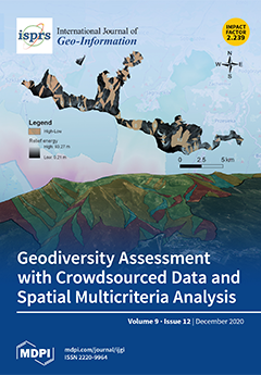
Cover Story (view full-size image): Geodiversity denotes variability in abiotic components in a hierarchical natural environment. Arguably, geodiversity underpins biodiversity. As such, geodiversity is essential to geoheritage, geoconservation, and human well-being. While the value of geodiversity is established, the methods of assessing it are not. Geodiversity assessment mainly involves expert judgement. The reliance on expert judgement rather than on direct quantitative valuation introduces ambiguity into geodiversity assessment. Might, however, the aggregate judgement of many experts be better than the judgement of a few? This paper tries to answer the question by crowdsourcing expert judgements and computing geodiversity with spatial multicriteria techniques. The reliability of geodiversity values is conveyed by uncertainty of assessment, which is computed and mapped. View this paper
  • Issues are regarded as officially published after their release is announced to the table of contents alert mailing list.
  • You may sign up for e-mail alerts to receive table of contents of newly released issues.
  • PDF is the official format for papers published in both, html and pdf forms. To view the papers in pdf format, click on the "PDF Full-text" link, and use the free Adobe Reader to open them.
Order results
Result details
Select all
Export citation of selected articles as:
15 pages, 17957 KiB  
Article
Local Segregation of Realised Niches in Lizards
by Neftalí Sillero, Elena Argaña, Cátia Matos, Marc Franch, Antigoni Kaliontzopoulou and Miguel A. Carretero
ISPRS Int. J. Geo-Inf. 2020, 9(12), 764; https://0-doi-org.brum.beds.ac.uk/10.3390/ijgi9120764 - 21 Dec 2020
Cited by 6 | Viewed by 3212
Abstract
Species can occupy different realised niches when sharing the space with other congeneric species or when living in allopatry. Ecological niche models are powerful tools to analyse species niches and their changes over time and space. Analysing how species’ realised niches shift is [...] Read more.
Species can occupy different realised niches when sharing the space with other congeneric species or when living in allopatry. Ecological niche models are powerful tools to analyse species niches and their changes over time and space. Analysing how species’ realised niches shift is paramount in ecology. Here, we examine the ecological realised niche of three species of wall lizards in six study areas: three areas where each species occurs alone; and three areas where they occur together in pairs. We compared the species’ realised niches and how they vary depending on species’ coexistence, by quantifying niche overlap between pairs of species or populations with the R package ecospat. For this, we considered three environmental variables (temperature, humidity, and wind speed) recorded at each lizard re-sighting location. Realised niches were very similar when comparing syntopic species occurring in the same study area. However, realised niches differed when comparing conspecific populations across areas. In each of the three areas of syntopy, the less abundant species shift its realised niche. Our study demonstrates that sympatry may shift species’ realised niche. Full article
(This article belongs to the Special Issue Application of GIS for Biodiversity Research)
Show Figures

Figure 1

16 pages, 5359 KiB  
Article
Participatory Rural Spatial Planning Based on a Virtual Globe-Based 3D PGIS
by Linjun Yu, Xiaotong Zhang, Feng He, Yalan Liu and Dacheng Wang
ISPRS Int. J. Geo-Inf. 2020, 9(12), 763; https://0-doi-org.brum.beds.ac.uk/10.3390/ijgi9120763 - 21 Dec 2020
Cited by 10 | Viewed by 2843
Abstract
With the current spatial planning reform in China, public participation is becoming increasingly important in the success of rural spatial planning. However, engaging various stakeholders in spatial planning projects is difficult, mainly due to the lack of planning knowledge and computer skills. Therefore, [...] Read more.
With the current spatial planning reform in China, public participation is becoming increasingly important in the success of rural spatial planning. However, engaging various stakeholders in spatial planning projects is difficult, mainly due to the lack of planning knowledge and computer skills. Therefore, this paper discusses the development of a virtual globe-based 3D participatory geographic information system (PGIS) aiming to support public participation in the spatial planning process. The 3D PGIS-based rural planning approach was applied in the village of XiaFan, Ningbo, China. The results demonstrate that locals’ participation capacity was highly promoted, with their interest in 3D PGIS visualization being highly activated. The interactive landscape design tools allow stakeholders to present their own suggestions and designs, just like playing a computer game, thus improving their interactive planning abilities on-site. The scientific analysis tools allow planners to analyze and evaluate planning scenarios in different disciplines in real-time to quickly respond to suggestions from participants on-site. Functions and tools such as data management, marking, and highlighting were found to be useful for smoothing the interactions among planners and participants. In conclusion, virtual globe-based 3D PGIS highly supports the participatory rural landscape planning process and is potentially applicable to other regions. Full article
Show Figures

Figure 1

22 pages, 5876 KiB  
Article
The Correlation between the Jobs–Housing Relationship and the Innovative Development of Sci-Tech Parks in New Urban Districts: A Case Study of the Hangzhou West Hi-Tech Corridor in China
by Yue Wu, Yue Yang, Qiuxiao Chen and Weishun Xu
ISPRS Int. J. Geo-Inf. 2020, 9(12), 762; https://0-doi-org.brum.beds.ac.uk/10.3390/ijgi9120762 - 21 Dec 2020
Cited by 1 | Viewed by 2451
Abstract
Sci-tech parks (STPs), as a key space carrier of urbanization, have transformed into comprehensive parks with mixed urban functions and advanced hi-tech industries. The jobs–housing relationship, which is closely related to the two major urban functions of work and residence, affects the efficiency [...] Read more.
Sci-tech parks (STPs), as a key space carrier of urbanization, have transformed into comprehensive parks with mixed urban functions and advanced hi-tech industries. The jobs–housing relationship, which is closely related to the two major urban functions of work and residence, affects the efficiency of urban operation. This study focused on the correlation between the jobs–housing relationship and the innovative development of STPs, adopting the Hangzhou West Hi-Tech Corridor as a case study. Four indicators reflecting the jobs–housing balance index and commuting distance and ten indicators reflecting agglomeration degree, development scale, innovative ability, financial status, and comprehensive development level of enterprises were selected to perform partial least squares regression. The results show that the jobs–housing relationship was correlated with the innovative development of STPs. Relatively short commuting distance may promote the development and agglomeration of sci-tech enterprises. However, short average commuting distance was not necessarily good. The working space and living space needed to be mixed at an appropriate scale and distance—to be close but not too close. This study provides references for the future development of STPs and the application of mixed-use zoning in the urban spatial planning; additionally, it supports for the research and practice of industry–city integration and urbanization. Full article
Show Figures

Figure 1

19 pages, 6932 KiB  
Article
Adjusting the Regular Network of Squares Resolution to the Digital Terrain Model Surface Shape
by Dariusz Gościewski and Małgorzata Gerus-Gościewska
ISPRS Int. J. Geo-Inf. 2020, 9(12), 761; https://0-doi-org.brum.beds.ac.uk/10.3390/ijgi9120761 - 20 Dec 2020
Cited by 2 | Viewed by 1857
Abstract
A regular network of squares is formed by points uniformly distributed (mostly in the square corners) over the surface that is represented by the network. Each point (node) of the network has specified coordinates (X and Y) with a fixed constant distance between [...] Read more.
A regular network of squares is formed by points uniformly distributed (mostly in the square corners) over the surface that is represented by the network. Each point (node) of the network has specified coordinates (X and Y) with a fixed constant distance between them. The third coordinate in a node (H) is determined by the application of interpolation based on the points distributed (usually dispersed as a point cloud e.g., from LiDAR) over the surface of the area surrounding the node. The regular network of squares formed in this manner allows the representation of a digital terrain model (DTM) to be performed in spatial information systems (SIP, GIS). The main problem that arises during the construction of such a network is the proper determination of its resolution (the base distance between the coordinates X and Y) depending on the topography. This article presents a method of the regular network of squares resolution determination depending on the morphological shape of the terrain surface. Following the application of the procedures being described, a differently shaped terrain is assigned various network densities. This enables the minimisation of inaccuracies of the surface model being formed. Consequently, a regular network of squares is formed with different base square sizes, which is adjusted with its resolution to the morphology of the surface it describes. Such operations allow the terrain model accuracy to be maintained over the entire area while reducing the number of points stored in the DTM database to the minimum. Full article
Show Figures

Figure 1

15 pages, 16905 KiB  
Article
Structural Elements Detection and Reconstruction (SEDR): A Hybrid Approach for Modeling Complex Indoor Structures
by Ke Wu, Wenzhong Shi and Wael Ahmed
ISPRS Int. J. Geo-Inf. 2020, 9(12), 760; https://0-doi-org.brum.beds.ac.uk/10.3390/ijgi9120760 - 19 Dec 2020
Cited by 8 | Viewed by 2421
Abstract
We present a hybrid approach for modeling complex interior structural elements from the unstructured point cloud without additional information. The proposed approach focuses on an integrated modeling strategy that can reconstruct structural elements and keep the balance of model completeness and quality. First, [...] Read more.
We present a hybrid approach for modeling complex interior structural elements from the unstructured point cloud without additional information. The proposed approach focuses on an integrated modeling strategy that can reconstruct structural elements and keep the balance of model completeness and quality. First, a data-driven approach detects the complete structure points of indoor scenarios including the curved wall structures and detailed structures. After applying the down-sampling process to point cloud dataset, ceiling and floor points are detected by RANSAC. The ceiling boundary points are selected as seed points of the growing algorithm to acquire points related to the wall segments. Detailed structures points are detected using the Grid-Slices analysis approach. Second, a model-driven refinement is conducted to the structure points that aims to decrease the impact of point cloud accuracy on the quality of the model. RANSAC algorithm is implemented to detect more accurate layout, and the hole in structure points is repaired in this refinement step. Lastly, the Screened Poisson surface reconstruction approach is conducted to generate the model based on the structure points after refinement. Our approach was validated on the backpack laser dataset, handheld laser dataset, and synthetic dataset, and experimental results demonstrate that our approach can preserve the curved wall structures and detailed structures in the model with high accuracy. Full article
Show Figures

Figure 1

23 pages, 7055 KiB  
Article
An Efficient Probabilistic Registration Based on Shape Descriptor for Heritage Field Inspection
by Yufu Zang, Bijun Li, Xiongwu Xiao, Jianfeng Zhu and Fancong Meng
ISPRS Int. J. Geo-Inf. 2020, 9(12), 759; https://0-doi-org.brum.beds.ac.uk/10.3390/ijgi9120759 - 19 Dec 2020
Cited by 1 | Viewed by 2432
Abstract
Heritage documentation is implemented by digitally recording historical artifacts for the conservation and protection of these cultural heritage objects. As efficient spatial data acquisition tools, laser scanners have been widely used to collect highly accurate three-dimensional (3D) point clouds without damaging the original [...] Read more.
Heritage documentation is implemented by digitally recording historical artifacts for the conservation and protection of these cultural heritage objects. As efficient spatial data acquisition tools, laser scanners have been widely used to collect highly accurate three-dimensional (3D) point clouds without damaging the original structure and the environment. To ensure the integrity and quality of the collected data, field inspection (i.e., on-spot checking the data quality) should be carried out to determine the need for additional measurements (i.e., extra laser scanning for areas with quality issues such as data missing and quality degradation). To facilitate inspection of all collected point clouds, especially checking the quality issues in overlaps between adjacent scans, all scans should be registered together. Thus, a point cloud registration method that is able to register scans fast and robustly is required. To fulfill the aim, this study proposes an efficient probabilistic registration for free-form cultural heritage objects by integrating the proposed principal direction descriptor and curve constraints. We developed a novel shape descriptor based on a local frame of principal directions. Within the frame, its density and distance feature images were generated to describe the shape of the local surface. We then embedded the descriptor into a probabilistic framework to reject ambiguous matches. Spatial curves were integrated as constraints to delimit the solution space. Finally, a multi-view registration was used to refine the position and orientation of each scan for the field inspection. Comprehensive experiments show that the proposed method was able to perform well in terms of rotation error, translation error, robustness, and runtime and outperformed some commonly used approaches. Full article
(This article belongs to the Special Issue Cultural Heritage Mapping and Observation)
Show Figures

Figure 1

14 pages, 14885 KiB  
Article
Deep Learning for Detecting and Classifying Ocean Objects: Application of YoloV3 for Iceberg–Ship Discrimination
by Frederik Seerup Hass and Jamal Jokar Arsanjani
ISPRS Int. J. Geo-Inf. 2020, 9(12), 758; https://0-doi-org.brum.beds.ac.uk/10.3390/ijgi9120758 - 19 Dec 2020
Cited by 18 | Viewed by 3318
Abstract
Synthetic aperture radar (SAR) plays a remarkable role in ocean surveillance, with capabilities of detecting oil spills, icebergs, and marine traffic both at daytime and at night, regardless of clouds and extreme weather conditions. The detection of ocean objects using SAR relies on [...] Read more.
Synthetic aperture radar (SAR) plays a remarkable role in ocean surveillance, with capabilities of detecting oil spills, icebergs, and marine traffic both at daytime and at night, regardless of clouds and extreme weather conditions. The detection of ocean objects using SAR relies on well-established methods, mostly adaptive thresholding algorithms. In most waters, the dominant ocean objects are ships, whereas in arctic waters the vast majority of objects are icebergs drifting in the ocean and can be mistaken for ships in terms of navigation and ocean surveillance. Since these objects can look very much alike in SAR images, the determination of what objects actually are still relies on manual detection and human interpretation. With the increasing interest in the arctic regions for marine transportation, it is crucial to develop novel approaches for automatic monitoring of the traffic in these waters with satellite data. Hence, this study aims at proposing a deep learning model based on YoloV3 for discriminating icebergs and ships, which could be used for mapping ocean objects ahead of a journey. Using dual-polarization Sentinel-1 data, we pilot-tested our approach on a case study in Greenland. Our findings reveal that our approach is capable of training a deep learning model with reliable detection accuracy. Our methodical approach along with the choice of data and classifiers can be of great importance to climate change researchers, shipping industries and biodiversity analysts. The main difficulties were faced in the creation of training data in the Arctic waters and we concluded that future work must focus on issues regarding training data. Full article
Show Figures

Figure 1

18 pages, 4368 KiB  
Article
Understanding Spatiotemporal Variations of Ridership by Multiple Taxi Services
by Wenbo Zhang, Yinfei Xi and Satish V. Ukkusuri
ISPRS Int. J. Geo-Inf. 2020, 9(12), 757; https://0-doi-org.brum.beds.ac.uk/10.3390/ijgi9120757 - 18 Dec 2020
Cited by 1 | Viewed by 2237
Abstract
Recent years have seen the big growth of app-based taxi services by not only competing for rides with street-hailing taxi services but also generating new taxi rides. Moreover, the innovation in dynamic pricing also makes it competitive in both passenger and driver sides. [...] Read more.
Recent years have seen the big growth of app-based taxi services by not only competing for rides with street-hailing taxi services but also generating new taxi rides. Moreover, the innovation in dynamic pricing also makes it competitive in both passenger and driver sides. However, current literature still lacks better understandings of induced changes in spatiotemporal variations in multiple taxi ridership after app-based taxi service launch. This study develops two study cases in New York City to explore impacts of presence of app-based taxi services on daily total and street-hailing taxi rides and impacts of dynamic pricing on hourly app-based taxi rides. Considering the panel data and treatment effect measurement in this problem, we introduce a mixed modeling structure with both geographically weighted panel regression and difference-in-difference estimator. This mixed modeling structure outperforms traditional fixed effects model in our study cases. Empirical analyses identified the significant spatiotemporal variations in impacts of presence of app-based taxi services; for instance, impacts daily total taxi rides in 2014 and 2016 and impacts on street-hailing taxi rides from 2012 to 2016. Moreover, we capture the spatial variations in impacts of dynamic pricing on hourly app-based taxi rides, as well as significant impacts of time of day, day of week, and vehicle supply. Full article
(This article belongs to the Special Issue Spatio-Temporal Models and Geo-Technologies)
Show Figures

Figure 1

13 pages, 5069 KiB  
Article
Identifying Port Calls of Ships by Uncertain Reasoning with Trajectory Data
by Lin Wu, Yongjun Xu and Fei Wang
ISPRS Int. J. Geo-Inf. 2020, 9(12), 756; https://0-doi-org.brum.beds.ac.uk/10.3390/ijgi9120756 - 18 Dec 2020
Cited by 9 | Viewed by 3366
Abstract
Considering that ports are key nodes of the maritime transport network, it is of great importance to identify ships’ arrivals and departures. Compared with partial proprietary data from a port authority or shipping company, approaches based on compulsory Automatic Identification System (AIS) data [...] Read more.
Considering that ports are key nodes of the maritime transport network, it is of great importance to identify ships’ arrivals and departures. Compared with partial proprietary data from a port authority or shipping company, approaches based on compulsory Automatic Identification System (AIS) data reported by ships can produce transparent datasets covering wider areas, which is necessary for researchers and policy makers. Detecting port calls based on trajectory data is a difficult problem due to the huge uncertainty inherent in information such as ships’ ambiguous statuses and ports’ irregular boundaries. However, we noticed that little attention has been paid to this fundamental problem of shipping network analysis, and considerable noise may have been introduced in previous work on maritime network assessment based on AIS data, which usually modeled each port as a circle with a fixed radius such as 1 or 2 km. In this paper, we propose a method for identifying port calls by uncertain reasoning with trajectory data, which represents each port with an arbitrary shape as a set of geographical grid cells belonging to berths inside this port. Based on this high-spatial-resolution representation, port calls were identified when a ship was in any of these cells. Our method was implemented with around 14 billion AIS messages worldwide over 8 months, and examples of the results are provided. Full article
(This article belongs to the Special Issue Spatio-Temporal Models and Geo-Technologies)
Show Figures

Figure 1

16 pages, 2577 KiB  
Article
Infrastructure of the Spatial Information in the European Community (INSPIRE) Based on Examples of Italy and Poland
by Marek Ogryzek, Eufemia Tarantino and Krzysztof Rząsa
ISPRS Int. J. Geo-Inf. 2020, 9(12), 755; https://0-doi-org.brum.beds.ac.uk/10.3390/ijgi9120755 - 16 Dec 2020
Cited by 14 | Viewed by 3070
Abstract
Binding and planned community regulations regarding INSPIRE and other documents resulting from work on INSPIRE have forced the member countries to implement new or updated regulations. The purpose of creating the spatial information infrastructure was to unify the exchange of geographical data at [...] Read more.
Binding and planned community regulations regarding INSPIRE and other documents resulting from work on INSPIRE have forced the member countries to implement new or updated regulations. The purpose of creating the spatial information infrastructure was to unify the exchange of geographical data at the national and international levels, create transparent and favorable conditions for the use of geographical data, facilitate decision-making and develop business activity, and, as a consequence, facilitate the creation of the INSPIRE geoportal by the European Research Center (JRC) of the European Commission, which aims be the central hub of the European spatial information infrastructure. Land management systems use layers from geoportals and are also a data source because their task is to develop sustainable space development. The article presents the rules for implementing EU directives in Poland and Italy at various levels of detail and examines access to data and spatial information infrastructure. A comparative analysis of geoportals was performed in terms of the functionality and availability of free data (types of data) at national and local levels in terms of verification of compliance with the Ubiquitous Public Access Context Information Model (UPA) defined by the International Organization for Standardization (ISO) 19100. National geoportals (Polish Geoportal 2 and the Italian-Geoportale Nazionale) and Municipal Spatial Information Systems from the cities of Olsztyn and Bari were compared. Full article
(This article belongs to the Special Issue Digital Twins and Land Administration Systems)
Show Figures

Figure 1

16 pages, 4565 KiB  
Article
The Land Use Mapping Techniques (Including the Areas Used by Pedestrians) Based on Low-Level Aerial Imagery
by Maciej Smaczyński, Beata Medyńska-Gulij and Łukasz Halik
ISPRS Int. J. Geo-Inf. 2020, 9(12), 754; https://0-doi-org.brum.beds.ac.uk/10.3390/ijgi9120754 - 16 Dec 2020
Cited by 7 | Viewed by 2983
Abstract
Traditionally, chorochromatic maps with a qualitative measurement level are used for land use presentations. Along with the use of UAV (Unmanned Aerial Vehicles), it became possible to register dynamic phenomena in a small space. We analyze the application of qualitative and quantitative mapping [...] Read more.
Traditionally, chorochromatic maps with a qualitative measurement level are used for land use presentations. Along with the use of UAV (Unmanned Aerial Vehicles), it became possible to register dynamic phenomena in a small space. We analyze the application of qualitative and quantitative mapping methods to visualize land use in a dynamic context thanks to cyclically obtained UAV imaging. The aim of the research is to produce thematic maps showing the actual land use of the small area urbanized by pedestrians. The research was based on low-level aerial imagery that recorded the movement of pedestrians in the research area. Additionally, based on the observation of pedestrian movement, researchers pointed out the areas of land that pedestrians used incorrectly. For this purpose, the author will present his own concept of the point-to-polygon transformation of pedestrians’ representation. The research was an opportunity to demonstrate suitable mapping techniques to effectively convey the information on land use by pedestrians. The results allowed the authors of this article to draw conclusions on the choice of suitable mapping techniques during the process of thematic land use map design and to specify further areas for research. Full article
(This article belongs to the Special Issue Multimedia Cartography)
Show Figures

Figure 1

22 pages, 3274 KiB  
Review
Towards Self-Service GIS—Combining the Best of the Semantic Web and Web GIS
by Alexandra Rowland, Erwin Folmer and Wouter Beek
ISPRS Int. J. Geo-Inf. 2020, 9(12), 753; https://0-doi-org.brum.beds.ac.uk/10.3390/ijgi9120753 - 15 Dec 2020
Cited by 18 | Viewed by 4525
Abstract
The field of geographic information science has grown exponentially over the last few decades and, particularly within the context of the pervasiveness of the internet, bears witness to a rapid transition of its associated technologies from stand-alone systems to increasingly networked and distributed [...] Read more.
The field of geographic information science has grown exponentially over the last few decades and, particularly within the context of the pervasiveness of the internet, bears witness to a rapid transition of its associated technologies from stand-alone systems to increasingly networked and distributed systems as geospatial information becomes increasingly available online. With its long-standing history for innovation, the field has adopted many disruptive technologies from the fields of computer and information sciences through this transition towards web geographic information systems (GIS); most interestingly in the context of this research is the limited uptake of semantic web technologies by the field and its associated technologies, the lack of which has resulted in a technological disjoint between these fields. As the field seeks to make geospatial information more accessible to more users and in more contexts through ‘self-service’ applications, the use of these technologies is imperative to support the interoperability between distributed data sources. This paper aims to provide insight into what linked data tooling already exists, and based on the features of these, what may be possible for the achievement of self-service GIS. Findings include what visualisation, interactivity, analytics and usability features could be included in the realisation of self-service GIS, pointing to the opportunities that exist in bringing GIS technologies closer to the user. Full article
(This article belongs to the Special Issue Spatial Data Infrastructure for Distributed Management and Processing)
Show Figures

Figure 1

20 pages, 1547 KiB  
Article
Opportunities and Challenges of Geospatial Analysis for Promoting Urban Livability in the Era of Big Data and Machine Learning
by Anna Kovacs-Györi, Alina Ristea, Clemens Havas, Michael Mehaffy, Hartwig H. Hochmair, Bernd Resch, Levente Juhasz, Arthur Lehner, Laxmi Ramasubramanian and Thomas Blaschke
ISPRS Int. J. Geo-Inf. 2020, 9(12), 752; https://0-doi-org.brum.beds.ac.uk/10.3390/ijgi9120752 - 15 Dec 2020
Cited by 22 | Viewed by 7409
Abstract
Urban systems involve a multitude of closely intertwined components, which are more measurable than before due to new sensors, data collection, and spatio-temporal analysis methods. Turning these data into knowledge to facilitate planning efforts in addressing current challenges of urban complex systems requires [...] Read more.
Urban systems involve a multitude of closely intertwined components, which are more measurable than before due to new sensors, data collection, and spatio-temporal analysis methods. Turning these data into knowledge to facilitate planning efforts in addressing current challenges of urban complex systems requires advanced interdisciplinary analysis methods, such as urban informatics or urban data science. Yet, by applying a purely data-driven approach, it is too easy to get lost in the ‘forest’ of data, and to miss the ‘trees’ of successful, livable cities that are the ultimate aim of urban planning. This paper assesses how geospatial data, and urban analysis, using a mixed methods approach, can help to better understand urban dynamics and human behavior, and how it can assist planning efforts to improve livability. Based on reviewing state-of-the-art research the paper goes one step further and also addresses the potential as well as limitations of new data sources in urban analytics to get a better overview of the whole ‘forest’ of these new data sources and analysis methods. The main discussion revolves around the reliability of using big data from social media platforms or sensors, and how information can be extracted from massive amounts of data through novel analysis methods, such as machine learning, for better-informed decision making aiming at urban livability improvement. Full article
(This article belongs to the Special Issue Geodata Science and Spatial Analysis in Urban Studies)
Show Figures

Figure 1

20 pages, 3563 KiB  
Article
Analysis of the Temporal Characteristics of the Elderly Traveling by Bus Using Smart Card Data
by Zhicheng Shi, Lilian S. C. Pun-Cheng, Xintao Liu, Jianhui Lai, Chengzhuo Tong, Anshu Zhang, Min Zhang and Wenzhong Shi
ISPRS Int. J. Geo-Inf. 2020, 9(12), 751; https://0-doi-org.brum.beds.ac.uk/10.3390/ijgi9120751 - 15 Dec 2020
Cited by 12 | Viewed by 2744
Abstract
Many cities around the world face the challenge of an aging population. A full understanding of the mobility behavior characteristics of the elderly is one necessary and urgent consideration as regards the current aging trend if sustainable urban development is to be fully [...] Read more.
Many cities around the world face the challenge of an aging population. A full understanding of the mobility behavior characteristics of the elderly is one necessary and urgent consideration as regards the current aging trend if sustainable urban development is to be fully realized. This paper presents a systematic approach to analyzing the dynamic mobility characteristics of the elderly who travel by bus using smart card big data. The characteristics include temporal distribution, travel distance, travel duration, travel frequency, and also the spatial distribution of such travelers. The findings of these mobility characteristics can directly contribute to both public transport policy making, service, and management. In this study, the analytics of the elderly are also compared with that of the average adult group so as to identify both the similarities and differences between the two groups. Beijing, a megacity, with a very high life expectancy and in which the bus is the dominant mode of public transport for the elderly, was used as the study area. The significance of this research concerns a newly developed systematic approach that is able to analyze the dynamic mobility characteristics of the elderly using smart card data. Full article
Show Figures

Figure 1

17 pages, 5159 KiB  
Article
A Virtual Reality Simulation Method for Crowd Evacuation in a Multiexit Indoor Fire Environment
by Yukun Guo, Jun Zhu, Yu Wang, Jinchuan Chai, Weilian Li, Lin Fu, Bingli Xu and Yuhang Gong
ISPRS Int. J. Geo-Inf. 2020, 9(12), 750; https://0-doi-org.brum.beds.ac.uk/10.3390/ijgi9120750 - 15 Dec 2020
Cited by 20 | Viewed by 3232
Abstract
Evacuation simulations in virtual indoor fire scenes hold great significance for public safety. However, existing evacuation simulation methods are inefficient and provide poor visualized when applied to virtual reality (VR) simulations. Additionally, the influences of the interaction of evacuation processes on the choice [...] Read more.
Evacuation simulations in virtual indoor fire scenes hold great significance for public safety. However, existing evacuation simulation methods are inefficient and provide poor visualized when applied to virtual reality (VR) simulations. Additionally, the influences of the interaction of evacuation processes on the choice of multiple exits have not been fully considered. In the paper, we propose a VR simulation method for crowd evacuation in a multiexit indoor fire environment. An indoor 3D scene model and character model, for studying the environmental factors that affect the multiexit selection of personnel during the fire process, are combined with environmental factors to enhance the evacuation route planning algorithm to improve the efficiency of the VR simulation of evacuation in the scene. In addition, a prototype system that supports multiple experience modes is proposed, and case experiment analyses are performed. The results show that the method described in this paper can effectively support the real-time simulation of indoor fire evacuations in virtual scenes, providing both reliable simulation results and good visualization effects. Full article
Show Figures

Figure 1

16 pages, 12476 KiB  
Article
Data Gap Classification for Terrestrial Laser Scanning-Derived Digital Elevation Models
by Matthew S. O’Banion, Michael J. Olsen, Jeff P. Hollenbeck and William C. Wright
ISPRS Int. J. Geo-Inf. 2020, 9(12), 749; https://0-doi-org.brum.beds.ac.uk/10.3390/ijgi9120749 - 15 Dec 2020
Cited by 6 | Viewed by 2163
Abstract
Extensive gaps in terrestrial laser scanning (TLS) point cloud data can primarily be classified into two categories: occlusions and dropouts. These gaps adversely affect derived products such as 3D surface models and digital elevation models (DEMs), requiring interpolation to produce a spatially continuous [...] Read more.
Extensive gaps in terrestrial laser scanning (TLS) point cloud data can primarily be classified into two categories: occlusions and dropouts. These gaps adversely affect derived products such as 3D surface models and digital elevation models (DEMs), requiring interpolation to produce a spatially continuous surface for many types of analyses. Ultimately, the relative proportion of occlusions in a TLS survey is an indicator of the survey quality. Recognizing that regions of a scanned scene occluded from one scan position are likely visible from another point of view, a prevalence of occlusions can indicate an insufficient number of scans and/or poor scanner placement. Conversely, a prevalence of dropouts is ordinarily not indicative of survey quality, as a scanner operator cannot usually control the presence of specular reflective or absorbent surfaces in a scanned scene. To this end, this manuscript presents a novel methodology to determine data completeness by properly classifying and quantifying the proportion of the site that consists of point returns and the two types of data gaps. Knowledge of the data gap origin can not only facilitate the judgement of TLS survey quality, but it can also identify pooled water when water reflections are the main source of dropouts in a scene, which is important for ecological research, such as habitat modeling. The proposed data gap classification methodology was successfully applied to DEMs for two study sites: (1) A controlled test site established by the authors for the proof of concept of classification of occlusions and dropouts and (2) a rocky intertidal environment (Rabbit Rock) presenting immense challenges to develop a topographic model due to significant tidal fluctuations, pooled water bodies, and rugged terrain generating many occlusions. Full article
(This article belongs to the Special Issue Advancements in Remote Sensing Derived Point Cloud Processing)
Show Figures

Figure 1

22 pages, 8469 KiB  
Article
Flash Flood Susceptibility Assessment Based on Geodetector, Certainty Factor, and Logistic Regression Analyses in Fujian Province, China
by Yifan Cao, Hongliang Jia, Junnan Xiong, Weiming Cheng, Kun Li, Quan Pang and Zhiwei Yong
ISPRS Int. J. Geo-Inf. 2020, 9(12), 748; https://0-doi-org.brum.beds.ac.uk/10.3390/ijgi9120748 - 14 Dec 2020
Cited by 36 | Viewed by 3396
Abstract
Flash floods are one of the most frequent natural disasters in Fujian Province, China, and they seriously threaten the safety of infrastructure, natural ecosystems, and human life. Thus, recognition of possible flash flood locations and exploitation of more precise flash flood susceptibility maps [...] Read more.
Flash floods are one of the most frequent natural disasters in Fujian Province, China, and they seriously threaten the safety of infrastructure, natural ecosystems, and human life. Thus, recognition of possible flash flood locations and exploitation of more precise flash flood susceptibility maps are crucial to appropriate flash flood management in Fujian. Based on this objective, in this study, we developed a new method of flash flood susceptibility assessment. First, we utilized double standards, including the Pearson correlation coefficient (PCC) and Geodetector to screen the assessment indicator. Second, in order to consider the weight of each classification of indicator and the weights of the indicators simultaneously, we used the ensemble model of the certainty factor (CF) and logistic regression (LR) to establish a frame for the flash flood susceptibility assessment. Ultimately, we used this ensemble model (CF-LR), the standalone CF model, and the standalone LR model to prepare flash flood susceptibility maps for Fujian Province and compared their prediction performance. The results revealed the following. (1) Land use, topographic relief, and 24 h precipitation (H24_100) within a 100-year return period were the three main factors causing flash floods in Fujian Province. (2) The area under the curve (AUC) results showed that the CF-LR model had the best precision in terms of both the success rate (0.860) and the prediction rate (0.882). (3) The assessment results of all three models showed that between 22.27% and 29.35% of the study area have high and very high susceptibility levels, and these areas are mainly located in the east, south, and southeast coastal areas, and the north and west low mountain areas. The results of this study provide a scientific basis and support for flash flood prevention in Fujian Province. The proposed susceptibility assessment framework may also be helpful for other natural disaster susceptibility analyses. Full article
Show Figures

Figure 1

22 pages, 7444 KiB  
Article
A BIM Based Hybrid 3D Indoor Map Model for Indoor Positioning and Navigation
by Jianhua Liu, Jingyan Luo, Jiwei Hou, Danqi Wen, Guoqiang Feng and Xu Zhang
ISPRS Int. J. Geo-Inf. 2020, 9(12), 747; https://0-doi-org.brum.beds.ac.uk/10.3390/ijgi9120747 - 13 Dec 2020
Cited by 10 | Viewed by 5330
Abstract
Accurate and fast indoor Location-Based Services (LBS) is very important for daily life and emergency response. Indoor map is the basis of indoor LBS. The model construction and data organization of indoor map are the key scientific problems that urgently need to be [...] Read more.
Accurate and fast indoor Location-Based Services (LBS) is very important for daily life and emergency response. Indoor map is the basis of indoor LBS. The model construction and data organization of indoor map are the key scientific problems that urgently need to be solved in the current indoor LBS application. In recent years, hybrid models have been used widely in the research of indoor map, because they can balance the limitations of single models. However, the current studies about hybrid model pay more attention to the model accuracy and modeling algorithm, while ignoring its relationship between positioning and navigation and its practicality in mobile indoor LBS applications. This paper addresses a new indoor map model, named Building Information Modeling based Positioning and Navigation (BIMPN), which is based on the entity model and the network model. The highlight of BIMPN is that it proposes a concept of Step Node (SN) to assist indoor positioning and navigation function. We developed the Mobile Indoor Positioning and Navigation System (MIPNS) to verify the practicability of BIMPN. Results indicate that the BIMPN can effectively organize the characteristics of indoor spaces and the building features, and assist indoor positioning and navigation. The BIMPN proposed in this paper can be used for the construction of indoor maps and it is suitable for mobile indoor positioning and navigation systems. Full article
Show Figures

Graphical abstract

25 pages, 15981 KiB  
Article
Mapping Food and Health Premises in Barcelona. An Approach to Logics of Distribution and Proximity of Essential Urban Services
by Carles Crosas and Eulàlia Gómez-Escoda
ISPRS Int. J. Geo-Inf. 2020, 9(12), 746; https://0-doi-org.brum.beds.ac.uk/10.3390/ijgi9120746 - 13 Dec 2020
Cited by 6 | Viewed by 3051
Abstract
The research analyzes the image of Barcelona and compares differences in quantity, variety and proximity of some essential services in diverse urban fragments. Focusing on food and health premises as critical universal services, series of maps provide overviews on the intensity of use [...] Read more.
The research analyzes the image of Barcelona and compares differences in quantity, variety and proximity of some essential services in diverse urban fragments. Focusing on food and health premises as critical universal services, series of maps provide overviews on the intensity of use to which each service is subjected, latent logics of their physical proximity and performance in regular urban fabrics due to the combination of activities and population distribution. The research uses a methodological approach and parameterization of the minimum daily urban mixture to highlight the uniqueness of the case of Barcelona, distinguished by the compactness of the urban fabric and the contiguity of activities, and to describe an extensive characterization of areas that from this perspective can be considered hyper-served or under-served. This investigation aims to contribute to the understanding of the necessity of the urban mixture and to provide clues about the distribution of services and activities. Full article
(This article belongs to the Special Issue Measuring, Mapping, Modeling, and Visualization of Cities)
Show Figures

Figure 1

20 pages, 6786 KiB  
Article
Recognition Method of New Address Elements in Chinese Address Matching Based on Deep Learning
by Hongwei Zhang, Fu Ren, Huiting Li, Renfei Yang, Shuai Zhang and Qingyun Du
ISPRS Int. J. Geo-Inf. 2020, 9(12), 745; https://0-doi-org.brum.beds.ac.uk/10.3390/ijgi9120745 - 12 Dec 2020
Cited by 15 | Viewed by 3016
Abstract
Location services based on address matching play an important role in people’s daily lives. However, with the rapid development of cities, new addresses are constantly emerging. Due to the untimely updating of word segmentation dictionaries and address databases, the accuracy of address segmentation [...] Read more.
Location services based on address matching play an important role in people’s daily lives. However, with the rapid development of cities, new addresses are constantly emerging. Due to the untimely updating of word segmentation dictionaries and address databases, the accuracy of address segmentation and the certainty of address matching face severe challenges. Therefore, a new address element recognition method for address matching is proposed. The method first uses the bidirectional encoder representations from transformers (BERT) model to learn the contextual information and address model features. Second, the conditional random field (CRF) is used to model the constraint relationships among the tags. Finally, a new address element is recognized according to the tag, and the new address element is put into the word segmentation dictionary. The spatial information is assigned to it, and it is put into the address database. Different sequence tagging models and different vector representations of addresses are used for comparative evaluation. The experimental results show that the method introduced in this paper achieves the maximum generalization ability, its F1 score is 0.78, and the F1 score on the testing dataset also achieves a high value (0.95). Full article
Show Figures

Figure 1

15 pages, 2176 KiB  
Article
Quantifying the Spatial Heterogeneity and Driving Factors of Aboveground Forest Biomass in the Urban Area of Xi’an, China
by Xuan Zhao, Jianjun Liu, Hongke Hao and Yanzheng Yang
ISPRS Int. J. Geo-Inf. 2020, 9(12), 744; https://0-doi-org.brum.beds.ac.uk/10.3390/ijgi9120744 - 12 Dec 2020
Cited by 4 | Viewed by 2177
Abstract
Investigating the spatial distribution of urban forest biomass and its potential influencing factors would provide useful insights for configuring urban greenspace. Although China is experiencing an unprecedented scale of urbanization, the spatial pattern of the urban forest biomass distribution as a critical component [...] Read more.
Investigating the spatial distribution of urban forest biomass and its potential influencing factors would provide useful insights for configuring urban greenspace. Although China is experiencing an unprecedented scale of urbanization, the spatial pattern of the urban forest biomass distribution as a critical component in the urban landscape has not been fully examined. Using the geographic detector method, this research examines the impacts of four geographical factors (GFs)—dominant tree species, forest categories, land types, and age groups—on the aboveground biomass distribution of urban forests in 1480 plots in Xi’an, China. The results indicate that (1) the aboveground biomass and four GFs show obvious heterogeneity regarding their spatial distribution in Xi’an; (2) the dominant tree species and age group which impacts the patterns of aboveground biomass are the primary GFs, with the independent q value (a statistic metric used to quantify the impacts of GFs in this study) reaching 0.595 and 0.202, respectively, while the forest category and land type were weakly linked to the spatial variation of aboveground biomass, with a q value of 0.087 and 0.076, respectively; and (3) the interactions among these four GFs also tend to contribute to the distribution pattern of aboveground biomass. The interactions between GFs achieved a larger impact than the sum of impacts that were independently obtained from the factors. Our results showed that the method of using a geographical detector is a useful tool in the urban area, and can reveal the driver pattern of aboveground biomass and provide a reference for city planning and management. Full article
(This article belongs to the Special Issue Geo-Information Technology and Its Applications)
Show Figures

Figure 1

18 pages, 2515 KiB  
Article
Automatic Workflow for Roof Extraction and Generation of 3D CityGML Models from Low-Cost UAV Image-Derived Point Clouds
by Arnadi Murtiyoso, Mirza Veriandi, Deni Suwardhi, Budhy Soeksmantono and Agung Budi Harto
ISPRS Int. J. Geo-Inf. 2020, 9(12), 743; https://0-doi-org.brum.beds.ac.uk/10.3390/ijgi9120743 - 12 Dec 2020
Cited by 15 | Viewed by 4351
Abstract
Developments in UAV sensors and platforms in recent decades have stimulated an upsurge in its application for 3D mapping. The relatively low-cost nature of UAVs combined with the use of revolutionary photogrammetric algorithms, such as dense image matching, has made it a strong [...] Read more.
Developments in UAV sensors and platforms in recent decades have stimulated an upsurge in its application for 3D mapping. The relatively low-cost nature of UAVs combined with the use of revolutionary photogrammetric algorithms, such as dense image matching, has made it a strong competitor to aerial lidar mapping. However, in the context of 3D city mapping, further 3D modeling is required to generate 3D city models which is often performed manually using, e.g., photogrammetric stereoplotting. The aim of the paper was to try to implement an algorithmic approach to building point cloud segmentation, from which an automated workflow for the generation of roof planes will also be presented. 3D models of buildings are then created using the roofs’ planes as a base, therefore satisfying the requirements for a Level of Detail (LoD) 2 in the CityGML paradigm. Consequently, the paper attempts to create an automated workflow starting from UAV-derived point clouds to LoD 2-compatible 3D model. Results show that the rule-based segmentation approach presented in this paper works well with the additional advantage of instance segmentation and automatic semantic attribute annotation, while the 3D modeling algorithm performs well for low to medium complexity roofs. The proposed workflow can therefore be implemented for simple roofs with a relatively low number of planar surfaces. Furthermore, the automated approach to the 3D modeling process also helps to maintain the geometric requirements of CityGML such as 3D polygon coplanarity vis-à-vis manual stereoplotting. Full article
(This article belongs to the Special Issue Virtual 3D City Models)
Show Figures

Figure 1

20 pages, 8745 KiB  
Article
Exploring the Attractiveness of Residential Areas for Human Activities Based on Shared E-Bike Trajectory Data
by Xiaoqian Cheng, Weibing Du, Chengming Li, Leiku Yang and Linjuan Xu
ISPRS Int. J. Geo-Inf. 2020, 9(12), 742; https://0-doi-org.brum.beds.ac.uk/10.3390/ijgi9120742 - 11 Dec 2020
Cited by 2 | Viewed by 2246
Abstract
Human activities generate diverse and sophisticated functional areas and may impact the existing planning of functional areas. Understanding the relationship between human activities and functional areas is key to identifying the real-time urban functional areas based on trajectories. Few previous studies have analyzed [...] Read more.
Human activities generate diverse and sophisticated functional areas and may impact the existing planning of functional areas. Understanding the relationship between human activities and functional areas is key to identifying the real-time urban functional areas based on trajectories. Few previous studies have analyzed the interactive information on humans and regions for functional area identification. The relationship between human activities and residential areas is the most representative for urban functional areas because residential areas cover a wide range and are closely connected with human life. The aim of this paper is to propose the CARA (Commuting Activity and Residential Area) model to quantify the correlation between human activities and urban residential areas. In this model, human activities are represented by hot spots extracted by the Gaussian Mixture Model algorithm while residential areas are represented by POI (point of interest) data. The model shows that human activities and residential areas present a logarithmic relationship. The CARA model is further assessed by retrieving urban residential areas in Tengzhou City from shared e-bike trajectories. Compared with the actual map, the accuracy reaches 83.3%, thus demonstrating the model’s reliability and feasibility. This study provides a new method for functional areas identification based on trajectory data, which is helpful for formulating the urban people-oriented policies. Full article
Show Figures

Figure 1

30 pages, 14649 KiB  
Article
Virtual Touring for the Puglia Regional Museum Directorate
by Antonella Lerario and Nicola Maiellaro
ISPRS Int. J. Geo-Inf. 2020, 9(12), 741; https://0-doi-org.brum.beds.ac.uk/10.3390/ijgi9120741 - 11 Dec 2020
Cited by 3 | Viewed by 2970
Abstract
The article describes the design process carried out to deliver a tool for the virtual fruition of the resources of the Puglia Regional Museum Directorate through multimedia content, within the frame of the Vi.S.T.A. (Virtual and Social heritage Touring Application) project. Identifying the [...] Read more.
The article describes the design process carried out to deliver a tool for the virtual fruition of the resources of the Puglia Regional Museum Directorate through multimedia content, within the frame of the Vi.S.T.A. (Virtual and Social heritage Touring Application) project. Identifying the virtual tour as the most suitable technology to achieve the promotion and exploitation needs of the Directorate’s museums, the project envisages the realization of an integrated system, conceived as a dedicated IT platform including a specific virtual touring section, for a selected pilot case. The article focuses on the design study for the virtual tour interface and the selection of the most appropriate functions for it, and describes the collaborative approach adopted. After the description of the project objectives and context, the design study and the related methodology are presented. Then, the results of the design activity are presented and discussed. Full article
(This article belongs to the Special Issue Cultural Heritage Mapping and Observation)
Show Figures

Figure 1

19 pages, 5572 KiB  
Article
Spatial Modeling for Homicide Rates Estimation in Pernambuco State-Brazil
by Carlos Silva, Silas Melo, Alex Santos, Pedro Almeida Junior, Simone Sato, Katarina Santiago and Lucilene Sá
ISPRS Int. J. Geo-Inf. 2020, 9(12), 740; https://0-doi-org.brum.beds.ac.uk/10.3390/ijgi9120740 - 11 Dec 2020
Cited by 14 | Viewed by 3247
Abstract
Homicide rates have been increasing worldwide, especially in Latin America, where it is considered one of the most lethal of the continents. Despite that, the occurrence of homicides are not homogeneous in time and space on the continent or in the Brazilian cities. [...] Read more.
Homicide rates have been increasing worldwide, especially in Latin America, where it is considered one of the most lethal of the continents. Despite that, the occurrence of homicides are not homogeneous in time and space on the continent or in the Brazilian cities. Therefore, the main objective of this study is to present a spatial analysis of homicides in the state of Pernambuco, Brazil, between the years of 2016 and 2019, by the use of an exploratory analysis of spatial homicide data with five variables that could explain its occurrence. In addition to that, it was applied the Global and Local Moran’s Index, Ordinary Least Squares (OLS) regression, and Geographically Weighted Regression (GWR), all implemented in the Geographic Information System (GIS) software. Thus, the distribution of clusters revealed a spatial autocorrelation for homicide rates, confirming a spatial dependence. This data also showed the polarization of the rate between the coast and the interior of the state of Pernambuco. Full article
(This article belongs to the Special Issue Using GIS to Improve (Public) Safety and Security)
Show Figures

Figure 1

14 pages, 8502 KiB  
Article
Correlation between Geochemical and Multispectral Patterns in an Area Severely Contaminated by Former Hg-As Mining
by Carlos Boente, Lorena Salgado, Emilio Romero-Macías, Arturo Colina, Carlos A. López-Sánchez and José Luis R. Gallego
ISPRS Int. J. Geo-Inf. 2020, 9(12), 739; https://0-doi-org.brum.beds.ac.uk/10.3390/ijgi9120739 - 10 Dec 2020
Cited by 7 | Viewed by 2681
Abstract
In the context of soil pollution, plants suffer stress when exposed to extreme concentrations of potentially toxic elements (PTEs). The alterations to the plants caused by such stressors can be monitored by multispectral imagery in the form of vegetation indices, which can inform [...] Read more.
In the context of soil pollution, plants suffer stress when exposed to extreme concentrations of potentially toxic elements (PTEs). The alterations to the plants caused by such stressors can be monitored by multispectral imagery in the form of vegetation indices, which can inform pollution management strategies. Here we combined geochemistry and remote sensing techniques to offer a preliminary soil pollution assessment of a vast abandoned spoil heap in the surroundings of La Soterraña mining site (Asturias, Spain). To study the soil distribution of the PTEs over time, twenty-seven soil samples were randomly collected downstream of and around the main spoil heap. Furthermore, the area was covered by an unmanned aerial vehicle (UAV) carrying a high-resolution multispectral camera with four bands (red, green, red-edge and near infrared). Multielement analysis revealed mercury and arsenic as principal pollutants. Two indices (from a database containing up to 55 indices) offered a proper correlation with the concentration of PTEs. These were: CARI2, presenting a Pearson Coefficient (PC) of 0.89 for concentrations >200 mg/kg of As; and NDVIg, PC of −0.67 for >40 mg/kg of Hg. The combined approach helps prediction of those areas susceptible to greatest pollution, thus reducing the costs of geochemical campaigns. Full article
(This article belongs to the Special Issue Integrating GIS and Remote Sensing in Soil Mapping and Modeling)
Show Figures

Figure 1

28 pages, 36378 KiB  
Article
The Methodology of Creating Variable Resolution Maps Based on the Example of Passability Maps
by Krzysztof Pokonieczny
ISPRS Int. J. Geo-Inf. 2020, 9(12), 738; https://0-doi-org.brum.beds.ac.uk/10.3390/ijgi9120738 - 09 Dec 2020
Cited by 3 | Viewed by 1985
Abstract
The paper presents the methodology for creating variable resolution maps, which was developed by the author and implemented to generate passability maps. These studies are used in military applications and crisis management in order to determine the possibility of crossing the area off-road. [...] Read more.
The paper presents the methodology for creating variable resolution maps, which was developed by the author and implemented to generate passability maps. These studies are used in military applications and crisis management in order to determine the possibility of crossing the area off-road. They may significantly facilitate the process of planning rescue or search operations. The developed methodology uses source data in the form of a spatial database to generate maps consisting of Voronoi polygons. The proposed solution automates the process of creating such maps, which was realized in practice by developing a dedicated IT system. It served to generate a series of passability maps in various configurations, which were then thoroughly compared. The conducted research demonstrated that variable resolution passability maps may successfully replace maps that consist of sometimes several dozen times higher numbers of primary fields. This enables reducing the amount of data stored in computer memory and shortens the time necessary to access visualization and information analysis on passability maps. Full article
(This article belongs to the Special Issue Using GIS to Improve (Public) Safety and Security)
Show Figures

Figure 1

21 pages, 4134 KiB  
Article
A Fuzzy Logic-Based Approach for Modelling Uncertainty in Open Geospatial Data on Landfill Suitability Analysis
by Neema Nicodemus Lyimo, Zhenfeng Shao, Ally Mgelwa Ally, Nana Yaw Danquah Twumasi, Orhan Altan and Camilius A. Sanga
ISPRS Int. J. Geo-Inf. 2020, 9(12), 737; https://0-doi-org.brum.beds.ac.uk/10.3390/ijgi9120737 - 09 Dec 2020
Cited by 10 | Viewed by 3079
Abstract
Besides OpenStreetMap (OSM), there are other local sources, such as open government data (OGD), that have the potential to enrich the modeling process with decision criteria that uniquely reflect some local patterns. However, both data are affected by uncertainty issues, which limits their [...] Read more.
Besides OpenStreetMap (OSM), there are other local sources, such as open government data (OGD), that have the potential to enrich the modeling process with decision criteria that uniquely reflect some local patterns. However, both data are affected by uncertainty issues, which limits their usability. This work addresses the imprecisions on suitability layers generated from such data. The proposed method is founded on fuzzy logic theories. The model integrates OGD, OSM data and remote sensing products and generate reliable landfill suitability results. A comparison analysis demonstrates that the proposed method generates more accurate, representative and reliable suitability results than traditional methods. Furthermore, the method has facilitated the introduction of open government data for suitability studies, whose fusion improved estimations of population distribution and land-use mapping than solely relying on free remotely sensed images. The proposed method is applicable for preparing decision maps from open datasets that have undergone similar generalization procedures as the source of their uncertainty. The study provides evidence for the applicability of OGD and other related open data initiatives (ODIs) for land-use suitability studies, especially in developing countries. Full article
Show Figures

Figure 1

18 pages, 2541 KiB  
Article
Geographic Information System Technology Combined with Back Propagation Neural Network in Groundwater Quality Monitoring
by Jing Sun and Genhou Wang
ISPRS Int. J. Geo-Inf. 2020, 9(12), 736; https://0-doi-org.brum.beds.ac.uk/10.3390/ijgi9120736 - 09 Dec 2020
Cited by 3 | Viewed by 1888
Abstract
This study was conducted to explore the distribution and changes of groundwater resources in the research area, and to promote the application of geographic information system (GIS) technology and its deep learning methods in chemical type distribution and water quality prediction of groundwater. [...] Read more.
This study was conducted to explore the distribution and changes of groundwater resources in the research area, and to promote the application of geographic information system (GIS) technology and its deep learning methods in chemical type distribution and water quality prediction of groundwater. The Shiyang River Basin in Minqin County was selected as the research object for analyzing the natural components distribution and its preliminary forecast in partial areas. With the priority control of groundwater pollutants, the concentration changes of four indicators (including the permanganate index) in different spatial distributions were analyzed based on the GIS technology, so as to provide a basis for the groundwater quality prediction. Taking the permanganate as a benchmark, this study evaluated the prediction effects of the conventional back propagation (BP) neural network (BPNN) model and the optimized BPNN based on the golden section (GBPNN) and wavelet transform (WBPNN). The algorithm proposed in this study is compared with several classic prediction algorithms for analysis. Groundwater quality level and distribution rules in the research area are evaluated with the proposed algorithm and GIS technology. The results reveal that GIS technology can characterize the spatial concentration distribution of natural indicators and analyze the chemical distribution of groundwater quality based on it. In contrast, the WBPNN has the best prediction result. Its average error of the whole process is 3.66%, and the errors corresponding to the six predicated values are all below 10%, which is dramatically better than the values of the other two models. The maximal prediction accuracy of the proposed algorithm is 97.68%, with an average accuracy of 96.12%. The prediction results on the water quality level are consistent with the actual condition, and the spatial distribution rules of the groundwater water quality can be shown clearly with the GIS technology combined with the proposed algorithm. Therefore, it is of great significance to explore the distribution and changes of regional groundwater quality, and this studywill play a critical role in determining the groundwater quality. Full article
(This article belongs to the Special Issue The Use of GIS and Soft Computing Methods in Water Resource Planning)
Show Figures

Figure 1

25 pages, 9783 KiB  
Article
Combining Satellite Remote Sensing and Climate Data in Species Distribution Models to Improve the Conservation of Iberian White Oaks (Quercus L.)
by Carlos Vila-Viçosa, Salvador Arenas-Castro, Bruno Marcos, João Honrado, Cristina García, Francisco M. Vázquez, Rubim Almeida and João Gonçalves
ISPRS Int. J. Geo-Inf. 2020, 9(12), 735; https://0-doi-org.brum.beds.ac.uk/10.3390/ijgi9120735 - 08 Dec 2020
Cited by 18 | Viewed by 5137
Abstract
The Iberian Peninsula hosts a high diversity of oak species, being a hot-spot for the conservation of European White Oaks (Quercus) due to their environmental heterogeneity and its critical role as a phylogeographic refugium. Identifying and ranking the drivers that shape [...] Read more.
The Iberian Peninsula hosts a high diversity of oak species, being a hot-spot for the conservation of European White Oaks (Quercus) due to their environmental heterogeneity and its critical role as a phylogeographic refugium. Identifying and ranking the drivers that shape the distribution of White Oaks in Iberia requires that environmental variables operating at distinct scales are considered. These include climate, but also ecosystem functioning attributes (EFAs) related to energy–matter exchanges that characterize land cover types under various environmental settings, at finer scales. Here, we used satellite-based EFAs and climate variables in species distribution models (SDMs) to assess how variables related to ecosystem functioning improve our understanding of current distributions and the identification of suitable areas for White Oak species in Iberia. We developed consensus ensemble SDMs targeting a set of thirteen oaks, including both narrow endemic and widespread taxa. Models combining EFAs and climate variables obtained a higher performance and predictive ability (true-skill statistic (TSS): 0.88, sensitivity: 99.6, specificity: 96.3), in comparison to the climate-only models (TSS: 0.86, sens.: 96.1, spec.: 90.3) and EFA-only models (TSS: 0.73, sens.: 91.2, spec.: 82.1). Overall, narrow endemic species obtained higher predictive performance using combined models (TSS: 0.96, sens.: 99.6, spec.: 96.3) in comparison to widespread oaks (TSS: 0.80, sens.: 92.6, spec.: 87.7). The Iberian White Oaks show a high dependence on precipitation and the inter-quartile range of Normalized Difference Water Index (NDWI) (i.e., seasonal water availability) which appears to be the most important EFA variable. Spatial projections of climate–EFA combined models contribute to identify the major diversity hotspots for White Oaks in Iberia, holding higher values of cumulative habitat suitability and species richness. We discuss the implications of these findings for guiding the long-term conservation of Iberian White Oaks and provide spatially explicit geospatial information about each oak species (or set of species) relevant for developing biogeographic conservation frameworks. Full article
(This article belongs to the Special Issue Application of GIS for Biodiversity Research)
Show Figures

Figure 1

Previous Issue
Next Issue
Back to TopTop