1. Introduction
Openness typically refers to transparency, to free and unrestricted access to information, and to inclusive consensus-based decision-making [
1]. The architects of the twenty-first century digital age proclaim that openness is their foundational value [
2]. The technological foundations that sustain this vision of openness are digital: the Internet, mobile telephony, and distributed systems. According to [
2], “openness” is a “marriage of technology and ideology and a fusion of technology, democracy, and entrepreneurial capitalism”.
The concept and practice of openness finds its first and highest level of application in that of knowledge. Following the definition of the Open Knowledge Foundation [
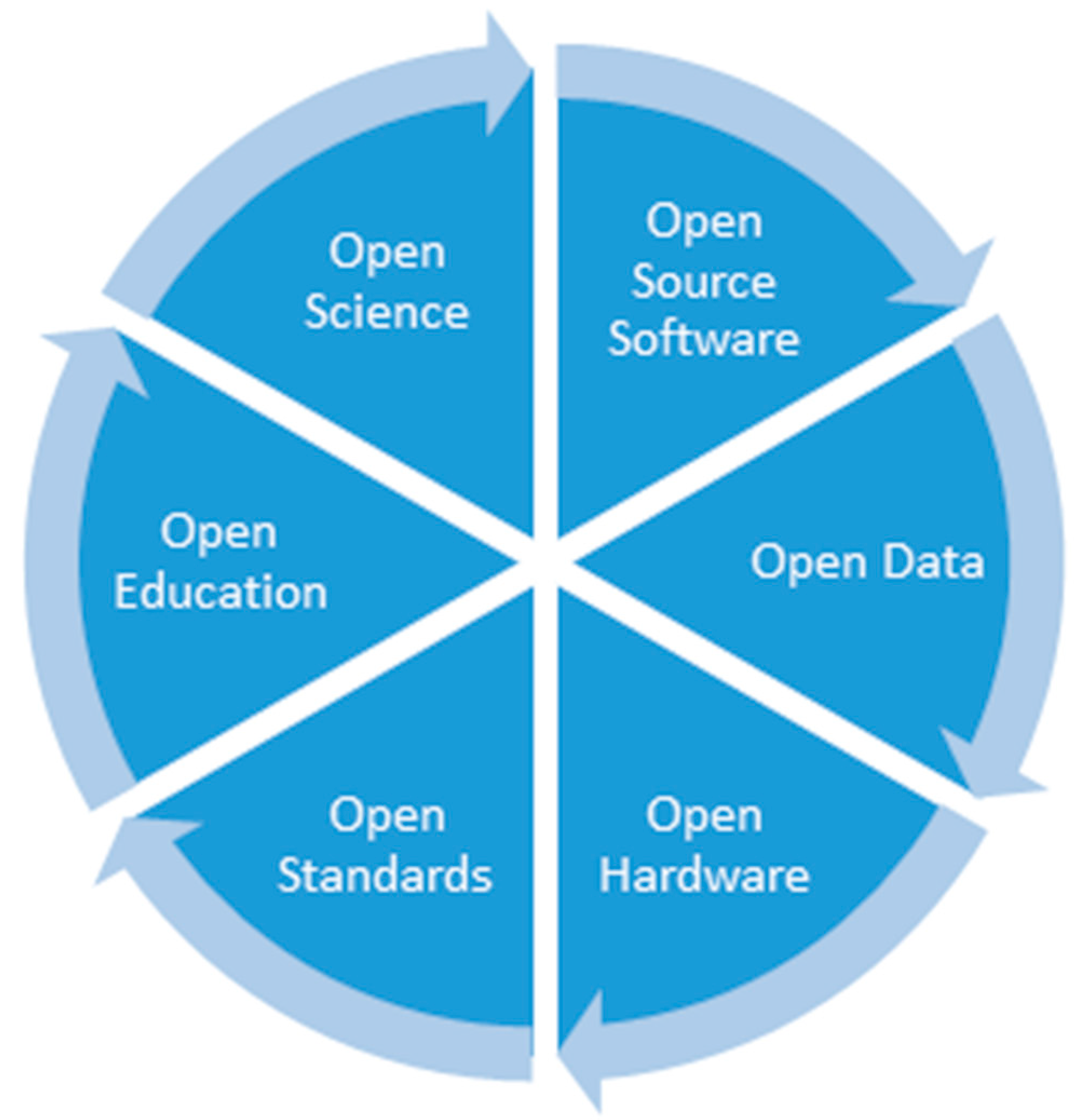
3], “Knowledge is open if anyone is free to access, use, modify, and share it—subject, at most, to measures that preserve provenance and openness.” Two main components of knowledge are (1) science, the process of building knowledge; and (2) education, the process of transferring knowledge. Therefore, the open knowledge principles that emerged in the past few decades have deeply affected both science and education. Academia and scientific organizations have started incorporating the multi-dimensional aspects of openness into their activities. Openness is a virtuous circle, with many components (see
Figure 1):
Open source software, i.e., free and open collaborative software development;
Open data, i.e., freely accessible, shareable, and usable data;
Open hardware, i.e., physical products, machines and systems designed and offered by means of publicly shared information;
Open standards, i.e., technology neutral specifications for hardware, software, or data developed through an open process;
Open education, i.e., learning and teaching without barriers; and
Open science, i.e., making scientific research and its dissemination accessible to all levels of the society.
Each component benefits from the success and implementation of all the others and the circle is not complete if one component is missing.
This paper focuses on open source software and open data in the geospatial domain. What has been seen regarding openness in the past few decades has been general and not limited to the geospatial field, but advances and experiences related to openness in the geospatial field are significant and worth sharing.
The paper highlights the community aspect of open source software and open data because they would not have emerged without the practice of sharing and participation, and the attention given not only to the products, but also to the people behind them. In the past, the attitude of governments and institutions toward the adoption of open source geospatial software and data has been diverse: from opposition, to lack of interest, neutrality, and warm support. More recently, many countries are aligning themselves toward consideration of openness and some agencies are implementing their flagship initiatives based on it. This gives more visibility to the communities revolving around the open ecosystem and raises awareness of their importance.
Given the widespread availability and use of open source geospatial software and open geospatial data, we review the current state and present a perspective on future developments informed by responses from professionals in key organizations in the global geospatial community to questions about the future of open source geospatial software and open geospatial data.
The remainder of the article is structured as follows:
Section 2 and
Section 3 review open source geospatial software and open geospatial data respectively, followed by a brief review of open standards, important facilitators of open source software and data in
Section 4.
Section 5 provides a summary of the responses on future developments.
Section 6 concludes with a discussion of how synergies between open source geospatial software and open geospatial data are likely to evolve in future.
2. Open Source Geospatial Software
2.1. Introduction
Open source software has its origins in the early days of computing when programming problems were solved through scientific collaboration. Software was shared and each programmer added a new aspect to existing knowledge [
4]. It evolved into a software development and licensing approach that ensures transparency through access to the source code and collaboration through a set of rights that protect the copyright to the source code. Through the free redistribution of the software and works derived from it, it is possible to create software products based on each other’s work [
5].
Open source software development subscribes to the concept of a community of developers collaborating on a software product. In the past, this was often without any legal agreement or financial remuneration, however today, many software developers contribute to open source geospatial software as part of their job. This approach can foster innovation by removing barriers, such as software licensing costs, that tend to surround proprietary computer operating systems and software products [
6]. Because the development process, including bug reporting, is transparent, it encourages healthy competition among developers. Modern technologies and globalization have facilitated and accelerated global open source software advancement.
Open source geospatial software includes a broad range of libraries, tools, applications, and platforms developed and released under different Open Source Initiative (OSI) licenses (see e.g., [
7]). An exhaustive review of all approaches and domains where open source geospatial software is being implemented is not possible within the scope of this paper, therefore, we focus on the Open Source Geospatial Foundation’s (OSGeo) software ecosystem that provides some of the core libraries and vetted, mature software packages. We also briefly highlight relevant projects and trends outside the OSGeo umbrella, including projects within the modern data science languages as well as the institutional and government initiatives.
2.2. Open Source Geospatial Software Roots
The roots of open source geospatial software go back to the early 1980s [
7,
8], eventually leading to a large number of open source software packages that were difficult to evaluate and navigate. To address this issue, a key event took place in February 2006 when several leading teams of free and open source geospatial software projects joined efforts to create the Open Source Geospatial Foundation (OSGeo) (
www.osgeo.org, accessed on 19 October 2019). OSGeo was founded as a not-for-profit organization with the mission to support the collaborative development of open geospatial technologies, data, and education, and to promote their widespread use.
The founding of OSGeo was driven by the need to organize and navigate the rapidly growing field of open source geospatial projects. On the one hand, it highlighted the maturity achieved by several leading software projects, and on the other hand, it reflected the need for coordination and synergy in the development of tools. Interoperability became a high priority and the open source software development model was well positioned to become a leading approach to fulfill this requirement. At the same time, geospatial data and its applications moved from niche to mainstream, and the Internet presented new requirements and opportunities. Since the beginning, the main benchmarks for OSGeo projects were interoperability and the choice of Open Source Initiative (OSI) certified licenses, which not only increased the interoperability of different technologies but also allowed integration and exchange of code among them.
Richard Stallman, the prominent activist for free software, argues that: “The free software movement campaigns for freedom for the users of computing; it is a movement for freedom and justice. By contrast, the open source idea values mainly practical advantage and does not campaign for principles” [
9]. In OSGeo, the practical open source approach and the principled free software view cohabit. OSGeo respects projects that choose to go beyond “open source” to also embrace “free software” ideals. While not required for participation in OSGeo, the foundation recognizes this level of commitment and offers full support to “free software” projects [
10].
OSGeo is open, self-organizing, and global, and participation in the Foundation is free. OSGeo’s activities are volunteer-driven and built with partnerships and an open approach to software, standards, data, and education. Since its founding, OSGeo has provided organizational, legal, and financial support for open source geospatial software projects and related educational initiatives. Different kinds of support are made available by the global community for both the use and development of tools through the OSGeo portal and websites for the different projects, forums, wikis, mailing lists, blogs, web seminars, tutorials, notebooks, and open courses offered by GeoForAll, the OSGeo Education Initiative.
2.3. OSGeo Software Ecosystem
OSGeo serves as an umbrella organization for projects that have become the foundation of the open source geospatial software ecosystem and, in fact, provide core functionality for many proprietary geospatial software products and services as well. The quality and sustainability of these projects is addressed through an incubation process that examines not only the licenses of the project components, but also the software development process and management. The incubation outlines the conditions that need to be fulfilled to ensure open source software sustainability and highlights the fact that open source software does not only mean access to source code. The projects must function in an open and public manner and in addition to open source license(s), they also need to have open communication channels and an open decision-making process.
To ensure sustainability, an active and vigorous community is essential. This implies that the project must have a community of developers and users who actively collaborate and support each other in a constructive way. An example can be the collaboration on project activities such as testing, creating documentation, and training material. This makes the community diverse in terms of expertise, with more capacity for addressing the variety of requests from the external world. Anyone is welcome and can find their role within the community. OSGeo is not only for developers; user contributions, for instance providing, improving, or translating documentation are very well appreciated.
Moreover, the long-term viability of the project is demonstrated by showing participation and direction from multiple developers, who come from multiple organizations (at least two). This makes the project resilient enough to sustain loss of a developer or a supporting organization. Decisions about the software development and future directions are made openly, which empowers all developers to take ownership of the project and facilitates spreading knowledge from long-term to new team members.
The principles of the OSGeo projects (globally called the “OSGeo Way”) are summarized as follows:
Consensus/inclusiveness: the participation from all people—from novice users to advanced developers—is welcomed;
Fostering: as most contributions are donated, projects encourage and recognize the participation of its volunteers;
Openness: projects adopt open standards and collaborate with other OSGeo projects; and
Responsibility: projects are responsible for checking their code integrity with respect to the open source basics.
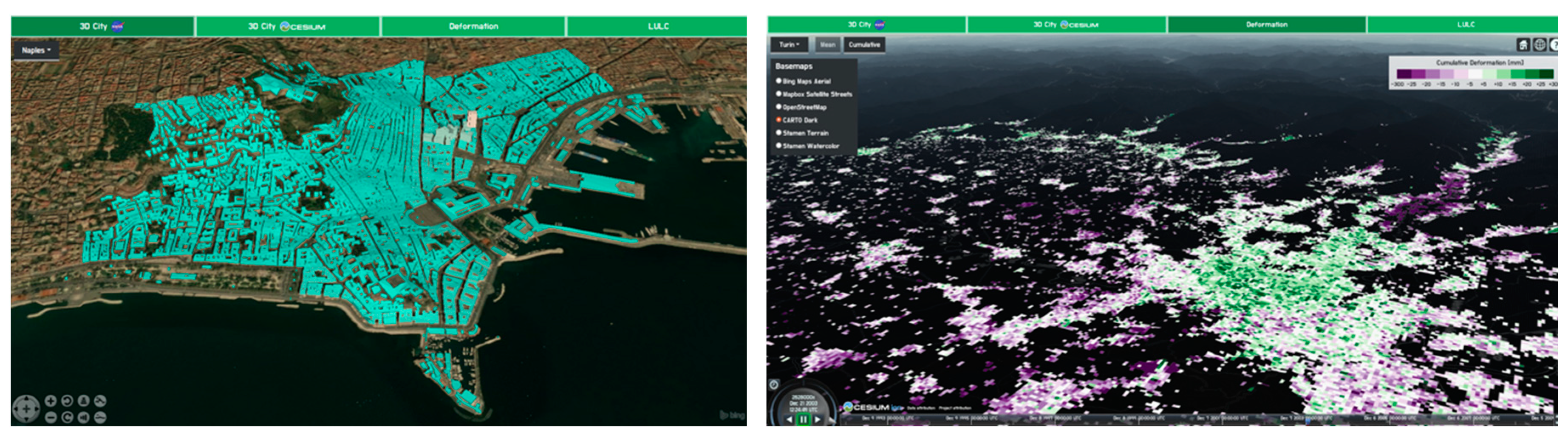
Today, there is at least one mature, sophisticated open source software product for every geo-technology area and geospatial application—from data collection in the field, crowdsourcing, data processing, analysis, modeling and simulations, spatial extensions to database management systems, visualization, web mapping, that can be integrated within a software stacks (see examples in
Figure 2,
Figure 3 and
Figure 4). Together, they can be used to create sophisticated free and open Web and cloud-based systems [
11,
12].
Projects under the OSGeo umbrella are categorized as either “OSGeo” or “Community” projects. “OSGeo” projects are mature, sustainable projects that passed the incubation process and are therefore “certified” by the OSGeo Incubation Committee. All projects fulfill the requirements of being geospatial, having an open source license, accepting contributions, and accepting the code of conduct of OSGeo.
OSGeo projects must have an open community with transparent communication. The community has to include users and developers who collaborate constructively. The members supporting the projects must belong to several organizations to ensure long-term project viability, while the development leadership (Project Steering Committee) must offer both transparent decision- making and opportunities for new members to participate. On the technical side, the development of the code must be supported by version control and an issue tracker; both user and developer documentation must be available; and well-defined procedures for release and testing of the software must be available. These requirements are described in more detail in an incubation graduation checklist document [
18]. Currently, there are 25 such projects of five different types (see
Table 1).
Several of the desktop systems are also available on web or mobile platforms (see for example, Ecology of the QGIS System [
19], or gvSIG mobile [
20] and gvSIG Online [
21]) and/or are used as geospatial processing back-end for web-based or cloud-based applications (e.g., GRASS GIS, see examples of analysis and modeling in
Figure 2).
Community projects are at the entrance door to the OSGeo project family: the proposers get acquainted with the rules and conventions of OSGeo, get more opportunities to interact with mature, projects and communities and increase their visibility, which often leads to attracting new developers and users. Of the 16 Community projects, six are currently in incubation, aiming to become “certified” OSGeo projects (see
Table 2). To support innovation, several OSGeo projects provide infrastructure for contributing add-ons or plugins outside the core code base with lower barriers for contributions, the developers are then fully responsible for maintaining and updating their code.
It is important to note that the rigor of the incubation process or even the lower requirements for community projects may be challenging for individual developers, who may chose to focus on the development outside the OSGeo ecosystem, often within well-established data science communities. In such cases, the open source software “market” plays an important role in selecting which tools survive, which are quickly replaced or never broadly adopted. Vibrant, loose development of geospatial software tools thus creates a broad base from which sustainable long term projects can emerge.
2.4. Open Source Geospatial Software Development Community
Every year an international Free and Open Source Software for Geospatial (FOSS4G) conference is held, which reaches beyond the OSGeo community, and represents a larger array of collaboratively developed open source geospatial projects. The event is a good opportunity to get updated on the latest projects, applications and tools. Apart from presentations, the conferences host workshops in computer labs; “Installfests” in which community members help participants to install FOSS4G software on their laptops and take first steps; “Birds of a Feather” meetings for like-minded people; and Hackers’ Code Sprints. Much effort goes into providing the presentations remotely (streaming in real-time or later) to those who are not able to join the conference. For example, the videos of the last conference in Bucharest, August 2019, [
22] were already available online in September [
23]. In addition to the global conference, many regional conferences are organized by local communities or individual projects, highlighting the need for face-to-face communication and interaction for sustainable software development, user feedback and contribution.
Education and training are critical for the future of open source geospatial software. OSGeo has transformed its education initiative into a global network of open source geospatial laboratories (GeoForAll), where participants contribute to the vision of enabling geospatial education, data, and capabilities accessible to everybody. Many of these laboratories develop and contribute open source software, thereby offering more than just “plain” software user training.
Moreover, the OSGeo community puts huge effort into participating in related community initiatives which expose (mostly) younger generations to open source. Since 2007, almost 200 students have participated in the Google Summer of Code under the mentorship of OSGeo volunteers. In the last few years, OSGeo also participated in the Google Code-in, a contest that introduces pre-university students (ages 13–17) to open source software development, and in the Google Season of Docs, OSGeo members mentor a project for the development of a common geospatial glossary of terms for OSGeo Live.
Open source communities have created self-organized models of collaborative software development that include important collaborative events referred to as code sprints or the more general community sprints. These events bring together developers from multiple projects to address development issues that often can be solved more efficiently through face-to-face interaction, discussion and hands-on coding. The sprints are frequently associated with FOSS4G conferences or as separate events focused on core functionality within or between projects.
2.5. Beyond the OSGeo Software Ecosystem
With geospatial data and tools becoming ubiquitous across scientific disciplines, industries, governments, and communities, there are rapidly growing geospatial software development projects associated with open source data science languages, modeling, and simulation platforms, virtual reality engines and web applications (
Table 3).
R [
24] has recently emerged as one of the leading open source data science languages in remote sensing and geospatial science, building upon its well-established support for processing of georeferenced data and extensive set of tools for spatial analysis (see [
25] for an up-to-date overview and [
26] for Rspatial tutorials). The raster package [
27] facilitates development of tools for efficient analysis of large gridded and imagery data sets and numerous packages support handling and analyzing spatio-temporal data [
27]. R packages, developed by contributors from all over the world, are distributed through Comprehensive R Archive Network (CRAN) and must follow CRAN repository policy, ensuring that methods and code are of scientific publication quality. R and OSGeo communities closely collaborate to support interoperability between the relevant libraries, projects, and packages.
Python is the leading scripting and programming language for both proprietary and open source geospatial software, including several OSGeo projects (see GeoPython [
28]). However, there is also a rapidly growing number of independent geospatial projects based on Python, such as GeoPandas [
29], spatial statistics package PySAL [
30], or landscape simulation libraries landlab [
31], to name just a few. Python is also used to create applications in sophisticated 3D rendering engines, such as Blender that recently added support for geospatial data [
32].
Relatively new libraries and platforms support 3D mapping and modeling, including point cloud data processing with PDAL [
34] and related on-line point cloud visualization plas.io (see
Table 3); as well as drone data processing with OpenDroneMap [
35]). WebODM [
36], is a cloud-based platform that integrates several open source geospatial software tools to process and analyze drone imagery and derived 3D models. OpenEO is an example of “open application programming interface (API) to connect R, python, javascript and other clients to big Earth observation cloud back-ends in a simple and unified way” [
37] while SpatioTemporal Asset Catalog (STAC) is a community-driven catalog initiative based on JSON [
38]. Geoscience computing is supported also in a data science language Julia using JuliaGeo projects [
39]. Many open source agent based models have geospatial components (CoMSES Network) [
40]. Although independent from OSGeo, many of these projects have close partnerships with OSGeo and use some of the OSGeo libraries for core functionality (e.g., GDAL or PROJ).
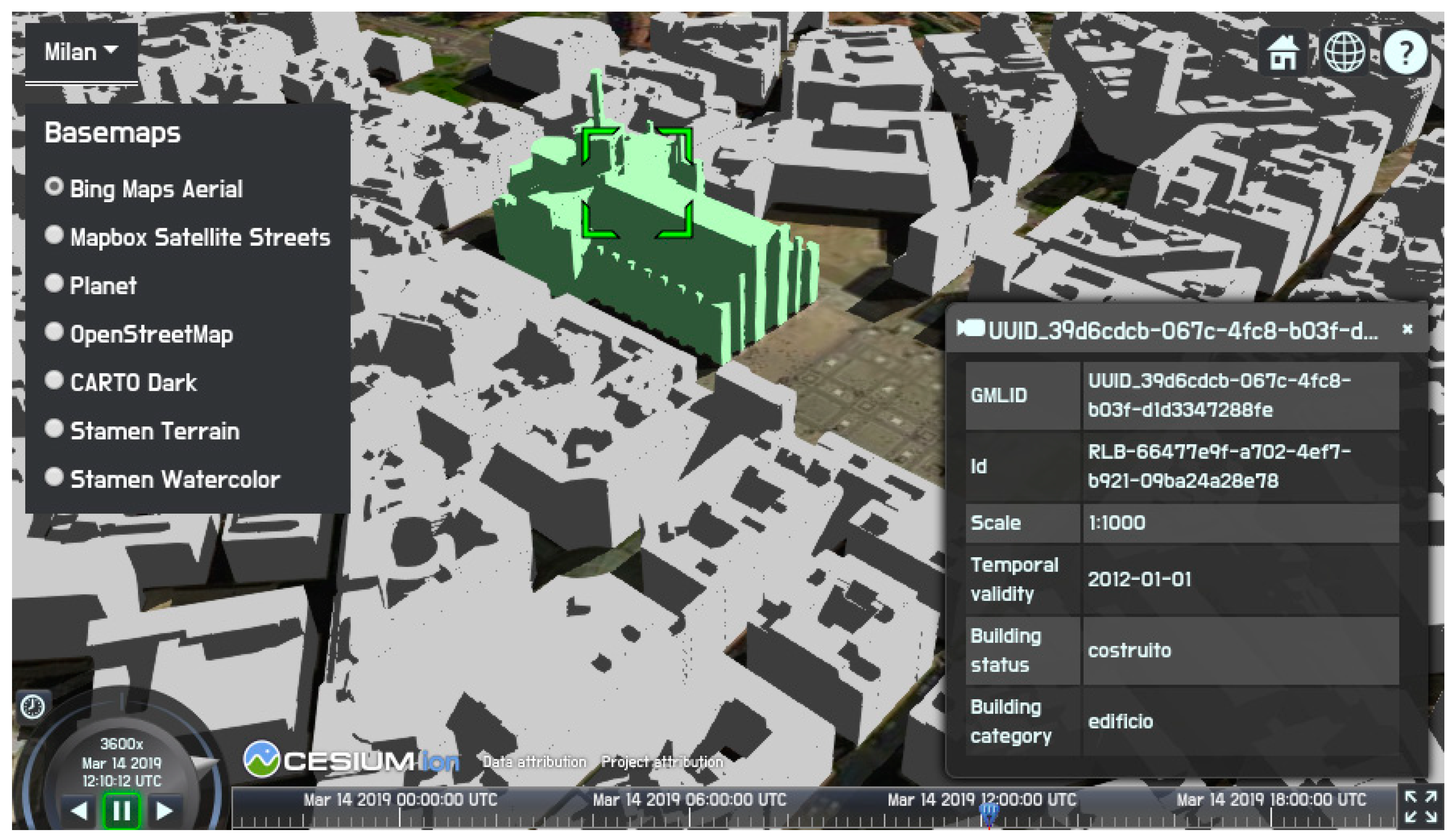
Currently the most comprehensive resource for open source geospatial software is OSGeo Live (
Table 4), a self-contained bootable DVD, USB thumb drive or Virtual Machine based on Lubuntu operating system that allows users to try a wide variety of open source geospatial software without installing anything. In addition to the OSGeo projects (
Table 1) and OSGeo Community projects (
Table 2), it also includes well-established and emerging geospatial software that is not part of the OSGeo software stack but uses OSGeo libraries (such as GDAL), such as Cesium (see
Figure 5). Getting started tutorials and sample data accompany the software packages, facilitating the use of OSGeo Live for workshops and other educational opportunities.
Several commercially focused open source software projects (released under Apache license or similar and strictly vetted) have formed a LocationTech working group within the Eclipse foundation (
https://www.locationtech.org/, accessed on 19 October 2019). GeoMesa, Spatial4j, GeoWave, GeoTrellis are examples of projects in this community. Several of these projects rely on OSGeo libraries and tools and some of the LocationTech libraries (JTS) and platforms (uDig) are included in OSGeo Live. Additionally some geospatial open source software tools and applications are dependent on proprietary software, e.g., MapWindow runs on Microsoft Windows only (
https://www.mapwindow.org/, accessed on 19 October 2019).
2.6. Institutional and Government Supported Open Source Geospatial Initiatives
In many contexts, institutions have also been playing a central role in the development of open source geospatial software. Just to mention some examples, GRASS has been developed since 1982 with the substantive effort of federal US agencies and universities, the evolution of its core components and the management of the integration being accomplished by the U.S. Army—Construction Engineering Research Laboratory (USA-CERL) in Champaign, Illinois [
44]. MapServer was originally developed (1994) at the University of Minnesota with support from NASA [
45]; and Worldwind [
46] has been curated by NASA since 2002.
If these initiatives, which nevertheless produced significant results, were still sporadic, an important change of pace occurred in the United States in 2016 with the new federal source code policy. The policy decreed that at least 20% of the custom-developed code by or for any agency of the federal government must be released as open source software and that all source code has to be shared between agencies [
47]. The announcement of the policy was commented by its co-author, Tony Scott, as follows: “This is, after all, the People’s code. Explore it. Learn from it. Improve it. Use it to propel America’s next breakthrough in innovation” [
48]. The relevant point in this official comment is the declaration, made by the United States Chief Information Officer, that openness boosts innovation. Besides, this sentiment is not an isolated one. Despite the fact that global political power balances are changing, trade wars are looming and some countries are “closing up,” in most parts of the world there is currently a strong attitude toward openness. Some examples are reported in the following.
In the last decade, Europe has moved at a rapid pace in the direction of openness and has reached important successes. To demonstrate the awarded level of maturity, very recently, in November 2019, a workshop about the future of Open Source Software and Open Source Hardware, “Open Source Beyond 2020—Powering a digital Europe,” was jointly organized by two top actors: the European Commission Directorate-General Communications Networks, Content and Technology (DG CONNECT) and the Directorate-General Informatics (DIGIT) [
49]. Among others, two topics were discussed: The role of open source as an innovation enabler, recognizing this important role of open source software; and how to nurture open source communities, a debate based on the multi-annual results and inputs from the Commission’s Free and Open Source Software Auditing (EU-FOSSA) project [
50] and the Commission’s Open Source Observatory and Repository (OSOR) [
51].
In the geospatial domain, many important initiatives have been taken by European agencies, the ESA (European Space Agency) and the Copernicus Programme pivotal among them. The Sentinel Hub [
52] is a web service allowing users to create Web Mapping Services (WMS) instances of Sentinel data readable by a QGIS plugin [
53] and therefore immediately available in a user-friendly GIS environment for everyone. The Sentinel Toolboxes [
54] and the Sentinel Application Platform full code [
55] are freely available in Github under the GNU GPL license. STEP [
56] is the community platform for accessing software and documentation, communicating with the developers, promoting results, and providing tutorials and material for training users. These products are meant for the exploitation of the huge amount of available open satellite data. Besides some other open technologies, they use some OSGeo software, like GDAL, GeoTools, and Orfeo Toolbox and at the same time, contributions to the code are elicited through the developer wiki [
57] and the forum. The toolboxes have been conceived to host new functionalities developed by the scientific community, and SNAP can be used as it is or can be embedded in the user’s Python programs.
The ESA Thematic Exploitation Platforms (TEP), developed for Coastal, Forestry, Hydrology, Geohazards, Polar, Urban, and Food Security applications, are based on the same philosophy; they are open source platform environments “allowing users to integrate, test, run, and manage applications (i.e., processors) without the complexity of building and maintaining their own infrastructure, and providing access to standard platform services and functions such as collaborative tools, data mining, and visualization applications, the most relevant development tools (such as Python, IDL, etc.), communication tools (social network) and documentation, accounting and reporting tools to manage resource utilization” [
58].
The European Copernicus Programme, “the third largest (open) data provider globally,” completely embraced the open source software logic, emphasizing the importance that OSGeo has played in this field [
59] and has since called for collaboration and the sharing of new code.
On the other side of the world, Digital Earth Australia [
60] is the Australian government’s implementation of the open-source analysis platform developed as part of the Open Data Cube (ODC) initiative [
61]. The ODC is an initiative to increase the value and use of satellite data by providing users with access to free and open data management technologies, based on a set of Python libraries and the PostgreSQL database [
62,
63]. ODC, as declared on the overview of the website of the project, “will always be 100% open source software, free for all to use and released under the liberal terms of the Apache 2.0 license” [
64]. The added value of these new solutions is the possibility for advanced users not only to query and access data but also to do analyses. A collection of Jupiter notebooks (open-source web applications that allow users to create and share documents containing executable code, equations, visualizations, and explanatory text) for various uses, such as forest degradation, land change, and coast change, is shared in the GitHub repository.
Everyone is encouraged to publish their new algorithms and applications in such a way to increase the ODC ecosystem. These documents are invaluable for beginners for learning how to use the data cube and for developing new case studies that will then be available to the entire community.
The open source nature of the ODC, originally developed by and for Australia, was an important factor in this tool being selected by many other countries [
65].
Through the CEOS Data Cube (CDC) Initiative, CEOS (Committee on Earth Observation Satellites) organization was established in 2017 to reach operational Data Cubes in 20 countries by 2022 under the leadership of NASA’s CEOS Systems Engineering Office (SEO) and engaging stakeholder organizations and users [
66]. In some cases, these data cubes will cover the entire country, but in other cases, there will be smaller cubes for specific regions or applications.
The Swiss Data Cube (SDC) [
67] is an initiative supported by the Federal Office for the Environment (FOEN) and is developed, implemented, and operated by the United Environment Program (UNEP)/GRID-Geneva in partnership with the University of Geneva (UNIGE), the University of Zurich (UZH), and the Swiss Federal Institute for Forest, Snow and Landscape Research (WSL). The Colombia Data Cube has been developed by the IDEAM (Instituto de Hidrología, Meteorología y Estudios Ambientales and the University of Andes. The Africa Regional Data Cube (ARDC) was launched in May 2018 by the Global Partnership for Sustainable Development Data (GPSDD), CEOS, and Amazon, to support five countries: Kenya, Senegal, Sierra Leone, Ghana, and Tanzania. Through a collaboration with Geoscience Australia, the Mexican Geospatial Data Cube (MGDC) is being developed at the National Institute of Statistics and Geography of Mexico (INEGI). Many other projects [
68] are in development (United States, Vietnam, Taiwan, Uganda, United Kingdom, Georgia, Moldova) or under review (Uruguay, Armenia, Ukraine, Cambodia, India, Balkans, China, Peru) under the CEOS umbrella initiative.
These initiatives demonstrate there is much more than a rustle of open source software in the public sector and the path toward sharing and collaboration is becoming a reality. OSGeo is the most relevant and structured geospatial community but others are emerging as a result of the efforts and initiatives of some institutions highlighted above.
4. The Role of Open Standards in Open Geospatial Software and Data
Over the past three decades, the members of the integrated standardization ecosystem (which include governments, industry, and academia) have developed policies and procedures for working together to develop consensus-based open interfaces and encoding standards that provide a way for any two computer systems to request and return any kind of geospatial data [
116]. In this way, standards are essential for open geospatial data and many open source geospatial software solutions implement open standards. An “open standard” is one that is publicly available for anyone to download and use (non-discriminatory); unencumbered by patents, intellectual property and license fees; data and vendor neutral; and developed through consensus [
117,
118]. Legally, the developer of an open standard retains all related patents and intellectual property rights related to the standard, but third-party users are free to support and create products that conform to it.
Open standards for geographic information (currently, more than 100 have been published) are traditionally developed by three key international standards development organizations: the International Hydrographic Organization (IHO), the International Organization for Standardization (ISO), and the Open Geospatial Consortium (OGC). General-purpose IT standards developed by the Internet Engineering Task Force (IETF) and the World Wide Web Consortium (W3C), on which many of the geographic information standards are based, are also open [
119].
Even though the above organizations develop and publish open standards, there are some impediments. ISO/TC 211, Geographic information/Geomatics, is the ISO technical committee concerned with standards for geospatial information. ISO/TC 211 members are national standards development organizations. In some countries, membership of the local mirror committee of a national standards development organization is free, in others, there is paid membership. Other ISO TCs and liaison organizations can participate in the development of standards but do not have voting rights. Published standards can either be bought from ISO, which is rather expensive, or if a standard is adopted as a national standard, it is usually available at a much lower cost from the national standards development organization. The OGC is an international not for profit standards organization with paid membership at different levels. Depending on the level, a member has more or less influence on the standards development process. ISO/TC 211 standards and OGC standards complement each other: ISO standards are typically at a higher level of abstraction, while OGC standards are closer to the actual implementations. Theoretically, anyone can participate remotely in the development of ISO and OGC standards, but in practice, face-to-face discussions are required and excludes those without the resources to do this. Any form of payment, be it for membership or for a standard, is a further impediment to openness.
An interesting emerging trend is the development of geospatial open standards outside these organizations or in collaboration with other organizations. GeoJSON, for example, has its origins outside any standards development organization, and is now maintained by the authors of the original specification in conjunction with the Internet Engineering Task Force (
https://geojson.org/). Another example is the SpatioTemporal Asset Catalog (STAC), a community-driven catalog initiative based on JSON [
38] with the aim of increasing the interoperability of searching for satellite imagery. The three key international standardization organizations attach great importance to harmonization and backward compatibility among standards, not only among those published within their respective organizations, but also between the standardization organizations [
120]. Isolated standards do not have to consider such “baggage” and are not encumbered by governance rules of large organizations, but they run the risk of impeding interoperability if they are not harmonized with other widely used standards.
The advancement of the web and proliferation of data, including geospatial data, on the web has motivated the establishment of a joint OGC and W3C working group on Spatial Data on the Web (SDW). Its main objective is to define best practice for publication of geospatial data on the web and thereby helping organizations to overcome a longstanding problem of obscurity of SDI data to mainstream web use [
121]. To support best practices for data on the web, applications need to be both software- and hardware-neutral, calling for geospatial data access and query mechanisms that are architecture neutral, distributed, and open.
First implementations of such APIs were explored in the late 1990s [
122]; later OGC web service implementation specifications provided architecture neutral specifications for geospatial data that are widely used today [
123], but have certain scalability limitations. Today, with the aim of providing access to geospatial data without having to implement a full web service interface, the OGC together with the W3C’s SDW and ISO/TC 211 are investigating the feasibility of Geospatial API [
124,
125], as a standard, language-agnostic interface to geospatial resources.
Open standards are a central element in the growing trend toward open government. The most immediate drawback of not using open standards is that an organization creates an information and technology silo that impedes the organization’s interoperability [
117,
126] and incurs delays and costs of expanding or adapting data and software tools when working with other resources, software, or organizations. In an ever-changing world, open standards help assure that organizations can more quickly take advantage of new geospatial information sources and new technology tools.
5. Future Perspectives in the Global Geospatial Community
Questions about the future of open source geospatial software and open geospatial data were sent to representatives of 34 key organizations in the global geospatial community. Twelve responses were received (see Acknowledgements). While this is not a representative sample and not a large enough sample for a quantitative analysis, a summary of the qualitative information from the responses provides insight into perceptions at managerial level. These perceptions are of interest because the respondents are decision-makers who have significant influence on the use and development of open source and open data in the workplace.
5.1. How Will Open Source Geospatial Software Evolve into the Future?
This section summarizes responses from professionals in key organizations in the global geospatial community to the following questions:
- -
How do you think development and use of open source geospatial software will evolve over the next decade?
- -
What opportunities do you think will arise from open source geospatial software?
- -
What challenges do you think lie ahead for open source geospatial software?
- -
How does your organization (or the members that you represent) plan to use and/or contribute to the development of open source geospatial software?
All respondents (contacted via email) predicted growth for open source geospatial software: growth in terms of more users, more solutions, more organizations adopting open source and more service provider companies providing open source solutions. They predict this growth to happen across sectors: public and private sectors, academia and non-profit organizations. Young users, developers and scientists are already familiar with working in an open environment and will accelerate this growth as they join the community. This growing community will come up with many more solutions to address the diversity, complexity, and rapid changes in the digital geospatial landscape. It is expected that research by academia will continue to be done mostly in open source geospatial software projects.
Because more users and organizations adopting open source geospatial solutions, we will see a rise in companies providing value-added services for open source geospatial software. These service providers are likely to contribute to the development of open source geospatial software, which, in turn, will attract more users and will further grow the community.
Open source geospatial products will be benchmarked against closed source products and as the open source equivalents are maturing and their functionality is improving, it will become ever more difficult to justify the upfront investment in expensive software licenses. QGIS is an example of an open source product where additional features are added at a fast pace, while the product is consolidated and stabilized at the same time. Such stable and mature products make it easier for new users to switch to open source tools, further accelerating the pace of adoption. With the move to cloud platforms, more companies that traditionally preferred “closed source software development” will share their code as open source as they change from a product-based business model to a value-added and service-based business model. Because there is no need to convince users to pay upfront for licenses, the focus will shift from sales-pitch type functionality to functionality that addresses real and specific user needs.
Another interesting development is that some open source geospatial software is becoming the foundational software infrastructure for both open source and closed source products. Examples are the GDAL and PROJ libraries for handling geospatial data and coordinate reference systems respectively, and PostGIS and SpatiaLite for data storage. This makes it possible for developers of both open and closed source software to collaborate on the foundational software layer, sharing and saving on development time. Having this foundational software infrastructure in place, makes it possible to focus on novel and innovative services that extract insights from geospatial data.
Open source geospatial software solutions remove the barrier to viewing and processing geospatial data; they will therefore lead to wider “data democracy” where any citizen can access available data with such tools. Open source software enables anyone to use the software and therefore levels the playing field for users and service providers. In many parts of the developing world, open source software is the only option for viewing and processing geospatial data. Open source geospatial software will therefore also become more important in education and capacity building.
Transitioning a large organization to using open source software requires time and investment in change management and capacity building. For smaller organizations this transition may be less painful. Wider use of open source geospatial software will require raising awareness among organizations about intellectual property rights in open source software to ensure that there are no infringements. Without understanding the open source geospatial software environment and its benefits, organizations may continue considering a single vendor with an off-the-shell product to be a less risky option. The perception is often that software developed by more than one organization is more prone to bugs and security risks, however, in accordance with Linus’s Law, more eyes on a code base are more likely to identify and resolve bugs [
127]. Nevertheless, if an open source product is developed and maintained by a small number of people, they are at a larger risk of being wiped out by the proverbial bus. Be that as it may, the success of open source geospatial software in the future requires building trust and confidence in software quality and longevity.
Support for open source geospatial software is typically provided through a user forum and, despite general willingness and support of the community, at times a timely and reliable answer to technical problems may take longer than expected (or needed). Lack of ownership over the product means support cannot be easily identified and quantified, and total cost of ownership for the open source product is therefore not easy to calculate. While the number of companies providing support is expected to rise in the future, respondents consider the current small number of service providers to remain a challenge in the foreseeable future.
Apart from support challenges, there is limited documentation and training material for some open source geospatial software products. This problem is recognized by the OSGeo community and addressed through initiatives, such as the Google Season of Docs and the UN OSGeo Challenge. Such initiatives should continue to encourage collaboration on documentation and training material into the future. With the predicted growth in open source geospatial software, the demand for companies focusing on open-source geospatial software training will also rise. This presents opportunities for service providers to differentiate their offering from other providers through quality training material.
Software development on closed source products is often supported by extensive research and development budgets. Conversely, functionality is often only added to open source geospatial products as and when a client pays for it, which implies that the open source community will be challenged with competing with such large budgets. This will be especially challenging for software with a smaller user base: generating a large enough community to sustain a product takes effort, time, and ultimately funding.
Various respondents are planning to move to a hybrid model where some needs are addressed by open source products and others by closed source products. Such an approach can address the concern that enterprise-wide open source geospatial solutions are not yet possible. Respondents indicated that open standards and a common foundational software infrastructure are essential for making a hybrid approach work.
Most respondents plan (to continue) to contribute to open source geospatial software solutions in various ways in the future: by contributing to software development directly or indirectly (e.g., through the funding of software development); by building capacity around the use of open source geospatial software in their organizations; by being actively engaged as users and implementers of open solutions; or by encouraging the sharing of prototype code or geospatial software produced through research as open source, e.g., via collaborative and code-sharing platforms, such as Microsoft GitHub or Atlasian Bitbucket.
5.2. How Will Open Data Evolve into the Future?
This section summarizes responses from professionals in key organizations in the global geospatial community to the following questions:
- -
How do you think production and use of open geospatial data will evolve over the next decade?
- -
What opportunities do you think will arise from open geospatial data?
- -
What challenges do you think lie ahead for open geospatial data?
- -
How does your organization (or the members that you represent) plan to use and/or contribute to the production of open geospatial data?
All respondents agreed that the availability and volume of open geospatial data will continue to grow in the future, be it in the form of collaborative vector geospatial data (e.g., OSM) or as satellite imagery and authoritative data, collected by authorities and distributed under open data licenses. Respondents agreed that OSM will play an important role in the future and that it may become the standard base map for online mapping sites and applications. Authoritative and high-value geospatial data will be open by default for the benefit of society at large. Generally, the ubiquitous availability of geospatial data will increase, also because of smartphone market penetration, leading to data being available to anyone, anywhere, anytime. However, respondents expect that there will continue to be restrictions on geospatial datasets involving personal or other sensitive information.
The need to find solutions for societal challenges is a contributing factor to the increasing trend of open geospatial data. Moreover, multi-disciplinary teams that collaborate on solving societal challenges require a common understanding of geospatial data. At the same time, when data are open, accessible, and available, users might use these in previously uncharted ways and in unexpected applications. The future will also see an increase in the use of spatially-enabled services and the shift from analyzing discrete data sets toward working with streams of spatially-enabled data (e.g., real time location-based mobile services) will continue.
Cloud-based platforms will transform the way in which we access and process geospatial data with a fundamental shift away from fixed products to on-demand production of user-specified and customizable products. Making the imagery directly accessible by users is a game changer: instead of downloading pre-packaged image products, users can customize products according to their own specific requirements. On the technical front this has already led to the development of standards supporting interoperability in the cloud, such as cloud optimized GeoTIFFs, Zarr (used by the UK Met Office to store vast quantities of met-ocean data), the STAC [
38] for metadata about Earth Observation data, and GeoJSON. Because of the rapidly evolving landscape, some of these standards are developed and implemented to become de facto standards before they are documented and published by one of the standards developing organizations.
Increased availability of processing power and advances in efficiency of algorithms for feature extraction from imagery collected by satellites and unmanned aerial vehicles will accelerate the creation and maintenance of geospatial datasets. This is especially promising for developing countries and remote regions for which data collected from the field is not available or not possible. Moreover, this will reduce the need for costly field data collection efforts. The accelerated creation of such geospatial datasets presents vast opportunities for innovation and can lead to improved public service, scientific advances, and new business opportunities, and can contribute to elevating developing countries into the competitive global geospatial arena. It will also contribute to the evolution of the geospatial industry by developing new user communities and application domains.
At the same time, the vast volumes of geospatial data collected by sensors and other means will continue to present challenges for storage capacities and processing power. The challenge will not be the lack of geospatial data but the transformation of “raw” data into insights and meaningful information. Cartography can play an important role in overcoming this challenge. Visualizing data with relevant cartographic techniques will lead to better understand and help addressing privacy and confidentiality concerns.
Some geospatial data owners are still uncomfortable with openly sharing their data, especially when this becomes available across national boundaries. The fear of loss of control, which is often mentioned as a barrier to data sharing, will also need to be addressed in the future. Advocacy for the development and implementation of spatial data infrastructures through which open geospatial data can be made discoverable, accessible, interoperable, and reusable, both nationally and globally, will therefore remain a priority. It will be necessary to put in place systematic and comprehensive frameworks with related policies, resources, and structures that make geospatial information technologies easily accessible to decision-makers and the community in a coordinated way. Moreover, open standards will continue to play an important role in facilitating the interoperability of vast amounts of open geospatial data. However, capacity building has been raised as a major concern for the implementation of open geospatial standards.
Governance of open geospatial datasets that are collected and maintained by a community of contributors will remain a challenge into the future. Users want to know how much they can trust the data: Is it accurate? Is it up to date? How does one detect data vandalism? How does one know whether features were moved or modified to support a specific political agenda? Recent reports of social media influencing elections are also a concern for crowdsourced geospatial datasets: How does one know whether a feature was moved or modified to support a specific political agenda?
When different datasets are integrated, it will increasingly be difficult to know the actual source for a specific feature, especially when a feature is modified over time. One user may have added the initial location as a point feature, various users may have added attributes over time, another user may have improved the accuracy of the location, etc. Similar situations will arise where community-based data are integrated with authoritative data. Metadata will therefore continue to play an important role.
6. Discussion
Considering the responses in the previous section, we asked ourselves how synergies between open source geospatial software and open geospatial data are likely to evolve over the next decade, and what opportunities and challenges this would bring.
First, we expect the communities involved in open source geospatial software and open geospatial data to move even closer to each other because they subscribe to like-minded principles. The relationship between the two communities should therefore be fostered. The well-being of these communities will be a major challenge in the future. As we have seen, the novelty and success of open source and open data is closely tied to the communities behind them. Sustaining a vital and healthy community composed of academia, civic society, the private and public sectors can be challenging.
The amount of data being collected today is beyond massive. Even with technological advances in processing, it may become challenging to ensure data quality, especially if it is processed by complex software that nobody understands and nobody is personally responsible for (open source does not guarantee that somebody actually looks at the software, it only allows it). There are also societal challenges—openness makes the data and software more vulnerable to abuse with potential for control and manipulation. To address these concerns, the testing and control infrastructure is growing stronger, but it remains to be seen whether it will be sufficient.
Both open source projects and open datasets are examples of shared resources, also known as a commons that is maintained, belongs to, or affects an entire community [
128]. Questions have been raised if and how volunteers contributing to commons can be retained [
129]. Based on a comprehensive study of open source software projects, [
130] established that the success of such projects lies with a geographically dispersed community connected to each other via the Internet and the joint purpose of the commons. Success also depends heavily on long-established principles, such as hard work, good administration, and leadership. Interestingly, programming skills of the developers did not seem to play a strong role in determining success, apparently because a large majority of open source software developers are highly skilled professionals anyhow. The long-term motivation of the volunteers that contribute to open geospatial data projects has been questioned, but has been proven, at least for OpenStreetMap [
83]. Professionals involved in coordinated collection initiatives, such as those arranged by the World Bank’s OpenCities project (opencitiesproject.org, accessed on 19 October 2019), Missing Maps (
www.missingmaps.org, accessed on 19 October 2019), and the Humanitarian OpenStreetMap Team (HOT) (
www.hotosm.org, accessed on 19 October 2019), may well be the equivalent to the highly skilled professionals found in open source software projects.
At this moment in time, there is a strong sentiment toward openness linked to significant scientific activism by citizens, as well as a strong trend by governments toward publishing open data. Similarly, large funding agencies, such as the European Union and the US National Science Foundation, promote open science in their programs. Consequently, scientists are encouraged to use open source software and open data in order to share their research results. Unfortunately, this is not the case for large corporations, which are often holders of enormous volumes of (our) data. Data are essential both for monitoring and controlling the world in which we live. How far the pendulum will swing toward control instead of monitoring will depend on the freedom of data for everyone.
There are various ways in which geospatial software and data will influence each other in future. The future will see an increase in the use of spatially enabled services and the shift from analyzing discrete data sets toward software that can process streams of spatially-enabled data (e.g., real time location-based mobile services) will continue. This is in line with current trend for FAIR, transparent, traceable and reproducible science and, as selected pioneers in the earth science domain prove, this is not only desirable but also viable way forward [
112,
131].
Ever increasing volumes of free and open geospatial data call for computing platforms that can efficiently and effectively extract useful information from such data [
132]. Cloud platforms are maturing and are transforming the way in which geospatial data are processed, analyzed, and visualized. For example, instead of downloading spatial data, map production services can be performed on datasets stored in the cloud. This is especially useful for large and/or processing intensive datasets, such as satellite imagery or point clouds [
133]. The software as a service business model dramatically changed adoption and contribution to open source. Open source software is becoming a standard component upon which geospatial companies are building their data services. Companies producing proprietary software are contributing to the development of open source libraries and encouraging the development of open source add-ons.
Processing the data where they are (usually in the cloud) will lead to tighter synergies between the data and software. The importance of standards will therefore increase. Furthermore, being able to process and analyze open data via open cloud platforms takes open data accessibility to another level. Open source is an opportunity to accelerate the use of open data—because the open source removes barriers to working with the data. This, in turn, may lead to even more widespread use of geospatial data, which is especially relevant and important in the developing world. This will broaden the opportunities for participatory decision making and implementation of real time, adaptive management. The synergies will provide critical data, tools, and infrastructure to address the most pressing societal challenges, such as climate change and inequality.
Moreover, organizations producing geospatial data, especially those funded publicly, increasingly aim to comply with public requirements of access to data and therefore publish their resources on the Web. In doing so, many of them aim at following community best practice, e.g., as recommended by OGC and W3C [
121]. With geospatial data resources being accessible on the web, this will naturally lead to improved capabilities of open source geospatial software to “deal with them.” This requires not only proper formats (e.g., RDF, JSON-LD), interface (e.g., Geospatial API), and documentation of these resources (machine-readable metadata, including information on license), but also geospatial software functionality to access, document, and publish derived geospatial resources in a reusable way (e.g., document the provenance of new data). This is possible when not only geospatial data are shared, but also their definitions, i.e., ontologies and vocabularies used to define them.
An opportunity for the future lies in collaboration toward defining best practice for publishing, managing, and documenting increasingly available and accessible geospatial datasets. Examples of such collaborations include the recent collaboration to define the Spatial Data on the Web Best Practice [
121]; the well-established practice within OGC standard working groups among members from both closed source and open source industry representatives, e.g., OGC’s GeoPackage standard, or recent collaboration on joint ISO and OGC standard for Geospatial API.
An open question is if the process of writing software can be automated, and if, by when. Some first results based on artificial intelligence show that this is at least possible [
134]. If anybody can produce code (automatically), proprietary solutions will become meaningless because nobody will be prepared to pay for something they can produce themselves for free. However, artificial intelligence solutions can only learn to write code by analyzing existing code and data. Therefore, open source software and data will play a role in this process.
One of the biggest challenges for the future remains raising awareness of the advantages of open-source geospatial software and the efficacy of FAIR and open geospatial data. As mentioned earlier, because of the lack of awareness, users and producers of geospatial data are often inclined toward “safe practice” and opt for a proprietary solution despite open alternatives being available. Increasingly, academic institutions now educate the next generation to solve problems by making use of a wide variety of open source geospatial technologies. Moreover, we can find examples in geospatial curricula introducing reproducible code sharing practice by using interactive collaborative services for coding (e.g., Jupyter Notebooks) and code-sharing environments (GitHub or Bitbucket) for code exchange within geospatial community. However, this is, surprisingly, not the case everywhere in the world, with many institutions in both developed and developing countries still teaching in proprietary product without acknowledging the importance of reproducibility of scientific results. Academia should align their curricula to meet these needs. Future professionals need to be proficient in any kind of geospatial product. Hence the open source geospatial software and open geospatial data communities need to enhance their “marketing strategies” and “sales pitch.” Events, such as the FOSS4G, State of the Map (SotM) and GEO Week conferences, and events and networking through GeoForAll, the Commission on Open Source Geospatial Technologies of the International Cartographic Association and the International Society of Photogrammetry and Remote Sensing contribute in this regard.
Despite enhanced marketing strategies, there will continue to be push-back from established stakeholders, both software and data producers, who have built businesses around making money by selling licenses for their products. There is often the perception that open source geospatial software and open geospatial data are maintained entirely by volunteers, and then people are disappointed when they find out that they have to pay for some services. Equally, the open communities have to continue to seek funding for their work in order to sustain the products and data in the long run. It will therefore remain important for individuals and organizations contributing to open source and open data to find sustainable business models.


