Next Issue
Volume 2, June
Previous Issue
Volume 1, December


Quaternary, Volume 2, Issue 1 (March 2019) – 14 articles

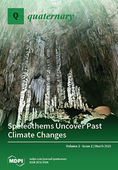
Cover Story (view full-size image): Proxies in speleothems can be used to reconstruct past changes in the climate. Here, we review past changes of the South American Monsoon by making use of the Speleothem Isotopes Synthesis and Analysis (SISAL) database. We demonstrate that those changes occurred coherently in South America and were strongly influenced by the Northern Hemisphere climate. View this paper.
  • Issues are regarded as officially published after their release is announced to the table of contents alert mailing list.
  • You may sign up for e-mail alerts to receive table of contents of newly released issues.
  • PDF is the official format for papers published in both, html and pdf forms. To view the papers in pdf format, click on the "PDF Full-text" link, and use the free Adobe Reader to open them.
Order results
Result details
Select all
Export citation of selected articles as:
26 pages, 13501 KiB  
Article
Shoreline Displacement, Coastal Environments and Human Subsistence in the Hanö Bay Region during The Mesolithic
by Anton Hansson, Adam Boethius, Dan Hammarlund, Per Lagerås, Ola Magnell, Björn Nilsson, Anette Nilsson Brunlid and Mats Rundgren
Quaternary 2019, 2(1), 14; https://0-doi-org.brum.beds.ac.uk/10.3390/quat2010014 - 19 Mar 2019
Cited by 6 | Viewed by 4593
Abstract
Southern Scandinavia experienced significant environmental changes during the early Holocene. Shoreline displacement reconstructions and results from several zooarchaeological studies were used to describe the environmental changes and the associated human subsistence and settlement development in the Hanö Bay region of southern Sweden during [...] Read more.
Southern Scandinavia experienced significant environmental changes during the early Holocene. Shoreline displacement reconstructions and results from several zooarchaeological studies were used to describe the environmental changes and the associated human subsistence and settlement development in the Hanö Bay region of southern Sweden during the Mesolithic. GIS-based palaeogeographic reconstructions building on shoreline displacement records from eastern Skåne and western Blekinge together with a sediment sequence from an infilled coastal lake were used to describe the environmental changes during five key periods. The results show a rapid transformation of the coastal landscape during the Mesolithic. During this time, the investigated coastal settlements indicate a shift towards a more sedentary lifestyle and a subsistence focused on large-scale freshwater fishing. The development of permanent settlements coincided with an extended period of coastline stability and the development of rich coastal environments in a more closed forest vegetation. This study provides a regional synthesis of the shoreline displacement, coastal landscape dynamics and settlement development during the Mesolithic. It also demonstrates a new way of combining zooarchaeological and palaeoecological approaches, which can produce multi-faceted and highly resolved palaeoenvironmental reconstructions in a wide range of settings. Full article
Show Figures

Figure 1

21 pages, 5378 KiB  
Article
Holocene Carbon Burial in Lakes of the Uinta Mountains, Utah, USA
by Jeffrey Munroe and Quinn Brencher
Quaternary 2019, 2(1), 13; https://0-doi-org.brum.beds.ac.uk/10.3390/quat2010013 - 16 Mar 2019
Cited by 4 | Viewed by 3311
Abstract
Recent research suggests that organic matter sequestered in lake sediment comprises a larger component of the global carbon cycle than once thought, yet little is known about carbon storage in mountain lakes. Here, we used a set of sediment cores collected from lakes [...] Read more.
Recent research suggests that organic matter sequestered in lake sediment comprises a larger component of the global carbon cycle than once thought, yet little is known about carbon storage in mountain lakes. Here, we used a set of sediment cores collected from lakes in the Uinta Mountains (Utah, USA) to inform a series of calculations and extrapolations leading to estimates of carbon accumulation rates and total lacustrine carbon storage in this mountain range. Holocene rates of carbon accumulation in Uinta lakes are between 0.1 and 20.5 g/m2/yr, with an average of 5.4 g/m2/yr. These rates are similar to those reported for lakes in Greenland and Finland and are substantially lower than estimates for lakes in Alberta and Minnesota. The carbon content of modern sediments of seven lakes is notably elevated above long-term Holocene values, suggesting recent changes in productivity. The lakes of the Uintas have accumulated from 6 to 10 × 105 Mt of carbon over the Holocene. This is roughly equivalent to the annual carbon emissions from Salt Lake City, Utah. Based on their long-term Holocene rates, lakes in the Uintas annually sequester an amount of carbon equivalent to the emissions of <20 average Americans. Full article
Show Figures

Figure 1

4 pages, 214 KiB  
Editorial
Quaternary Highlights (December 2018–February 2019)
by Valentí Rull
Quaternary 2019, 2(1), 12; https://0-doi-org.brum.beds.ac.uk/10.3390/quat2010012 - 13 Mar 2019
Cited by 1 | Viewed by 2278
Abstract
Editorial summaries of selected papers relevant to Quaternary science published in high-impact multidisciplinary journals between December 2018 and February 2019 [...] Full article
19 pages, 7194 KiB  
Article
Dropstones in Lacustrine Sediments as a Record of Snow Avalanches—A Validation of the Proxy by Combining Satellite Imagery and Varve Chronology at Kenai Lake (South-Central Alaska)
by Sien Thys, Maarten Van Daele, Nore Praet, Britta J.L. Jensen, Thomas Van Dyck, Peter J. Haeussler, Elke Vandekerkhove, Veerle Cnudde and Marc De Batist
Quaternary 2019, 2(1), 11; https://0-doi-org.brum.beds.ac.uk/10.3390/quat2010011 - 01 Mar 2019
Cited by 7 | Viewed by 4236
Abstract
Snow avalanches cause many fatalities every year and damage local economies worldwide. The present-day climate change affects the snowpack and, thus, the properties and frequency of snow avalanches. Reconstructing snow avalanche records can help us understand past variations in avalanche frequency and their [...] Read more.
Snow avalanches cause many fatalities every year and damage local economies worldwide. The present-day climate change affects the snowpack and, thus, the properties and frequency of snow avalanches. Reconstructing snow avalanche records can help us understand past variations in avalanche frequency and their relationship to climate change. Previous avalanche records have primarily been reconstructed using dendrochronology. Here, we investigate the potential of lake sediments to record snow avalanches by studying 27 < 30-cm-long sediment cores from Kenai Lake, south-central Alaska. We use X-ray computed tomography (CT) to image post-1964 varves and to identify dropstones. We use two newly identified cryptotephras to update the existing varve chronology. Satellite imagery is used to understand the redistribution of sediments by ice floes over the lake, which helps to explain why some avalanches are not recorded. Finally, we compare the dropstone record with climate data to show that snow avalanche activity is related to high amounts of snowfall in periods of relatively warm or variable temperature conditions. We show, for the first time, a direct link between historical snow avalanches and dropstones preserved in lake sediments. Although the lacustrine varve record does not allow for the development of a complete annual reconstruction of the snow avalanche history in the Kenai Lake valley, our results suggest that it can be used for long-term decadal reconstructions of the snow-avalanche history, ideally in combination with similar records from lakes elsewhere in the region. Full article
(This article belongs to the Special Issue Annually Laminated Lake Sediments)
Show Figures

Figure 1

24 pages, 2581 KiB  
Article
Revisiting the Foraging Ecology and Extinction History of Two Endemic Vertebrates from Tenerife, Canary Islands
by Brooke Erin Crowley, Yurena Yanes, Stella Grace Mosher and Juan Carlos Rando
Quaternary 2019, 2(1), 10; https://0-doi-org.brum.beds.ac.uk/10.3390/quat2010010 - 21 Feb 2019
Cited by 6 | Viewed by 3754
Abstract
We used carbon (δ13C) and nitrogen (δ15N) isotopes to examine the foraging ecology of Tenerife giant rats (Canariomys bravoi) and lizards (Gallotia goliath) in northwestern Tenerife, which until recently, were the island’s largest terrestrial vertebrates. [...] Read more.
We used carbon (δ13C) and nitrogen (δ15N) isotopes to examine the foraging ecology of Tenerife giant rats (Canariomys bravoi) and lizards (Gallotia goliath) in northwestern Tenerife, which until recently, were the island’s largest terrestrial vertebrates. We combined new isotope data for 28 C. bravoi and 14 G. goliath with published regional data for both species and then compared these with data for co-occurring extant taxa and modern C3 plants. Isotope data suggest both extinct species relied primarily on C3 resources and were trophic omnivores. However, the two species appear to have partitioned their resources when living in sympatry. Isotopic overlap between C. bravoi and Rattus spp., and between G. goliath, extant Gallotia galloti, and introduced rabbits (Oryctolagus cuniculus) suggests reliance on similar foods. We radiocarbon dated four C. bravoi and two G. goliath with the most extreme isotope values. These new dates do not settle the question of what triggered the demise of either species. Nevertheless, the data are most consistent with anthropogenically-induced extinction. Temporal isotopic trends contradict expectations if regional climate were responsible, and confidence intervals for radiocarbon dates suggest it is highly likely that both species were present when humans first settled the island. Full article
Show Figures

Figure 1

34 pages, 7009 KiB  
Article
Using Soil Stratigraphy and Tephrochronology to Understand the Origin, Age, and Classification of a Unique Late Quaternary Tephra-Derived Ultisol in Aotearoa New Zealand
by David J. Lowe
Quaternary 2019, 2(1), 9; https://0-doi-org.brum.beds.ac.uk/10.3390/quat2010009 - 20 Feb 2019
Cited by 9 | Viewed by 8281
Abstract
In this article, I show how an Ultisol, representative of a globally-important group of soils with clay-rich subsoils, low base saturation, and low fertility, in the central Waikato region in northern North Island, can be evaluated using soil stratigraphy and tephrochronology to answer [...] Read more.
In this article, I show how an Ultisol, representative of a globally-important group of soils with clay-rich subsoils, low base saturation, and low fertility, in the central Waikato region in northern North Island, can be evaluated using soil stratigraphy and tephrochronology to answer challenging questions about its genesis, age and classification. The Kainui soil, a Typic Kandiudult (Soil Taxonomy) and Buried-granular Yellow Ultic Soil (New Zealand Soil Classification), occurs on low rolling hills of Mid-Quaternary age mainly in the Hamilton lowlands in, and north and northeast of, Hamilton city. It is a composite, multi-layered tephra-derived soil consisting of two distinct parts, upper and lower. The upper part is a coverbed typically c. 0.4–0.7 m in thickness (c. 0.6 m on average) comprising numerous late Quaternary rhyolitic and andesitic tephras that have been accumulating incrementally since c. 50 ka (the age of Rotoehu Ash at the coverbed’s base) whilst simultaneously being pedogenically altered (i.e., forming soil horizons) via developmental upbuilding pedogenesis during Marine Oxygen Isotope Stages (MOIS) 3-1. Any original depositional (fall) bedding has been almost entirely masked by pedogenic alteration. Sediments in lakes aged c. 20 ka adjacent to the low hills have preserved around 40 separate, thin, macroscopic tephra-fall beds mainly rhyolitic in composition, and equivalent subaerial deposits together form the upper c. 30 cm of the coverbed. Okareka (c. 21.8 ka), Okaia (c. 28.6 ka), Tāhuna (c. 39.3 ka) and (especially) Rotoehu tephras make up the bulk of the lower c. 30 cm of the coverbed. Tephra admixing has occurred throughout the coverbed because of soil upbuilding processes. Moderately well drained, this upper profile is dominated by halloysite (not allophane) in the clay fraction because of limited desilication. In contrast, Otorohanga soils, on rolling hills to the south of Hamilton, are formed in equivalent but thicker (>c. 0.8 m) late Quaternary tephras ≤c. 50 ka that are somewhat more andesitic although predominantly rhyolitic overall. These deeper soils are well drained with strong desilication and thus are allophanic, generating Typic Hapludands. Ubiquitous redox features, together with short-lived contemporary reduction observed in the lower coverbed of a Kainui soil profile, indicate that the Kainui soil in general is likely to be saturated by perching for several days, or near saturation for several months, each year. The perching occurs because the coverbed overlies a slowly-permeable, buried, clay-rich paleosol on upper Hamilton Ash beds, >c. 50 ka in age, which makes up the lower part of the two-storeyed Kainui soil. The coverbed-paleosol boundary is a lithologic discontinuity (unconformity). Irregular in shape, it represents a tree-overturn paleosurface that may be c. 74 ka in age (MOIS 5/4 boundary). The buried paleosol is markedly altered and halloysitic with relict clay skins (forming paleo-argillic and/or paleo-kandic horizons) and redoximorphic features. It is inferred to have formed via developmental upbuilding pedogenesis during the Last Interglacial (MOIS 5e). The entire Hamilton Ash sequence, c. 3 m in thickness and overlain unconformably by Rotoehu Ash and underlain by c. 340-ka Rangitawa Tephra at the base, represents a thick composite (accretionary) set of clayey, welded paleosols developed by upbuilding pedogenesis from MOIS 10 to 5. Full article
(This article belongs to the Special Issue Feature Papers in Quaternary)
Show Figures

Graphical abstract

15 pages, 6269 KiB  
Article
Grain-Size Distribution and Structural Characteristics of Varved Sediments from Lake Żabińskie (Northeastern Poland)
by Maurycy Żarczyński, Jacek Szmańda and Wojciech Tylmann
Quaternary 2019, 2(1), 8; https://0-doi-org.brum.beds.ac.uk/10.3390/quat2010008 - 04 Feb 2019
Cited by 17 | Viewed by 4830
Abstract
Typically, the description of varve microfacies is based on microscopic sedimentary structures, while standard grain-size analysis is commonly applied with lower resolution. Studies involving a direct comparison of varve microfacies and particle-size distributions, common for clastic environments, are scarce for biogenic varves. In [...] Read more.
Typically, the description of varve microfacies is based on microscopic sedimentary structures, while standard grain-size analysis is commonly applied with lower resolution. Studies involving a direct comparison of varve microfacies and particle-size distributions, common for clastic environments, are scarce for biogenic varves. In this study, we analyzed nine-year resolution grain-size data from Lake Żabińskie (northeastern Poland) to detect differences between varve microfacies. Six varve microfacies were differentiated using grain-size distributions and sedimentological attributes (calcite layer thickness, dark layer thickness, mass accumulation rate). However, changes in particle-size distributions between different varve types are relatively small and indicate a similar source for the material deposited. Decomposition of grain-size distributions with the end-member approach allows recognition of relative changes for the deposition of allochthonous (mineral) and autochthonous (carbonates, (hydr)oxides) components. Grain-size data suggest that sources of allochthonous material remained constant, while varve formation was controlled mostly by in-lake processes. Full article
(This article belongs to the Special Issue Annually Laminated Lake Sediments)
Show Figures

Figure 1

11 pages, 547 KiB  
Editorial
SISAL: Bringing Added Value to Speleothem Research
by Laia Comas-Bru and Sandy P. Harrison
Quaternary 2019, 2(1), 7; https://0-doi-org.brum.beds.ac.uk/10.3390/quat2010007 - 01 Feb 2019
Cited by 16 | Viewed by 4875
Abstract
Isotopic records from speleothems are an important source of information about past climates and, given the increase in the number of isotope-enabled climate models, are likely to become an important tool for climate model evaluation. SISAL (Speleothem Isotopes Synthesis and Analysis) have created [...] Read more.
Isotopic records from speleothems are an important source of information about past climates and, given the increase in the number of isotope-enabled climate models, are likely to become an important tool for climate model evaluation. SISAL (Speleothem Isotopes Synthesis and Analysis) have created a global database of isotopic records from speleothems in order to facilitate regional analyses and data-model comparison. The papers in this Special Issue showcase the use of the database for regional analyses. In this paper, we discuss some of the important issues underpinning the use of speleothems and how the existence of this database assists palaeoclimate research. We also highlight some of the lessons learned in the creation of the SISAL database and outline potential research going forward. Full article
(This article belongs to the Special Issue Speleothem Records and Climate)
Show Figures

Figure 1

21 pages, 7267 KiB  
Review
Late Quaternary Variations in the South American Monsoon System as Inferred by Speleothems—New Perspectives Using the SISAL Database
by Michael Deininger, Brittany Marie Ward, Valdir F. Novello and Francisco W. Cruz
Quaternary 2019, 2(1), 6; https://0-doi-org.brum.beds.ac.uk/10.3390/quat2010006 - 28 Jan 2019
Cited by 28 | Viewed by 5813
Abstract
Here we present an overview of speleothem δ18O records from South America, most of which are available in the Speleothem Isotopes Synthesis and Analysis (SISAL_v1) database. South American tropical and subtropical speleothem δ18O time series are primarily interpreted to [...] Read more.
Here we present an overview of speleothem δ18O records from South America, most of which are available in the Speleothem Isotopes Synthesis and Analysis (SISAL_v1) database. South American tropical and subtropical speleothem δ18O time series are primarily interpreted to reflect changes in precipitation amount, the amount effect, and consequently history of convection intensity variability of convergence zones such as the Intertropical Convergence Zone (ITCZ) and the South America Monsoon System (SAMS). We investigate past hydroclimate scenarios in South America related to the South American Monsoon System in three different time periods: Late Pleistocene, Holocene, and the last two millennia. Precession driven summertime insolation is the main driver of convective variability over the continent during the last 120 kyrs (from present day to 120 kyrs BP), including the Holocene. However, there is a dipole between speleothem δ18O records from western and eastern South America. Records located in the central region of Brazil are weakly affected by insolation-driven variability, and instead are more susceptible to the variability associated with the South Atlantic Convergence Zone (SACZ). Cold episodic events in the Northern Hemisphere, such as Heinrich and Bond Events, and the Little Ice Age, increase the convective activity of the SAMS, resulting in increased precipitation amount in South America. Full article
(This article belongs to the Special Issue Speleothem Records and Climate)
Show Figures

Figure 1

33 pages, 5196 KiB  
Review
Speleothem Paleoclimatology for the Caribbean, Central America, and North America
by Jessica L. Oster, Sophie F. Warken, Natasha Sekhon, Monica M. Arienzo and Matthew Lachniet
Quaternary 2019, 2(1), 5; https://0-doi-org.brum.beds.ac.uk/10.3390/quat2010005 - 28 Jan 2019
Cited by 20 | Viewed by 6567
Abstract
Speleothem oxygen isotope records from the Caribbean, Central, and North America reveal climatic controls that include orbital variation, deglacial forcing related to ocean circulation and ice sheet retreat, and the influence of local and remote sea surface temperature variations. Here, we review these [...] Read more.
Speleothem oxygen isotope records from the Caribbean, Central, and North America reveal climatic controls that include orbital variation, deglacial forcing related to ocean circulation and ice sheet retreat, and the influence of local and remote sea surface temperature variations. Here, we review these records and the global climate teleconnections they suggest following the recent publication of the Speleothem Isotopes Synthesis and Analysis (SISAL) database. We find that low-latitude records generally reflect changes in precipitation, whereas higher latitude records are sensitive to temperature and moisture source variability. Tropical records suggest precipitation variability is forced by orbital precession and North Atlantic Ocean circulation driven changes in atmospheric convection on long timescales, and tropical sea surface temperature variations on short timescales. On millennial timescales, precipitation seasonality in southwestern North America is related to North Atlantic climate variability. Great Basin speleothem records are closely linked with changes in Northern Hemisphere summer insolation. Although speleothems have revealed these critical global climate teleconnections, the paucity of continuous records precludes our ability to investigate climate drivers from the whole of Central and North America for the Pleistocene through modern. This underscores the need to improve spatial and temporal coverage of speleothem records across this climatically variable region. Full article
(This article belongs to the Special Issue Speleothem Records and Climate)
Show Figures

Figure 1

33 pages, 7171 KiB  
Review
A Window into Africa’s Past Hydroclimates: The SISAL_v1 Database Contribution
by Kerstin Braun, Carole Nehme, Robyn Pickering, Mike Rogerson and Nick Scroxton
Quaternary 2019, 2(1), 4; https://0-doi-org.brum.beds.ac.uk/10.3390/quat2010004 - 23 Jan 2019
Cited by 16 | Viewed by 5627
Abstract
Africa spans the hemispheres from temperate region to temperate region and has a long history of hominin evolution. Although the number of Quaternary palaeoclimatic records from the continent is increasing, much of the history of spatial and temporal climatic variability is still debated. [...] Read more.
Africa spans the hemispheres from temperate region to temperate region and has a long history of hominin evolution. Although the number of Quaternary palaeoclimatic records from the continent is increasing, much of the history of spatial and temporal climatic variability is still debated. Speleothems, as archives of terrestrial hydroclimate variability, can help reveal this history. Here we review the progress made to date, with a focus on the first version of the Speleothem Isotopes Synthesis and AnaLysis (SISAL) database. The geology of Africa has limited development of large karst regions to four areas: along the northern coast bordering the Mediterranean, eastern Africa and the Horn of Africa, southwestern Africa and southern Africa. Exploitation of the speleothem palaeoclimate archives in these regions is uneven, with long histories of research, e.g., in South Africa, but large areas with no investigations such as West Africa. Consequently, the evidence of past climate change reviewed here is irregularly sampled in both time and space. Nevertheless, we show evidence of migration of the monsoon belt, with enhanced rainfall during interglacials observed in northeast Africa, southern Arabia and the northern part of southern Africa. Evidence from eastern Africa indicates significant decadal and centennial scale rainfall variability. In northwestern and southern Africa, precession and eccentricity influence speleothem growth, largely through changing synoptic storm activity. Full article
(This article belongs to the Special Issue Speleothem Records and Climate)
Show Figures

Figure 1

30 pages, 9944 KiB  
Article
The Lowermost Tejo River Terrace at Foz do Enxarrique, Portugal: A Palaeoenvironmental Archive from c. 60–35 ka and Its Implications for the Last Neanderthals in Westernmost Iberia
by Pedro P. Cunha, António A. Martins, Jan-Pieter Buylaert, Andrew S. Murray, Maria P. Gouveia, Eric Font, Telmo Pereira, Silvério Figueiredo, Cristiana Ferreira, David R. Bridgland, Pu Yang, José C. Stevaux and Rui Mota
Quaternary 2019, 2(1), 3; https://0-doi-org.brum.beds.ac.uk/10.3390/quat2010003 - 18 Jan 2019
Cited by 24 | Viewed by 5223
Abstract
Reconstruction of Pleistocene environments and processes in the sensitive geographical location of westernmost Iberia, facing the North Atlantic Ocean, is crucial for understanding impacts on early human communities. We provide a characterization of the lowest terrace (T6) of the Lower Tejo River, at [...] Read more.
Reconstruction of Pleistocene environments and processes in the sensitive geographical location of westernmost Iberia, facing the North Atlantic Ocean, is crucial for understanding impacts on early human communities. We provide a characterization of the lowest terrace (T6) of the Lower Tejo River, at Vila Velha de Ródão (eastern central Portugal). This terrace comprises a lower gravel bed and an upper division consisting of fine to very fine sands and coarse silts. We have used a multidisciplinary approach, combining geomorphology, optically stimulated luminescence (OSL) dating, grain-size analysis and rock magnetism measurement, in order to provide new insights into the environmental changes coincident with the activity of the last Neanderthals in this region. In addition, we conducted palynological analysis, X-ray diffraction measurement and scanning electron microscopy coupled with energy dispersive spectra of the clay fraction and carbonate concretions. We discuss these new findings in the context of previously published palaeontological and archeological data. The widespread occurrence of carbonate concretions and rizoliths in the T6 profile is evidence for episodic pedogenic evaporation, in agreement with the rare occurrence and poor preservation of phytoliths. We provide updated OSL ages for the lower two Tejo terraces, obtained by post infra-red stimulated luminescence: (i) T5 is c. 140 to 70 ka; (ii) T6 is c. 60 to 35 ka. The single archaeological and fossiliferous level located at the base of the T6 upper division, recording the last regional occurrence of megafauna (elephant and rhinoceros) and Mousterian artefacts, is now dated at 44 ± 3 ka. With reference to the arrival of Neanderthals in the region, probably by way of the Tejo valley (from central Iberia), new dating suggests a probable age of 200–170 ka for the earliest Mousterian industry located in the topmost deposits of T4. Full article
(This article belongs to the Special Issue Special External Effects on Fluvial System Evolution)
Show Figures

Figure 1

2 pages, 150 KiB  
Editorial
Acknowledgement to Reviewers of Quaternary in 2018
by Quaternary Editorial Office
Quaternary 2019, 2(1), 2; https://0-doi-org.brum.beds.ac.uk/10.3390/quat2010002 - 11 Jan 2019
Viewed by 2076
Abstract
Rigorous peer-review is the corner-stone of high-quality academic publishing [...] Full article
22 pages, 12986 KiB  
Review
Setting the Stage: The Late Pleistocene Colonization of North America
by Michael J. O’Brien
Quaternary 2019, 2(1), 1; https://0-doi-org.brum.beds.ac.uk/10.3390/quat2010001 - 21 Dec 2018
Cited by 7 | Viewed by 8492
Abstract
The timing of human entrance into North America has been a topic of debate that dates back to the late 19th century. Central to the modern discussion is not whether late Pleistocene-age populations were present on the continent, but the timing of their [...] Read more.
The timing of human entrance into North America has been a topic of debate that dates back to the late 19th century. Central to the modern discussion is not whether late Pleistocene-age populations were present on the continent, but the timing of their arrival. Key to the debate is the age of tools—bone rods, large prismatic stone blades, and bifacially chipped and fluted stone weapon tips—often found associated with the remains of late Pleistocene fauna. For decades, it was assumed that this techno-complex—termed “Clovis”—was left by the first humans in North America, who, by 11,000–12,000 years ago, made their way eastward across the Bering Land Bridge, or Beringia, and then turned south through a corridor that ran between the Cordilleran and Laurentide ice sheets, which blanketed the northern half of the continent. That scenario has been challenged by more-recent archaeological and archaeogenetic data that suggest populations entered North America as much as 15,300–14,300 years ago and moved south along the Pacific Coast and/or through the ice-free corridor, which apparently was open several thousand years earlier than initially thought. Evidence indicates that Clovis might date as early as 13,400 years ago, which means that it was not the first technology in North America. Given the lack of fluted projectile points in the Old World, it appears certain that the Clovis techno-complex, or at least major components of it, emerged in the New World. Full article
Show Figures

Figure 1

Previous Issue
Next Issue
Back to TopTop