Next Issue
Volume 5, June
Previous Issue
Volume 4, December


Quaternary, Volume 5, Issue 1 (March 2022) – 18 articles

Cover Story (view full-size image): 
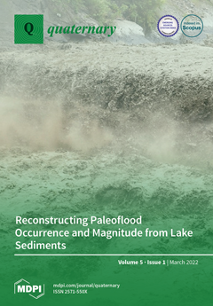
As the important and stable archive of paleoenvironmental change, lake sediments document past flood occurrence and magnitude and their evolution over centuries to millennia. Paleo-flood data can be used to better understand the processes causing extreme flood events, inform flood design and risk assessment, and unravel how climatic changes and other drivers of change affect flood characteristics, which has led to an increasing focus on paleo-flood hydrology from lake sediments over the past decade. Bruno Wilhelm et al. provide a review of the latest knowledge of flood depositional processes and systems, as well as the latest methods for reconstructing and interpreting paleo-flood records. View this paper.
  • Issues are regarded as officially published after their release is announced to the table of contents alert mailing list.
  • You may sign up for e-mail alerts to receive table of contents of newly released issues.
  • PDF is the official format for papers published in both, html and pdf forms. To view the papers in pdf format, click on the "PDF Full-text" link, and use the free Adobe Reader to open them.
Order results
Result details
Select all
Export citation of selected articles as:
45 pages, 670 KiB  
Review
Late Quaternary Proboscidean Sites in Africa and Eurasia with Possible or Probable Evidence for Hominin Involvement
by Gary Haynes
Quaternary 2022, 5(1), 18; https://0-doi-org.brum.beds.ac.uk/10.3390/quat5010018 - 16 Mar 2022
Cited by 8 | Viewed by 4123
Abstract
This paper presents a list of >100 publicly known late Quaternary proboscidean sites that have certain or possible traces of hominin utilization in Africa, Europe, and Asia, along with a sample of references, chronometric or estimated ages, and brief descriptions of the associated [...] Read more.
This paper presents a list of >100 publicly known late Quaternary proboscidean sites that have certain or possible traces of hominin utilization in Africa, Europe, and Asia, along with a sample of references, chronometric or estimated ages, and brief descriptions of the associated materials and bone modifications. Summary discussions of important sites are also presented. Lower Palaeolithic/Early Stone Age hominins created far fewer proboscidean site assemblages than hominins in later Palaeolithic phases, in spite of the time span being many times longer. Middle Palaeolithic/Middle Stone Age hominins created assemblages at eight times the earlier hominin rate. Upper Palaeolithic/Later Stone Age hominins created site assemblages at >90 times the rate of Lower Palaeolithic hominins. Palaeoloxodon spp. occur in nearly one third of the sites with an identified or probable proboscidean taxon and Mammuthus species are in nearly one half of the sites with identified or probable taxon. Other identified proboscidean genera, such as Elephas, Loxodonta, and Stegodon, occur in few sites. The sites show variability in the intensity of carcass utilization, the quantity of lithics bedded with bones, the extent of bone surface modifications, such as cut marks, the diversity of associated fauna, and mortality profiles. Full article
Show Figures

Graphical abstract

18 pages, 3700 KiB  
Article
Extreme Body Size Variation in Pleistocene Dwarf Elephants from the Siculo-Maltese Palaeoarchipelago: Disentangling the Causes in Time and Space
by Matthew Edward Scarborough
Quaternary 2022, 5(1), 17; https://0-doi-org.brum.beds.ac.uk/10.3390/quat5010017 - 11 Mar 2022
Cited by 2 | Viewed by 4410
Abstract
The phenomenon of insular dwarfism in proboscideans is particularly well represented on the Siculo-Maltese Palaeoarchipelago, an island group on which a species complex of palaeoloxodont elephants evolved during the Middle-Late Pleistocene. This likely included three species from Malta, four from Sicily (and possibly [...] Read more.
The phenomenon of insular dwarfism in proboscideans is particularly well represented on the Siculo-Maltese Palaeoarchipelago, an island group on which a species complex of palaeoloxodont elephants evolved during the Middle-Late Pleistocene. This likely included three species from Malta, four from Sicily (and possibly its palaeo-islands), and one from Favignana Island, ranging in size from the 1 m-tall Palaeoloxodon falconeri to continental-sized 4m-tall P. antiquus. However, our understanding of the causes for extreme differences in body size among insular samples in such a small geographic region is still limited. Here, I document the full range in size of elephants from the palaeoarchipelago, and discuss the reasons for size differences on the three islands in time and space in relation to predation, competition, resource limitation, accelerated life history, and duration of isolation. Differences in size between larger and smaller Sicilian elephants from Luparello Fissure, as well as possibly also in P. ex gr. P. mnaidriensis from Puntali Cave, San Teodoro Cave, and Favignana Island, may relate to the duration of isolation, or alternatively environmental stressors associated with the Last Glacial Maximum in the case of the Favignana elephant. Additionally, small but significant differences in size observable in Middle Pleistocene P. ex gr. P. falconeri from different localities on Sicily, as well as in Maltese P. ‘melitensis’ may also relate to duration of isolation, highlighting the need for better geochronological data in order to better distinguish macro-ecological causes driving body size change from more subtle effects relating to duration of isolation. Full article
Show Figures

Figure 1

25 pages, 26890 KiB  
Article
Contextual, Taphonomic, and Paleoecological Insights from Anurans on Tiwanaku Sites in Southern Peru
by Juliana Rubinatto Serrano, Maria Camila Vallejo-Pareja, Susan D. deFrance, Sarah I. Baitzel and Paul S. Goldstein
Quaternary 2022, 5(1), 16; https://0-doi-org.brum.beds.ac.uk/10.3390/quat5010016 - 07 Mar 2022
Cited by 2 | Viewed by 2951
Abstract
We examine the processes that resulted in the deposition of bones of at least three anuran genera on four archaeological sites associated with the Tiwanaku culture occupied between 700–1100 CE in the Moquegua Valley of far southern Peru. We review archaeological data and [...] Read more.
We examine the processes that resulted in the deposition of bones of at least three anuran genera on four archaeological sites associated with the Tiwanaku culture occupied between 700–1100 CE in the Moquegua Valley of far southern Peru. We review archaeological data and ethnographic accounts of Andean peoples using frogs and toads for food and in rain-quest rituals. Anuran bones are common in prehispanic cemeteries, but far less common in habitational and ceremonial sites. The quantity of anuran remains in certain cemeteries is anomalous in comparison to other archaeological sites in the valley and to Tiwanaku sites in other geographic settings. We conclude that anurans are most common where abandoned below-ground rock-covered tombs are likely to have been reused by nesting owls, and propose that most anuran remains in archaeological contexts in Moquegua are the result of predation. We consider environmental, cultural and taphonomic explanations and posit that the abundance of anuran remains relates to the 14th-century Miraflores ENSO event. This event generated increased rainfall in the desert, creating conditions favorable for frogs and toads, and predation by owls. We also advocate for the use of fine-screening to recover small-sized animal remains, such as anurans, that can be used to understand taphonomic processes and paleoenvironmental conditions. Full article
Show Figures

Figure 1

31 pages, 5885 KiB  
Article
Macroscopic Chop Mark Identification on Archaeological Bone: An Experimental Study of Chipped Stone, Ground Stone, Copper, and Bronze Axe Heads on Bone
by Tiffany R. Okaluk and Haskel J. Greenfield
Quaternary 2022, 5(1), 15; https://0-doi-org.brum.beds.ac.uk/10.3390/quat5010015 - 02 Mar 2022
Cited by 9 | Viewed by 6757
Abstract
This paper presents a new macroscopic method for identifying chop marks on archaeological faunal assemblages and highlights the major differences in the morphology of chop marks created by stone and metal axes. The method provides macroscopic criteria that aid in the identification of [...] Read more.
This paper presents a new macroscopic method for identifying chop marks on archaeological faunal assemblages and highlights the major differences in the morphology of chop marks created by stone and metal axes. The method provides macroscopic criteria that aid in the identification of both complete and incomplete chop mark types as well as the raw material of the axe. Experiments with modern stone (chipped and ground) and metal (copper and bronze) axes found that the degree of fragmentation within a chop mark is related to both the width and sharpness of the axe and can be classed on a scale from 1–5 using a variety of criteria. The experiments demonstrate that sharp chipped stone axes are fragile (often break upon impact) and do not create clean and well-defined chop marks. Ground stone axes are more durable but tend to create very fragmented chop marks without a clean cut (sheared) surface. Unalloyed copper metal axes can create sheared chopped surfaces; however, the relatively soft metal creates more crushing at the point of entry than bronze axes. In contrast, bronze axes are durable and create chop marks with exceptionally low rates of fragmentation resulting in a clean-cut sheared surface that extends into the bone for more than 3 mm. The method is applied to the faunal assemblage from the Early Bronze Age site of Göltepe, Turkey to determine whether the chop marks on bones were made by stone or metal axes at this early metal processing settlement. The results suggest that many of the chop marks were made by metal implements (e.g., axes). Hence, this method provides another means to monitor the adoption rates of new raw materials at a time when both metal and stone axes coexisted. Full article
Show Figures

Figure 1

13 pages, 10584 KiB  
Article
Defining Fragmentation Patterns of Archaeological Bone Remains without Typologies: A Landmark-Based Approach on Rodent Mandibula
by Marine Durocher, Sandrine Grouard, Violaine Nicolas, Renan Maestri and Allowen Evin
Quaternary 2022, 5(1), 14; https://0-doi-org.brum.beds.ac.uk/10.3390/quat5010014 - 02 Mar 2022
Cited by 2 | Viewed by 3396
Abstract
Fragmentation is a recurring feature of archaeological faunal material, and impacts many aspects of zooarchaeological studies from taxonomical identification to biometric studies. It can result from anthropic and natural actions that occurred respectively before and/or after bone deposit. While several bone fragmentation typologies [...] Read more.
Fragmentation is a recurring feature of archaeological faunal material, and impacts many aspects of zooarchaeological studies from taxonomical identification to biometric studies. It can result from anthropic and natural actions that occurred respectively before and/or after bone deposit. While several bone fragmentation typologies have been described, they are currently based on both macroscopic observations and researcher subjectivity and lack the universality necessary for inter-study comparisons. To fulfill this need we present a standardized landmark-based protocol for the description and quantification of mandibular fragmentation patterns, using two insular rodents of different sizes as models. The rice rats (Oryzomyini tribe) and the agouti (Dasyprocta) from the Lesser Antilles were abundant during the pre-Columbian Ceramic Age (500 BCE-1500 CE). Their mandibles’ shapes were quantified using the coordinates of 13 2D-landmarks. We show that landmark-based measurements can be used to:—assess the preservation differences between taxa of the same taxonomic group (e.g., rodents),—estimate the level of preservation of a skeletal part (e.g., mandible),—describe fragmentation patterns without pre-existing typologies and—facilitate the application of geometric morphometric methods to fragmented archaeological material. Our novel approach, leveraging fragmentation analyses and establishing specific fragmentation patterns, frees itself from existing typologies and could be systematically applied to future research. Full article
Show Figures

Figure 1

26 pages, 16630 KiB  
Article
Evolution of the Upper Reaches of Fluvial Systems within the Area of the East European Plain Glaciated during MIS 6
by Andrey Panin, Olga Borisova, Vladimir Belyaev, Yuri Belyaev, Ekaterina Eremenko, Yulia Fuzeina, Elena Sheremetskaya and Aleksey Sidorchuk
Quaternary 2022, 5(1), 13; https://0-doi-org.brum.beds.ac.uk/10.3390/quat5010013 - 22 Feb 2022
Cited by 1 | Viewed by 2507
Abstract
The headwaters of fluvial systems on the East European Plain between the boundaries of the Marine Isotope Stage 2 (MIS 2) and MIS 6 glaciations evolved during the last 150,000 years. At least three main events of high surface runoff caused intensive erosion: [...] Read more.
The headwaters of fluvial systems on the East European Plain between the boundaries of the Marine Isotope Stage 2 (MIS 2) and MIS 6 glaciations evolved during the last 150,000 years. At least three main events of high surface runoff caused intensive erosion: at the end of MIS 6, at the end of MIS 2 and in the Middle Holocene. Erosion developed in the territory with variable resistance of geological substrate, from hard-to-erode tills to weak sandy deposits. All erosional features in moraines formed in the pre-Holocene time. Even relatively large forms, such as balkas (small dry valleys), have not yet reached concave longitudinal profiles. A general tendency of their development was deepening. Short episodes of incision occurring during climatic events with increased water flow alternated with long periods of stabilization. Sand-covered areas are most favorable for linear erosion. The gullies formed in the Middle Holocene developed concave longitudinal profiles. The diversity of catchment areas, initial slope inclinations and sediment properties causing their resistance to erosion led to greater differences in the relief features and evolution of the upper reaches of the fluvial systems within the MIS 6 glaciation area compared to the more uniform landscape conditions in the extraglacial regions. Full article
(This article belongs to the Special Issue Fluvial Archives: Climatic and Topographical Influences)
Show Figures

Figure 1

31 pages, 5046 KiB  
Article
Neanderthal Fossils, Mobile Toolkit and a Hyena Den: The Archaeological Assemblage of Lateral Gallery 1 in Cova Del Gegant (NE Iberian Peninsula)
by Joan Daura, Montserrat Sanz, Manuel Vaquero, Juan Manuel López-García, Hugues-Alexandre Blain and Antonio Sánchez Marco
Quaternary 2022, 5(1), 12; https://0-doi-org.brum.beds.ac.uk/10.3390/quat5010012 - 18 Feb 2022
Cited by 4 | Viewed by 4736
Abstract
Lateral Gallery 1 (GL1) in Cova del Gegant is a Middle Palaeolithic assemblage yielding diagnostic Neanderthal remains, together with Mousterian tools and faunal remains. It is a good archive for evaluating the environmental conditions of the coastal areas during MIS 4 and MIS [...] Read more.
Lateral Gallery 1 (GL1) in Cova del Gegant is a Middle Palaeolithic assemblage yielding diagnostic Neanderthal remains, together with Mousterian tools and faunal remains. It is a good archive for evaluating the environmental conditions of the coastal areas during MIS 4 and MIS 3 in the NE of the Iberian Peninsula, and also the Neanderthals’ behaviour and mobility. Here we provide a comprehensive assessment of all of the data available from GL1, such as lithics, human remains, fauna and chronostratigraphic details. The biotic ecofacts studied point to the development of a coastal plain in front of the cave and indicate that local conditions likely favoured a large variety of ecosystems characterised by open environments and woodland-edge taxa, and favoured repeated visits by humans during the Middle Palaeolithic. The evidence suggests that the gallery was mainly used by carnivores, such as hyenas, and also by Neanderthals as a brief stopping place, in view of the presence of transported and abandoned ergonomic lithic artifacts and/or the placement of bodies (or parts of bodies). The regional context suggests high human mobility and emphasises the variability of Neanderthal behaviour. Full article
Show Figures

Figure 1

19 pages, 11484 KiB  
Article
Understanding the Impact of Trampling on Rodent Bones
by Yolanda Fernández-Jalvo, Lucía Rueda, Fernando Julian Fernández, Sara García-Morato, María Dolores Marin-Monfort, Claudia Ines Montalvo, Rodrigo Tomassini, Michael Chazan, Liora K. Horwitz and Peter Andrews
Quaternary 2022, 5(1), 11; https://0-doi-org.brum.beds.ac.uk/10.3390/quat5010011 - 10 Feb 2022
Cited by 5 | Viewed by 3623
Abstract
Experiments based on the premise of uniformitarism are an effective tool to establish patterns of taphonomic processes acting either before, or after, burial. One process that has been extensively investigated experimentally is the impact of trampling to large mammal bones. Since trampling marks [...] Read more.
Experiments based on the premise of uniformitarism are an effective tool to establish patterns of taphonomic processes acting either before, or after, burial. One process that has been extensively investigated experimentally is the impact of trampling to large mammal bones. Since trampling marks caused by sedimentary friction strongly mimic cut marks made by humans using stone tools during butchery, distinguishing the origin of such modifications is especially relevant to the study of human evolution. In contrast, damage resulting from trampling on small mammal fossil bones has received less attention, despite the fact that it may solve interesting problems relating to site formation processes. While it has been observed that the impact of compression depends on the type of substrate and dryness of the skeletal elements, the fragility of small mammal bones may imply that they will break as a response to compression. Here, we have undertaken a controlled experiment using material resistance compression equipment to simulate a preliminary experiment, previously devised by one of us, on human trampling of owl pellets. Our results demonstrate that different patterns of breakage can be distinguished under wet and dry conditions in mandibles, skulls and long bones that deform or break in a consistent way. Further, small compact bones almost always remain intact, resisting breakage under compression. The pattern obtained here was applied to a Pleistocene small mammal fossil assemblage from Wonderwerk Cave (South Africa). This collection showed unusually extensive breakage and skeletal element representation that could not be entirely explained by excavation procedures or digestion by the predator. We propose that trampling was a significant factor in small mammal bone destruction at Wonderwerk Cave, partly the product of trampling caused by the raptor that introduced the microfauna into the cave, as well as by hominins and other terrestrial animals that entered the cave and trampled pellets covering the cave floor. Full article
Show Figures

Figure 1

2 pages, 201 KiB  
Editorial
Acknowledgment to Reviewers of Quaternary in 2021
by Quaternary Editorial Office
Quaternary 2022, 5(1), 10; https://0-doi-org.brum.beds.ac.uk/10.3390/quat5010010 - 08 Feb 2022
Viewed by 1518
Abstract
Rigorous peer-reviews are the basis of high-quality academic publishing [...] Full article
31 pages, 5942 KiB  
Review
Reconstructing Paleoflood Occurrence and Magnitude from Lake Sediments
by Bruno Wilhelm, Benjamin Amann, Juan Pablo Corella, William Rapuc, Charline Giguet-Covex, Bruno Merz and Eivind Støren
Quaternary 2022, 5(1), 9; https://0-doi-org.brum.beds.ac.uk/10.3390/quat5010009 - 01 Feb 2022
Cited by 10 | Viewed by 4319
Abstract
Lake sediments are a valuable archive to document past flood occurrence and magnitude, and their evolution over centuries to millennia. This information has the potential to greatly improve current flood design and risk assessment approaches, which are hampered by the shortness and scarcity [...] Read more.
Lake sediments are a valuable archive to document past flood occurrence and magnitude, and their evolution over centuries to millennia. This information has the potential to greatly improve current flood design and risk assessment approaches, which are hampered by the shortness and scarcity of gauge records. For this reason, paleoflood hydrology from lake sediments received fast-growing attention over the last decade. This allowed an extensive development of experience and methodologies and, thereby, the reconstruction of paleoflood series with increasingly higher accuracy. In this review, we provide up-to-date knowledge on flood sedimentary processes and systems, as well as on state-of-the-art methods for reconstructing and interpreting paleoflood records. We also discuss possible perspectives in the field of paleoflood hydrology from lake sediments by highlighting the remaining challenges. This review intends to guide the research interest in documenting past floods from lake sediments. In particular, we offer here guidance supported by the literature in how: to choose the most appropriate lake in a given region, to find the best suited sedimentary environments to take the cores, to identify flood deposits in the sedimentary sequence, to distinguish them from other instantaneous deposits, and finally, to rigorously interpret the flood chronicle thus produced. Full article
Show Figures

Figure 1

23 pages, 6411 KiB  
Article
A Late Holocene Stable Isotope and Carbon Accumulation Record from Teringi Bog in Southern Estonia
by Nathan D. Stansell, Eric S. Klein, Kristyn Hill, Jaanus Terasmaa, Justin Dodd, Maxwell Boes, Mariliis Eensalu, Carolyn Fortney, Annabella Fritts, Roxana Garcia, Brittany Price and Brandy Swanson
Quaternary 2022, 5(1), 8; https://0-doi-org.brum.beds.ac.uk/10.3390/quat5010008 - 01 Feb 2022
Viewed by 2733
Abstract
Radiocarbon-dated peat cores collected from an ombrotrophic bog in southern Estonia record shifting environmental conditions and carbon accumulation rates in northern Europe during the late Holocene. Modern observations indicate that the water balance of the peatland is highly influenced by changes in relative [...] Read more.
Radiocarbon-dated peat cores collected from an ombrotrophic bog in southern Estonia record shifting environmental conditions and carbon accumulation rates in northern Europe during the late Holocene. Modern observations indicate that the water balance of the peatland is highly influenced by changes in relative humidity, followed by temperature and precipitation. The modern δ18O and δ2H values of surface water suggest that the groundwater is an integration of several months of precipitation. There also appears to be little or no direct influence of surface evaporation on the water within the bog, suggesting that water loss is preferentially through transpiration and sub-surface flow. Bulk peat δ13C values exhibit a trend of higher values through the late Holocene, suggesting a pattern of overall increased surface wetness. The δ15N values were low from ~4130 to 3645 cal yr BP, suggesting drier conditions, followed by intermediate values until ~2995 cal yr BP. The δ15N values decrease again from ~2995 to 2470 cal yr BP, suggesting a return to drier conditions, followed by intermediate values until ~955 cal yr BP. The δ15N values were high, suggesting wetter conditions from ~955 to 250 cal yr BP, followed by intermediate values through the modern. Carbon accumulation rates were low to intermediate from ~4200 to 2470 cal yr BP, followed by intermediate-to-high values until ~1645 cal yr BP. Carbon accumulation rates were then low until ~585 cal yr BP, followed by intermediate values through the modern. The geochemical data, combined with observed changes in peat composition and regional proxies of temperature and water table fluctuations through the late Holocene, suggest that carbon accumulation rates were relatively low under dry and warm conditions, whereas accumulation was generally higher (up to ~80 g C m−2 yr−1) when the climate was wetter and/or colder. These findings further suggest that future environmental changes affecting the regional water balance and temperature will impact the potential for northern peatlands to capture and store carbon. Full article
Show Figures

Figure 1

15 pages, 5824 KiB  
Article
Palaeogeographical Reconstruction of Ancient Diolkos Slipway by Using Beachrocks as Proxies, West Corinth Isthmus, Greece
by Giannis Saitis, Anna Karkani, Niki Evelpidou and Hampik Maroukian
Quaternary 2022, 5(1), 7; https://0-doi-org.brum.beds.ac.uk/10.3390/quat5010007 - 18 Jan 2022
Cited by 5 | Viewed by 3337
Abstract
Beachrocks are well known as significant proxies for paleoenvironmental analysis as they indicate the coastal evolution. The combination of geomorphological and archaeological sea level indicators has a significant contribution to the coastal paleogeographic reconstruction. In this study, we studied a beachrock from the [...] Read more.
Beachrocks are well known as significant proxies for paleoenvironmental analysis as they indicate the coastal evolution. The combination of geomorphological and archaeological sea level indicators has a significant contribution to the coastal paleogeographic reconstruction. In this study, we studied a beachrock from the Diolkos area (West Corinth canal, Greece) and remnants of Diolkos slipway to reconstruct the coastal evolution before Diolkos construction until today. We conducted detailed mapping of Diolkos beachrock using DGPS-GNSS, as well as mineralogical analysis and OSL dating of beachrock samples. The results showed that a beachrock slab was preserved before the construction of Diolkos below it, followed by its submergence by a co-seismic event after Diolkos abandonment during 146 B.C. Consequently, a new beachrock was developed on top of the submerged Diolkos around 120 ± 14 A.D. The RSL was stable until 1596 ± 57 A.D. when the beachrock developed even closer to the present-day coastline. After 1596 A.D., it was uplifted by 12 cm until it reached today’s condition. Full article
(This article belongs to the Special Issue Advances in Geoarchaeology and Cultural Heritage)
Show Figures

Figure 1

32 pages, 4471 KiB  
Article
Along the Rivers and into the Plain: Early Crop Diversity in the Central and Western Balkans and Its Relationship with Environmental and Cultural Variables
by Anne de Vareilles, Dragana Filipović, Djurdja Obradović and Marc Vander Linden
Quaternary 2022, 5(1), 6; https://0-doi-org.brum.beds.ac.uk/10.3390/quat5010006 - 15 Jan 2022
Cited by 8 | Viewed by 3707
Abstract
Agriculture is a complex and dynamic socio-ecological system shaped by environmental, economic, and social factors. The crop resource pool is its key component and one that best reflects environmental limitations and socio-economic concerns of the farmers. This pertains in particular to small-scale subsistence [...] Read more.
Agriculture is a complex and dynamic socio-ecological system shaped by environmental, economic, and social factors. The crop resource pool is its key component and one that best reflects environmental limitations and socio-economic concerns of the farmers. This pertains in particular to small-scale subsistence production, as was practised by Neolithic farmers. We investigated if and how the environment and cultural complexes shaped the spectrum and diversity of crops cultivated by Neolithic farmers in the central-western Balkans and on the Hungarian Plain. We did so by exploring patterns in crop diversity between biogeographical regions and cultural complexes using multivariate statistical analyses. We also examined the spectrum of wild-gathered plant resources in the same way. We found that the number of species in Neolithic plant assemblages is correlated with sampling intensity (the number and volume of samples), but that this applies to all archaeological cultures. Late Neolithic communities of the central and western Balkans exploited a large pool of plant resources, whose spectrum was somewhat different between archaeological cultures. By comparison, the earliest Neolithic tradition in the region, the Starčevo-Körös-Criş phenomenon, seems to have used a comparatively narrower range of crops and wild plants, as did the Linearbandkeramik culture on the Hungarian Plain. Full article
(This article belongs to the Special Issue Human Activities and Development of Food Production in the Holocene)
Show Figures

Figure 1

12 pages, 3729 KiB  
Article
Digital Deforestation: Comparing Automated Approaches to the Production of Digital Terrain Models (DTMs) in Agisoft Metashape
by Matthew D. Howland, Anthony Tamberino, Ioannis Liritzis and Thomas E. Levy
Quaternary 2022, 5(1), 5; https://0-doi-org.brum.beds.ac.uk/10.3390/quat5010005 - 14 Jan 2022
Cited by 2 | Viewed by 4053
Abstract
This paper tests the suitability of automated point cloud classification tools provided by the popular image-based modeling (IBM) software package Agisoft Metashape for the generation of digital terrain models (DTMs) at moderately-vegetated archaeological sites. DTMs are often required for various forms of archaeological [...] Read more.
This paper tests the suitability of automated point cloud classification tools provided by the popular image-based modeling (IBM) software package Agisoft Metashape for the generation of digital terrain models (DTMs) at moderately-vegetated archaeological sites. DTMs are often required for various forms of archaeological mapping and analysis. The suite of tools provided by Agisoft are relatively user-friendly as compared to many point cloud classification algorithms and do not require the use of additional software. Based on a case study from the Mycenaean site of Kastrouli, Greece, the mostly-automated, geometric classification tool “Classify Ground Points” provides the best results and produces a quality DTM that is sufficient for mapping and analysis. Each of the methods tested in this paper can likely be improved through manual editing of point cloud classification. Full article
(This article belongs to the Special Issue Advances in Geoarchaeology and Cultural Heritage)
Show Figures

Figure 1

22 pages, 4430 KiB  
Article
The Microvertebrates of Shanidar Cave: Preliminary Taphonomic Findings
by Emily Tilby, Preston Miracle and Graeme Barker
Quaternary 2022, 5(1), 4; https://0-doi-org.brum.beds.ac.uk/10.3390/quat5010004 - 10 Jan 2022
Cited by 5 | Viewed by 3791
Abstract
Shanidar Cave, Iraqi Kurdistan, is one of the most important Palaeolithic sites in Southwest Asia. This is due to the long sequence of hominin occupation of the cave and the discovery of multiple Neanderthal individuals from the original Solecki excavations (1951–1960) and recent [...] Read more.
Shanidar Cave, Iraqi Kurdistan, is one of the most important Palaeolithic sites in Southwest Asia. This is due to the long sequence of hominin occupation of the cave and the discovery of multiple Neanderthal individuals from the original Solecki excavations (1951–1960) and recent excavations (2014 to present). Preliminary taphonomic analyses of the microvertebrate assemblage were undertaken to understand the factors affecting assemblage formation and accumulation, and this paper presents the first results of these analyses. All contexts display a high proportion of fragmentation, with a slight decrease in breakage towards the base of the sequence. Black staining and root etching were observed in a similar pattern, present in most contexts but with an increase in the lower levels. A significant proportion of the microvertebrate remains examined displayed light traces of digestion, indicating some contribution to the assemblage by predators. The results are consistent with wider palaeoecological records that indicate relatively warm, wet conditions at the base of the sequence and cooler, drier conditions at the top. Full article
Show Figures

Graphical abstract

16 pages, 3766 KiB  
Article
Characterization of the Obsidian Used in the Chipped Stone Industry in Kendale Hecala
by Üftade Muşkara and Ayşin Konak
Quaternary 2022, 5(1), 3; https://0-doi-org.brum.beds.ac.uk/10.3390/quat5010003 - 07 Jan 2022
Cited by 2 | Viewed by 2603
Abstract
Kendale Hecala is located on the Ambar River in the Upper Tigris Basin, province of Diyarbakır in Southeast Anatolia. Various raw materials, including obsidian, radiolarite, chert, jasper, chalcedony, and quartzite, were used in the lithic industry. Obsidian artefacts constitute an average of 64% [...] Read more.
Kendale Hecala is located on the Ambar River in the Upper Tigris Basin, province of Diyarbakır in Southeast Anatolia. Various raw materials, including obsidian, radiolarite, chert, jasper, chalcedony, and quartzite, were used in the lithic industry. Obsidian artefacts constitute an average of 64% of the chipped stone assemblage. Technological analysis reveals that obsidian was brought to the settlement as nodules and chipped into various tools at the settlement. Understanding the operational sequence of the lithic industry, chaîne opératoire, including the distribution of raw material from source to site, is important to demonstrate the socio-cultural organization of the settlement in Southeastern Anatolia during the Ubaid period. In order to identify source varieties, the obsidian artefacts uncovered from Ubaid layers of Kendale Hecala were analyzed by macro-observations, and the characterization of archaeological samples was performed using a handheld XRF. Multivariate analysis of the data indicates the use of obsidian from different resources at the settlement, including Nemrut Dağ, Bingöl B, and Group 3d. Full article
(This article belongs to the Special Issue Advances in Geoarchaeology and Cultural Heritage)
Show Figures

Figure 1

14 pages, 2991 KiB  
Article
A 1900 Year Sediment Record Suggests Recent Establishment of Black Mangrove (Avicennia Germinans) Stands within a Salt Marsh in St. Augustine, Florida, USA
by Jessica Chamberlin, Camryn Soehnlein, Jason Evans and Benjamin Tanner
Quaternary 2022, 5(1), 2; https://0-doi-org.brum.beds.ac.uk/10.3390/quat5010002 - 01 Jan 2022
Viewed by 2545
Abstract
Salt marshes and mangroves are currently being affected by rising temperatures. Mangroves thrive below −29° N latitude in Florida, USA, and have a low tolerance for extreme cold events, whereas salt marshes dominate further north. One potential effect of climate change is a [...] Read more.
Salt marshes and mangroves are currently being affected by rising temperatures. Mangroves thrive below −29° N latitude in Florida, USA, and have a low tolerance for extreme cold events, whereas salt marshes dominate further north. One potential effect of climate change is a reduction in the frequency of extreme cold events, which may lead to mangrove expansion into salt marsh systems. Our research identified sediment proxy indicators of salt marsh and mangrove environments. These indicators were applied to soil cores from intertidal wetlands near the current northern limit of mangrove presence on the east coast of Florida, to determine if mangrove expansion into salt marsh environments has precedence in the deeper past. Our findings suggest that mangrove and salt marsh sediments can be distinguished using a combination of stable carbon isotope ratios of sedimentary organic matter and macroscopic plant fragments, and our results showed that a mangrove stand that we cored established only recently. This result is consistent with other work in the southeastern United States that suggests that mangroves established at the current boreal limit only recently after the end of the Little Ice Age, and that the current mangrove expansion may be fueled by anthropogenic climate change. Full article
Show Figures

Figure 1

18 pages, 3680 KiB  
Article
Luminescence Sensitivity of Rhine Valley Loess: Indicators of Source Variability?
by Kathryn E. Fitzsimmons, Zoran Perić, Maike Nowatzki, Susanne Lindauer, Mathias Vinnepand, Charlotte Prud’homme, Aditi K. Dave, Andreas Vött and Peter Fischer
Quaternary 2022, 5(1), 1; https://0-doi-org.brum.beds.ac.uk/10.3390/quat5010001 - 21 Dec 2021
Cited by 6 | Viewed by 3093
Abstract
Loess provides a valuable terrestrial record of past environmental conditions, including the dynamics and trajectories of air mass circulation responsible for dust transport. Here we explore variations in the luminescence sensitivity characteristics of sedimentary quartz and feldspar as possible tools for identifying changes [...] Read more.
Loess provides a valuable terrestrial record of past environmental conditions, including the dynamics and trajectories of air mass circulation responsible for dust transport. Here we explore variations in the luminescence sensitivity characteristics of sedimentary quartz and feldspar as possible tools for identifying changes in source down a loess-palaeosol sequence (LPS). Luminescence sensitivity is a rapidly measurable index which is the product of interplay between source lithology and the history of the quartz or feldspar clasts. Variations in sensitivity of down profile may therefore reflect changes in sediment provenance as well as other factors such as weathering through pedogenesis. We undertake an empirical investigation of the luminescence sensitivity of quartz and feldspar from different grain-size fractions from the Schwalbenberg LPS in the German Rhine valley. We compare samples from a 30 m core spanning the last full glacial cycle with samples of oxygen isotope stage (OIS) 3–2 age exposed within nearby profile. We find an overall inverse relationship between quartz and feldspar sensitivity, as well as variability in sensitivity between different quartz grain sizes. Statistical analyses yield a significant correlation between IR50 sensitivity from unprocessed sediments and clay content, and feldspar sensitivity and Si/Al ratios down the core. Since Si/Al ratios may indicate changes in provenance, the latter correlation suggests that IR50 measurements on unprocessed samples may be used to provide a reliable, rapid scan of source variability over millennial timescales. Full article
(This article belongs to the Special Issue Quaternary Loess Deposition and Climate Change)
Show Figures

Figure 1

Previous Issue
Next Issue
Back to TopTop