


Remote Sens. 2020, 12(19), 3176; https://0-doi-org.brum.beds.ac.uk/10.3390/rs12193176 - 28 Sep 2020
Cited by 9 | Viewed by 3677
Abstract
►
Show Figures
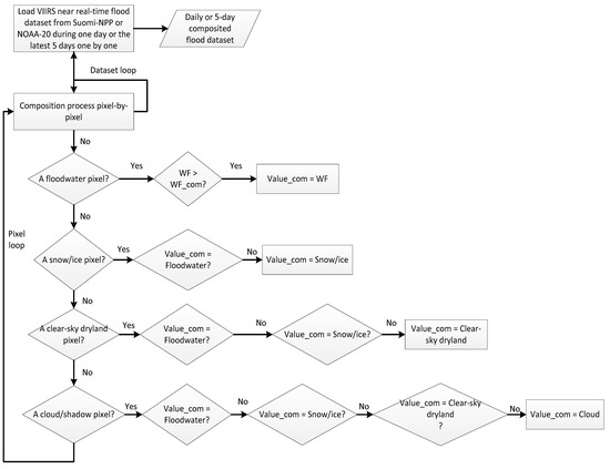
Since 2 June 2020, unusual heavy and continuous rainfall from the Asian summer monsoon rainy season caused widespread catastrophic floods in many Asian countries, including primarily the two most populated countries, China and India. To detect and monitor the floods and estimate the
[...] Read more.
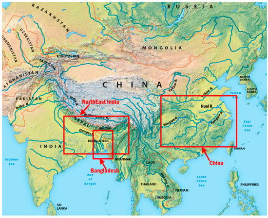
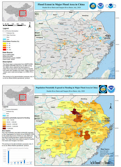
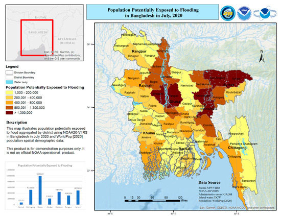
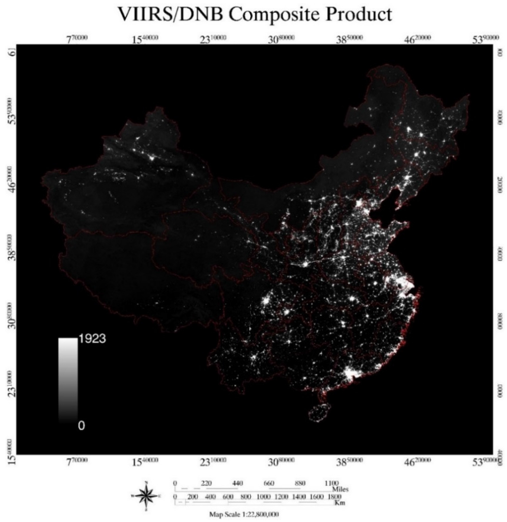
Since 2 June 2020, unusual heavy and continuous rainfall from the Asian summer monsoon rainy season caused widespread catastrophic floods in many Asian countries, including primarily the two most populated countries, China and India. To detect and monitor the floods and estimate the potentially affected population, data from sensors aboard the operational polar-orbiting satellites Suomi National Polar-Orbiting Partnership (S-NPP) and National Oceanic and Atmospheric Administration (NOAA)-20 were used. The Visible Infrared Imaging Radiometer Suite (VIIRS) with a spatial resolution of 375 m available twice per day aboard these two satellites can observe floodwaters over large spatial regions. The flood maps derived from the VIIRS imagery provide a big picture over the entire flooding regions, and demonstrate that, in July, in China, floods mainly occurred across the Yangtze River, Hui River and their tributaries. The VIIRS 5-day composite flood maps, along with a population density dataset, were combined to estimate the population potentially exposed (PPE) to flooding. We report here on the procedure to combine such data using the Zonal Statistic Function from the ArcGIS Spatial Analyst toolbox. Based on the flood extend for July 2020 along with the population density dataset, the Jiangxi and Anhui provinces were the most affected regions with more than 10 million people in Jingdezhen and Shangrao in Jiangxi province, and Fuyang and Luan in Anhui province, and it is estimated that about 55 million people in China might have been affected by the floodwaters. In addition to China, several other countries, including India, Bangladesh, and Myanmar, were also severely impacted. In India, the worst inundated states include Utter Pradesh, Bihar, Assam, and West Bengal, and it is estimated that about 40 million people might have been affected by severe floods, mainly in the northern states of Bihar, Assam, and West Bengal. The most affected country was Bangladesh, where one third of the country was underwater, and the estimated population potentially exposed to floods is about 30 million in Bangladesh.
Full article

Graphical abstract


