sensors-logo

Journal Browser

Journal Browser

Drone Sensing and Imaging for Environment Monitoring

A special issue of Sensors (ISSN 1424-8220). This special issue belongs to the section "Sensor Networks".

Deadline for manuscript submissions: closed (30 November 2022) | Viewed by 20466

Special Issue Editor


E-Mail Website
Guest Editor
Istituto Nazionale di Geofisica e Vulcanologia (INGV), Via di vigna murata 605, 00143 Roma, Italy
Interests: development of electronic and mechanical technologies for geophysical observation and volcanology; measurement instruments; embedded systems; mechatronic

Special Issue Information

Dear Colleagues,

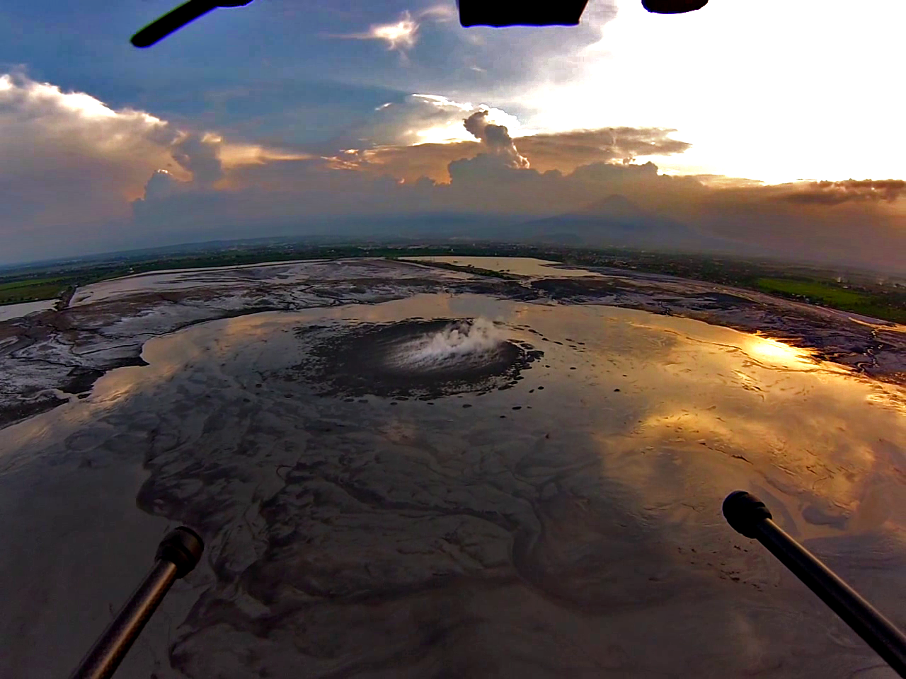
The development and diffusion of unmanned and remote controlled flying platforms (drones) has induced the universities and scientists to use these systems in many scientific field where is fondamental the observation, the inspection and management of critical areas by the remote sensing.

A drone can be equipped with small and compact instrumentation, precision GPS systems, thermal and multispectral cameras, magnetometers and high resolution cameras capable of performing reporting maps in very high precision, thermal photographs, high definition video footage, but also gas or ground material sampling or tools release.

Thus allowing to explore extreme sites and collect a wide range of useful data and details in short time for the study of natural phenomena and environmental monitoring, with very low operating costs.

These high-performance multipurpose flight systems can now safely access inaccessible environments. At the same time, they have stimulated technological research to develop new airborne instruments and sensors and new remote observation techniques.

This special issue is dedicated to environmental detection through drones and the application of new sensors and tools designed to be integrated on board drones and used for environmental research and monitoring

Dr. Giuseppe Di Stefano
Guest Editor

text

Manuscript Submission Information

Manuscripts should be submitted online at www.mdpi.com by registering and logging in to this website. Once you are registered, click here to go to the submission form. Manuscripts can be submitted until the deadline. All submissions that pass pre-check are peer-reviewed. Accepted papers will be published continuously in the journal (as soon as accepted) and will be listed together on the special issue website. Research articles, review articles as well as short communications are invited. For planned papers, a title and short abstract (about 100 words) can be sent to the Editorial Office for announcement on this website.

Submitted manuscripts should not have been published previously, nor be under consideration for publication elsewhere (except conference proceedings papers). All manuscripts are thoroughly refereed through a single-blind peer-review process. A guide for authors and other relevant information for submission of manuscripts is available on the Instructions for Authors page. Sensors is an international peer-reviewed open access semimonthly journal published by MDPI.

Please visit the Instructions for Authors page before submitting a manuscript. The Article Processing Charge (APC) for publication in this open access journal is 2600 CHF (Swiss Francs). Submitted papers should be well formatted and use good English. Authors may use MDPI's English editing service prior to publication or during author revisions.

Keywords

  • remote sensing
  • infrared camera
  • remote sampling
  • multipurpose drone
  • instruments release
  • gas sensors
  • multispectral camera

Published Papers (5 papers)

Order results
Result details
Select all
Export citation of selected articles as:

Research

21 pages, 8188 KiB  
Article
Building a UAV Based System to Acquire High Spatial Resolution Thermal Imagery for Energy Balance Modelling
by Krisztina Pintér and Zoltán Nagy
Sensors 2022, 22(9), 3251; https://0-doi-org.brum.beds.ac.uk/10.3390/s22093251 - 23 Apr 2022
Cited by 3 | Viewed by 1964
Abstract
High spatial resolution and geolocation accuracy canopy evapotranspiration (ET) maps are well suited tools for evaluation of small plot field trials. While creating such a map by use of an energy balance model is routinely performed, the acquisition of the necessary imagery at [...] Read more.
High spatial resolution and geolocation accuracy canopy evapotranspiration (ET) maps are well suited tools for evaluation of small plot field trials. While creating such a map by use of an energy balance model is routinely performed, the acquisition of the necessary imagery at a suitable quality is still challenging. An UAV based thermal/RGB integrated imaging system was built using the RaspberryPi (RPi) microcomputer as a central unit. The imagery served as input to the two-source energy balance model pyTSEB to derive the ET map. The setup’s flexibility and modularity are based on the multiple interfaces provided by the RPi and the software development kit (SDK) provided for the thermal camera. The SDK was installed on the RPi and used to trigger cameras, retrieve and store images and geolocation information from an onboard GNSS rover for PPK processing. The system allows acquisition of 8 cm spatial resolution thermal imagery from a 60 m height of flight and less than 7 cm geolocation accuracy of the mosaicked RGB imagery. Modelled latent heat flux data have been validated against latent heat fluxes measured by eddy covariance stations at two locations with RMSE of 75 W/m2 over a two-year study period. Full article
(This article belongs to the Special Issue Drone Sensing and Imaging for Environment Monitoring)
Show Figures

Figure 1

21 pages, 81299 KiB  
Article
A Cognitive Sample Consensus Method for the Stitching of Drone-Based Aerial Images Supported by a Generative Adversarial Network for False Positive Reduction
by Jeong-Kweon Seo
Sensors 2022, 22(7), 2474; https://0-doi-org.brum.beds.ac.uk/10.3390/s22072474 - 23 Mar 2022
Cited by 1 | Viewed by 1779
Abstract
When using drone-based aerial images for panoramic image generation, the unstableness of the shooting angle often deteriorates the quality of the resulting image. To prevent these polluting effects from affecting the stitching process, this study proposes deep learning-based outlier rejection schemes that apply [...] Read more.
When using drone-based aerial images for panoramic image generation, the unstableness of the shooting angle often deteriorates the quality of the resulting image. To prevent these polluting effects from affecting the stitching process, this study proposes deep learning-based outlier rejection schemes that apply the architecture of the generative adversarial network (GAN) to reduce the falsely estimated hypothesis relating to a transform produced by a given baseline method, such as the random sample consensus method (RANSAC). To organize the training dataset, we obtain rigid transforms to resample the images via the operation of RANSAC for the correspondences produced by the scale-invariant feature transform descriptors. In the proposed method, the discriminator of GAN makes a pre-judgment of whether the estimated target hypothesis sample produced by RANSAC is true or false, and it recalls the generator to confirm the authenticity of the discriminator’s inference by comparing the differences between the generated samples and the target sample. We have tested the proposed method for drone-based aerial images and some miscellaneous images. The proposed method has been shown to have relatively stable and good performances even in receiver-operated tough conditions. Full article
(This article belongs to the Special Issue Drone Sensing and Imaging for Environment Monitoring)
Show Figures

Figure 1

17 pages, 6005 KiB  
Article
Autonomous Multi-Rotor Aerial Platform for Air Pollution Monitoring
by Alexandru Cozma, Adrian-Cosmin Firculescu, Dan Tudose and Laura Ruse
Sensors 2022, 22(3), 860; https://0-doi-org.brum.beds.ac.uk/10.3390/s22030860 - 23 Jan 2022
Cited by 13 | Viewed by 2868
Abstract
During the last few years, scientists have become increasingly concerned about air quality. Particularly in large cities and industrialised areas, air quality is affected by pollution from natural and anthropogenic sources and this has a significant impact on human health. Continuous monitoring of [...] Read more.
During the last few years, scientists have become increasingly concerned about air quality. Particularly in large cities and industrialised areas, air quality is affected by pollution from natural and anthropogenic sources and this has a significant impact on human health. Continuous monitoring of air quality is an important step in investigating the causes and reducing pollution. In this paper, we propose a new autonomous multi-rotor aerial platform that can be used to perform real-time monitoring of air quality in large cities. The air quality monitoring system is able to cover large areas, with high spatial resolution, even above average buildings, while being relatively low cost. We evaluate the proposed system in several locations throughout a metropolitan city, during different seasons and generate fine-grained heat-maps that display the level of pollution of specific areas based on different altitudes. Full article
(This article belongs to the Special Issue Drone Sensing and Imaging for Environment Monitoring)
Show Figures

Figure 1

31 pages, 6889 KiB  
Article
Development of Drone-Mounted Multiple Sensing System with Advanced Mobility for In Situ Atmospheric Measurement: A Case Study Focusing on PM2.5 Local Distribution
by Hirokazu Madokoro, Osamu Kiguchi, Takeshi Nagayoshi, Takashi Chiba, Makoto Inoue, Shun Chiyonobu, Stephanie Nix, Hanwool Woo and Kazuhito Sato
Sensors 2021, 21(14), 4881; https://0-doi-org.brum.beds.ac.uk/10.3390/s21144881 - 17 Jul 2021
Cited by 23 | Viewed by 6189
Abstract
This study was conducted using a drone with advanced mobility to develop a unified sensor and communication system as a new platform for in situ atmospheric measurements. As a major cause of air pollution, particulate matter (PM) has been attracting attention globally. We [...] Read more.
This study was conducted using a drone with advanced mobility to develop a unified sensor and communication system as a new platform for in situ atmospheric measurements. As a major cause of air pollution, particulate matter (PM) has been attracting attention globally. We developed a small, lightweight, simple, and cost-effective multi-sensor system for multiple measurements of atmospheric phenomena and related environmental information. For in situ local area measurements, we used a long-range wireless communication module with real-time monitoring and visualizing software applications. Moreover, we developed four prototype brackets with optimal assignment of sensors, devices, and a camera for mounting on a drone as a unified system platform. Results of calibration experiments, when compared to data from two upper-grade PM2.5 sensors, demonstrated that our sensor system followed the overall tendencies and changes. We obtained original datasets after conducting flight measurement experiments at three sites with differing surrounding environments. The experimentally obtained prediction results matched regional PM2.5 trends obtained using long short-term memory (LSTM) networks trained using the respective datasets. Full article
(This article belongs to the Special Issue Drone Sensing and Imaging for Environment Monitoring)
Show Figures

Figure 1

14 pages, 9127 KiB  
Article
A Test on the Potential of a Low Cost Unmanned Aerial Vehicle RTK/PPK Solution for Precision Positioning
by Nicola Angelo Famiglietti, Gianpaolo Cecere, Carmine Grasso, Antonino Memmolo and Annamaria Vicari
Sensors 2021, 21(11), 3882; https://0-doi-org.brum.beds.ac.uk/10.3390/s21113882 - 04 Jun 2021
Cited by 31 | Viewed by 5079
Abstract
This paper investigated the achievable accuracy from a low-cost RTK (Real Time Kinematic)/PPK (Post Processing Kinematic) GNSS (Global Navigation Satellite Systems) system installed on board a UAV (Unmanned Aerial Vehicle), employing three different types of GNSS Bases (Alloy, RS2 and RING) working in [...] Read more.
This paper investigated the achievable accuracy from a low-cost RTK (Real Time Kinematic)/PPK (Post Processing Kinematic) GNSS (Global Navigation Satellite Systems) system installed on board a UAV (Unmanned Aerial Vehicle), employing three different types of GNSS Bases (Alloy, RS2 and RING) working in PPK mode. To evaluate the quality of the results, a set of seven GCPs (Ground Control Points) measured by means of the NRTK (Network Real Time Kinematic) technique was used. The outcomes show a RMSE (Root Mean Square Error) of 0.0189 m for an ALLOY Base, 0.0194 m for an RS2 Base and 0.0511 m for RING Base, respectively, on the vertical value of DEMs (Digital Elevation Models) obtained by a photogrammetric process. This indicates that, when changing the Base for the PPK, the solutions are different, but they can still be considered adequate for precision positioning with UAVs, especially when GCPs could be used with some difficulty. Therefore, the integration of a RTK/PPK GNSS module on a UAV allows the reconstruction of a highly detailed and precise DEM without using GCPs and provides the possibility to carry out surveys in inaccessible areas. Full article
(This article belongs to the Special Issue Drone Sensing and Imaging for Environment Monitoring)
Show Figures

Figure 1

Back to TopTop