Next Issue
Volume 8, December
Previous Issue
Volume 8, October


Geosciences, Volume 8, Issue 11 (November 2018) – 43 articles

Cover Story (view full-size image): 
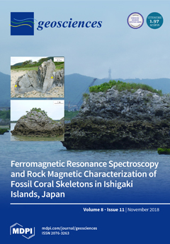
Coral tsunami boulders in Ishigaki Island, Japan showed a measurable intensity of remanent magnetization, although it is well known that corals skeletons have extremely weak remanent magnetization. To know what the origin of remanence is, in this study, we characterized magnetic assemblages in this coral skeleton to determine whether it is of biogenic or detrital magnetite using first-order reversal curve (FORC) measurements, ferromagnetic resonance (FMR) spectroscopy, and petrological observations through field-emission type scanning electron microscope (FE-SEM) with an acid treatment. Our findings indicate that the magnetic assemblage in coral tsunami boulders consists of biogenic-origin single-domain magnetites with a trace amount of detrital component. Therefore, fossil coral skeletons in Ishigaki Island have great potential for utilization for paleomagnetic studies. View this paper
  • Issues are regarded as officially published after their release is announced to the table of contents alert mailing list.
  • You may sign up for e-mail alerts to receive table of contents of newly released issues.
  • PDF is the official format for papers published in both, html and pdf forms. To view the papers in pdf format, click on the "PDF Full-text" link, and use the free Adobe Reader to open them.
Order results
Result details
Section
Select all
Export citation of selected articles as:
21 pages, 7880 KiB  
Article
Mud Flow Reconstruction by Means of Physical Erosion Modeling, High-Resolution Radar-Based Precipitation Data, and UAV Monitoring
by Phoebe Hänsel, Andreas Kaiser, Arno Buchholz, Falk Böttcher, Stefan Langel, Jürgen Schmidt and Marcus Schindewolf
Geosciences 2018, 8(11), 427; https://0-doi-org.brum.beds.ac.uk/10.3390/geosciences8110427 - 21 Nov 2018
Cited by 12 | Viewed by 4653
Abstract
Storm events and accompanying heavy rain endanger the silty soils of the fertile and intensively-used agricultural landscape of the Saxon loess province in the European loess belt. In late spring 2016, persistent weather conditions with repeated and numerous storm events triggered flash floods, [...] Read more.
Storm events and accompanying heavy rain endanger the silty soils of the fertile and intensively-used agricultural landscape of the Saxon loess province in the European loess belt. In late spring 2016, persistent weather conditions with repeated and numerous storm events triggered flash floods, landslides, and mud flows, and caused severe devastation to infrastructure and settlements throughout Germany. In Saxony, the rail service between Germany and the Czech Republic was disrupted twice because of two mud flows within eight days. This interdisciplinary study aims to reconstruct the two mud flows by means of high-resolution physical erosion modeling, high-resolution, radar-based precipitation data, and Unmanned Aerial Vehicle monitoring. Therefore, high-resolution, radar-based precipitation data products are used to assess the two storm events which triggered the mud flows in this unmonitored area. Subsequently, these data are used as meteorological input for the soil erosion model EROSION 3D to reconstruct and predict mud flows in the form of erosion risk maps. Finally, the model results are qualitatively validated by orthophotos generated from images from Unmanned Aerial Vehicle monitoring and Structure from Motion Photogrammetry. High-resolution, radar-based precipitation data reveal heavy to extreme storm events for both days. Erosion risk maps show erosion und deposition patterns and source areas as in reality, depending on the radar-based precipitation product. Consequently, reconstruction of the mud flows by these interdisciplinary methods is possible. Therefore, the development of an early warning system for soil erosion in agricultural landscapes by means of E 3D and high-resolution, radar-based precipitation forecasting data is certainly conceivable. Full article
(This article belongs to the Special Issue Mechanics of Erosion: Process Response to Change)
Show Figures

Figure 1

14 pages, 25226 KiB  
Article
Comparison of the Sweetness Seismic Attribute and Porosity–Thickness Maps, Sava Depression, Croatia
by Kristina Novak Zelenika, Karolina Novak Mavar and Stipica Brnada
Geosciences 2018, 8(11), 426; https://0-doi-org.brum.beds.ac.uk/10.3390/geosciences8110426 - 21 Nov 2018
Cited by 8 | Viewed by 5236
Abstract
The sweetness seismic attribute is a very useful tool for proper description of the depositional environment, reservoir quality and lithofacies discrimination. This paper shows that depositional channels and turbidity sandstones deposited during the Upper Pannonian and Lower Pontian in the Sava Depression can [...] Read more.
The sweetness seismic attribute is a very useful tool for proper description of the depositional environment, reservoir quality and lithofacies discrimination. This paper shows that depositional channels and turbidity sandstones deposited during the Upper Pannonian and Lower Pontian in the Sava Depression can be described using porosity–thickness and sweetness seismic attribute maps. Two studied reservoirs are of Neogene stage (“UP” reservoir of Upper Pannonian age and “LP” reservoir of Lower Pontian age) and located in the Sava Depression, Croatia. Both reservoirs contain medium to fine grained sandstones that are intercalated with basinal marls. A comparison of the sweetness seismic attribute and porosity–thickness maps show a good visual match with correlation coefficient of approximately 0.85. A mismatch was observed in areas with small reservoir thickness. This work demonstrates the importance of using porosity–thickness maps for reservoir characterization. The workflow presented in this work has wider applications in frontier areas with poor seismic data or coverage. Full article
(This article belongs to the Special Issue Geostatistical Applications in Petroleum Geology)
Show Figures

Figure 1

12 pages, 12244 KiB  
Article
Multi-Azimuth Ground Penetrating Radar Surveys to Improve the Imaging of Complex Fractures
by Federico Lombardi and Maurizio Lualdi
Geosciences 2018, 8(11), 425; https://0-doi-org.brum.beds.ac.uk/10.3390/geosciences8110425 - 20 Nov 2018
Cited by 3 | Viewed by 3646
Abstract
Ground Penetrating Radar (GPR) images are affected, to some degree, by the relative orientation of antennas and subsurface targets. This is particularly true not only for targets that show a significant directivity, but also for inclined planes, such as fractures and faults. Depending [...] Read more.
Ground Penetrating Radar (GPR) images are affected, to some degree, by the relative orientation of antennas and subsurface targets. This is particularly true not only for targets that show a significant directivity, but also for inclined planes, such as fractures and faults. Depending on the relative geometry between the antennas and the orientation of the target, radar waves can be preferentially scattered, which causes changes in the reflected signal amplitude. Therefore, traditional single polarization and single azimuth surveys may produce inadequate results. The work presented here examines the use of a multi-azimuth GPR survey to increase the imaging performance of inclined fractures, showing the shortcomings of single-profile surveying and highlighting the benefits that such a strategy has on detection and characterization. Full article
(This article belongs to the Special Issue Advances in Ground Penetrating Radar Research)
Show Figures

Figure 1

2 pages, 174 KiB  
Editorial
Editorial for Glacial and Geomorphological Cartography Special Issue
by Ramón Pellitero Ondicol
Geosciences 2018, 8(11), 424; https://0-doi-org.brum.beds.ac.uk/10.3390/geosciences8110424 - 20 Nov 2018
Viewed by 2026
Abstract
Landforms are the most superficial part of the earth’s crust. [...] Full article
(This article belongs to the Special Issue Glacial and Geomorphological Cartography)
20 pages, 4083 KiB  
Article
Hydrodynamic Shear-Induced Densification of Bacteriogenic Iron Oxides: Mechanisms and Implications
by Brock A. Edwards and F. Grant Ferris
Geosciences 2018, 8(11), 423; https://0-doi-org.brum.beds.ac.uk/10.3390/geosciences8110423 - 16 Nov 2018
Cited by 1 | Viewed by 2750
Abstract
Bacterial–mineral aggregates are the products of a tight biogeochemical coupling between microbes and geological media and play an outsized role in governing the composition of natural waters through biogeochemical cycling and mineral formation and dissolution processes. The results of combined batch column settling [...] Read more.
Bacterial–mineral aggregates are the products of a tight biogeochemical coupling between microbes and geological media and play an outsized role in governing the composition of natural waters through biogeochemical cycling and mineral formation and dissolution processes. The results of combined batch column settling experiments, volumetric analyses, and microscopic investigations demonstrate that composite bacteriogenic iron oxide aggregates are sensitive to densification in response to hydrodynamic shear, a physical fluid phenomenon that introduces significant alterations to aggregate size and structure, permeability, and settling and transport behaviour. After exposing aggregate suspensions to varying degrees of shear stress, final solids volume fractions decreased by as much as 75% from initial data, while aggregate bulk density saw increases from 999 kg·m–3 to as much as 1010 kg·m–3. Inverse modelling of time course data yielded estimates for settling rate constants and initial settling velocities that increased with shear stress application. As well as having implications for aqueous contaminant transport and potential bacterial bioenergetic strategies, these results suggest the preservation potential of microfossils formed from bacterial–mineral aggregates may be significantly reduced with shear-induced alterations, leading to a possible underrepresentation of these microfossils in the sedimentary record and a gap in our understanding of early life on Earth. Full article
(This article belongs to the Special Issue Microbial Biomineralization)
Show Figures

Figure 1

13 pages, 3664 KiB  
Article
Precious Metal Enrichment at the Myra Falls VMS Deposit, British Columbia, Canada
by Daniel Marshall, Carol-Anne Nicol, Robert Greene, Rick Sawyer, Armond Stansell and Ross Easterbrook
Geosciences 2018, 8(11), 422; https://0-doi-org.brum.beds.ac.uk/10.3390/geosciences8110422 - 15 Nov 2018
Cited by 9 | Viewed by 6136
Abstract
Gold, present as electrum, in the Battle Gap, Ridge North-West, HW, and Price deposits at the Myra Falls mine, occurs in late veinlets cutting the earlier volcanogenic massive sulphide (VMS) lithologies. The ore mineral assemblage containing the electrum comprises dominantly galena, tennantite, bornite, [...] Read more.
Gold, present as electrum, in the Battle Gap, Ridge North-West, HW, and Price deposits at the Myra Falls mine, occurs in late veinlets cutting the earlier volcanogenic massive sulphide (VMS) lithologies. The ore mineral assemblage containing the electrum comprises dominantly galena, tennantite, bornite, sphalerite, chalcopyrite, pyrite, and rarely stromeyerite, and is defined as an Au-Zn-Pb-As-Sb association. The gangue is comprised of barite, quartz, and minor feldspathic volcanogenic sedimentary rocks and clay, comprised predominantly of kaolinite with subordinate illite. The deposition of gold as electrum in the baritic upper portions of the sulphide lenses occurs at relatively shallow water depths beneath the sea floor. Primary, pseudosecondary, and secondary fluid inclusions, petrographically related to gold, show boiling fluid inclusion assemblages in the range of 123 to 173 °C, with compositions and eutectic melt temperatures consistent with seawater at approximately 3.2 wt % NaCl equivalent. The fluid inclusion homogenization temperatures are consistent with boiling seawater corresponding to water depths ranging from 15 to 125 m. Slightly more dilute brines corresponding to salinities of approximately 1 wt % NaCl indicate that there is input from very low-salinity brines, which could represent a transition from subaqueous VMS to epithermal-like conditions for precious metal enrichment, mixing with re-condensed vapor, or very low-salinity igneous fluids. Full article
(This article belongs to the Special Issue Magmatic-Hydrothermal Ore Deposits)
Show Figures

Figure 1

10 pages, 3167 KiB  
Article
Statistical Analysis of Displacement and Length Relation for Normal Faults in the Barents Sea
by Dmitriy Kolyukhin, Anita Torabi, Audun Libak, Behzad Alaei and Tatiana Khachkova
Geosciences 2018, 8(11), 421; https://0-doi-org.brum.beds.ac.uk/10.3390/geosciences8110421 - 14 Nov 2018
Cited by 2 | Viewed by 3773
Abstract
This paper is devoted to the statistical analysis of dependence between fault length (L) and displacement (D). The main purpose of this work is to study the scaling relations between fault length and displacement using a database that includes datasets of 21 faults [...] Read more.
This paper is devoted to the statistical analysis of dependence between fault length (L) and displacement (D). The main purpose of this work is to study the scaling relations between fault length and displacement using a database that includes datasets of 21 faults with geometric data extracted from 3D seismic coherence cubes of the Norwegian Barents Sea. Multiple linear regression and Bayesian and Akaike information criterions are applied to obtain optimal regression parameters. Our dataset is unique since it includes segment lengths of individual faults, unlike the previously published datasets. Hence, we studied both the dependence of fault segment length and accumulated fault length on displacement. The latter relation (accumulated fault length versus displacement) shows a general agreement (positive correlation and power-law relation) with the previously published results that are mainly obtained from outcrop studies, although the slopes vary for different lithologies. The differences could be attributed to the unique characteristics of our dataset that includes data of all segment lengths of individual faults. Full article
(This article belongs to the Special Issue Geostatistical Applications in Petroleum Geology)
Show Figures

Figure 1

17 pages, 837 KiB  
Article
The Impact of Biochar Incorporation on Inorganic Nitrogen Fertilizer Plant Uptake; An Opportunity for Carbon Sequestration in Temperate Agriculture
by Rebecca Hood-Nowotny, Andrea Watzinger, Anna Wawra and Gerhard Soja
Geosciences 2018, 8(11), 420; https://0-doi-org.brum.beds.ac.uk/10.3390/geosciences8110420 - 14 Nov 2018
Cited by 12 | Viewed by 4752
Abstract
Field studies of biochar addition to soil and nutrient cycling using 15N fertilizers in temperate agriculture are scant. These data are required in order to make evidence based assessments. This study was conducted to test the hypothesis that biochar application can increase [...] Read more.
Field studies of biochar addition to soil and nutrient cycling using 15N fertilizers in temperate agriculture are scant. These data are required in order to make evidence based assessments. This study was conducted to test the hypothesis that biochar application can increase crop yields through improving the nitrogen uptake and utilization of added inorganic fertilizer, whilst sequestering significant quantities of carbon. Results showed that although biochar addition led to significant spring barley grain yield increases in the first year of biochar application, an unusually dry year; this was possibly not solely the result of improved nitrogen uptake, as total crop N was similar in both treatments. Results suggested it was improved water utilization, indicated by the crop carbon isotope values and soil moisture characteristics. In the second year, there were no significant effects of the previous year’s biochar addition on the sunflower yield, N status, fertilizer recovery or any signs of improved water utilization. These data add to a growing body of evidence, suggesting that biochar addition has only slightly positive or neutral effects on crop growth and fertilizer retention but has the potential to sequester vast amounts of carbon in the soil with minimal yield losses in temperate agriculture. Full article
(This article belongs to the Special Issue Carbon Sequestration)
Show Figures

Figure 1

14 pages, 2309 KiB  
Article
Estimating Groundwater Abstractions at the Aquifer Scale Using GRACE Observations
by Alexandra Gemitzi and Venkat Lakshmi
Geosciences 2018, 8(11), 419; https://0-doi-org.brum.beds.ac.uk/10.3390/geosciences8110419 - 14 Nov 2018
Cited by 13 | Viewed by 3536
Abstract
Groundwater monitoring requires costly in situ networks, which are difficult to maintain over long time periods, especially in countries facing economic recession such as Greece. Our work aims at providing a methodology to estimate groundwater abstractions at the aquifer scale using publicly available [...] Read more.
Groundwater monitoring requires costly in situ networks, which are difficult to maintain over long time periods, especially in countries facing economic recession such as Greece. Our work aims at providing a methodology to estimate groundwater abstractions at the aquifer scale using publicly available remotely sensed data from the NASA’s Gravity Recovery and Climate Experiment (GRACE) together with publicly available meteorological observations that serve as input variables to an Artificial Neural Network (ANN) method. The methodology was demonstrated in an alluvial aquifer in NE Greece for a 10-year period (2005–2014), where irrigation agriculture poses a serious threat to both groundwater resources and their dependent ecosystems. To generalize the developed model, an ensemble of 100 ANNs was created by the initial weight randomization approach and output was computed by averaging the output of each individual model. Scaled Root Mean Square Error and Nash–Sutcliffe coefficient were used to test the model efficiency. Both of these performance metrics indicated that monthly groundwater abstractions can be estimated efficiently and that the developed methodology offers an inexpensive substitute for in situ groundwater monitoring when in situ networks are not available or cannot operate properly. Full article
Show Figures

Graphical abstract

20 pages, 2048 KiB  
Article
Rare Biosphere Archaea Assimilate Acetate in Precambrian Terrestrial Subsurface at 2.2 km Depth
by Maija Nuppunen-Puputti, Lotta Purkamo, Riikka Kietäväinen, Mari Nyyssönen, Merja Itävaara, Lasse Ahonen, Ilmo Kukkonen and Malin Bomberg
Geosciences 2018, 8(11), 418; https://0-doi-org.brum.beds.ac.uk/10.3390/geosciences8110418 - 13 Nov 2018
Cited by 14 | Viewed by 4655
Abstract
The deep biosphere contains a large portion of the total microbial communities on Earth, but little is known about the carbon sources that support deep life. In this study, we used Stable Isotope Probing (SIP) and high throughput amplicon sequencing to identify the [...] Read more.
The deep biosphere contains a large portion of the total microbial communities on Earth, but little is known about the carbon sources that support deep life. In this study, we used Stable Isotope Probing (SIP) and high throughput amplicon sequencing to identify the acetate assimilating microbial communities at 2260 m depth in the bedrock of Outokumpu, Finland. The long-term and short-term effects of acetate on the microbial communities were assessed by DNA-targeted SIP and RNA targeted cell activation. The microbial communities reacted within hours to the amended acetate. Archaeal taxa representing the rare biosphere at 2260 m depth were identified and linked to the cycling of acetate, and were shown to have an impact on the functions and activity of the microbial communities in general through small key carbon compounds. The major archaeal lineages identified to assimilate acetate and metabolites derived from the labelled acetate were Methanosarcina spp., Methanococcus spp., Methanolobus spp., and unclassified Methanosarcinaceae. These archaea have previously been detected in the Outokumpu deep subsurface as minor groups. Nevertheless, their involvement in the assimilation of acetate and secretion of metabolites derived from acetate indicated an important role in the supporting of the whole community in the deep subsurface, where carbon sources are limited. Full article
Show Figures

Figure 1

14 pages, 3438 KiB  
Article
Hellenic Karst Aquifers Vulnerability Approach Using Factor Analysis: The Example of the Louros Karst Aquifers
by Konstantina Katsanou
Geosciences 2018, 8(11), 417; https://0-doi-org.brum.beds.ac.uk/10.3390/geosciences8110417 - 13 Nov 2018
Cited by 5 | Viewed by 3138
Abstract
The karst aquifers of the Hellenic territory display high vulnerability that is related to the existence of the epikarst zone. If present, the epikarst zone regulates the vertical movement of the groundwater, which results in the chemical pollutants staying longer within it, thus [...] Read more.
The karst aquifers of the Hellenic territory display high vulnerability that is related to the existence of the epikarst zone. If present, the epikarst zone regulates the vertical movement of the groundwater, which results in the chemical pollutants staying longer within it, thus facilitating the inactivation of the microbial loads. The Hellenic karst is well developed; it displays high hydraulic conductivity, relatively large storage, and the characteristics of an important water reservoir. Although its porosity was calculated to be between 0.005–8%, the statistical processing of the springs’ discharge time series points to an increased storage. The increased storage was attributed to the presence of the epikarst zone, which regulates the water movement to the underlying formations, and finally to its discharge from the karst system through springs. In these areas, the influence of nitrogen compounds on the water quality is evident. The presence of cyanobacteria and toxic substances at concentrations that are too high for fresh, flowing waters whose temperature does not exceed 17 °C advocates the role of nutrients, even at concentrations that do not exceed the maximum permissible limits of drinking water. In mountainous areas, where agriculture is limited, the presence of these compounds is attributed to heavily polluting land uses. The impact of such uses became apparent from the application of factor analysis, which not only highlighted their contribution to the overall groundwater quality, but also determined their geographical distribution and origin. From the above, it becomes evident that there is a need for protection of the karst aquifers, and investigation of their vulnerability mechanisms. The Hellenic karst, which is expected to cover the drinking water needs in the near future, proves to be very vulnerable to any kind of pollution. Full article
Show Figures

Figure 1

8 pages, 1737 KiB  
Technical Note
Technical Note on the Dynamic Changes in Kalman Gain when Updating Hydrodynamic Urban Drainage Models
by Morten Borup, Henrik Madsen, Morten Grum and Peter Steen Mikkelsen
Geosciences 2018, 8(11), 416; https://0-doi-org.brum.beds.ac.uk/10.3390/geosciences8110416 - 13 Nov 2018
Cited by 4 | Viewed by 2731
Abstract
To prevent online models diverging from reality they need to be updated to current conditions using observations and data assimilation techniques. A way of doing this for distributed hydrodynamic urban drainage models is to use the Ensemble Kalman Filter (EnKF), but this requires [...] Read more.
To prevent online models diverging from reality they need to be updated to current conditions using observations and data assimilation techniques. A way of doing this for distributed hydrodynamic urban drainage models is to use the Ensemble Kalman Filter (EnKF), but this requires running an ensemble of models online, which is computationally demanding. This can be circumvented by calculating the Kalman gain, which is the governing matrix of the updating, offline if the gain is approximately constant in time. Here, we show in a synthetic experiment that the Kalman gain can vary by several orders of magnitude in a non-uniform and time-dynamic manner during surcharge conditions caused by backwater when updating a hydrodynamic model of a simple sewer system with the EnKF. This implies that constant gain updating is not suitable for distributed hydrodynamic urban drainage models and that the full EnKF is in fact required. Full article
(This article belongs to the Special Issue Hydrology of Urban Catchments)
Show Figures

Figure 1

20 pages, 4427 KiB  
Article
How to Define Priorities in Coastal Vulnerability Assessment
by Francesca De Serio, Elvira Armenio, Michele Mossa and Antonio Felice Petrillo
Geosciences 2018, 8(11), 415; https://0-doi-org.brum.beds.ac.uk/10.3390/geosciences8110415 - 12 Nov 2018
Cited by 39 | Viewed by 6317
Abstract
Awareness of coastal landscapes vulnerability to both natural and man-made hazards induce to monitor their evolution, adaptation, resilience and to develop appropriate defence strategies. The necessity to transform the monitoring results into useful information is the motivation of the present paper. Usually, to [...] Read more.
Awareness of coastal landscapes vulnerability to both natural and man-made hazards induce to monitor their evolution, adaptation, resilience and to develop appropriate defence strategies. The necessity to transform the monitoring results into useful information is the motivation of the present paper. Usually, to this scope, a coastal vulnerability index is deduced, by assigning ranking values to the different parameters governing the coastal processes. The principal limitation of this procedure is the individual discretion used in ranking. Moreover, physical parameters are generally considered, omitting socio-economic factors. The aim of the present study is to complement a geographical information system (GIS) with an analytical hierarchical process (AHP), thus allowing an objective prioritization of the key parameters. Furthermore, in the present case, socio-economic parameters have been added to physical ones. Employing them jointly, an integrated coastal vulnerability index (ICVI) has been estimated and its effectiveness has been investigated. To show how it works, the proposed method has been applied to a portion of the Adriatic coastline, along the Apulian region in southern Italy. It has permitted to identify and prioritize the most vulnerable areas, revealing its efficacy as a potential tool to support coastal planning and management. Full article
Show Figures

Figure 1

35 pages, 11689 KiB  
Article
Present Glaciers of Tavan Bogd Massif in the Altai Mountains, Central Asia, and Their Changes since the Little Ice Age
by Dmitry A. Ganyushkin, Kirill V. Chistyakov, Ilya V. Volkov, Dmitry V. Bantcev, Elena P. Kunaeva, Tatyana A. Andreeva, Anton V. Terekhov and Demberel Otgonbayar
Geosciences 2018, 8(11), 414; https://0-doi-org.brum.beds.ac.uk/10.3390/geosciences8110414 - 12 Nov 2018
Cited by 14 | Viewed by 4524
Abstract
The Tavan Bogd mountains (of which, the main peak, Khuiten Uul, reaches 4374 m a.s.l.) are situated in the central part of the Altai mountain system, in the territories of Russia, Mongolia and China. The massif is the largest glacierized area of Altai. [...] Read more.
The Tavan Bogd mountains (of which, the main peak, Khuiten Uul, reaches 4374 m a.s.l.) are situated in the central part of the Altai mountain system, in the territories of Russia, Mongolia and China. The massif is the largest glacierized area of Altai. The purposes of this study were to provide a full description of the scale and structure of the modern glacierized area of the Tavan Bogd massif, to reconstruct the glaciers of the Little Ice Age (LIA), to estimate the extent of the glaciers in 1968, and to determine the main glacial trends, and their causes, from the peak of the LIA. This work was based on the results of long-term field studies and analysis of satellite and aerial data. At the peak of the LIA, Tavan Bogd glaciation comprised 243 glaciers with a total area of 353.4 km2. From interpretation of Corona images, by 1968 the number of glaciers had decreased to 236, with a total area of 242 km2. In 2010, there were 225 glaciers with a total area of 201 km2. Thus, since the peak of the LIA, the glacierized area of the Tavan Bogd mountains decreased by 43%, which is somewhat less than for neighboring glacial centers (i.e., Ikh-Turgen, Tsambagarav, Tsengel-Khairkhan and Mongun-Taiga mountains). The probable causes are higher altitude and the predominance of larger glaciers resistant to warming. Accordingly, the smallest decline in Tavan Bogd occurred in the basins of the Tsagan-Gol (31.7%) and Sangadyr (36.4%) rivers where the largest glaciers are located. In contrast, on the lower periphery of the massif, where small glaciers predominate, the relative reduction was large (74–79%). In terms of general retreat trends, large valley glaciers retreated faster in 1968–1977 and after 2010. During the 1990s, the retreat was slow. After 2010, glacial retreat was rapid. The retreat of glaciers in the last 50–60 years was caused by a trend decrease in precipitation until the mid-1970s, and a sharp warming in the 1990s and early 2000s. Full article
(This article belongs to the Special Issue Remote Sensing of Land Ice)
Show Figures

Figure 1

8 pages, 2317 KiB  
Communication
Unusual Isolated Large Clasts from the Periphery of the Lagonaki Highland, Western Caucasus: New Evidence of Classification and Origin
by Dmitry A. Ruban
Geosciences 2018, 8(11), 413; https://0-doi-org.brum.beds.ac.uk/10.3390/geosciences8110413 - 12 Nov 2018
Cited by 2 | Viewed by 1909
Abstract
Large clasts are in focus of the modern geoscience research, but their broadly-accepted classification is absent and specialists tend to over-emphasize on clasts of coastal zones. New field investigations in the Western Caucasus have permitted the finding of isolated large clasts of carbonate [...] Read more.
Large clasts are in focus of the modern geoscience research, but their broadly-accepted classification is absent and specialists tend to over-emphasize on clasts of coastal zones. New field investigations in the Western Caucasus have permitted the finding of isolated large clasts of carbonate composition that occur above the Early–Middle Jurassic shale sequence and that are covered by modern soils. These clasts can be determined either as large boulders or megaclasts (blocks) depending on the preferred classification. Their shape is chiefly irregular, although smoothened surfaces and rounded angles (resulting from previous karstification) are also registered. These large clasts are located quite far from the natural outcrops of the Late Jurassic carbonates, which are their parent rocks. The origin of these clasts can be linked to collapses of the Pleistocene cliff of a cuesta-type mountain range, which later retreated to its present position. The evidence from the study area implies the size of 1 m or 2 m as a plausible criterion for distinction of boulders and megaclasts, and it also makes claims towards the development of a wider genetic typology of megaclasts. Full article
(This article belongs to the Section Biogeosciences)
Show Figures

Graphical abstract

19 pages, 10420 KiB  
Article
Field Survey of 2018 Typhoon Jebi in Japan: Lessons for Disaster Risk Management
by Tomoyuki Takabatake, Martin Mäll, Miguel Esteban, Ryota Nakamura, Thit Oo Kyaw, Hidenori Ishii, Justin Joseph Valdez, Yuta Nishida, Fuma Noya and Tomoya Shibayama
Geosciences 2018, 8(11), 412; https://0-doi-org.brum.beds.ac.uk/10.3390/geosciences8110412 - 09 Nov 2018
Cited by 32 | Viewed by 9344
Abstract
Typhoon Jebi struck Japan on the 4 September 2018, damaging and inundating many coastal areas along Osaka Bay due to the high winds, a storm surge, and wind driven waves. In order to understand the various damage mechanisms, the authors conducted a field [...] Read more.
Typhoon Jebi struck Japan on the 4 September 2018, damaging and inundating many coastal areas along Osaka Bay due to the high winds, a storm surge, and wind driven waves. In order to understand the various damage mechanisms, the authors conducted a field survey two days after the typhoon made landfall, measuring inundation heights and depths at several locations in Hyogo Prefecture. The survey results showed that 0.18–1.27 m inundation depths were caused by Typhoon Jebi. As parts of the survey, local residents were interviewed about the flooding, and a questionnaire survey regarding awareness of typhoons and storm surges, and their response to the typhoon was distributed. The authors also mapped the location of some of the containers that were displaced by the storm surge, aiming to provide information to validate future simulation models of container displacement. Finally, some interesting characteristics of the storm surge are summarized, such as possible overtopping at what had initially been thought to be a low risk area (Suzukaze town), and lessons learnt in terms of disaster risk management are discussed. Full article
(This article belongs to the Special Issue River, Urban, and Coastal Flood Risk)
Show Figures

Figure 1

25 pages, 16898 KiB  
Article
An Investigation into the Theft of Concentrates and Their Upgrading to Saleable Platinum-Products
by Robert Schouwstra, Johan Mocke, Michael Duncan, Siksha Bramdeo and Yolanda Scharneck
Geosciences 2018, 8(11), 411; https://0-doi-org.brum.beds.ac.uk/10.3390/geosciences8110411 - 09 Nov 2018
Viewed by 4667
Abstract
Over the years the theft of material from platinum producers has mainly taken place from high-grade areas such as the precious- and base-metal refineries and the converter and smelting operations. At some concentrators, the metallic stream, which concentrated the larger platinum group mineral [...] Read more.
Over the years the theft of material from platinum producers has mainly taken place from high-grade areas such as the precious- and base-metal refineries and the converter and smelting operations. At some concentrators, the metallic stream, which concentrated the larger platinum group mineral (PGM) grains using shaking tables (a gravity process), was also at risk due to its high grade. However, the processing of metallics was discontinued many years ago. The relative low grade of concentrator products has led to the belief that the concentrators are a low-risk area for theft. The final products are still very diluted by the gangue minerals, and to recover and purify the various metals contained in these products requires costly processing techniques (i.e., smelting and refining). High-grade stolen products are generally offered to small refineries who either further process, and package, or directly ship the material overseas for refining. In the case of stolen concentrates, the volume and value of the material would make that an unprofitable option. This assumption, as well as the risk the thieves run of being caught while removing large quantities of material from the concentrators, has resulted in management considering theft from concentrators of lesser importance than theft from the smelters or refineries. However, over the past few years investigations by protection services at concentrators have shown that high-grade platinum products are smuggled off-site. These products have been found on the concentrator as well as at illegal smelthouses where these type of products are processed further. Forensic investigations indicated that these upgraded products are much higher in grade than the normal concentrator products, characterised by high platinum contents, and contain high-density minerals such as galena (lead sulphide) and chromite. This suggests that these materials are significantly upgraded prior to smuggling these out of the operations. The method used by the perpetrators results in much of the value minerals being discarded, giving rise to concentrates that are atypical of Bushveld products. To better understand the process of upgrading these products and to get more information for the ‘fingerprinting’ database on the ‘at-risk products’, concentrator products were obtained from areas where material is stolen for further upgrading. This paper describes the upgrading process used by the illegal ‘processors’ and discusses the mineralogy and chemistry of the various products down the illegal processing chain. The study indicates that products containing coarse, liberated platinum-group minerals are the most favorable for upgrading. Flotation products with high precious metal grades and low chromite contents are preferred by the syndicate members. These are typically the first cells of the rougher banks, final concentrates, and the various cleaners and re-cleaners feeding into the final concentrates. Full article
(This article belongs to the Special Issue Forensic Geoscience)
Show Figures

Figure 1

11 pages, 6027 KiB  
Article
Geochemical Features of Fallow Land in Ancient Plots in the Chora of Chersonesos
by Fedor Lisetskii, Eugenia Zelenskaya and Maria Rodionova
Geosciences 2018, 8(11), 410; https://0-doi-org.brum.beds.ac.uk/10.3390/geosciences8110410 - 09 Nov 2018
Cited by 13 | Viewed by 3379
Abstract
The ancient city of Chersonesos created an agricultural zone in the 4th and 3rd centuries BC (under the conditions of climate aridization); this zone was initially used for viticulture and the export of wine, and grain farming later developed at the distant chora [...] Read more.
The ancient city of Chersonesos created an agricultural zone in the 4th and 3rd centuries BC (under the conditions of climate aridization); this zone was initially used for viticulture and the export of wine, and grain farming later developed at the distant chora (in North-Western (NW) Crimea). The purpose of our work was to verify whether the ampeloecological conditions, especially the geochemical features of the soil and rock, limited viticulture in NW Crimea. Fallow lands in 13 plots in the near and distant chora of Chersonesos were studied using ampelopedology; specifically, we compared agrochemical properties and the concentrations of macro- and trace elements in the renaturation soil horizon and in the parent rock. The main differences between the soils of the two regions were determined by the accumulation of cinnamonic soils of Chersonesos Si, K, Fe, Al, P2O5; in the distant chora, there are specific elements, including V, Pb, Rb, Cr. The climate and the biogeochemical diversity of soils and rock could be significant factors causing the differences in wine quality in the two regions of western Crimea; these factors are still reflected in modern viticultural practices when using the concept of “terroir”. These findings are consistent with the different roles of ancient viticulture in SW (South-Western) and NW (North-Western) Crimea (i.e., export and local consumption, respectively), which have been highlighted by historians. Full article
Show Figures

Figure 1

26 pages, 16021 KiB  
Article
Hydrodynamic and Debris-Damming Failure of Bridge Decks and Piers in Steady Flow
by Kevin Oudenbroek, Nader Naderi, Jeremy D. Bricker, Yuguang Yang, Cor Van der Veen, Wim Uijttewaal, Shuji Moriguchi and Sebastiaan N. Jonkman
Geosciences 2018, 8(11), 409; https://0-doi-org.brum.beds.ac.uk/10.3390/geosciences8110409 - 09 Nov 2018
Cited by 29 | Viewed by 7368
Abstract
In countries with steep rivers, such as Japan and the United States, bridges fail on an annual basis. Bridges on spread footings are especially susceptible to failure by hydrodynamic loading, often exacerbated by debris damming. Here, such failures are investigated via small scale [...] Read more.
In countries with steep rivers, such as Japan and the United States, bridges fail on an annual basis. Bridges on spread footings are especially susceptible to failure by hydrodynamic loading, often exacerbated by debris damming. Here, such failures are investigated via small scale model laboratory experiments and full scale numerical simulations. In the laboratory, lift and drag forces and overturning moment on bridge decks, piers, and deck-pier systems, are measured and compared with threshold of failure criteria used in design guidelines. Effects of debris on lift, drag, and moment, as well as three-dimensional effects, are quantified. Via numerical simulations, flow patterns and free surface behaviour responsible for these forces are investigated, and described in a framework as a function of the water depth, flow speed, deck clearance, and girder height. Results show that current guidelines are non-conservative in some cases. Importantly, failure of both decks and piers can be prevented by strengthening pier-deck connections, or by streamlining decks. Full article
(This article belongs to the Special Issue River, Urban, and Coastal Flood Risk)
Show Figures

Figure 1

18 pages, 3937 KiB  
Article
Selenium, Sulphur, Trace Metal, and BTEX Levels in Soil, Water, and Lettuce from the Croatian Raša Bay Contaminated by Superhigh-Organic-Sulphur Coal
by Gordana Medunić, Željka Kuharić, Adela Krivohlavek, Marija Đuroković, Kristina Dropučić, Ankica Rađenović, Borna Lužar Oberiter, Aleksandra Krizmanić and Mladen Bajramović
Geosciences 2018, 8(11), 408; https://0-doi-org.brum.beds.ac.uk/10.3390/geosciences8110408 - 08 Nov 2018
Cited by 27 | Viewed by 3951
Abstract
This paper elaborates soil, water, and lettuce contamination status with respect to selenium, sulphur, trace metals, and BTEX (benzene, toluene, ethylbenzene, and xylenes) in a coal-based area (Raša Bay, Adriatic Sea, Croatia). A local coal-fired power plant polluted soil with S, Se, Cd, [...] Read more.
This paper elaborates soil, water, and lettuce contamination status with respect to selenium, sulphur, trace metals, and BTEX (benzene, toluene, ethylbenzene, and xylenes) in a coal-based area (Raša Bay, Adriatic Sea, Croatia). A local coal-fired power plant polluted soil with S, Se, Cd, and PAHs due to the combustion of domestic superhigh-organic-sulphur coal. The locality is dotted with waste from coal mining/separation, coal combustion, former metal factories, untreated municipal and coal mine effluents, along with various harbour activities, which contribute to environmental contamination. The methodology involved ICP-MS and GC-MS for the measurement of trace elements and BTEX, respectively, while soil sulphur was determined with Eschka’s mixture. The max values of the analysed trace elements in soil (mg/kg) are reported: Hg 1.14, Cd 3.29, V 624, Se 10.3, Pb 872, Cr 1860, Zn 6580, Cu 1850, and U 25.2. According to ecological indices, these values fall into the category of an extremely high level of soil pollution. Elevated total Se values in surface water are ascribed to leaching of seleniferous coal, ash, and coal-polluted soil. Levels of BTEX in water samples were very low (0–0.83 µg/L). The data provide basic information on the inorganic and organic contamination status of the Raša Bay area. Full article
(This article belongs to the Special Issue Geochemical Equilibrium and Processes in Seawater)
Show Figures

Graphical abstract

19 pages, 6423 KiB  
Article
Automatic Coastline Extraction Using Edge Detection and Optimization Procedures
by Vasilis Paravolidakis, Lemonia Ragia, Konstantia Moirogiorgou and Michalis E. Zervakis
Geosciences 2018, 8(11), 407; https://0-doi-org.brum.beds.ac.uk/10.3390/geosciences8110407 - 07 Nov 2018
Cited by 47 | Viewed by 4985
Abstract
Coastal areas are quite fragile landscapes as they are among the most vulnerable to climate change and natural hazards. Coastline mapping and change detection are essential for safe navigation, resource management, environmental protection, and sustainable coastal development and planning. In this paper, we [...] Read more.
Coastal areas are quite fragile landscapes as they are among the most vulnerable to climate change and natural hazards. Coastline mapping and change detection are essential for safe navigation, resource management, environmental protection, and sustainable coastal development and planning. In this paper, we proposed a new methodology for the automatic extraction of coastline, using aerial images. This method is based on edge detection and active contours (snake method). Initially the noise of the image is reduced which is followed by an image segmentation. The output images are further processed to remove all small spatial objects and to concentrate on the spatial objects of interests. Then, the morphological operators are applied. We used aerial images taken from an aircraft and high-resolution satellite images from a coastal area in Crete, Greece, and we compared the results with geodetic measurements, to validate the methodology. Full article
Show Figures

Figure 1

15 pages, 3973 KiB  
Communication
Ball Milling Effect on the CO2 Uptake of Mafic and Ultramafic Rocks: A Review
by Ioannis Rigopoulos, Ioannis Ioannou, Andreas Delimitis, Angelos M. Efstathiou and Theodora Kyratsi
Geosciences 2018, 8(11), 406; https://0-doi-org.brum.beds.ac.uk/10.3390/geosciences8110406 - 07 Nov 2018
Cited by 15 | Viewed by 3752
Abstract
Mineral carbonation is considered to be the most stable mechanism for the sequestration of CO2. This study comprises a comparative review of the effect of ball milling on the CO2 uptake of ultramafic/mafic lithologies, which are the most promising rocks [...] Read more.
Mineral carbonation is considered to be the most stable mechanism for the sequestration of CO2. This study comprises a comparative review of the effect of ball milling on the CO2 uptake of ultramafic/mafic lithologies, which are the most promising rocks for the mineralization of CO2. Samples of dunite, pyroxenite, olivine basalt and of a dolerite quarry waste material were previously subjected to ball milling to produce ultrafine powders with enhanced CO2 uptake. The optimum milling conditions were determined through selective CO2 chemisorption followed by temperature-programmed desorption (TPD) experiments, revealing that the CO2 uptake of the studied lithologies can be substantially enhanced via mechanical activation. Here, all these data are compared, demonstrating that the behavior of each rock under the effect of ball milling is predominantly controlled by the mineralogical composition of the starting rock materials. The ball-milled rock with the highest CO2 uptake is the dunite, followed by the olivine basalt, the pyroxenite and the dolerite. The increased CO2 uptake after ball milling is mainly attributed to the reduction of particle size to the nanoscale range, thus creating more adsorption sites per gram basis, as well as to the structural disordering of the constituent silicate minerals. Full article
(This article belongs to the Special Issue Carbon Sequestration)
Show Figures

Figure 1

17 pages, 4970 KiB  
Article
3D Numerical Modelling and Sensitivity Analysis of the Processes Controlling Organic Matter Distribution and Heterogeneity—A Case Study from the Toarcian of the Paris Basin
by Benjamin Bruneau, Marc Villié, Mathieu Ducros, Benoit Chauveau, François Baudin and Isabelle Moretti
Geosciences 2018, 8(11), 405; https://0-doi-org.brum.beds.ac.uk/10.3390/geosciences8110405 - 06 Nov 2018
Cited by 4 | Viewed by 4060
Abstract
The active debate about the processes governing the organic-rich sediment deposition generally involves the relative roles of elevated primary productivity and enhanced preservation related to anoxia. However, other less spotlighted factors could have a strong impact on such deposits, e.g., residence time into [...] Read more.
The active debate about the processes governing the organic-rich sediment deposition generally involves the relative roles of elevated primary productivity and enhanced preservation related to anoxia. However, other less spotlighted factors could have a strong impact on such deposits, e.g., residence time into the water column (bathymetry), sedimentation rate, transport behavior of organo-mineral floccules on the sea floor. They are all strongly interrelated and may be obscured in the current conceptual models inspired from most representative modern analogues (i.e., upwelling zones and stratified basins). To improve our comprehension of organic matter distribution and heterogeneities, we conducted a sensitivity analysis on the processes involved in organic matter production and preservation that have been simulated within a 3D stratigraphic forward model. The Lower-Middle Toarcian of the Paris Basin was chosen as a case study as it represents one of the best documented example of marine organic matter accumulation. The relative influence of the critical parameters (bathymetry, diffusive transport, oxygen mixing rate and primary production) on the output parameters (Total Organic Carbon, and oxygen level), determined performing a Global Sensitivity Analysis, shows that, in the context of a shallow epicontinental basin, a moderate primary productivity (>175 gC·m−2·year−1) can led to local anoxia and organic matter accumulation. We argue that, regarding all the processes involved, the presence and distribution of organic-rich intervals is linked as a first-order parameter to the morphology of the basin (e.g., ramp slope, bottom topography). These interpretations are supported by very specific ranges of critical parameters that allowed to obtain output parameter values in accordance with the data. This quantitative approach and its conclusions open new perspectives about the understanding of global distribution and preservation of organic-rich sediments. Full article
(This article belongs to the Special Issue Geostatistical Applications in Petroleum Geology)
Show Figures

Figure 1

15 pages, 3118 KiB  
Article
Analysis of QualitySpec Trek Reflectance from Vertical Profiles of Taiga Snowpack
by Leena Leppänen and Anna Kontu
Geosciences 2018, 8(11), 404; https://0-doi-org.brum.beds.ac.uk/10.3390/geosciences8110404 - 06 Nov 2018
Cited by 4 | Viewed by 4008
Abstract
Snow microstructure is an important factor for microwave and optical remote sensing of snow. One parameter used to describe it is the specific surface area (SSA), which is defined as the surface-area-to-mass ratio of snow grains. Reflectance at near infrared (NIR) and short-wave [...] Read more.
Snow microstructure is an important factor for microwave and optical remote sensing of snow. One parameter used to describe it is the specific surface area (SSA), which is defined as the surface-area-to-mass ratio of snow grains. Reflectance at near infrared (NIR) and short-wave infrared (SWIR) wavelengths is sensitive to grain size and therefore also to SSA through the theoretical relationship between SSA and optical equivalent grain size. To observe SSA, the IceCube measures the hemispherical reflectance of a 1310 nm laser diode from the snow sample surface. The recently developed hand-held QualitySpec Trek (QST) instrument measures the almost bidirectional spectral reflectance in the range of 350–2500 nm with direct contact to the object. The geometry is similar to the Contact Probe, which was previously used successfully for snow measurements. The collected data set includes five snow pit measurements made using both IceCube and QST in a taiga snowpack in spring 2017 in Sodankylä, Finland. In this study, the correlation between SSA and a ratio of 1260 nm reflectance to differentiate between 1260 nm and 1160 nm reflectances is researched. The correlation coefficient varied between 0.85 and 0.98, which demonstrates an empirical linear relationship between SSA and reflectance observations of QST. Full article
(This article belongs to the Special Issue Remote Sensing of Snow and Its Applications)
Show Figures

Figure 1

4 pages, 1341 KiB  
Correction
Correction: Patrick Nadoll et al. REY and Trace Element Chemistry of Fluorite from Post-Variscan Hydrothermal Veins in Paleozoic Units of the North German Basin. Geosciences, 2018, 8, 283
by Patrick Nadoll, Meike Rehm, Florian Duschl, Reiner Klemd, Dennis Kraemer and Marta Sośnicka
Geosciences 2018, 8(11), 403; https://0-doi-org.brum.beds.ac.uk/10.3390/geosciences8110403 - 05 Nov 2018
Cited by 1 | Viewed by 2762
Abstract
The authors would like to correct the published article [...] Full article
(This article belongs to the Special Issue Magmatic-Hydrothermal Ore Deposits)
Show Figures

Figure 1

17 pages, 3220 KiB  
Article
Holocene Soil Evolution in South Siberia Based on Phytolith Records and Genetic Soil Analysis (Russia)
by Denis A. Gavrilov, Sergey V. Loiko and Nina V. Klimova
Geosciences 2018, 8(11), 402; https://0-doi-org.brum.beds.ac.uk/10.3390/geosciences8110402 - 05 Nov 2018
Cited by 5 | Viewed by 4282
Abstract
Dark, coniferous hemiboreal forests in the south of West Siberia are located in the Holocene forest-steppe ecotone, where natural environmental conditions have been quite dynamic. This dynamic environment resulted in the contrasting evolution of regional soil cover and the development of unique soil [...] Read more.
Dark, coniferous hemiboreal forests in the south of West Siberia are located in the Holocene forest-steppe ecotone, where natural environmental conditions have been quite dynamic. This dynamic environment resulted in the contrasting evolution of regional soil cover and the development of unique soil profiles with the second humus horizon. The second humus horizon is assumed to be a relic from the dark-humus soil formation stage in the mid-Holocene. This article draws conclusions about changes in regional environmental conditions by analysing data from a geochemically interrelated coevolutionary soil series, obtained by using a combination of conventional soil studies, phytolith analyses, and accelerator mass spectrometry (AMS) dating of phytolith-occluded carbon (PhytOC) and humic acids. The results showed that, in general, phytocenoses changed from mire-meadow vegetation towards forest vegetation via the meadow stage. However, these stages had different durations, depending on the soil catenary position. The topographical divergence of soil phytolith profiles reflects the relief effect on the development of specific soil type combinations, accounting for the major elements of the regional mid-Holocene soil cover. The leading elementary soil-forming processes were humus accumulation and hydrogenic accumulation of calcium carbonates. In the hilltop site of Endocalcic Stagnic Albic Luvisols, the evolutionary changes were shown by the shift from the meadow phytocenosis (Calcic Stagnic Chernozem) to the forest phytocenosis. In the midslope site, the environment was more humid from the start, favouring a phytocenosis with features of the meadow-mire type. The shift from the meadow-mire environment (with Spodic Chernic Gleysols) to the forest type environment with leading profile-forming processes, acid hydrolysis and lessivage, was gradual, occurring via the meadow stage with Calcic Stagnic Chernozem. In the toeslope site (Calcic Stagnic Greyzemic Epidystric Umbrisols), the meadow-mire stage (with Spodic Chernic Gleysols) was succeeded by the forest stage of soil formation. The AMS-dating of PhytOC estimated that the dark-humus stage of soil formation began 6.5–5.7 years calBC. Despite the observed slight translocation of phytoliths down soil profiles and phytolith solubilisation, phytolith analysis can be used to reconstruct shifts in the soil formation environment for surface Holocene palaeosols. Full article
(This article belongs to the Special Issue The Imprint of Palaeoenvironments on Soils and Palaeosols)
Show Figures

Figure 1

13 pages, 3603 KiB  
Article
Estimators of the Impact of Climate Change in Salt Weathering of Cultural Heritage
by Beatriz Menéndez
Geosciences 2018, 8(11), 401; https://0-doi-org.brum.beds.ac.uk/10.3390/geosciences8110401 - 03 Nov 2018
Cited by 30 | Viewed by 4526
Abstract
Changes induced by climate change in salt weathering of built cultural heritage are estimated in different ways, but generally as a function of phase changes phenomena of two common salts, sodium chloride and sodium sulfate. We propose to use not only these salts, [...] Read more.
Changes induced by climate change in salt weathering of built cultural heritage are estimated in different ways, but generally as a function of phase changes phenomena of two common salts, sodium chloride and sodium sulfate. We propose to use not only these salts, but also other common salts as calcium sulfate, or mixtures of chlorides, sulfates, and nitrates of sodium, calcium, magnesium, and potassium. Comparisons between the predicted changes in salt weathering obtained for single salts and for combinations of different salts are presented. We applied the proposed methodology to 41 locations uniformly distributed in France. The results show that estimations of actual and evolution of future weathering depend on the selected salt or combination of salts. According to our results, when using a combination of different salts, weathering evolution is less favorable (more damage in the future) than when using a single salt. Full article
Show Figures

Figure 1

11 pages, 6669 KiB  
Article
Ferromagnetic Resonance Spectroscopy and Rock Magnetic Characterization of Fossil Coral Skeletons in Ishigaki Islands, Japan
by Yuho Kumagai, Norihiro Nakamura, Tetsuro Sato, Toshitaka Oka and Hirokuni Oda
Geosciences 2018, 8(11), 400; https://0-doi-org.brum.beds.ac.uk/10.3390/geosciences8110400 - 02 Nov 2018
Cited by 3 | Viewed by 3793
Abstract
Skeletons of hermatypic corals (e.g., Porites) might have enormous potential as a high-resolution paleomagnetic recorder owing to their rapid and continuous growth over hundreds of years at a rate of up to 2 cm/year, although typical corals show an extremely weak intensity [...] Read more.
Skeletons of hermatypic corals (e.g., Porites) might have enormous potential as a high-resolution paleomagnetic recorder owing to their rapid and continuous growth over hundreds of years at a rate of up to 2 cm/year, although typical corals show an extremely weak intensity of remanence and low stability. We found that coral tsunami boulders with negligible amounts of calcite on Ishigaki Island show a measurable intensity of remanence; thus, we attempted to characterize the magnetic assemblages in this coral skeleton to determine whether it is of biogenic or detrital magnetite using first-order reversal curve (FORC) measurements, ferromagnetic resonance (FMR) spectroscopy, and petrological observations through field-emission type scanning electron microscope (FE-SEM) with an acid treatment. The FMR derivative spectra of coral skeleton samples represent multiple derivative maxima and extended low-field absorption, indicating the presence of intact biogenic magnetite chains. FORC diagrams represent a “central ridge” signature with a vertical spread. These FMR and FORC features indicate the magnetization of these coral skeletons that are mainly created using intact biogenic magnetites and mixtures of grains from collapsed biogenic magnetites, pseudo-single domain grains, and multi-domain grains such as detrital magnetite. FE-SEM observations confirm the presence of a chain-like structure of iron oxides corresponding to the features of biogenic magnetite. Therefore, the magnetic mineral assemblage in coralline boulders from Ishigaki Island consists of dominant biogenic-origin single-domain magnetite and a trace amount of detrital component, indicating that fossil coral skeletons in Ishigaki Island have potential for utilization in paleomagnetic studies. Full article
(This article belongs to the Section Biogeosciences)
Show Figures

Figure 1

18 pages, 3025 KiB  
Article
Acetate Activates Deep Subsurface Fracture Fluid Microbial Communities in Olkiluoto, Finland
by Hanna Miettinen, Malin Bomberg and Minna Vikman
Geosciences 2018, 8(11), 399; https://0-doi-org.brum.beds.ac.uk/10.3390/geosciences8110399 - 01 Nov 2018
Cited by 10 | Viewed by 3393
Abstract
Crystalline bedrock has been chosen for deep geologic long-term storage of used nuclear fuel in Finland. The risks generated by the deep subsurface microbial communities in these disposal sites need to be well characterised in advance to ensure safety. Deep subsurface microbial communities [...] Read more.
Crystalline bedrock has been chosen for deep geologic long-term storage of used nuclear fuel in Finland. The risks generated by the deep subsurface microbial communities in these disposal sites need to be well characterised in advance to ensure safety. Deep subsurface microbial communities in a steady state are unlikely to contribute to known risk factors, such as corrosion or gas production. However, the construction of the geological final-disposal facility, bedrock disturbances, and hydraulic gradients cause changes that affect the microbial steady-state. To study the induced metabolism of deep microbial communities in changing environmental conditions, the activating effect of different electron donors and acceptors were measured with redox sensing fluorescent dyes (5-Cyano-2,3-ditolyl tetrazolium chloride, CTC and RedoxSensor™ Green, RSG). Fluids originating from two different fracture zones of the Finnish disposal site in Olkiluoto were studied. These fracture fluids were very dissimilar both chemically and in terms of bacterial and archaeal diversity. However, the microbial communities of both fracture fluids were activated, especially with acetate, which indicates the important role of acetate as a preferred electron donor for Olkiluoto deep subsurface communities. Full article
Show Figures

Figure 1

18 pages, 6942 KiB  
Article
Heavy Metal Signature and Environmental Assessment of Nearshore Sediments: Port of Koper (Northern Adriatic Sea)
by Nastja Rogan Šmuc, Matej Dolenec, Sabina Kramar and Ana Mladenović
Geosciences 2018, 8(11), 398; https://0-doi-org.brum.beds.ac.uk/10.3390/geosciences8110398 - 31 Oct 2018
Cited by 17 | Viewed by 3584
Abstract
Heavy metal abundance and potential environmental risks are reported for surface sediments (n = 21) from the Port of Koper area, Republic of Slovenia. The enrichment factor (EF) indicates minor enrichment in arsenic (As), cadmium (Cd), copper (Cu), molybdenum (Mo), lead (Pb), [...] Read more.
Heavy metal abundance and potential environmental risks are reported for surface sediments (n = 21) from the Port of Koper area, Republic of Slovenia. The enrichment factor (EF) indicates minor enrichment in arsenic (As), cadmium (Cd), copper (Cu), molybdenum (Mo), lead (Pb), antimony (Sb), and zinc (Zn), moderately to severely enriched with nickel (Ni). The trace metal chemistries, in the context of sediment quality guidelines (SQG), imply adverse threshold effect concentrations (TEC) and probable effect concentrations (PEC), for Ni only. Sediment sequential leaching experiments demonstrated that the majority of heavy metals were of natural lithogenic origin and low bioavailability. The heavy metals’ potential for “Risk Assessment Code” values exhibited no or low anthropogenic environmental burden, with the exception of Mo. Full article
(This article belongs to the Special Issue Geochemical Equilibrium and Processes in Seawater)
Show Figures

Figure 1

Previous Issue
Next Issue
Back to TopTop