Article

Interannual Variability of Atmospheric CH4 and Its Driver Over South Korea Captured by Integrated Data in 2019

1
Innovative Meteorological Research Department, National Institute of Meteorological Sciences (NIMS), 33, Seohobuk-ro, Seogwipo-si 63568, Jeju-do, Korea
2
R&D Satellite and Observations Group, Royal Netherlands Meteorological Institute (KNMI), 3731GA De Bilt, The Netherlands
*
Author to whom correspondence should be addressed.
Remote Sens. 2021, 13(12), 2266; https://0-doi-org.brum.beds.ac.uk/10.3390/rs13122266
Submission received: 28 April 2021 / Revised: 2 June 2021 / Accepted: 8 June 2021 / Published: 9 June 2021
(This article belongs to the Special Issue Remote Sensing for Greenhouse Gases from Natural Sources)

Abstract

:
Understanding the temporal variability of atmospheric methane (CH4) and its potential drivers can advance the progress toward mitigating changes to the climate. To comprehend interannual variability and spatial characteristics of anomalous CH4 mole fractions and its drivers, we used integrated data from different platforms such as in situ measurements and satellites (TROPOspheric Monitoring Instrument (TROPOMI) and Greenhouse Gases Observing SATellite (GOSAT)) retrievals. A pronounced change of annual growth rate was detected at Anmyeondo (AMY), Republic of Korea, ranging from −16.8 to 31.3 ppb yr−1 as captured in situ through 2015–2020 and 3.9 to 16.4 ppb yr−1 detected by GOSAT through 2014–2019, respectively. High growth rates were discerned in 2016 (31.3 ppb yr−1 and 13.4 ppb yr−1 from in situ and GOSAT, respectively) and 2019 (27.4 ppb yr−1 and 16.4 ppb yr−1 from in situ and GOSAT, respectively). The high growth in 2016 was essentially explained by the strong El Niño event in 2015–2016, whereas the large growth rate in 2019 was not related to ENSO. We suggest that the growth rate that appeared in 2019 was related to soil temperature according to the Noah Land Surface Model. The stable isotopic composition of 13C/12C in CH4 (δ13-CH4) collected by flask-air sampling at AMY during 2014–2019 supported the soil methane hypothesis. The intercept of the Keeling plot for summer and autumn were found to be −53.3‰ and −52.9‰, respectively, which suggested isotopic signature of biogenic emissions. The isotopic values in 2019 exhibited the strongest depletion compared to other periods, which suggests even a stronger biogenic signal. Such changes in the biogenic signal were affected by the variations of soil temperature and soil moisture. We looked more closely at the variability of XCH4 and the relationship with soil properties. The result indicated a spatial distribution of interannual variability, as well as the captured elevated anomaly over the southwest of the domain in autumn 2019, up to 70 ppb, which was largely explained by the combined effect of soil temperature and soil moisture changes, indicating a pixel-wise correlation of XCH4 anomaly with those parameters in the range of 0.5–0.8 with a statistical significance (p < 0.05). This implies that the soil-associated drivers are able to exert a large-scale influence on the regional distribution of CH4 in Korea.

1. Introduction

Methane (CH4) is the second most effective greenhouse gas after carbon dioxide (CO2), and therefore a substantial contributor to global warming. CH4 has multiple sources, including natural sources such as wetlands, oceans, and termites, that account for 35–50% of total emissions, and the rest from anthropogenic sources such as agricultural soils, landfill, rice paddies, ruminants, biomass burning, and energy utilization [1]. According to the Food and Agriculture Organization (FAO), the livestock industry emits 37% of anthropogenic CH4, mainly from ruminant enteric fermentation. CH4 is produced in the soils under anoxic environments by methanogenic microbes during the anaerobic digestion of organic matter or removed from the soils by microbial oxidation, which is carried out in the aerobic zone of methanogenic soils (methanotrophy) and in upland soils that oxidize atmospheric methane [2]. There are environmental factors that affect the process, for example, (i) change of water content in the soil that alters gas diffusion in connection with the oxido-reduction level and CH4 transfer; (ii) the soil temperature, which influences the microbial activities in the soil, i.e., low soil temperatures decrease CH4 production by decreasing the activity of methanogens [2,3,4]. Methane is mainly removed through reaction with hydroxyl radical (OH) in the troposphere and stratosphere while its sources are diverse [5].
CH4 has a relatively short lifetime (~9 years) [6] after emitting into the atmosphere, so we can see the effect in a reasonably short time when we reduce its emission. However, the geographical distribution and sectorial attribution of methane emissions, and the interannual variations of the sources, are uncertain [5,7,8]. This gap hampers the effective formulation of emission-mitigation strategies. Recent global atmospheric CH4 levels had reached 1867 ppb by the end of the 2010s and are growing faster than at any time in the past two decades [9]. Between 2007 and 2013, global CH4 has annual growth rates of about 6 ppb yr−1 [10], and has accelerated to 10 ppb yr−1 between 2014 and 2018 [6]. The drivers of this increase are partly addressed and may embrace enhanced emissions and a possible decline in the destruction of methane in the air [6]. Especially, it is known that the growth rate is related to ENSO, e.g., [10,11], while the growth rate increased in 2019 without ENSO over Korea, which is the main focus of this paper for investigation.
Asia is a substantial contributor to climate change, with greenhouse gas emissions not only from CO2 [12] but also from a CH4 perspective. East Asia covers highly populated and industrialized areas with large anthropogenic CH4 sources in the Eurasia continent [13]. Specifically, considering CH4 distributions over South Korea, 20% of the total emission was derived from the agriculture sector. The other significant sources of CH4 are enteric fermentation and livestock manure management, which were estimated to have annual growth rates of 1.7% and 2.6%, respectively, from 1990 to 2009 [14]. Complying with the Paris Agreement, the South Korean government recently declared a roadmap to reduce its GHG emissions by 2030, which proposed a reduction in overall greenhouse gas (GHG) emissions from the agriculture sector by 5.2% [15] and by 2050, it will attain a net-zero carbon emission. Therefore, in this context, advancing the understanding of the interannual variations of CH4 with a focus on indicating anomalous events and their major causes of variations are essential inputs for carbon-mitigation strategies.
To understand the increase of CH4 in 2019 over South Korea, integrated data comprising of near-surface CH4 observations from the surface in situ and column-averaged CH4 retrievals from space-borne instruments (e.g., Greenhouse Gases Observing SATellite (GOSAT) [16], TROPOspheric Monitoring Instrument (TROPOMI) [17] were utilized. The World Meteorological Organization/Global Atmosphere Watch (WMO/GAW) Anmyeondo (AMY) regional station has the longest continuous records of atmospheric CH4 from 1999 till present in Korea. To explore the possible attributes for the large growth of CH4, ancillary data for soil temperature soil moisture content at 10 cm depth parameters from the Land Data Assimilation System (FLDAS) Noah Land Surface Model (LSM) L4 [18] and the El Niño-Southern Oscillation (ENSO) were used to assess the impact of the global climate [11]. We also used 13C/12C isotopes ratios in CH4 (δ13C-CH4) data from flask-air sampling at AMY to infer the information about the source signature [19].
This paper attempts to address the large growth CH4 in 2019, characterize their spatial distributions, indicate the source signature, and explore the potential drivers of anomalous atmospheric CH4 mole fractions with integrated data such as in situ surface and satellite data over South Korea.

2. Data and Methods

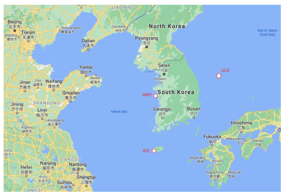
2.1. AMY Near-Surface In Situ Data

The AMY station is located at the west coast of South Korea at 36.54°N, 126.33°E, and 46 m above sea level (Figure 1). Its climatic conditions are described as winter (December–February) is the coldest season (average temperature around −2 °C) with north-westerly winds while summer (June-August) is the warmest season (average temperature around 25 °C) with southerly winds. For the precipitation, according to each year, the accumulated amount can be different, but its value is highest in summer due to summer monsoon with 362–1267 mm in recent 10 years (2011-2020) while winter observes the lowest level, less than 180 mm. It is a WMO/GAW regional station. Several GHGs have been regularly monitored, of which atmospheric mole fractions of CH4 from 40 m tower has been continuously measured using Cavity Ring Down Spectroscopy (CRDS 2401, Picarro, CA, USA) based on 5 s intervals from 2016. Before the CRDS, we monitored CH4 with a Gas Chromatography–Flame Ionization Detector (GC-FID) based on 30 min intervals. This instrument is calibrated against the WMO-X2004A scale with 4 reference tanks every 2 weeks while the GC-FID with 1 reference gas every 6 h. The difference between hourly data from both CRDS and GC-FID and weekly flask-air samples analyzed by National Oceanic and Atmospheric Administration (NOAA) are within the WMO/GAW compatibility goal ±2 ppb. Here, compatibility goal is defined as “property of a set of measurement results for a specified measured, such that the absolute value of the difference of any pair of measured quantity values from two different measurement results is smaller than some chosen multiple of the standard measurement uncertainty of that difference” and also “Meteorological compatibility of measurement results replaces the traditional concept of “staying within the error”, as it represents the criterion for deciding whether two measurement results refer to “the same measured or not” [20]. Since the compatibility goal for CH4 is ±2 ppb, we can consider the differences are almost the same with NOAA. NOAA has a role in the Central Calibration Laboratory, which serves the primary standard for CH4 in the GAW network; our results were very close to the standard, and our calibration method is also reliable. To highlight the source signatures of CH4, flask-air measurements of 13C/12C in CH4 (δ13C-CH4) [19] (ftp://aftp.cmdl.noaa.gov/data/trace_gases accessed on 4 February 2021) were analyzed. Near-surface data used in this work covered 2014–2020. Further details about the station and instruments can be found in [21]. CH4 measurements at AMY provide a constraint on the regional methane source strength, which is seen in Tae-ahn Peninsula in close proximity to AMY (about 28 km) [22]. On account of this, the purpose of using the station data in this analysis is to understand whether the behavior of CH4 growth rate, source signature, and the possible attributes can share the same behavior with the regional average over Korea or not.

2.2. TROPOMI Retrievals

The TROPOMI instrument onboard the Sentinel-5 Precursors (S5P) [17] satellite was launched on 13 October 2017 and was put into a near-polar, sun-synchronous orbit with a mean altitude of 824 km above Earth’s surface, an Equator crossing time of 13:30 LT, and a revisit time of 1 day. Its daily global coverage was provided at a spatial resolution of 7 × 7 km2 since its launch in October 2017 and improved to 5.5 × 7 km2 in August 2019. Data were screened with a retrieval quality flag of 1.0 (QC = 1.0). S5P bias-corrected XCH4 has been evaluated against TCCON data, and the accuracy and precision were found to be 0.25% and 0.57%, respectively [23]. Data spanning April 2018–December 2020 were utilized to analyze the spatial variations of interannual variability of XCH4 through finding anomalous distributions with the focus on 2019 over Korea, since it provides much denser spatial sampling as compared to GOSAT.

2.3. GOSAT Retrievals

Greenhouse Gases Observing SATellite (GOSAT) was launched into a sun-synchronous orbit on 23 January 2009 by an H-IIA launch vehicle and was positioned in a sun-synchronous orbit at a 666 km altitude. It has a 3-day revisit orbit cycle. The TANSO-FTS onboard GOSAT makes global observations both with the nadir and off-nadir modes, and makes use of the spectral band Short Wavelength InfraRed (SWIR) for deriving CH4 [24]. Version 9.0 of the University of Leicester (UoL) GOSAT Proxy XCH4 data [25,26] from 2014 to 2019 were utilized. Parker et al. [26] validated the proxy XCH4 data against ground-based TCCON (Total Carbon Column Observing Network) observations and found an accuracy of 4.8 ppb (~0.27%) and a single precision of 13.4 ppb (~0.74%). Primary use of these data is to analyze the seasonal and interannual variability of XCH4 of the domain averaged over the region of interest near AMY, though the spatial sparsity of the data coverage is a caveat.

2.4. Ancillary Parameters

To understand the attributes for interannual variability and spatial characteristics of atmospheric CH4 anomalies captured by the instruments, soil temperature and soil moisture content at 10 cm depth with a spatial resolution of 0.1-degree of latitude–longitude and monthly temporal resolution from the Famine Early Warning Systems Network (FEWS NET), the Land Data Assimilation System (FLDAS) and Noah Land Surface Model (LSM) L4 (https://disc.gsfc.nasa.gov/datasets/FLDAS_NOAH01_C_GL_M_001 accessed on 25 January 2021) were used. This model simulation was forced by a combination of the Modern-Era Retrospective analysis for Research 2 (MERRA-2) and Climate Hazard Group Infrared Precipitation with Station (CHIRPS) 6-hourly rainfall data [18] (McNally, Chicago, IL, USA, 2018). FLDAS monthly products of soil moisture were compared to remotely sensed observations and the overall agreement was good [27]. As described in Section 1, soil temperature and soil moisture are the trigger factors for changes in CH4 emissions coming from agriculture soils through affecting the methanogenic and methanotrophic activities in the soils [2]. South Korea’s bottom-up CH4 surface-emission data from agriculture sector were used to look into the annual variations along with CH4 growth rate interannual variations.
The El Niño-Southern Oscillation (ENSO) index (https://psl.noaa.gov/data/climateindices (accessed on 22 January 2021)) was exploited to analyze the influence of ENSO on the interannual variability CH4 growth rate [11]. ENSO is an indicator of interannual variability in global climate system [28], which affects seasonal to decadal global climate and impacts temperature and precipitation.

2.5. Data Analysis Method

To analyze the seasonal variability and long-term trend of the data from the surface and satellites after deseasonalized, we applied Thoning’s method [29]. Seasonal variability was extracted from the detrended data, and the long-term trend was derived from the deseasonalized data. Data were selected here to compare the column data. Therefore, the surface data can reflect the activities on a regional/local scale. The annual increase of atmospheric CH4 in a given year is the increase of mole fraction from January 1 in that year to January 1 of the next year after removing the seasonal cycle. The yearly or monthly anomaly was computed as subtracting the annual means from the individual mean estimates. We also applied Pearson’s correlation coefficient to quantify how well the interannual variability of CH4 co-varied with drivers such as soil temperature and soil moisture. When aggregating TROPOMI overpass soundings within 0.1° × 0.1°, we collected all soundings that fall in pixel and made daily averages from which we calculated monthly means. The spatial distributions of TROPOMI data that were made by a cluster average within 0.1° by 0.1° latitude–longitude have the same spatial resolution with that of soil temperature and soil moisture data. The gridded data were then averaged on a monthly basis. While selecting satellite soundings at AMY, a spatial coincident criteria of 2.0° by 2.0° of latitude–longitude was applied. To infer the source signatures of CH4, the flask-air measurements of δ13C-CH4 ratio in CH4 at AMY were utilized. Furthermore, a Keeling plot [19] was implemented to characterize source signatures responsible for CH4 enhancement.

3. Results and Discussion

3.1. Seasonal Variability of CH4 in Korea

Figure 2 top panel shows the time series of CH4 as described in Section 2.5 at AMY from in situ for 2014–2020 and XCH4 from TROPOMI for 2018–2020, and GOSAT for 2014–2019. At the station, seasonality was well captured by both satellites (TROPOMI and GOSAT) and in situ. It was noted that the interannual variability of seasonal maximum was higher than the seasonal minimum but the trend of their periods remained to be consistent. Figure 2 bottom panel demonstrates the seasonal cycle after detrending the data obtained from all instruments exhibiting a minimum in April and March and a maximum in September. The mean seasonal amplitudes were estimated to be 86.4 ± 22.4 ppb, 43.0 ± 5.7 ppb, 39.2 ± 1.3 ppb, for in situ, TROPOMI, and GOSAT, respectively. The seasonal cycle illustrated in AMY was found to be in contrast with other Korean in situ stations located in Jeju-Gosan (JGS: 33.3°N, 126.16°E, 71.47 m) and Ulleungdo (ULD, 37.48°N, 130.9°E, 220.9 m) (Figure 2, right panel). The seasonal cycle of CH4 in the Northern Hemisphere is more complex [30]. While the destruction of CH4 due to reaction with OH is expected to be stronger in summer, sources are diverse and also strongly vary with the seasons. As for describing the station locations, for the AMY station, within 35 km to the northeast and southeast, there are the largest thermal power plants fired by coal and heavy oil. In addition to that, agricultural activities such as rice paddies surrounding this station are known to affect the high CH4 in this region [21]. The ULD station is placed in the eastern part of Ulleungdo Island (an area of 72 km2), which is in the southwest of South Korea, and 155 km away from the mainland. There are farming activities but the station is located at the mountain (220.9 m from the ground), and is less affected by those activities. JGS station is located in the west part of Jeju Island, which is in the southwest of South Korea and 90 km far from the mainland (Figure 1). JGS station from the southwest to the northwest is open to the sea, and the wind speed is the highest among the three stations, so that it is hard to capture the local CH4 sources. Details about the sampling sites are provided in [20]. Therefore, strong local sources might not affect strong local sources that can influence the seasonal cycle of CH4 at JGS and ULD, while transport could be playing a major role in modulating the seasonal behavior with a depleted CH4 signal from the ocean. Unlike JGS and ULD, AMY is located in the proximity of local sources, indicating that the seasonal maximum (2042.7 ppb) and minimum (1982.1 ppb) occurred in the summer and spring, respectively. In ULD and JGS, the minimum values were detected in summer, with 1936.8 ppb and 1933.0 ppb, respectively, whereas the maximum was observed in the winter (ULD) and autumn (JGS), with mean values of 1968.7 ppb and 1977.7 ppb, respectively. Such complex information will be refined further in the subsequent study focused on source investigation of CH4 and CO2 over Korea GAW stations. When comparing with the surface data in other global stations located in the Northern Hemisphere, the AMY result is similar to the seasonal cycle observed at Waliguan [31]. The spatial differences on the seasonal cycle of CH4 depend on the regional sources and sinks, and atmospheric transport. The behavior of the seasonal cycle of XCH4 integrated over Korea has a similar trend to AMY (Figure 2, right panel) given that the actual magnitudes of amplitude were expected to be varied. This suggests the dominant drivers are the same.

3.2. Interannual Variability of CH4 Growth Rate in Korea

The annual increase was calculated from the trend line (Figure 3a) as the increase from January 1 in 1 year to January 1 in the next year, after removing the seasonal cycle. The successive annual differences of CH4 at AMY were determined in the range of −16.8 ppb yr−1–31.3 ppb yr−1 by in situ and 3.9 ppb yr−1–16.4 ppb yr−1 by GOSAT (Table 1). The annual averages CH4 estimated from in situ and GOSAT were 7.55 ± 23.59 ppb yr−1 and 8.92 ± 6.87 ppb yr−1, respectively (Table 1). The large growth rates dramatically increased in 2016 (31.3 ppb yr−1 and 13.4, ppb yr−1 as seen by in situ and GOSAT, respectively) and 2019 (27.4 ppb yr−1 and 16.4, ppb yr−1, in situ and GOSAT, respectively). Though we considered changing instruments from GC-FID to CRDS, this growth rate seems to be related to natural phenomena rather than the measurement system since GOSAT also captured the higher growth rate, and the differences with flasks data are also in the compatibility goal as described in 2.1. Regarding TROPOMI, data in 2018 were started from April so that this large data gap can affect the yearly growth estimate, so we skipped that to discuss the result obtained. Similar to AMY, the spikes of peak growth obtained from the domain averaged were demonstrated in 2016 and 2019. Figure 3 shows deseasonalized long-term trends and the instantaneous growth rate of near-surface and column-averaged CH4 mole fractions at AMY, as well as integrated over South Korea using in situ and GOSAT. The long-term trend revealed that the increase from 2014 to 2016 corresponding with the cold-to-warm transition from weak La Niña started in the earlier period of 2014 to a strong El Niño event in 2016 (Figure 4). After 2016, the trend has shown to be oscillated, with maximum and minimum growth in 2018 and 2019, respectively. A higher temperature in 2019 was observed in Korea, which could be caused by the presence of atmospheric instability in the region (Figure S1). A large part of the mid-latitude temperature variability can be described by natural variability, which is essentially chaotic rather than a reflection of a forced signal such as Arctic warming linked to sea ice loss [32]. Geographically, Korea is located in the middle latitudes of the Northern Hemisphere, on the east coast of the Eurasia continent, and also adjacent to the western pacific. Therefore, it unveils complex climate behaviors. In October 2019, high pressure over the north Pacific Ocean was developed, which was larger than the usual in the east–west direction. Such structure affected the temperature and moisture over Korea. After mid-October, anticyclone circulation near the Ural mountain moved to the east. Combined with high atmospheric pressure in the north pacific, it contributed to high temperatures over Korea. Sea-surface temperature was observed higher than normal over the tropical West Indian Ocean. Under this condition, convection was suppressed near the Philippine Sea, whereas active convection was detected near Japan and Korea. In the vicinity, the downdraft of the airmass was noticed and thus contributed to the formation of an anticyclone condition [33].
Quantitatively, the correlation between interannual variabilities of yearly growth rate captured by in situ and soil temperature changes was found to be 0.92 with a statistical significance of a 95% confidence interval. In recent findings, Sun et al. [34] studied the long-term field CH4 flux measurement in the Yangtze River delta, China, and determined that higher temperatures and less rainfall in 2013 caused CH4 emissions to increase from rice paddies by 58–294%. [35] indicated that the rising temperature results in an enhanced CH4 production per unit of livestock products. In other studies, Lee et al. [36] reported that the forage quality declines with elevating temperature and leads to an increase of enteric CH4 production, and they indicated the increase is 0.9% °C−1.
As we compare the trend and growth rate patterns detected at AMY with the other Korea’s in situ stations located in the east (ULD) and south (JGS), it was found to be similar to ULD, but a contrasting pattern with JGS in the period between 2015 and 2017 (Figure S2), which will be investigated as the reason for disagreement with JGS in the future. The overall temporal characteristics of the growth rate of AMY and the region of interest have similar behaviors of growth rate patterns in the entire period (Figure 3a), and thus imply the significant drivers are the same.
A noteworthy decline of the growth rate in 2020 was registered, which is 1.7 ppb yr−1. Interestingly, 2020 recognized the COVID-19 pandemic globally, so that many countries have implemented lock-down situations. As a result, this could affect surface emissions for various trace species, and thus can induce the surface temperature change [37]. Despite the reduction of emissions, 2020 was the second warmest year over a period of 2010–2020. As we can see specifically over Korea, 2019 was warmer than 2020 (Figure S1), which is due to the occurrence of extended summer monsoon Changma in 2020 [38]. Changma is derived from the Korean words for “prolonged rainy period” in summer.

3.3. CH4 Growth Rate Related to Isotopic Ratios in 2019

The isotopic composition of atmospheric methane 13C/12C (expressed as δ13C-CH4) collected by flask-air sampling weekly at AMY was used to understand the source signatures. Figure 5a depicts the time series of monthly and yearly means of atmospheric observations of δ13C-CH4 (‰) during 2014–2019. The monthly result fluctuated within −47.96‰ to −47.17‰, with an annual average of −47.59 ± 0.19‰, and strong depletion fell in August–September. Differences between successive annual mean values were −0.053‰, −0.149‰, 0.019‰, 0.025‰, and −0.142‰, from 2015 to 2019, respectively, and elevated depletions shown in 2016 and 2019 were driven by the summer and autumn seasons. We also computed the intercept of the Keeling plot to infer the isotopic signature of the source responsible for enhancements in CH4, and the intercept values for summer and autumn were found to be −53.3‰ and −52.9‰, respectively (Figure 5b), which is consistent with biogenic emissions. The aircraft data observed over western Korea in the summer season also revealed biogenic emissions signatures using CH4/CO ratio analysis [39]. As reported in [19], high-latitude CH4 has distinct δ13C isotopic signatures, from −60 to −50‰ for CH4 hydrates; ruminants-digesting C4 plants give off CH4 at −55 to −50‰, whereas those eating C3 plants give off −65 to −60‰ CH4, since C3 and C4 plants have different photosynthetic pathways that result in a different signature. The enhanced depletions found in 2016 and 2019 accounts for enhanced biogenic CH4 signals that coincided with the high growth rates of CH4 in those respective years. The observed interannual variability of the CH4 growth rate associated with the climate variability was not reflected in Korea’s CH4 emission estimate from the agriculture sector from 2014 to 2018, though data for 2019 were not available (Figure 6).

3.4. CH4 Growth Rate Related to Soil Temperature and Moisture in 2019

Regarding the high growth in 2019 at AMY, we probed the spatial extent of XCH4 distributions in the same year. The short-term anomalous XCH4 can contribute to a large growth rate change. In this context, we scrutinized the spatial variations of XCH4 interannual variability over Korea estimated from the monthly means of TROPOMI data from April 2018 to August 2020. The estimated annual means were predominantly higher over the west, central, and south of most regions (Figure 7a). The illustrated standard deviations highlight the magnitude of interannual variability, and the higher values were clustered over the southwest region, fluctuating within 18–28 ppb (Figure 7b). It was also depicted the number of monthly means data used in Figure 7c. A large increase of XCH4 was discerned in October 2019, and this was estimated to be a maximum of 70 ppb after subtracting the annual mean (Figure 8). This change apparently responded to the variations of soil temperature and soil moisture (Figure 9). A higher soil temperature was evident in October 2019. While comparing the actual monthly mean estimate of soil temperature, it was shown above 16 °C in October 2019 over the west and south part of the domain, which is almost 2–3 °C higher than the same month in 2018 (Figure 9a,b). The period of 2019 was characterized by a large positive soil temperature anomaly in the entire domain, which is in contrast to 2018 (Figure 9c,d). Similarly, the spatial moisture variation was also noticeable in those respective periods. Quantitatively, the spatial Pearson correlation of XCH4 interannual variability with the aforementioned attributes was determined between 0.5 and 0.8 and statistically significant (p < 0.05) (Figure 10). This finding highlighted the influence of the drivers over a large spatial extent in the domain of interest. As discussed in Section 3.3, earlier findings [34,35,36] pointed out that increased temperature causes rising CH4 emissions from livestock and paddy fields.

4. Conclusions

In this work, we studied the seasonal and interannual variability of CH4, as well as their spatial distributions over South Korea, with the focus on unprecedented growth in 2019. The seasonal cycle of CH4 at AMY was found to be maximum in summer and minimum in spring, which is similar to the seasonal cycle of XCH4 averaged over Korea. Thus, the drivers of CH4 seasonal change over AMY are most likely identical to the regional-scale drivers of CH4 in Korea. At AMY, the average growth rates computed from in situ and GOSAT were 7.0 ± 19.7 ppb yr−1 and 8.6 ± 5.1 ppb yr−1, for 2014–2020 and 2014–2019, respectively. The high growth rates were detected in 2016 and 2019, resulting in 27.4–31.4 ppb yr−1 from in situ and 13–16 ppb yr−1 from GOSAT. The high growth rate in 2016 was influenced by a strong El Niño in 2015–2016. On the other hand, the large growth recorded in 2019 was induced by high temperatures due to enhanced regional atmospheric instability. We demonstrate those reasons with two types of data.
(1) The isotopic composition of CH4 (δ13-CH4) collected by flask-air sampling at AMY was analyzed to infer the source signatures, and the result was varied within −47.96‰ to −47.17‰, with an annual average of −47.59 ± 0.19‰. Enhanced depletions appeared in 2016 and 2019 that matched the large growth of CH4. These elevated depletions were driven by the summer and autumn seasons. The intercepts of the Keeling plot for summer and autumn were found to be −53.3‰, and −52.9‰, respectively, which is consistent with biogenic emissions that are accountable for the enhancements in CH4. The change of soil temperature and soil moisture affected CH4 emission from biogenic sources.
(2) We also probed the spatial variations of XCH4 interannual variability with the center of indicating anomalous events over Korea from April 2018 to December 2020 based on TROPOMI observations. We discerned the enhanced spatial distribution of XCH4 in October 2019. This was characterized by a considerably large anomaly of XCH4 after removing the annual mean, up to 70 ppb. This suggests that the short-term enhancement can appreciably contribute to the observed yearly growth rate changes. We also found that the likely attributes for such changes were soil temperature and soil moisture content. More importantly, the increase in soil temperature was very pronounced during October 2019. Furthermore, the overall correlation of the interannual variability of XCH4 and those attributes was determined to be in the range of 0.5–0.8 with the statistical significance of a 95% confidence interval. We can infer that biogenic-related CH4 with associated drivers such as soil temperature and moisture is relevant in understanding the interannual variability of the growth rate over our domain. Our findings, related to the characteristics of CH4 and its source characterization derived from the integrated data such as in situ and satellite data, can improve the numerical model uncertainties in the CH4 budget and source identification (based on isotope information). The quantified relationship of the spatial variability of CH4 and soil temperature and moisture changes can improve the model uncertainty of CH4 related to soil variables. When more TROPOMI observations are available, one will also be able to identify temporally stable XCH4 anomalies and distinguish them from the short-term anomalous CH4 events in the future. This will open the prospects for providing observational-based contrasts between the local short-term contributions and long-term (meteorologically driven) exposure of the region to CH4 transport.

Supplementary Materials

The following are available online at https://0-www-mdpi-com.brum.beds.ac.uk/article/10.3390/rs13122266/s1, Figure S1: Spatial plot of soil temperature (10 cm depth) anomaly (oC) during 2014-2020 (a-f). Figure S2: The plot demonstrates de-seasonalized long-term trend (left panel) and instantaneous growth rates (right panel) for AMY, Gosan (GSN 33.3°N, 126.16°E, 71.47 m) during Jan. 2014-Feb. 2020, and Ulleungdo (ULD, 37.48°N,130.9°E, 220.9 m) during Jan. 2014-March 2021.

Author Contributions

S.T.K. prepared the original draft; H.L. provided surface in situ data; discussion, review, and editing, S.J.; discussion, review, and editing, S.L.; discussion, review, and editing, L.D.L.; review and editing, C.-Y.C.; project leader, and Y.-H.K.; principal investigator. All authors have read and agreed to the published version of the manuscript.

Funding

This research was funded by the Korea Meteorological Administration Research and Development Program, “Development of application technology on atmospheric research aircraft”, under grant (KMA2018-00222).

Institutional Review Board Statement

Not applicable.

Informed Consent Statement

Not applicable.

Acknowledgments

The authors strongly acknowledge the science teams of TROPOMI and GOSAT satellites for the provision of XCH4 data. We are also very grateful to the NOAA science team for accessing ENSO index data and the NASA science team for Noah model version 3.6.1 Famine Early Warning Systems Network (FEWS NET) Land Data Assimilation System data for soil temperature and soil moisture. We extend our great appreciation to the South Korean bottom-up GHG emission data team for providing the CH4 emission data. Special thanks is extended to Dlugokencky, E. J., from the Earth System Research Laboratory, Global Monitoring Division, US National Oceanic and Atmospheric Administration, Boulder, CO, USA, who provided constructive comments and proofreading of the manuscript. We greatly appreciate Sylvia Englund Michel from the Institute of Arctic and Alpine Research (INSTAAR), University of Colorado, Boulder, Colorado, USA, for the provision of flask-air measurements of 13C/12C data and comments.

Conflicts of Interest

The authors declare no conflict of interest.

References

  1. Wu, X.; Zhang, X.; Chuai, X.; Huang, X.; Wang, Z. Long-Term Trends of Atmospheric CH4 Concentration across China from 2002 to 2016. Remote Sens. 2019, 11, 538. [Google Scholar] [CrossRef]
  2. Le Mer, J.; Roger, P. Production, oxidation, emission and consumption of methane by soils: A review. Eur. J. Soil Biol. 2001, 37, 25–50. [Google Scholar] [CrossRef]
  3. Whalen, S.C.; Reeburgh, W.S.; Sandbeck, K.A. Rapid methane oxidation in a landfill cover soil. Appl. Environ. Microbiol. 1990, 56, 3405–3411. [Google Scholar] [CrossRef] [PubMed]
  4. Sundh, I.; Mikkela, C.; Nilsson, M.; Svenson, H. Potential aerobic methane oxydation in a sphagnum dominated peatland-controlling factors and relation to methane emission. Soil Biol. Biochem. 1995, 27, 829–837. [Google Scholar] [CrossRef]
  5. Saunois, M.; Stavert, A.R.; Poulter, B.; Bousquet, P.; Canadell, J.G.; Jackson, R.B.; Raymond, P.A.; Dlugokencky, E.J.; Houweling, S.; Patra, P.K.; et al. The Global Methane Budget 2000–2017. Earth Syst. Sci. Data 2020, 12, 1561–1623. [Google Scholar] [CrossRef]
  6. Prather, M.J.; Holmes, C.D.; Hsu, J. Reactive greenhouse gas scenarios: Systematic exploration of uncertainties and the role of atmospheric chemistry. Geophys. Res. Lett. 2012, 39, L09803. [Google Scholar] [CrossRef]
  7. Nisbet, E.G.; Manning, M.R.; Dlugokencky, E.J.; Fisher, R.E.; Lowry, D.; Michel, S.E.; Myhre, C.L.; Platt, S.M.; Allen, G.; Bousquet, P.; et al. Very strong atmospheric methane growth in the 4 year 2014-2017: Implications for the Paris agreement. Glob. Biogeochem. Cycles 2019, 33, 318–342. [Google Scholar] [CrossRef]
  8. Wang, F.; Maksyutov, S.; Janardanan, R.; Tsuruta, A.; Ito, A.; Morino, I.; Yoshida, Y.; Tohjima, Y.; Kaiser, J.W.; Maenhout, G.J.; et al. Interannual variability on methane emissions in monsoon Asia derived from GOSAT and surface observations. Environ. Res. Lett. 2021, 16, 024040. [Google Scholar] [CrossRef]
  9. Ghosh, A.; Patra, P.; Ishijima, K.; Umezawa, T.; Ito, A.; Etheridge, D.; Sugawara, S.; Kawamura, K.; Miller, J.; Dlugokencky, E.J.; et al. Variations in global methane sources and sinks during 1910–2010. Atmos. Chem. Phys. 2015, 15, 2595–2612. [Google Scholar] [CrossRef]
  10. Dlugokencky, E.J.; Bruhwiler, L.; White, J.W.C.; Emmons, L.K.; Novelli, P.C.; Montzka, S.A.; Masarie, K.A.; Lang, P.M.; Crotwell, A.M.; Miller, J.B.; et al. Observational constraints on recent increases in the atmospheric CH4 burden. Geophys. Res. Lett. 2009, 36, L18803. [Google Scholar] [CrossRef]
  11. Schaefer, H.; Smale, D.; Nichol, S.E.; Bromley, T.M.; Brailsford, G.W.; Martin, R.J.; Moss, R.; Englund Michel, S.; White, J.W.C. Limited impact of El Niño–Southern Oscillation on variability and growth rate of atmospheric methane. Biogeosciences 2018, 15, 6371–6386. [Google Scholar] [CrossRef]
  12. Labzovskii, L.D.; Mak, H.W.L.; Kenea, S.T.; Rhee, J.-S.; Lashkari, A.; Li, S.; Goo, T.-Y.; Oh, Y.-S.; Byun, Y.-H. What can we learn about effectiveness of carbon reduction policies from interannual variability of fossil fuel CO2 emissions in East Asia? Environ. Sci. Policy 2019, 96, 132–140. [Google Scholar] [CrossRef]
  13. Ishizawa, M.; Uchino, O.; Morino, I.; Inoue, M.; Yoshida, Y.; Mabuchi, K.; Shirai, T.; Tohjima, Y.; Maksyutov, S.; Ohyama, H.; et al. Large XCH4 anomaly in summer 2013 over northeast Asia observed by GOSAT. Atmos. Chem. Phys. 2016, 16, 9149–9161. [Google Scholar] [CrossRef]
  14. Ji, E.S.; Park, K.-H. Methane and Nitrous Oxide Emissions from Livestock Agriculture in 16 Local Administrative Districts of Korea. Asian-Australas. J. Anim. Sci. 2012, 25, 1768–1774. [Google Scholar] [CrossRef]
  15. Ha, S.; Tae, S.; Kim, R. A Study on the Limitations of South Korea’s National Roadmap for Greenhouse Gas Reduction by 2030 and Suggestions for Improvement. Sustainability 2019, 11, 3969. [Google Scholar] [CrossRef]
  16. Yoshida, Y.; Kikuchi, N.; Morino, I.; Uchino, O.; Oshchepkov, S.; Bril, A.; Saeki, T.; Schutgens, N.; Toon, G.C.; Wunch, D.; et al. Improvement of the retrieval algorithm for GOSAT SWIR XCO2 and XCH4 and their validation using TCCON data. Atmos. Meas. Tech. 2013, 6, 1533–1547. [Google Scholar] [CrossRef]
  17. Veefkind, J.P.; Aben, I.; McMullan, K.; Förster, H.; de Vries, J.; Otter, G.; Claas, J.; Eskes, H.J.; de Haan, J.F.; Kleipool, Q.; et al. TROPOMI on the ESA Sentinel-5 Precursor: A GMES mission for global observations of the atmospheric composition for climate, air quality and ozone layer applications. Remote Sens. Environ. 2012, 120, 70–83. [Google Scholar] [CrossRef]
  18. Amy McNally NASA/GSFC/HSL (2018), FLDAS Noah Land Surface Model L4 Global Monthly 0.1 x 0.1 Degree (MERRA-2 and Climate CHIRPS), Greenbelt, MD, USA, Goddard Earth Sciences Data and Information Services Center (GES DISC). Available online: https://disc.gsfc.nasa.gov/datasets/FLDAS_NOAH01_C_GL_M_001 (accessed on 25 January 2021). [CrossRef]
  19. Dlugokencky, E.J.; Nisbet, E.G.; Fisher, R.; Lowry, D. Global atmospheric methane: Budget, changes and dangers. Philos. Trans. R. Soc. A 2011, 369, 2058–2072. [Google Scholar] [CrossRef]
  20. JCGM: International Vocabulary of Metrology-Basic and General Concepts and Associated Terms (VIM, 3rd Edition, 2008 Version with Minor Corrections). 2012. Available online: https://www.bipm.org/documents/20126/2071204/JCGM_200_2012.pdf (accessed on 25 May 2021).
  21. Lee, H.; Han, S.-O.; Ryoo, S.-B.; Lee, J.-S.; Lee, G.-W. The measurement of atmospheric CO2 at KMA GAW regional stations, its characteristics, and comparisons with other East Asian sites. Atmos. Chem. Phys. 2019, 19, 2149–2163. [Google Scholar] [CrossRef]
  22. Dlugokencky, E.J.; Haris, J.M.; Chung, Y.S.; Tans, P.P.; Fung, I. The relationship between the methane seasonal cycle and regional sources and sinks at Tae-ahn peninsula, Korea. Atmos. Environ. Part A 1993, 27, 2015–2120. [Google Scholar] [CrossRef]
  23. Sha, M.K.; Langerock, B.; Blavier, J.-F.L.; Blumenstock, T.; Borsdorff, T.; Buschmann, M.; Dehn, A.; De Mazière, M.; Deutscher, N.M.; Feist, D.G.; et al. Validation of Methane and Carbon Monoxide from Sentinel-5 Precursor using TCCON and NDACC-IRWG stations. Atmos. Meas. Tech. Discuss. 2021. In review. [Google Scholar] [CrossRef]
  24. Kuze, A.; Suto, H.; Nakajima, M.; Hamazaki, T. Thermal and near infrared sensor for carbon observation Fourier-transform spectrometer on the greenhouse gases observing satellite for greenhouse gases monitoring. Appl. Opt. 2009, 48, 6716–6733. [Google Scholar] [CrossRef] [PubMed]
  25. Parker, R.J.; Boesch, H.; Byckling, K.; Webb, A.J.; Palmer, P.I.; Feng, L.; Bergamaschi, P.; Chevallier, F.; Notholt, J.; Deutscher, N.; et al. Assessing 5 years of GOSAT Proxy XCH4 data and associated uncertainties. Atmos. Meas. Tech. 2015, 8, 4785–4801. [Google Scholar] [CrossRef]
  26. Parker, R.J.; Webb, A.; Boesch, H.; Somkuti, P.; Barrio Guillo, R.; Di Noia, A.; Kalaitzi, N.; Anand, J.; Bergamaschi, P.; Chevallier, F.; et al. Decade of GOSAT Proxy Satellite CH4 Observations. Earth Syst. Sci. Data 2020, 12, 3383–3412. [Google Scholar] [CrossRef]
  27. McNally, A.; Arsenault, K.; Kumar, S.; Shukla, S.; Peterson, P.; Wang, S.; Funk, C.; Peters-Lidard, C.D.; James, P.; Verdin, J.P. A land data assimilation system for sub-Saharan Africa food and water security applications. Sci. Data 2017, 4. [Google Scholar] [CrossRef]
  28. Trenberth, K.; Branstator, G.; Karoly, D.; Kumar, A.; Lau, N.; Ropelewski, C. Progress during TOGA in understanding and modeling global teleconnections associated with tropical sea surface temperatures. J. Geophys. Res. 1998, 103, 14291–14324. [Google Scholar] [CrossRef]
  29. Thoning, K.W.; Tans, P.P.; Komhyr, W.D. Atmospheric carbon dioxide at Mauna Loa observatory 2. Analysis of the NOAA GMCC data, 1974–1985. J. Geophys. Res. Atmos. 1989, 94, 8549–8565. [Google Scholar] [CrossRef]
  30. Dlugokencky, E.J.; Steele, L.O.; Lang, P.M.; Masarie, K.A. The growth rate and distribution of atmospheric methane. J. Geophys. Res. 1994, 99, 1702117044. [Google Scholar] [CrossRef]
  31. Liu, S.; Fang, S.; Liu, P.; Liang, M.; Guo, M.; Feng, Z. Measurement report: Changing characteristics of atmospheric CH4 in the Tibetan Plateau: Records from 1994 to 2019 at the Mount Waliguan station. Atmos. Chem. Phys. 2021, 21, 393–413. [Google Scholar] [CrossRef]
  32. Barns, E.; Screen, J. The impact of Arctic warming on the mid-latitude jet-stream: Can it? Has it? Will it? WIRES. Clim. Chang. 2015, 6, 277–286. [Google Scholar]
  33. Abnormal Climate Report in 2019, South Korea (2019), The Office for Government Policy Coordination and Korea Meteorological Administration (In Korean). pp. 76–77. Available online: https://www.gihoo.or.kr/portal/kr/community/data_view.do?p=1&idx=21061&column=&groupname=data&groupid=&f=1&q= (accessed on 28 May 2021).
  34. Sun, H.; Zhou, S.; Zhang, J.; Zhang, X.; Wang, C. Year-to-year climate variability affects methane emission from paddy fields under irrigated conditions. Environ. Sci. Pollut. Res. 2020, 27, 14780–14789. [Google Scholar] [CrossRef] [PubMed]
  35. Broucek, J. Methane yield from cattle, sheep, and goats housing with emphasis on emission factors: A review. Slovak J. Anim. Sci. 2015, 48, 122–139. [Google Scholar]
  36. Lee, M.; Davis, A.; Chagunda, M.; Manning, P. Forage quality declines with rising temperatures, with implications for livestock production and methane emissions. Biogeosciences 2017, 14, 1403–1417. [Google Scholar] [CrossRef]
  37. Gettelman, A.; Lamboll, R.; Bardeen, C.G.; Forster, P.M.; Watson-Parris, D. Climate impacts of COVID-19 induced emission changes. Geophys. Res. Lett. 2021, 48, e2020GL091805. [Google Scholar] [CrossRef]
  38. Chung, Y.S.; Kim, H.S. Observations on changes in Korean Changma rain associated with climate warming in 2017 and 2018. Air Qual. Atmos. Health 2019, 12, 197–215. [Google Scholar] [CrossRef]
  39. Li, S.; Kim, Y.; Kim, J.; Kenea, S.T.; Goo, T.-Y.; Labzovskii, L.D.; Byun, Y.-H. In Situ Aircraft Measurements of CO2 and CH4; Mapping Spatio-Temporal Variations over western Korea in High resolutions. Remote Sens. 2020, 12, 3093. [Google Scholar] [CrossRef]
Figure 1. Map of South Korea in situ stations marked by red stars, Anmyeondo (AMY: 36.54°N, 126.33°E, 46 m), Jeju-Gosan (JGS, 33.3°N, 126.16°E, 71.47 m), and Ulleungdo (ULD, 37.48°N, 130.9°E, 220.9 m). Taken from Google Maps.
Remotesensing 13 02266 g001
Figure 2. Top panel depicts the time series of CH4 measurements at AMY from in situ (January 2014–December 2020), XCH4 from TROPOMI (April 2018–December 2020), and GOSAT (January 2014–March 2021). Symbol “o” denotes original data from in situ and satellites. Right panel shows the seasonal cycles from detrended annual cycles for AMY (in situ, and GOSAT), Jeju-Gosan (JGS, 33.3°N, 126.16°E, 71.47 m), during January 2014-February 2020, and Ulleungdo (ULD, 37.48°N, 130.9°E, 220.9 m) during January 2014–March 2021, and integrated over Korea (TROPOMI) during April 2018–December 2020.
Remotesensing 13 02266 g002
Figure 3. The plot demonstrates deseasonalized long-term trend (a) and instantaneous growth rates (b) of in situ CH4 (blue line), GOSAT XCH4 AMY (red line), and GOSAT XCH4 South Korea domain (green line), mole fractions 2014–2020. Noted that GOSAT XCH4 in panel (a) is scaled by adding 150 ppb (GOSAT XCH4 + 150 ppb), which is just used to zoom in the plot.
Remotesensing 13 02266 g003
Figure 4. The time series of ENSO index during 2014–2020.
Remotesensing 13 02266 g004
Figure 5. Panel (a) shows the time series of monthly and yearly means of atmospheric observations of δ13C-CH4 (‰) collected by flask-air sampling at AMY during 2014–2019. Panel (b) depicts δ13C-CH4 (‰) versus inverse CH4 mole fractions at AMY for summer (green) and autumn (pink) seasons.
Remotesensing 13 02266 g005
Figure 6. The plot shows South Korea’s CH4 emission estimate from agriculture during 2014–2018.
Remotesensing 13 02266 g006
Figure 7. Spatial distribution of XCH4 annual mean (a), its standard deviation (b), and number of data (c), derived from the monthly means with spatial gridded of 0.1 by 0.1 degrees of TROPOMI data from April 2018 to December 2020.
Remotesensing 13 02266 g007
Figure 8. Spatial distribution of XCH4 anomaly derived from TROPOMI observations. XCH4 anomaly, calculated as XCH4 anomaly in Oct. 2018 (ppb) = monthly mean of XCH4 in October 2018-annual mean (a), and similarly for XCH4 anomaly in Oct. 2019 (b). Annual mean covers April 2018 to December 2020.
Remotesensing 13 02266 g008
Figure 9. Spatial distributions of monthly mean soil temperatures at 10 cm depth in October 2018 (a) and 2019 (b), soil temperature anomaly in October 2018 (c) and 2019 (d), and soil moisture content 10 cm depth anomaly (m3 m−3) in October 2018 (e) and 2019 (f) are depicted. Data are obtained from Noah 3.6.1 model.
Remotesensing 13 02266 g009
Figure 10. The correlation of TROPOMI XCH4 anomaly versus soil temperature (a) and soil moisture anomalies (b) during April 2018-December 2020. Anomaly is calculated by subtracting annual mean from monthly means. Overlay plots marked by dots denote a statistical significance of p < 0.05.
Remotesensing 13 02266 g010
Table 1. Annual means (ppb) and yearly growth rates (ppb yr−1) of in situ CH4 and GOSAT XCH4 at AMY derived using curve-fitting method [29] after being deseasonalized. Annual mean is derived from the trend curve, after removing the seasonal cycle, and then yearly growth rate is computed as a difference of successive annual means (i.e., 1 January in that year to 1 January of the next year), and relative increase is given in percentage in open bracket. Growth rate is denoted as GR and relative increase as RI (%).
In Situ CH4GOSAT XCH4
YearMeanGR (RI%)MeanGR(RI%)
20141989.5-1836.17.3 (0.4)
20151998.69.1 (0.5)1841.15.0 (0.3)
20162029.931.3 (1.6)1854.513.4 (0.7)
20172013.1−16.8 (−0.8)1858.43.9 (0.2)
20182001.6−11.5 (−0.6)1864.25.8 (0.3)
20192029.027.4 (1.4)1880.616.4 (0.9)
20202031.52.5 (0.1)--
Average2013.3 ± 17.27.0 ± 19.71855.8 ± 16.18.6 ± 5.1
Publisher’s Note: MDPI stays neutral with regard to jurisdictional claims in published maps and institutional affiliations.

