Article

Modeling Snow Depth and Snow Water Equivalent Distribution and Variation Characteristics in the Irtysh River Basin, China

1
College of Geography Science, Qinghai Normal University, Xining 810008, China
2
Qinghai Provincial Key Laboratory of Physical Geography and Environmental Processes, Xining 810008, China
3
MOE Key Laboratory of Tibetan Plateau Land Surface Processes and Ecological Conservation, Xining 810008, China
4
Northwest Institute of Eco-Environment and Resources, Chinese Academy of Sciences, Lanzhou 730000, China
*
Authors to whom correspondence should be addressed.
Submission received: 7 July 2021 / Revised: 29 August 2021 / Accepted: 5 September 2021 / Published: 9 September 2021
(This article belongs to the Special Issue Advancing Complexity Research in Earth Sciences and Geography)

Abstract

:
Accurate simulation of snow cover process is of great significance to the study of climate change and the water cycle. In our study, the China Meteorological Forcing Dataset (CMFD) and ERA-Interim were used as driving data to simulate the dynamic changes in snow depth and snow water equivalent (SWE) in the Irtysh River Basin from 2000 to 2018 using the Noah-MP land surface model, and the simulation results were compared with the gridded dataset of snow depth at Chinese meteorological stations (GDSD), the long-term series of daily snow depth dataset in China (LSD), and China’s daily snow depth and snow water equivalent products (CSS). Before the simulation, we compared the combinations of four parameterizations schemes of Noah-MP model at the Kuwei site. The results show that the rainfall and snowfall (SNF) scheme mainly affects the snow accumulation process, while the surface layer drag coefficient (SFC), snow/soil temperature time (STC), and snow surface albedo (ALB) schemes mainly affect the melting process. The effect of STC on the simulation results was much higher than the other three schemes; when STC uses a fully implicit scheme, the error of simulated snow depth and snow water equivalent is much greater than that of a semi-implicit scheme. At the basin scale, the accuracy of snow depth modeled by using CMFD and ERA-Interim is higher than LSD and CSS snow depth based on microwave remote sensing. In years with high snow cover, LSD and CSS snow depth data are seriously underestimated. According to the results of model simulation, it is concluded that the snow depth and snow water equivalent in the north of the basin are higher than those in the south. The average snow depth, snow water equivalent, snow days, and the start time of snow accumulation (STSA) in the basin did not change significantly during the study period, but the end time of snow melting was significantly advanced.

1. Introduction

Snow plays an important role in the climatic system due to its high reflectivity, low thermal conductivity, and high melting latent heat, which directly affect the surface energy balance, and has obvious feedback, regulation, and indication effects on regional and global climate change [1,2,3,4]. It is also an important part of the global water cycle and an important source of fresh water [5]. In addition, the losses caused by floods, avalanches, and other disasters caused by snowmelt to industrial and agricultural production as well as the loss of people’s lives and property cannot be ignored. Therefore, accurate snow cover simulation has important significance for water resources development, climate change, and geological disaster prediction.
Modeling is an important means to study snow cover change [6]. Snow models can be generally divided into two categories: one is an empirical model based on simple statistical methods; the other is physical models based on the energy and mass balance processes [7,8,9]. The advantage of the empirical model is that it requires fewer input parameters. Therefore, it has been widely used to simulate snow and glacier melting in Northern Europe, the Alps, the Greenland ice sheet, the Tibetan Plateau, and other regions [10,11]. Some hydrological models, such as Snowmelt Runoff Model (SRM) [12,13] and the HBV model [14,15], also use an empirical model to describe the melting process of ice, snow and glacier. These snowmelt runoff simulations also achieved good results [16,17,18,19]. However, the empirical model simulation accuracy decreases with the improvement in time resolution, and it is impossible to describe the spatial variation of snow surface ablation [20]. Compared with the empirical model, the snow model based on energy balance can better reflect the physical process, the exchange of energy and water between snow cover and atmosphere, the snow melt infiltration, the dynamic change in snow surface albedo, the compaction of snow cover, and other processes [21,22,23]. Therefore, physical models have a wide range of applications. There are many snowmelt models based on energy balance, such as the Utah Energy Balance model (UEB) [24] and the SNOWPACK model [25,26]. Some hydrological models, such as VIC [27] and WEB-DHM [28], also use physical models to describe snowmelt runoff. Land surface models, such as CLM [29], Noah-MP [30,31] and SURFEX [32], have continuously evolved according to the requirements of atmospheric and hydrological disciplines and can also effectively simulate snow processes. Wrzesien et al. [33] combined the Weather Research and Forecasting (WRF) regional climate model with the Noah-MP model to simulate the snow cover fraction (SCF) and snow water equivalent (SWE) over the central Sierra Nevada Mountains and demonstrated that the models can be an efficient approach to simulate snow processes.
Irtysh River is the second largest river in Xinjiang, and it is also an international river. It flows through China, the Republic of Mongolia, Kazakhstan, and Russia, which plays an important role in the social and economic development of these countries [23]. Snow has an important contribution to the hydrological process in the basin. However, due to the lack of systematic observation, there is little research on snow cover in the basin. Wu et al. [34] used a UEB model to simulate the snowmelt process at a site in the upper reaches of Irtysh River Basin. Wu et al. [35] coupled the WRF model with the temperature-index model to simulate snow melt in the Kayiertesi River Basin, which is in the upper reaches of the Irtysh River Basin. Zhang et al. [36] used a stable isotope technique to analyze the influence of snow melt water on regional hydrological processes in the upper reaches of the Irtysh River Basin. Wu et al. [37] relied on the Geomorphology-Based Ecohydrological Model (GBEHM) to simulate snowmelt processes of a river basin in the Altai Mountains of northwestern China. However, these studies mainly focused on small parts of the Irtysh River Basin, and there is a lack of research on the snow cover process in the whole basin.
Based on the above background, this study used two sets of high-resolution meteorological forcing data sets as drivers to simulate the spatial–temporal change in snow cover in the Irtysh River Basin from 2000 to 2018 by using the Noah-MP model. The main objective of this study is to obtain the dynamic change process of snow cover in the Irtysh River Basin in recent decades. The rest of the paper is arranged as follows: The overview of the study area and the models, data and statistical methods used in this study are introduced in Section 2. In Section 3, the simulation results of the Noah-MP model were verified at a single site, and the parameterization scheme suitable for the study area was selected and the long time series snow cover process in the whole study area was simulated. In Section 4, we discuss the possible reasons for the simulation errors and the shortcomings of this study. The conclusions are presented in Section 5.

2. Materials and Methods
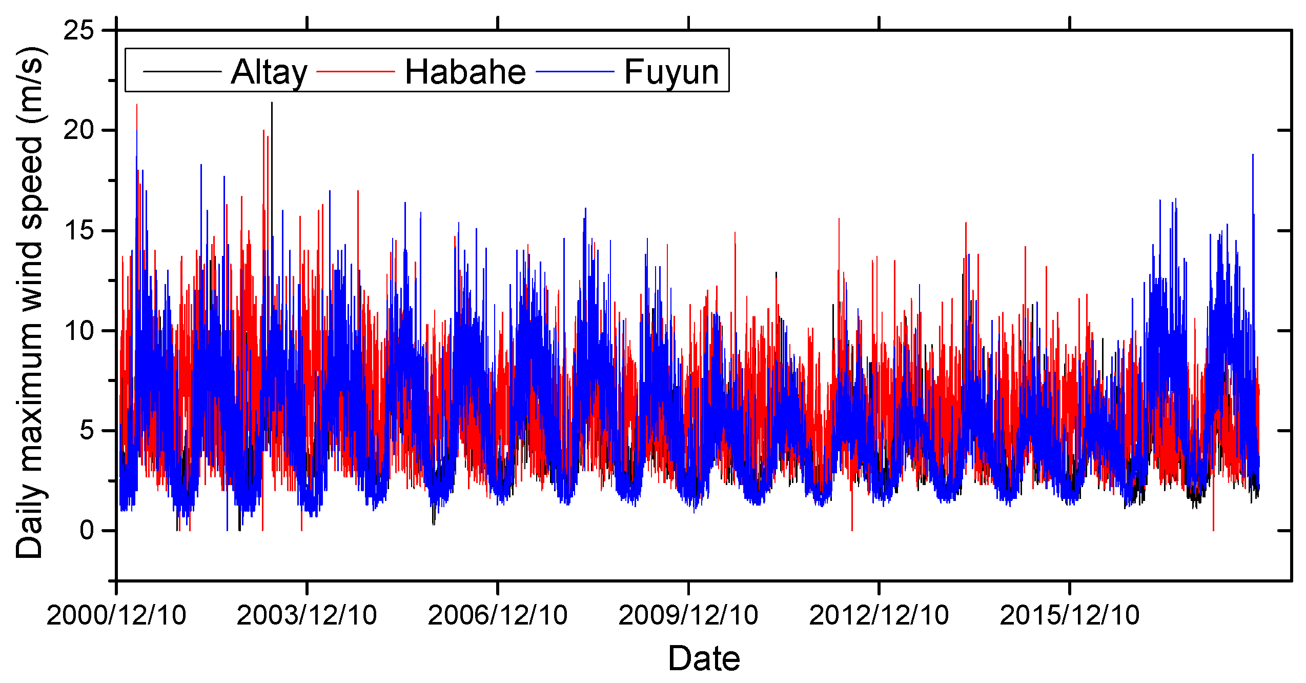
2.1. Study Area

Irtysh River is the largest tributary of Ob River. It originates from the Altai Mountains, crosses the Chinese border, and flows west through Zaysan Lake and northwest across eastern Kazakhstan. The total length of Irtysh River is 4248 km, and total area of the basin is 1.64 million km2 [38]. The upper reaches are above the border between China and Kazakhstan, the middle reaches are above the border between Kazakhstan and Russia, and the lower reaches are from the border between Kazakhstan and Russia to the confluence of the Ob River. Our study area is located in the Irtysh River Basin of China (Figure 1), with a river length of 633 km and a basin area of 4.53 × 10⁴ km2. The annual average precipitation of the basin is 200–500 mm, and the annual average runoff at the estuary is 95 billion m3. The basin is higher in the northeast and lower in the southwest, with an average elevation of 1790 m. It has a temperate continental climate in the middle temperate zone, with long and cold winters and short and cool summers. The average annual temperature is about 4 °C. The water vapor in the basin mainly comes from the Atlantic Ocean, the precipitation is more in winter and summer than in spring and autumn, and there is more snowfall than rainfall. The runoff is mainly supplied by snow melting, precipitation, and ice melting. The proportion of snow melting water is the largest, accounting for 45%, while rainfall and glacier melting water account for 26% and 7.7%, respectively. The snow cover period lasts from November to April of the next year, and the snow cover period is longer in the areas with higher elevations [39]. The snow cover is thick, and the maximum snow cover thickness can even reach more than 1 m in some years.
In the Irtysh River Basin, the National Meteorological Administration of China has set up three meteorological observation stations in Altay, Habahe, and Fuyun. The observations include temperature, relative humidity, wind speed, and precipitation. The observations of Altay station also include downward shortwave radiation. In the upper reaches of the basin, the Kuwei comprehensive meteorological observation station (47°21′9.1″ N, 89°39′43.22″ E; altitude of 1379 m) was set up in 2011. At the Kuwei site, meteorological observations include temperature, wind speed, wind direction, relative humidity, precipitation, downward and upward shortwave radiation, and longwave radiation; snow observations include snow depth, snow water equivalent, and snow temperature; and soil observations include soil temperature, soil moisture, and soil heat flux. The specifications of these observation instruments are presented in Table 1.

2.2. Model Description

Noah-MP is a new land surface model developed on the basis of the Noah model [30,31]. Compared to Noah, Noah-MP adds 12 physical processes and provides multiple alternative parameterization schemes for each physical process (Table 2). The physical processes directly related to snow cover include snow surface albedo (ALB) and rainfall and snowfall (SNF). Snow/soil temperature time scheme (STC) is a solver option used to solve heat conduction equations and also has a great impact on snow cover [40]. You et al. [40] also proposed that surface layer drag coefficient (SFC) is also closely related to snow cover process.

2.3. Dataset

ERA-Interim [41] and CMFD [42,43,44] were used as driving data for the Noah-MP land surface model, respectively. ERA-Interim data were downloaded from the European Centre for Medium-Range Forecasts (https://apps.ecmwf.int/ (accessed on 4 May 2020)). Air temperature, dew point temperature, and wind speed are real-time data with a time resolution of 6 h. Radiation and precipitation are forecast data, and 3 h time resolution can be obtained through processing. There are 11 kinds of spatial resolution available; the highest resolution is 0.125 × 0.125°, the lowest resolution is 3 × 3°, and the data resolution selected in this study is 0.125 × 0.125°. The CMFD data has a temporal resolution of 3 h and a spatial resolution of 0.1 × 0.1°. The data can be downloaded from the National Tibetan Plateau Third Pole Environment Data Center (http://data.tpdc.ac.cn/ (accessed on 26 April 2020)), and the detailed description of the data can also be obtained from the website.
In addition to meteorological data, land use data is also needed for Noah-MP model operation. In this study, we selected the global land use data developed by Tsinghua University (http://0-data-ess-tsinghua-edu-cn.brum.beds.ac.uk/ (accessed on 10 May 2020)), and the spatial resolution of the data was 30 m [45]. By resampling, we obtained land use data with the same resolution as ERA-Interim and CMFD data.
A gridded dataset of snow depth at Chinese meteorological stations (GDSD) was used to evaluate the simulation accuracy of the Noah-MP model at watershed scale. GDSD data was obtained by interpolation based on the snow depth data observed by more than 700 meteorological observation stations in China [46]. This interpolation method divides the 200 km range into one unit, calculates the orientational relationship (O), distance (D), and correlation coefficient (C) of all observation stations in each unit, and finally determines the interpolation weight of each grid point based on the relationship between O, D, and C. This interpolation method fully considers the spatial representation of snow depth at each station and its functional relationship with the snow depth at surrounding stations. The gridded snow depth obtained by this interpolation method was also compared with the snow depth data obtained by arithmetic average method and inverse distance weight method. The results show that the difference of snow depth data obtained by the three methods is very small. The GDSD data has a temporal resolution of about 5 days and a spatial resolution of 0.5 × 0.5°. This data can be downloaded from the National Cryosphere Desert Data Center (http://www.ncdc.ac.cn/ (accessed on 31 May 2021)) and a detailed description of the data can also be found on this website.
The error of snow depth simulated by the Noah-MP model was also compared with two sets of snow depth data retrieved based on microwave remote sensing. The first was the long-term series of daily snow depth dataset in China (LSD) released by Che and Dai [47], and the second was China’s daily snow depth and snow water equivalent products (CSS) released by Jiang et al. [48]. These two sets of data were both produced using SMMR, SSM/I, and SSMIS satellite remote sensing brightness temperature data with a spatial resolution of 25 km × 25 km and a temporal resolution of 1 day. The LSD data can be downloaded from the National Tibetan Plateau Data Center (http://data.tpdc.ac.cn/ (accessed on 23 May 2021)) and the CSS data can be downloaded from the National Cryosphere Desert Data Center (http://www.ncdc.ac.cn/ (accessed on 31 May 2021)).

2.4. Statistical Method

Several statistical indicators were used to represent the characteristics of snow cover in the study area and the accuracy of simulation results or meteorological data. These indicators are listed as follows:
(1)
Snow year
The snow year is considered to be the time from the beginning of snow accumulation in a year to the next year before the snow starts to accumulate. According to the characteristics of snow cover in the Irtysh River Basin, we regard 1 September to 30 August of the following year as a snow year.
(2)
Mean deviation (MD) and root mean squared error (RMSE)
Mean deviation (MD) and root mean squared error (RMSE) are used to evaluate the accuracy of model simulation results or weather-driven data. The calculation formulas of MD and RMSE are as follows:
M D = 1 n i = 1 n ( R D i O i )
R M S E = 1 n i = 1 n ( R D i O i ) 2
In the above formula, RDi is the meteorological value recorded by meteorological forcing data or the snow parameter value simulated by the model at ith time, Oi is the observed meteorological element or snow parameter value at ith time, and n is the number of samples. The closer the MD and RMSE values are to 0, the higher the accuracy of meteorological forcing data or model simulation results are. If the MD value is greater than 0, it means meteorological forcing data or simulation results are overestimated, and if the MD value is less than 0, it means underestimated.
(3)
Linear slope and Mann–Kendall test
The linear slope is used to indicate trends of snow depth, snow water equivalent, snow days, and other snow parameters. The Mann–Kendall (M–K) test is used to determine the significance of the trends. When the statistic p > 0.1, the change trend of the time series is not significant; otherwise, the change trend is significant. The calculation process of the M–K method can be found in the published literature [49].

3. Results

3.1. Testing Noah-MP Model at Kuwei Site

In order to evaluate the simulation effect of the Noah-MP model on a single point, we first drive the model based on the meteorological observation data of Kuwei site from September 2013 to April 2014, and verify it based on the observed snow depth and snow water equivalent. As can be seen from Table 2, Noah-MP can combine more than 20,000 optional parameterization schemes. You et al. [40] tested these parameterization schemes at a site in the Altai Mountains, which is also located in the Irtysh River Basin, and the results show SFC and STC have the greatest influence on the simulation results of snow depth and snow water equivalent. At the Kuwei site, we also tested the SFC and STC parameterization schemes, and obtained four simulation results (Figure 2a,b). It can be seen from Figure 2a,b that different SFC and STC schemes have little influence on the simulation results during the snow accumulation period, but have a great influence on the simulation results during the ablation period. During the ablation period, the effect of SFC scheme on the simulation results was smaller than that of STC; when STC uses a fully implicit scheme, the error of simulated snow depth and snow water equivalent is greater than that of a semi-implicit scheme. The ALB and SNF parameterizations schemes were also tested at the Kuwei site. From the results obtained (Figure 2c–f), ALB mainly affects the melting process of snow, while SNF mainly affects the accumulation process. However, compared with STC, ALB and SNF have much less influence on the snow cover process. Furthermore, the simulated snow depth of all combined schemes is less than the observed value. In this study, SR50 sensor with a resolution of 1 cm is used for snow depth observation at the Kuwei site. However, in actual monitoring, especially in mountainous areas with complex terrain, the error of the SR50 sensor may be much higher than 1 cm. This may also be an important reason for the difference between the Noah-MP-simulated and the observed snow depth during the snow accumulation and melting period.

3.2. Testing Noah-MP Model in the Irtysh River Basin

From the simulation results at the Kuwei site, the simulation accuracy of SFC1STC1 and SFC2STC1 is better than that of SFC1STC2 and SFC2STC2. At another site in the Irtysh River Basin, You et al. [40] also proposed that the SFC1STC1 scheme has the best simulation accuracy for snow depth and snow water equivalent. Combined with the test results of this study at the Kuwei site, we chose the SFC1STC1AB2SNF1 scheme to simulate the snow depth and snow water equivalent at the whole basin, and the other eight schemes adopted the default selection of the model. Considering that the Noah-MP model requires a long time to reach equilibrium state [50,51,52], this study refers to the method proposed by You et al. [53], and uses the forcing data from 1 January 2000 to 30 August 2001 to spin-up the model. Through the simulation, we get the simulation results of snow depth and snow water equivalent at a 3 h time scale in the Irtysh River Basin from September 2001 to December 2018. In order to evaluate the accuracy of the model simulation results, we process the snow depth data from all sources to the same time resolution as the GDSD data, and give the time series of the average snow depth in the Irtysh River Basin (Figure 3). As can be seen from Figure 3c,d, the accuracy of snow depth simulated by the Noah-MP model is distinctly higher than that obtained based on microwave remote sensing inversion in the Irtysh River Basin. In years with small snow depth, the snow depth recorded by LSD and CSS data is highly consistent with GDSD data. However, in years with high snow depth, such as 2002, 2006, 2008, 2009, 2010, and 2012, LSD and CSS snow depth are seriously underestimated. The snow depth series simulated based on the CMFD and ERA-Interim data were in good agreement with the GDSD data. Through the calculation results of MD and RMSE (Table 3), it is found that the MD and RMSE values between Noah_CMFD and GDSD are smaller than those between Noah_ERA and GDSD. Therefore, the results obtained by using CMFD as the driving simulation in Irtysh River Basin are the most accurate.

3.3. SD and SWE Distribution and Variation Characteristics in the Irtysh River Basin

Based on the simulation results of the Noah-MP model, the annual maximum snow depth and snow water equivalent are calculated, and the spatial distribution of annual average maximum snow depth and snow water equivalent in the Irtysh River Basin is given (Figure 4). It can be seen from Figure 4 that the annual average maximum snow depth and snow water equivalent simulated based on CMFD and ERA-Interim data have good consistency in spatial distribution. Both snow depth and snow water equivalent are high in the north and low in the south of the basin. This spatial distribution feature is consistent with the topography of the basin. In the north of the basin, the altitude is high and the temperature is relatively low, which is conducive to the accumulation of snow. In the south of the basin, the altitude is relatively low, the temperature is relatively high, and the snow is easier to melt. Based on CMFD and era interim data, we also give the spatial distribution characteristics of the annual average precipitation in the basin (Figure 5). It can be seen from Figure 5 that the precipitation in the north of the basin is much higher than that in the south. High altitude and higher precipitation are the main reasons for the higher snow depth and snow water equivalent in the north of the basin than that in the south.
When analyzing the temporal variation characteristics of snow cover, because the accuracy of snow depth based on ERA-Interim simulation is slightly lower than that based on CMFD simulation, only the simulation results based on CMFD data are selected. In addition to the average maximum snow depth (SDmax) and snow water equivalent (SWEmax), we also selected the average snow days, the average start time of snow accumulation (STSA), and the end time of snow melting (ETSM) to analyze the variation characteristics of snow from 2001 to 2017. The linear slope and M–K test were used to determine the trend of these time series (Figure 6). As can be seen from Figure 6, the maximum snow depth, snow water equivalent, and snow days in the Irtysh River Basin showed an insignificant decreasing trend from 2001 to 2017. The start time of snow accumulation was delayed, but the change trend was not significant, while the end time of snow melting was significantly advanced.

4. Discussion

4.1. The Influence of Data Quality Uncertainty on Simulation Results

In previous studies, Guenther et al. [9] and Zhang et al. [54] analyzed the factors that affect the accuracy of snow cover simulation by land surface process model, and found that the uncertainty of forcing data has a greater impact on the simulation results than the structure and parameterization scheme of the model itself. In this study, meteorological station observation data were used to evaluate the accuracy of CMFD and ERA-Interim data. Since the data of Habahe, Altay, and Fuyun stations are used in the production of CMFD data, only the observation data of Kuwei station were selected. Meteorological data from CMFD and ERA-Interim were extracted based on the longitude and latitude of the Kuwei site. Scatter plots were drawn based on the CMFD, ERA-Interim, and the observed data, and the accuracy of the two meteorological forcing data was evaluated using MD and RMSE statistical parameters (Figure 7). It can be seen from Figure 7 that there are some deviations between CMFD, ERA-Interim and the observed temperature, wind speed, relative humidity, precipitation, and downward shortwave and longwave radiation. On the one hand, the reason for this phenomenon lies in the difference in spatial range between grid points and stations; on the other hand, the error of meteorological forcing data itself is also an important reason. From the calculated MD and RMSE values, the accuracy of CMFD temperature, wind speed, and downward shortwave and longwave radiation data is higher than ERA-Interim data. Although the accuracy of ERA-Interim relative humidity and precipitation is slightly better than that of CMFD at the Kuwei site, considering that the CMFD precipitation and relative humidity data were generated through fusion of remote sensing products, reanalysis datasets, and in situ station data [42], it is considered that CMFD also has high accuracy at the watershed scale. This is also the reason why the modeled snow depths by using the CMFD data are more consistent with GDSD data.

4.2. Limitations of This Study

In high-latitude mountainous areas, wind blowing snow is also a factor that cannot be ignored. Wind blowing snow includes material migration and sublimation, which have great influence on the secondary distribution of snow in space [55,56]. In previous studies, the minimum wind speed threshold for wind blowing snow was generally set at 7 m/s [57], and when the wind speed is higher than the threshold, blowing snow will occur. Through the analysis of the daily maximum wind speed at the Altay, Habahe, and Fuyun meteorological stations in the study area from 2001 to 2018 (Figure 8), it was found that there are many days when the daily maximum wind speed of the three stations exceeds the wind blowing snow threshold. However, the Noah-MP model lacks the consideration of the wind blowing snow process, which may also be an important reason for the deviation between the snow depth simulated in this study and GDSD data.

5. Conclusions

In this study, we tested the Noah-MP model for snow accumulation and melting process modeling at the Kuwei site in the Irtysh River Basin, and simulated the snow cover process by using CMFD and ERA-Interim as forcing data at the whole basin from 2000 to 2018. The simulation results were also compared with the gridded dataset of snow depth at Chinese meteorological stations (GDSD) and snow depth obtained from microwave remote sensing (LSD and CSS data). The main findings are as follows:
(1).
STC, SFC, and ALB schemes mainly affect the snow melting process, while SNF mainly affects the accumulation process. Among the four schemes, STC has the greatest impact on the accuracy of snow cover simulation. When STC use the semi-implicit scheme, the overall simulation accuracy is better than that of the fully implicit scheme.
(2).
CMFD and ERA-Interim as the forcing data can accurately simulate the snow accumulation and melting process of the whole basin, and the results of CMFD simulation are more accurate than those of ERA-Interim simulation. The main reason is that the data accuracy of CMFD is higher than that of ERA-Interim.
(3).
In the years with low snow depth, the snow depth retrieved based on microwave remote sensing is in good agreement with the observed snow depth. However, in the years with high snow depth, such as 2002, 2004, 2008, 2009, 2010, and 2012, the snow depth retrieved by remote sensing is seriously underestimated.
(4).
Spatially, the snow depth and snow depth equivalent in the north of Irtysh River Basin are higher than those in the south, mainly because the altitude and precipitation in the north are higher than those in the south. The snow depth, snow water equivalent, snow days, and the start time of snow accumulation (STSA) in the basin did not change significantly from 2001 to 2017. However, the end time of snow melting was obviously advanced.

Author Contributions

Conceptualization, L.Z.; methodology, L.G.; software, L.G. and M.A.; validation, L.G.; formal analysis, L.G. and L.Z.; investigation, L.G., L.Z. and W.Z.; resources, Y.S.; data curation, L.G. and W.Z.; writing—original draft preparation, L.G. and L.Z.; writing—review and editing, Y.Z.; supervision, Y.S.; project administration, L.Z.; funding acquisition, L.Z. All authors have read and agreed to the published version of the manuscript.

Funding

This study is supported by the National Natural Science Foundation of China (grant number 42001060, 42171467 and 41705139), Key Special Subject of the National Key Research and Development Program of China (grant number 2019YFC1510502) and the Natural Science Foundation of Qinghai Province (grant number 2021-ZJ-947Q).

Institutional Review Board Statement

Not applicable.

Informed Consent Statement

Not applicable.

Data Availability Statement

The data supporting this study are available from the authors.

Conflicts of Interest

The authors declare no conflict of interest.

References

  1. Kang, S.; Guo, W.; Zhong, X.; Xu, M. Changes in the mountain cryosphere and their impacts and adaptation measures. Clim. Chang. Res. 2020, 16, 143–152. [Google Scholar]
  2. Kevin, J.P.W.; Kotlarski, S.; Scherrer, S.C.; Schär, C. The Alpine snow-albedo feedback in regional climate models. Clim. Dyn. 2017, 48, 1109–1124. [Google Scholar]
  3. Henderson, G.R.; Peings, Y.; Kushner, P.J. Snow–atmosphere coupling in the Northern Hemisphere. Nat. Clim. Chang. 2018, 8, 954–963. [Google Scholar] [CrossRef]
  4. Kokhanovsky, A.; Lamare, M.; Danne, O.; Brockmann, C.; Dumont, M.; Picard, G.; Arnaud, L.; Favier, V.; Jourdain, B.; Meur, E.L.; et al. Retrieval of snow properties from the Sentinel-3 Ocean and Land Colour Instrument. Remote Sens. 2019, 11, 2280. [Google Scholar] [CrossRef] [Green Version]
  5. Barnett, T.P.; Adam, J.C.; Lettenmaier, D.P. Potential impacts of a warming climate on water availability in snow-dominated regions. Nature 2005, 438, 303–309. [Google Scholar] [CrossRef]
  6. Richard, E.; Pierre, E. Parameter sensitivity in simulations of snowmelt. J. Geophys. Res. 2004, 109, 2107–2117. [Google Scholar]
  7. Winkler, M.; Schellander, H.; Gruber, S. Snow water equivalents exclusively from snow depths and their temporal changes: The ΔSNOW model. Hydrol. Earth Syst. Sci. 2021, 25, 1165–1187. [Google Scholar] [CrossRef]
  8. Saloranta, T.M. Operational snow mapping with simplified data assimilation using the seNorge snow model—ScienceDirect. J. Hydrol. 2016, 538, 314–325. [Google Scholar] [CrossRef]
  9. Guenther, D.; Markel, T.; Essery, R.; Strasser, U. Uncertainties in snowpack simulations—Assessing the impact of model structure, parameter choice and forcing data error on point-scale energy-balance snow model performance. Water Resour. Res. 2019, 55, 2779–2800. [Google Scholar] [CrossRef] [Green Version]
  10. Liu, S.; Xie, Z.; Song, G.; MA, L.; Ageta, Y. Mass balance of Kangwure (flat-top) Glacier on the north side of Mt. Xixiabangma, China. Bull. Glacier. Res. 1996, 14, 37–43. [Google Scholar]
  11. Braithwaite, R.J.; Zhang, Y. Sensitivity of mass balance of five Swiss glaciers to temperature changes assessed by tuning a degree-day model. J. Glaciol. 1994, 46, 7–14. [Google Scholar] [CrossRef] [Green Version]
  12. Abudu, S.; Saydi, M.; King, J.P. Application of snowmelt runoff model (SRM) in mountainous watersheds: A review. Water Sci. Eng. 2012, 2, 123–136. [Google Scholar]
  13. Martinec, J.; Rango, A. Parameter values for snowmelt runoff modelling. J. Hydrol. 1986, 84, 197–219. [Google Scholar] [CrossRef]
  14. Firouzi, S.; Sadeghian, M.S. Application of Snow Melt Runoff Model in a Mountainous Basin of Iran. J. Geosci. Environ. Prot. 2016, 4, 74. [Google Scholar] [CrossRef] [Green Version]
  15. Huang, S.; Eisner, S.; Magnusson, J.O.; Lussana, C.; Yang, X.; Beldring, S. Improvements of the spatially distributed hydrological modelling using the HBV model at 1 km resolution for Norway. J. Hydrol. 2019, 577, 123585. [Google Scholar] [CrossRef]
  16. Tiwari, S.; Kar, S.C.; Bhatla, R.; Bansal, R. Temperature index based snowmelt runoff modelling for the Satluj River basin in the western Himalayas. Met. Apps. 2018, 25, 302–313. [Google Scholar] [CrossRef]
  17. Ma, H.; Cheng, G. Snowmelt runoff simulation in Gongnaisi River Basin using of SRM. Chin. Sci. Bull. 2003, 48, 2088–2093. [Google Scholar]
  18. Latif, Y.; Ma, Y.; Ma, W.; Muhammad, S.; Adnan, M.; Yaseen, M.; Fealy, R. Differentiating Snow and Glacier Melt Contribution to Runoff in the Gilgit River Basin via Degree-Day Modelling Approach. Atmosphere 2020, 11, 1023. [Google Scholar] [CrossRef]
  19. Osuch, M.; Wawrzyniak, T.; Nawrot, A. Diagnosis of the hydrology of a small Arctic permafrost catchment using HBV conceptual rainfall-runoff model. Hydrol. Res. 2019, 50, 459–478. [Google Scholar] [CrossRef] [Green Version]
  20. Zhang, Y.; Liu, S.; Ding, Y. Spatial variation of degree-day factors on the observed glaciers in western China. Acta. Geogr. Sin. 2006, 61, 89. [Google Scholar] [CrossRef] [Green Version]
  21. Touzeau, A.; Landais, A.; Morin, S.; Arnaud, L.; Picard, G. Numerical experiments on vapor diffusion in polar snow and firn and its impact on isotopes using the multi-layer energy balance model Crocus in SURFEX v8. 0. Geosci. Model. Dev. 2018, 11, 2393–2418. [Google Scholar] [CrossRef] [Green Version]
  22. Sauter, T.; Arndt, A.; Schneider, C. COSIPY v1.2—An open-source coupled snowpack and ice surface energy and mass balance model. Geosci. Model. Dev. Discuss. 2020, 2020, 1–25. [Google Scholar]
  23. Gao, L.M.; Zhang, Y.N.; Shen, Y.P.; Zhang, L.L. Analysis of water and heat transfer in snow layer during snowmelt period in Irtysh River Basinbased on energy balance theory. J. Glaciol. Geocryol. 2016, 38, 323–331. [Google Scholar]
  24. Tarboton, D.G.; Luce, C.H. Utah Energy Balance Snow Accumulation and Melt Model (UEB): Computer Model Technical Description and User’s Guide; Utah Water Research Laboratory and USDA Forest Service Intermountain Research Station: Logan, UT, USA, 1996.
  25. Bartelt, P.; Lehning, M. A physical SNOWPACK model for the Swiss avalanche warning: Part I: Numerical model. Cold. Reg. Sci. Technol. 2002, 35, 123–145. [Google Scholar] [CrossRef]
  26. Lehning, M.; Bartelt, P.; Brown, B. A physical SNOWPACK model for the Swiss avalanche warning: Part III: Meteorological forcing, thin layer formation and evaluation. Cold. Reg. Sci. Technol. 2002, 35, 169–184. [Google Scholar] [CrossRef]
  27. Liang, X.; Wood, E.F.; Lettenmaier, D.P. Modeling ground heat flux in land surface parameterization schemes. J. Geophys. Res. 1999, 104, 9581–9600. [Google Scholar] [CrossRef]
  28. Shrestha, M.; Wang, L.; Koike, T.; Xue, Y.; Hirabayashi, Y. Improving the snow physics of WEB-DHM and its point evaluation at the SnowMIP sites. Hydrol. Earth Syst. Sci. 2010, 14, 2577–2594. [Google Scholar] [CrossRef] [Green Version]
  29. Toure, A.M.; Rodell, M.; Yang, Z.L.; Beaudoing, H.; Kim, E.; Zhang, Y.; Kwon, Y. Evaluation of the snow simulations from the Community Land Model, version 4 (CLM4). J. Hydrometeorol. 2016, 17, 153–170. [Google Scholar] [CrossRef]
  30. Niu, G.Y.; Yang, Z.L.; Mitchell, K.E.; Chen, F.; Ek, M.B.; Barlage, M.; Kumar, A.; Manning, K.; Niyogi, D.; Rosero, E.; et al. The community Noah land surface model with multi-parameterization options (Noah-MP): 1. Model description and evaluation with local-scale measurements. J. Geophys. Res. 2011, 116, D12109. [Google Scholar] [CrossRef] [Green Version]
  31. Yang, Z.L.; Niu, G.Y.; Mitchell, K.E.; Chen, F.; Ek, M.B.; Barlage, M.; Longuevergne, L.; Manning, K.; Niyogi, D.; Tewari, M.; et al. The community Noah land surface model with multiparameterization options (Noah-MP): 2. Evaluation over global river basins. J. Geophys. Res. 2011, 116, D12110. [Google Scholar] [CrossRef]
  32. Vionnet, V.; Brun, E.; Morin, S.; Boone, A.; Faroux, S.; Moigne, P.L.; Martin, E.; Willemet, J.M. The detailed snowpack scheme Crocus and its implementation in SURFEX v7.2. Geosci. Model. Dev. 2012, 5, 73–791. [Google Scholar] [CrossRef] [Green Version]
  33. Wrzesien, M.L.; Durand, M.T.; Pavelsky, T.M.; Howat, L.M.; Margulis, S.A.; Huning, L.S. Comparison of methods to estimate snow water equivalent at the mountain range scale: A case study of the California Sierra Nevada. J. Hydrometeorol. 2017, 18, 1101–1119. [Google Scholar] [CrossRef]
  34. Wu, X.; Wang, N.; Shen, Y.; He, J.; Zhang, W. In-situ observations and modeling of spring snowmelt processes in an Altay Mountains river basin. J. Appl. Remote Sens. 2014, 8, 214–233. [Google Scholar] [CrossRef]
  35. Wu, X.; Shen, Y.; Wang, N.; Pan, X.; Zhang, W.; He, J.; Wang, G. Coupling the WRF model with a temperature index model based on remote sensing for snowmelt simulations in a river basin in the Altay Mountains, north-west China. Hydrol. Process. 2016, 30, 3967–3977. [Google Scholar] [CrossRef]
  36. Zhang, W.; Kang, S.C.; Shen, Y.P.; He, J.Q.; Chen, A.A. Response of snow hydrological processes to a changing climate during 1961 to 2016 in the headwater of Irtysh River Basin, Chinese Altai Mountains. J. Mt. Sci. 2017, 11, 2295–2310. [Google Scholar] [CrossRef]
  37. Wu, X.; Zhang, W.; Li, H.; Long, Y.; Pan, X.; Shen, Y. Analysis of seasonal snowmelt contribution using a distributed energy balance model for a river basin in the Altai Mountains of northwestern China. Hydrol. Process. 2021, 35, e14046. [Google Scholar] [CrossRef]
  38. Huang, F.; Xia, Z.; Li, F.; Guo, L.; Yang, F. Hydrological changes of the Irtysh River and the possible causes. Water Resour. Manag. 2012, 26, 3195–3208. [Google Scholar] [CrossRef] [Green Version]
  39. Liu, M.; Xiong, C.; Pan, J.; Wang, T.; Shi, J.; Wang, N. High-resolution reconstruction of the maximum snow water equivalent based on remote sensing data in a mountainous area. Remote Sens. 2020, 12, 460. [Google Scholar] [CrossRef] [Green Version]
  40. You, Y.H.; Huang, C.L.; Zhang, Y.; Hou, J.L. Sensitivity evaluation of snow simulation to multi-parameterization schemes in the Noah-MP Model. Adv. Earth Sci. 2019, 34, 356–365. [Google Scholar]
  41. Dee, D.P.; Uppala, S.M.; Simmons, A.J.; Berrisford, P.; Poli, P.; Kobayashi, S.; Andrae, U.; Balmaseda, M.A.; Balsamo, G.; Bauer, P.; et al. The ERA-Interim reanalysis: Configuration and performance of the data assimilation system. Q. J. R. Meteorol. Soc. 2011, 137, 553–597. [Google Scholar] [CrossRef]
  42. He, J.; Yang, K.; Tang, W.; Lu, H.; Qin, J.; Chen, Y.Y.; Li, X. The first high-resolution meteorological forcing dataset for land process studies over China. Sci. Data 2020, 7, 25. [Google Scholar] [CrossRef] [PubMed] [Green Version]
  43. Yang, K.; He, J.; Tang, W.J.; Qin, J.; Cheng, C. On downward shortwave and longwave radiations over high altitude regions: Observation and modeling in the Tibetan Plateau. Agric. For. Meteorol. 2010, 150, 38–46. [Google Scholar] [CrossRef]
  44. Yang, K.; He, J. China Meteorological Forcing Dataset (1979–2018). National Tibetan Plateau Data Center. 2019. Available online: http://data.tpdc.ac.cn/en/data/8028b944-daaa-4511-8769-965612652c49/ (accessed on 26 April 2020).
  45. Gong, P.; Liu, H.; Zhang, M.; Li, C.; Wang, J.; Huang, H.; Clinton, N.; Li, L.; Ji, L.; Li, W.; et al. Stable classification with limited sample: Transferring a 30-m resolution sample set collected in 2015 to mapping 10-m resolution global land cover in 2017. Sci. Bull. 2019, 64, 370–373. [Google Scholar] [CrossRef] [Green Version]
  46. Ma, L. Gridded Data Set of Snow Depth at Chinese Meteorological Stations in 1951–2015. National Cryosphere Desert Data Center. 2020. Available online: http://www.ncdc.ac.cn/portal/metadata/9d6375ee-ef40-4f2e-8340-87748ecd4d95 (accessed on 31 May 2021).
  47. Che, T.; Dai, L. Long-Term Series of Daily Snow Depth Dataset in China (1979–2020). National Tibetan Plateau Data Center. 2015. Available online: https://data.tpdc.ac.cn/zh-hans/data/df40346a-0202-4ed2-bb07-b65dfcda9368/ (accessed on 23 May 2021).
  48. Jiang, L.; Yang, J.; Dai, L.; Li, X.; Qiu, Y.; Wu, S.; Li, Z. China’s Daily Snow Water Equivalent 25 km Spatial Resolution Products from 1980 to 2020. National Cryosphere Desert Data Center. 2020. Available online: http://www.ncdc.ac.cn/portal/metadata/63c5cebb-587d-42cf-bd81-6f1325f1e165 (accessed on 31 May 2021).
  49. Feng, W.; Lu, H.; Yao, T.; Yu, Q. Drought characteristics and its elevation dependence in the Qinghai–Tibet plateau during the last half-century. Sci. Rep. 2020, 10, 14323. [Google Scholar] [CrossRef]
  50. Cai, X.; Yang, Z.L.; David, C.H.; Niu, G.Y.; Rodell, M. Hydrological evaluation of the Noah-MP land surface model for the Mississippi River Basin. J. Geophys. Res. 2014, 119, 23–38. [Google Scholar] [CrossRef]
  51. Chen, F.; Barlage, M.; Tewari, M.; Rasmussen, R.; Jin, J.; Lettenmaier, D.; Livneh, B.; Lin, C.; Miguez-Macho, G.; Niu, G.; et al. Modeling seasonal snowpack evolution in the complex terrain and forested Colorado Headwaters region: A model inter-comparison study. J. Geophys. Res. 2014, 119, 13795–13819. [Google Scholar] [CrossRef]
  52. Gao, Y.; Li, K.; Chen, F.; Jiang, Y.; Lu, C. Assessing and improving Noah-MP land model simulations for the central Tibetan Plateau. J. Geophys. Res. 2015, 120, 9258–9278. [Google Scholar] [CrossRef]
  53. You, Y.; Huang, C.; Yang, Z.; Zhang, Y.; Bai, Y.; Gu, J. Assessing Noah-MP Parameterization Sensitivity and Uncertainty Interval Across Snow Climates. J. Geophys. Res. 2020, 125, e2019JD030417. [Google Scholar] [CrossRef]
  54. Zhang, Y. Multivariate Land Snow Data Assimilation in the Northern Hemisphere: Development, Evaluation and Uncertainty Quantification of the Extensible Data Assimilation System. Ph.D. Thesis, The University of Texas at Austin, Austin, TX, USA, May 2015. [Google Scholar]
  55. Yang, J.; Yau, M.K.; Fang, X.; Pomeroy, J.W. A triple-moment blowing snow-atmospheric model and its application in computing the seasonal wintertime snow mass budget. Hydrol. Earth Syst. Sci. 2010, 14, 1063–1079. [Google Scholar] [CrossRef] [Green Version]
  56. Palm, S.P.; Kayetha, V.; Yang, K.; Pauly, R. Blowing snow sublimation and transport over Antarctica from 11 years of CALIPSO observations. Cryosphere 2017, 11, 2555–2569. [Google Scholar] [CrossRef] [Green Version]
  57. Gordon, M.; Simon, K.; Taylor, P.A. On snow depth predictions with the Canadian land surface scheme including a parametrization of blowing snow sublimation. Atmos.-Ocean 2006, 44, 239–255. [Google Scholar] [CrossRef]
Figure 1. Geographical location of the Irtysh River Basin.
Applsci 11 08365 g001
Figure 2. Modeling snow depth (a,c,e) and snow water equivalent (b,d,f) using Noah-MP model at Kuwei site. SFC1STC1 means the surface layer drag coefficient uses the M-O scheme, and snow/soil temperature time uses the semi-implicit scheme. Similarly, the parameterization schemes selected by SFC1STC2, SFC2STC1, SFC2STC2, SFC1STC1AB1, SFC1STC1AB2, SFC1STC1AB2SNF1, SFC1STC1AB2SNF2, and SFC1STC1AB2SNF3 can be obtained.
Applsci 11 08365 g002
Figure 3. Average snow depth (SD) of each five-day period in the Irtysh River Basin from September 2001 to August 2014 based on GDSD data and CMFD simulation (a), GDSD data and ERA-Interim simulation (b), GDSD and LSD data (c), GDSD and CSS microwave remote sensing data (d). Noah_CMFD represents the SD series by Noah-MP simulation with CMFD as the driving data and Noah_ERA represents the SD series by Noah-MP simulation with ERA-Interim as the driving data.
Applsci 11 08365 g003
Figure 4. Annual average maximum snow depth and snow water equivalent from 2001 to 2018 based on Noah-MP simulations. (a,c) represent SD and SWE with CMFD as the drive, (b,d) represent the results obtained with ERA-Interim as the drive.
Applsci 11 08365 g004
Figure 5. Spatial distribution of annual average precipitation based on CMFD (a) and ERA-Interim (b) data in the Irtysh River Basin.
Applsci 11 08365 g005
Figure 6. Average SDmax (a), SWEmax (b), snow days (c), STSA (d), and ETSM (e) in the Irtysh River Basin from 2001 to 2017.
Applsci 11 08365 g006
Figure 7. Scatter plot based on the hourly CMFD, ERA-Interim, and the observed temperature (a,g), relative humidity (b,h), wind speed (c,i), precipitation (d,j), downward shortwave radiation (e,k), downward longwave radiation (f,l) data during the study period.
Applsci 11 08365 g007
Figure 8. Daily maximum wind speed at the Altay, Habahe, and Fuyun sites from 2001 to 2018.
Applsci 11 08365 g008
Table 1. Specifications of the observations and the instruments at Kuwei site.
ObservationsInstrumentsAccuracy
Air temperature1000 Ω PRT, IEC 751 1/3 Class B±0.4 °C
Wind speed R.M. YOUNG 05103±0.3 m/s
Wind directionR.M. YOUNG 05103±3°
Relative humidityHUMICAP 180R±2%
PrecipitationGeonor T-200B±0.1 mm
RadiationKipp and Zonen CNR4 ±1%
Snow depthCampbell SR50A±1 cm
Snow water equivalentSnow pillow±1 mm
Snow temperatureCampbell SI-111 (USA)±0.5 °C
Soil temperatureHydra±0.1 °C
Soil moistureCampbell CS616/CS625 (USA)±0.1%
Soil heat fluxThermopile±5%
Data loggerCampbell CR1000 (USA)-
Table 2. Alternative parameterization schemes for 12 physical processes in Noah-MP model.
Physical ProcessShort NameParameterization Schemes
Vegetation modelDEVG1. prescribed (table LAI, shdfac = FVEG); 2. dynamic; 3. table LAI, calculate FVEG 4. table LAI, shdfac = maximum
Canopy stomatal resistanceCRS1. Ball-Berry; 2. Jarvis
Soil moisture factor for stomatal resistanceBTR1. Noah; 2. CLM; 3. SSiB
Runoff and groundwaterRUN1. SIMGM; 2. SIMTOP; 3. Schaake96; 4. BATS
Surface layer drag coefficientSFC1. M-O; 2. Chen97
Supercooled liquid waterFRZ1. NY06; 2. Koren99
Frozen soil permeabilityINF1. NY06; 2. Koren99
Radiation transferRAD1. gap = F (3D, cosz); 2. gap = 0; 3. gap = 1-veg
Snow surface albedoALB1. BATS; 2. CLASS
Rainfall and snowfallSNF1. Jordan91; 2. BATS; 3. Noah
Lower boundary of soil temperatureTBOT1. zero-flux; 2. Noah
Snow/soil temperature time schemeSTC1. semi-implicit; 2. fully implicit
Table 3. MD and RMSE values between Noah_CMFD, Noah_ERA, and GDSD snow depth.
Noah_CMFD vs. GDSDNoah_ERA vs. GDSD
MD5.0710.27
RMSE6.4711.32
Publisher’s Note: MDPI stays neutral with regard to jurisdictional claims in published maps and institutional affiliations.

