Next Issue
Volume 8, September
Previous Issue
Volume 8, July


Forests, Volume 8, Issue 8 (August 2017) – 41 articles

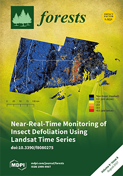
Cover Story (view full-size image): Using the 2016 gypsy moth (Lymantria dispar) outbreak in Southern New England as a case study, the authors present a new approach for near-real-time defoliation monitoring using synthetic images produced from Landsat time series. Qualitative and quantitative comparisons suggest their Landsat Time Series (LTS) products improve identification of defoliation events relative to existing products and provide a repeatable metric of change in condition. View this paper.
  • Issues are regarded as officially published after their release is announced to the table of contents alert mailing list.
  • You may sign up for e-mail alerts to receive table of contents of newly released issues.
  • PDF is the official format for papers published in both, html and pdf forms. To view the papers in pdf format, click on the "PDF Full-text" link, and use the free Adobe Reader to open them.
Order results
Result details
Section
Select all
Export citation of selected articles as:
2376 KiB  
Article
Land-Use Redistribution Compensated for Ecosystem Service Losses Derived from Agriculture Expansion, with Mixed Effects on Biodiversity in a NW Argentina Watershed
by Ana Sofía Nanni and Héctor Ricardo Grau
Forests 2017, 8(8), 303; https://0-doi-org.brum.beds.ac.uk/10.3390/f8080303 - 18 Aug 2017
Cited by 10 | Viewed by 5065
Abstract
Areas of land abandonment and agriculture expansion usually differ in location and associated environmental characteristics; thus, land-use redistribution affects the provision of ecosystem services and biodiversity conservation. In a subtropical region undergoing land redistribution patterns characteristic of Latin America, we estimated 20-year changes [...] Read more.
Areas of land abandonment and agriculture expansion usually differ in location and associated environmental characteristics; thus, land-use redistribution affects the provision of ecosystem services and biodiversity conservation. In a subtropical region undergoing land redistribution patterns characteristic of Latin America, we estimated 20-year changes in food production, above-ground carbon stocks and soil erosion due to land cover change, and the potential effects of such redistribution of forests on the diversity of birds and mammals. Between 1986 and 2006, despite only 0.3% of net forest cover change, 7% of the total area (ca. 280,000 has) switched between forest and non-forest covers. Food production increased by 46%, while the estimated ecosystem services changed by less than 10%. Forest carbon remained stable, with gains in montane humid forests compensating for losses in lowlands. Modeled soil erosion increased, but sediment accumulation at the watershed bottom remained stable. The responses of birds and mammals to forest redistribution differed and were stronger in birds. Due to the strong responses of birds to forest loss, lowland bird communities might be especially threatened by current land-use trends. Results suggest that land redistribution associated with the adjustment of agriculture towards soils suitable for mechanized agriculture can help mitigate associated losses in ecosystem services and biodiversity, but species and supporting services depending on easily-converted ecosystems require appropriate landscape management practices. Full article
(This article belongs to the Special Issue How Topography Impacts Forests under Global Change?)
Show Figures

Figure 1

22247 KiB  
Article
Use of Multi-Temporal UAV-Derived Imagery for Estimating Individual Tree Growth in Pinus pinea Stands
by Juan Guerra-Hernández, Eduardo González-Ferreiro, Vicente J. Monleón, Sonia P. Faias, Margarida Tomé and Ramón A. Díaz-Varela
Forests 2017, 8(8), 300; https://0-doi-org.brum.beds.ac.uk/10.3390/f8080300 - 18 Aug 2017
Cited by 95 | Viewed by 7926
Abstract
High spatial resolution imagery provided by unmanned aerial vehicles (UAVs) can yield accurate and efficient estimation of tree dimensions and canopy structural variables at the local scale. We flew a low-cost, lightweight UAV over an experimental Pinus pinea L. plantation (290 trees distributed [...] Read more.
High spatial resolution imagery provided by unmanned aerial vehicles (UAVs) can yield accurate and efficient estimation of tree dimensions and canopy structural variables at the local scale. We flew a low-cost, lightweight UAV over an experimental Pinus pinea L. plantation (290 trees distributed over 16 ha with different fertirrigation treatments) to determine the tree positions and to estimate individual tree height (h), diameter (d), biomass (wa), as well as changes in these variables between 2015 and 2017. We used Structure from Motion (SfM) and 3D point cloud filtering techniques to generate the canopy height model and object-based image analysis to delineate individual tree crowns (ITC). ITC results were validated using accurate field measurements over a subsample of 50 trees. Comparison between SfM-derived and field-measured h yielded an R2 value of 0.96. Regressions using SfM-derived variables as explanatory variables described 79% and 86–87% of the variability in d and wa, respectively. The height and biomass growth estimates across the entire study area for the period 2015–2017 were 0.45 m ± 0.12 m and 198.7 ± 93.9 kg, respectively. Significant differences (t-test) in height and biomass were observed at the end of the study period. The findings indicate that the proposed method could be used to derive individual-tree variables and to detect spatio-temporal changes, highlighting the potential role of UAV-derived imagery as a forest management tool. Full article
Show Figures

Figure 1

5232 KiB  
Article
Climate-Induced Northerly Expansion of Siberian Silkmoth Range
by Viacheslav I. Kharuk, Sergei T. Im, Kenneth J. Ranson and Mikhail N. Yagunov
Forests 2017, 8(8), 301; https://0-doi-org.brum.beds.ac.uk/10.3390/f8080301 - 16 Aug 2017
Cited by 23 | Viewed by 6021
Abstract
Siberian silkmoth (Dendrolimus sibiricus Tschetv.) is a dangerous pest that has affected nearly 2.5 × 10⁶ ha of “dark taiga” stands (composed of Abies sibirica, Pinus sibirica and Picea obovata) within the latitude range of 52°–59° N. Here we [...] Read more.
Siberian silkmoth (Dendrolimus sibiricus Tschetv.) is a dangerous pest that has affected nearly 2.5 × 10⁶ ha of “dark taiga” stands (composed of Abies sibirica, Pinus sibirica and Picea obovata) within the latitude range of 52°–59° N. Here we describe a current silkmoth outbreak that is occurring about half degree northward of its formerly documented outbreak range. This outbreak has covered an area of about 800 thousand ha with mortality of conifer stands within an area of about 300 thousand ha. The primary outbreak originated in the year 2014 within stands located on gentle relatively dry southwest slopes at elevations up to 200 m above sea level (a.s.l.) Then the outbreak spread to the mesic areas including northern slopes and the low-elevation forest belts along the Yenisei ridge. Within the outbreak area, the northern Siberian silkmoth population has reduced generation length from two to one year. Our study showed that the outbreak was promoted by droughts in prior years, an increase of the sum of daily temperatures (t > +10 °C), and a decrease in ground cover moisture. Within the outbreak area, secondary pests were also active, including the aggressive Polygraphus proximus bark borer beetle. The outbreak considered here is part of the wide-spread (panzonal) Siberian silkmoth outbreak that originated during 2014–2015 with a range of up to 1000 km in southern Siberia. Our work concludes that observed climate warming opens opportunities for Siberian silkmoth migration into historically outbreak free northern “dark taiga” stands. Full article
Show Figures

Figure 1

2284 KiB  
Article
The Impact of Water Content on Sources of Heterotrophic Soil Respiration
by Kristin M. McElligott, John R. Seiler and Brian D. Strahm
Forests 2017, 8(8), 299; https://0-doi-org.brum.beds.ac.uk/10.3390/f8080299 - 16 Aug 2017
Cited by 6 | Viewed by 5051
Abstract
Heterotrophic respiration (RH) is a major flux of CO2 from forest ecosystems and represents a large source of uncertainty in estimating net ecosystem productivity (NEP) using regional soil respiration (RS) models. RH from leaf litter (RHL [...] Read more.
Heterotrophic respiration (RH) is a major flux of CO2 from forest ecosystems and represents a large source of uncertainty in estimating net ecosystem productivity (NEP) using regional soil respiration (RS) models. RH from leaf litter (RHL) may contribute greatly to annual RH estimates, but its contribution may be misrepresented due to the logistical and technical challenges associated with chamber-based field measurements of RHL. The purpose of this study was to evaluate the sensitivity of sources of RH (mineral soil-derived heterotrophic respiration [RHM] and leaf litter-derived heterotrophic respiration [RHL]) of a loblolly pine plantation (Pinus taeda L.) to varying soil and litter water content over the course of a dry down event. Additionally, we investigated whether fertilization influenced RHL and RHM to understand how forest nutrient management may impact forest soil carbon (C) dynamics. RHL was measured under dry conditions and at field capacity to evaluate water content controls on RHL, determine the duration of increased CO2 release following wetting, and evaluate the potential contribution to total RH. We also measured RHM inside collars that excluded plant roots and litter inputs, from field capacity until near-zero RHM rates were attained. We found that RHL was more sensitive to water content than RHM, and increased linearly with increasing litter water content (R2 = 0.89). The contribution of RHL to RH was greatest immediately following the wetting event, and decreased rapidly to near-zero rates between 3 and 10 days. RHM also had a strong relationship with soil water content (R2 = 0.62), but took between 200 and 233 days to attain near-zero RHM rates. Fertilization had no effect on RHM (p = 0.657), but significantly suppressed RHL rates after the wetting event (p < 0.009). These results demonstrate that there is great temporal variability in both CO2 released and the water content of differing sources of RH, and forest fertilization may largely impact forest floor C stocks. This variability may not be captured reliably using conventional weekly to monthly chamber-based field sampling efforts and could lead to over- or underestimation of RH. In the context of climate change, changes in the frequency and intensity of wetting and drying events will likely alter RHL and its contribution to RS. Separate consideration of RH sources and controls, along with increased field sampling frequency using chamber-based methodology under a broader range of specific environmental conditions, are likely needed to reduce variability in RH estimates and improve the accuracy of forest NEP predictions. Full article
(This article belongs to the Collection Forests Carbon Fluxes and Sequestration)
Show Figures

Figure 1

4411 KiB  
Article
How Climate Change Will Affect Forest Composition and Forest Operations in Baden-Württemberg—A GIS-Based Case Study Approach
by Ferréol Berendt, Mathieu Fortin, Dirk Jaeger and Janine Schweier
Forests 2017, 8(8), 298; https://0-doi-org.brum.beds.ac.uk/10.3390/f8080298 - 16 Aug 2017
Cited by 15 | Viewed by 5803
Abstract
In order to accommodate foreseen climate change in European forests, the following are recommended: (i) to increase the number of tree species and the structural diversity; (ii) to replace unsuitable species by native broadleaved tree species, and (iii) to apply close-to-nature silviculture. The [...] Read more.
In order to accommodate foreseen climate change in European forests, the following are recommended: (i) to increase the number of tree species and the structural diversity; (ii) to replace unsuitable species by native broadleaved tree species, and (iii) to apply close-to-nature silviculture. The state forest department of Baden-Württemberg (BW) currently follows the concept of Forest Development Types (FDTs). However, future climatic conditions will have an impact on these types of forest as well as timber harvesting operations. This Geographic Information System (GIS)-based analysis identified appropriate locations for main FDTs and timber harvesting and extraction methods through the use of species suitability maps, topography, and soil sensitivity data. Based on our findings, the most common FDT in the state forest of BW is expected to be coniferous-beech mixed forests with 29.0% of the total forest area, followed by beech-coniferous (20.5%) and beech-broadleaved (15.4%) mixed forests. Where access for fully mechanized systems is not possible, the main harvesting and extraction methods would be motor manual felling and cable yarding (29.1%). High proportions of large dimensioned trees will require timber extraction using forestry tractors, and these will need to be operated from tractor roads on sensitive soils (23.0%), and from skid trails on insensitive soils (18.4%). Full article
(This article belongs to the Special Issue Forest Operations, Engineering and Management)
Show Figures

Figure 1

1701 KiB  
Article
Comparison of Heat Transfer and Soil Impacts of Air Curtain Burner Burning and Slash Pile Burning
by Woongsoon Jang, Deborah S. Page-Dumroese and Han-Sup Han
Forests 2017, 8(8), 297; https://0-doi-org.brum.beds.ac.uk/10.3390/f8080297 - 16 Aug 2017
Cited by 5 | Viewed by 4253
Abstract
We measured soil heating and subsequent changes in soil properties between two forest residue disposal methods: slash pile burning (SPB) and air curtain burner (ACB). The ACB consumes fuels more efficiently and safely via blowing air into a burning container. Five burning trials [...] Read more.
We measured soil heating and subsequent changes in soil properties between two forest residue disposal methods: slash pile burning (SPB) and air curtain burner (ACB). The ACB consumes fuels more efficiently and safely via blowing air into a burning container. Five burning trials with different fuel sizes were implemented in northern California, USA. Soil temperature was measured at 1, 2, 3, 4, 6, and 8 cm depth. Immediately after burning, soil samples from two depths (0–10 and 10–20 cm) and ash samples were collected for analyzing organic matter; carbon and nitrogen content; and calcium, magnesium, and potassium concentrations. The highest temperature observed was 389 °C at 1 cm depth under the SPB. Mean peak temperatures were 133.2 °C and 162.2 °C for ACB and SPB, respectively. However, there were no significant differences in peak temperatures and duration of lethal soil temperatures (total minutes over 60 °C) between ACB and SPB. Heat transfer decreased rapidly as the soil depth increased. There is little evidence that any subsequent changes in soil chemical properties occurred, concluding that these small-scale burns had few negative impacts at our study site. Therefore, given the lack of extreme soil heating and more efficient and safer woody residue reduction, the ACB may be more effective than open SPB, especially where fire escape or long-term fire damage to soils are of concern. Full article
Show Figures

Figure 1

2132 KiB  
Article
Air Curtain Burners: A Tool for Disposal of Forest Residues
by Eunjai Lee and Han-Sup Han
Forests 2017, 8(8), 296; https://0-doi-org.brum.beds.ac.uk/10.3390/f8080296 - 14 Aug 2017
Cited by 6 | Viewed by 6859
Abstract
Open pile burning (OPB) forest residues have been limited due to several concerns, including atmospheric pollution, risk of fire spread, and weather conditions restrictions. Air Curtain Burner (ACB) systems could be an alternative to OPB and can avoid some of the negative effects [...] Read more.
Open pile burning (OPB) forest residues have been limited due to several concerns, including atmospheric pollution, risk of fire spread, and weather conditions restrictions. Air Curtain Burner (ACB) systems could be an alternative to OPB and can avoid some of the negative effects that may result from OPB. The main objective was to compare the burning consumption rates and costs of two types of ACB machines, the S-220 and BurnBoss. In addition, we tested a hand-pile burning (HPB) consumption rate for a comparison with BurnBoss unit. The S-220’s burning consumption rates ranged between 5.7 and 6.8 green metric ton (GmT)/scheduled machine hour (SMH) at a cost between US $12.8 and US $10.8/GmT, respectively. Costs were 70% higher when using the BurnBoss unit. Burning residue consumption rates and cost of disposal were considerably different: they were highly dependent on machine size, species, and fuel age of forest residues. Particularly, BurnBoss test burned over 40% more than HPB method and produced clean burn by airflow. The results from this study suggest that ACBs can be a useful tool to dispose of forest residues piled in many forests areas with less concerns of air quality and fire escape risks. Full article
(This article belongs to the Special Issue Forest Operations, Engineering and Management)
Show Figures

Figure 1

1307 KiB  
Review
A Review of Carbon Forest Development in China
by Wei Zhou, Peichen Gong and Lan Gao
Forests 2017, 8(8), 295; https://0-doi-org.brum.beds.ac.uk/10.3390/f8080295 - 13 Aug 2017
Cited by 21 | Viewed by 6688
Abstract
This paper provides an overview of China’s climate mitigation policy related to the forestry sector, with a special focus on the development of carbon forests which are established to mitigate climate change. A total of 3.5 million ha of carbon forest were planted [...] Read more.
This paper provides an overview of China’s climate mitigation policy related to the forestry sector, with a special focus on the development of carbon forests which are established to mitigate climate change. A total of 3.5 million ha of carbon forest were planted in the past decade. In recent years, the number of Voluntary Emission Reduction forest carbon projects has increased rapidly. The main challenges for future development of carbon forests under market mechanisms include increasing costs, uncertainty in the future supply and demand for China-certified emission reduction, and potential disputes between households and project developers. Full article
Show Figures

Figure 1

3926 KiB  
Article
Environmental Factors Driving the Recovery of Bay Laurels from Phytophthora ramorum Infections: An Application of Numerical Ecology to Citizen Science
by Guglielmo Lione, Paolo Gonthier and Matteo Garbelotto
Forests 2017, 8(8), 293; https://0-doi-org.brum.beds.ac.uk/10.3390/f8080293 - 13 Aug 2017
Cited by 18 | Viewed by 4997
Abstract
Phytophthora ramorum is an alien and invasive plant pathogen threatening forest ecosystems in Western North America, where it can cause both lethal and non-lethal diseases. While the mechanisms underlying the establishment and spread of P. ramorum have been elucidated, this is the first [...] Read more.
Phytophthora ramorum is an alien and invasive plant pathogen threatening forest ecosystems in Western North America, where it can cause both lethal and non-lethal diseases. While the mechanisms underlying the establishment and spread of P. ramorum have been elucidated, this is the first attempt to investigate the environmental factors driving the recovery of bay laurel, the main transmissive host of the pathogen. Based on a large dataset gathered from a citizen science program, an algorithm was designed, tested, and run to detect and geolocate recovered trees. Approximately 32% of infected bay laurels recovered in the time period between 2005 and 2015. Monte Carlo simulations pointed out the robustness of such estimates, and the algorithm achieved an 85% average rate of correct classification. The association between recovery and climatic, topographic, and ecological factors was assessed through a numerical ecology approach mostly based on binary logistic regressions. Significant (p < 0.05) coefficients and the information criteria of the models showed that the probability of bay laurel recovery increases in association with high temperatures and low precipitation levels, mostly in flat areas. Results suggest that aridity might be a key driver boosting the recovery of bay laurels from P. ramorum infections. Full article
(This article belongs to the Special Issue Forest Pathology and Plant Health)
Show Figures

Figure 1

1801 KiB  
Communication
Differential Effects of Coarse Woody Debris on Microbial and Soil Properties in Pinus densiflora Sieb. et Zucc. Forests
by Seongjun Kim, Guanlin Li, Seung Hyun Han, Hanna Chang, Hyun-Jun Kim and Yowhan Son
Forests 2017, 8(8), 292; https://0-doi-org.brum.beds.ac.uk/10.3390/f8080292 - 11 Aug 2017
Cited by 11 | Viewed by 4150
Abstract
Although coarse woody debris (CWD) is important for soil functioning, the mechanism which affects soil properties beneath CWD are unclear. Here, initial changes in microbial and soil properties were studied using homogenous CWD samples in eight Korean red pine (Pinus densiflora Sieb. [...] Read more.
Although coarse woody debris (CWD) is important for soil functioning, the mechanism which affects soil properties beneath CWD are unclear. Here, initial changes in microbial and soil properties were studied using homogenous CWD samples in eight Korean red pine (Pinus densiflora Sieb. et Zucc.) forests. For each forest, CWD samples (diameter: 11.1 ± 0.1 cm; length: 10.2 ± 0.0 cm) from similarly aged Korean red pine trees were laid on the mineral soil surface from May to June, 2016, and soils were sampled at points beneath CWD and at a distance of 1 m from the CWD after 1 year. Soils beneath the CWD had higher moisture but lower inorganic nitrogen (N) and a higher microbial biomass C (carbon)/N ratio than those sampled 1 m from the CWD. No differences in total C and N, labile C, pH, and C substrate utilization between the soils were significant. The difference in inorganic N between the soils decreased with increasing CWD decomposition, whereas that for microbial biomass fraction in total C and N increased correspondingly. Our results showed that soil microbial affinity for retaining N might become higher than that for retaining C under the presence of CWD, which possibly alters N availability and generates a spatial heterogeneity in forest soils. Full article
(This article belongs to the Special Issue Coarse Woody Debris of Forests in a Changing World)
Show Figures

Figure 1

6587 KiB  
Article
Carbon Emissions from Deforestation and Degradation in a Forest Reserve in Venezuela between 1990 and 2015
by Carlos Pacheco-Angulo, Emilio Vilanova, Inmaculada Aguado, Sergio Monjardin and Susana Martinez
Forests 2017, 8(8), 291; https://0-doi-org.brum.beds.ac.uk/10.3390/f8080291 - 11 Aug 2017
Cited by 12 | Viewed by 8383
Abstract
This study presents for the first time in Venezuela a joint analysis of deforestation and forest degradation processes, including its effects on carbon emissions. The Caparo Forest Reserve, located in the Western Plains ecoregion, in one of the national hot spots of deforestation, [...] Read more.
This study presents for the first time in Venezuela a joint analysis of deforestation and forest degradation processes, including its effects on carbon emissions. The Caparo Forest Reserve, located in the Western Plains ecoregion, in one of the national hot spots of deforestation, served as a case study using three different periods: 1990–2000, 2000–2010 and 2010–2015. In the context of the United Nations Framework Convention on Climate Change (UNFCCC) framework, the Practice Guidance for Land Use, Land-Use Change and Forestry from the Intergovernmental Panel on Climate Change (IPCC) was followed. These guidelines combine the activity data for the estimation of deforestation and degradation rates, in this case using open access Landsat imagery in conjunction with the TerraAmazon system with the emission factors, and these based on aboveground biomass (AGB) estimations using field data from permanent plots monitored during the study period. Deforestation was responsible of a net loss of −53,461 ha, while close to −3667 ha were classified as degraded forests during the 1990–2000 decade (−4.9% annual deforestation rate). An estimated area of −36,447 ha and −515 ha between 2000 and 2010 was affected by both processes (−4.3% annual forest loss), and −8111 ha and −737 ha between 2010 and 2015 (−3.2% per year). These processes were responsible for an estimated equivalent in carbon emissions of 2.21 ± 0.32 (SEM—Standard Error of the Mean) Mt CO2 year−1 (1990–2000), 1.56 ± 0.19 Mt CO2per year between 2000 and 2010, while 0.80 ± 0.11 Mt CO2 year−1 during the 2010–2015 period. Between 92.9% and 98.63% (mean 94.9%) of these emissions came from deforestation, and between 1.37% and 7.79% (mean 5.1%) from forest degradation. Using available data, at national scale, deforestation and forest degradation in Caparo represented, on average, 0.49% of the total CO2 emissions and about 1.79% of land use change related emissions for the same period in Venezuela. Finally, we briefly outline a set of elements so these results can serve as a baseline for the potential establishment of a Reducing Emissions from Deforestation and Forest Degradation (REDD+) strategy in the area. Full article
Show Figures

Figure 1

1014 KiB  
Article
An Analysis of Non-State and State Approaches for Forest Certification in Mexico
by Emily García-Montiel, Frederick Cubbage, Alberto Rojo-Alboreca, Concepción Lujan-Álvarez, Eusebio Montiel-Antuna and José Javier Corral-Rivas
Forests 2017, 8(8), 290; https://0-doi-org.brum.beds.ac.uk/10.3390/f8080290 - 10 Aug 2017
Cited by 9 | Viewed by 4937
Abstract
Mexico has had a non-state forest certification system under the Forest Stewardship Council (FSC) since it was initiated in 1993, and developed a new state-sponsored Mexican Forest Certification System (MFCS) that began in 2008. Several analyses have been made of FSC forest certification [...] Read more.
Mexico has had a non-state forest certification system under the Forest Stewardship Council (FSC) since it was initiated in 1993, and developed a new state-sponsored Mexican Forest Certification System (MFCS) that began in 2008. Several analyses have been made of FSC forest certification in Mexico, but none have summarized the new MFCS system or compared its standards with FSC. We compare the implementation of the non-state FSC market forest certification with the state-sponsored MFCS system in Mexico, and review literature on forest certification, focusing on all studies in Mexico. MFCS has had substantial enrollment of more than 902,802 ha by 2016, compared to 900,388 ha for the more-established FSC program. MFCS can be acceptable for stand-alone forest certification, and might be viewed as a stepwise path to FSC certification. The merits of both systems are analyzed in terms of standard content, likely sustainable forestry practices, access to markets, and community forestry enterprises. Full article
(This article belongs to the Special Issue Sustainable Forest Management and Forest Certification)
Show Figures

Figure 1

3068 KiB  
Article
Irregular Shelterwood Cuttings Promote Viability of European Yew Population Growing in a Managed Forest: A Case Study from the Starohorské Mountains, Slovakia
by Denisa Sedmáková, Milan Saniga, Stanislav Kucbel, Ján Pittner, Mariana Kýpeťová, Peter Jaloviar, Michal Bugala, Jaroslav Vencurik and Ivan Lukáčik
Forests 2017, 8(8), 289; https://0-doi-org.brum.beds.ac.uk/10.3390/f8080289 - 09 Aug 2017
Cited by 5 | Viewed by 5060
Abstract
The increasing probability of Taxus baccata (L.) decline given climate change brings forth many uncertainties for conservation management decisions. In this article, the authors present the effects of applying regeneration cuttings since the year 2000 on the viability of the understory yew population. [...] Read more.
The increasing probability of Taxus baccata (L.) decline given climate change brings forth many uncertainties for conservation management decisions. In this article, the authors present the effects of applying regeneration cuttings since the year 2000 on the viability of the understory yew population. By collecting data from a stand located at the centre of the largest population of European yew in Slovakia, containing approximately 160,000 individuals, and analysing tree-ring records from 38 sampled trees, the improved performance of yews, including stem growth, seed production, and number of regenerated individuals, was revealed. Thinning the canopy by removing 15% of the growing stock volume per decade, combined with the subsequent irregular shelterwood cuttings, was assessed as a useful strategy. Moreover, lower radial growth of females compared to males, but simultaneously their similar response to climate, suggests a possible trade-off between reproduction and growth. Release cuttings of up to 30% of the standing volume in the vicinity of the female trees, executed in the rainy summers following warmer winters, and consistent elimination of deer browsing, can further enhance the positive effects of applied cuts on yew viability. Overall, the suggested active measures could be considered as an effective option to preserve the unique biodiversity of calcareous beech-dominated forests in Central Europe. Full article
(This article belongs to the Special Issue Forest Sustainable Management)
Show Figures

Graphical abstract

5905 KiB  
Article
Mapping Tree Density in Forests of the Southwestern USA Using Landsat 8 Data
by Kamal Humagain, Carlos Portillo-Quintero, Robert D. Cox and James W. Cain III
Forests 2017, 8(8), 287; https://0-doi-org.brum.beds.ac.uk/10.3390/f8080287 - 09 Aug 2017
Cited by 16 | Viewed by 8554
Abstract
The increase of tree density in forests of the American Southwest promotes extreme fire events, understory biodiversity losses, and degraded habitat conditions for many wildlife species. To ameliorate these changes, managers and scientists have begun planning treatments aimed at reducing fuels and increasing [...] Read more.
The increase of tree density in forests of the American Southwest promotes extreme fire events, understory biodiversity losses, and degraded habitat conditions for many wildlife species. To ameliorate these changes, managers and scientists have begun planning treatments aimed at reducing fuels and increasing understory biodiversity. However, spatial variability in tree density across the landscape is not well-characterized, and if better known, could greatly influence planning efforts. We used reflectance values from individual Landsat 8 bands (bands 2, 3, 4, 5, 6, and 7) and calculated vegetation indices (difference vegetation index, simple ratios, and normalized vegetation indices) to estimate tree density in an area planned for treatment in the Jemez Mountains, New Mexico, characterized by multiple vegetation types and a complex topography. Because different vegetation types have different spectral signatures, we derived models with multiple predictor variables for each vegetation type, rather than using a single model for the entire project area, and compared the model-derived values to values collected from on-the-ground transects. Among conifer-dominated areas (73% of the project area), the best models (as determined by corrected Akaike Information Criteria (AICc)) included Landsat bands 2, 3, 4, and 7 along with simple ratios, normalized vegetation indices, and the difference vegetation index (R2 values for ponderosa: 0.47, piñon-juniper: 0.52, and spruce-fir: 0.66). On the other hand, in aspen-dominated areas (9% of the project area), the best model included individual bands 4 and 2, simple ratio, and normalized vegetation index (R2 value: 0.97). Most areas dominated by ponderosa, pinyon-juniper, or spruce-fir had more than 100 trees per hectare. About 54% of the study area has medium to high density of trees (100–1000 trees/hectare), and a small fraction (4.5%) of the area has very high density (>1000 trees/hectare). Our results provide a better understanding of tree density for identifying areas in need of treatment and planning for more effective treatment. Our analysis also provides an integrated method of estimating tree density across complex landscapes that could be useful for further restoration planning. Full article
Show Figures

Figure 1

2467 KiB  
Article
Estimation of Forest Biomass Patterns across Northeast China Based on Allometric Scale Relationship
by Xiliang Ni, Chunxiang Cao, Yuke Zhou, Lin Ding, Sungho Choi, Yuli Shi, Taejin Park, Xiao Fu, Hong Hu and Xuejun Wang
Forests 2017, 8(8), 288; https://0-doi-org.brum.beds.ac.uk/10.3390/f8080288 - 08 Aug 2017
Cited by 7 | Viewed by 5685
Abstract
This study develops a modeling framework for utilizing the large footprint LiDAR waveform data from the Geoscience Laser Altimeter System (GLAS) onboard NASA’s Ice, Cloud, and Land Elevation Satellite (ICESat), Moderate Resolution Imaging Spectro-Radiometer (MODIS) imagery, meteorological data, and forest measurements for monitoring [...] Read more.
This study develops a modeling framework for utilizing the large footprint LiDAR waveform data from the Geoscience Laser Altimeter System (GLAS) onboard NASA’s Ice, Cloud, and Land Elevation Satellite (ICESat), Moderate Resolution Imaging Spectro-Radiometer (MODIS) imagery, meteorological data, and forest measurements for monitoring stocks of total biomass (including aboveground biomass and root biomass). The forest tree height models were separately used according to the artificial neural network (ANN) and the allometric scaling and resource limitation (ASRL) tree height models which can both combine the climate data and satellite data to predict forest tree heights. Based on the allometric approach, the forest aboveground biomass model was developed from the field measured aboveground biomass data and the tree heights derived from two tree height models. Then, the root biomass should scale with the aboveground biomass. To investigate whether this approach is efficient for estimating forest total biomass, we used Northeast China as the object of study. Our results generally proved that the method proposed in this study could be meaningful for forest total biomass estimation (R2 = 0.699, RMSE = 55.86). Full article
Show Figures

Figure 1

3346 KiB  
Article
Changes in Seed Germination Ability, Lipid Peroxidation and Antioxidant Enzyme Activities of Ginkgo biloba Seed during Desiccation
by Jing Feng, Yongbao Shen, Fenghou Shi and Chengzhong Li
Forests 2017, 8(8), 286; https://0-doi-org.brum.beds.ac.uk/10.3390/f8080286 - 06 Aug 2017
Cited by 16 | Viewed by 5780
Abstract
With the aim of investigating the antioxidant system and germinability in response to the desiccation of Ginkgo biloba seeds, they were put in a drying room (25 ± 2% relative humidity, 25 °C) for 67 days. Results showed that the germination rate remained [...] Read more.
With the aim of investigating the antioxidant system and germinability in response to the desiccation of Ginkgo biloba seeds, they were put in a drying room (25 ± 2% relative humidity, 25 °C) for 67 days. Results showed that the germination rate remained constant when seed moisture content (MC) decreased from 48% (fresh seeds) to 45.1%. However, when MC reached 40.1%, the germination percentage decreased from 92% to 50%. A significant positive correlation was observed between the MC and seed germination percentage (r = 0.910). The electrical conductivity was significantly increased during the initial desiccation (48–45.1%). Furthermore, both the superoxide dismutase (SOD) and peroxidase (POD) activity first reduced, then elevated to peak values before they declined again. POD activity rose earlier than SOD activity, indicating that the POD reaction was more desiccation-sensitive than the SOD. Significant negative correlations were observed between the MC and malondialdehyde (MDA) content (r = −0.619) and electrical conductivity (r = −0.745). Our collective results suggest that G. biloba seeds are highly sensitive to desiccation. Excessive desiccation could reduce the antioxidant enzyme activity of G. biloba seeds and intensify membrane lipid peroxidation, which causes the consequent reduction—or even the complete loss—of seed germinability. Full article
Show Figures

Figure 1

4664 KiB  
Article
Projected Future Distribution of Tsuga canadensis across Alternative Climate Scenarios in Maine, U.S
by Kathleen Dunckel, Aaron Weiskittel and Greg Fiske
Forests 2017, 8(8), 285; https://0-doi-org.brum.beds.ac.uk/10.3390/f8080285 - 06 Aug 2017
Cited by 13 | Viewed by 5591
Abstract
Climate change is having an impact on forest ecosystems around the world and is expected to alter the suitable habitat of individual tree species. Forest managers require resources about potential impacts of climate change at the regional scale to aid in climate mitigation [...] Read more.
Climate change is having an impact on forest ecosystems around the world and is expected to alter the suitable habitat of individual tree species. Forest managers require resources about potential impacts of climate change at the regional scale to aid in climate mitigation efforts. By understanding the geographic distribution of changes in suitable habitat, migration corridors can be identified for conservation and active management. With the increased availability of climate projection data, ancillary Geographic Information Systems data, and field observations, modeling efforts at the regional scale are now possible. Here, we modeled and mapped the continuous distribution of Tsuga canadensis throughout the state of Maine at the regional scale(30 m) with high precision (89% of pixels had a coefficient of variation ≤ 4.0%). The random forest algorithm was used to create a strong prediction of suitable habitat for the years 2050 and 2100 from both high and low emission climate projections. The results clearly suggest a significant gain in suitable habitat for Tsuga canadensis range with a general northwest expansion. Full article
Show Figures

Figure 1

2022 KiB  
Article
C:N:P Stoichiometry and Carbon Storage in a Naturally-Regenerated Secondary Quercus variabilis Forest Age Sequence in the Qinling Mountains, China
by Peipei Jiang, Yunming Chen and Yang Cao
Forests 2017, 8(8), 281; https://0-doi-org.brum.beds.ac.uk/10.3390/f8080281 - 06 Aug 2017
Cited by 22 | Viewed by 5053
Abstract
Large-scale Quercus variabilis natural secondary forests are protected under the Natural Forest Protection (NFP) program in China to improve the ecological environment. However, information about nutrient characteristics and carbon (C) storage is still lacking. Plant biomass and C, nitrogen (N) and phosphorus (P) [...] Read more.
Large-scale Quercus variabilis natural secondary forests are protected under the Natural Forest Protection (NFP) program in China to improve the ecological environment. However, information about nutrient characteristics and carbon (C) storage is still lacking. Plant biomass and C, nitrogen (N) and phosphorus (P) stoichiometry of tree tissues, shrubs, herbs, litter, and soil were determined in young, middle-aged, near-mature and mature Quercus variabilis secondary forests in the Qinling Mountains, China. Tree leaf N and P concentrations indicated that the N-restricted situation worsened with forest age. The per hectare biomass of trees in decreasing order was near-mature, mature, middle-aged, then young stands. The majority of the biomass was in the stems (44.88–48.15%), followed by roots (24.54–28.68%), and branches (10.15–14.16%), and leaves made up the lowest proportion (2.86–3.55%) of trees. C storage at plant layer increased significantly with age, reaching maximum values in near-mature stand (100.4 Mg·ha−1) and then decreasing in mature stands. Soil C storage at a depth of 0 to 100 cm was 82.8, 96.8, 85.8, 104.2 Mg·ha−1, and C storage of forest ecosystem was 122.8, 163.0, 184.9, 178.3 Mg·ha−1 in young, middle-aged, near-mature, mature stands, respectively. There were significant correlations between biomass and C, N, P stoichiometry in different layers, especially in young stands. Full article
Show Figures

Figure 1

1260 KiB  
Article
Incorporating Intermediate-Severity Disturbances in Oak Stand Development
by Justin L. Hart and Lauren E. Cox
Forests 2017, 8(8), 284; https://0-doi-org.brum.beds.ac.uk/10.3390/f8080284 - 05 Aug 2017
Cited by 6 | Viewed by 3180
Abstract
We propose a conceptual framework for the development of closed canopy oak (Quercus) stands that incorporates the influence of intermediate-severity canopy disturbance events, provides for the possibility of multiple developmental pathways, and does not narrowly define an endpoint given the stochastic [...] Read more.
We propose a conceptual framework for the development of closed canopy oak (Quercus) stands that incorporates the influence of intermediate-severity canopy disturbance events, provides for the possibility of multiple developmental pathways, and does not narrowly define an endpoint given the stochastic nature of natural disturbances. The proposed model differs from the current oak stand development model in three primary ways. First, our proposed model acknowledges more than one mixed stage of development after an intermediate-severity disturbance based on the pre-disturbance condition and disturbance agent. Second, we suggest that these discrete mixed stages may progress in their development along different pathways and stands may be structurally dissimilar when they reach the complex stage. Third, we contend that the complex stage of development in oak stands is not usually achieved in the absence of the mixed stage because the return interval of these events is shorter than the period required for oak stands to reach the complex developmental stage via gap-phase processes alone. Our proposed framework for oak stand development should aid decision making in oak-dominated systems. Full article
Show Figures

Figure 1

1608 KiB  
Article
Growth and Physiological Adaptation of Salix matsudana Koidz. to Periodic Submergence in the Hydro-Fluctuation Zone of the Three Gorges Dam Reservoir of China
by Chaoying Wang, Yingzan Xie, Yanyan He, Xiaoxue Li, Wenhang Yang and Changxiao Li
Forests 2017, 8(8), 283; https://0-doi-org.brum.beds.ac.uk/10.3390/f8080283 - 04 Aug 2017
Cited by 8 | Viewed by 4063
Abstract
Submergence-tolerant trees are essential for vegetation restoration of the hydro-fluctuation zone of the Three Gorges Dam Reservoir (TGDR) area. Thus, it is of great significance to select the submergence-tolerant plant species by conducting in situ studies. To restore degraded riparian vegetation under the [...] Read more.
Submergence-tolerant trees are essential for vegetation restoration of the hydro-fluctuation zone of the Three Gorges Dam Reservoir (TGDR) area. Thus, it is of great significance to select the submergence-tolerant plant species by conducting in situ studies. To restore degraded riparian vegetation under the circumstances of dynamic impoundment of the TGDR, Salix matsudana Koidz., a flooding-tolerant native tree species, was introduced to conduct an in situ practical study to test its performance in re-vegetating and restoring the hydro-fluctuation zone of the TGDR. Effects of periodic moderate submergence (MS) and deep submergence (DS) on photosynthesis and growth of Salix matsudana Koidz. were investigated after three water cycles compared to a control (i.e., shallow submergence, abbreviated as SS) in order to specifically assess its application prospects in vegetation restoration under such extreme environment. Results showed that net photosynthetic rate (Pn), intrinsic water use efficiency (WUEi) and limiting value of stomata (Ls) of S. matsudana were significantly reduced in DS. However, pigment content had no significant change in all submergence treatments. Diameter at breast height (DBH) and tree height of S. matsudana were significantly decreased in both MS and DS when compared to that of SS, respectively. In contrast, the primary branch number of S. matsudana was significantly increased as submergence increased. In addition, relative diameter and height growth rates of S. matsudana were also reduced under submergence. Considering the sustained growth of this species, S. matsudana saplings are tolerant to long-term periodic submergence and can be applied to the vegetative restoration of the hydro-fluctuation zone of the TGDR region. Full article
Show Figures

Figure 1

2864 KiB  
Article
Species Diversity, Stand Structure, and Species Distribution across a Precipitation Gradient in Tropical Forests in Myanmar
by Inkyin Khaine, Su Young Woo, Hoduck Kang, MyeongJa Kwak, Sun Mi Je, Hana You, Taeyoon Lee, Jihwi Jang, Hyun Kyung Lee, Euddeum Lee, Li Yang, Haenaem Kim, Jong Kyu Lee and Jieun Kim
Forests 2017, 8(8), 282; https://0-doi-org.brum.beds.ac.uk/10.3390/f8080282 - 04 Aug 2017
Cited by 14 | Viewed by 5982
Abstract
An understanding of how species diversity, structural pattern, and species distribution vary across different environmental regions is crucially important for tropical ecology. In this study, we explored how these ecological parameters vary across various rainfall regions in the tropics with annual rainfall levels [...] Read more.
An understanding of how species diversity, structural pattern, and species distribution vary across different environmental regions is crucially important for tropical ecology. In this study, we explored how these ecological parameters vary across various rainfall regions in the tropics with annual rainfall levels ranging from 843 to 2035 mm. Diversity, similarity, structure, and forest classification, and their correspondence with rainfall regions were tested. We found that species diversity, site class, and structural complexity increased with rainfall, with differences of 1000 mm having significant effects on diversity. The structure and heterogeneity of forests were higher in the high rainfall regions than the low rainfall regions. The forest structure was significantly correlated with rainfall, and the structure differed substantially where annual rainfall differed among sites by approximately 200 or 400 mm. Forests could be classified into two types according to whether they had high annual rainfall (1411–2035 mm) or low annual rainfall (843–1029 mm). In addition, the dominance of species changed noticeably from high- to low-rainfall regions, with Tectona hamiltoniana and Terminalia oliveri only being abundant in the low rainfall region. Species diversity and richness were significantly correlated with rainfall and average temperature. These findings will provide invaluable information for forest management and ecological phytogeography. Full article
Show Figures

Figure 1

3892 KiB  
Article
Warning Signals of Adverse Interactions between Climate Change and Native Stressors in British Columbia Forests
by Alex J. Woods, K. David Coates, Martin Watts, Vanessa Foord and Erin I. Holtzman
Forests 2017, 8(8), 280; https://0-doi-org.brum.beds.ac.uk/10.3390/f8080280 - 04 Aug 2017
Cited by 9 | Viewed by 5153
Abstract
We examine the direct effects of multiple disturbance agents on individual tree development and stand productivity in 15–40-year-old managed forests in British Columbia, Canada. Our primary interest was to establish a baseline assessment of damage in these forests and, especially, to focus on [...] Read more.
We examine the direct effects of multiple disturbance agents on individual tree development and stand productivity in 15–40-year-old managed forests in British Columbia, Canada. Our primary interest was to establish a baseline assessment of damage in these forests and, especially, to focus on the degree to which biotic and abiotic stressors cause physical damage and diffuse mortality. Based on extensive climate data for the study area and the ecology of the disturbance agents we explore possible interactions between individual stressors and climate. Mean annual temperature increased by over 1 °C in the last century and annual precipitation increased by 8%, with that in the summer increasing by 18%. Disturbance agents were a central driver of mortality, growth and physical damage and their combined impact in lodgepole pine stands was as much as four times greater than expected particularly in the dominant trees most counted upon for stand productivity and timber supply. Climate-mediated disturbances accounted for five of the top six damage agent categories in terms of percent of basal area impacted but the lack of long-term disturbance monitoring data, a global information gap, limits our ability to conclusively link high damage rates to climatic changes. Full article
Show Figures

Figure 1

2211 KiB  
Article
Expression Profiling in Pinus pinaster in Response to Infection with the Pine Wood Nematode Bursaphelenchus xylophilus
by Daniel Gaspar, Cândida Trindade, Ana Usié, Brígida Meireles, Pedro Barbosa, Ana M. Fortes, Cátia Pesquita, Rita L. Costa and António M. Ramos
Forests 2017, 8(8), 279; https://0-doi-org.brum.beds.ac.uk/10.3390/f8080279 - 03 Aug 2017
Cited by 20 | Viewed by 6518
Abstract
Forests are essential resources on a global scale, not only for the ecological benefits, but also for economical and landscape purposes. However, in recent years, a large number of forest species have suffered a serious decline, with maritime pine being one of the [...] Read more.
Forests are essential resources on a global scale, not only for the ecological benefits, but also for economical and landscape purposes. However, in recent years, a large number of forest species have suffered a serious decline, with maritime pine being one of the most affected. In Portugal, the maritime pine forest has been devastated by the pine wood nematode (PWN), the causal agent of pine wilt disease. In this study, RNA-Seq data was used to characterize the maritime pine response to infection with PWN, by determining the differentially expressed genes and identifying the regulatory networks and pathways associated. The analyses showed clear differences between an early response that occurs immediately after inoculation and a late response that is observed seven days after inoculation. Moreover, differentially expressed genes related to secondary metabolism, oxidative stress and defense against pathogen infection were identified over different time points. These results provide new insights about the molecular mechanisms and metabolic pathways involved in the response of Pinus pinaster against PWN infection, which will be a useful resource in follow-up studies and for future breeding programs to select plants with lower susceptibility to this disease. Full article
(This article belongs to the Special Issue Genetics and Genomics of Forest Trees)
Show Figures

Figure 1

1956 KiB  
Article
Recent Patterns in Climate, Vegetation, and Forest Water Use in California Montane Watersheds
by Philip Saksa, Mohammad Safeeq and Salli Dymond
Forests 2017, 8(8), 278; https://0-doi-org.brum.beds.ac.uk/10.3390/f8080278 - 01 Aug 2017
Cited by 5 | Viewed by 4654
Abstract
California has recently experienced one of the worst droughts on record, negatively impacting forest ecosystems across the state. As a major source of the region’s water supply, it is important to evaluate the vegetation and water balance response of these montane forested watersheds [...] Read more.
California has recently experienced one of the worst droughts on record, negatively impacting forest ecosystems across the state. As a major source of the region’s water supply, it is important to evaluate the vegetation and water balance response of these montane forested watersheds to climate variability across the range of rain- to snow-dominated precipitation regimes. The Standardized Precipitation Index (SPI) and the Standardized Runoff Index (SRI) were used to capture the hydrologic drought signal, and MODIS vegetation indices (i.e., the normalized difference vegetation index and the enhanced vegetation index) were used to evaluate the vegetation and evapotranspiration response in three headwater catchments. The study catchments comprised a low elevation rain-dominated site (Caspar Creek) on the northern California coast, a mid-elevation site with a mix of rain and snow (Providence Creek) in the California Sierra Nevada, and a high elevation snow-dominated site (Bull Creek) in the Sierra Nevada. Lowest SPI values occurred in the third drought year of 2014 for all sites. Lowest SRI was in 2014 for Caspar, but in 2015 for Providence and Bull, reflecting differences in snowpack-delayed runoff and subsurface storage capacity between the lower and higher elevation watersheds. The most accurate water balance closure using evapotranspiration estimates from vegetation indices was within 10% of measured precipitation at snow-dominated Bull. The rain-dominated Caspar watershed had the highest vegetation index values and annual evapotranspiration, with the lowest variability over the previous 13 years (2004–2016). Vegetation index values and annual evapotranspiration decreased with increasing elevation and snow contribution to precipitation. Both snow-influenced Sierra Nevada watersheds showed elevated vegetation and evapotranspiration responses to interannual climate variability. There remains a need for institutional support to expand long-term observations in remote forested mountain watersheds to monitor and research these changing and extreme environmental conditions in source watershed regions. Full article
Show Figures

Figure 1

12216 KiB  
Article
Tropical-Forest Structure and Biomass Dynamics from TanDEM-X Radar Interferometry
by Robert Treuhaft, Yang Lei, Fabio Gonçalves, Michael Keller, João Roberto dos Santos, Maxim Neumann and André Almeida
Forests 2017, 8(8), 277; https://0-doi-org.brum.beds.ac.uk/10.3390/f8080277 - 31 Jul 2017
Cited by 30 | Viewed by 6317
Abstract
Changes in tropical-forest structure and aboveground biomass (AGB) contribute directly to atmospheric changes in CO 2 , which, in turn, bear on global climate. This paper demonstrates the capability of radar-interferometric phase-height time series at X-band (wavelength = 3 cm) to monitor changes [...] Read more.
Changes in tropical-forest structure and aboveground biomass (AGB) contribute directly to atmospheric changes in CO 2 , which, in turn, bear on global climate. This paper demonstrates the capability of radar-interferometric phase-height time series at X-band (wavelength = 3 cm) to monitor changes in vertical structure and AGB, with sub-hectare and monthly spatial and temporal resolution, respectively. The phase-height observation is described, with a focus on how it is related to vegetation-density, radar-power vertical profiles, and mean canopy heights, which are, in turn, related to AGB. The study site covers 18 × 60 km in the Tapajós National Forest in the Brazilian Amazon. Phase-heights over Tapajós were measured by DLR’s TanDEM-X radar interferometer 32 times in a 3.2 year period from 2011–2014. Fieldwork was done on 78 secondary and primary forest plots. In the absence of disturbance, rates of change of phase-height for the 78 plots were estimated by fitting the phase-heights to time with a linear model. Phase-height time series for the disturbed plots were fit to the logistic function to track jumps in phase-height. The epochs of clearing for the disturbed plots were identified with ≈1-month accuracy. The size of the phase-height change due to disturbance was estimated with ≈2-m accuracy. The monthly time resolution will facilitate REDD+ monitoring. Phase-height rates of change were shown to correlate with LiDAR RH90 height rates taken over a subset of the TanDEM-X data’s time span (2012–2013). The average rate of change of phase-height across all 78 plots was 0.5 m-yr - 1 with a standard deviation of 0.6 m-yr - 1 . For 42 secondary forest plots, the average rate of change of phase-height was 0.8 m-yr - 1 with a standard deviation of 0.6 m-yr - 1 . For 36 primary forest plots, the average phase-height rate was 0.1 m-yr - 1 with a standard deviation of 0.5 m-yr - 1 . A method for converting phase-height rates to AGB-rates of change was developed using previously measured phase-heights and field-estimated AGB. For all 78 plots, the average AGB-rate was 1.7 Mg-ha - 1 -yr - 1 with a standard deviation of 4.0 Mg-ha - 1 -yr - 1 . The secondary-plot average AGB-rate was 2.1 Mg-ha - 1 -yr - 1 , with a standard deviation of 2.4 Mg-ha - 1 -yr - 1 . For primary plots, the AGB average rate was 1.1 Mg-ha - 1 -yr - 1 with a standard deviation of 5.2 Mg-ha - 1 -yr - 1 . Given the standard deviations and the number of plots in each category, rates in secondary forests and all forests were significantly different from zero; rates in primary forests were consistent with zero. AGB-rates were compared to change models for Tapajós and to LiDAR-based change measurements in other tropical forests. Strategies for improving AGB dynamical monitoring with X-band interferometry are discussed. Full article
(This article belongs to the Special Issue Remote Sensing of Forest Disturbance)
Show Figures

Figure 1

1021 KiB  
Communication
Effectiveness of Diesel as a Mammal Repellent for Direct Seeding of Acorns
by Alexandro B. Leverkus, Manuel Carrión, Mercedes Molina-Morales and Jorge Castro
Forests 2017, 8(8), 276; https://0-doi-org.brum.beds.ac.uk/10.3390/f8080276 - 31 Jul 2017
Cited by 6 | Viewed by 3861
Abstract
The assisted regeneration of oaks can be achieved through seeding or planting. Whereas direct seeding of acorns has several advantages over planting nursery-grown seedlings, the problem of seed predation by mammals precludes its widespread application. We investigated the potential of diesel as a [...] Read more.
The assisted regeneration of oaks can be achieved through seeding or planting. Whereas direct seeding of acorns has several advantages over planting nursery-grown seedlings, the problem of seed predation by mammals precludes its widespread application. We investigated the potential of diesel as a mammal repellent to prevent the consumption of Holm oak acorns. We tested the effect of submerging acorns in diesel for 0, 6, 12, and 24 h on acorn predation in a field experiment in the Sierra Nevada Natural Park (Granada province, Spain), and the potential effect of the same treatments on seedling emergence and growth in a nursery experiment. The field experiment showed no reduction in acorn predation through diesel. On the other hand, submersion in diesel hindered the germination of one in every four sown acorns regardless of submersion time. Our results are in line with many failed attempts to protect acorns with chemical repellents and suggest that an effective, universally-abundant, inexpensive, and easy-to-apply acorn protector to enhance the success of seeding operations is yet to be found. Full article
Show Figures

Figure 1

9076 KiB  
Article
Near-Real-Time Monitoring of Insect Defoliation Using Landsat Time Series
by Valerie J. Pasquarella, Bethany A. Bradley and Curtis E. Woodcock
Forests 2017, 8(8), 275; https://0-doi-org.brum.beds.ac.uk/10.3390/f8080275 - 31 Jul 2017
Cited by 45 | Viewed by 9334
Abstract
Introduced insects and pathogens impact millions of acres of forested land in the United States each year, and large-scale monitoring efforts are essential for tracking the spread of outbreaks and quantifying the extent of damage. However, monitoring the impacts of defoliating insects presents [...] Read more.
Introduced insects and pathogens impact millions of acres of forested land in the United States each year, and large-scale monitoring efforts are essential for tracking the spread of outbreaks and quantifying the extent of damage. However, monitoring the impacts of defoliating insects presents a significant challenge due to the ephemeral nature of defoliation events. Using the 2016 gypsy moth (Lymantria dispar) outbreak in Southern New England as a case study, we present a new approach for near-real-time defoliation monitoring using synthetic images produced from Landsat time series. By comparing predicted and observed images, we assessed changes in vegetation condition multiple times over the course of an outbreak. Initial measures can be made as imagery becomes available, and season-integrated products provide a wall-to-wall assessment of potential defoliation at 30 m resolution. Qualitative and quantitative comparisons suggest our Landsat Time Series (LTS) products improve identification of defoliation events relative to existing products and provide a repeatable metric of change in condition. Our synthetic-image approach is an important step toward using the full temporal potential of the Landsat archive for operational monitoring of forest health over large extents, and provides an important new tool for understanding spatial and temporal dynamics of insect defoliators. Full article
(This article belongs to the Special Issue Remote Sensing of Forest Disturbance)
Show Figures

Figure 1

2998 KiB  
Article
Effects of Fire Frequency and Soil Temperature on Soil CO2 Efflux Rates in Old-Field Pine-Grassland Forests
by David R. Godwin, Leda N. Kobziar and Kevin M. Robertson
Forests 2017, 8(8), 274; https://0-doi-org.brum.beds.ac.uk/10.3390/f8080274 - 30 Jul 2017
Cited by 18 | Viewed by 4962
Abstract
Soil CO2 efflux (Rs) is a significant source of carbon dioxide from soils to the atmosphere and is a critical component of total ecosystem carbon budgets. Prescribed fire is one of the most prevalent forest management tools employed in the [...] Read more.
Soil CO2 efflux (Rs) is a significant source of carbon dioxide from soils to the atmosphere and is a critical component of total ecosystem carbon budgets. Prescribed fire is one of the most prevalent forest management tools employed in the southeastern USA. This study investigated the influence of prescribed fire on Rs rates in old-field pine-grassland forests in north Florida, USA, that had been managed with prescribed fire annually and biennially for over 40 years, or left unburned for approximately the same period. Monthly measurements were taken of Rs, soil temperature (Ts), and soil moisture from August 2009 to May 2011. Results showed that sites managed with annual and biennial dormant season prescribed fire had significantly lower monthly mean Rs rates and estimated annual soil carbon fluxes than sites where fire had been excluded. While Ts explained a significant amount of the temporal variations in Rs, it did not explain the differences in Rs among prescribed fire treatments. Our results provide new insight into the effects of prescribed fire and fire exclusion on soil carbon fluxes, and suggest that future methods to model ecosystem carbon budgets should incorporate not only current vegetative conditions, but also prescribed fire management activities. Full article
Show Figures

Figure 1

1403 KiB  
Article
Contributions of China’s Wood-Based Panels to CO2 Emission and Removal Implied by the Energy Consumption Standards
by Shanshan Wang, Han Zhang, Ying Nie and Hongqiang Yang
Forests 2017, 8(8), 273; https://0-doi-org.brum.beds.ac.uk/10.3390/f8080273 - 29 Jul 2017
Cited by 8 | Viewed by 5232
Abstract
Life cycle analysis on wood-based panels in terms of CO2 flux can be used to quantitatively assess the climate change contributions of these materials. In this study, the annual CO2 flux between 1990 and 2015 was calculated through gate-to-gate life cycle [...] Read more.
Life cycle analysis on wood-based panels in terms of CO2 flux can be used to quantitatively assess the climate change contributions of these materials. In this study, the annual CO2 flux between 1990 and 2015 was calculated through gate-to-gate life cycle analysis of wood-based panels. As implied by the energy consumption standards, China’s wood-based panels used to be carbon sources during the period 1990–2007, with the average contribution to CO2 emissions of 9.20 Mt/year. The implementation of new standards and the development of Cleaner production technologies in China, decreased the energy consumption per panel. China’s wood-based panels acted as a carbon sink between 2008 and 2015, with the average contribution to CO2 removal of 31.71 Mt/year. Plywood produced the largest contributions to the emission and removal of CO2, and was followed by fiberboard and particleboard. China’s wood-based panels, with good prospects and strong demands projected in the future, can potentially contribute to climate change mitigation. Full article
Show Figures

Figure 1

1377 KiB  
Article
Remnant Trees in Enrichment Planted Gaps in Quintana Roo, Mexico: Reasons for Retention and Effects on Seedlings
by Angélica Navarro-Martínez, Sebastian Palmas, Edward A. Ellis, Pascual Blanco-Reyes, Carolina Vargas-Godínez, Ana Cecilia Iuit-Jiménez, Irving Uriel Hernández-Gómez, Peter Ellis, Alfredo Álvarez-Ugalde, Yavé Guadalupe Carrera-Quirino, Samaria Armenta-Montero and Francis E. Putz
Forests 2017, 8(8), 272; https://0-doi-org.brum.beds.ac.uk/10.3390/f8080272 - 29 Jul 2017
Cited by 10 | Viewed by 6547
Abstract
Natural forest management in the tropics is often impeded by scarcity of advanced regeneration of commercial species. To supplement natural regeneration in a forest managed by a community in the Selva Maya of Mexico, nursery-grown Swietenia macrophylla seedlings were planted in multiple-tree felling [...] Read more.
Natural forest management in the tropics is often impeded by scarcity of advanced regeneration of commercial species. To supplement natural regeneration in a forest managed by a community in the Selva Maya of Mexico, nursery-grown Swietenia macrophylla seedlings were planted in multiple-tree felling gaps, known as bosquetes. Remnant trees are often left standing in gaps for cultural and economic reasons or due to their official protected status. We focus on these purposefully retained trees and their impacts on planted seedlings. Sampled bosquetes were 400–1800 m2, of which remnant trees covered a mean of 29%. Seedling height growth rates over the first 18 months after out-planting more than doubled with increased canopy openness from 0.09 m year−1 under medium cover to 0.22 m year−1 in full sun. Liana infestations and shoot tip damage were most frequent on seedlings in the open, but, contrary to our expectations, height growth rates were 0.14 m year−1 faster for liana-infested seedlings than non-infested and did not differ between damaged and undamaged seedlings. Apparently the more rapid height growth of well-illuminated seedlings more than compensated for the effects of lianas or shoot tip damage. Despite the abundance of remnant trees and their negative effects on seedling growth, enrichment planting in bosquetes has potential for community-based natural forest management in the tropics in supplementing natural regeneration of commercial species. One obvious recommendation is to leave fewer remnant trees, especially those of commercial species that are non-merchantable due to stem defects and trees retained for no apparent reason, which together constituted half of the remnant crown cover in the sampled bosquetes. Finally, given the rapid growth of lianas and understory palms in large canopy gaps, at least the most vigorous of the planted seedlings should be tended for at least two years. Full article
Show Figures

Figure 1

Previous Issue
Next Issue
Back to TopTop