


Atmosphere 2024, 15(5), 534; https://0-doi-org.brum.beds.ac.uk/10.3390/atmos15050534 - 26 Apr 2024
Abstract
In recent years, the frequency and intensity of global extreme weather events have gradually increased, leading to significant changes in urban rainfall patterns. The uneven distribution of rainfall has caused varying degrees of water security issues in different regions. Accurately grasping the spatiotemporal
[...] Read more.
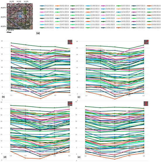
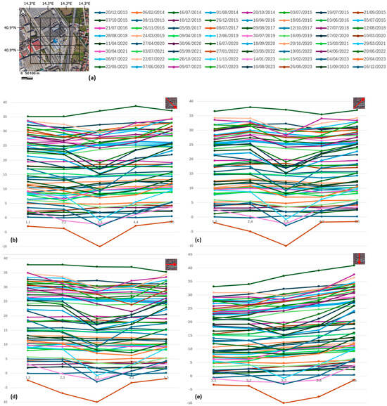
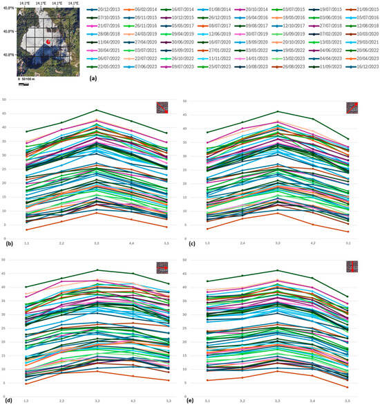
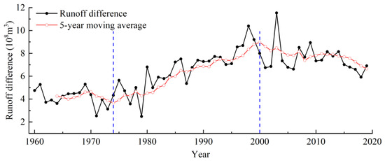
In recent years, the frequency and intensity of global extreme weather events have gradually increased, leading to significant changes in urban rainfall patterns. The uneven distribution of rainfall has caused varying degrees of water security issues in different regions. Accurately grasping the spatiotemporal distribution patterns of rainfall is crucial for understanding the hydrological cycle and predicting the availability of water resources. This study collected rainfall data every five minutes from 62 rain gauge stations in the main urban area of Kunming City from 2019 to 2021, constructing an unsupervised hybrid dimensionality reduction-clustering (HDRC) model. The model employs the Locally Linear Embedding (LLE) algorithm from manifold learning for dimensionality reduction of the data samples and uses the dynamic clustering K-Means algorithm for cluster analysis. The results show that the model categorizes the rainfall in the Kunming area into three types: The first type has its rainfall center distributed on the north shore of Dian Lake and the southern part of Kunming’s main urban area, with spatial dynamics showing the rainfall distribution gradually developing from the Dian Lake water body towards the land. The second type’s rainfall center is located in the northern mountainous area of Kunming, with a smaller spatial dynamic change trend. The water vapor has a relatively fixed and concentrated rainfall center due to the orographic uplift effect of the mountains. The third type’s rainfall center is located in the main urban area of Kunming, with this type of rainfall showing smaller variations in all indicators, mainly occurring in May and September when the temperature is lower, related to the urban heat island effect. This research provides a general workflow for spatial rainfall classification, capable of mining the spatiotemporal distribution patterns of regional rainfall based on extensive data and generating typical samples of rainfall types.
Full article
(This article belongs to the Special Issue Characteristics of Extreme Climate Events over China)


