Next Issue
Volume 12, February
Previous Issue
Volume 11, December


Geosciences, Volume 12, Issue 1 (January 2022) – 45 articles

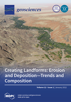
Cover Story (view full-size image): Landform series and their sedimentary deposits are the result of aeolian, mass wasting, cryogenic, fluvial, coastal–marine and lacustrine processes. The mapping of landforms and illustrating the trends and composition of their sedimentary deposits are tools to describe and numerically constrain the land-forming processes and the physical–chemical regime of formation (Eh and pH). Climate zonation and crustal maturity are the exogenous and endogenous “drivers”. This approach bridges the gap between a review and a hybrid manual fed by data generated by field work devoted to applied geosciences in extractive and environmental geology (“E & E issue”). View this paper.
  • Issues are regarded as officially published after their release is announced to the table of contents alert mailing list.
  • You may sign up for e-mail alerts to receive table of contents of newly released issues.
  • PDF is the official format for papers published in both, html and pdf forms. To view the papers in pdf format, click on the "PDF Full-text" link, and use the free Adobe Reader to open them.
Order results
Result details
Section
Select all
Export citation of selected articles as:
17 pages, 12285 KiB  
Article
Census-Based Typological Damage Fragility Curves and Seismic Risk Scenarios for Unreinforced Masonry Buildings
by Maria Zucconi and Luigi Sorrentino
Geosciences 2022, 12(1), 45; https://0-doi-org.brum.beds.ac.uk/10.3390/geosciences12010045 - 17 Jan 2022
Cited by 11 | Viewed by 2185
Abstract
Seismic risk assessment has become a crucial issue for optimal management of economic resources allocated to mitigation. For this purpose, in the last decades, several research activities were aimed to update hazard, exposure, and vulnerability models that contribute to seismic risk assessment. From [...] Read more.
Seismic risk assessment has become a crucial issue for optimal management of economic resources allocated to mitigation. For this purpose, in the last decades, several research activities were aimed to update hazard, exposure, and vulnerability models that contribute to seismic risk assessment. From this perspective, the present work focuses on developing new empirical damage fragility curves for census-based typological unreinforced masonry buildings. In particular, damage data observed after the 2009 L’Aquila earthquake, Italy, related to almost 57,000 residential buildings, were used to calibrate the fragility functions. These data were complemented with the census data with the aim of obtaining an accurate estimation of the number of undamaged buildings. Damage fragility curves were identified for typological building classes, defined considering parameters present in both post-earthquake observations and census data with the aim of extending the results to the whole national territory. Six typological classes were defined considering the categories of the construction timespan and of the state of repair parameters. Then, a further distinction of the typological classes considering the number of stories parameter was included where relevant. The fragility curves were defined as a function of peak ground acceleration for five damage states, defined according to the European macroseismic scale. The results confirmed that older buildings are more vulnerable than newer ones and highlighted the crucial role of the state of repair on the damage fragility curves. Finally, the new set of damage fragility functions was uploaded in the Italian Risk Maps information technology platform, used by the Civil Protection Department for risk evaluation, as an exemplification of the potential application of the fragility curves. Full article
Show Figures

Figure 1

29 pages, 6798 KiB  
Article
Arctic Inshore Biogeochemical Regime Influenced by Coastal Runoff and Glacial Melting (Case Study for the Templefjord, Spitsbergen)
by Maria Pogojeva, Alexander Polukhin, Petr Makkaveev, André Staalstrøm, Anfisa Berezina and Evgeniy Yakushev
Geosciences 2022, 12(1), 44; https://0-doi-org.brum.beds.ac.uk/10.3390/geosciences12010044 - 17 Jan 2022
Cited by 8 | Viewed by 2179
Abstract
Observations and predictions show that consequences of climate warming such as declining summer sea ice cover, melting glaciers, thawing permafrost, and increased river runoff to the Arctic Ocean will likely modify processes relevant to the freshwater and carbon budget, which in turn affect [...] Read more.
Observations and predictions show that consequences of climate warming such as declining summer sea ice cover, melting glaciers, thawing permafrost, and increased river runoff to the Arctic Ocean will likely modify processes relevant to the freshwater and carbon budget, which in turn affect high-latitude marine ecosystems. There is a knowledge gap in terms of understanding the seasonal variability of biogeochemical characteristics in coastal environments, first of all due to a lack of winter data. More data are also needed on the biogeochemical composition of different environmental media, i.e., sediments, snow, and ice. The aim of this work was to assess the current biogeochemical regime of a fjord system exposed to coastal runoff and glacial melting and discuss the possible consequences connected with climate warming. We used data from five expeditions to the Templefjord, West Spitsbergen, obtained in different seasons (February 2011, September 2011, March 2014, June 2015, and June 2017). In all the expeditions, the distributions of dissolved oxygen, nutrients, and carbonate system parameters in the water column were studied. The principal environmental media, i.e., seawater, bottom sediments, river water, sea ice, river ice, glacier ice, and snow, were sampled. The collected data allowed us to describe seasonal dynamics in the water column and to estimate the concentrations of the parameters under study in different environmental media. Our observations revealed the glacial and river footprints in the water column biogeochemistry; the glacial influence can be traced both in summer and in winter season. The results demonstrated the significant influence of coastal runoff and melted glacier water on the carbonate system and nutrient regime in the Templefjord, and can be extrapolated to other Arctic fjord systems. Full article
(This article belongs to the Section Cryosphere)
Show Figures

Figure 1

25 pages, 4290 KiB  
Article
Running across the Silurian/Devonian Boundary along Northern Gondwana: A Conodont Perspective
by Annalisa Ferretti, Maria Giovanna Corriga, Ladislav Slavík and Carlo Corradini
Geosciences 2022, 12(1), 43; https://0-doi-org.brum.beds.ac.uk/10.3390/geosciences12010043 - 17 Jan 2022
Cited by 5 | Viewed by 3037
Abstract
The Global Stratotype Section and Point (GSSP) of the Silurian/Devonian boundary, Lower Devonian Series and Lochkovian Stage was formally placed in 1977 at Klonk, in the Czech Republic, at the first appearance of the graptolite Uncinatograptus uniformis uniformis (Přibyl). However, since then, correlation [...] Read more.
The Global Stratotype Section and Point (GSSP) of the Silurian/Devonian boundary, Lower Devonian Series and Lochkovian Stage was formally placed in 1977 at Klonk, in the Czech Republic, at the first appearance of the graptolite Uncinatograptus uniformis uniformis (Přibyl). However, since then, correlation of this limit has been often hampered in carbonate facies where graptolites are uncommon or totally absent. A large calcareous deposition occurred at the Silurian/Devonian boundary along the northern and peri-Gondwana margin, thus representing an ideal location to select and test a possible additional biostratigraphic marker of the limit among conodonts. The first appearance of Caudicriodus hesperius almost simultaneously at the base of the Devonian in Bohemia, the Carnic Alps, Sardinia, Morocco and elsewhere indicates that this taxon is the conodont that best approximates the beginning of the Period. The first or last appearance of other species (e.g., Ozarkodina confluens, Zieglerodina klonkensis, Z. remscheidensis and Caudicriodus woschmidti) may help to recognise the boundary as well. Full article
Show Figures

Figure 1

21 pages, 3494 KiB  
Review
Benthic Foraminifera as Environmental Indicators in Mediterranean Marine Caves: A Review
by Elena Romano, Luisa Bergamin and Mario Parise
Geosciences 2022, 12(1), 42; https://0-doi-org.brum.beds.ac.uk/10.3390/geosciences12010042 - 16 Jan 2022
Cited by 11 | Viewed by 4359
Abstract
Marine caves are characterized by wide environmental variability for the interaction between marine and continental processes. Their conditions may be defined as extreme for inhabiting organisms due to the enclosed morphology, lack of light, and scarcity of nutrients. Therefore, it is necessary to [...] Read more.
Marine caves are characterized by wide environmental variability for the interaction between marine and continental processes. Their conditions may be defined as extreme for inhabiting organisms due to the enclosed morphology, lack of light, and scarcity of nutrients. Therefore, it is necessary to identify reliable ecological indicators for describing and assessing environmental conditions in these habitats even more than elsewhere. This review aims to provide the state of art related to the application of benthic foraminifera as proxies in the (paleo)ecological characterization of different habitats of marine caves. Special attention was addressed to a research project focused on Mediterranean marine caves with different characteristics, such as extent, morphology, freshwater influence, salinity, sediment type, oxygenation, and organic matter supply. This review aims to illustrate the reliability of foraminifera as an ecological and paleoecological indicator in these habitats. They respond to various environmental conditions with different assemblages corresponding to a very detailed habitat partitioning. Because marine caves may be considered natural laboratories for environmental variability, the results of these studies may be interpreted in the perspective of the global variability to understand the environmental drivers of future changes in marine systems. Full article
(This article belongs to the Special Issue Recent and Fossil Submarine Caves)
Show Figures

Figure 1

30 pages, 17393 KiB  
Article
Effect of Geometric Parameters and Construction Sequence on Ground Settlement of Offset Arrangement Twin Tunnels
by Md Shariful Islam and Magued Iskander
Geosciences 2022, 12(1), 41; https://0-doi-org.brum.beds.ac.uk/10.3390/geosciences12010041 - 14 Jan 2022
Cited by 4 | Viewed by 2348
Abstract
A parametric study that examines the ground surface settlement due to the excavation of shallow offset arrangement twin tunnels is presented. Offset arrangement tunnels are those that run parallel to each other, but at different elevations. The study focuses on the influence of [...] Read more.
A parametric study that examines the ground surface settlement due to the excavation of shallow offset arrangement twin tunnels is presented. Offset arrangement tunnels are those that run parallel to each other, but at different elevations. The study focuses on the influence of both the construction sequence and various geometric parameters on the induced soil settlement. A series of three-dimensional finite element analyses was carried out to investigate the settlement behavior and interactions between offset arrangement twin tunnels excavated in clay using a simplified mechanized excavation method. Analyses were carried out for three cover-to-diameter (C/D) ratios, three possible construction sequences, five angular relative positions, and five angular spacings. In addition, settlement data were also investigated by varying horizontal and vertical spacings while keeping the angular spacing constant. The total settlement of the excavated twin tunnels and the settlement induced solely by the new second tunnel are both presented, and special attention was paid to identifying the dominant geometric parameters. The observed data trends from this study are generally consistent with the limited data available in the literature. This study confirmed a few perceived behaviors. First, angular relative position better describes the settlement behavior in comparison to angular spacing. Second, the effect of the vertical distance is noticeably more significant than that of the horizontal distance between the two tunnels. Third, excavation of the lower tunnel at first induces higher total ground settlement than when the upper tunnel is excavated first or when both tunnels are excavated concurrently. Fourth, settlement due to the construction of the newer tunnel decreases with the increase in the cover depth. In addition, two design charts have been proposed to calculate the settlement induced from a new second tunnel excavation and the eccentricity of the maximum total settlement relative to the center of the new tunnel. Full article
(This article belongs to the Collection New Advances in Geotechnical Engineering)
Show Figures

Figure 1

12 pages, 2866 KiB  
Article
ICESat-2 Applications for Investigating Emerging Volcanoes
by Christine Simurda, Lori A. Magruder, Jonathan Markel, James B. Garvin and Daniel A. Slayback
Geosciences 2022, 12(1), 40; https://0-doi-org.brum.beds.ac.uk/10.3390/geosciences12010040 - 14 Jan 2022
Cited by 5 | Viewed by 3458
Abstract
Submarine volcanism in shallow waters (<100 m), particularly in remote settings, is difficult to monitor quantitatively and, in the rare formation of islands, it is challenging to understand the rapid-paced erosion. However, these newly erupted volcanic islands become observable to airborne and/or satellite [...] Read more.
Submarine volcanism in shallow waters (<100 m), particularly in remote settings, is difficult to monitor quantitatively and, in the rare formation of islands, it is challenging to understand the rapid-paced erosion. However, these newly erupted volcanic islands become observable to airborne and/or satellite remote sensing instruments. NASA’s ICESat-2 satellite laser altimeter, combined with visible imagery (optical and microwave), provide a novel method of evaluating the elevation characteristics of newly emerged volcanoes and their subaerial eruption products. Niijima Fukutoku-Okanoba (NFO) is a submarine volcano 1300 km south of Tokyo (Ogasawara Archipelago of Japan) that periodically breaches the ocean surface to create new islands that are subsequently eroded. The recent eruption in August 2021 is a rare opportunity to investigate this island evolution using high-resolution satellite datasets with geodetic-quality ICESat-2 altimetry. Lansdat-8 and Planet imagery provide a qualitative analysis of the exposed volcanic deposits, while ICESat-2 products provide elevation profiles necessary to quantify the physical surface structures. This investigation determines an innovative application for ICESat-2 data in evaluating newly emerged islands and how the combination of satellite remote sensing (visible and lidar) to investigate these short-lived volcanic features can improve our understanding of the volcanic island system in ways not previously possible. Full article
(This article belongs to the Special Issue Scientific Assessment of Recent Natural Hazard Events)
Show Figures

Figure 1

20 pages, 13908 KiB  
Article
Age of the Most Extensive Glaciation in the Alps
by Catharina Dieleman, Marcus Christl, Christof Vockenhuber, Philip Gautschi, Hans Rudolf Graf and Naki Akçar
Geosciences 2022, 12(1), 39; https://0-doi-org.brum.beds.ac.uk/10.3390/geosciences12010039 - 13 Jan 2022
Cited by 7 | Viewed by 3187
Abstract
Previous research suggested that the Alpine glaciers of the Northern Swiss Foreland reached their maximum extensive position during the Middle Pleistocene. Relict tills and glaciofluvial deposits, attributed to the Most Extensive Glaciation (MEG), have been found only beyond the extents of the Last [...] Read more.
Previous research suggested that the Alpine glaciers of the Northern Swiss Foreland reached their maximum extensive position during the Middle Pleistocene. Relict tills and glaciofluvial deposits, attributed to the Most Extensive Glaciation (MEG), have been found only beyond the extents of the Last Glacial Maximum (LGM). Traditionally, these sediments have been correlated to the Riss glaciation sensu Penck and Brückner and have been morphostratigraphically classified as the Higher Terrace (HT) deposits. The age of the MEG glaciation was originally proposed to be intermediate to the Brunhes/Matuyama transition (780 ka) and the Marine Isotope Stage 6 (191 ka). In this study, we focused on the glacial deposits in Möhlin (Canton of Aargau, Switzerland), in order to constrain the age of the MEG. The sediments from these deposits were analyzed to determine the provenance and depositional environments. We applied isochron-burial dating, with cosmogenic 10Be and 26Al, to the till layer in the Bünten gravel pit near Möhlin. Our results indicate that a glacier of Alpine origin reached its most extensive position during the Middle Pleistocene (500 ± 100 ka). The age of the MEG thus appears to be synchronous with the most extensive glaciations in the northern hemisphere. Full article
(This article belongs to the Special Issue Cutting Edge Earth Sciences: Three Decades of Cosmogenic Nuclides)
Show Figures

Figure 1

20 pages, 1324 KiB  
Review
Biomolecular Composition of Sea Ice Microalgae and Its Influence on Marine Biogeochemical Cycling and Carbon Transfer through Polar Marine Food Webs
by Rebecca Julianne Duncan and Katherina Petrou
Geosciences 2022, 12(1), 38; https://0-doi-org.brum.beds.ac.uk/10.3390/geosciences12010038 - 13 Jan 2022
Cited by 9 | Viewed by 3445
Abstract
Microalgae growing on the underside of sea ice are key primary producers in polar marine environments. Their nutritional status, determined by their macromolecular composition, contributes to the region’s biochemistry and the unique temporal and spatial characteristics of their growth makes them essential for [...] Read more.
Microalgae growing on the underside of sea ice are key primary producers in polar marine environments. Their nutritional status, determined by their macromolecular composition, contributes to the region’s biochemistry and the unique temporal and spatial characteristics of their growth makes them essential for sustaining polar marine food webs. Here, we review the plasticity and taxonomic diversity of sea ice microalgae macromolecular composition, with a focus on how different environmental conditions influence macromolecular production and partitioning within cells and communities. The advantages and disadvantages of methodologies for assessing macromolecular composition are presented, including techniques that provide high throughput, whole macromolecular profile and/or species-specific resolution, which are particularly recommended for future studies. The directions of environmentally driven macromolecular changes are discussed, alongside anticipated consequences on nutrients supplied to the polar marine ecosystem. Given that polar regions are facing accelerated rates of environmental change, it is argued that a climate change signature will become evident in the biochemical composition of sea ice microalgal communities, highlighting the need for further research to understand the synergistic effects of multiple environmental stressors. The importance of sea ice microalgae as primary producers in polar marine ecosystems means that ongoing research into climate-change driven macromolecular phenotyping is critical to understanding the implications for the regions biochemical cycling and carbon transfer. Full article
(This article belongs to the Special Issue Biogeochemistry of Arctic and Antarctic Sea Ice)
Show Figures

Figure 1

27 pages, 8018 KiB  
Article
Fault-Related Fluid Flow Implications for Unconventional Hydrocarbon Development, Beetaloo Sub-Basin (Northern Territory, Australia)
by Emanuelle Frery, Conor Byrne, Russell Crosbie, Alec Deslandes, Tim Evans, Christoph Gerber, Cameron Huddlestone-Holmes, Jelena Markov, Jorge Martinez, Matthias Raiber, Chris Turnadge, Axel Suckow and Cornelia Wilske
Geosciences 2022, 12(1), 37; https://0-doi-org.brum.beds.ac.uk/10.3390/geosciences12010037 - 12 Jan 2022
Cited by 3 | Viewed by 2788
Abstract
This study assesses potential geological connections between the unconventional petroleum plays in the Beetaloo Sub-basin, regional aquifers in overlying basins, and the near surface water assets in the Beetaloo Sub-basin Northern Territory, Australia. To do so, we built an innovative multi-disciplinary toolbox including [...] Read more.
This study assesses potential geological connections between the unconventional petroleum plays in the Beetaloo Sub-basin, regional aquifers in overlying basins, and the near surface water assets in the Beetaloo Sub-basin Northern Territory, Australia. To do so, we built an innovative multi-disciplinary toolbox including multi-physics and multi-depth imaging of the geological formations, as well as the study of potentially active tectonic surface features, which we combined with measurement of the helium content in water sampled in the aquifer systems and a comparative analysis of the surface drainage network and fault lineaments orientation. Structures, as well as potential natural active and paleo-fluid or gas leakage pathways, were imaged with a reprocessing and interpretation of existing and newly acquired Beetaloo seismic reflection 2D profiles and magnetic datasets to determine potential connections and paleo-leakages. North to north-northwest trending strike slip faults, which have been reactivated in recent geological history, are controlling the deposition at the edges of the Beetaloo Sub-basin. There are two spring complexes associated with this system, the Hot Spring Valley at the northern edge of the eastern Beetaloo Sub-basin and the Mataranka Springs 10 km north of the western sub-basin. Significant rectangular stream diversions in the Hot Spring Valley also indicates current or recently active tectonics. This suggests that those deep-rooted fault systems are likely to locally connect the shallow unconfined aquifer with a deeper gas or fluid source component, possibly without connection with the Beetaloo unconventional prospective plays. However, the origin and flux of this deeper source is unknown and needs to be further investigated to assess if deep circulation is happening through the identified stratigraphic connections. Few north-west trending post-Cambrian fault segments have been interpreted in prospective zones for dry gas plays of the Velkerri Formation. The segments located in the northern part of the eastern Beetaloo Sub-basin do not show any evidence of modern leakages. The segments located around Elliot, in the south of the eastern Beetaloo Sub-basin, as well as low-quality seismic imaging of potential faults in the central part of the western sub-basin, could have been recently reactivated. They could act as open pathways of fluid and gas leakage, sourced from the unconventional plays, deeper formations of the Beetaloo Sub-basin or even much deeper origin, excluding the mantle on the basis of low 3He/4He ratios. In those areas, the data are sparse and of poor quality; further field work is necessary to assess whether such pathways are currently active. Full article
(This article belongs to the Special Issue Geogases in Fault Zones)
Show Figures

Figure 1

20 pages, 7357 KiB  
Article
Diachronous Redistribution of Hf and Nd Isotopes at the Crystal Scale—Consequences for the Isotopic Evolution of a Poly-Metamorphic Crustal Terrane
by Adrien Vezinet, Emilie Thomassot, Yan Luo, Chiranjeeb Sarkar and D. Graham Pearson
Geosciences 2022, 12(1), 36; https://0-doi-org.brum.beds.ac.uk/10.3390/geosciences12010036 - 12 Jan 2022
Cited by 1 | Viewed by 1940
Abstract
In metamorphic rocks, mineral species react over a range of pressure–temperature conditions that do not necessarily overlap. Mineral equilibration can occur at varied points along the metamorphic pressure–temperature (PT) path, and thus at different times. The sole or dominant use of zircon isotopic [...] Read more.
In metamorphic rocks, mineral species react over a range of pressure–temperature conditions that do not necessarily overlap. Mineral equilibration can occur at varied points along the metamorphic pressure–temperature (PT) path, and thus at different times. The sole or dominant use of zircon isotopic compositions to constrain the evolution of metamorphic rocks might then inadvertently skew geological interpretations towards one aspect or one moment of a rock’s history. Here, we present in-situ U–Pb/Sm–Nd isotope analyses of the apatite crystals extracted from two meta-igneous rocks exposed in the Saglek Block (North Atlantic craton, Canada), an Archean metamorphic terrane, with the aim of examining the various signatures and events that they record. The data are combined with published U–Pb/Hf/O isotope compositions of zircon extracted from the same hand-specimens. We found an offset of nearly ca. 1.5 Gyr between U-Pb ages derived from the oldest zircon cores and apatite U–Pb/Sm–Nd isotopic ages, and an offset of ca. 200 Ma between the youngest zircon metamorphic overgrowths and apatite. These differences in metamorphic ages recorded by zircon and apatite mean that the redistribution of Hf isotopes (largely hosted in zircon) and Nd isotopes (largely hosted in apatite within these rocks), were not synchronous at the hand-specimen scale (≤~0.001 m3). We propose that the diachronous redistribution of Hf and Nd isotopes and their parent isotopes was caused by the different PT conditions of growth equilibration between zircon and apatite during metamorphism. These findings document the latest metamorphic evolution of the Saglek Block, highlighting the role played by intra-crustal reworking during the late-Archean regional metamorphic event. Full article
(This article belongs to the Section Geochemistry)
Show Figures

Figure 1

23 pages, 2854 KiB  
Article
Lab-Scale Permeability Enhancement by Chemical Treatment in Fractured Granite (Cornubian Batholith) for the United Downs Deep Geothermal Power Project, Cornwall (UK)
by Katja E. Schulz, Kristian Bär and Ingo Sass
Geosciences 2022, 12(1), 35; https://0-doi-org.brum.beds.ac.uk/10.3390/geosciences12010035 - 12 Jan 2022
Cited by 3 | Viewed by 2736
Abstract
A hydrothermal doublet system was drilled in a fault-related granitic reservoir in Cornwall. It targets the Porthtowan Fault Zone (PTF), which transects the Carnmenellis granite, one of the onshore plutons of the Cornubian Batholith in SW England. At 5058 m depth (TVD, 5275 [...] Read more.
A hydrothermal doublet system was drilled in a fault-related granitic reservoir in Cornwall. It targets the Porthtowan Fault Zone (PTF), which transects the Carnmenellis granite, one of the onshore plutons of the Cornubian Batholith in SW England. At 5058 m depth (TVD, 5275 m MD) up to 190 °C were reached in the dedicated production well. The injection well is aligned vertically above the production well and reaches a depth of 2393 m MD. As part of the design process for potential chemical stimulation of the open-hole sections of the hydrothermal doublet, lab-scale acidification experiments were performed on outcrop analogue samples from the Cornubian Batholith, which include mineralised veins. The experimental setup comprised autoclave experiments on sample powder and plugs, and core flooding tests on sample plugs to investigate to what degree the permeability of natural and artificial (saw-cut) fractures can be enhanced. All samples were petrologically and petrophysically analysed before and after the acidification experiments to track all changes resulting from the acidification. Based on the comparison of the mineralogical composition of the OAS samples with the drill cuttings from the production well, the results can be transferred to the hydrothermally altered zones around the faults and fractures of the PTF. Core Flooding Tests and Autoclave Experiments result in permeability enhancement factors of 4 to >20 and 0.1 to 40, respectively. Mineral reprecipitation can be avoided in the stimulated samples by sufficient post-flushing. Full article
Show Figures

Figure 1

13 pages, 4873 KiB  
Article
Application of the Controlled Source Radiomagnetotellurics (CSRMT) in the Study of Rocks Overlying Kimberlite Pipes in Yakutia/Siberia
by Alexander K. Saraev, Arseny A. Shlykov and Buelent Tezkan
Geosciences 2022, 12(1), 34; https://0-doi-org.brum.beds.ac.uk/10.3390/geosciences12010034 - 12 Jan 2022
Cited by 4 | Viewed by 1940
Abstract
Тhe task of searching for kimberlite pipes in covered areas of the Yakutia kimberlite province is very difficult due to the significant heterogeneity of the rocks overlying kimberlite pipes. The overlying strata of terrigenous sediments contain rocks of the trap complex (dolerite sills, [...] Read more.
Тhe task of searching for kimberlite pipes in covered areas of the Yakutia kimberlite province is very difficult due to the significant heterogeneity of the rocks overlying kimberlite pipes. The overlying strata of terrigenous sediments contain rocks of the trap complex (dolerite sills, tuff bodies). We consider the results of the controlled source radiomagnetotelluric (CSRMT) soundings in Yakutia/Siberia. Due to the great thickness of the overlying rocks (near 100 m) and the relatively small horizontal sizes of kimberlite pipes (80–200 m), they cannot confidently be detected directly. An additional difficulty in identifying pipe anomalies is the presence of a layer of conductive carbonaceous siltstones in the overlying strata. Therefore, the main aim of the CSRMT surveys was the study of overlying rocks and the search for indirect indications of the presence of pipes. Possibilities to study the structure of dolerite sills located within overlying sediments and to map the top edge of hosting carbonate rocks are demonstrated using the CSRMT data. The pinching out of dolerite sills above pipes («windows in traps») and the lowering of the top edge of hosting rocks at pipes can be considered as indirect indications of the presence of pipes. Full article
(This article belongs to the Special Issue Applications of EM Methods for Subsurface Exploration)
Show Figures

Figure 1

16 pages, 5448 KiB  
Article
The Evolution of Preseismic Patterns Related to the Central Crete (Mw6.0) Strong Earthquake on 27 September 2021 Revealed by Multiresolution Wavelets and Natural Time Analysis
by Filippos Vallianatos, Georgios Michas, George Hloupis and Georgios Chatzopoulos
Geosciences 2022, 12(1), 33; https://0-doi-org.brum.beds.ac.uk/10.3390/geosciences12010033 - 10 Jan 2022
Cited by 11 | Viewed by 2251
Abstract
On 27 September 2021, a shallow earthquake with focal depth of 10 km and moment magnitude Mw6.0 occurred onshore in central Crete (Greece). The evolution of possible preseismic patterns in the area of central Crete before the Mw6.0 event [...] Read more.
On 27 September 2021, a shallow earthquake with focal depth of 10 km and moment magnitude Mw6.0 occurred onshore in central Crete (Greece). The evolution of possible preseismic patterns in the area of central Crete before the Mw6.0 event was investigated by applying the method of multiresolution wavelet analysis (MRWA), along with that of natural time (NT). The monitoring of preseismic patterns by critical parameters defined by NT analysis, integrated with the results of MRWA as the initiation point for the NT analysis, forms a promising framework that may lead to new universal principles that describe the evolution patterns before strong earthquakes. Initially, we apply MRWA to the interevent time series of the successive regional earthquakes in order to investigate the approach of the regional seismicity towards critical stages and to define the starting point of the natural time domain. Then, using the results of MRWA, we apply the NT analysis, showing that the regional seismicity approached criticality for a prolonged period of ~40 days before the occurrence of the Mw6.0 earthquake, when the κ1 natural time parameter reached the critical value of κ1 = 0.070, as suggested by the NT method. Full article
(This article belongs to the Special Issue Morphogenic Faulting: Current Practices and Future Challenges)
Show Figures

Figure 1

17 pages, 3200 KiB  
Article
First Observation of Unicellular Organisms Concentrating Arsenic in ACC Intracellular Inclusions in Lake Waters
by Agathe Martignier, Montserrat Filella, Jean-Michel Jaquet, Mathieu Coster and Daniel Ariztegui
Geosciences 2022, 12(1), 32; https://0-doi-org.brum.beds.ac.uk/10.3390/geosciences12010032 - 08 Jan 2022
Viewed by 1351
Abstract
In unicellular organisms, intracellular inclusions of amorphous calcium carbonate (ACC) were initially described in cyanobacteria and, later, in unicellular eukaryotes from Lake Geneva (Switzerland/France). Inclusions in unicellular eukaryotes, named micropearls, consist of hydrated ACCs, frequently enriched in Sr or Ba, and displaying internal [...] Read more.
In unicellular organisms, intracellular inclusions of amorphous calcium carbonate (ACC) were initially described in cyanobacteria and, later, in unicellular eukaryotes from Lake Geneva (Switzerland/France). Inclusions in unicellular eukaryotes, named micropearls, consist of hydrated ACCs, frequently enriched in Sr or Ba, and displaying internal oscillatory zonations, due to variations in the Ba:Ca or Sr:Ca ratios. An analysis of our database, consisting of 1597 micropearl analyses from Lake Geneva and 34 from Lake Titicaca (Bolivia/Peru), showed that a certain number of Sr- and Ba-enriched micropearls from these lakes contain As in amounts measurable by EDXS. A Q-mode statistical analysis confirmed the existence of five chemically distinct morpho-chemical groups of As-bearing micropearls, among which was a new category identified in Lake Geneva, where As is often associated with Mg. This new type of micropearl is possibly produced in a small (7–12 μm size) bi-flagellated organism. Micropearls from Lake Titicaca, which contain Sr, were found in an organism very similar to Tetraselmis cordiformis, which was observed earlier in Lake Geneva. Lake Titicaca micropearls contain larger As amounts, which can be explained by the high As concentration in the water of this lake. The ubiquity of this observed biomineralization process points to the need for a better understanding of the role of amorphous or crystalline calcium carbonates in As cycling in surface waters. Full article
(This article belongs to the Special Issue Current and Future Perspectives in Microbial Carbonate Precipitation)
Show Figures

Figure 1

14 pages, 2121 KiB  
Article
Effects of Artificial Sweat Formulation and Extraction Temperature on Estimation of the Dermal Bioaccessibility of Potentially Toxic Elements in a Contaminated Soil from an E-Waste Recycling Site
by Oluwaseun H. Anselm, Christine M. Davidson, Aderonke O. Oyeyiola and Temilola O. Oluseyi
Geosciences 2022, 12(1), 31; https://0-doi-org.brum.beds.ac.uk/10.3390/geosciences12010031 - 07 Jan 2022
Cited by 3 | Viewed by 1930
Abstract
Informal recycling of electronic waste leads to soil contamination that can impact human health. To accurately assess exposure to potentially toxic elements (PTE) in soil it is necessary to consider their bioavailability through ingestion, inhalation and dermal contact. However, bioaccessibility tests that estimate [...] Read more.
Informal recycling of electronic waste leads to soil contamination that can impact human health. To accurately assess exposure to potentially toxic elements (PTE) in soil it is necessary to consider their bioavailability through ingestion, inhalation and dermal contact. However, bioaccessibility tests that estimate dermal absorption following adhesion of contaminated soil particles to skin are not well established. In this study the concentrations of As, Cd, Cr, Cu, Fe, Mn, Ni, Pb and Zn were estimated in the <45 µm particle size fraction of a bulk composite soil from an e-waste recycling site using five different artificial sweat formulations. Extractions were performed at temperatures ranging from 17 to 47 °C to investigate the effect of ambient temperature on bioaccessibility. Results obtained using the different artificial sweats were not consistent with one another. In particular, the NIHS 96-10 formulation solubilized larger amounts of analytes (ranging from 6.3 times the next most effective extractant for Cu to 1700 times the next most effective for Pb). There was a general increase in release of PTE with increasing temperature, except for As. Although trends varied between analytes and formulations, this highlights the need to consider ambient temperature when estimating dermal bioaccessibility of PTE in soil. Full article
(This article belongs to the Special Issue Medical Geology in the Urban Environment)
Show Figures

Figure 1

16 pages, 6566 KiB  
Article
Finite-Element Modeling of Spontaneous Potential in an Axisymmetric Reservoir Model with Account of Its Shale Content
by Mikhail Epov, Anastasia Glinskikh and Oleg Nechaev
Geosciences 2022, 12(1), 30; https://0-doi-org.brum.beds.ac.uk/10.3390/geosciences12010030 - 07 Jan 2022
Cited by 2 | Viewed by 1386
Abstract
(1) This article is devoted to the development of a theoretical and algorithmic basis for numerical modeling of the spontaneous potential method (SP) as applied to the study of sandy-argillaceous reservoirs. (2) In terms of coupled flows, we consider a physical–mathematical model of [...] Read more.
(1) This article is devoted to the development of a theoretical and algorithmic basis for numerical modeling of the spontaneous potential method (SP) as applied to the study of sandy-argillaceous reservoirs. (2) In terms of coupled flows, we consider a physical–mathematical model of SP signals from an electrochemical source, with regards to the case of fluid-saturated shaly sandstone. (3) An algorithm for 2D finite-element modeling of SP signals was developed and implemented in software, along with its internal and external testing with analytical solutions. The numerical SP modeling was carried out, determining the dependences on the reservoir thickness and porosity, the amount of argillaceous material and the type of minerals. We performed a comparative analysis of the simulated and field SP data, using the results of laboratory core examinations taken from wells in a number of fields in the Latitudinal Ob Region of Western Siberia. (4) The results of the study may be used either for the development of the existing SP techniques, by providing them with a consistent computational model, or for the design of new experimental approaches. Full article
Show Figures

Figure 1

60 pages, 10119 KiB  
Review
Adakites, High-Nb Basalts and Copper–Gold Deposits in Magmatic Arcs and Collisional Orogens: An Overview
by Pavel Kepezhinskas, Nikolai Berdnikov, Nikita Kepezhinskas and Natalia Konovalova
Geosciences 2022, 12(1), 29; https://0-doi-org.brum.beds.ac.uk/10.3390/geosciences12010029 - 07 Jan 2022
Cited by 15 | Viewed by 3755
Abstract
Adakites are Y- and Yb-depleted, SiO2- and Sr-enriched rocks with elevated Sr/Y and La/Yb ratios originally thought to represent partial melts of subducted metabasalt, based on their association with the subduction of young (<25 Ma) and hot oceanic crust. Later, adakites [...] Read more.
Adakites are Y- and Yb-depleted, SiO2- and Sr-enriched rocks with elevated Sr/Y and La/Yb ratios originally thought to represent partial melts of subducted metabasalt, based on their association with the subduction of young (<25 Ma) and hot oceanic crust. Later, adakites were found in arc segments associated with oblique, slow and flat subduction, arc–transform intersections, collision zones and post-collisional extensional environments. New models of adakite petrogenesis include the melting of thickened and delaminated mafic lower crust, basalt underplating of the continental crust and high-pressure fractionation (amphibole ± garnet) of mantle-derived, hydrous mafic melts. In some cases, adakites are associated with Nb-enriched (10 ppm < Nb < 20 ppm) and high-Nb (Nb > 20 ppm) arc basalts in ancient and modern subduction zones (HNBs). Two types of HNBs are recognized on the basis of their geochemistry. Type I HNBs (Kamchatka, Honduras) share N-MORB-like isotopic and OIB-like trace element characteristics and most probably originate from adakite-contaminated mantle sources. Type II HNBs (Sulu arc, Jamaica) display high-field strength element enrichments in respect to island-arc basalts coupled with enriched, OIB-like isotopic signatures, suggesting derivation from asthenospheric mantle sources in arcs. Adakites and, to a lesser extent, HNBs are associated with Cu–Au porphyry and epithermal deposits in Cenozoic magmatic arcs (Kamchatka, Phlippines, Indonesia, Andean margin) and Paleozoic-Mesozoic (Central Asian and Tethyan) collisional orogens. This association is believed to be not just temporal and structural but also genetic due to the hydrous (common presence of amphibole and biotite), highly oxidized (>ΔFMQ > +2) and S-rich (anhydrite in modern Pinatubo and El Chichon adakite eruptions) nature of adakite magmas. Cretaceous adakites from the Stanovoy Suture Zone in Far East Russia contain Cu–Ag–Au and Cu–Zn–Mo–Ag alloys, native Au and Pt, cupriferous Ag in association witn barite and Ag-chloride. Stanovoy adakites also have systematically higher Au contents in comparison with volcanic arc magmas, suggesting that ore-forming hydrothermal fluids responsible for Cu–Au(Mo–Ag) porphyry and epithermal mineralization in upper crustal environments could have been exsolved from metal-saturated, H2O–S–Cl-rich adakite magmas. The interaction between depleted mantle peridotites and metal-rich adakites appears to be capable of producing (under a certain set of conditions) fertile sources for HNB melts connected with some epithermal Au (Porgera) and porphyry Cu–Au–Mo (Tibet, Iran) mineralized systems in modern and ancient subduction zones. Full article
Show Figures

Figure 1

22 pages, 5531 KiB  
Perspective
Inclusions of Amorphous and Crystalline SiO2 in Minerals from Itrongay (Madagascar) and Other Evidence for the Natural Occurrence of Hydrosilicate Fluids
by Daniil V. Popov, Richard A. Spikings and Théodore Razakamanana
Geosciences 2022, 12(1), 28; https://0-doi-org.brum.beds.ac.uk/10.3390/geosciences12010028 - 07 Jan 2022
Cited by 1 | Viewed by 2320
Abstract
Experimental studies increasingly often report low-temperature (200–800 °C) and low-pressure (0.05–3 kbar) hydrosilicate fluids with >40 wt.% of SiO2 and >10 wt.% of H2O. Compositionally similar fluids were long suggested to potentially exist in natural systems such as pegmatites and [...] Read more.
Experimental studies increasingly often report low-temperature (200–800 °C) and low-pressure (0.05–3 kbar) hydrosilicate fluids with >40 wt.% of SiO2 and >10 wt.% of H2O. Compositionally similar fluids were long suggested to potentially exist in natural systems such as pegmatites and hydrothermal veins. However, they are rarely invoked in recent petrogenetic models, perhaps because of the scarcity of direct evidence for their natural occurrence. Here we review such evidence from previous works and add to this by documenting inclusions of hydrosilicate fluids in quartz and feldspar from Itrongay. The latter comprise opal-A, opal-CT, moganite and quartz inclusions that frequently contain H2O and have negative crystal shapes. They coexist with inclusions of CO2- and H2O-rich fluids and complex polycrystalline inclusions containing chlorides, sulphates, carbonates, arsenates, oxides, hydroxides and silicates, which we interpret as remnants of saline liquids. Collectively, previous studies and our new results indicate that hydrosilicate fluids may be common in the Earth’s crust, although their tendency to transform into quartz upon cooling and exhumation renders them difficult to recognise. These data warrant more comprehensive research into the nature of such hydrosilicate fluids and their distribution across a wide range of pressure and temperature conditions and geological systems. Full article
(This article belongs to the Section Geochemistry)
Show Figures

Figure 1

23 pages, 851 KiB  
Review
A Survey of Uncertainty Quantification in Machine Learning for Space Weather Prediction
by Talha Siddique, Md Shaad Mahmud, Amy M. Keesee, Chigomezyo M. Ngwira and Hyunju Connor
Geosciences 2022, 12(1), 27; https://0-doi-org.brum.beds.ac.uk/10.3390/geosciences12010027 - 07 Jan 2022
Cited by 19 | Viewed by 4947
Abstract
With the availability of data and computational technologies in the modern world, machine learning (ML) has emerged as a preferred methodology for data analysis and prediction. While ML holds great promise, the results from such models are not fully unreliable due to the [...] Read more.
With the availability of data and computational technologies in the modern world, machine learning (ML) has emerged as a preferred methodology for data analysis and prediction. While ML holds great promise, the results from such models are not fully unreliable due to the challenges introduced by uncertainty. An ML model generates an optimal solution based on its training data. However, if the uncertainty in the data and the model parameters are not considered, such optimal solutions have a high risk of failure in actual world deployment. This paper surveys the different approaches used in ML to quantify uncertainty. The paper also exhibits the implications of quantifying uncertainty when using ML by performing two case studies with space physics in focus. The first case study consists of the classification of auroral images in predefined labels. In the second case study, the horizontal component of the perturbed magnetic field measured at the Earth’s surface was predicted for the study of Geomagnetically Induced Currents (GICs) by training the model using time series data. In both cases, a Bayesian Neural Network (BNN) was trained to generate predictions, along with epistemic and aleatoric uncertainties. Finally, the pros and cons of both Gaussian Process Regression (GPR) models and Bayesian Deep Learning (DL) are weighed. The paper also provides recommendations for the models that need exploration, focusing on space weather prediction. Full article
Show Figures

Figure 1

18 pages, 175671 KiB  
Article
Evaluation of a Semi-Airborne Electromagnetic Survey Based on a Multicopter Aircraft System
by Philipp O. Kotowski, Michael Becken, Anneke Thiede, Volkmar Schmidt, Jörg Schmalzl, Stefan Ueding and Stefan Klingen
Geosciences 2022, 12(1), 26; https://0-doi-org.brum.beds.ac.uk/10.3390/geosciences12010026 - 07 Jan 2022
Cited by 10 | Viewed by 2734
Abstract
The semi-airborne electromagnetic (EM) method has the potential to reach deeper exploration depths than purely airborne EM approaches. The concept of the method is to deploy high-power transmitters on the ground, which excite subsurface currents and induce strong magnetic fields, and to measure [...] Read more.
The semi-airborne electromagnetic (EM) method has the potential to reach deeper exploration depths than purely airborne EM approaches. The concept of the method is to deploy high-power transmitters on the ground, which excite subsurface currents and induce strong magnetic fields, and to measure the corresponding EM fields with a passive airborne receiver instrument. Following recent conceptual developments of the semi-airborne EM technique deployed on helicopters, we performed a 10 km2 semi-airborne EM survey near Münster (Germany) based on a multicopter aircraft system. For this purpose, horizontal electric dipole (HED) transmitters were installed in the survey area and were surveyed individually. Magnetic transfer functions were determined and a model of the conductivity of the study area was derived. Despite restrictions such as low payload capacity and multicopter-related EM noise, we were able to estimate spatially and spectrally consistent transfer functions of high quality up to a distance of 2 km from the respective transmitter. Our results could be validated with independent results from a magnetotelluric and a direct current sounding. The study demonstrates that an unmanned aircraft system (UAS) is suitable for semi-airborne EM application and that such a system can be beneficial where ground-based methods and manned techniques become impractical. Full article
(This article belongs to the Special Issue Applications of EM Methods for Subsurface Exploration)
Show Figures

Figure 1

17 pages, 4623 KiB  
Article
Experimental and Numerical Investigation of a Dissipative Connection for the Seismic Retrofit of Precast RC Industrial Sheds
by Virginio Quaglini, Carlo Pettorruso, Eleonora Bruschi and Luca Mari
Geosciences 2022, 12(1), 25; https://0-doi-org.brum.beds.ac.uk/10.3390/geosciences12010025 - 06 Jan 2022
Cited by 5 | Viewed by 1708
Abstract
Past earthquakes have highlighted the seismic vulnerability of prefabricated industrial sheds typical of past Italian building practices. Such buildings typically exhibited rigid collapse mechanisms due to the absence of rigid links between columns, beams, and roof elements. This study aims at presenting the [...] Read more.
Past earthquakes have highlighted the seismic vulnerability of prefabricated industrial sheds typical of past Italian building practices. Such buildings typically exhibited rigid collapse mechanisms due to the absence of rigid links between columns, beams, and roof elements. This study aims at presenting the experimental and numerical assessment of a novel dissipative connection system (DCS) designed to improve the seismic performance of prefabricated sheds. The device, which is placed on the top of columns, exploits the movement of a rigid slider on a sloped surface to dissipate seismic energy and control the lateral displacement of the beam, and to provide a recentering effect at the end of the earthquake. The backbone curve of the DCS, and the effect of vertical load, sliding velocity, and number of cycles were assessed in experimental tests conducted on a scaled prototype, according to a test protocol designed accounting for similarity requirements. In the second part of the study, non-linear dynamic analyses were performed on a finite element model of a portal frame implementing, at beam-column joints, either the DCS or a pure friction connection. The results highlighted the effectiveness of the DCS in controlling beam-to-column displacements, reducing shear forces on the top of columns, and limiting residual displacements that can accrue during ground motion sequences. Full article
Show Figures

Figure 1

59 pages, 14020 KiB  
Article
Trends and Composition—A Sedimentological-Chemical-Mineralogical Approach to Constrain the Origin of Quaternary Deposits and Landforms—From a Review to a Manual
by Harald G. Dill
Geosciences 2022, 12(1), 24; https://0-doi-org.brum.beds.ac.uk/10.3390/geosciences12010024 - 06 Jan 2022
Cited by 3 | Viewed by 4930
Abstract
In this study, six basic Quaternary landform series (LFS) and their sedimentary deposits (LFS1 aeolian, LFS 2.1 to 2.2 mass wasting, LFS 3 cryogenic-glacial, LFS 4.1 to 4.6 fluvial, LFS 5.1 to 5.2 coastal-marine, LFS 6.1 to 6.3 lacustrine) are subdivided into subtypes [...] Read more.
In this study, six basic Quaternary landform series (LFS) and their sedimentary deposits (LFS1 aeolian, LFS 2.1 to 2.2 mass wasting, LFS 3 cryogenic-glacial, LFS 4.1 to 4.6 fluvial, LFS 5.1 to 5.2 coastal-marine, LFS 6.1 to 6.3 lacustrine) are subdivided into subtypes and examined with regard to their sedimentological parameters and their mineralogical and chemical compositions. Emphasis is placed on the textural (related to transport and deposition), compositional (sediment load/weight, Eh and pH) and geodynamic maturity of the sedimentary deposits which are influenced by the parent lithology and bedrock tectonic and by the climate during the last 2 Ma. To constrain the development of the LFS and their sediments, composite trend-line diagrams are designed combining sedimentological (x-axis) and chemical/mineralogical dataset (y-axis): (1) sorting vs. heavy mineral content; (2) sphericity of grains vs. silica/carbonate contents; and (3) median vs. Ti/Fe ratios. In addition, the x-y plots showing the log SiO2/Al2O3 vs. log Na2O/K2O are amended by a dataset of the three most common clay minerals, i.e., kaolinite-, mica-, and smectite-group clay minerals. Such joint sedimentological-chemical-mineralogical investigations focused on the depositional environment of unconsolidated clastic sediments of Quaternary age can be used to describe the economic geology and environmental geology of mineral deposits in the pre-Quaternary sedimentary series according to the phrase: “The Present is the key to the Past”. Both trend diagrams and compositional x-y plots can contribute to constraining the development of the full transect of landform series from the fluvial incision and slope retreat to reef islands fringing the coastal zone towards the open sea as far as they are built up of clastic sedimentary deposits enriched in siliceous and/or carbonate minerals. Climate zonation and crustal maturity are the exogenous and endogenous “drivers”, as can be deduced from the compositional (mineralogy and chemistry) and physical (transport and deposition) variations observed in the Quaternary sediments. The current study bridges the gap between a review only based on literature and a hybrid manual generated by practical field studies devoted to applied geosciences in economic and environmental geology (“E & E issue”). Full article
(This article belongs to the Special Issue Quaternary Sedimentary Successions II)
Show Figures

Figure 1

31 pages, 11621 KiB  
Article
Geochemistry of Sub-Depositional Environments in Estuarine Sediments: Development of an Approach to Predict Palaeo-Environments from Holocene Cores
by Dahiru D. Muhammed, Naboth Simon, James E. P. Utley, Iris T. E. Verhagen, Robert A. Duller, Joshua Griffiths, Luke J. Wooldridge and Richard H. Worden
Geosciences 2022, 12(1), 23; https://0-doi-org.brum.beds.ac.uk/10.3390/geosciences12010023 - 05 Jan 2022
Cited by 3 | Viewed by 2200
Abstract
In the quest to use modern analogues to understand clay mineral distribution patterns to better predict clay mineral occurrence in ancient and deeply buried sandstones, it has been necessary to define palaeo sub-environments from cores through modern sediment successions. Holocene cores from Ravenglass [...] Read more.
In the quest to use modern analogues to understand clay mineral distribution patterns to better predict clay mineral occurrence in ancient and deeply buried sandstones, it has been necessary to define palaeo sub-environments from cores through modern sediment successions. Holocene cores from Ravenglass in the NW of England, United Kingdom, contained metre-thick successions of massive sand that could not be unequivocally interpreted in terms of palaeo sub-environments using conventional descriptive logging facies analysis. We have therefore explored the use of geochemical data from portable X-ray fluorescence analyses, from whole-sediment samples, to develop a tool to uniquely define the palaeo sub-environment based on geochemical data. This work was carried out through mapping and defining sub-depositional environments in the Ravenglass Estuary and collecting 497 surface samples for analysis. Using R statistical software, we produced a classification tree based on surface geochemical data from Ravenglass that can take compositional data for any sediment sample from the core or the surface and define the sub-depositional environment. The classification tree allowed us to geochemically define ten out of eleven of the sub-depositional environments from the Ravenglass Estuary surface sediments. We applied the classification tree to a core drilled through the Holocene succession at Ravenglass, which allowed us to identify the dominant paleo sub-depositional environments. A texturally featureless (massive) metre-thick succession, that had defied interpretation based on core description, was successfully related to a palaeo sub-depositional environment using the geochemical classification approach. Calibrated geochemical classification models may prove to be widely applicable to the interpretation of sub-depositional environments from other marginal marine environments and even from ancient and deeply buried estuarine sandstones. Full article
(This article belongs to the Collection Early Career Scientists’ (ECS) Contributions to Geosciences)
Show Figures

Figure 1

24 pages, 9370 KiB  
Article
Planktonic Foraminiferal Biostratigraphy of the Upper Cretaceous of the Central European Basin
by Danuta Peryt, Zofia Dubicka and Weronika Wierny
Geosciences 2022, 12(1), 22; https://0-doi-org.brum.beds.ac.uk/10.3390/geosciences12010022 - 05 Jan 2022
Cited by 10 | Viewed by 2690
Abstract
Planktonic foraminifera are one of the most stratigraphically important groups of organisms for the Cretaceous system. However, standard foraminiferal zonations based mostly on species from the Tethyan bioprovince are hardly applicable in temperate regions where warm-water taxa are scarce or lacking. We propose [...] Read more.
Planktonic foraminifera are one of the most stratigraphically important groups of organisms for the Cretaceous system. However, standard foraminiferal zonations based mostly on species from the Tethyan bioprovince are hardly applicable in temperate regions where warm-water taxa are scarce or lacking. We propose a foraminiferal zonation based on foraminiferal events recognized in the northern Foraminiferal Transitional Bioprovince, which likely has a high correlation potential at least at a regional scale. Fifteen planktonic foraminiferal zones are distinguished from the upper Albian up to the uppermost Maastrichtian strata in extra-Carpathian Poland and western Ukraine. From the bottom to the top, Thalmanninella appenninica, Th. globotruncanoides, Th. reicheli, Rotalipora cushmani, Whiteinella archaeocretacea, Helvetoglobotruncana helvetica, Marginotruncana coronata, M. sinuosa, Pseudotextularia nuttalli, Globotruncana linneiana, G. arca, Contusotruncana plummerae, Rugoglobigerina pennyi, Globotruncanella petaloidea and Guembelitria cretacea. These zones are calibrated by macrofaunal zonations. Full article
(This article belongs to the Special Issue Application of Foraminifera in Biochronology)
Show Figures

Figure 1

23 pages, 13277 KiB  
Review
Combined Zonation of the African-Levantine-Caucasian Areal of Ancient Hominin: Review and Integrated Analysis of Paleogeographical, Stratigraphic and Geophysical-Geodynamical Data
by Lev V. Eppelbaum and Youri I. Katz
Geosciences 2022, 12(1), 21; https://0-doi-org.brum.beds.ac.uk/10.3390/geosciences12010021 - 05 Jan 2022
Cited by 3 | Viewed by 2029
Abstract
The origin of the man on Earth is directly associated with the determination of directions of the flow distribution of the ancient man dispersal to adjacent territories. In such studies, mainly landscape and climatological changes are traditionally considered. We suggest that along with [...] Read more.
The origin of the man on Earth is directly associated with the determination of directions of the flow distribution of the ancient man dispersal to adjacent territories. In such studies, mainly landscape and climatological changes are traditionally considered. We suggest that along with the above factors, regional tectonic-geodynamic factors played a dominant role in the character of dispersal. The considered African-Levantine-Caucasian region is one of the most geologically complex regions of the world, where collisional and spreading processes of geodynamics converge. For the first time, we determined an essential influence of the Akchagylian hydrospheric maximum (about 200 m above the mean sea level) limiting the early dispersal of hominins from Africa to Eurasia. We propose that the Levantine Corridor emerged after the end of the Akchagylian transgression and landscape forming in the Eastern Mediterranean. This corridor location was formed by the movements between the Dead Sea Transform and the boundary of the carbonate platform of the Mesozoic Terrane Belt. Further landscape evolution was largely determined by the geodynamic behavior of the deep mantle rotating structure occurring below the central part of the region under study. All the mentioned events around and in the Levantine Corridor have been studied in detail on the basis of the combined geodynamic, paleogeographic, and paleomagnetic analyses performed in northern Israel (Carmel Uplift and Galilee Plateau). Careful studies of the Evron Quarry geological section indicate that it is unique for the dating of marine and continental archaeological sequences and sheds light on the early dispersal of hominins along the Levantine Corridor. Full article
Show Figures

Figure 1

28 pages, 6832 KiB  
Article
Wildfires and Monsoons: Cryptic Drivers for Highly Variable Provenance Signals within a Carboniferous Fluvial System
by Bébhinn Anders, Shane Tyrrell, David Chew, Gary O’Sullivan, Chris Mark, John Graham, Eszter Badenszki and John Murray
Geosciences 2022, 12(1), 20; https://0-doi-org.brum.beds.ac.uk/10.3390/geosciences12010020 - 04 Jan 2022
Cited by 2 | Viewed by 2391
Abstract
Sediment delivery and supply are explicitly controlled by variations in broad-scale processes such as climate, tectonics and eustasy. These in turn influence fluvial processes and hinterland evolution. A bespoke multi-proxy approach (integrating apatite and zircon U-Pb geochronology, trace elements in apatite, and Pb-in-K-feldspar [...] Read more.
Sediment delivery and supply are explicitly controlled by variations in broad-scale processes such as climate, tectonics and eustasy. These in turn influence fluvial processes and hinterland evolution. A bespoke multi-proxy approach (integrating apatite and zircon U-Pb geochronology, trace elements in apatite, and Pb-in-K-feldspar provenance tools) coupled with outcrop investigation is used to constrain the temporal trends in sediment delivery to channel sandstones of the fluvio-estuarine mid-Viséan Mullaghmore Sandstone Formation, Ireland. Provenance data indicate unique detrital signatures for all sampled horizons, indicating the fluctuating nature of sediment supply to this medium-sized basin. Tectonism and/or abrupt relative sea-level fall likely caused fluvial rejuvenation, resulting in local basement sourcing of the initial fill. Older and more distal sources, such as the Nagssugtoqidian Belt of East Greenland, become more prominent in stratigraphically younger channel sandstones suggesting catchment expansion. Paleoproterozoic to Mesoproterozoic sources are most dominant, yet the detrital grain cargo varies in each channel sandstone. Proximal sources such as the Donegal Batholith and Dalradian Supergroup are variable and appear to switch on and off. These signal shifts are likely the result of channel migration and paleoclimatic fluctuation. A monsoonal climate and large-scale wildfire events (evidenced by fusain) likely contributed to modify plant cover, intensify erosion, and increase run-off and sediment delivery rates from specific areas of the hinterland. Full article
(This article belongs to the Collection Detrital Minerals: Their Application in Palaeo-Reconstruction)
Show Figures

Graphical abstract

18 pages, 4674 KiB  
Article
Impact of Well Placement in the Fractured Geothermal Reservoirs Based on Available Discrete Fractured System
by Saeed Mahmoodpour, Mrityunjay Singh, Kristian Bär and Ingo Sass
Geosciences 2022, 12(1), 19; https://0-doi-org.brum.beds.ac.uk/10.3390/geosciences12010019 - 04 Jan 2022
Cited by 15 | Viewed by 2314
Abstract
Well placement in a given geological setting for a fractured geothermal reservoir is necessary for enhanced geothermal operations. High computational cost associated with the framework of fully coupled thermo-hydraulic-mechanical (THM) processes in a fractured reservoir simulation makes the well positioning a missing point [...] Read more.
Well placement in a given geological setting for a fractured geothermal reservoir is necessary for enhanced geothermal operations. High computational cost associated with the framework of fully coupled thermo-hydraulic-mechanical (THM) processes in a fractured reservoir simulation makes the well positioning a missing point in developing a field-scale investigation. To enhance the knowledge of well placement for different working fluids, we present the importance of this topic by examining different injection-production well (doublet) positions in a given fracture network using coupled THM numerical simulations. Results of this study are examined through the thermal breakthrough time, mass flux, and the energy extraction potential to assess the impact of well position in a two-dimensional reservoir framework. Almost ten times the difference between the final amount of heat extraction is observed for different well positions but with the same well spacing and geological characteristics. Furthermore, the stress field is a strong function of well position that is important concerning the possibility of high-stress development. The objective of this work is to exemplify the importance of fracture connectivity and density near the wellbores, and from the simulated cases, it is sufficient to understand this for both the working fluids. Based on the result, the production well position search in the future will be reduced to the high-density fracture area, and it will make the optimization process according to the THM mechanism computationally efficient and economical. Full article
Show Figures

Figure 1

12 pages, 10429 KiB  
Article
Landslide Susceptibility Analysis by Applying TRIGRS to a Reliable Geotechnical Slope Model
by Mariantonietta Ciurleo, Settimio Ferlisi, Vito Foresta, Maria Clorinda Mandaglio and Nicola Moraci
Geosciences 2022, 12(1), 18; https://0-doi-org.brum.beds.ac.uk/10.3390/geosciences12010018 - 31 Dec 2021
Cited by 6 | Viewed by 2102
Abstract
This paper presents the results of a research aimed at analysing the susceptibility to shallow landslides of a study area in the Calabria region (Southern Italy). These shallow landslides, which in some cases evolve as debris flows, periodically affect the study area, causing [...] Read more.
This paper presents the results of a research aimed at analysing the susceptibility to shallow landslides of a study area in the Calabria region (Southern Italy). These shallow landslides, which in some cases evolve as debris flows, periodically affect the study area, causing damage to structures and infrastructure. The involved soils come from the weathering of gneissic rocks and cover about 60% of the study area. To fulfil the goal of the research, the Transient Rainfall Infiltration and Grid-based Slope-Stability (TRIGRS) model was first used, assuming input data (including physical and mechanical parameters of soils) provided by the scientific literature. Then, the preliminary results obtained were used to properly locate in situ investigations that included sampling. Geotechnical laboratory tests allowed characterising the investigated soils, and related parameters were used as new input data of the TRIGRS model. The generated shallow landslide susceptibility scenario showed a good predictive capability based on the adoption of a cutoff-independent performance technique. Full article
(This article belongs to the Section Natural Hazards)
Show Figures

Figure 1

13 pages, 7130 KiB  
Article
The geoPebble System: Design and Implementation of a Wireless Sensor Network of GPS-Enabled Seismic Sensors for the Study of Glaciers and Ice Sheets
by Sridhar Anandakrishnan, Sven G. Bilén, Julio V. Urbina, Randall G. Bock, Peter G. Burkett and Joseph P. Portelli
Geosciences 2022, 12(1), 17; https://0-doi-org.brum.beds.ac.uk/10.3390/geosciences12010017 - 31 Dec 2021
Cited by 2 | Viewed by 2006
Abstract
The geoPebble system is a network of wirelessly interconnected seismic and GPS sensor nodes with geophysical sensing capabilities for the study of ice sheets in Antarctica and Greenland, as well as mountain glaciers. We describe our design methodology, which has enabled us to [...] Read more.
The geoPebble system is a network of wirelessly interconnected seismic and GPS sensor nodes with geophysical sensing capabilities for the study of ice sheets in Antarctica and Greenland, as well as mountain glaciers. We describe our design methodology, which has enabled us to develop these state-of-the art units using commercial-off-the-shelf hardware combined with custom-designed hardware and software. Each geoPebble node is a self-contained, wirelessly connected sensor for collecting seismic activity and position information. Each node is built around a three-component seismic recorder, which includes an amplifier, filter, and 24-bit analog-to-digital converter that can sample incoming seismic signals up to 10 kHz. The timing for each node is available from GPS measurements and a local precision oscillator that is conditioned by the GPS timing pulses. In addition, we record the carrier-phase measurement of the L1 GPS signal in order to determine location at sub-decimeter accuracy (relative to other geoPebble nodes within a radius of a few kilometers). Each geoPebble includes 32 GB of solid-state storage, wireless communications capability to a central supervisory unit, and auxiliary measurements capability (including tilt from accelerometers, absolute orientation from magnetometers, and temperature). The geoPebble system has been successfully validated in the field in Antarctica and Greenland. Full article
(This article belongs to the Section Cryosphere)
Show Figures

Figure 1

31 pages, 7996 KiB  
Article
An Attempt to Study Natural H2 Resources across an Oceanic Ridge Penetrating a Continent: The Asal–Ghoubbet Rift (Republic of Djibouti)
by Gabriel Pasquet, Rokiya Houssein Hassan, Olivier Sissmann, Jacques Varet and Isabelle Moretti
Geosciences 2022, 12(1), 16; https://0-doi-org.brum.beds.ac.uk/10.3390/geosciences12010016 - 29 Dec 2021
Cited by 14 | Viewed by 3267
Abstract
Dihydrogen (H2) is generated by fluid–rock interactions along mid-ocean ridges (MORs) and was not, until recently, considered as a resource. However, in the context of worldwide efforts to decarbonize the energy mix, clean hydrogen is now highly sought after, and the [...] Read more.
Dihydrogen (H2) is generated by fluid–rock interactions along mid-ocean ridges (MORs) and was not, until recently, considered as a resource. However, in the context of worldwide efforts to decarbonize the energy mix, clean hydrogen is now highly sought after, and the production of natural H2 is considered to be a powerful alternative to electrolysis. The Afar Rift System has many geological features in common with MORs and offers potential in terms of natural H2 resources. Here, we present data acquired during initial exploration in this region. H2 contents in soil and within fumaroles were measured along a 200 km section across the Asal–Ghoubbet rift and the various intervening grabens, extending from Obock to Lake Abhe. These newly acquired data have been synthesized with existing data, including those from the geothermal prospect area of the Asal–Ghoubbet rift zone. Our results demonstrate that basalt alteration with oxidation of iron-rich facies and simultaneous reduction in water is the likely the source of the hydrogen, although H2S reduction cannot be ruled out. However, H2 volumes at the surface within fumaroles were found to be low, reaching only a few percent. These values are considerably lower than those found in MORs. This discrepancy may be attributed to bias introduced by surface sampling; for example, microorganisms may be preferentially consuming H2 near the surface in this environment. However, the low H2 generation rates found in the study area could also be due to a lack of reactants, such as fayalite (i.e., owing to the presence of low-olivine basalts with predominantly magnesian olivines), or to the limited volume and slow circulation of water. In future, access to additional subsurface data acquired through the ongoing geothermal drilling campaign will bring new insight to help answer these questions. Full article
Show Figures

Figure 1

Previous Issue
Next Issue
Back to TopTop