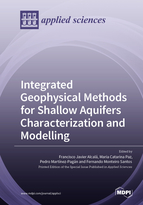
Integrated Geophysical Methods for Shallow Aquifers Characterization and Modelling

A special issue of Applied Sciences (ISSN 2076-3417). This special issue belongs to the section "Earth Sciences".

Deadline for manuscript submissions: closed (31 October 2021) | Viewed by 25527

Printed Edition Available!
A printed edition of this Special Issue is available here.

Special Issue Editors


E-Mail Website
Guest Editor
Experimental Station of Arid Zones, Spanish National Research Council (EEZA-CSIC), 04120 Almería, Spain
Interests: water resource management; techniques and computational applications for modelling of groundwater dynamics at different spatiotemporal scales and climate conditions; applied geophysics
Special Issues, Collections and Topics in MDPI journals

E-Mail Website
Guest Editor
Polytechnic Institute of Setúbal, Portugal
Interests: applications of near-surface geophysical techniques in modelling of subsurface hydrological processes, using combined and time-lapse approaches at different resolution scales; sustainability of natural, agricultural, and urban groundwater systems

E-Mail Website
Guest Editor
Department of Civil and Mining Engineering, Technical University of Cartagena, 30203 Cartagena, Spain
Interests: applications of electrical, seismic, and electromagnetic techniques focused on near-surface characterization in environmental, mining, and hydrogeological research
Special Issues, Collections and Topics in MDPI journals

E-Mail Website
Guest Editor
IDL-University of Lisbon, Lisbon, Portugal
Interests: electromagnetic methods, numerical modelling, and inversion of geophysical data

Special Issue Information

Dear Colleagues,

Shallow aquifers support groundwater-dependent ecosystems, represent the solely water resource in many sparse areas, and are especially threatened by human-induced pollution and global climate change. Integrated near-surface geophysical (NSG) applications have become a part of the holistic strategy for shallow aquifers characterization, which is a necessary step to modelling shallow groundwater dynamics.

NSG techniques permit accurate and fast ground surveys in different hydrogeological environments for different scientific purposes. Moreover, several scientific software platforms having friendly interfaces, robust algorithms for data inversion, and tools for uncertainty analysis are available. For shallow aquifers characterization, electric and electromagnetic techniques are the most widely used methods, despite offering ambiguous interpretations when (1) highly conductive structures and pore-filling fluids (natural and human-induced) exist and (2) subsurface structures subjected to temporal dynamics of water content and dissolved ions are deduced from isolated-in-time surveys.

This Special Issue aims to attract world-leading researchers in applied NSG techniques for shallow groundwater research. The accepted contributions will include: (1) NSG applications as a part of the holistic strategy for shallow aquifer characterization and modelling, (2) Integrated NSG techniques and time-lapse approaches to reduce the ambiguity of interpretations, (3) Innovative theoretical (e.g., formulations) and experimental (e.g., field surveys design and software) developments for characterization and modelling, and (4) Case studies surveying saturated and unsaturated zones for methodological and conceptual purposes. Reviews of (1) state of the art of NSG techniques, (2) software developments, (3) monographies for specific environments such as groundwater-dependent ecosystems and urban areas, and (4) comparisons between geographical areas and technologies are also welcome.

Dr. Francisco Javier Alcalá
Dr. Maria Catarina Paz
Prof. Pedro Martínez-Pagán
Dr. Fernando Monteiro Santos
Guest Editors

Manuscript Submission Information

Manuscripts should be submitted online at www.mdpi.com by registering and logging in to this website. Once you are registered, click here to go to the submission form. Manuscripts can be submitted until the deadline. All submissions that pass pre-check are peer-reviewed. Accepted papers will be published continuously in the journal (as soon as accepted) and will be listed together on the special issue website. Research articles, review articles as well as short communications are invited. For planned papers, a title and short abstract (about 100 words) can be sent to the Editorial Office for announcement on this website.

Submitted manuscripts should not have been published previously, nor be under consideration for publication elsewhere (except conference proceedings papers). All manuscripts are thoroughly refereed through a single-blind peer-review process. A guide for authors and other relevant information for submission of manuscripts is available on the Instructions for Authors page. Applied Sciences is an international peer-reviewed open access semimonthly journal published by MDPI.

Please visit the Instructions for Authors page before submitting a manuscript. The Article Processing Charge (APC) for publication in this open access journal is 2400 CHF (Swiss Francs). Submitted papers should be well formatted and use good English. Authors may use MDPI's English editing service prior to publication or during author revisions.

Keywords

  • Near-Surface Geophysical (NSG) Techniques
  • Integrated NSG Applications
  • Time-Lapse Approaches
  • Shallow Aquifers
  • Conceptualization and Modelling
  • Aquifer Geometry
  • Shallow Groundwater Quantity and Quality Dynamics

Published Papers (10 papers)

Order results
Result details
Select all
Export citation of selected articles as:

Editorial

Jump to: Research

4 pages, 194 KiB  
Editorial
Integrated Geophysical Methods for Shallow Aquifers Characterization and Modelling
by Francisco Javier Alcalá, Maria Catarina Paz, Pedro Martínez-Pagán and Fernando Monteiro Santos
Appl. Sci. 2022, 12(5), 2271; https://0-doi-org.brum.beds.ac.uk/10.3390/app12052271 - 22 Feb 2022
Cited by 2 | Viewed by 1124
Abstract
Aquifers stock about 31 [...] Full article

Research

Jump to: Editorial

19 pages, 9636 KiB  
Article
Hydrogeophysical Characterization of Fractured Aquifers for Groundwater Exploration in the Federal District of Brazil
by Yawar Hussain, José Eloi Guimarães Campos, Welitom Rodrigues Borges, Rogério Elias Soares Uagoda, Omar Hamza and Hans-Balder Havenith
Appl. Sci. 2022, 12(5), 2509; https://0-doi-org.brum.beds.ac.uk/10.3390/app12052509 - 28 Feb 2022
Viewed by 2382
Abstract
The present study applies a geophysical approach to the Federal district of Brazil, a challenging hydrogeologic setting that requires improved investigation to enhance groundwater prospecting to meet the rising water demand. The geophysical characterization of a complex hard-rock aquifer sub-system was conducted using [...] Read more.
The present study applies a geophysical approach to the Federal district of Brazil, a challenging hydrogeologic setting that requires improved investigation to enhance groundwater prospecting to meet the rising water demand. The geophysical characterization of a complex hard-rock aquifer sub-system was conducted using direct current (DC) electrical resistivity tomography (ERT) integrated with surface geological information. With a total of twenty-seven ERT profiles, the resistivity acquisition was carried out using a dipole-dipole array of electrodes with an inter-electrode spacing of 10 m. Based on resistivity ranges, the interpretation of the inverted resistivity values indicated a ground profile consisting of upper dry soil, saprolite, weathered, and fresh bedrock. Along with this layered subsurface stratigraphy, the approach allowed us to map the presence of significant hydrogeological features sharp contrasting anomalies that may suggest structural controls separating high-resistivity (≥7000 Ω m) and low-resistivity (<7000 Ω m) conducting zones in the uppermost 10 m of the ground. The assumed impacts of these features on groundwater development are discussed in light of the Brasilia aquifer settings. Full article
Show Figures

Figure 1

26 pages, 8837 KiB  
Article
Geophysical Characterization in the Shallow Water Estuarine Lakes of the Southern Everglades, Florida
by Michael Eyob Kiflai, Dean Whitman, René M. Price, Thomas A. Frankovich and Christopher J. Madden
Appl. Sci. 2022, 12(3), 1154; https://0-doi-org.brum.beds.ac.uk/10.3390/app12031154 - 22 Jan 2022
Cited by 3 | Viewed by 2408
Abstract
Anthropogenic activities have greatly modified freshwater flows through Everglades National Park (ENP) such that saltwater has intruded extensively inland from the coastline, causing coastal lakes and their ecosystems to be exposed to varying salinity conditions. The Comprehensive Everglades Restoration Plan (CERP) makes an [...] Read more.
Anthropogenic activities have greatly modified freshwater flows through Everglades National Park (ENP) such that saltwater has intruded extensively inland from the coastline, causing coastal lakes and their ecosystems to be exposed to varying salinity conditions. The Comprehensive Everglades Restoration Plan (CERP) makes an effort to restore the quantity, quality, timing, and distribution of freshwater flow in ENP with a goal of reducing salinity conditions within the coastal communities and adjacent estuaries. An understanding of the temporal and spatial variations of surface water and shallow groundwater salinity in the coastal lakes of ENP is needed to evaluate restoration efforts. Geophysical surveys were conducted between 2016 to 2019 using electrical resistivity and electromagnetic (EM) methods in the coastal lakes of ENP. A mean local formation factor of 10.7 ± 1.8 was calculated for the region by comparing the lakes’ bottom formation inverted electrical resistivity soundings with coincident pore water resistivity measured in groundwater wells. The conductivity of surface and groundwater increased during the dry season, reflecting decreased precipitation, increased evapotranspiration, and the increasing influence of saline water from Florida Bay. Spatially, salinity in the lakes increased from west to east in the surface water with an opposite trend observed in the shallow groundwater. Along the south to north inland direction, the salinity of both surface water and groundwater decreased. This study demonstrates that floating electrical resistivity and EM methods can characterize the subsurface formation resistivity and describe temporal and spatial patterns of surface and shallow groundwater conductivity. Full article
Show Figures

Figure 1

19 pages, 5772 KiB  
Article
Usefulness of Compiled Geophysical Prospecting Surveys in Groundwater Research in the Metropolitan District of Quito in Northern Ecuador
by Lilia Peñafiel, Francisco Javier Alcalá and Javier Senent-Aparicio
Appl. Sci. 2021, 11(23), 11144; https://0-doi-org.brum.beds.ac.uk/10.3390/app112311144 - 24 Nov 2021
Cited by 1 | Viewed by 1650
Abstract
As in other large Andean cities, the population in the Metropolitan District of Quito (MDQ) in northern Ecuador is growing, and groundwater is becoming essential to meet the increasing urban water demand. Quito’s Public Water Supply Company (EPMAPS) is promoting groundwater research for [...] Read more.
As in other large Andean cities, the population in the Metropolitan District of Quito (MDQ) in northern Ecuador is growing, and groundwater is becoming essential to meet the increasing urban water demand. Quito’s Public Water Supply Company (EPMAPS) is promoting groundwater research for sustainable water supply, and geophysical prospecting surveys are used to define aquifer geometry and certain transient groundwater features. This paper examines the usefulness of existing geophysical prospecting surveys in groundwater research in the MDQ. A database was built using 23 representative geophysical prospecting surveys compiled from EPMAPS’ public repository, official geotechnical research reports, and the scientific literature. Fifteen EPMAPS-promoted surveys used near-surface electrical techniques (seven used electrical resistivity tomography and eight used vertical electrical sounding) to explore Holocene and Pleistocene sedimentary and volcano-sedimentary formations in the 25–500-m prospecting depth range, some of which form shallow aquifers used for water supply. Four other surveys used near-surface seismic techniques (refraction microtremor) for geotechnical research in civil works. These surveys have been reinterpreted to define shallow aquifer geometry. Finally, four surveys compiled from the scientific literature used electromagnetic techniques (magnetotelluric sounding and other very low-frequency methods) to explore Holocene to late Pliocene formations, some of which form thick regional aquifers catalogued as the larger freshwater reservoirs in the MDQ. However, no geophysical prospecting surveys exploring the complete saturated thickness of the Pliocene aquifers could be compiled. Geophysical prospecting surveys with greater penetration depth are proposed to bridge this research gap, which prevents the accurate assessment of the renewable groundwater fraction of the regional aquifers in the MDQ that can be exploited sustainably. Full article
Show Figures

Figure 1

18 pages, 4415 KiB  
Article
Temporal and Spatial Groundwater Contamination Assessment Using Geophysical and Hydrochemical Methods: The Industrial Chemical Complex of Estarreja (Portugal) Case Study
by Tiago Marques, Manuel Senos Matias, Eduardo Ferreira da Silva, Nuno Durães and Carla Patinha
Appl. Sci. 2021, 11(15), 6732; https://0-doi-org.brum.beds.ac.uk/10.3390/app11156732 - 22 Jul 2021
Cited by 5 | Viewed by 2104
Abstract
With more than a half-century in operation, the industrial chemical complex of Estarreja (ICCE) in northern Portugal has left serious environmental liabilities in the region. Although protective measures were implemented, soils, surface, and groundwater contamination caused by persistent pollutants are still prevalent. This [...] Read more.
With more than a half-century in operation, the industrial chemical complex of Estarreja (ICCE) in northern Portugal has left serious environmental liabilities in the region. Although protective measures were implemented, soils, surface, and groundwater contamination caused by persistent pollutants are still prevalent. This study presents data from several geophysical and hydrochemical campaigns carried out to monitor groundwater contamination in the Estarreja region over a period of 30 years. Both geophysical and hydrochemical data showed a good agreement and revealed an important anomaly caused by groundwater contamination (high levels of Na, Cl, SO4, and Fe, among others) in 2006–2007, likely caused by the remobilization of waste pollutants (roasted pyrites, soils, and sludge) during their deposition in a sealed landfill (operating between 2003 and 2005). More recently, in 2016, this impact persists, but was more attenuated and showed a general migration pattern from E to SW according to one of the main groundwater flow paths. Groundwater flow in this region has a local radial behaviour. Drainage effluent systems, such as ditches and buried pipes formerly used by ICCE, are also likely to contribute to some contamination “hotspots”. Finally, the results obtained by the combined use of these two approaches allowed for the delineation of the contamination plume for future monitoring. Full article
Show Figures

Figure 1

21 pages, 7119 KiB  
Article
Combining of MASW and GPR Imaging and Hydrogeological Surveys for the Groundwater Resource Evaluation in a Coastal Urban Area in Southern Spain
by Francisco Javier Alcalá, Pedro Martínez-Pagán, Maria Catarina Paz, Manuel Navarro, Jaruselsky Pérez-Cuevas and Francisco Domingo
Appl. Sci. 2021, 11(7), 3154; https://0-doi-org.brum.beds.ac.uk/10.3390/app11073154 - 01 Apr 2021
Cited by 13 | Viewed by 2695
Abstract
This paper conceptualizes and evaluates the groundwater resource in a coastal urban area hydrologically influenced by peri-urban irrigation agriculture. Adra town in southern Spain was the case study chosen to evaluate the groundwater resource contributed from the northern steep urban sector (NSUS) to [...] Read more.
This paper conceptualizes and evaluates the groundwater resource in a coastal urban area hydrologically influenced by peri-urban irrigation agriculture. Adra town in southern Spain was the case study chosen to evaluate the groundwater resource contributed from the northern steep urban sector (NSUS) to the southern flat urban sector (SFUS), which belongs to the Adra River Delta Groundwater Body (ARDGB). The methodology included (1) geological and hydrogeological data compilation; (2) thirteen Multichannel Analysis of Surface Waves (MASW), and eight Ground Penetrating Radar (GPR) profiles to define shallow geological structures and some hydrogeological features; (3) hydrogeological surveys for aquifer hydraulic definition; (4) conceptualization of the hydrogeological functioning; and (5) the NSUS groundwater resource evaluation. All findings were integrated to prepare a 1:5000 scale hydrogeological map and cross-sections. Ten hydrogeological formations were defined, four of them (Paleozoic weathered bedrock, Pleistocene littoral facies, Holocene colluvial, and anthropogenic filling) in the NSUS contributing to the SFUS. The NSUS groundwater discharge and recharge are, respectively, around 0.28 Mm3 year−1 and 0.31 Mm3 year−1, and the actual groundwater storage is around 0.47 Mm3. The groundwater renewability is high enough to guarantee a durable small exploitation for specific current and future urban water uses which can alleviate the pressure on the ARDGB. Full article
Show Figures

Figure 1

16 pages, 3785 KiB  
Article
Identifying Changes in Sediment Texture along an Ephemeral Gravel-Bed Stream Using Electrical Resistivity Tomography 2D and 3D
by Marcos A. Martínez-Segura, Carmelo Conesa-García, Pedro Pérez-Cutillas, Pedro Martínez-Pagán and Marco D. Vásconez-Maza
Appl. Sci. 2021, 11(7), 3030; https://0-doi-org.brum.beds.ac.uk/10.3390/app11073030 - 29 Mar 2021
Cited by 4 | Viewed by 2102
Abstract
Differences in deposit geometry and texture with depth along ephemeral gravel-bed streams strongly reflect fluctuations in bedload which are due to environmental changes at the basin scale and to morphological channel adjustments. This study combines electrical resistivity tomography (ERT) with datasets from borehole [...] Read more.
Differences in deposit geometry and texture with depth along ephemeral gravel-bed streams strongly reflect fluctuations in bedload which are due to environmental changes at the basin scale and to morphological channel adjustments. This study combines electrical resistivity tomography (ERT) with datasets from borehole logs to analyse the internal geometry of channel cross-sections in a gravel-bed ephemeral stream (southeast Spain). The survey was performed through longitudinal and transverse profiles in the upper channel stretch, of 14 to 30 m in length and 3 to 6 m in depth, approximately. ERT values were correlated with data on sediment texture as grain size distribution, effective grain sizes, sorting, and particle shape (Zingg’s classification). The alluvial channel-fills showed the superposition of four layers with uneven thickness and arrangement: (1) the softer rocky substrate (<1000 Ω.m); (2) a thicker intermediate layer (1000 to 2000 Ω.m); and (3) an upper set composed of coarse gravel and supported matrix, ranging above 2000 Ω.m, and a narrow subsurface layer, which is the most resistive (>5000 Ω.m), corresponding to the most recent armoured deposits (gravel and pebbles). The ERT results coupled with borehole data allowed for determining the horizontal and vertical behaviour of the materials in a 3D model, facilitating the layer identification. Full article
Show Figures

Figure 1

19 pages, 4012 KiB  
Article
Characterization of a Shallow Coastal Aquifer in the Framework of a Subsurface Storage and Soil Aquifer Treatment Project Using Electrical Resistivity Tomography (Port de la Selva, Spain)
by Alex Sendrós, Aritz Urruela, Mahjoub Himi, Carlos Alonso, Raúl Lovera, Josefina C. Tapias, Luis Rivero, Ruben Garcia-Artigas and Albert Casas
Appl. Sci. 2021, 11(6), 2448; https://0-doi-org.brum.beds.ac.uk/10.3390/app11062448 - 10 Mar 2021
Cited by 16 | Viewed by 3016
Abstract
Water percolation through infiltration ponds is creating significant synergies for the broad adoption of water reuse as an additional non-conventional water supply. Despite the apparent simplicity of the soil aquifer treatment (SAT) approaches, the complexity of site-specific hydrogeological conditions and the processes occurring [...] Read more.
Water percolation through infiltration ponds is creating significant synergies for the broad adoption of water reuse as an additional non-conventional water supply. Despite the apparent simplicity of the soil aquifer treatment (SAT) approaches, the complexity of site-specific hydrogeological conditions and the processes occurring at various scales require an exhaustive understanding of the system’s response. The non-saturated zone and underlying aquifers cannot be considered as a black box, nor accept its characterization from few boreholes not well distributed over the area to be investigated. Electrical resistivity tomography (ERT) is a non-invasive technology, highly responsive to geological heterogeneities that has demonstrated useful to provide the detailed subsurface information required for groundwater modeling. The relationships between the electrical resistivity of the alluvial sediments and the bedrock and the difference in salinity of groundwater highlight the potential of geophysical methods over other more costly subsurface exploration techniques. The results of our research show that ERT coupled with implicit modeling tools provides information that can significantly help to identify aquifer geometry and characterize the saltwater intrusion of shallow alluvial aquifers. The proposed approaches could improve the reliability of groundwater models and the commitment of stakeholders to the benefits of SAT procedures. Full article
Show Figures

Figure 1

16 pages, 11681 KiB  
Article
Geophysical Characterization of Aquifers in Southeast Spain Using ERT, TDEM, and Vertical Seismic Reflection
by Javier Rey, Julián Martínez, Rosendo Mendoza, Senén Sandoval, Vladimir Tarasov, Alex Kaminsky, M. Carmen Hidalgo and Kevin Morales
Appl. Sci. 2020, 10(20), 7365; https://0-doi-org.brum.beds.ac.uk/10.3390/app10207365 - 21 Oct 2020
Cited by 8 | Viewed by 2538
Abstract
We assess the effectiveness of complementary geophysical techniques to characterize a Jurassic dolomite confined aquifer at Loma de Ubeda, Spain. This aquifer, which is penetrated by wells in the 100–600-m depth range, is confined by Triassic clays (bottom) and Miocene marls (top). The [...] Read more.
We assess the effectiveness of complementary geophysical techniques to characterize a Jurassic dolomite confined aquifer at Loma de Ubeda, Spain. This aquifer, which is penetrated by wells in the 100–600-m depth range, is confined by Triassic clays (bottom) and Miocene marls (top). The Jurassic dolomite is characterized by prominent seismic reflectors of high amplitude. Thus, it is readily differentiated from the low-amplitude reflectors of the confining clay-rich Triassic and Miocene materials. Electrical resistivity tomography (ERT) allowed us to detail the characteristics of the aquifer up to a maximum depth of 220 m. Lateral changes in facies and small faults have been identified using ERT. Time-domain electromagnetic (TDEM) is an excellent complement to the two above-mentioned techniques in order to widen the analyzed depth range. We acquire TDEM data with different configurations at multiple study sites while simultaneously varying measurement parameters. In doing so and by comparing the effectiveness of these different configurations, we expand the use of TDEM for aquifer characterization. Full article
Show Figures

Figure 1

27 pages, 5106 KiB  
Article
Integrated MASW and ERT Imaging for Geological Definition of an Unconfined Alluvial Aquifer Sustaining a Coastal Groundwater-Dependent Ecosystem in Southwest Portugal
by Maria Catarina Paz, Francisco Javier Alcalá, Ana Medeiros, Pedro Martínez-Pagán, Jaruselsky Pérez-Cuevas and Luís Ribeiro
Appl. Sci. 2020, 10(17), 5905; https://0-doi-org.brum.beds.ac.uk/10.3390/app10175905 - 26 Aug 2020
Cited by 13 | Viewed by 3429
Abstract
This paper integrates multichannel analysis of surface waves (MASW) and time-lapse electrical resistivity tomography (ERT) to define aquifer geometry and identify transient groundwater features of the Cascalheira Stream Basin Holocene alluvial aquifer (aquifer H), which contributes to the Santo André Lagoon, part of [...] Read more.
This paper integrates multichannel analysis of surface waves (MASW) and time-lapse electrical resistivity tomography (ERT) to define aquifer geometry and identify transient groundwater features of the Cascalheira Stream Basin Holocene alluvial aquifer (aquifer H), which contributes to the Santo André Lagoon, part of a coastal groundwater-dependent ecosystem (GDE), located in southwest Portugal. MASW measures shear-wave velocity (VS), allowing one to obtain steady geological models of the subsurface, and ERT measures subsurface electrical resistivity (ER), being subjected to ambient changes. MASW enables disambiguation of geological structures in low ER environments, such as coastal areas. This research covered one natural year and involved one MASW campaign, four ERT campaigns, and additional geological field surveys and groundwater monitoring to assist interpretation of results. In the area, the conjugate NW–SE and NE–SW strike-slip fault systems determine compartmentalization of geological structures and subsequent accommodation space for Holocene sedimentation. MASW and ERT surveys show how the NW–SE system deepens these structures toward the coast, whereas the NE–SW system generates small horsts and grabens, being one of these occupied by aquifer H. From upstream to downstream, aquifer H thickness and width increase from 10 m to 12 m and from 140 m to 240 m, respectively. Performance of VS and ER models was satisfactory, with a normalized error of the VR and ER models in the 0.01–0.09 range, meaning that a quantitative quota of uncertainty can be segregated from the overall uncertainty of groundwater models without substantially affecting its simulations accuracy. This methodology seeks to improve the design of shallow groundwater research in GDE preservation policies. Full article
Show Figures

Figure 1

Back to TopTop